The Forgotten Rim of the Grand Canyon
No Comments
The Grand Canyon’s North Rim receives nine times fewer visitors than its South Rim. To the west, the awesome Toropweap overlook (described here) is seen by considerably fewer. However, no matter how little traffic Toroweeps gets, it still dwarfs that of the rim points further west, the subject of this post.
The northwestern rim Grand Canyon overlooks located in Parashant National Monument include some of the most remote locations in the continental United States. How remote? They require a round-trip drive of 180 miles on unpaved roads, some of which beyond the reach of standard SUVs. As an indication of how wild Parashant National Monument is, it has about the same area as Grand Canyon National Park, but does not include a single paved road, established campground, or toilet, not to mention any commercial facilities. Needless to say, the utmost preparation and self-sufficiency are required to visit.
Before starting any trip into Parashant National Monument, I recommend a stop at the BLM Interagency Visitor Center in St. George to get maps and information about road conditions. All the roads look the same on the map, but some are significantly more difficult than others, and the knowledgeable staff can give you advice. The free NPS map is easy to read and sufficient for travel on the main roads. The BLM Arizona Strip map is very detailed, but it is more difficult to read, and its paper version is quite bulky, as it also covers Vermilion Cliffs National Monument. My preference is to use the free geo-referenced electronic version on the Avenza Maps mobile app. During winter, snow above 5,000 feet can make the roads very muddy and impassable, while summers are subject to monsoons and hot temperatures.
Whitmore Canyon Overlook
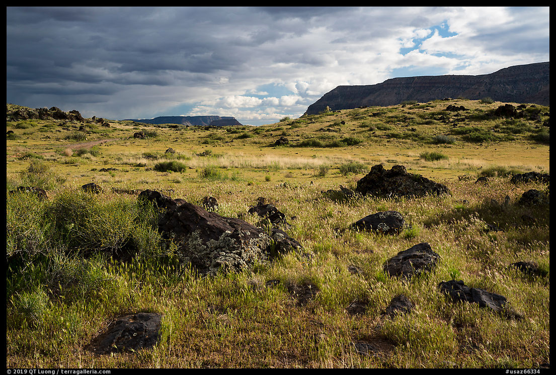
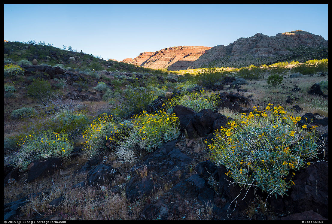
When dry, the drive from St George up to the Bar 10 Ranch is straightforward and can be made by most vehicles. At the Bar 10 Ranch, a private enclave within Parashant National Monument, I encountered a gate with a menacing “No Trespassing” sign, but that was the correct road to the Whitmore Canyon Overlook, with public access. Past the Bar 10 Ranch, a steppe surprisingly verdant contrasted with black volcanic rocks.
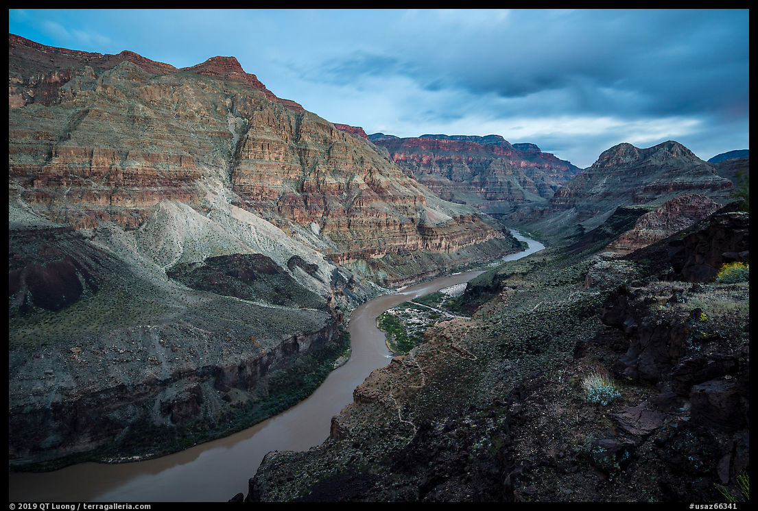
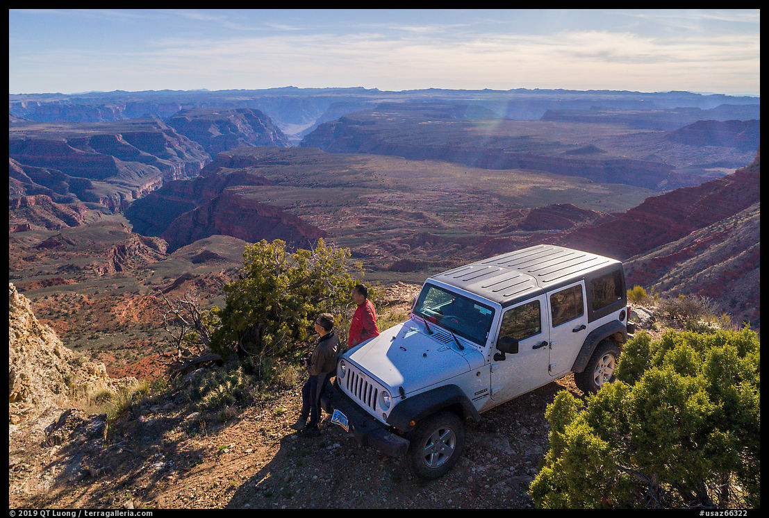
The road became steep and covered with sharp lava rocks, a tough combination. We had to be over cautious because rather than the rugged all-terrain tires normally used on a Jeep, which are key on this type of road, our rented vehicle had tires that were quite beaten up. As it took us almost an hour to drive the last 7 miles, we arrived in view of the river quite late, as the opposite rim caught the last light. At least it looked like we had escaped tire damage.
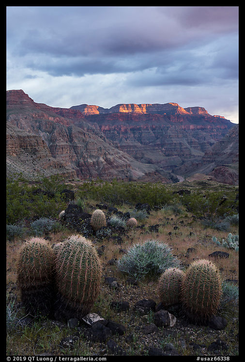
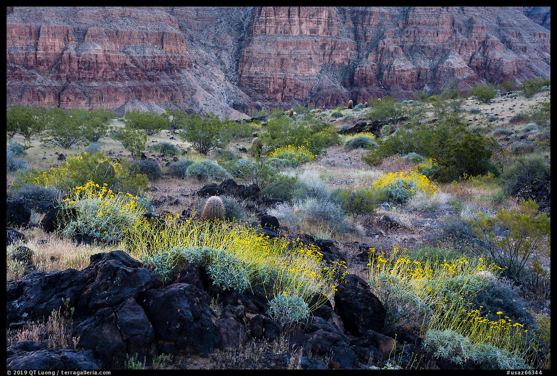
Whitmore Canyon Overlook differs from the other overlooks over the Grand Canyon in that it is located on a lower rim. The view over the river from the overlook is excellent both upstream and downstream, as it is not too high above the river.
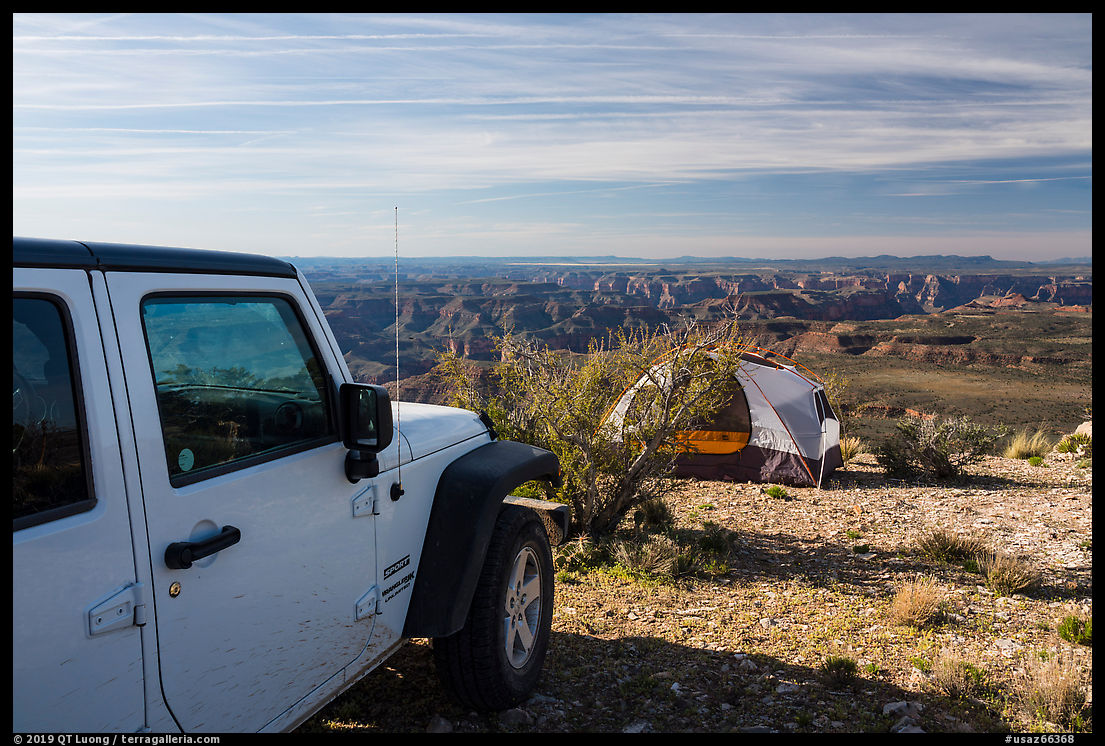
To get to a lower rim elsewhere in the Grand Canyon requires a hike, but here you can drive to the overlook and also car-camp there. Being on a lower rim means that you are surrounded by higher rims rather than flat terrain. They caught the early morning light.
The cliffs opposite the overlook face west. In the morning, they are in the shade. I timed the picture for when the penumbra hit the flowers, adding a subtle glow.
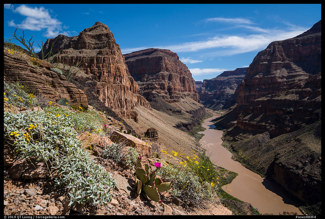
Whitmore Canyon Overlook offers the easiest access to the Colorado River inside Grand Canyon National Park, along its Whitmore Trail, with only 900 feet elevation loss to reach the river, as opposed to 3,000 feet from the South Rim or 4,000 feet from the North Rim. Shortly after the start of the trail various plants provided foreground elements.
Twin Point
Like for Whitmore Canyon Overlook, the road to Twin Point starts quite tamely and then degrades at the end, especially after the BLM/NPS boundary, making a high-clearance 4WD a necessity. Since a large part of the road is common, it may be tempting to combine trips to both destinations, but that would be stretching a full tank of gas to its limit. Driving a mile of steep and bumpy road uses more gas than a mile of highway. Since there is no gas between St George and the Colorado River, it is more prudent to come back to St George to refuel between the two trips. You don’t want to get stuck in this very remote area that sees very little traffic!
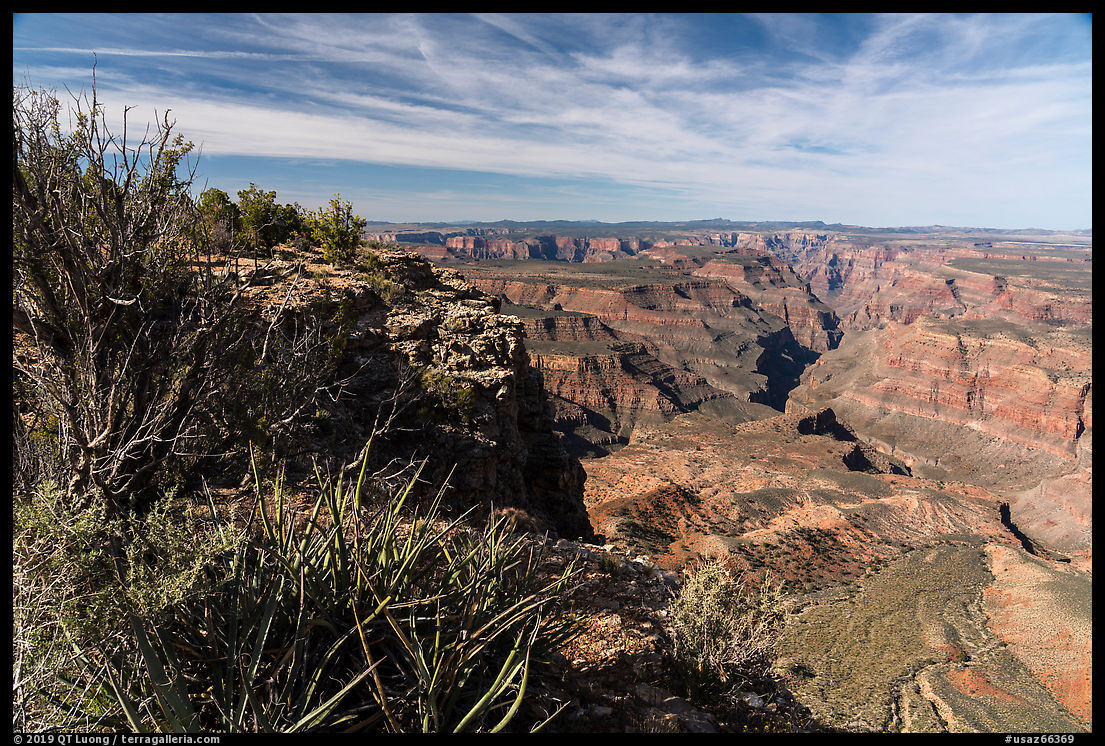
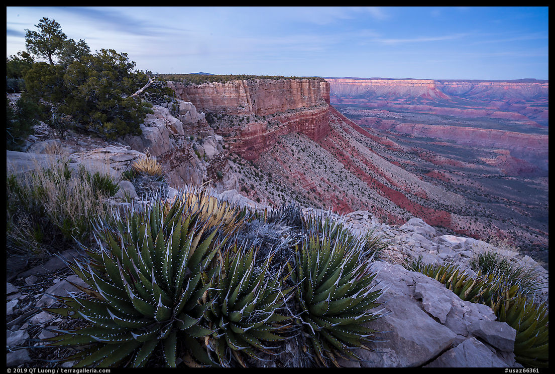
Unlike Whitmore Canyon Overlook, which is on a lower rim, Twin Point is located on the upper rim of the Grand Canyon, at 6,000 feet. The last part of the drive takes place on a narrow rib, so there are views both towards the east and the west. The road skirts the western edge of the rib several times.
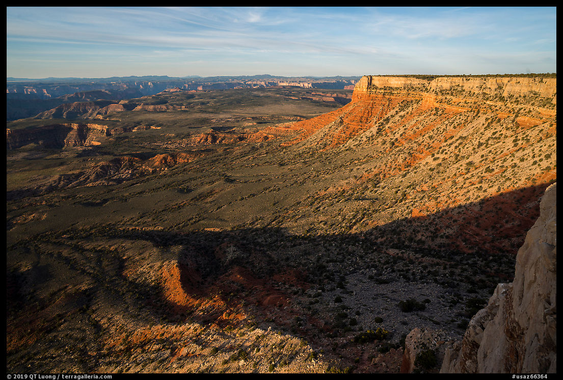
At the end of the road, Twin Point faces east and provides an unusual perspective over the Grand Canyon. The view is mostly over a wide plateau, at sunrise, I used the triangular shape of a shadow to add another element to the composition.
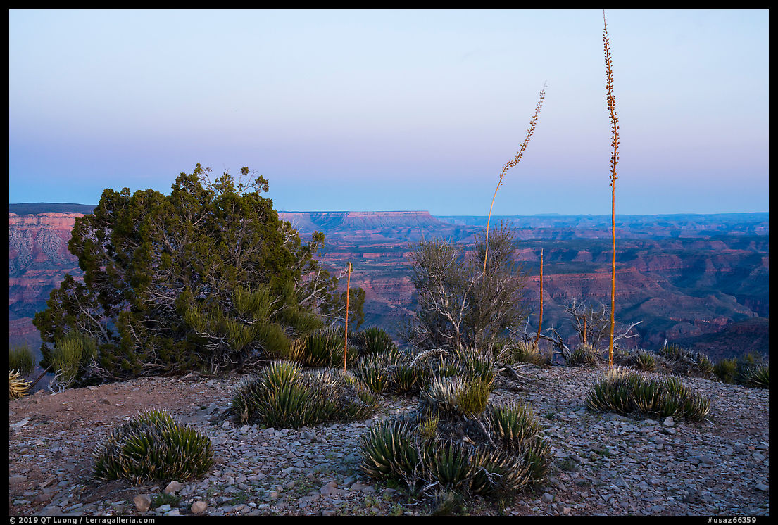
At Twin Point, a large number of agaves and succulents grew right at the rim. In the late afternoon, shadows were disrupting their shape and texture, which was better captured after the sun had set.
Although co-managed by the NPS and the BLM, Parashant National Monument is much less regulated than Grand Canyon National Park. Dispersed camping is authorized everywhere without permit, which means that at Twin Point, you can not only drive within a few yards of the Grand Canyon Rim, but also set up your tent in such a unique setting. Like at Whitmore Overlook, we stayed overnight, and not a single person was in sight from our arrival in the late afternoon to our departure the next morning.
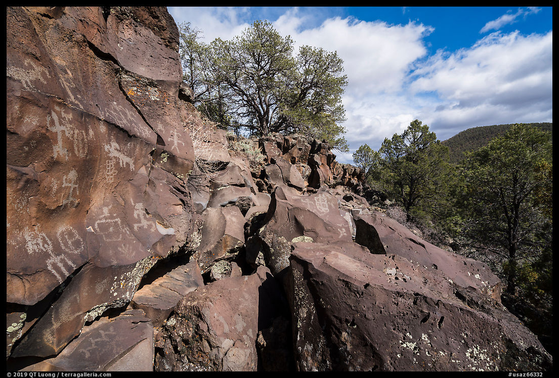
P.S. I have chosen the title of this post “The Forgotten Rim” carefully. While in modern times almost nobody goes there, compared to the other rims, that was not always so. The area abunds in archeological artifacts, and the nearby Nampaweap site feature some of the most impressive petroglyph collections I have seen. Besides the Canyon rim, Parashant also features a significant desert part and a mountain part.
Part 3 of 6: 1 | 2 | 3 | 4 | 5

