Terra Galleria Photography

Sharing Photography Locations & National Monuments Book

Whether to share locations of photographs has been debated for a while, but the question has taken a new urgency in the age of mass travel and social media. In view of that, I’d like to ask you about your opinion on that subject, and what information you’d like included in my next book about the national monuments.

There is no doubt that locations have changed, and always for the worst. Back in the 1990s, when I photographed Mesa Arch at sunrise, I had the place to myself. Fast-forward a quarter-century, you need to arrive well in advance to secure a shooting spot where you will be standing literally shoulder to shoulder with others, tripod legs interlocked. But folks, including professional photographers keep coming.

At Horseshoe Bend, back then there was an unmarked pullout, a dirt user path, no guardrails, and I also had the place to myself at dawn. The city of Page has now built a large parking lot and in 2019 started charging visitors $10 per car, but even though it often fills up, passenger drop-off and pick-up at the entrance are not allowed, and cars parked on the side of the highway are ticketed. Despite those regulations, in 2019, more than two million visited Horseshoe Bend.

I have not been to Mesa Arch nor Horseshoe Bend recently, but I would guess that nobody goes there without a camera of some sort. So at first, photography appears to be the primary driver of visitation. Look a bit deeper, though, and you realize the problem is rather with social media. The reason Horseshoe Bend has become so popular is that it is “Instagramable”. What is driving people to Horseshoe Bend is the sheer number of images online. The more people see those images, and see that they are liked, the more they want to get the exact same shots for themselves and to post them. That’s the way snowballs become avalanches.

I’ve recently heard several photographers advocate never sharing any photographic location at all. There are compelling reasons for not wanting to be the one who throws out the first snowball. The two locations previously mentioned are not particularly ecologically sensitive, but others are and would be permanently damaged by an influx of visitors. Sometimes one or a few careless individuals are all it would take. Even if they are not, the wilderness quality of the experience, the solitude, peace, quiet, and remoteness may be lost forever. And there is a lot that is objectionable with the copycat approach to photography that some types of location sharing encourages.

Addressing those concerns would require a longer and more carefully considered discussion that may be the subject of another post. For now, I’ll only ask of those who advocate this absolutist, black and white approach: did you discover yourself the locations you photographed?

In my case, although I’ve been around the block, the answer is a resounding no. Over the years, I have made abundant use of photography location newsletters, guidebooks, and online resources. In this blog, and in Treasured Lands, I’ve been simply trying to pay those forward. Since I’ve learned about each of the locations somewhere else, there is no location that is disclosed for the first time, and for which you couldn’t find the information elsewhere. That said, I believe I can still write usefully because I add my curation and perspective.

Many of you have a copy of Treasured Lands. For my new book, Our National Monuments, I was thinking about using a similar format, since Treasured Lands was so well-received. However, the locations in the new book are much less known, so maybe some adjustments would be in order? For example, would it be useful to provide more precise descriptions or directions, and fewer stories about my experience? Would that be too dry to read? I would appreciate any comments or if you would take the poll below to give me some feedback.

If you do not see the survey below or if you’d prefer a larger window, click here

Grand Staircase Escalante Ends

Days 9,10

Just like in Treasured Lands, for my new national monuments book one of my goals was to cover each of the monument’s corners, providing photographs and information about each of its significant areas. I had visited Grand Staircase Escalante National Monument multiple times before, but the monument is so vast that there were still two areas demanding my attention. Located respectively at the Northeast end and Southwest end of the monument, they include canyons of diverse sizes.

The Burr Trail – with a UT-12 intermission

Although my 180-mile route from Bears Ears National Monument to Grand Staircase Escalante National Monument via UT-95, UT-24, and UT-12 traversed some of the most stunning terrain in the Southwest, I contented myself with enjoying the scenery from behind the windshield, as I was planning to arrive early enough in Long Canyon to photograph.

The Burr Trail is a backcountry road starting from the town of Boulder and featuring remarkable domes and cliffs on its way to the wild southern section of Capitol Reef National Park. Its first 31 miles, up to the national park boundary, were paved in the 1990s, significantly increasing the area’s visitation. I had driven the Burr Trail before on my way to Capitol Reef National Park but as I prioritized destinations like Strike Valley Overlook and Halls Creek Overlook, I did not make much effort to photograph along the Burr Trail. Midway between Boulder and Capitol Reef National Park, the Burr Trail follows the bottom of aptly named Long Canyon for 7 miles. When I got there, the sun already quite low on the horizon did not create any reflected light in the canyon. After driving back and forth, I settled for a view of the canyon from the road at the point before it drops. The soft light occurring after sunset worked well for such a view from above. Afterward, it was too dark in the canyon.

I drove back to the Deer Creek Campground. The small campground (7 sites), tucked into a delightful riparian area would be cozy place to relax, enjoying the luxury of the picnic table, but the next day I woke up again an hour before sunrise. I thought that it would be more productive to spend sunrise time on UT-12 at overlooks over open terrain, rather than in Long Canyon. Although Grand Staircase Escalante National Monument is vast, most of it is roadless. UT-12, or Scenic Byway 12 is one of the most spectacular roads in America. My favorite section is between Escalante and Boulder, where it stays almost entirely inside the monument and traverses colorful slickrock terrain, giving an excellent introduction to the monument. I photographed from the Head of the Rocks Overlook, about half an hour drive from the campground, in pre-dawn light. On the way, I had noticed a pullout from the Hogback Ridge, a stretch of UT-12 with precipitous drops on both sides, but it was pretty dark and I was engrossed in an audiobook, so I did not stop. It was a mistake to let myself be distracted. I realized that it would have been preferable to switch those two locations, or even better to head there last evening instead of Long Canyon. The canyons would have benefited from the pre-dawn light, similar to the Long Canyon image above, while direct light would have worked at Head of the Rocks right after sunrise. However, right after sunrise, the canyons were shaded by the Hogback Ridge, with the light actually improving as the sun rose.

Back to Long Canyon, I strolled into a small side canyon on the north side of the road, slightly more than a mile from the southwestern end of the canyon. Called Singing Canyon because of its acoustics, this slot canyon is enlivened by photogenic trees and a beautiful glow from reflected light in mid-morning. As the sun reached the canyon, although I had expected the contrast to become problematic, I was able to use the play of light and shadow for images of different character. Don’t assume that a certain type of light will be “better”!

The sheer red walls of Long Canyon are graced with desert varnish and unusual erosion patterns, best photographed in the shade with reflected light. As I exited the canyon to the east, the red cliffs turn multicolored like those of the distant Waterpocket Fold, with a saddle at the rim of the Circle Cliffs providing an excellent viewpoint over badlands, plains, and cliffs.

Skutumpah Road

Near the west edge of the monument, Skutumpah Road, continuing south as Johnson Canyon Road for a total of 46-miles provides an alternative to Cottonwood Canyon Road for crossing the monument from north to south. The clay road is generally well maintained, but a few short rough sections are best navigated with a high clearance vehicle. Although it traverses unspectacular wooded hills and valleys, Skutumpah Road provides access to interesting canyons. The most accessible of them is Willis Creek, 6.3 miles from the north end of the road. Its narrows starting just a quarter-mile from the trailhead are distinguished by a year-round stream and curving walls. It was also interesting to look out of the narrows and see pine trees. Although I had explored several slot canyons in the monument, I had not seen those characteristics before.

Shortly after the junction with Skutumpah Road, Johnson Canyon Road enters a 4-mile section of white slickrock walls where the scenery improved considerably. After photographing them at the edge of the light, I almost hit a deer in the dark. As I applied brakes, the snack bags on the passenger seat spilled. Since it was still early in the evening, I made a detour into Kanab. I bought fresh fruit, bread, juice, and chips at the supermarket. Since I was in town, I ordered a pizza to go, and while I was waiting, I cleaned up the spilled food in the car. The pizza would save me cooking time, since I could eat it while driving to the White House Campground. The campground – one of only three developed campgrounds in a parkland of nearly 1.9 million acres – was part of lands removed from Grand Staircase Escalante National Monument. On that day, I had driven almost 250 miles, while circling around half of Grand Staircase Escalante, a good indication of the size of the monument. I was looking forward to leaving my car parked for the next day.

The Last Road Trip: 1 | 2 | 3 | 4 | 5 | 6 | 7 | 8 | 9 to be continued

Freezing in Bears Ears National Monument

Days 7,8,9

Since 2018, each autumn found myself in Bears Ears National Monument. 2020 was no exception. This time, I had planned to start at Valley of the Gods, where I ended my previous visit. On that evening of November 2019, after a promising afternoon, clouds had blocked the western horizon at sunset time. About a year later, I was hoping for a different outcome but as I drove from New Mexico, the day was growing increasingly cloudy. After a detour to refuel in Bluff, as I passed again the enormous cut made in the Comb Ridge on UT-95, I thought that while not favorable for landscape photos from the ground, the light conditions resulting from the cloud cover may work well for aerial photos. The drone handled the high winds surprisingly well.

Back to Valley of the Gods

In retrospect, it would have been smarter to continue that line of work at the Goosenecks of the San Juan River, but afterward, I stuck to my plan and headed for Valley of the Gods, where due to a combination of unfavorable light, wind, and light rain, I ended up making no photographs. When I cooked dinner, I had to take refuge in the car. Outside the door, due to the wind, my stove was taking much longer than usual to boil water. It didn’t help that the cartridge was nearly empty and I insisted on finishing it up before opening a new one. I went to bed quite late despite the unproductive evening. The next day, more than an hour before sunrise, although still blowing, the wind had abated enough that I was able to make a few long exposure photographs with a few stars in the sky, although most of them were hidden by the cloud cover. It was so cold that after a few photographs, I had to get inside the car to warm up my numb hands before trying again. Although a band of clouds on the eastern horizon blocked the sunrise, the day grew sunnier, but the temperatures remained frigid. Two days before, in New Mexico, the temperatures remained quite a bit above freezing at night, but the weather forecast had called for them to drop to single digits there. What I was experiencing in Utah was the edge of the cold snap.

Bullet Canyon

Grand Gulch, a mostly dry 50-mile canyon draining the western half of Cedar Mesa, is the archeological crown jewel of Bears Ears National Monument. The canyon had the densest population in North America before the arrival of non-native settlers, resulting in a high concentration of well-preserved rock art and dwellings. In addition, with only unmaintained and unsigned rugged user trails in a pleasant and beautiful sandstone canyon, the wilderness experience in Grand Gulch rivals any other in the southwest. That combination attracts many backpackers (permits required in advance), however, a dozen tributary canyons join Grand Gulch, making it possible to explore parts of it on shorter loops and day trips (permits available at trailheads). The most popular are those located close to UT-261: Kane Gulch, Todie Canyon, Sheiks Canyon, and Bullet Canyon. The latter is the largest of those side canyons, joining Grand Gulch in 7 miles. The trailhead is accessed by an easy 1-mile unpaved road from UT-261, about 11 miles from UT-95. After spending the morning at Valley of the Gods, I didn’t start hiking until 1 PM, quite late given the short length of the days at the end of October. Although that was the warmest time of the day, the temperatures were freezing. I wore four layers, including a thick fleece jacket and a shell, and packed a down jacket, but when not moving could barely keep warm enough.

From the trailhead, it took about 5 miles of easy hiking in a beautiful canyon to two significant ruins located high on the north side of the canyon. Located beneath a large alcove, Perfect Kiva includes among other structures a kiva that has been partly restored and has a replacement ladder so that one can climb down into it. As I made long exposures necessitated by the dim light inside the kiva, I enjoyed surprisingly warm temperatures thanks to the subterranean setting, a welcome change from the freezing temperatures outside. I admired the wisdom of the ancient builders who had designed structures with such efficient insulation out of such simple materials. I had originally planned to hike to the junction with Grand Gulch, but I was too late because it took me a while to find and then photograph Perfect Kiva. Instead, after checking out the nearby two-level Jailhouse ruin named so because of an unusual lattice window, I returned to Perfect Kiva for night photographs. To evoke the time when the Ancestral Puebloans lived there, I placed a light inside the kiva and adjusted it to be just slightly brighter than the moonlight. Although I was aided by a nearly full moon, the return trip took twice as much time as the hike in. Vegetated canyons that are relatively straightforward to navigate by daylight can become tricky and disorienting at night. At one point, I had a feeling of deja vu before realizing that I had hiked on a full circle through a jumble of rocks. After that, as I made sure to check my GPS app frequently, the battery charger I had packed proved useful! When I reached the trailhead around 2:30 am, my car was covered in rim ice, and the thermometer read 16F. I felt hungry enough to cook some noodles.

Elk Ridge and Bears Ears

I woke up just before sunrise. My plan was to try to photograph the Bears Ears while driving towards them along UT-261. These twin namesake buttes standing at 8,700 feet are visible from all over the monument and so distinctive that in each of the native languages of the region, their name is the same. I could not find a satisfying composition due to the dense forested cover of the plateau. The monument protects an entire watershed from the top of 11,000-feet Abajo Mountains all the way down to the Colorado and San Juan Rivers. The 48-mile Elk Ridge Road, following the Elk Ridge spine between UT-211 in the north and UT-95 in the south seems to be on top of the world at nearly 9,000 feet, with views up to 200 miles away. The dirt/gravel road is well maintained, but a high clearance vehicle is recommended in dry weather and 4WD necessary if there has been recent precipitation. The southern end until the saddle between the two Bears Ears buttes offered great views over Cedar Mesa and is accessible to a passenger car. Since the Bears Ears buttes are a sacred space for tribes and a source of medicinal gathering, I showed respect by staying off them and instead made an aerial photograph with the drone. After driving Elk Ridge Road for a while, I turned around, since following it to the northeast would have resulted in too long of a detour to my next destination in Grand Staircase Escalante National Monument, located to the southwest. Instead, I exited Bears Ears National Monument via UT-95.

The Last Road Trip: 1 | 2 | 3 | 4 | 5 | 6 | 7 | 8 | to be continued

Rio Grande Del Norte National Monument on Foot

Days 5,6,7

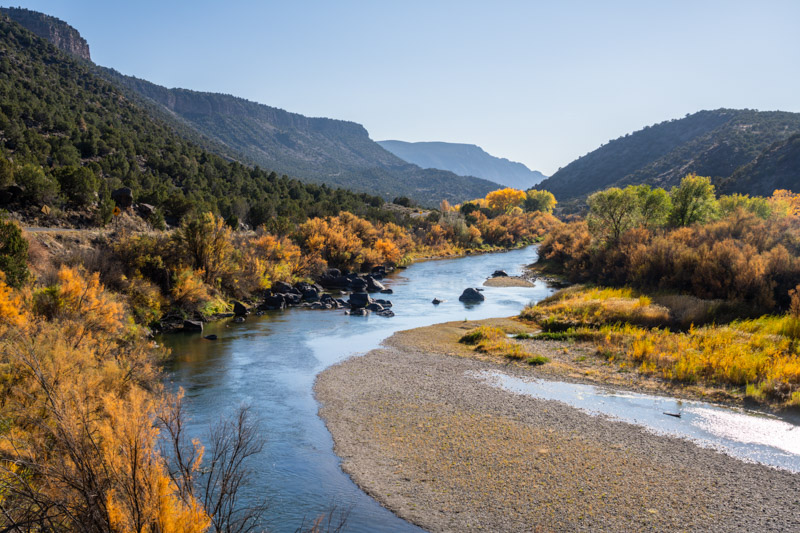
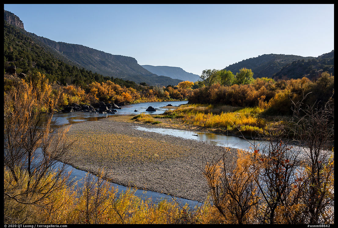
Although I could always look for more, I needed just one 
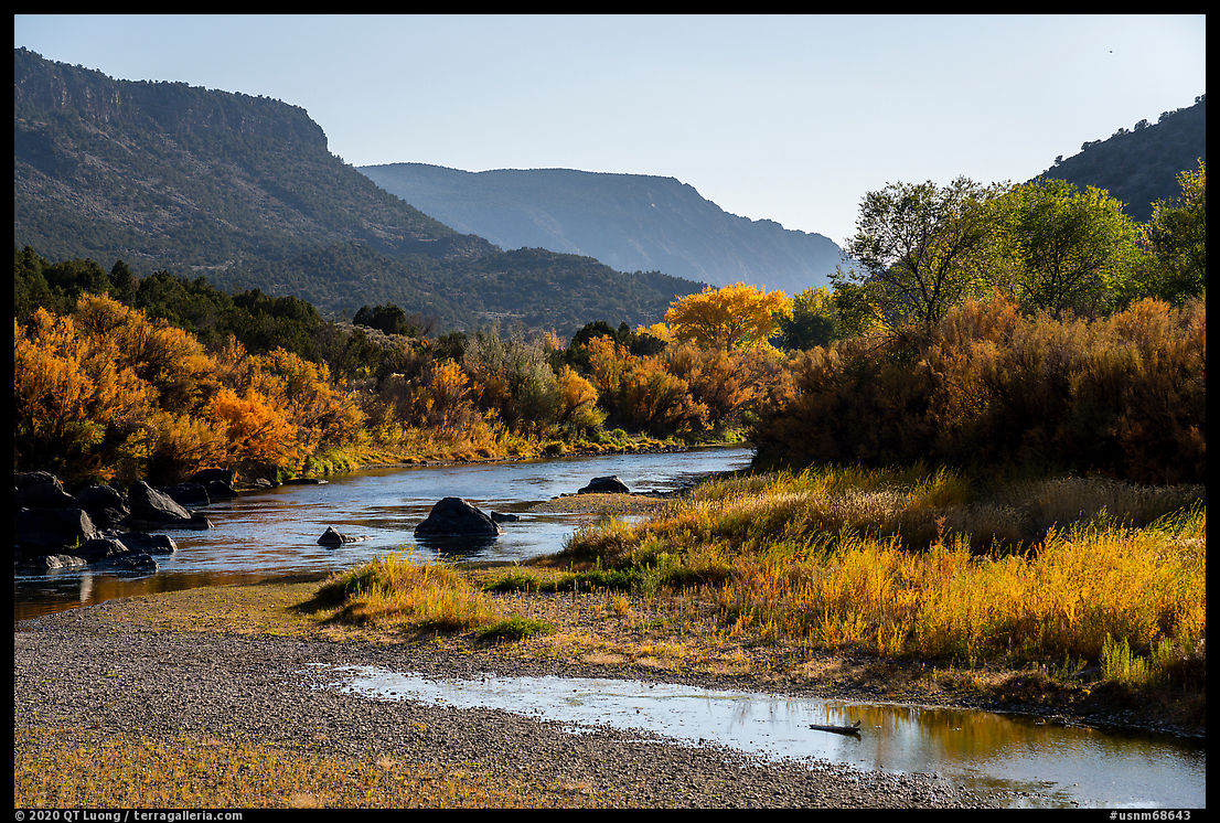
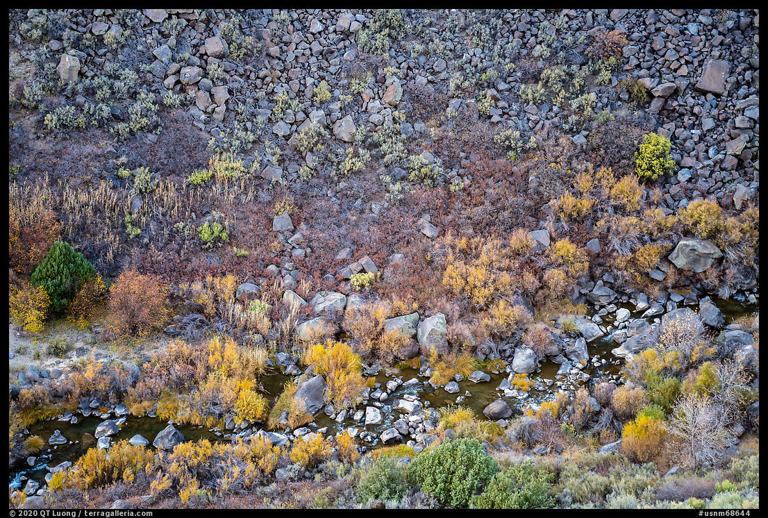
image of Rio Grande Del Norte National Monument with autumn foliage, and being reasonably confident with the one I made, I could now turn to locations that had eluded me during my previous trip. Instead of roadside photography, they would require short hikes.

Taos Valley Overlook

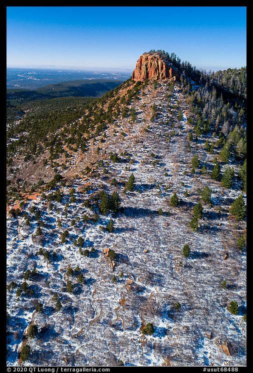
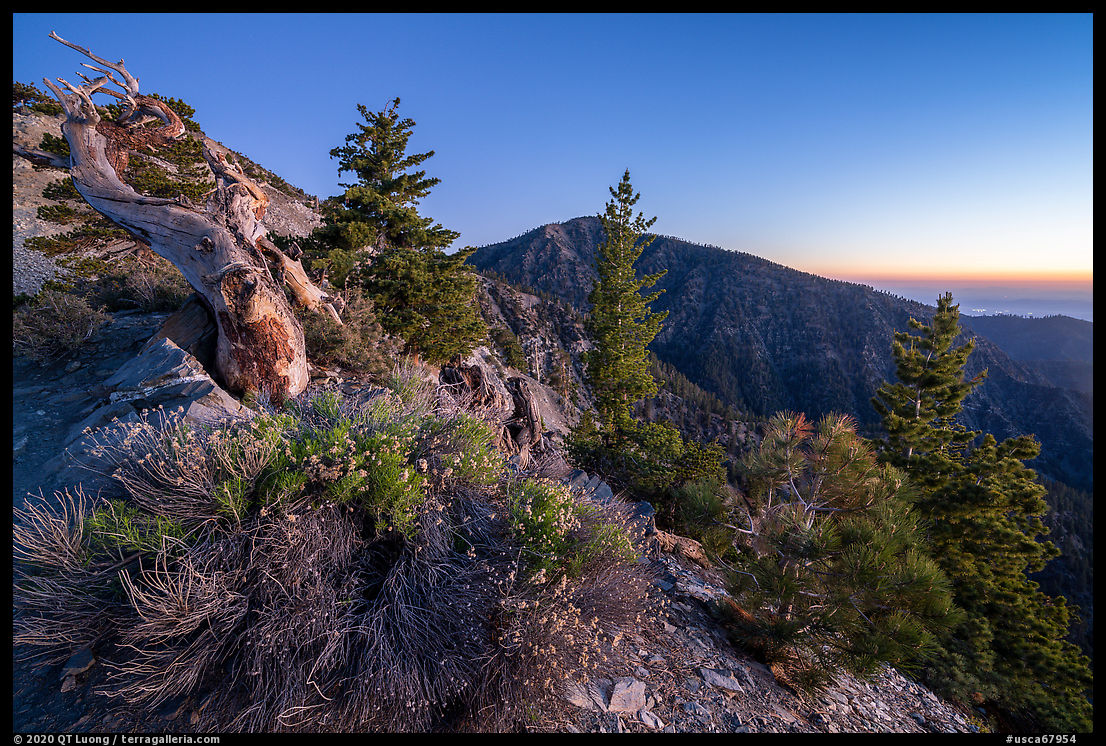
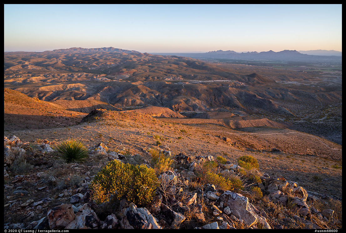
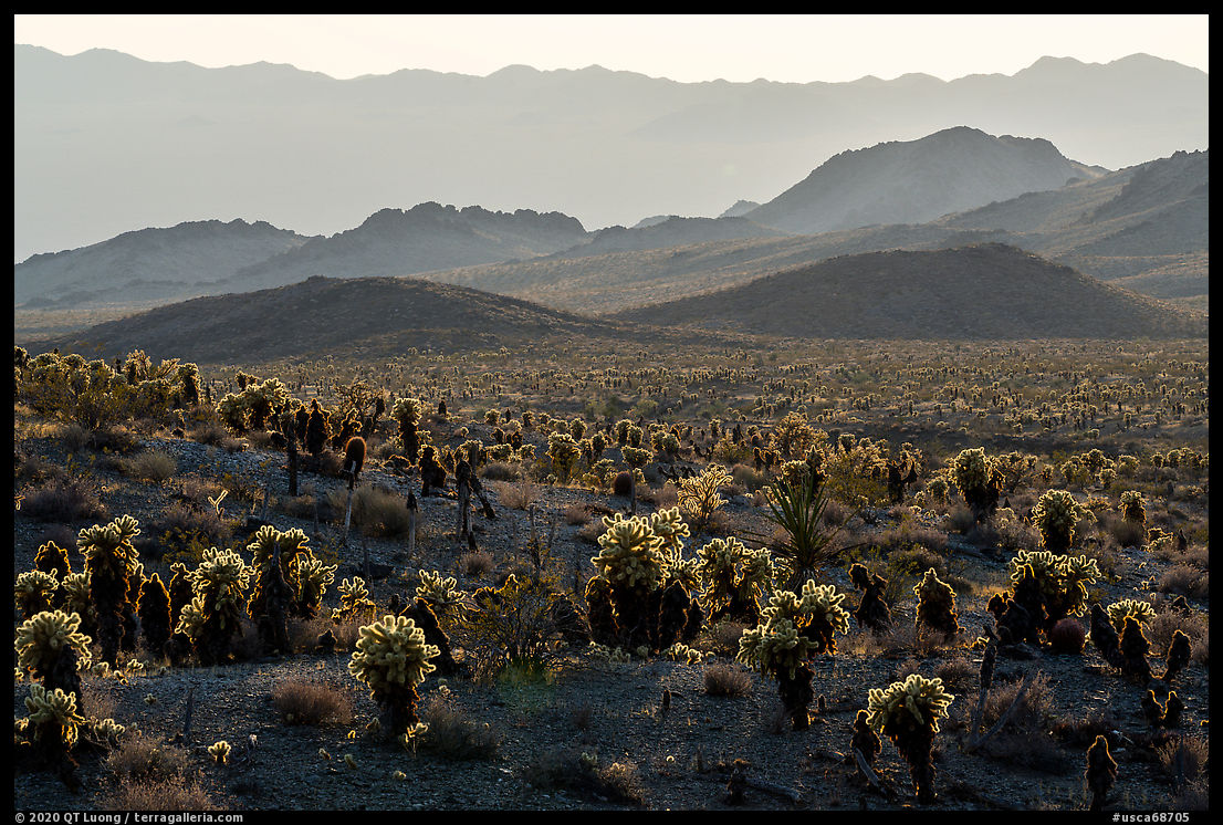
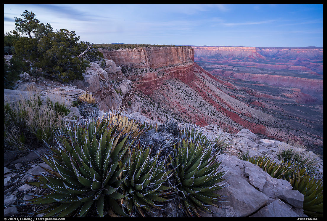
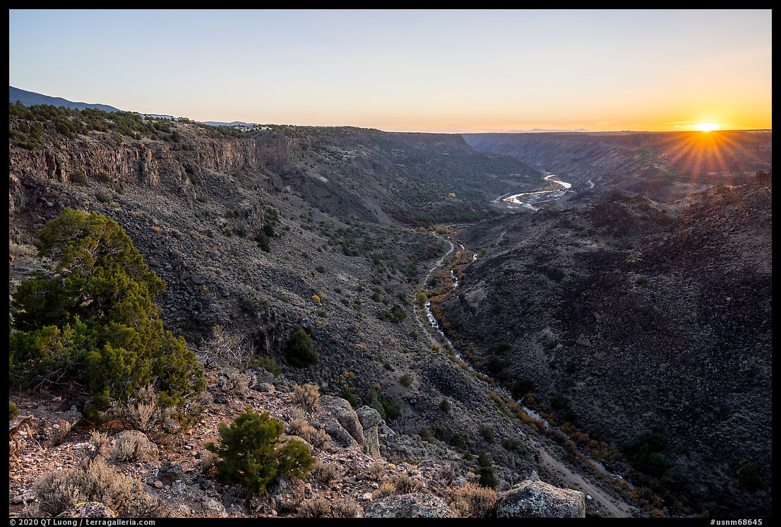
Despite its name, Taos Valley Overlook is not a single overlook, but rather an entire area on the east side of the gorge where a network of almost level trails popular with mountain bikers crisscrosses the sagebrush plateau, leading to the rim of the Gorge. A woman at the visitor center in Pilar had told me that since it wasn’t particularly photogenic nor remarkable, I should spend my time along MN-570 in the gorge instead. However, since I had missed Taos Valley Overlook during my last visit, despite the warming, I was still curious to see what I could discover there. Because of the late hour, I took the most direct route to the rim, the Traders Trail (3.4 miles roundtrip, 250 elevation gain) accessed from a trailhead along NM-68. There was indeed nothing but flats until the rim of the gorge, and the view from that rim was not as spectacular as other rim views in the monument. While the mesa was just a bit breezy, that particular spot on the rim was extremely windy as the lower gorge acted like a funnel. When I tried to photograph with a telephoto lens, it took multiple tries to get a sharp image. Fortunately, I could review on the spot at 100% pixel view to check sharpness and try again. I timed an image for sunset to add a bit of interest to the view, then stayed on the rim until dusk for the soft directional light that I like for canyons. In contrast with southern New Mexico, after sunset the temperatures got chilly. After hiking back in the dark, I drove to La Junta Campground, eating snacks along the way, and arrived at 9:30 pm.
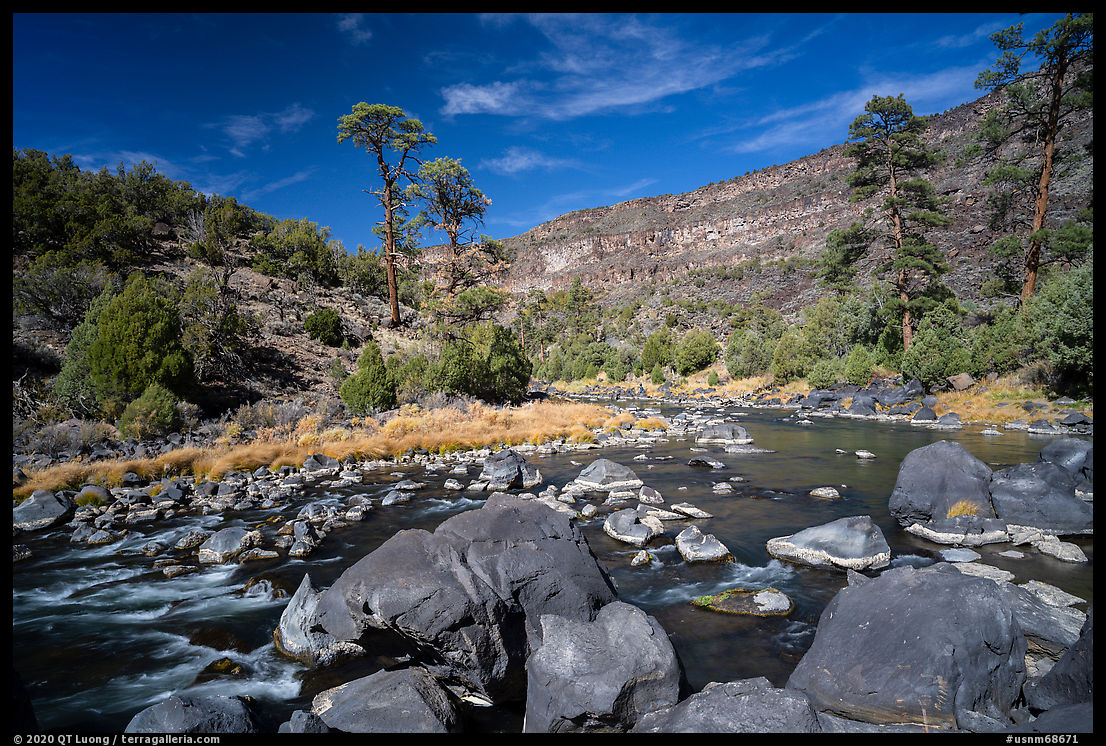
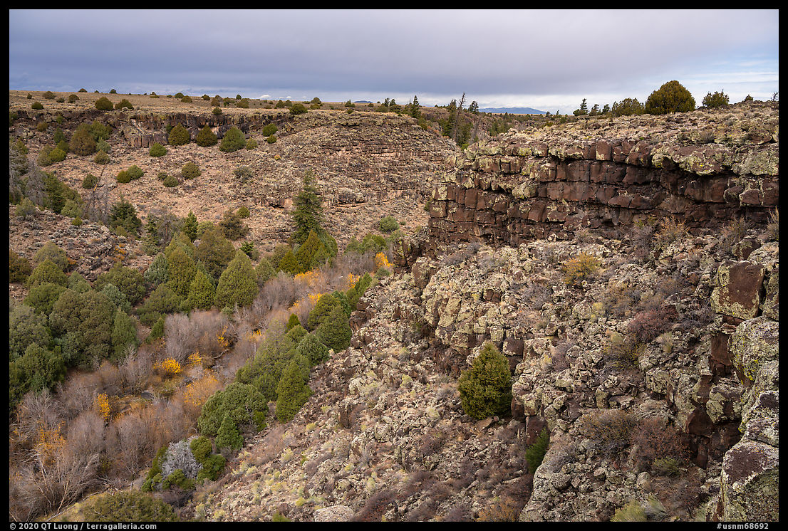
Wild Rivers

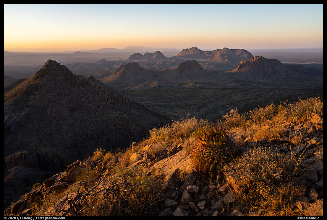
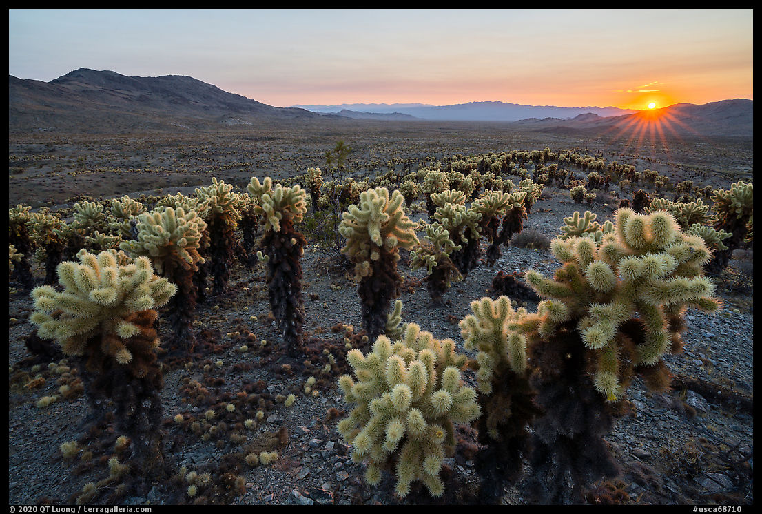
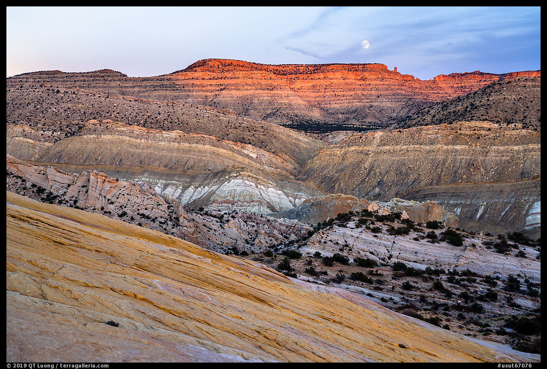
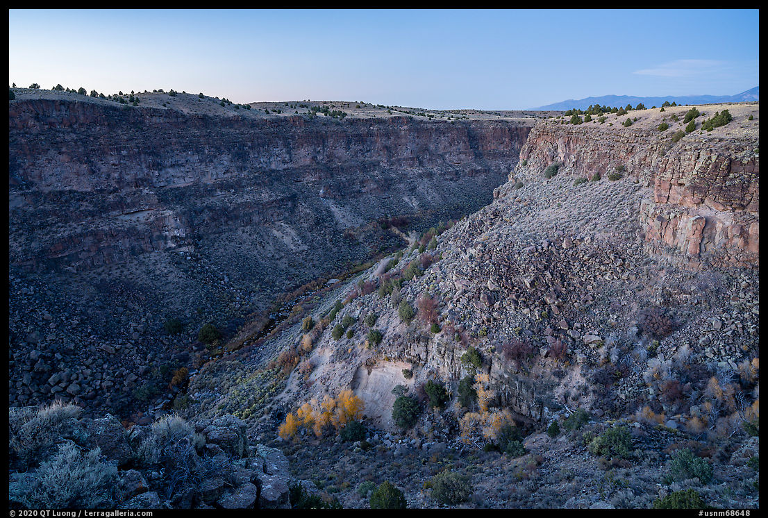
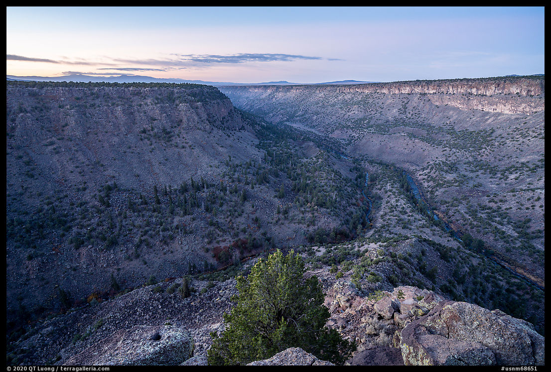
Waking up at 6:30 am, about an hour before sunrise, I headed towards what I thought would be La Junta Point, at the southern tip of the plateau, where a viewpoint overlooks the confluence of the Rio Grande River and Red River. After walking for ten minutes, I remembered that the overlook wasn’t that far, and checked my map app to find I had been headed in the wrong direction. This meant I’d be missing the most favorable pre-dawn light for both this view, and also the next one, at Sheep Crossing, about 20 minutes away. After waiting until after sunrise there, when I made images of the plateau, morning was well under way.

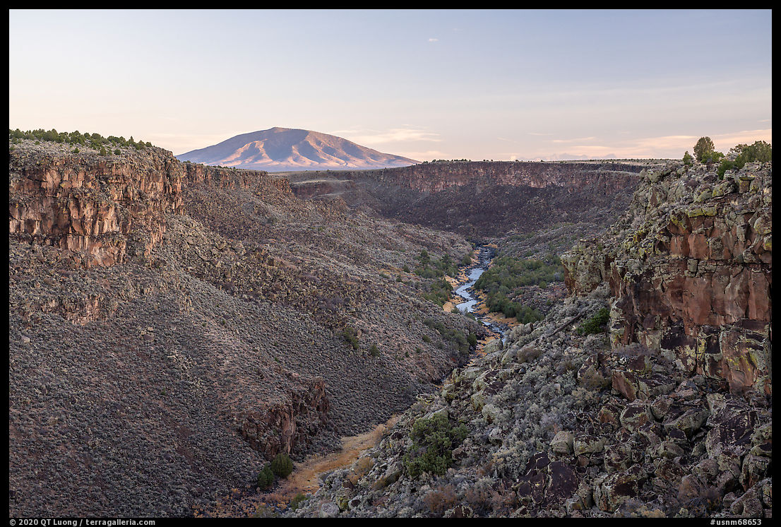
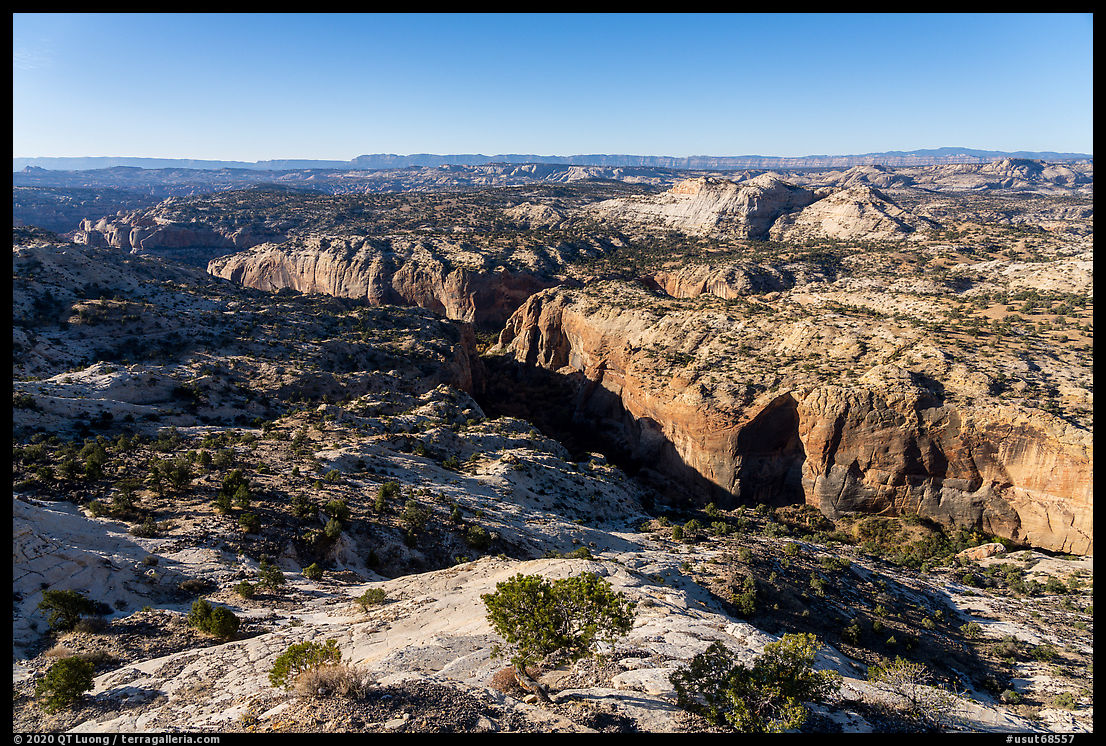
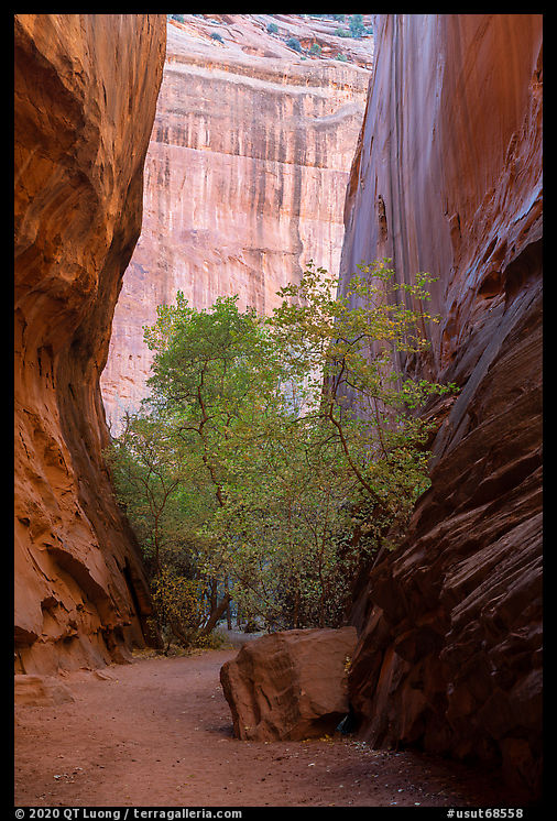
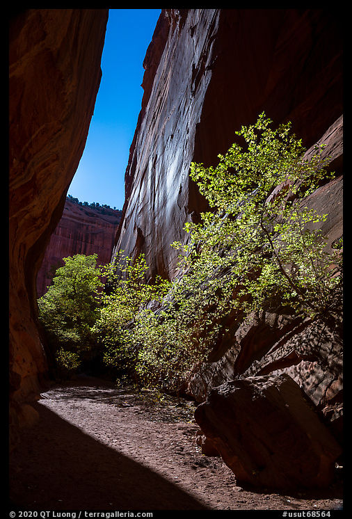
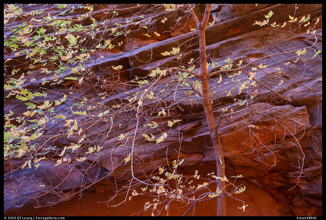
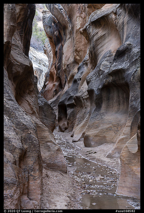
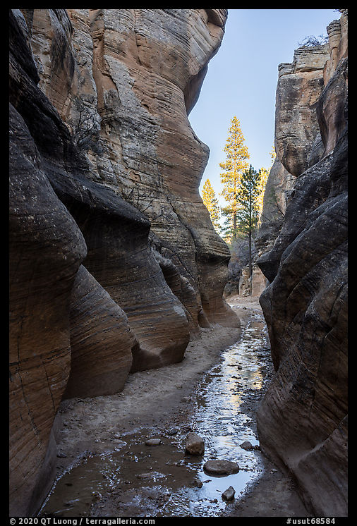
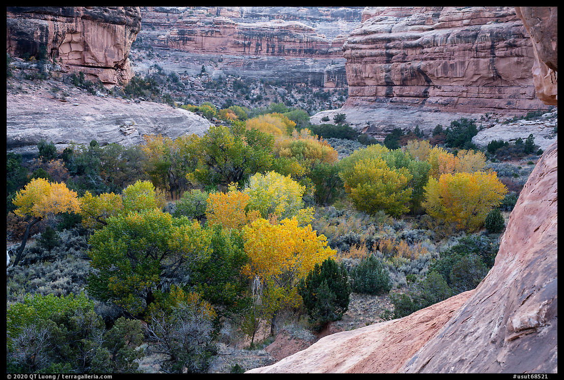
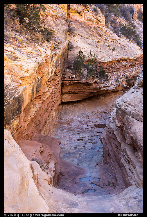
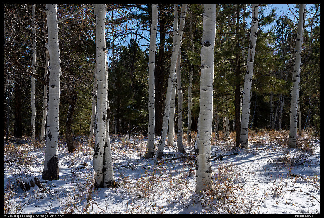
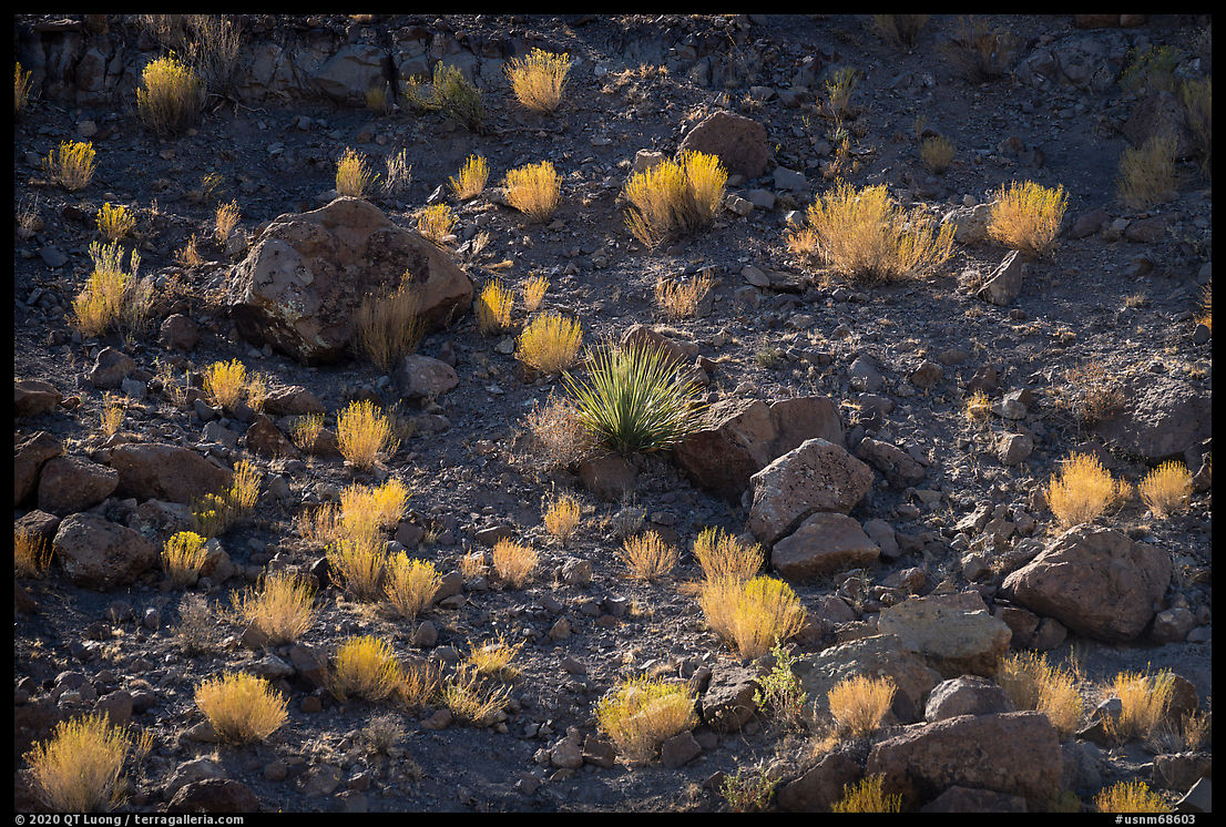
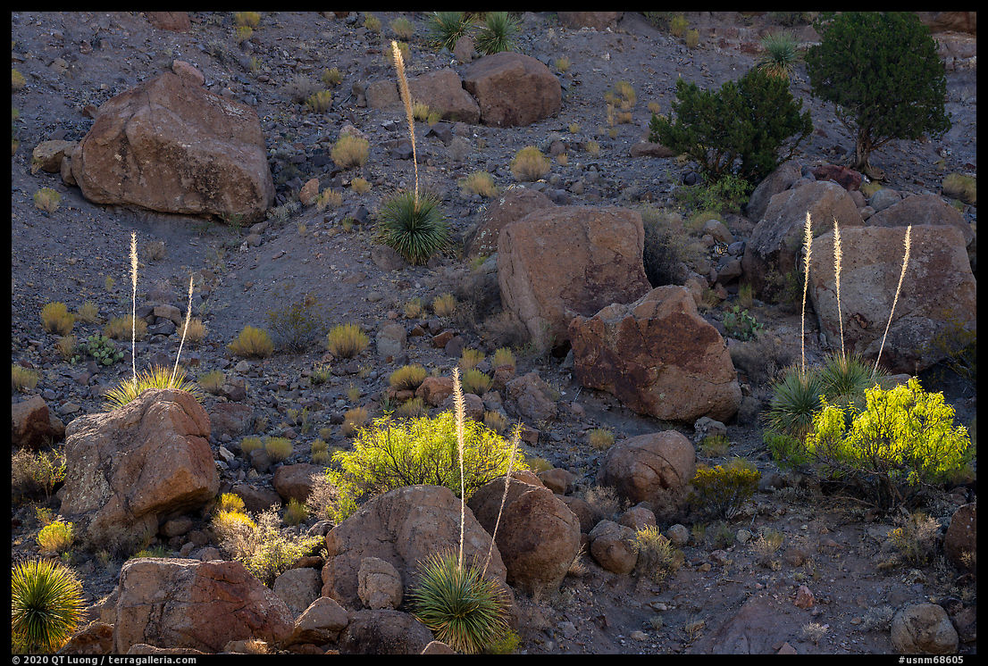
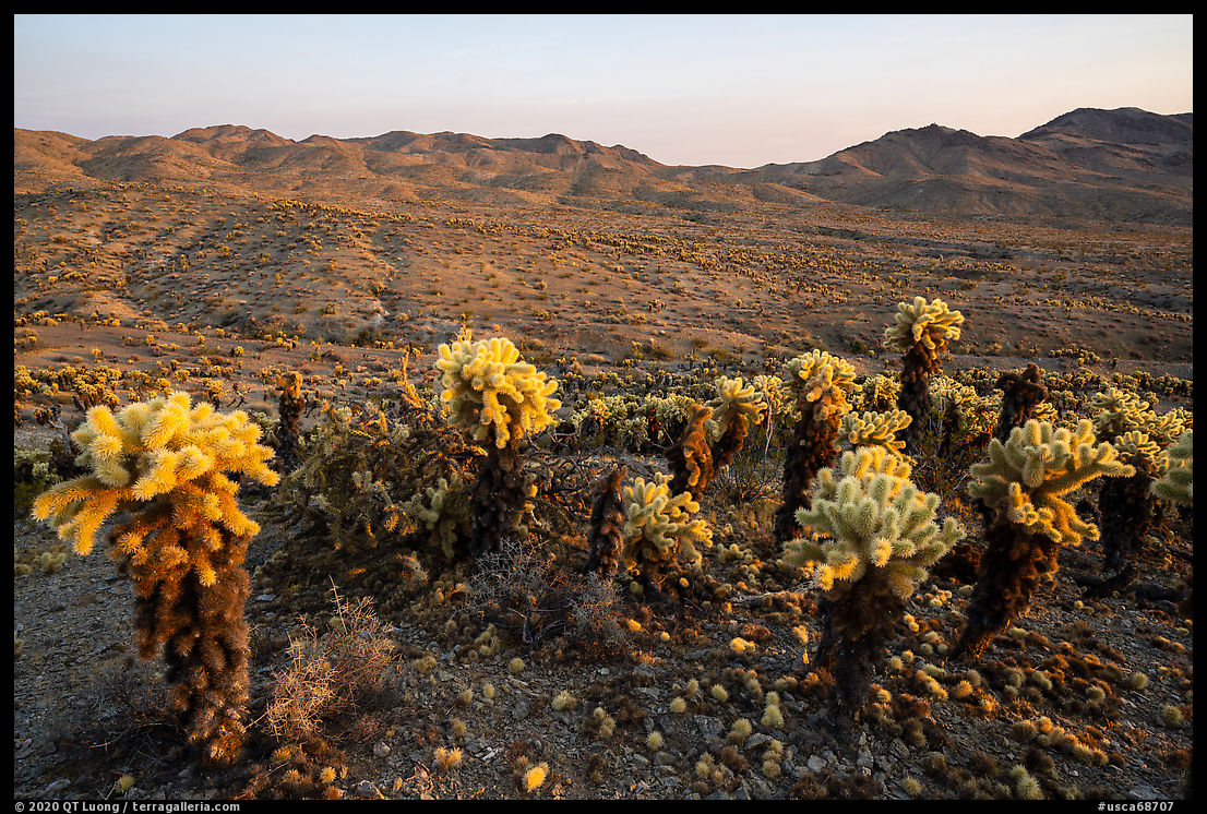
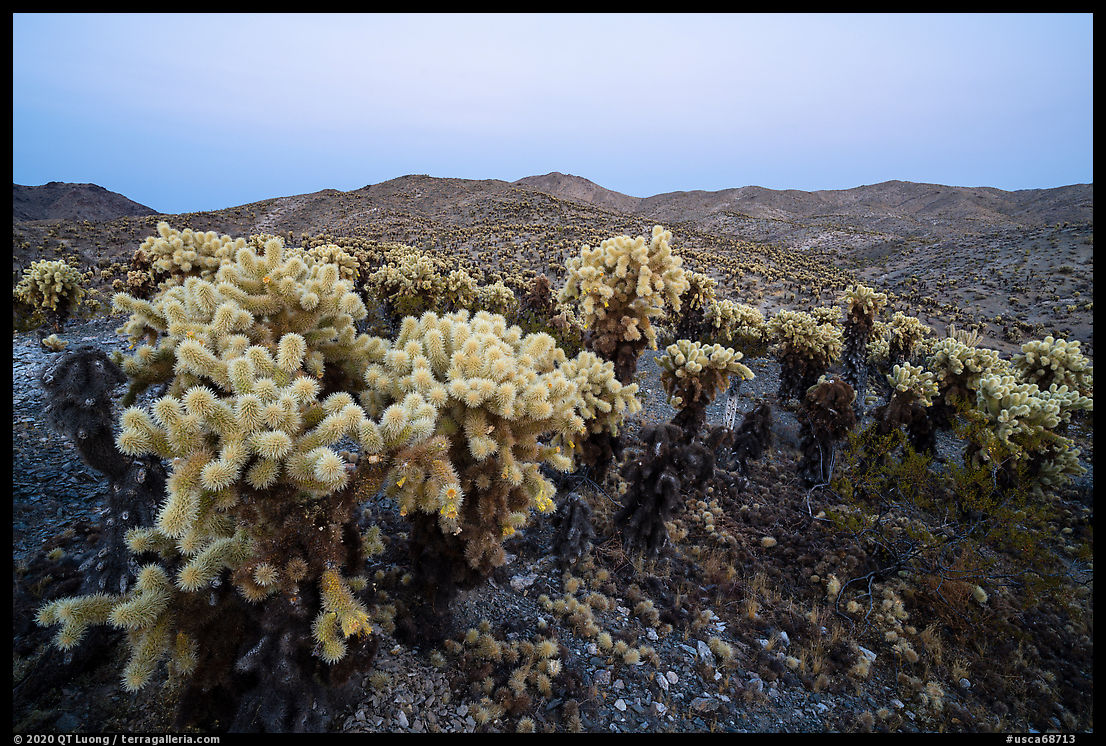
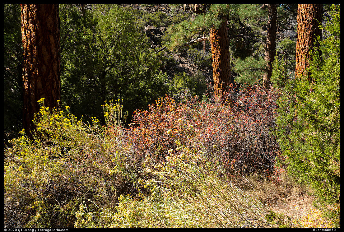
In the Wild Rivers area, six short and steep trails descend 700 feet to the river into the gorge, half-a-mile wide at this point. During my previous visit, the trails were closed because of icy conditions, and I was in no condition to hike anyway. I stopped at the BLM visitor center to ask for recommendations on which trail to take. While there, I noticed a publication whose cover featured a striking faraway view of the plateau incised by the gorge that I’d seen before, but when I inquired with the volunteers, they could not identify positively the location, suggesting the surroundings of the John Dunn Bridge. The Big Arsenic Trail (2.4 miles round-trip, 680 feet elevation change) is well-graded thanks to its switchbacks built by the Civilian Conservation Corps and an excellent introduction to the area’s diversity. It hugs the cliffs at the top and at the bottom reaches a clear spring (with no arsenic!). The riverside ponderosa pine and Douglas fir forest grows surprisingly below the pinon and junipers trees at the rim.

Looking for a view

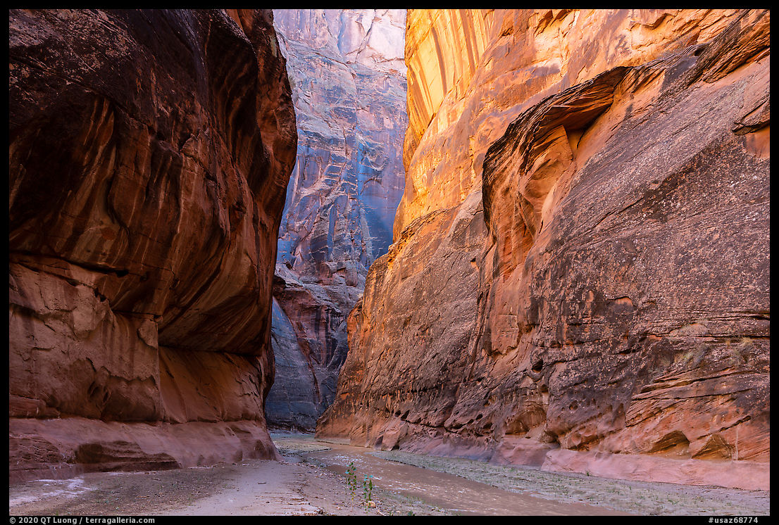
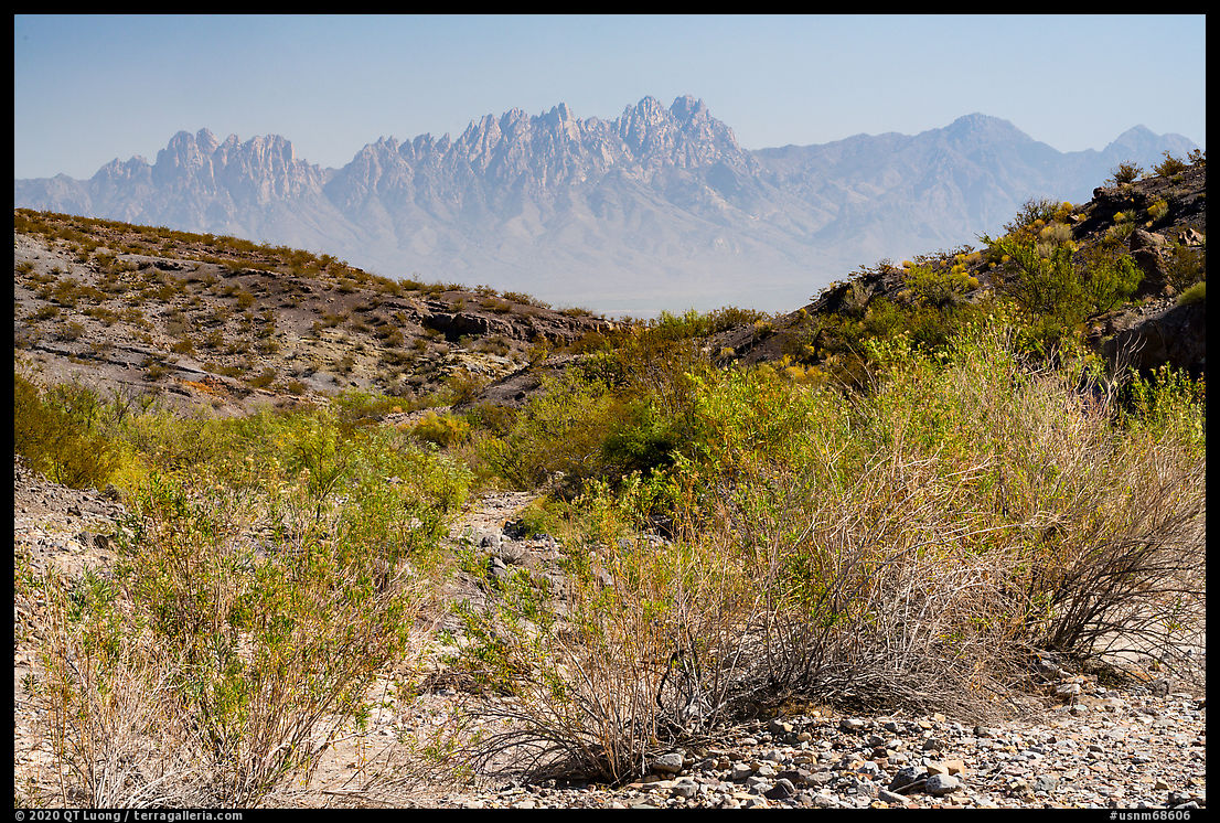
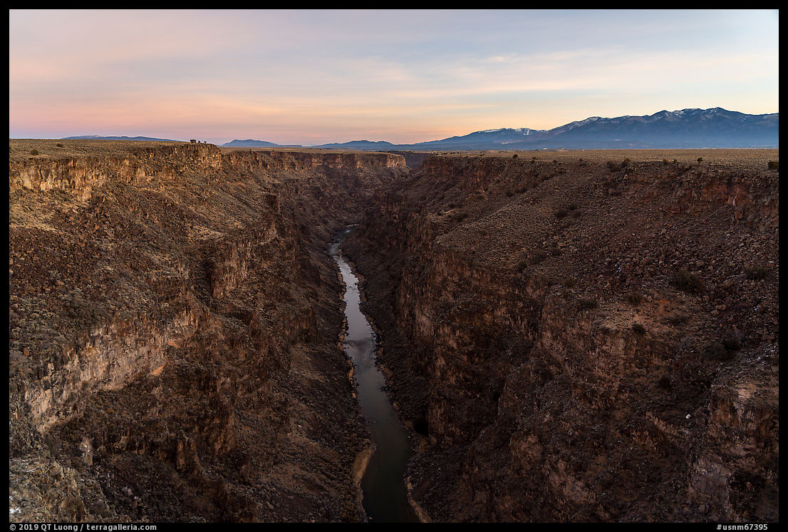
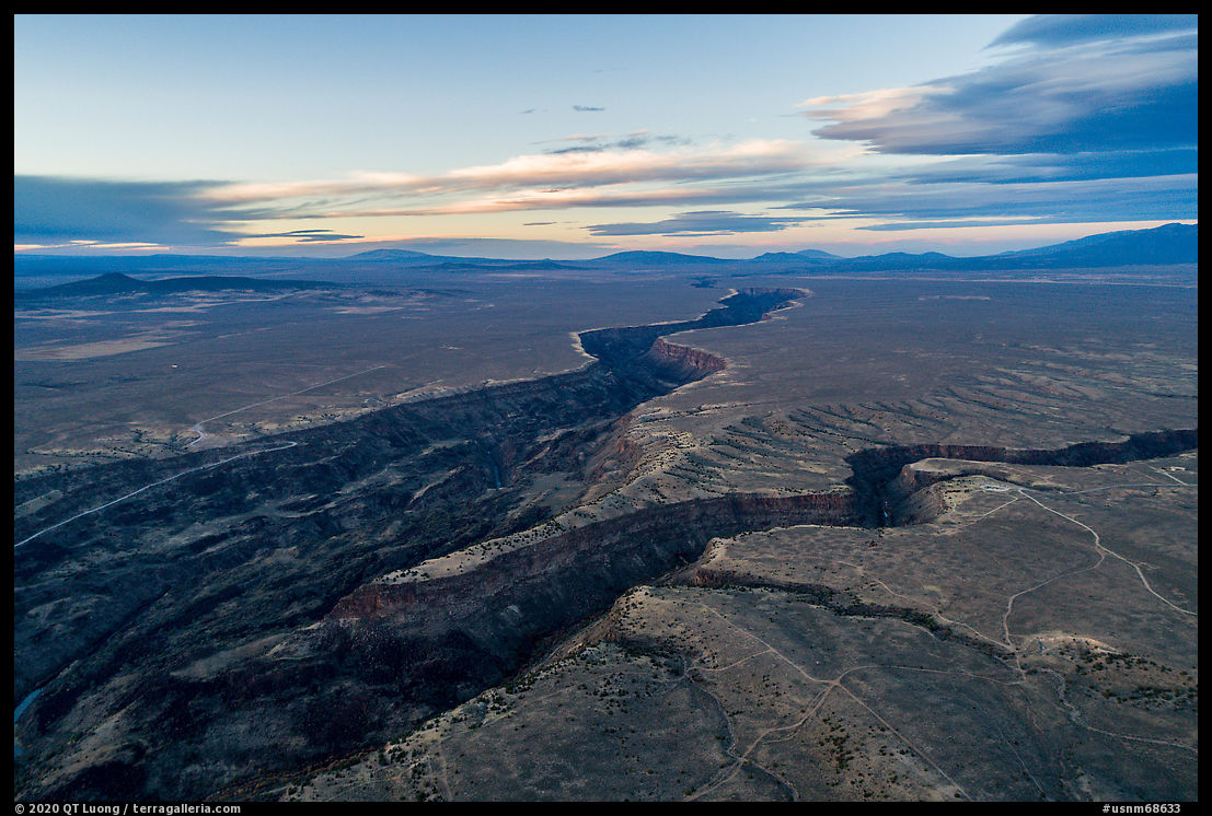
After completing the hike, I drove to the John Dunn Bridge looking for that faraway view. The last time, I hardly saw anybody there, but this time the place was packed. This wasn’t too surprising, since it is the only roadside river access beyond Orilla Verde, the weather was moderate, and the day sunny. As visitors had parked cars and put out chairs all over the riverbanks, I struggled to find an unpopulated view. Driving on the rim, I didn’t find any of the topography I was looking for, but after studying the map further, it occurred to me that I should look back south where I was the day before. The sun was already disappearing from the gorge floor, where I photographed at the edge of the light on the way.

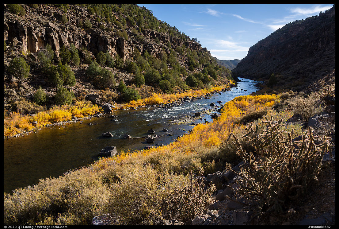
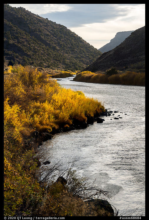
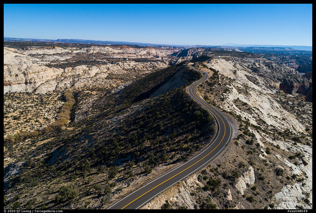
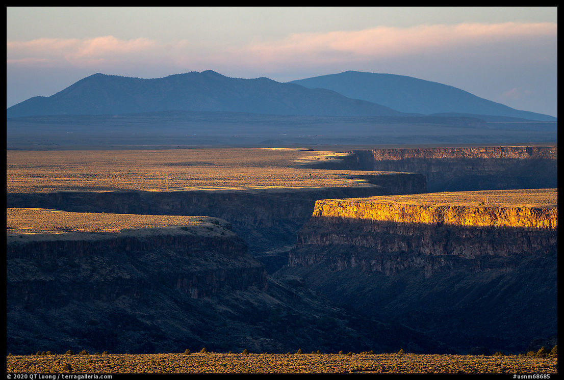
Driving along NM-68 between Pillar and the Taos Valley Overlook Trailhead with my eyes now trained on the plateau below, I soon noticed the cut of the gorge in the distance, indicating that my guess was correct. As the vantage point from the highway was not high enough for a clear view, I followed a dirt road heading up the slope, turning around when it became private. I could not find a composition with a foreground as distant as I’d liked, but the position was was nevertheless an improvement over roadside views. I waited for clouds to pass so that sunlight would illuminate the gorge. Since the gorge was so distant, I launched the drone to try for a closer perspective, but when it was in the position to take the picture, clouds obscured the sun again. The drone was more than a mile out, so there was not much battery power left for hovering while waiting. My next destination was the landmark High Bridge. I had previously photographed it at dawn, but I thought that dusk might be an improvement. On the way, as I approached a rest stop along NM-68, a better view of the faraway gorge presented itself. I could not resist setting up for another photograph, complicated again by the passing clouds and the wind that was shaking my telephoto lens. When I reached the High Bridge, it was 15 minutes late and too dark, an indirect consequence of failing to scout the faraway gorge view the previous day. I drove back towards Taos to find a gas station, then stopped again at the parking lot of the High Bridge to take advantage of the parking lights to cook dinner before driving into the darkness of the monument’s wildest corner.
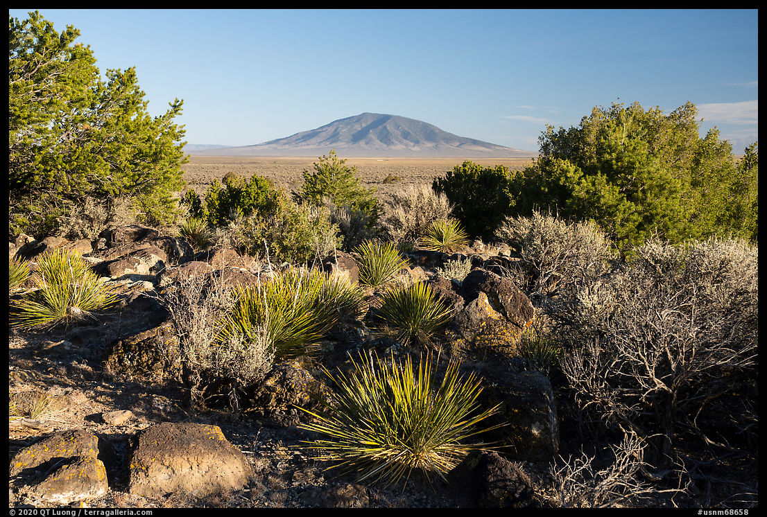
San Antonio

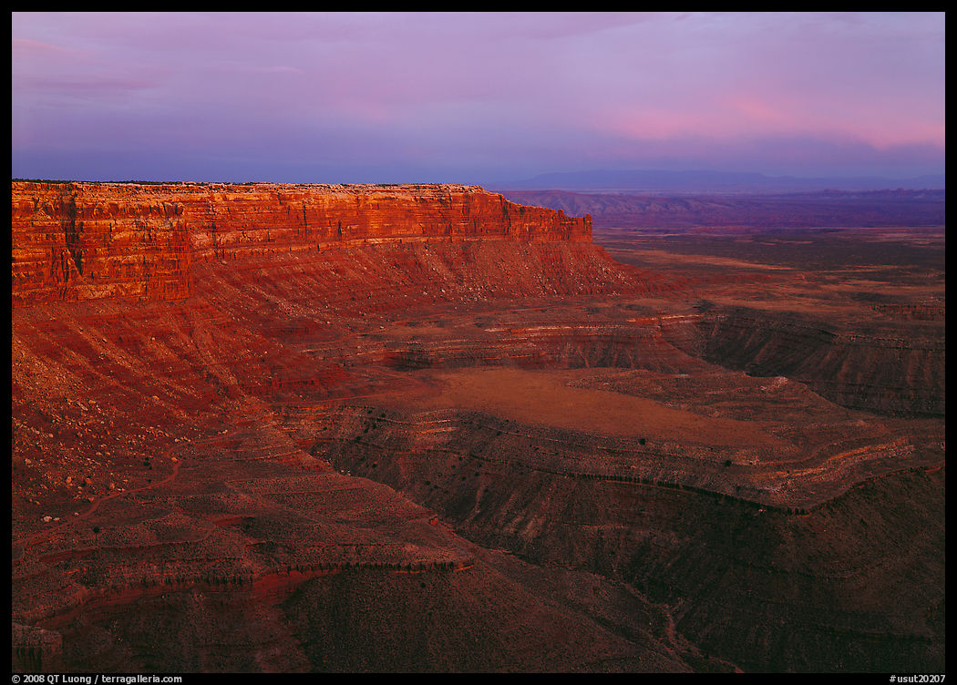
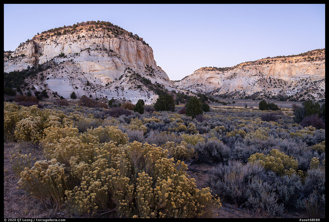
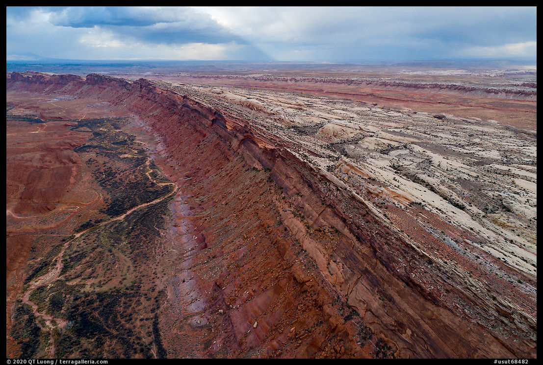
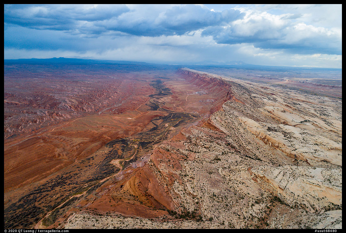
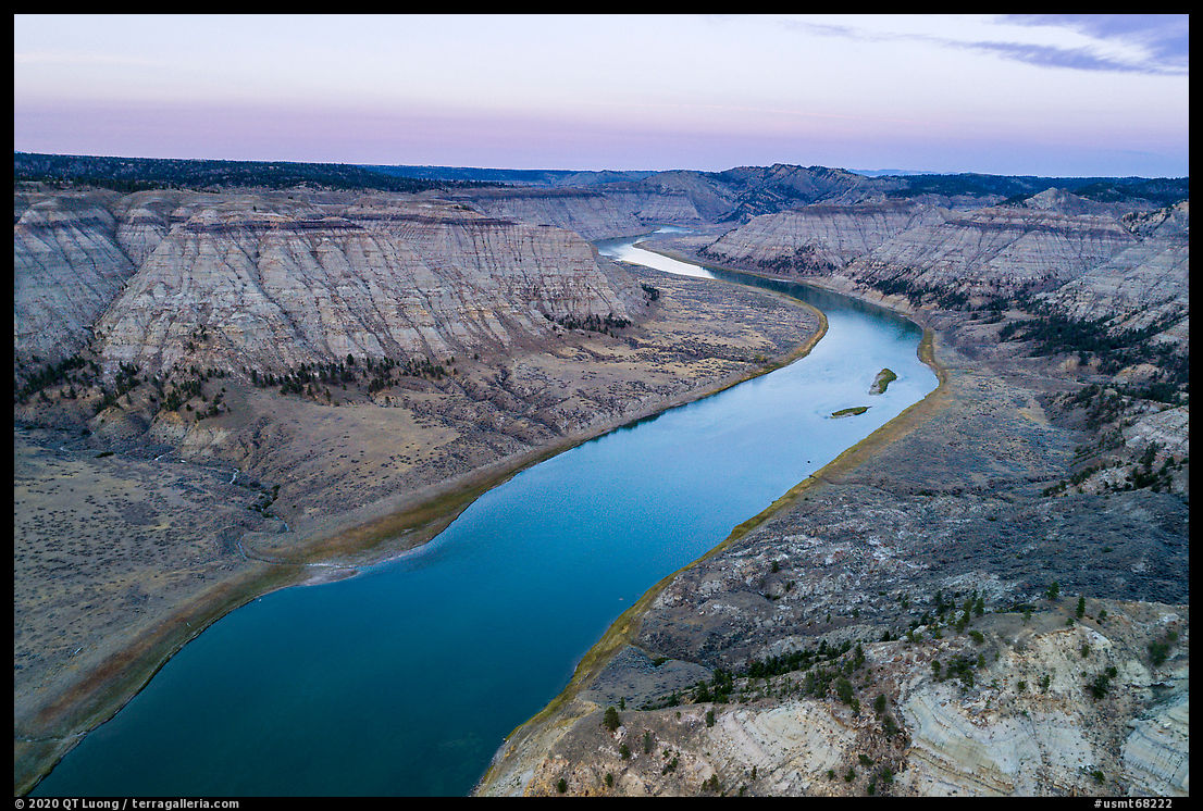
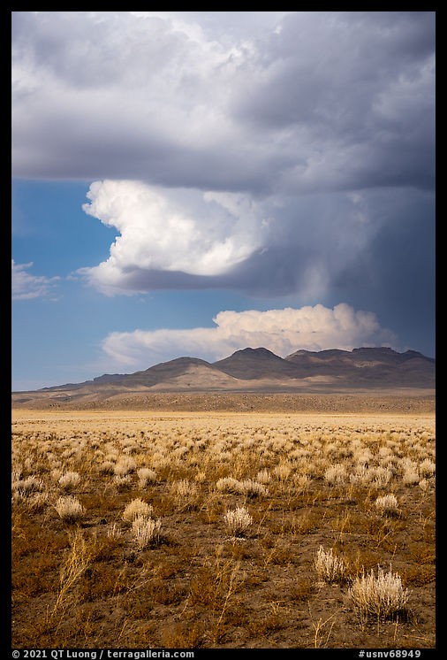
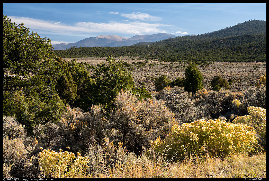
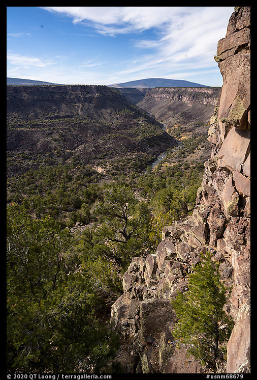
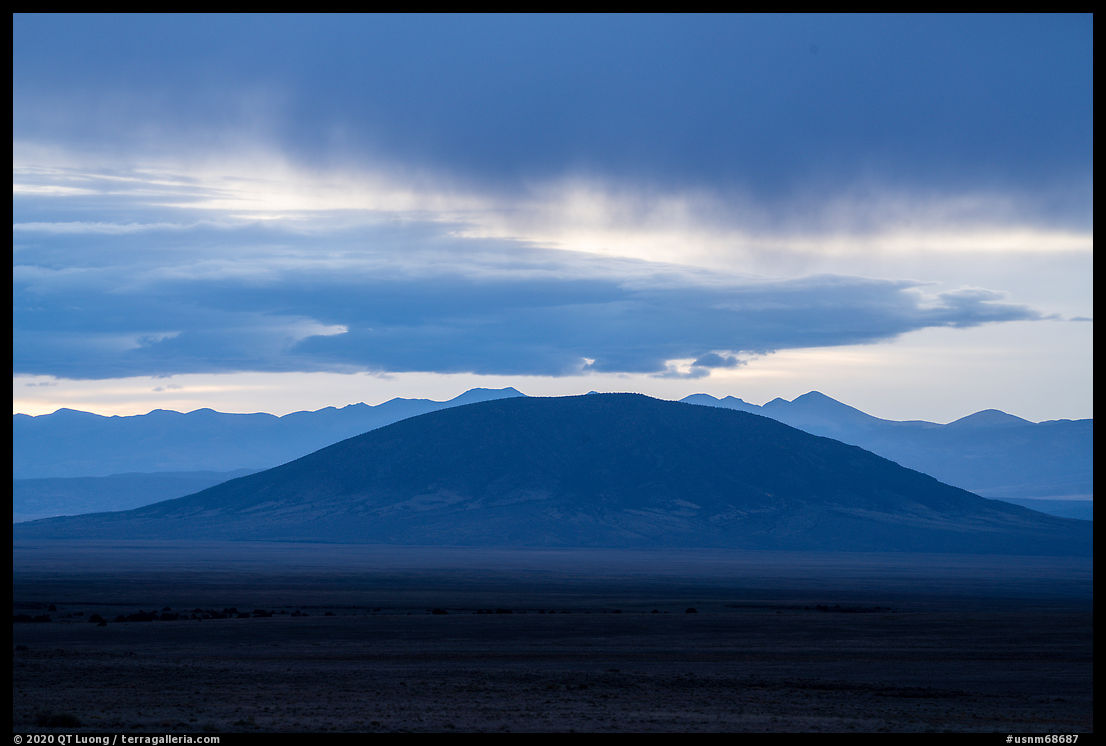
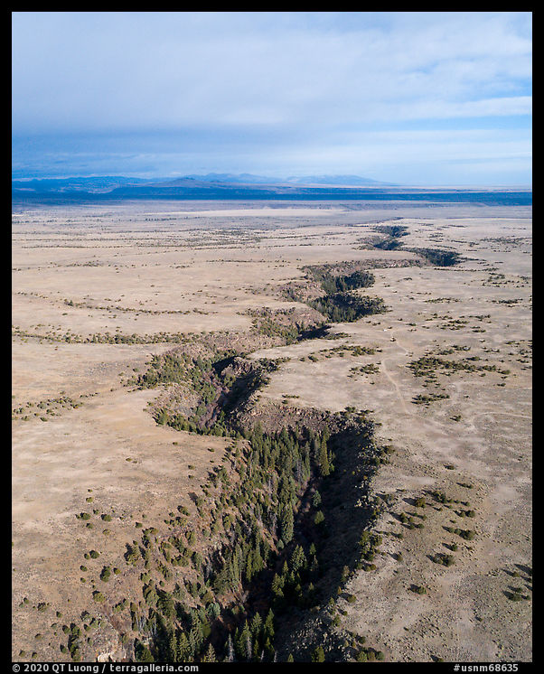
The corner of the monument west of US-285 consists of rolling grasslands dominated by San Antonio Mountain (10,908 feet), a dormant volcano barely outside the monument’s boundaries. It is a remote area without facilities and far from settlements. I had spotted on the map an unpaved Forest Service road just south of San Antonio Mountain. I followed it until I found a wide pullout where I parked for the night. I didn’t expect anybody to drive by before sunrise, but well before the pre-dawn time I had set my alarm for, several passing trucks woke me up. The morning was cloudy, with no color at sunrise, but dark storm clouds complemented the silhouette of Ute Mountain. Just north of San Antonio Mountain, the plains are incised by the Rio San Antonio, which the information booklet said was entirely hidden from a distance. As I tried to navigate a deeply rutted 4WD road, all I could see was grassy tablelands stretching to the horizon. The booklet at one point said to follow a “trail”, so I assumed I’d arrived at a trailhead reasonably close to the gorge, but all I could see where flats. I drove further until I reached what looked like the monument’s boundary and backtracked. I was about to give up trying to locate the gorge when it occurred to me that I could launch my drone for a higher viewpoint in the air. While I was piloting, out of nowhere a water truck came by to replenish cattle troughs, forcing me to leave the drone hovering as I moved the car entirely out of the way. Even after figuring out the route, a ranching dirt road (that the booklet had called a trail) heading north about 3.5 miles west of US-285 on Forest Road 118 and then branching west after 1.25 miles, the gorge remained hidden by the flats right until I got almost to its rim. It was filled up with mature trees, contrasting with the barren and mostly treeless lands above. The 200 feet deep gorge of dark basalt looked like a miniature version of the Rio Grande Gorge.

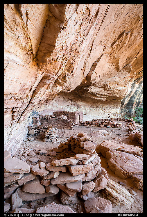
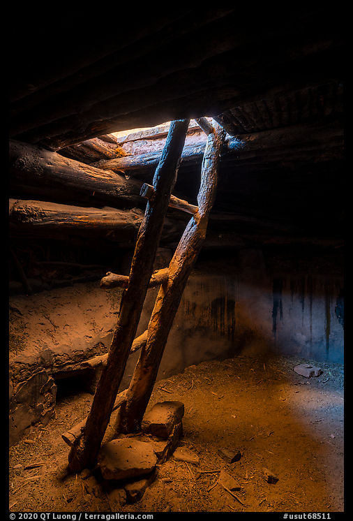
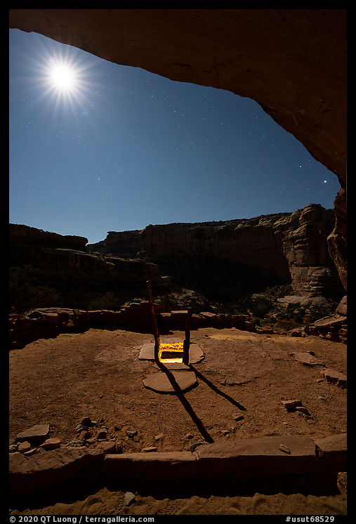
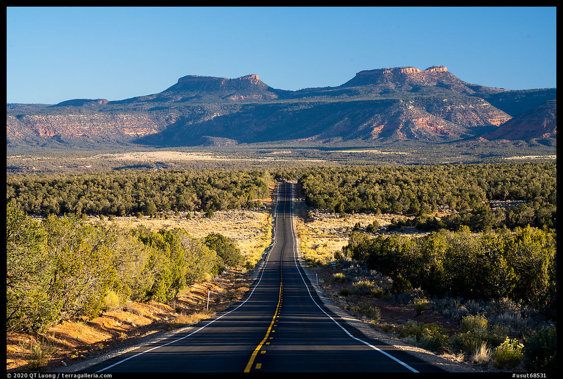
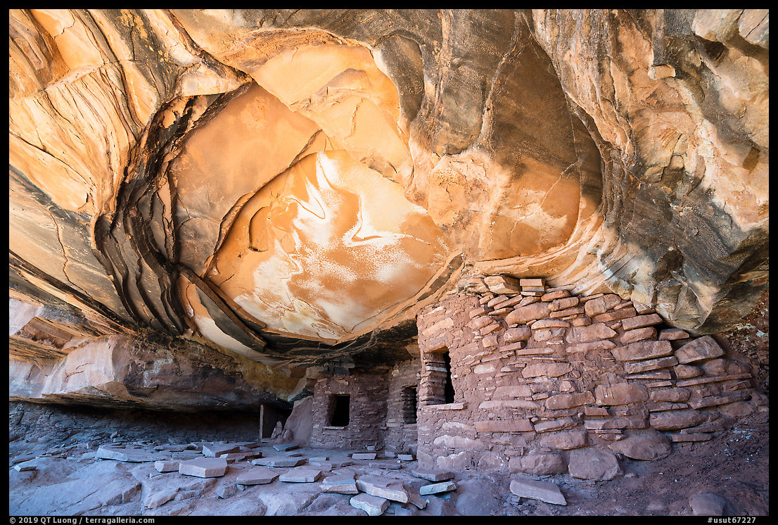
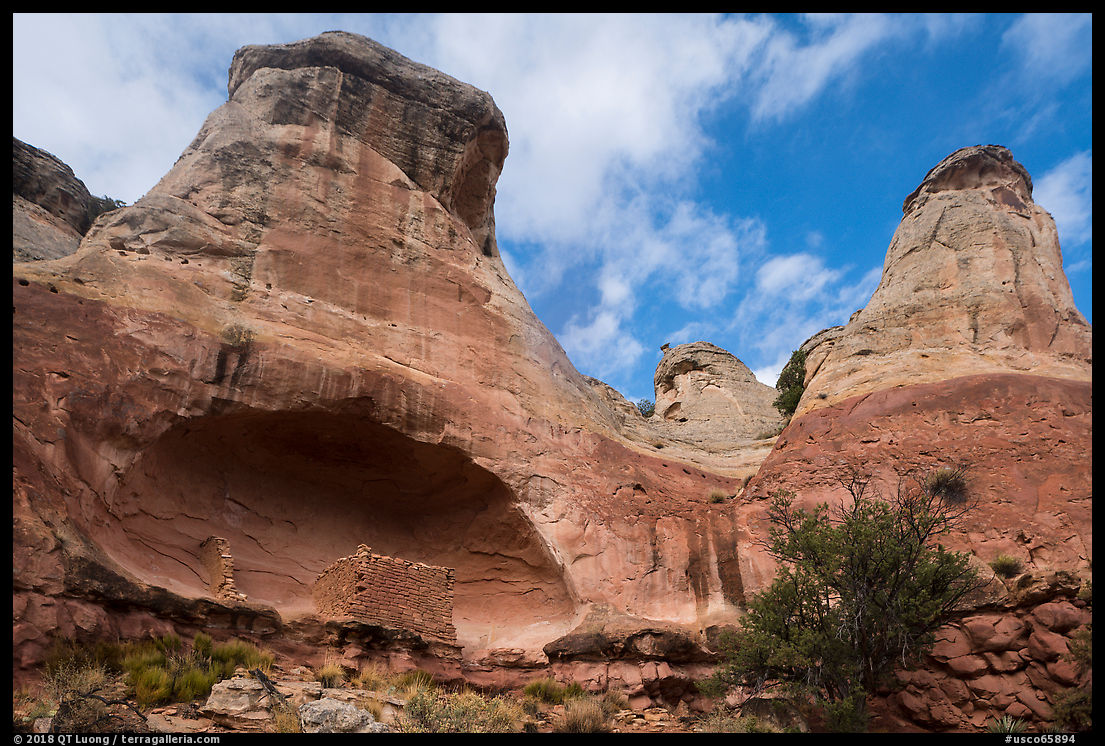
On the way back, the tracks on the flats were disorienting enough that I had to check my GPS app to stay on route. Once I reached the pavement, I settled for the 300-mile drive to Valley of the Gods that would take me through four states. After passing mountains in Colorado, for a break from driving, I bought a Subway sandwich. Shiprock under storm clouds was mesmerizing as always. I had to pull out for a photograph, after which I declined to stop in town to refil gas, thinking that I could do so later in Arizona or Utah. By the time I reached UT-163, no gas station had presented itself, so I had to detour to Bluff to make sure I would enter Bears Ears National Monument with a full tank.

The Last Road Trip: 1 | 2 | 3 | 4 | 5 | 6 | 7 | To be continued

2020 In Review and Happy New Year

While 2020 has been a challenging year, I am grateful to have been able to find a bit of comfort, hope, and escape in our public lands. For the first time in decades, I spent almost no time in the national parks. Instead, I traveled for several weeks in national monuments, working on my forthcoming book. Thankfully, it turned out that those BLM lands are much better places for social distancing than the national parks, due to the considerably lighter visitation and absence of facilities that concentrate people. Traveling to them also fosters self-reliance, which in turn helps minimize contact with surrounding communities. Links below point to blog posts with more images and details.

In mid-March, I traveled to the Sonoran Desert during the annual bloom, visiting both Sonoran Desert National Monument and Ironwood Forest National Monument. I found both as beautiful as the better known Saguaro National Park. During that trip, I first started the socially-distanced autonomous travel practices that I would keep all year.

In Santa Clara County, we had the earliest shutdown in the country, starting in mid-March, just while I was returning from Arizona, and lasting into early June. This was a period of stringent and (maybe unwarranted?) closures. You couldn’t even go to the beach. In local city parks, bathrooms and playgrounds were all closed. Save for grocery shopping every other week and jogging every other day – that I did on suburban streets rather than trails as the latter are less amenable to social distancing, I stayed home until the early summer.

The spring had totally gone by, and even though summer is my least favorite season to travel, with the (too premature?) re-opening of California and the realization that one must take responsibility for their own safety, I started to catch up with my project backlog. In late June, as a test trip, I headed to Southern California, visiting the southern part of Giant Sequoia National Monument and hiking Mount Baldy in San Gabriel Mountains National Monument. Despite the Southern California heat, it felt good to get out of the city.

In early July, for my only visit to a national park this year, I drove to Roads End in Kings Canyon National Park to pick up family members hiking the John Muir Trail. On the way, I explored the northern part of Giant Sequoia National Monument. With the number of cases rising again, a new shutdown order was imposed. In San Jose, our summer went from bad to worse when the SCU fire became the second-largest in California’s history. It burned less than 5 miles away from our home, and a mandatory evacuation zone was declared less than a mile away.

In September, with the fire contained, I started to plan interstate travel again. Although a minor concern compared to family safety, the fire season was also causing problems for photography. Not only did I have to optimize travel time and take weather into consideration, I also needed to monitor rapidly changing air quality as smoky air can be unhealthy and doesn’t lend itself to great landscape photographs. Normally, I would have flown, as this saves both time and carbon emissions, but in the new normal, I embarked instead on a two week, 3300-mile road trip to public lands in the Northwest, revisiting Craters of the Moon National Monument and Hanford Reach National Monument.

The main objective of the trip was to visit Upper Missouri River Breaks National Monument, the last park missing for my new book project. I had planned to go there in September 2019, but a car crash injury had sidelined me that entire month. By the time I had recovered, the ground was already covered by snow in central Montana. This time I caught autumn colors in perfect weather as I floated the river for four days.

In mid-October, barely after finishing processing images from the September Northwest tour, I hit the road again for the final major trip of the national monuments project. It was a culmination of sorts, as my most packed two-week trip to date: 4,000+ miles driven with each day including some off-pavement. With the objective to tighten up loose ends, it was a series of quick stops in many national monuments to locations that I had missed before, starting with the deserts: Mojave Trails, Ironwood Forest in the Sonoran Desert, and the Desert Peaks in the Chihuahuan Desert.

In the Sonoran, I had encountered temperatures up to 95F on short but steep hikes to obscure peaks. The return leg of the trip in Utah and Northern Arizona was marked by temperatures dropping as low as 16F during a day trip into the Grand Gulch, and day hikes up to 17 miles such as the Paria Canyon, but that did little to temper my enjoyment of all the beauty I was privileged to experience. In keeping with my chronicle of that last road trip, I will be writing about those adventures in the next few weeks.

I returned home on Election Eve. Slightly past noon that day, just before leaving Basin and Range National Monument, I made my last landscape photograph of the year a few yards from the park’s boundary.

If you’ve read so far, my sincere thanks for your interest in my work. I wish you and your loved one a safe and healthy 2021.

Steps behind the image: Orilla Verde Autumn

To those who celebrate the occasion, Merry Christmas!

Day 5

After driving 350 miles straight from Las Cruces save for a gas stop, I breathed a sigh of relief upon seeing bright yellow spots dotting the Rio Grande River gorge. Shortly past the village of Pilar, NM-570 follows the river banks inside the gorge as forms a riparian corridor where the foliage of cottonwood trees contrasts with the barren plateaus above. Over the past days, I had been more hurried than I liked because I wanted to get to Rio Grande Del Norte National Monument while the leaves would still be on the trees.

Northern New Mexico as a whole is high desert, and most of Rio Grande Del Norte National Monument is about 7,000 ft. In December and January, temperatures barely rise above freezing even in the middle of the day. Snowfall occurs from November to April. During my first visit to Rio Grande Del Norte National Monument, at the end of December, when from a distance everything appeared bare and brown, a closer look at the shrubs revealed a varied palette of colors. However, as they were quite subtle, I still wanted to capture the lushness of the canyon with foliage. After coming back from a two-week trip to the Northwest at the beginning of October, I was planning to stay home for a month before hitting the road again. When in mid-October I inquired with a photographer living near the monument about fall foliage, he told me that it was turning quickly and would likely be gone by the beginning of November. Thus, I resolved to leave after barely two weeks at home. As I didn’t want to drive more total miles than absolutely necessary, I had to visit my target destinations in the specific order that would minimize the distance driven instead of heading to Rio Grande Del Norte National Monument first. As I was hiking in the desert, my mind was preoccupied by wondering if during those extra days the foliage would hold.

NM-570 stays inside the gorge for six miles past several riverside campgrounds, picnic areas, boat launches, and trailheads in the Orilla Verde (“green banks”) Recreation Area. Past the Taos Junction Bridge, the road turns briefly to dirt and climbs out of the gorge on the west side. As it was already late afternoon, with just two hours of daylight left, I turned around to head to my next destination. On my way up the gorge, I was mostly trying to evaluate possibilities as I was driving, with the idea of photographing on the drive back. On the way down the gorge, I made a single stop at the location that looked the most promising. I started with a wide-angle composition from the pullout, but the roadway intruded in the picture.

Framing more tightly eliminated the part of the roadway on the left of the image. However, a distant segment of it became more visible.

I tried a vertical composition that excluded the roadway, basically the right half of the previous image. While it is balanced enough, the flow wasn’t as good, and besides, I still wanted a horizontal composition.

Since I had exhausted the possibilities from the pullout, it was time to try a new viewpoint. I scrambled down the slope, so I would stand below the road level. From there, the trees hide the roadway.

Compared to the original wide-angle composition, improvements are possible. The river is partly obscured, therefore interrupting the flow, an issue similar to the modern photos of the Snake River Overlook picture where trees have grown since Ansel Adams created his celebrated photograph. The shape of the central riverbank also becomes too prominent.

Framing more tightly fixes those issues, with the arm of the river to the right now leading the eye from the right bottom corner and more prominence given to the trees.

Afterward, I drove to the Taos Valley Overlook. On the way, although a quick glimpse of a faraway view of the gorge looked intriguing, I didn’t stop. I didn’t realize it at the time, but this turned out to be maybe the first miss on the trip.

The Last Road Trip: 1 | 2 | 3 | 4 | 5 | 6 | to be continued

The Desert Peaks

Days 3,4,5

Organ Mountains-Desert Peaks National Monument protects five mountain ranges located in four detached sections of distinct character straddling all sides of the city of Las Cruces and separated by two interstate highways, I-10 and I-25. To the east, the 20-mile-long Organ Mountains, although they form the second smallest section, are the most developed and most impressive. To the southwest, the Potrillo Mountains are the most remote section of the monument. To the northwest are the Robledo Mountains and Sierra de las Uvas. To the north are the Doña Ana Mountains, the smallest unit. Those three ranges together form the Desert Peaks. Having visited the Organ and Potrillo Mountains in a previous trip, this time my objective was to photograph the Desert Peaks.

Picacho Peak

The Robledo and Sierra de las Uvas section consists of low peaks, secluded canyons, grassy tablelands, and riparian areas. It memorializes the largest amount of human history in the monument. Valles Canyon includes rock art from three cultural periods. Also present are also records of early travelers along the Camino Real, the Gadsden Purchase, Civil and Apache Wars, outlaws, and World War II aircraft training targets. The vast area is little visited, except for the Picacho Mountain Recreation Area located just 7 miles west of Las Cruces.

The route to the Picacho Peak trailhead passes a residential area and follows Loop Road for 0.9 miles after it changes to dirt then turns north towards the mountain. Driving from Tucson, I arrived there with less than one hour of daylight left. Although in retrospect it would probably have been more productive to photograph by drone, after the long drive, I was eager to stretch my legs and instead started the hike to the peak through the well-used and wide trail (2.5 miles round-trip, 770 feet elevation gain). The area was popular with locals for hiking with their dogs, on the way up I met several walking down. Picacho Peak (4954 feet) provides a view of the entire monument, second in the area only to Organ Needle – a much more difficult hike, but by the time I made it to the summit, the light didn’t work very well.

I returned at dawn the next day, arriving at the summit about half an hour before sunrise. While the landscape was beautiful to see at dawn, I thought that the rather flat and distant landforms benefited from the stronger light that occurred after sunrise. The different light required a different foreground composition. Instead of backtracking I continued east and returned via the less used Box Canyon Loop Trail (5.3 miles, 1000 feet elevation gain) that traverses canyons and arroyos north of Picacho Peak. With the sun high and clear skies, I tried to look for places with light contrast and found some on slopes at an angle that made them grazed by the sunlight.

Dona Ana Peak

The Dona Ana Mountains section of the monument is centered around a striking cluster of pyramidal peaks of monzonite porphyry, of which the highest is Dona Ana Peak (5,835 feet). The area is popular with mountain bikers who use the trailhead located at the end of Desert Wind Way, quite a distance from the peaks. Unlike Picacho Peak, Dona Ana Peak is not popular for hiking. There is no signage, official trailhead nor established trails, and for the entire afternoon I didn’t see anybody. There are several ways to get closer to the peaks via unpaved roads, but they all require a SUV. The research I did prior to the trip turned out several accounts of requiring a 4WD truck. Because of the incident on the first day of the trip, this made me apprehensive, but the roads turned out to be only moderately challenging.

To approach the peak from the east, from US-70, I followed North Jordana Road for 3.7 miles, turned left at a cattle gate, right at a power line road, and left after 1.1 miles. From the end of the track to the summit, it was 1,000 feet elevation gain in less than a mile through the valley between the peaks reached by a class 2 scramble, and then a very steep slope with difficult footing straight towards the peak. Although there were sections of user trails, I mostly missed them, but fortunately, spiny desert plants were scattered. When I reached the ridge, the afternoon wind hit me with full force, but once at the top, by descending a bit on the downwind side, I found a spot sheltered enough to enable photos with long exposures at sunset without vibrations. Hiking down at night, by following the arroyo at the bottom of the valley rather than a path on the slope, the hiking was easier than on my way up until the dry watercourse dropped precipitously. I had to scramble up over rocks to reach passable terrain.

Back to Aguirre Spring

During my previous trip, I had misplanned my activities at Aguirre Spring, on the east side of the Organ Mountain. Since Aguirre Spring is the only campground in the monument, after hiking down from Dona Ana Peak, I drove there with the easy plan to photograph the mountains at sunrise. This time instead of being high up on the Pine Tree Loop Trail, I worked from the campground area, with its granite boulders and Chihuahuan Desert vegetation. It was a nice change from each of the two previous days, when starting to hike a mountain well before sunrise, I finished a hike on another mountain well after sunset.

The Last Road Trip: 1 | 2 | 3 | 4 | to be continued

Waterman Peak, Ironwood Forest National Monument

Day 3

After arriving at the trailhead for Waterman Peak in Ironwood Forest National Monument at 12:30 am, I walked around to locate the trail. Having driven straight from the previous sunset location, I had re-arrange the gear in my new rental car to make room for sleeping before setting up the alarm clock for 5 am. I had two reasons to start early. I wanted to catch the sunrise high up on the mountain. Although it was late October, the Arizona weather forecast still called for high temperatures in the mid-90s, so I was hoping to be off the mountain before the day would heat up.

I could see the lights of Tucson, below, but as they were distant, I expected the quiet of the wilderness. Maybe around 4 am, the noise of an approaching truck woke me up. At first, I thought that maybe some other hikers had the same idea I had. However, it sounded like the truck turned around and left shortly after arriving at the trailhead. Then the same thing happened again, and that time I identified the noise as generated by a large truck. After the third occurrence, I just decided to wake up to see what was going on. A truck – big indeed – appeared to be going back and forth to spray water. I wondered why, but at least, it put me on an early start, as I started the trail before 5 am. Better too early than late.

Waterman Peak (3830 ft) is a rare desert limestone uplift featuring endangered flora such as Nichol’s Turk’s head cactus, a round blue-green barrel cactus, or the elephant tree reaching its easternmost range. The last population of bighorn sheep indigenous to the Tucson basin has thrived there since the establishment of the monument. To protect them, the BLM suggests not hike in the area during the calving season from February to April. My previous visit to Ironwood Forest National Monument was in March. Although the closure is voluntary rather than enforced, and although I wasn’t sure when I’d be back, I had refrained from hiking the mountain tops.

To reach the trailhead from I-10, follow the Avra Valley Road (exit 242 on I-10) for 20 miles, then turn left onto Johnson Mine Road. The trailhead is at the second parking area, 1.2 miles from Avra Valley Road, you won’t have to drive on any unpaved road to reach it.

The trail to the summit (3.5 miles, 1260 feet elevation gain) has the distinction of being the only official trail in the entire monument, but apart from the first half mile that follows an old mining road to a saddle, I found it faint. Fortunately, the rocks on the slope were stable and there was little vegetation, so missing the trail did not matter much. After an hour of hiking, I reached a second saddle, and although it was still too dark to see well, the position looked promising, as it offered views in several directions. I stopped and began photographing, at first using the “bright monitoring” function of the Sony that provides something akin to night vision. Soon enough, dawn arrived, and I alternated between compositions, orientations, and focal lengths as the light quickly changed.

The actual summit didn’t come to view until a broad ramp and required a bit of easy scrambling to reach a narrow summit ridge with excellent 360-degree views. It included a large open-pit mine. The century-old copper mining operation on the south side of Silverbell Mountain moves 3,6 billion pounds of earth every month and has sought to have the monument reduced so that they can assert new claims. Heavily loaded trucks frequently come and go and maybe that was why the road needed to be frequently maintained. The mine foregrounded any wide views of Ragged Top, the monument’s crown jewel – and not so wide views, the last photo above used a 200mm focal length! I figured it out that for a nature image, I could hide the mine with the western summit ridge of Waterman Peak, but with the sun in my back, the landscape lacked any depth. However, when isolated clouds began to quickly move across the land, I sensed an opportunity. It materialized when their shadow fell on the slopes of Silverbell Mountain, providing contrast and separation.

Back to the trailhead, having slept less than 4 hours, I yearned for a nap, but without any shade nearby, the temperature in the car was now too warm. On my way back to the interstate, I pulled out for 20 minutes on the parking lot of a church with a large tree before starting the 300-mile drive to my Picacho Peak. 300 miles you ask? Isn’t Picacho Peak just a short hop north on I-10? Well, I am referring to the less-known Picacho Peak in New Mexico, near Las Cruces. I would need to break the drive with another 20-minute nap before getting there.

The Last Road Trip: 1 | 2 | 3 | 4 | to be continued

Bigelow Cholla Garden Wilderness

Day 2

In Mojave Trails National Monument, Bigelow Cholla Garden Wilderness, 18 miles west of Needles, protects California’s densest population of the fluffy cactus. The Wilderness area is bounded by I-40 on the north and power utility roads on the southwest and southeast. On my first visit, I tried to drive the later roads in a regular SUV starting from the Water Road Exit, but they seriously degraded towards the east, and I had to turn around before locating the dense stands of cactus. The photograph below, made by standing on the car roof, is the best I could find. Not exactly dense.

Looking for more information about the area, I found the name of a BLM land manager who had posted images. Although he was no longer working in California, by contacting a local BLM bureau, I was able to get in touch with him. I learned from him that the easiest way to access dense stands of Bigelow Cholla cactus is right from I-40, just before South Pass. When planning my next trip, I used Google Earth to try to decide whether to show up for sunrise or sunset. Google Earth has a slider that lets you visualize shading at a given time of the day and year. It appeared that the light would be better at sunset (2nd image) since at sunrise closer hills on the east would block the light, as evidenced by the darker tones.

However, since I would be driving from San Jose and also planned to visit Bonanza Springs, located west of Bigelow Cholla Garden Wilderness before continuing on to Arizona, visiting the Bigelow Cholla Garden Wilderness at sunset meant that I would have to backtrack at night to be at Bonanza Springs for sunrise. Not only that, but I would be parked on the eastbound side of the I-40 and would need to continue east for quite a while to the next exit before going back west. Since it was already high-mileage a solo trip in an SUV, I didn’t like the idea of backtracking. Having read that Bonanza Springs requires 4WD, I also didn’t like the idea of trying to get there at night, when it is more difficult to see the road. So I decided to visit Bonanza Springs at sunset and Bigelow Cholla Garden Wilderness at sunrise.

In the previous entry, you can read how this plan turned out. By the time my replacement car had arrived, it was already mid-afternoon, way too late to make it to my next destination near Tucson before dark. That delay was a blessing in disguise, as it made it possible to photograph at sunset rather than sunrise. Going eastbound on I-40, South Pass has an enlarged shoulder used for emergency parking by trucks, with signs prohibiting non-emergency stops. I made sure to pull over before getting to South Pass. From the freeway shoulder, decent telephoto images are possible, but getting closer is much more satisfying.

Walking less than half a mile into the wilderness, I found those stands more extensive and dense than Joshua Tree National Park’s famed Cholla Cactus Garden. The land slopes towards the west. As the backlight of the late afternoon made them glow, I was elated to be able to walk cross-country around them in topographically diverse terrain with nobody else around, but even armed with a comb and pliers to remove spines, I had to be careful not to brush or even step on cactus segments, as the spines would easily go through my shoes.

I got back to my car as darkness felt around 6:45 PM, and started on the 350-mile drive to my next destination, Ironwood Forest National Monument. For the first half of the drive, the route did not follow freeways, but instead US-95, at this point winding and plied by many commercial trucks. At last, I got in sight of I-10. After refueling, I got my usual Subway veggie sandwich. It turned out to be the most sour ever, and the last time in a week I would buy any food. Due to the vagaries of time zones – Arizona is on MST but doesn’t observe Daylight Savings, the GPS estimated time to arrival jumped up by one hour, making me wonder how much sleep I would get since I had planned to start hiking up the mountain before sunrise the next day. It eventually self-corrected, and I arrived at 12:30 AM.

The Last Road Trip: 1 | 2 | 3 | to be continued

New National Monuments Book

I am excited to be working on my new book, to be tentatively published on September 25, 2021 (National Public Lands Day). On that day of Thanksgiving, I am incredibly thankful for all the people in this country who have helped set apart and protect our public lands, and for the support of all my patrons and readers who have made it possible to continue to do work in them, a privilege made all the more special by the circumstances of this year.

The Antiquities Act of 1906 gave the President the authority to proclaim national monuments as an expedited way to protect areas of natural or cultural significance. From the north woods of Maine to the cactus-filled deserts of Arizona, national monuments include vast lands that rival the national parks in beauty, diversity, and historical heritage.

In 2017, an unprecedented executive order called for the review of 27 national monuments, 22 consisting of lands in the continental United States and 5 of oceanic waters. Back then, I encouraged readers of this blog to speak up for our public lands. At that time, I had been only to half a dozen of the national monuments under review. Since then, I have visited each of those 22 land-based monuments, most of them multiple times and with enough depth to do for them what I did for the national parks in Treasured Lands. At the end of the post, I am including an image for each of them and a link to related blog posts, with more on the way. I am honored that Ansel Adams award-winning photographer, filmmaker, author, and environmentalist Ian Shive, the only non-government person to have visited all the “visitable” marine national monuments, has agreed to provide images and writing about them.

This is the first book to open our eyes to each of those land and water areas under review. Located in 11 states and two oceans, they comprise most of the large national monuments. Combining hundreds of photographs with essays from each of the citizen conservation associations caring for those national treasures, the book comprehensive portrayals help readers understand what is at risk.

Those places, mostly under the Bureau of Land Management supervision, are under the radar and still offer considerable opportunities for solitude and adventure compared to the national parks. However, limited visitor information was available. Accompanying the collection of scenic photographs is an invaluable guide including maps of each national monument with carefully selected attractions keyed, as well as extended captions describing the locations of the photographs. Inviting the readers to experience for themselves those sacred lands and discover the remnants of cultures that thrived there, the book gives us hope that the last wild places in America remain untamed.

You may have noticed something quite important missing from the book description above: the title. I am still trying to decide on this, and that’s where your input would be helpful.

Update: Comments on final title/subtitle choice


Basin and Range

Bears Ears

Berryessa Snow Mountain

Canyon of the Ancients

Carrizo Plain

Cascade Siskiyou

Craters of the Moon

Giant Sequoia

Gold Butte

Grand Canyon-Parashant

Grand Staircase Escalante

Hanford Reach

Ironwood Forest

Katahdin Woods and Waters

Mojave Trails

Organ Mountains Desert Peaks

Rio Grande Del Norte

San Gabriel Mountains

Sand to Snow

Sonoran Desert

Upper Missouri River Breaks

Vermilion Cliffs