Freezing in Bears Ears National Monument
No Comments
Days 7,8,9
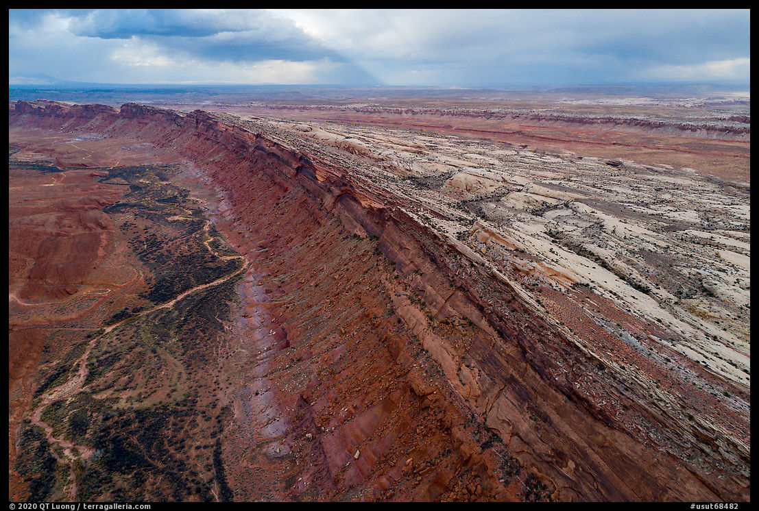
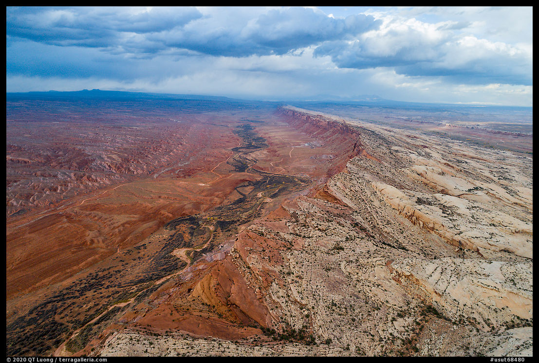
Since 2018, each autumn found myself in Bears Ears National Monument. 2020 was no exception. This time, I had planned to start at Valley of the Gods, where I ended my previous visit. On that evening of November 2019, after a promising afternoon, clouds had blocked the western horizon at sunset time. About a year later, I was hoping for a different outcome but as I drove from New Mexico, the day was growing increasingly cloudy. After a detour to refuel in Bluff, as I passed again the enormous cut made in the Comb Ridge on UT-95, I thought that while not favorable for landscape photos from the ground, the light conditions resulting from the cloud cover may work well for aerial photos. The drone handled the high winds surprisingly well.
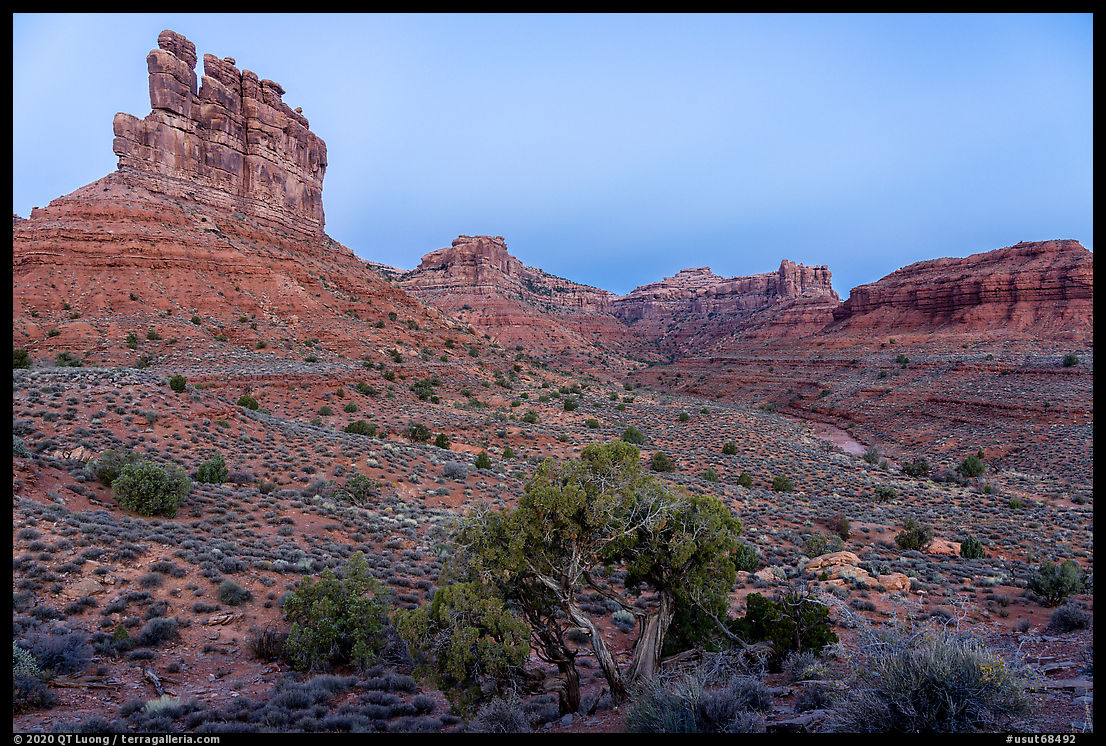
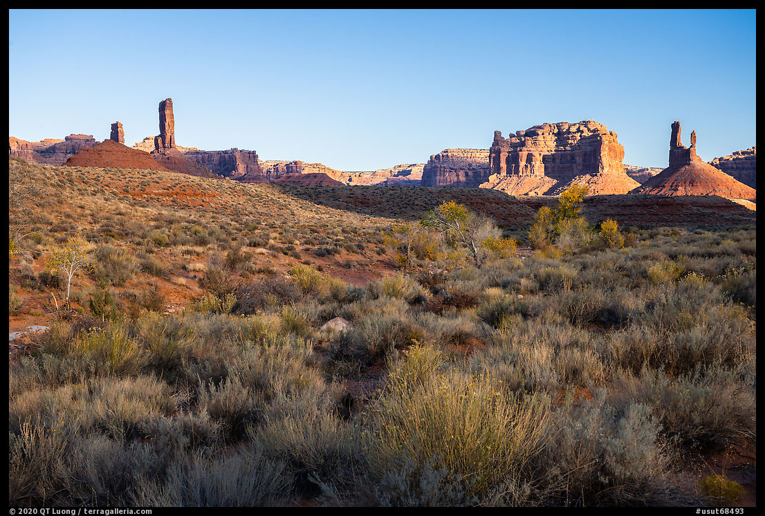
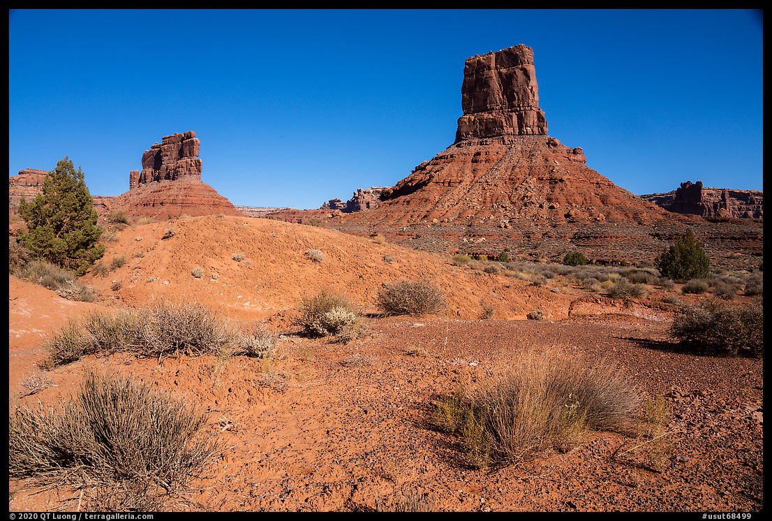
Back to Valley of the Gods
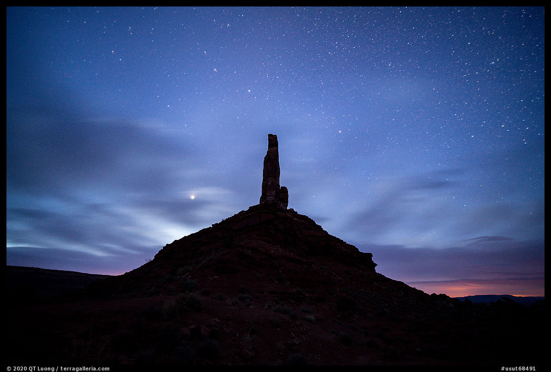
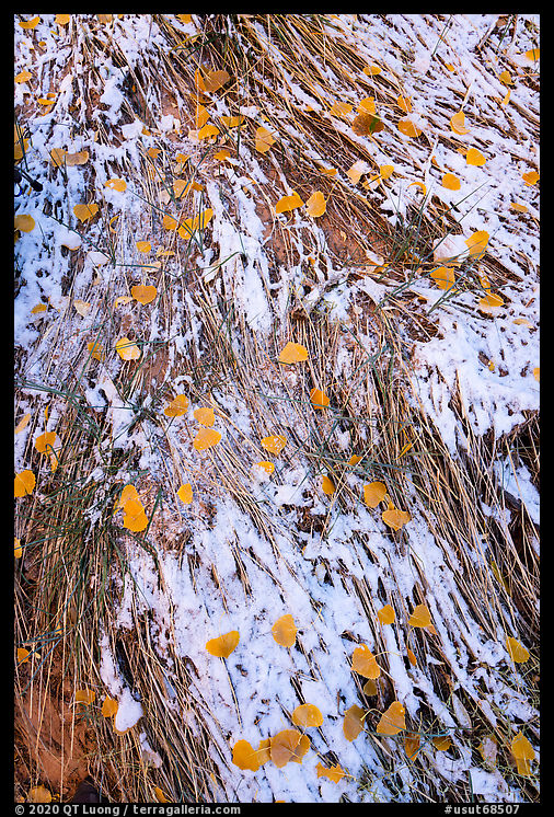
In retrospect, it would have been smarter to continue that line of work at the Goosenecks of the San Juan River, but afterward, I stuck to my plan and headed for Valley of the Gods, where due to a combination of unfavorable light, wind, and light rain, I ended up making no photographs. When I cooked dinner, I had to take refuge in the car. Outside the door, due to the wind, my stove was taking much longer than usual to boil water. It didn’t help that the cartridge was nearly empty and I insisted on finishing it up before opening a new one. I went to bed quite late despite the unproductive evening. The next day, more than an hour before sunrise, although still blowing, the wind had abated enough that I was able to make a few long exposure photographs with a few stars in the sky, although most of them were hidden by the cloud cover. It was so cold that after a few photographs, I had to get inside the car to warm up my numb hands before trying again. Although a band of clouds on the eastern horizon blocked the sunrise, the day grew sunnier, but the temperatures remained frigid. Two days before, in New Mexico, the temperatures remained quite a bit above freezing at night, but the weather forecast had called for them to drop to single digits there. What I was experiencing in Utah was the edge of the cold snap.
Bullet Canyon
Grand Gulch, a mostly dry 50-mile canyon draining the western half of Cedar Mesa, is the archeological crown jewel of Bears Ears National Monument. The canyon had the densest population in North America before the arrival of non-native settlers, resulting in a high concentration of well-preserved rock art and dwellings. In addition, with only unmaintained and unsigned rugged user trails in a pleasant and beautiful sandstone canyon, the wilderness experience in Grand Gulch rivals any other in the southwest. That combination attracts many backpackers (permits required in advance), however, a dozen tributary canyons join Grand Gulch, making it possible to explore parts of it on shorter loops and day trips (permits available at trailheads). The most popular are those located close to UT-261: Kane Gulch, Todie Canyon, Sheiks Canyon, and Bullet Canyon. The latter is the largest of those side canyons, joining Grand Gulch in 7 miles. The trailhead is accessed by an easy 1-mile unpaved road from UT-261, about 11 miles from UT-95. After spending the morning at Valley of the Gods, I didn’t start hiking until 1 PM, quite late given the short length of the days at the end of October. Although that was the warmest time of the day, the temperatures were freezing. I wore four layers, including a thick fleece jacket and a shell, and packed a down jacket, but when not moving could barely keep warm enough.
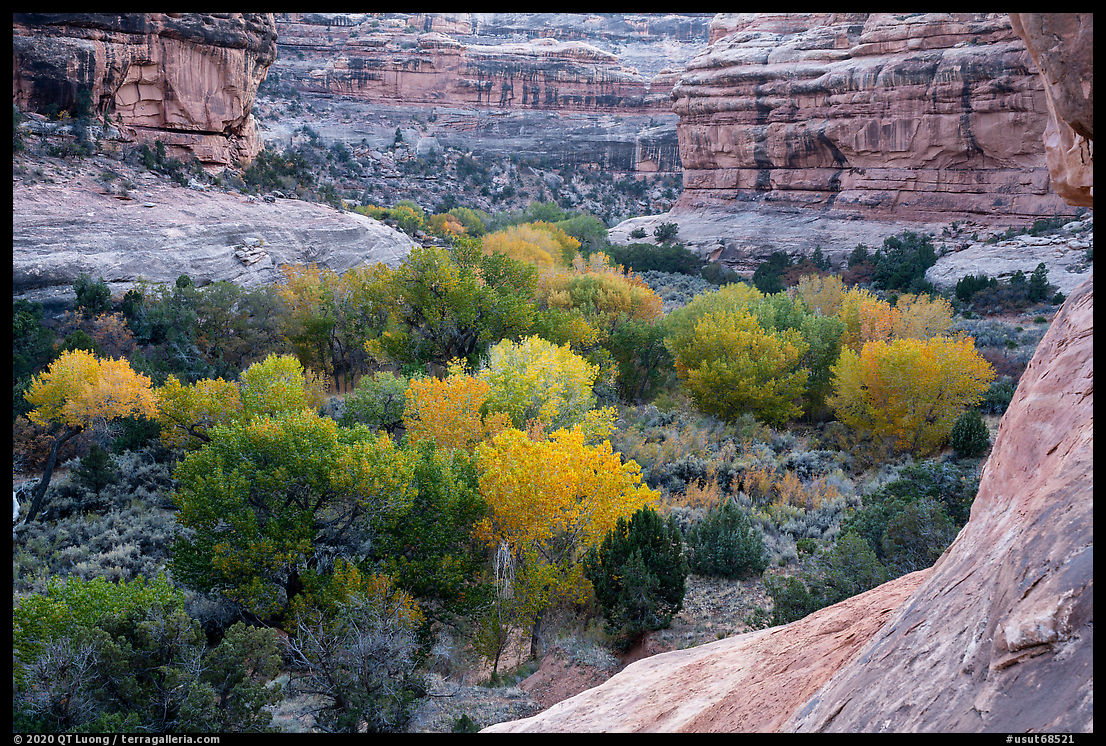
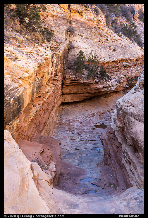
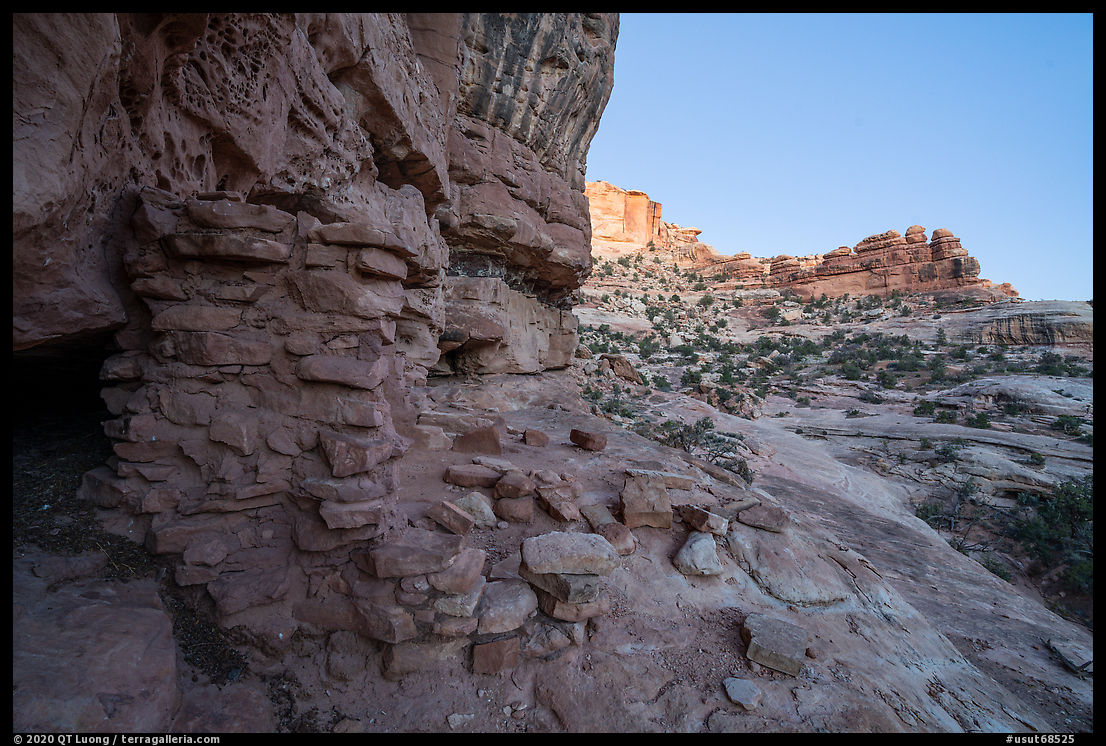
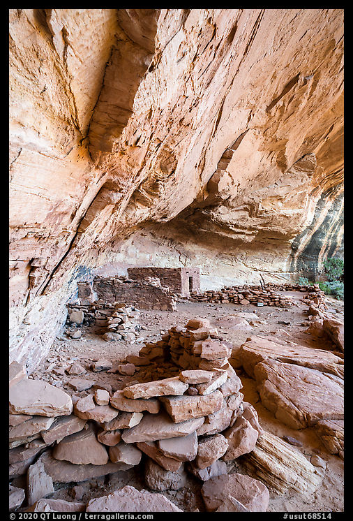
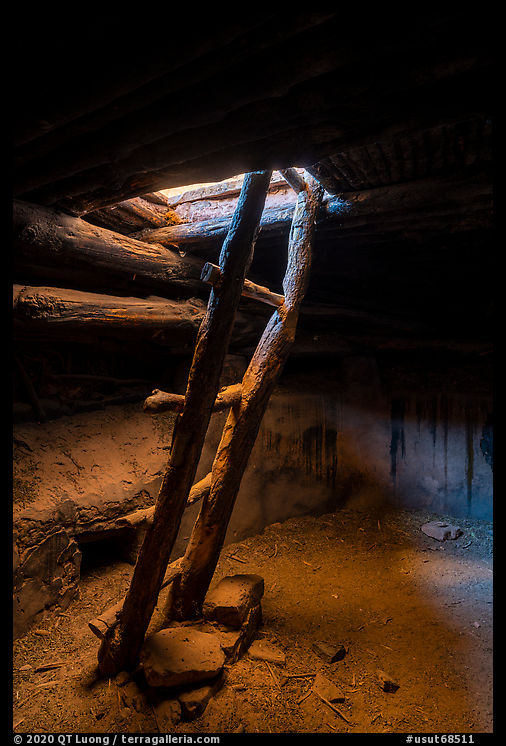
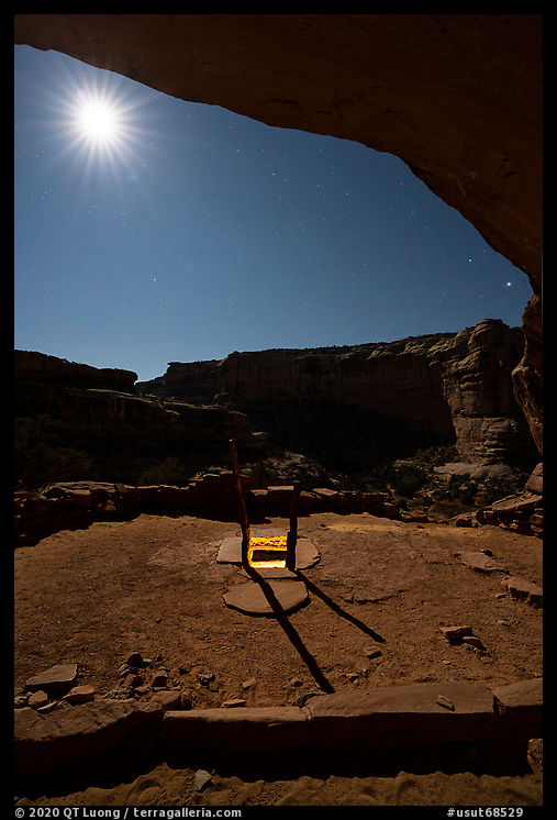
From the trailhead, it took about 5 miles of easy hiking in a beautiful canyon to two significant ruins located high on the north side of the canyon. Located beneath a large alcove, Perfect Kiva includes among other structures a kiva that has been partly restored and has a replacement ladder so that one can climb down into it. As I made long exposures necessitated by the dim light inside the kiva, I enjoyed surprisingly warm temperatures thanks to the subterranean setting, a welcome change from the freezing temperatures outside. I admired the wisdom of the ancient builders who had designed structures with such efficient insulation out of such simple materials. I had originally planned to hike to the junction with Grand Gulch, but I was too late because it took me a while to find and then photograph Perfect Kiva. Instead, after checking out the nearby two-level Jailhouse ruin named so because of an unusual lattice window, I returned to Perfect Kiva for night photographs. To evoke the time when the Ancestral Puebloans lived there, I placed a light inside the kiva and adjusted it to be just slightly brighter than the moonlight. Although I was aided by a nearly full moon, the return trip took twice as much time as the hike in. Vegetated canyons that are relatively straightforward to navigate by daylight can become tricky and disorienting at night. At one point, I had a feeling of deja vu before realizing that I had hiked on a full circle through a jumble of rocks. After that, as I made sure to check my GPS app frequently, the battery charger I had packed proved useful! When I reached the trailhead around 2:30 am, my car was covered in rim ice, and the thermometer read 16F. I felt hungry enough to cook some noodles.
Elk Ridge and Bears Ears
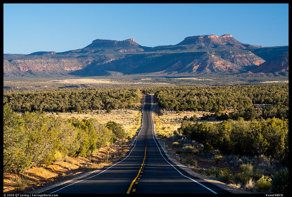
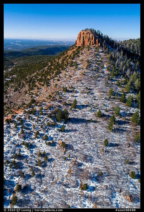
I woke up just before sunrise. My plan was to try to photograph the Bears Ears while driving towards them along UT-261. These twin namesake buttes standing at 8,700 feet are visible from all over the monument and so distinctive that in each of the native languages of the region, their name is the same. I could not find a satisfying composition due to the dense forested cover of the plateau. The monument protects an entire watershed from the top of 11,000-feet Abajo Mountains all the way down to the Colorado and San Juan Rivers. The 48-mile Elk Ridge Road, following the Elk Ridge spine between UT-211 in the north and UT-95 in the south seems to be on top of the world at nearly 9,000 feet, with views up to 200 miles away. The dirt/gravel road is well maintained, but a high clearance vehicle is recommended in dry weather and 4WD necessary if there has been recent precipitation. The southern end until the saddle between the two Bears Ears buttes offered great views over Cedar Mesa and is accessible to a passenger car. Since the Bears Ears buttes are a sacred space for tribes and a source of medicinal gathering, I showed respect by staying off them and instead made an aerial photograph with the drone. After driving Elk Ridge Road for a while, I turned around, since following it to the northeast would have resulted in too long of a detour to my next destination in Grand Staircase Escalante National Monument, located to the southwest. Instead, I exited Bears Ears National Monument via UT-95.
The Last Road Trip: 1 | 2 | 3 | 4 | 5 | 6 | 7 | 8 | to be continued

