Guide to Giant Sequoia National Monument: Southern Unit
6 Comments
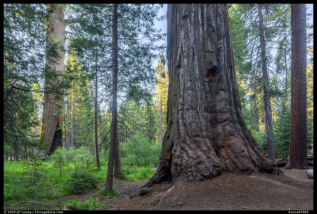
Giant sequoias grow only along a narrow band on the western slopes of the Sierra Nevada in California and I clustered in about 65 to 75 groves, depending on how you count them. Three groves grow in Yosemite National Park. The vast majority of them are located within a 70 mile long stretch centered around Sequoia and Kings Canyon National Parks. However, the national parks aren’t the only places to find giant sequoias. They are also found on National Forest lands. Unlike the national parks, that are primarily for preservation, National Forest are “lands of many uses”. While in recent times sequoias have been left standing, the other conifers around them have been logged, and sometimes clearcut. Giant Sequoia National Monument was designated in 2000 to protect no less than 33 sequoia groves by stopping the deforestation around them. As expected, the groves in Giant Sequoia National Monument are not as pristine as those in the national parks, however, the individual trees are just as impressive, and much less crowded.
The monument is divided into two units separated by Sequoia and Kings Canyon National Parks. The northern unit is in the Hume Lake Ranger District. The larger southern unit, in the Western Divide Ranger District, is mostly visited via a well-maintained loop from Springville to California Hot Springs via highway 190 and the Western Divide Highway (M107) along which most facilities and attractions are located, including most of the hikes to old-growth sequoia groves in the monument. This article is about the southern unit. The next one is about the northern unit.
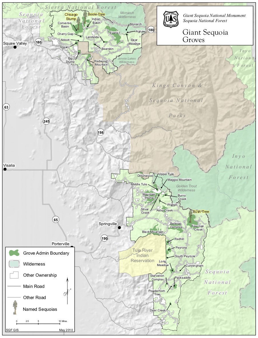
(click on map to enlarge)
Belknap Complex
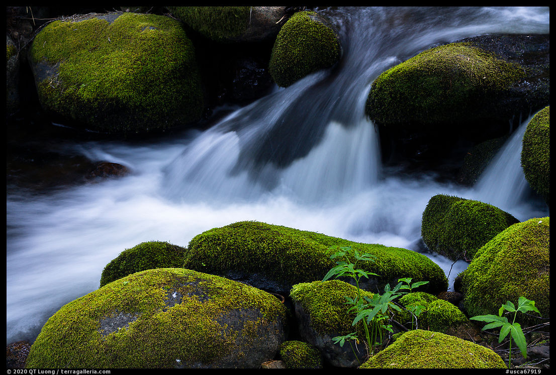
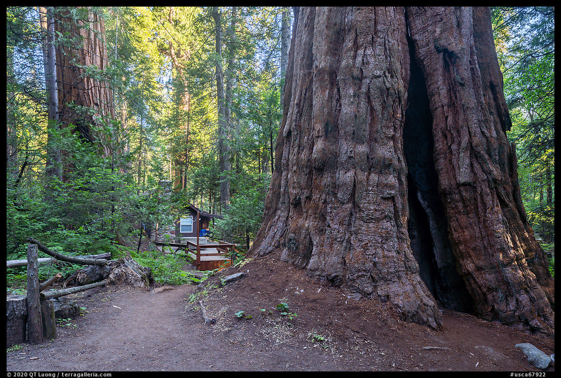
Located just outside the town of Camp Nelson, the small but popular Belknap Campground is the only drive-in campground located within a sequoia grove. Its location is made even more scenic by two creeks. Making a right turn at the entrance, I passed two bridges that lead to a trail linking quaint cabins that lent a sense of scale to the giant sequoias growing next to them.
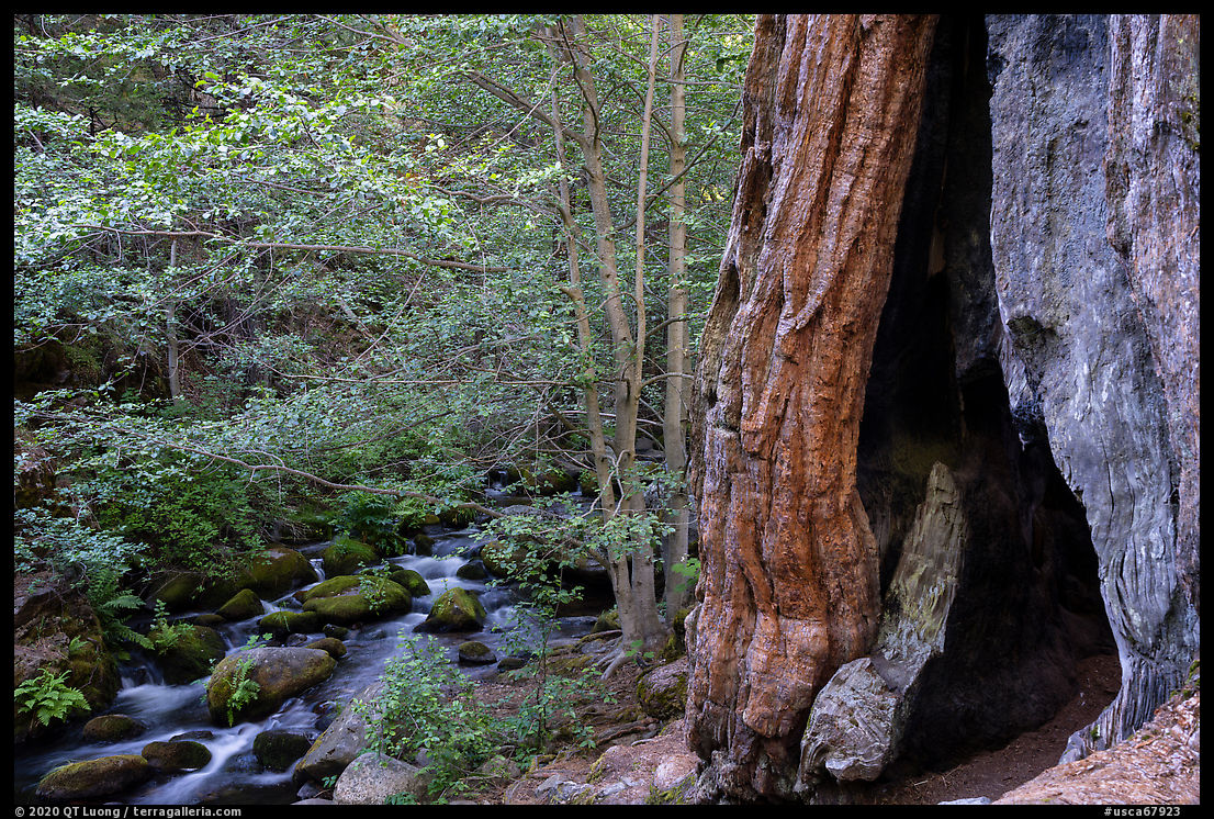
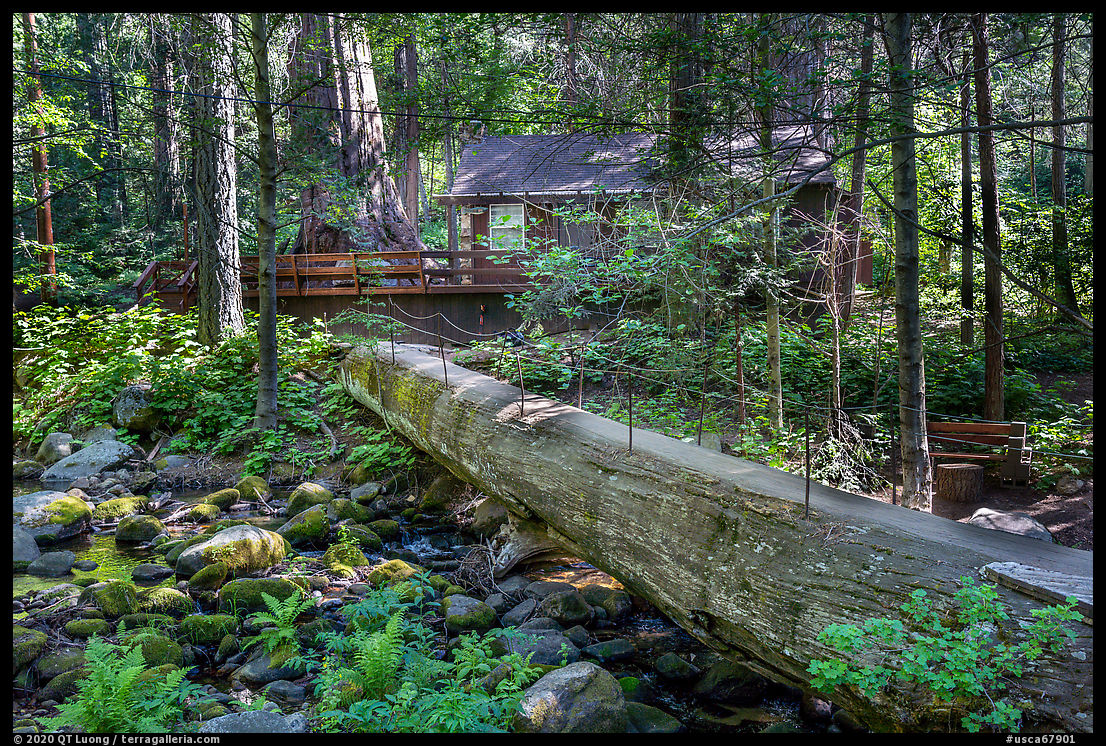
Right past a cabin next to an interesting footbridge made of a giant fallen tree, and just along the property fence of the next cabin (#22), an overgrown trail starts. It took me quite a while to find that start, and the USFS description said:
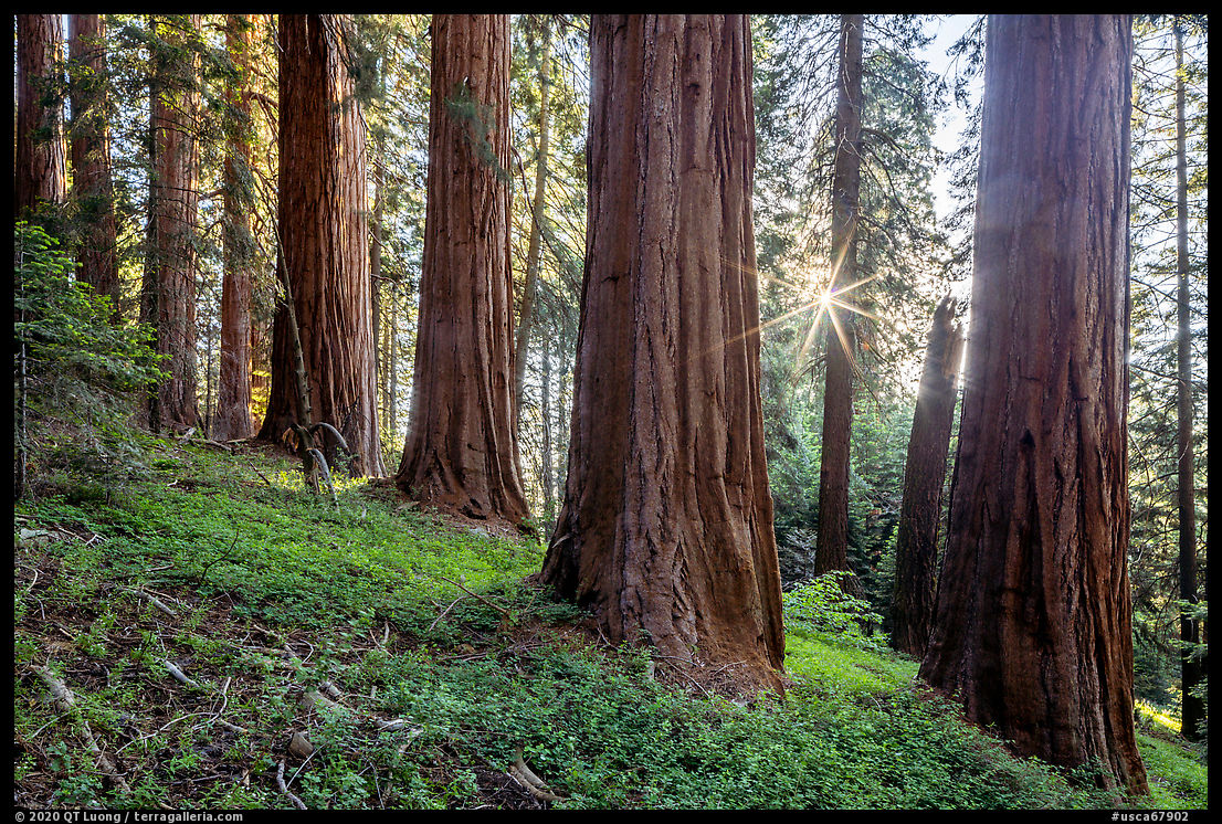
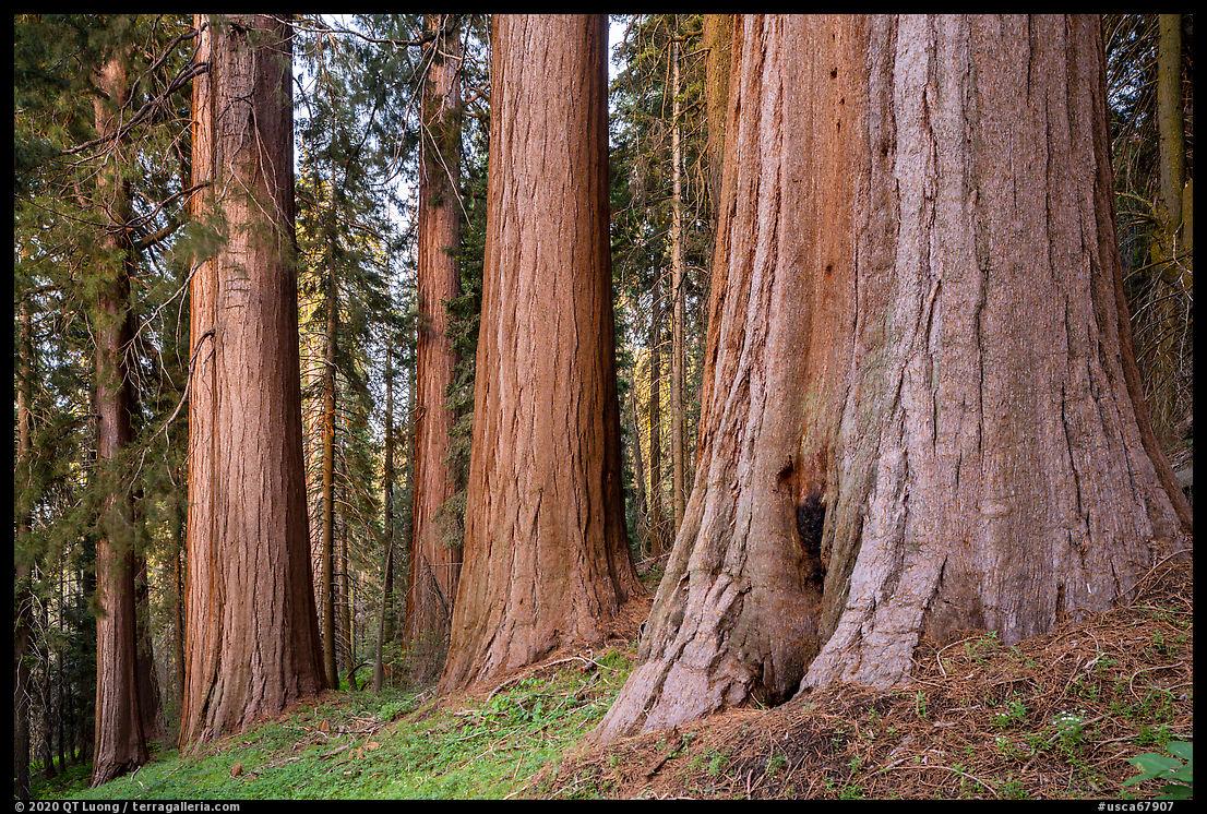
Should you loose the trail, proceed up-slope to the top of the ridge (about 1/2 mile, but it will seem like 5 or 10) where you will meet the fairly well maintained COY FLAT – BEAR RIDGE TRAIL (31E31)… If you are still on the trail…However, once on the hill, I found the trail fairly easy to follow, although very steep in places, climbing 1.2 miles to a ridge where it joins the Bear Creek Trail that starts next to the Coy Flat Campground. On the way, the trail passes a few large sequoias, but the best is yet to come. Going up (east), the Bear Creek Trail leads in another 1.5 miles (elevation gain from Belknap Campground: 2,200 feet) to the upper McIntyre Grove. Because of a continuous logging activity since the late 19th century, there are not too many unlogged groves in Sequoia National Monument. The hard-to-access, hillside location may have helped save the upper McIntyre Grove from the saw and dynamite. Even if the sequoias themselves have not been cut down, I prefer to see them surrounded by old-growth. Hillside groves are generally more open, affording a more clear view of the trees. In addition, the upper McIntyre Grove features many densely clustered, unusually large sequoias. All of this results in what is arguably the most scenic sequoia grove outside of a national park, at least among the trail-accessible ones. I had timed my arrival for the late afternoon, knowing that the best time to photograph the trees would occur right after sunset, when the light would become even. When the sun was still out, I photographed backlit so that the shape of the trees would not be broken by distracting bright spots, and as a bonus, was able to position the camera for a sun star. Afterward, I moved to the west side of the trees. The hillside faces the west, and receives the glow occurring after the sunset. The soft light brought out the tree’s texture and color. In both cases, I used the shift of the Canon 24mm TSE lens to keep the trees parallel, and made sure to include trees at different distances to provide a sense of scale, as well as depth.
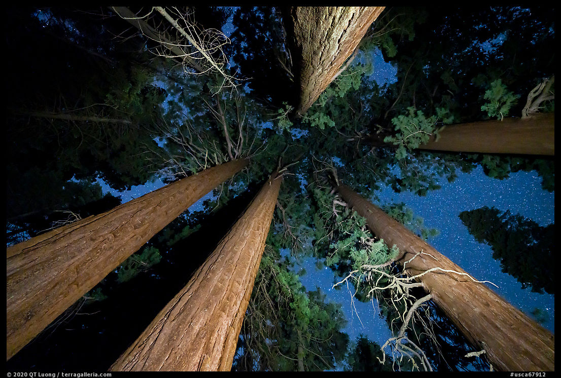
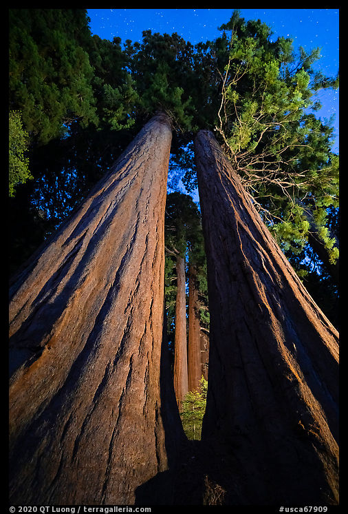
Since there was some effort to get there, I stayed out a few hours afterward to also make night photographs, using a flashlight to illuminate the giants. The two trees seen between the twin trees add much depth and interest to the image. Since it was not possible to light up well both foreground and background trees from the same viewpoint, I combined two exposures using the cave photography technique I previously described. To exaggerate the perspective, maximize the size of the opening between the twin trees, and include the stary sky, I used the widest angle lens I carried (16-35mm) and placed the camera just a few feet from the base of the twin trees. Even though it was a June week-end, I didn’t see any other hiker on this outing.
Trail of 100 Giants
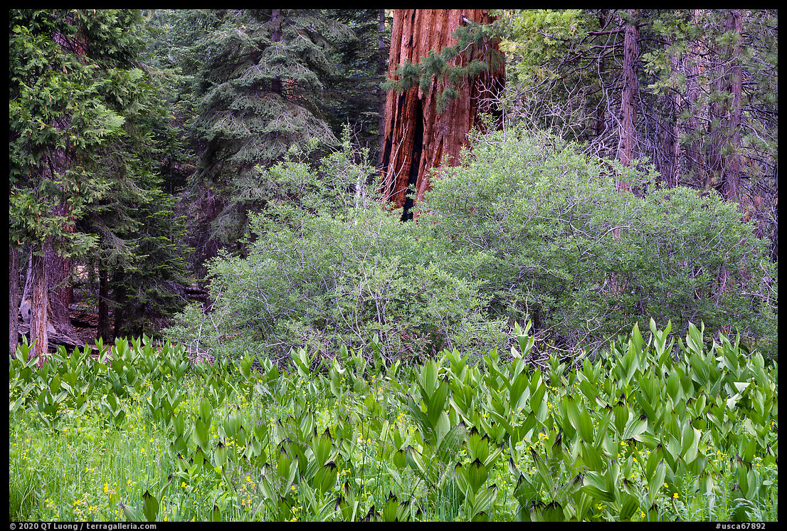
By contrast, the Trail of 100 Giants is the most popular attraction in the monument, as it is short (1.5 mile loop), almost flat, and meanders amongst a lot of seriously big trees in Long Meadow Grove – although not quite a hundred. You can park either at the adjacent Redwood Meadow Campground, or a picnic area. The later was filled up with cars by 9am. Although the sequoias are impressive, with many trunks on the ground, stumps, gathered wood, and sparse undergrowth, the grove sometimes reminded me of a lumber yard. The interpretive signs were even written from a forestry perspective. However, a meadow with a flowing creek provided a respite from the less-than-pristine environment. While the experience there cannot compare to, let say the Upper McIntyre grove, the Trail of 100 Giants has a high reward/effort ratio. It makes it possible to see a large number of amazing trees on a trail easily accessible to families with strollers or people with mobility limitations, since it is entirely paved, except for one section. That section was also paved, but had been obliterated when a huge double sequoia tree toppled over in 2011, an event captured on video. The area with the downed trees was closed for safety reasons, but when I visited, it had re-opened and you could go around the trees on a user trail.
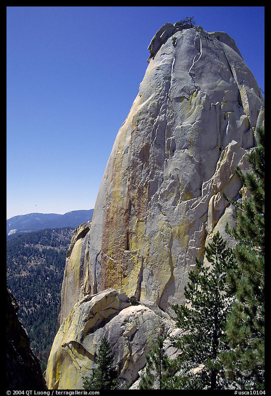
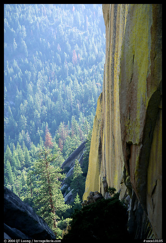
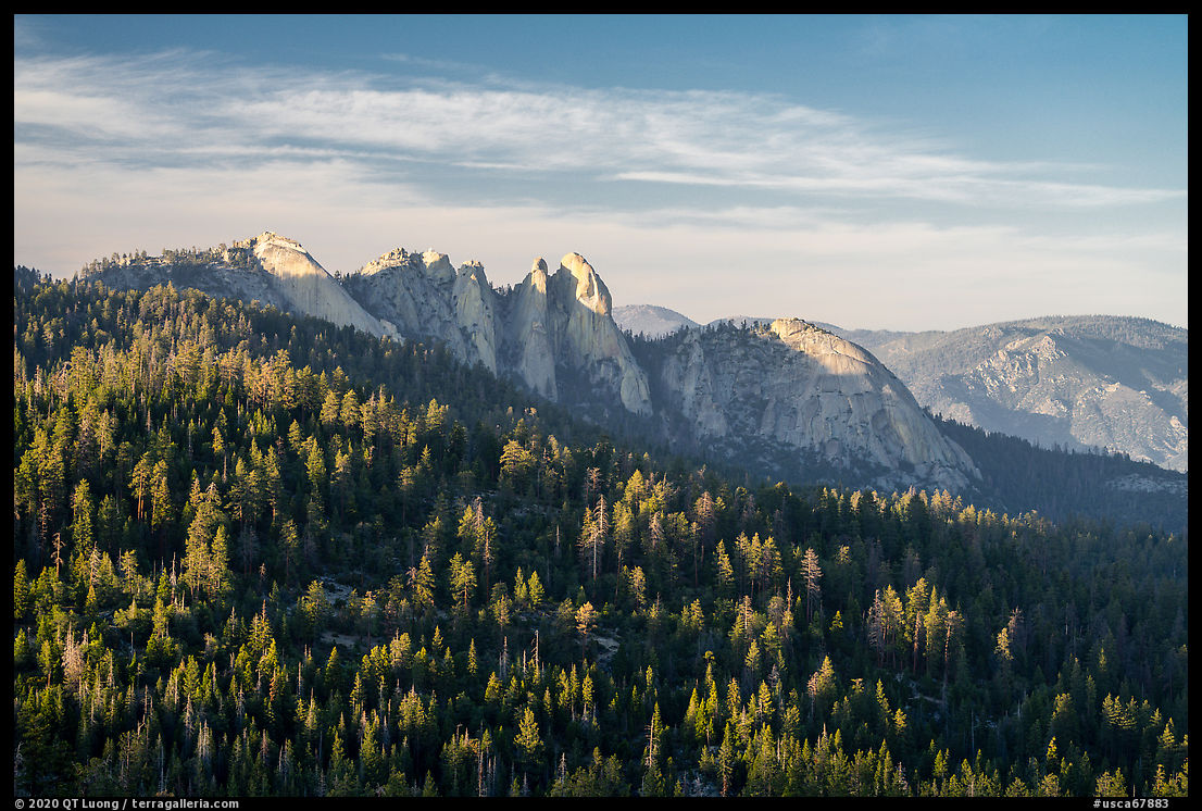
The Needles
The Needles are a cluster of massive sheer granite formations. I first visited them in 1993 for some excellent rock climbing. However, everybody without fear of heights could walk to the top by scaling a series of dizzying staircases. The reward was to reach a working fire lookout with a 360-degrees view. Unfortunately, the lookout was destroyed by fire in 2011 and staircases were removed in 2019. There are still views stretching to Mt Whitney along the approach hike (5 miles round-trip, 500 feet elevation gain). To get to the trailhead, turn east on unpaved Forest Route 21S05 a mile south of Quaking Aspen Campground, and continue for 2.5 miles.
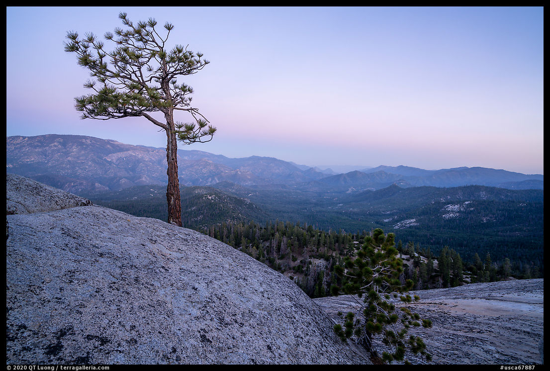
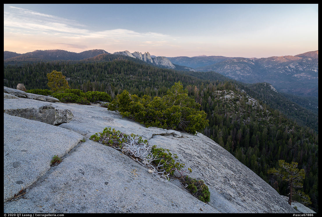
Dome Rock
For a more easily accessible view of the valley, from which you can also see the Needles, you can walk 0.25 miles to Dome Rock after driving the short Forest Route 21S05 starting 3.5 miles south of Quaking Aspen Campground. The top of the rock is flat, so the best views and foreground elements are at the edge of the rock, but you have to be careful because there is a sheer drop and also some may be rock climbing just below.
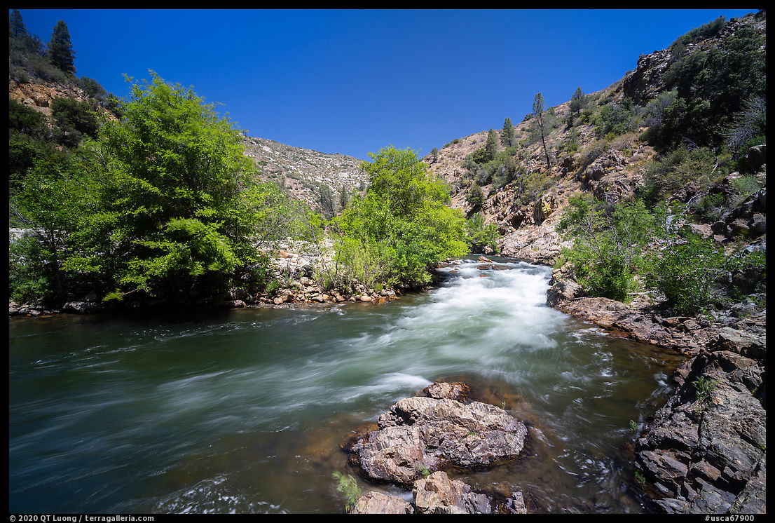
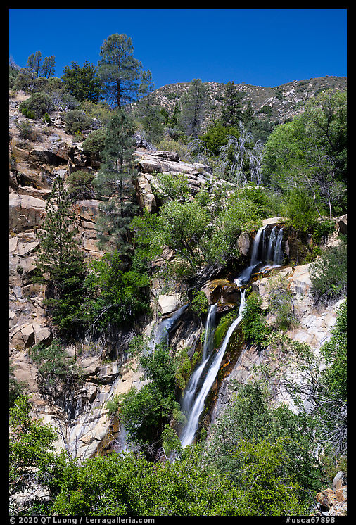
Kern River
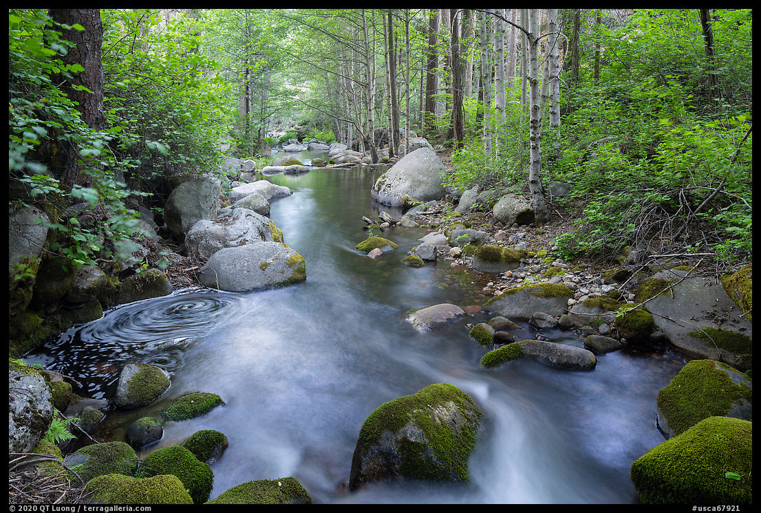
This tumbling mountain stream originating near Mount Whitney marks the eastern boundary of Giant Sequoia National Monument. Where route M-99 crosses the river, you’ll find a large parking area with a boat ramp, a good view of the river from the pedestrian bridge that leads to a river-level trail. Half a mile up M-99, South Creek forms a waterfall.


Another National Monument that I knew nothing about….it’s on my radar now! Very informative and I love these blog posts!
Thank you. Glad to contribute to raising awareness for those lands!
Impressive images from gigant trees. Thank you for sharing them.
Best regards
Bernhard
Great post, QT! I’ve only been to the Sequoia NM once, and would love to go back. My wife and I went before we were married. We have been to Sequoia/KCNP several times as well, but I’ve always wanted to spend more time in the NM. Now that we have two kids, it’s time to show them the BIG TREES!
Thanks! The Monument could be nice for kids because there are fewer restrictions such as climbing on roots or squeezing inside hollow trunks. Those are necessary in the national parks because of mass visitation.
Thanks for this information. I have shared it on my Fb account.
Maybe, several of my friends and family will pay you a visit ….
not physically 🙂