Kilbourne Hole Volcanic Crater: Photographing a Hole in the Ground
2 Comments
From a photographic point of view, a shallow depression in the ground didn’t seem too promising, but since from a geological point of view, Kilbourne Hole is one of the most unique and little-known natural features of the Southwest, I nevertheless decided to spend half a day checking it out, part of my explorations of the part of Organ Mountains Desert Peaks National Monument complementing the “Organ Mountains” part.
Kilbourne Hole is not your usual volcano. Although the expense of desert that surrounds it is pancake flat, the crater isn’t visible from a distance, because unlike a classical cone volcano, it doesn’t rise in elevation at the rim. Kilbourne Hole is a prime example of an uncommon maar crater. Instead of a lava eruption, what took place there is a steam explosion caused by magma superheating groundwater to forceful pressures. Little material was emitted except volcanic gas. That explosion left only a mile-wide shallow depression in the ground that looks like the result of a meteorite impact. Due to its resemblance to craters on the moon, astronauts from the Apollo missions came here to train.

The BLM website gives directions that sound complicated, but surprisingly, Google Maps provided accurate navigation. It involved driving for an hour on nondescript dirt roads that were all unmarked. Fortunately, I didn’t see any other vehicles, since in places this would have required backing out until you could get out of the narrow roadbed to make room for another car to pass.
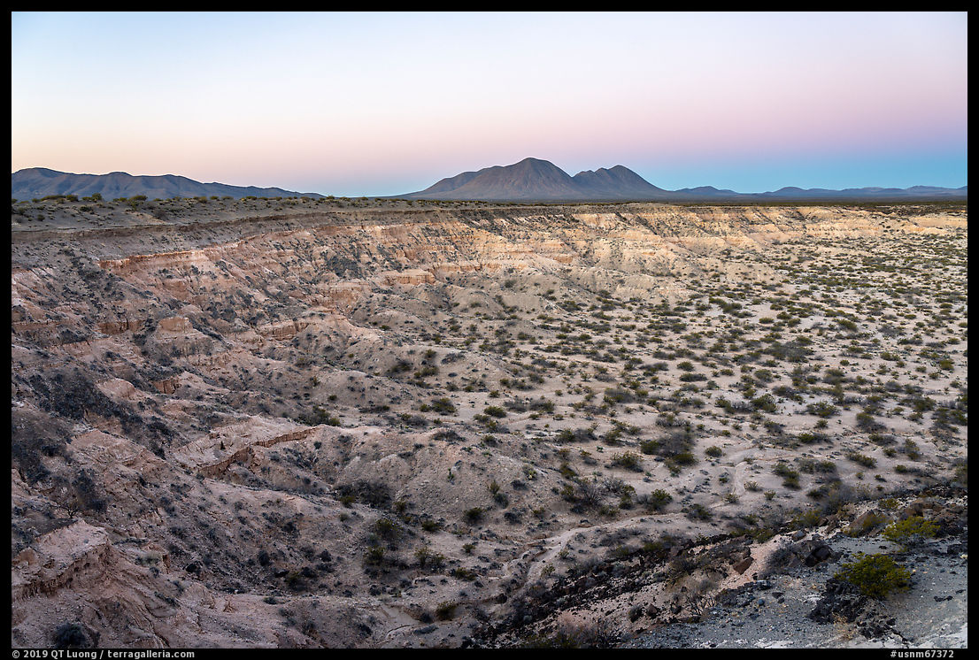
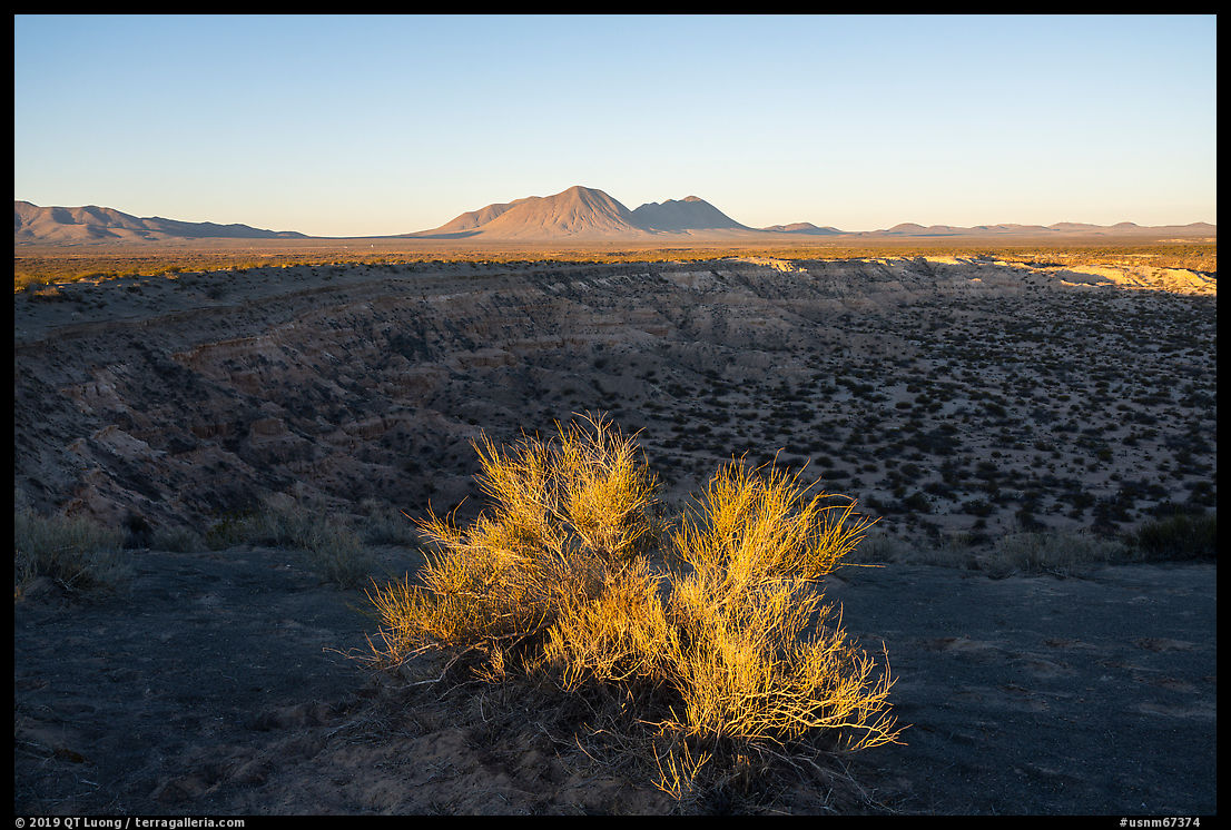
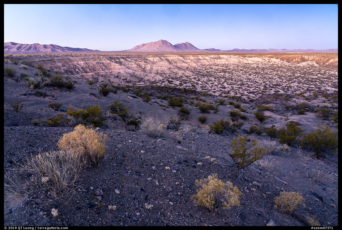
The app led to a spot that looked random rather than a trailhead or viewpoint, and since I was driving at night, I could not see much. However, a stroll confirmed that I had arrived near the crater’s rim, and I went to sleep wondering what I would see in the morning. I got up early to photograph in the light of pre-dawn since my experience is that depressions are often best photographed at twilight when there are no harsh shadows to break up or obscure the features of the land. Although the light works until sunrise, my favorite time was just before sunrise. There is a short moment when the earth casts its own shadow on the atmosphere, resulting in a dark blue band in the sky, low on the horizon, below a glowing pink band known as the “Belt of Venus.” I initially tried to contrast the dark volcanic rock with the crater’s lighter tones, and then got closer to the rim over slippery badlands for a view peering directly over the crater floor. As soon as the sun rose, the character of the scene changed dramatically, with the crater now in deep shade. I played with the contrast between the light and shade by looking for shrubs whose tops were grazed by sunlight. While the resulting photographs are interesting, they do not provide a clear depiction of the crater, unlike the twilight images.
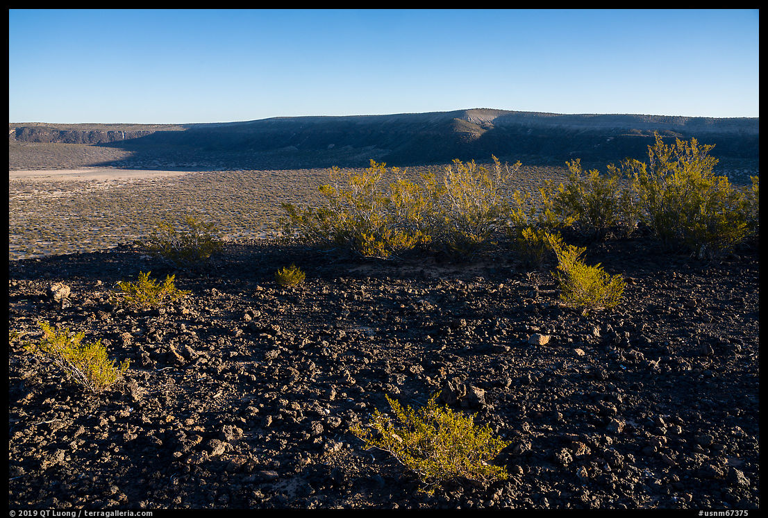
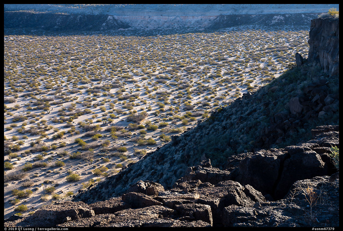
High clearance wasn’t needed, although for the last miles close to the rim, it was reassuring to have. On the other hand, if one wanted to circumnavigate the crater by vehicle, it would be needed. Instead, I chose to hike along a portion of the crater, which is a better way to be attuned to the differences in terrain. At the spot where I photographed at dawn, I was standing on badlands, but I later happened upon basalt cliffs. Only a few dozen yards separate the two photographs above. For the second one, I took an inventory of the visual components: the flat crater floor, cliffs, slope, and tops of balsalt cliffs, and tried to fit them into a single composition.
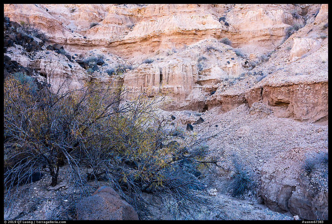
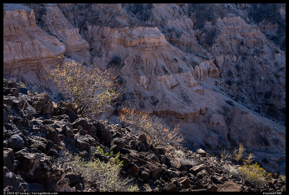
I eventually made my way to the bottom of the crater by scrambling on steep slopes, which are only a few hundred feet high, trying to avoid the more slippery parts. The flat floor didn’t hold much visual interest, and I headed towards the eroded cliffs. Seen close, they looked more imposing than from the rim. The two photographs above were made within a quarter of an hour. The first one, from the crater floor, shows the delicate colors of the cliffs in contrast to the foreground vegetation. Because all the frame was in open shade, the original contrast was low and could be increased into a bright image. The second one, made from partway the slope, evokes the cliffs rather than depicting them, preserving some of their mystery. The brightness of a sunlit foreground would normally overwhelm a subject in the shade, but this was not the case because I photographed dark lava rocks and vegetation backlit. Not too bad for a hole in the ground!
When I drove out of Kilbourne Hole, I initially tried to use Google Maps, since the app had served me well on the way in. However, with little signal, directions did not load. I had other off-line navigation apps on my phone, but they kept leading me to gates that were closed with ominous “No Trespassing” signs. I record GPS tracks essentially for geo-tagging, but since the previous night I did not plan to photograph, I had not recorded my track through the maze of dirt roads. Eventually, I was able to remember my itinerary of the previous night. I made a mental note to keep the GPS on whenever I drive on dirt roads, so that I could easily find the way back.


Beautiful pictures, your capture of the landscape is very satisfying. I have visited the southwest desert many time, always find it very peaceful and mind soothing. Thank you for sharing.
Thanks Jerri!