The Organ Mountains – Searching for a View
No Comments
National parks often consist of mountains. This isn’t surprising since mountains are the most spectacular landforms and the elevation range that they span lends itself to biodiversity. New Mexico’s two national parks, however, do not comprise significant mountains. Carlsbad Caverns National Park is known for its underground wonders. While surrounded by mountains, White Sands National Park is located in a flat basin. Instead, the most spectacular mountains in New Mexico are the Organ Mountains, the crown jewel of the southern Rocky Mountains.
Consisting of four detached units around the city of Las Cruces, Organ Mountains-Desert Peaks National Monument protects no fewer than five mountain ranges, the Robledo Mountains, Sierra de las Uvas, and Doña Ana Mountains (which together form the Desert Peaks), the Potrillo Mountains, and of course the Organ Mountains. The later, although they form the second smallest unit, are by far the most impressive mountains in the monument, reaching almost 9,000 feet in elevation, with a rise in elevation of 4,000 feet over three miles, making them one of the steepest mountain ranges in the continental U.S.
The East Side
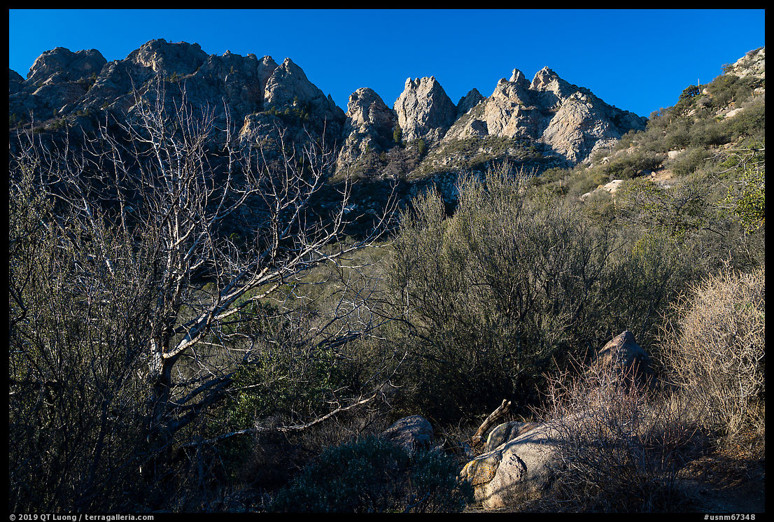
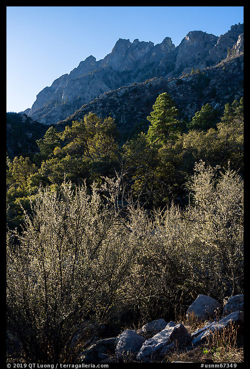
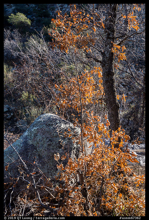
The only developed campground in the national monument is the Aguirre Spring Campground on the east side of the Organ Mountains. I arrived there by night. The next day, I set out at pre-dawn to hike the Pine Tree Loop Trail (4.2 miles, 1000 feet elevation gain), rated by hikingproject.com as the best trail in the monument. Shortly after the trailhead, I came to a fork. The left (E) branch seemed to be leading away from the mountains, whereas the right (W) branch headed towards them. I took the later, only to realize that it kept following the bottom of a ravine with heavy tree cover. The light of sunrise was striking the peaks above me, but by the time I reached open views of them, it was long gone. As I continued on the loop, I understood that the other branch would have placed me with open views right at about sunrise time. That was a mistake I could have avoided by studying detailed topographic maps of the trail beforehand! I was also expecting desert terrain, but the elevations, ranging from 5,700 feet to 6,700 feet, were high enough that I was hiking in a lush Ponderosa pine forest habitat, with also many deciduous trees. Early spring or late autumn would have been even beautiful.
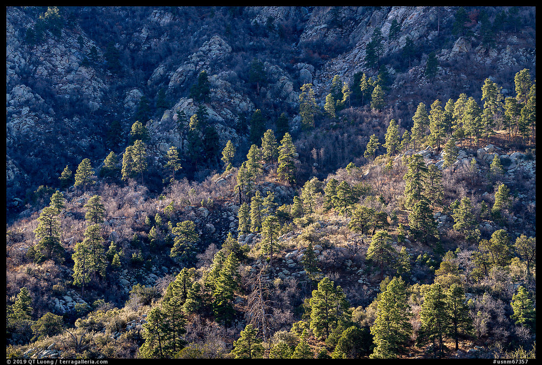
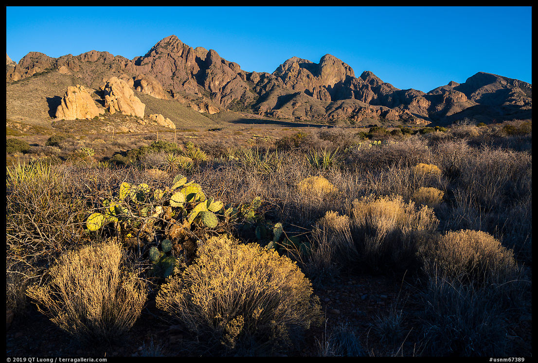
Back to the trailhead, as I drove through the rest of the loop road, I realized that the Organ Mountains looked more towering from there than from the trail, because from the trail, you are too high and too close, which results in the peaks appearing foreshortened. They were better detached against the sparse desert vegetation than against the forests. But by then it was late morning, and the peaks were getting in the shade. In general, it is preferable to arrive at a new site by daylight and scout for sunset than to arrive at night, since the sunrise would have to be photographed without prior scouting. However, I was traveling close to the winter solstice for White Sands National Park. At that time, the sun sets before 5 pm, and being on a short trip, I was hoping to be more productive by driving at night rather than settling down for such long nights.
The West Side
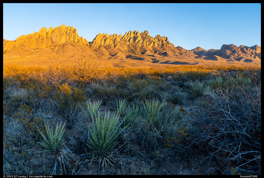
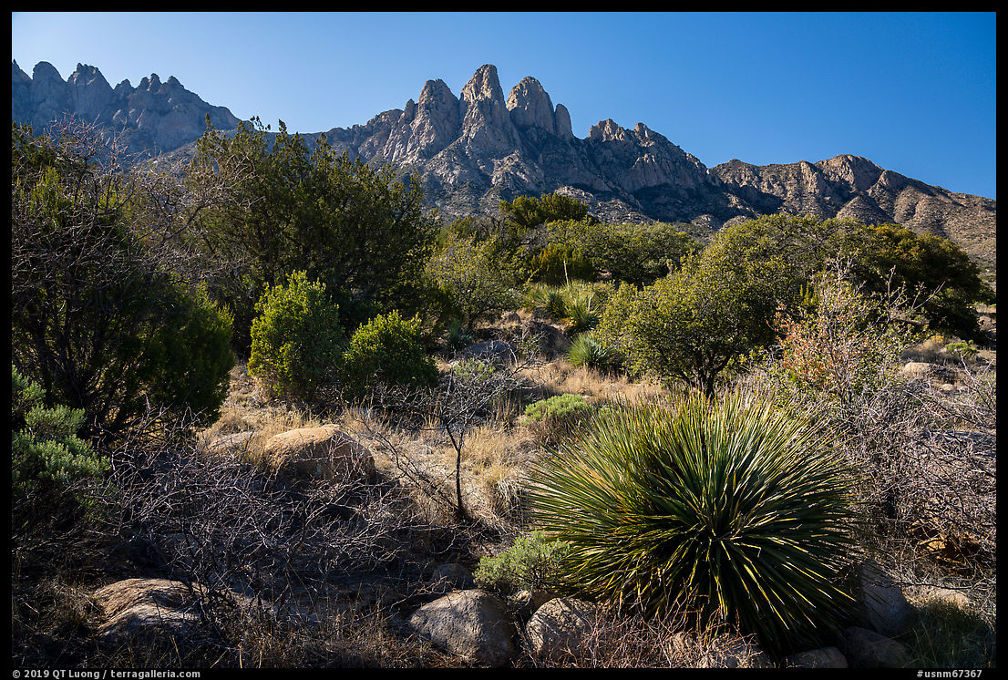
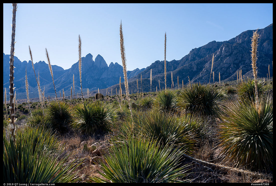
The Organ Mountains are more often observed from the west side, because that is where Las Cruces is situated. From the I-10 freeway, they tower strikingly in the distance, the steep spires indeed resembling the pipes of an organ. The most popular destination on the west side is the Dripping Springs natural area where a visitor center is located at the base of the most dramatic section of the Organ Mountains. From there, many hike the Dripping Springs Trail (3.2 miles round-trip, 470 feet elevation gain) that leads to historic ruins and a waterfall. However, this trail is too close to the base of the mountains if one is to capture their grandeur. In the late afternoon, I drove down from the visitor center and made a few photographs near a picnic loop on the north side of the road. However, even from there, the mountains didn’t look as majestic as I remembered them from the freeway. I drove further down, and turned right (N) on Baylor Canyon Rd. That was about the most distant spot I could get from the mountains while staying on a road located within the national monument. Since the spires would look flat if I photographed with the sun directly in my back, I continued north of the main group of spires in order to benefit from a bit of cross-lighting at sunset.