Tracing National Park and National Monument Designations Through Visitor Guides
One Comment
On the 110th anniversary of the National Park Service (NPS), this article continues my examination of the official NPS visitor guides over the years, focusing this time on the differences between early brochures for national parks and national monuments. If you haven’t done so, reading the previous installments of this series will provide context.
Part 6 of an ongoing series: 1 | 2 | 3 | 4 | 5 | 6 | to be continued
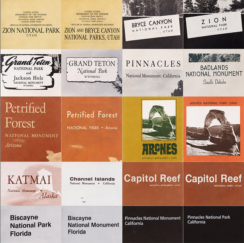
Today, the National Park Service (NPS) presents national parks, national monuments, historic sites, memorials, and its many other designations as parts of a single National Park System. Its visitor brochures reinforce that idea. Under the Unigrid system introduced in the late 1970s, the designation of a unit does not determine the basic design of its brochure. Historical visitor guides reveal that this uniform treatment developed gradually. National parks initially received priority, national monuments gained distinct brochures around 1940, and only after World War II did their visual treatment converge. This article traces those differences through the brochures themselves, focusing on the first or earliest brochures for parks and monuments, as well as the first brochures issued after an area became a national park, whether through the redesignation of an existing national monument or the creation of an entirely new NPS unit.
More so than in previous installments, the findings in this article require caution. Historical brochure archives are not necessarily complete, and absence from an archive cannot prove that no earlier publication ever existed. Visitation, accessibility, staffing, and development also affected whether a unit needed a brochure. The findings therefore are my inferences rather than proof of formal NPS policies.
1916-1939: National parks come first
When the National Park Service was created in 1916, besides the older Hot Springs and Casa Grande reservations, the areas it administered were either one of 14 national parks or 21 national monuments. In 1917, the agency issued visitor guide booklets for the following national parks: Yellowstone, Sequoia and General Grant, Yosemite, Mount Rainier, Crater Lake, Wind Cave, Mesa Verde, Glacier, Rocky Mountain, plus the Hot Springs Reservation. Although established in 1916, it took years for the lesser-visited Hawaii (1923) and Lassen Volcanic (1925) to receive a visitor guide, and even more for Alaska’s remote Mount McKinley (1927), established in 1917. Platt and Sullys Hill were considered minor units.
Consistent with the idea that national parks represented a higher standard than national monuments, those two designations did not receive comparable treatment in visitor publications. National parks had substantial official booklets with a standardized design based on a 6×9 inch trim. They contained maps, photographs, descriptions of scenery, transportation information, accommodations, regulations, and practical advice. For the major parks, new editions generally appeared annually. Grand Teton National Park, created from previously undesignated lands, gained a fully standardized booklet the year of its establishment in 1929. At that time, the 150 square mile park consisted mostly of the Teton Range and lakes at its base. In 1943, Jackson Hole National Monument was proclaimed to protect the adjacent high valley. The first postwar visitor guide for Grand Teton National Park had a section about Jackson Hole National Monument. The controversy about the monument ended in 1950, when the incorporation of most of it enlarged Grand Teton National Park to about 484 square miles.
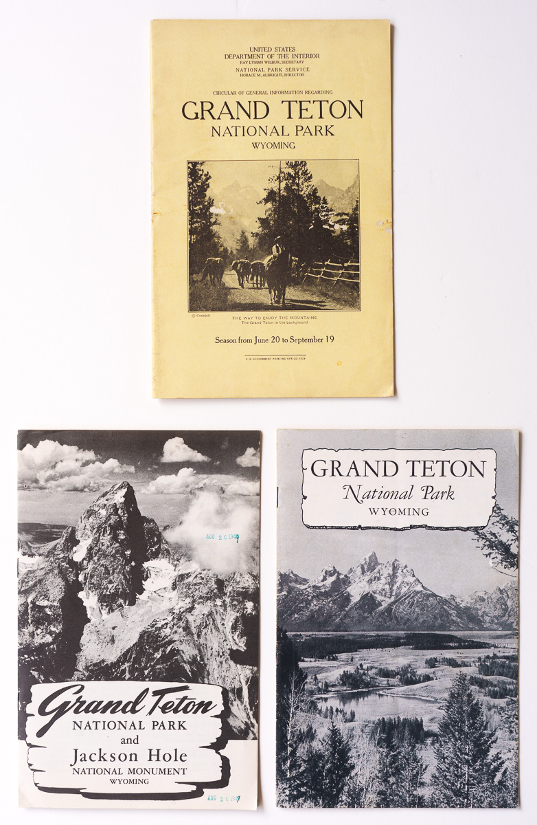
Top: The first visitor guide booklet for Grand Teton National Park (1929). Bottom: 1948 visitor guide booklet, earliest including Jackson Hole National Monument; 1950 visitor guide booklet, first after addition of monument to national park.
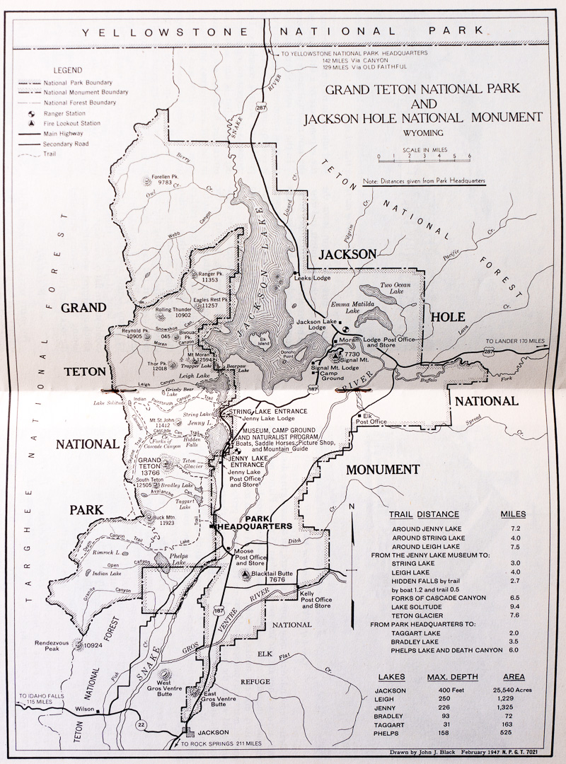
1948 Map of Grand Teton National Park and Jackson Hole National Monument.
During those years, Acadia (then Lafayette), Grand Canyon, Zion, Bryce Canyon, and Carlsbad Caverns began as national monuments and were later redesignated national parks. The National Park Service issued a booklet for them only after their redesignation. Bryce Canyon was proclaimed a national monument in 1923, and established as a national park in 1928. The following year, it was added to the Zion National Park booklet. The grouping would continue until 1940, when both gained their own booklet. Carlsbad Caverns was also proclaimed a national monument in 1923, and redesignated as a national park in 1930. Its first booklet is from 1933. Note how its cover design differs from the design standards for 1933 (refer to the first article of this series), a fact repeated for several initial visitor guides.
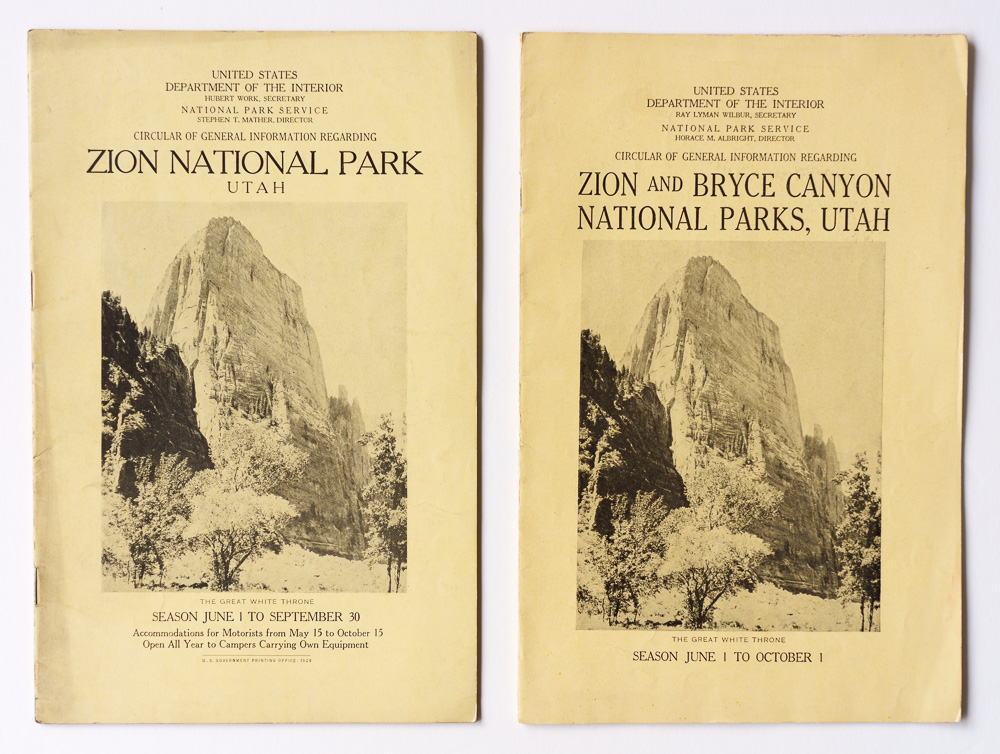
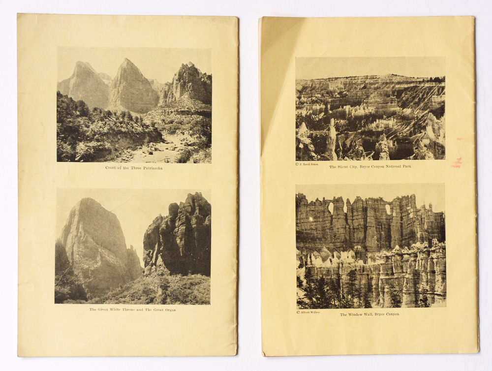
Front and back covers: 1928 visitor guide booklet for Zion National Park; 1929 visitor guide booklet for Zion National Park and Bryce Canyon National Park, first after establishment of Bryce Canyon National Park.
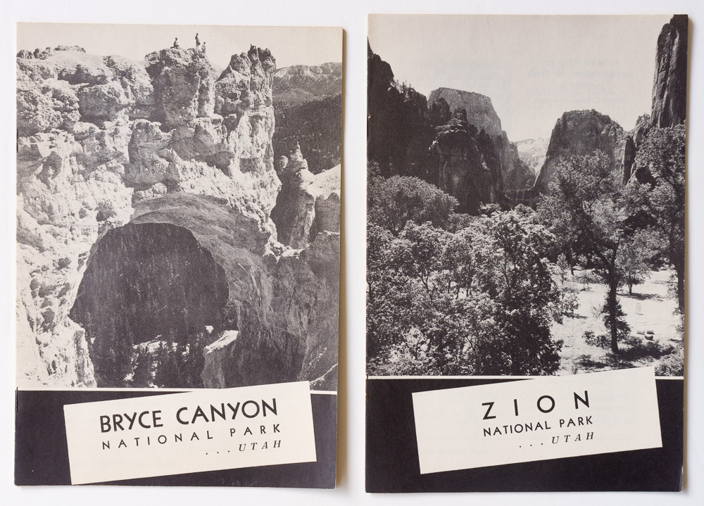
1940 visitor guide booklets for Zion and Bryce Canyon National Park, the first year they were separated.
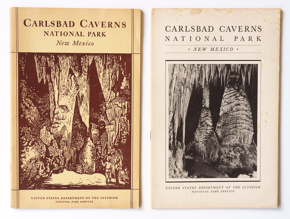
The earliest visitor guide booklet for Carlsbad Caverns National Park (1933); 1935 visitor guide booklet with standardized design for that year.
Most national monuments had nothing comparable to those booklets, even though national monument status repeatedly proved to be a precursor to national park status. As discussed here, about half of today’s national parks were first protected, entirely or substantially, as national monuments. Yet the early brochures suggest that the NPS regarded the national park designation as carrying greater importance.
The rare exceptions. By 1940, NPS administered 82 national monuments. Out of those, I have found only six national monuments with NPS visitor publications before 1940.
Casa Grande Ruins had been federally protected since 1892, when President Benjamin Harrison established the Casa Grande Ruin Reservation, the first federal prehistoric and cultural reserve. It had a resident custodian from 1901, Frank Pinkley, and considerable preservation work had already taken place before the NPS existed. When Casa Grande became a national monument in 1918, it was already a mature federal protected area. Its position grew when Pinkley became superintendent of the Southwestern National Monuments in 1923 while remaining based at Casa Grande, which became headquarters for the group. This helps explain why Casa Grande was the only national monument listed as having a booklet. Such mentions are found in contemporary booklets for major national parks from 1919, 1920, and 1921 (for example, Yosemite National Park 1921, p. 62). Even Grand Canyon National Monument and other major scenic national monuments did not receive this kind of attention.
As early as 1900, Representative John F. Lacey of Iowa, chairman of the House Committee on Public Lands and later a key sponsor of the Antiquities Act, reported a bill to Congress that would have established Petrified Forest National Park. His interest in protecting Petrified Forest may also have helped account for the inclusion of “objects of historic or scientific interest” in the Antiquities Act, language that broadened its reach beyond archaeological sites to natural features.
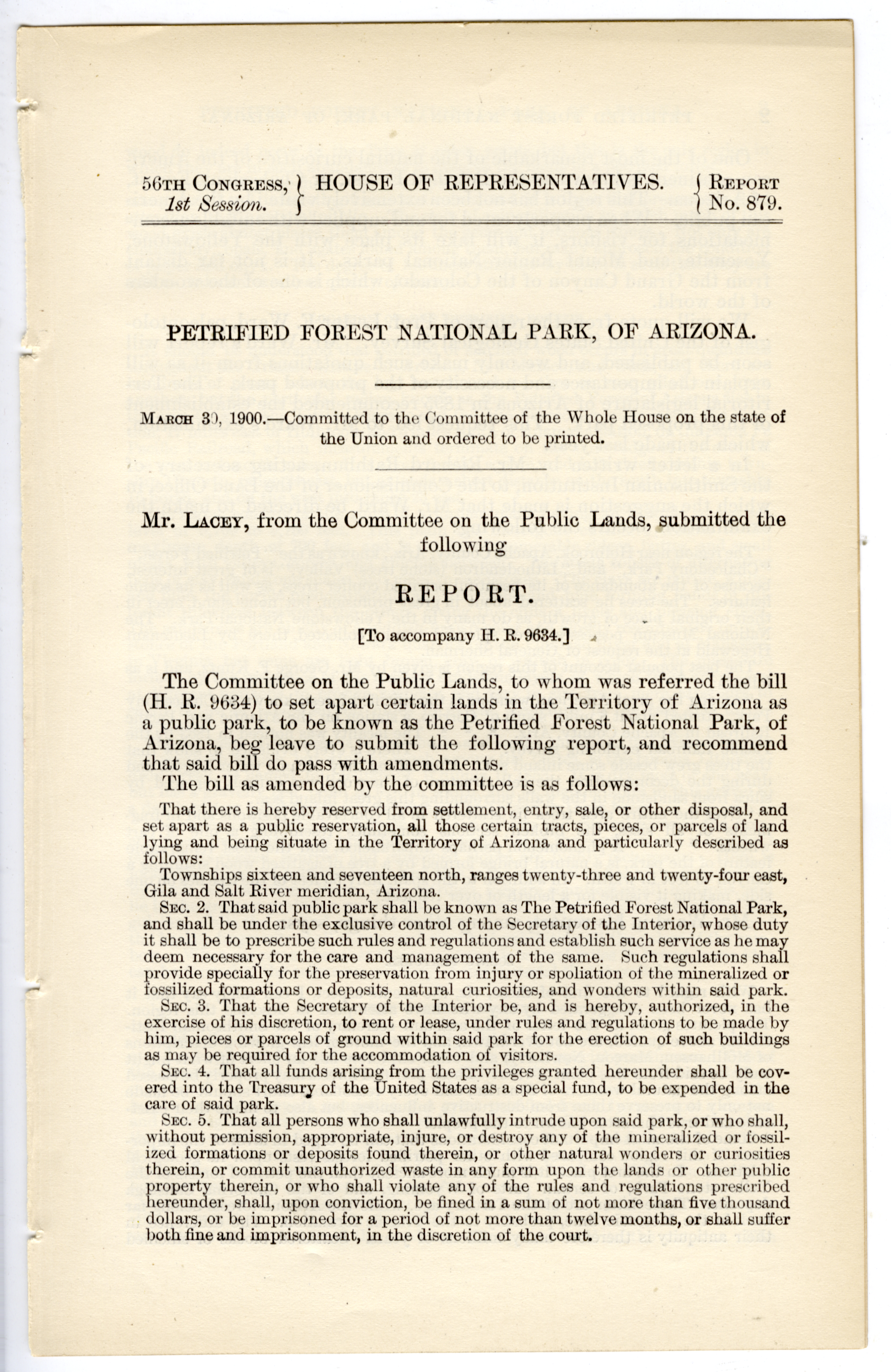
House Report No. 879 (1900), recommending passage of a bill to establish Petrified Forest National Park in Arizona.
After Congress failed to pass the bill, President Theodore Roosevelt proclaimed Petrified Forest National Monument in 1906. It received a 16-page illustrated booklet in 1925. Rather than resembling the simple monument two-fold leaflets that appeared later, the booklet was much closer to contemporary national-park publications in design and content. The monument had become an important destination and appears to have received correspondingly elevated treatment over the years. In 1941, unlike other national monuments, it received another 16-page stapled booklet.
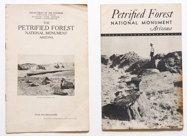
Earliest visitor guide booklet for Petrified Forest National Monument (1925); 1941 visitor guide booklet.
Besides the booklets above, we can find two types of leaflets for the monument. Information pamphlets included densely laid-out text on four pages with a map, while six-panel, two-fold leaflets illustrated with photos were designed like visitor guides. The years of issue indicate they were used simultaneously. Although few appear to have survived, I have located a handful of brochures of both types produced for national parks as well.
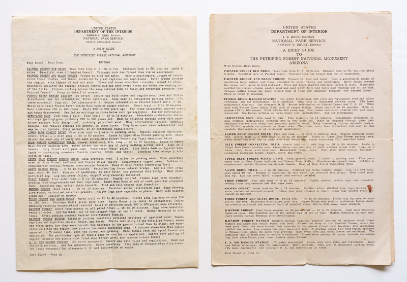
1939 and 1948 information pamphlets for Petrified Forest National Monument. Note more refined typography in the latter.
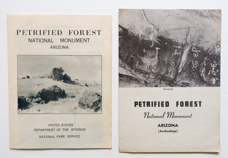
1939 and 1941 two-fold leaflets for Petrified Forest National Monument. The shorter height (8 inches) of the 1939 leaflet would often be used subsequently.
NPS Director Horace Albright had been advocating for a Death Valley National Park. President Hoover instead protected the area by proclaiming Death Valley National Monument in February 1933, and a four-panel leaflet appeared that very same year, followed by booklets ranging from 16 to 28 pages in each of the subsequent years. At roughly 1.6 million acres, Death Valley was the largest national monument in the contiguous United States and one of the largest units in the National Park System. Death Valley eventually became a national park in 1994, when an expansion to 3.4 million acres made it the largest national park in the contiguous United States.
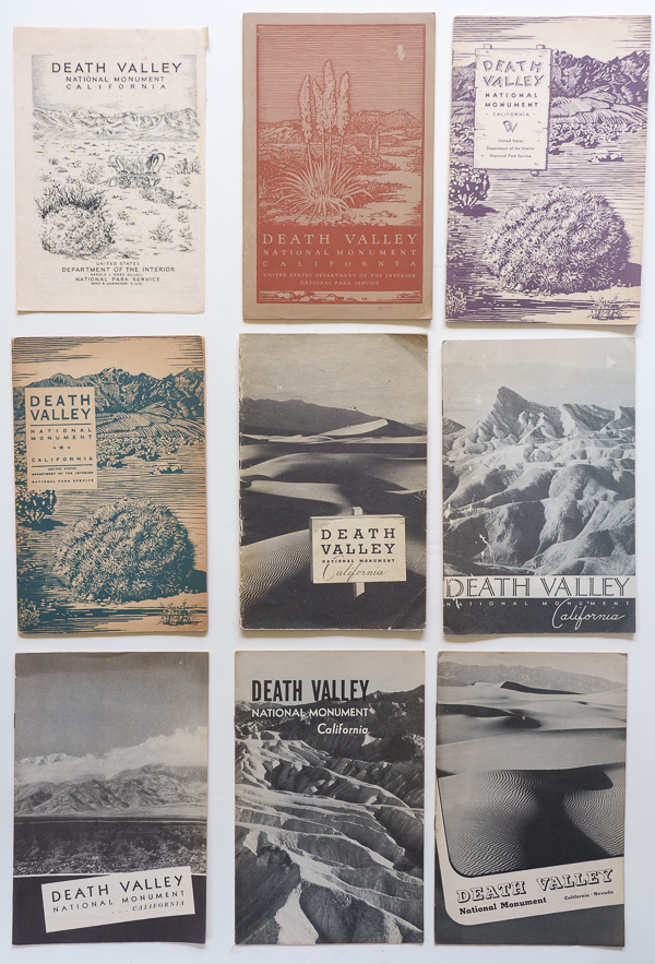
Visitor guides for Death Valley National Monument during its first decade, 1933–1942. Unlike others, the 6th and 7th covers follow the design standards for their respective years, 1939 and 1940. Initially located entirely within California, it gained Nevada lands in 1941, as can be seen in the 9th cover (1942).
Besides those three, Lava Beds (proclaimed 1925) and Oregon Caves (proclaimed 1909) received NPS brochures in 1936, when the NPS was expanding development and interpretation during the New Deal era. After almost three decades, Mount Olympus National Monument (proclaimed 1909) received an information pamphlet in 1937, shortly before becoming Olympic National Park in 1938. That year, a six-panel, two-fold leaflet was issued, followed by a booklet with standardized design in 1940. We find the same publication pattern of a two-fold leaflet followed by a full booklet for Shenandoah National Park.
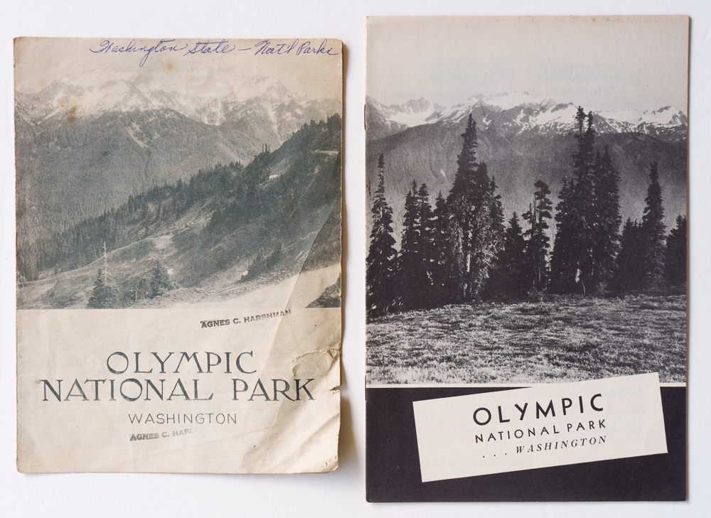
Earliest visitor guide two-fold leaflet for Olympic National Park (1938); earliest visitor guide booklet following standardized design for that year (1940).
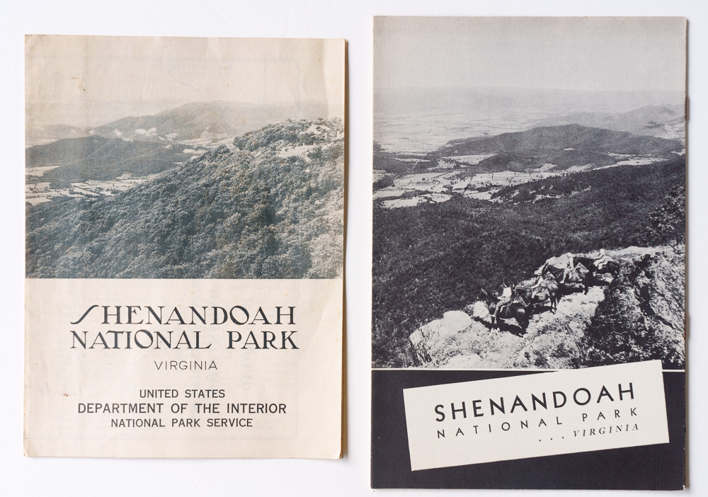
Earliest visitor guide two-fold leaflet for Shenandoah National Park (1939); first visitor guide booklet following design standards for that year (1940).
The rarity of exceptions reinforces the broader pattern. For the first two decades of NPS history, having an official visitor booklet was strongly associated with being a national park.
1940-1944: National monuments get their brochures
Around 1940 many national monuments that had existed for years or even decades suddenly began acquiring official brochures. Although the trend continued for decades, the table below lists only the first two years of this shift.
| First brochure | National Monument | Designated |
|---|---|---|
| 1940 | Fort Pulaski | 1924 |
| 1940 | Montezuma Castle | 1906 |
| 1940 | Ocmulgee | 1936 |
| 1940 | Saguaro | 1933 |
| 1940 | Walnut Canyon | 1915 |
| 1941 | Aztec Ruins | 1923 |
| 1941 | Badlands | 1939 |
| 1941 | Big Hole | 1910 |
| 1941 | Canyon de Chelly | 1931 |
| 1941 | Chaco Canyon | 1907 |
| 1941 | El Morro | 1906 |
| 1941 | George Washington Birthplace | 1930 |
| 1941 | Navajo | 1909 |
| 1941 | Pinnacles | 1908 |
| 1941 | Pipe Spring | 1923 |
| 1941 | Scotts Bluff | 1919 |
| 1941 | Tuzigoot | 1939 |
| 1941 | Wupatki | 1924 |
This flurry of publications wasn’t a coincidence. In 1940, the NPS established a more systematic publication program as it sought to provide visitor literature across a system that had expanded enormously, particularly after the 1933 government reorganization transferred monuments, military parks, battlefields, and historical areas from other federal agencies. By 1940, the NPS administered 82 national monuments but only 26 national parks. The new monument publications took several forms. Some were inexpensive folding leaflets and folders ranging from 6 by 8 inches to 6 by 9 inches, formats already used occasionally before 1940. Contemporary NPS publications used the term “two-fold leaflet” for six-panel sheets. The agency later used “informational folder” as the generic term for a general visitor publication printed on a single folded sheet, regardless of the number of panels. Others were substantial 16-page stapled booklets, unusually large at about 8 by 10½ inches and extensively illustrated with photographs. The latter proved short-lived. Monuments that initially received the large booklets subsequently switched to folding brochures; as early as 1942, for example, Statue of Liberty received a folding brochure instead of the large 16-page booklet used since 1940. The shift to the smaller format likely reflected economics: producing inexpensive folding brochures made it practical to extend and maintain visitor publications across a system containing far more national monuments than national parks.
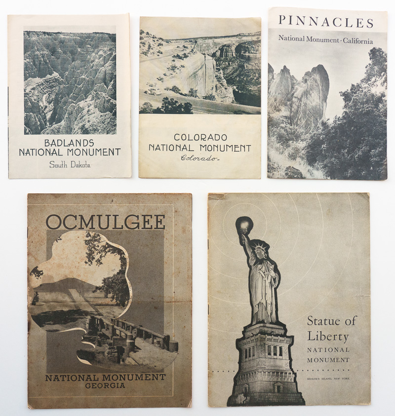
Top: Earliest visitor guide folding brochures for Badlands (1941), Colorado (1940), and Pinnacles (1941) National Monuments, which are 6 inches wide. Bottom: Earliest visitor guide booklets for Ocmulgee (1940) and Statue of Liberty (1940) National Monuments.
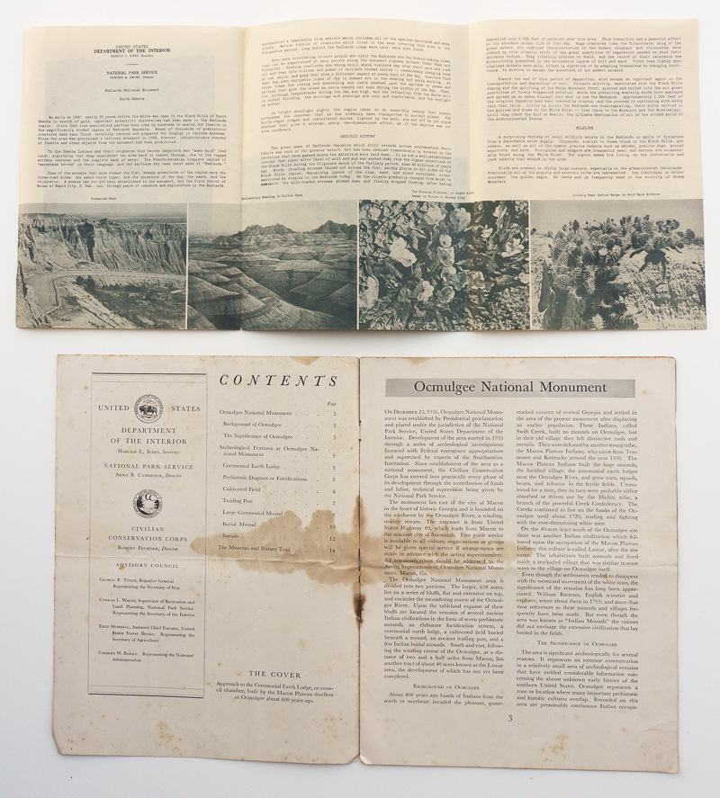
Interiors of visitor guides for Badlands (1941) and Ocmulgee (1940) National Monuments.
The new publications did not erase the hierarchy. Instead, they made it visible. National parks in the early 1940s used a recognizable standardized family of substantial guides. National monuments used distinctly different formats, ranging from folding brochures to large, photographically illustrated 16-page booklets. The distinction was therefore not simply one of size or elaborateness: even the most substantial monument publications remained visually separate from the standardized national-park series. Seen together, they clearly represented different publication classes.
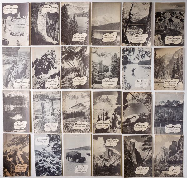
National park visitor guide booklets for the year 1941 (except Great Smoky Mountains, Mammoth Cave, and Yellowstone, details here). Grand Canyon and Yosemite had two different designs.
The change from the previous period was therefore incomplete: before 1940, many monuments had no dedicated NPS brochure. Beginning in 1940, monuments increasingly had brochures, but their brochures visibly identified them as belonging to a different category from national parks. The NPS was starting to provide information throughout its expanding system without yet presenting all designations in the same way.
1945-present: One visual system, but lingering differences in priority
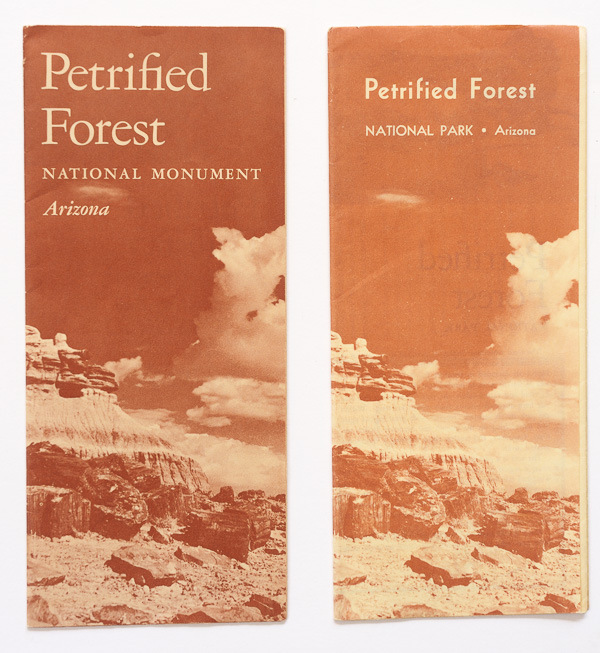
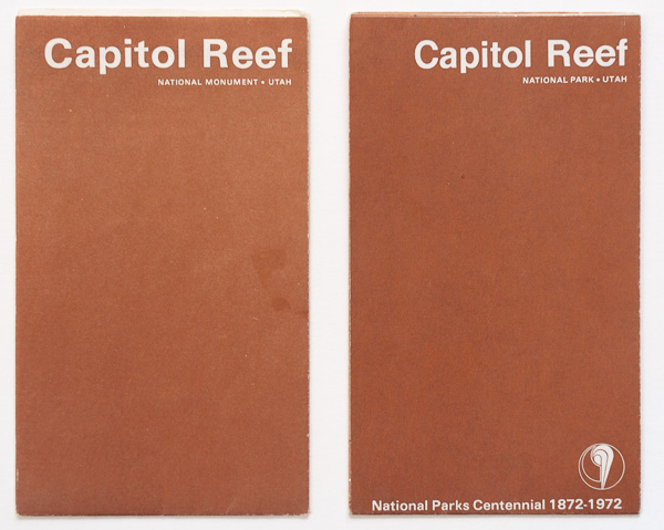
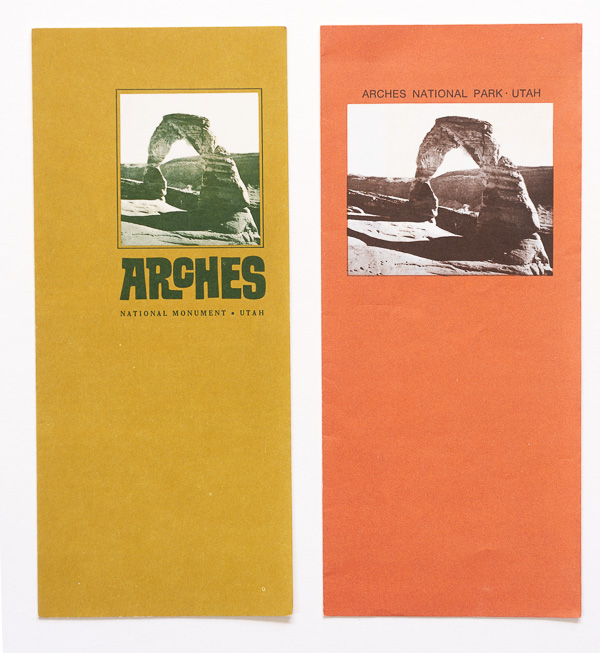
After World War II, the graphic distinction faded rapidly. System-wide design standards were relaxed. National parks and national monuments used the same varied brochure formats and design approaches. The clearest evidence comes from monuments subsequently redesignated as national parks. In earlier decades, becoming a park had often coincided with receiving an entirely different class of publication. After the war, the brochure could remain essentially the same, with only the designation changing from “National Monument” to “National Park”. We can see that on the five postwar design generations discussed in earlier installments. In the case of Biscayne, the change is visible only inside.
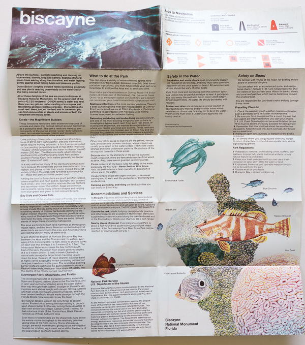
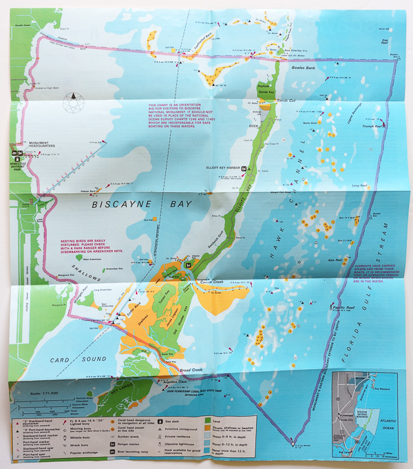
Front and back of unfolded 1980 Biscayne National Monument midi-folder
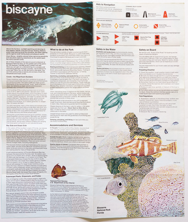
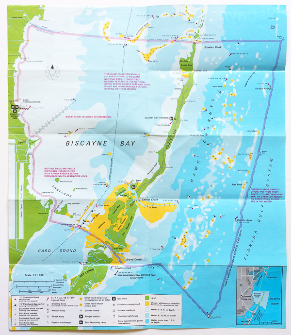
Front and back of unfolded 1981 Biscayne National Park midi-folder. The change to “National Park” can only be seen on the bottom right front panel, and on the map labels for the visitor center and the boundary.
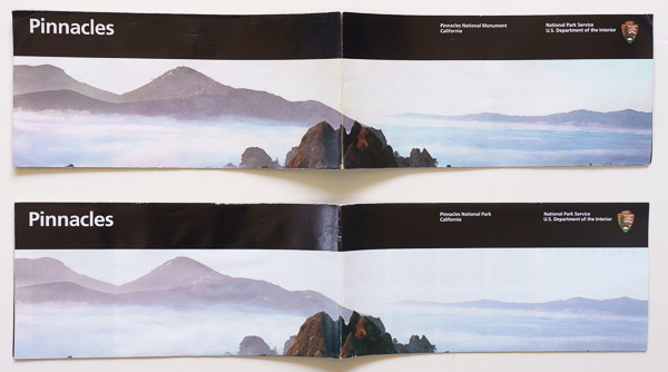
Partly unfolded 2012/2014 Unigrid brochures for Pinnacles National Monument/Park.
That is a significant institutional shift. The words “National Park” and “National Monument” still represented different designations, but they no longer used different visual identities. Unigrid would eventually formalize that principle. Beginning in 1977, the NPS worked with designer Massimo Vignelli on a system of common grids, typography, formats, and cartographic conventions. National parks, monuments, historic sites, memorials, and other units could all fit into the same graphic framework. But visual equality arrived before equality in publication priority.
Some monuments still waited decades. A number of monuments established before or during the war did not receive their first known NPS brochures until well afterward:| National Monument | Designated | Earliest brochure |
|---|---|---|
| White Sands | 1933 | 1945 |
| Chiricahua | 1924 | 1946 |
| Great Sand Dunes | 1932 | 1948 |
| Arches | 1929 | 1949 |
| Lehman Caves | 1922 | 1949 |
| Glacier Bay | 1925 | 1950 |
| Dry Tortugas | 1935 | 1950 |
| Capitol Reef | 1937 | 1951 |
| Katmai | 1918 | 1952 |
| Channel Islands | 1938 | 1968 |
For Katmai, 34 years elapsed between its 1918 monument proclamation and the earliest brochure represented in the archive. Channel Islands waited about 30 years. These places were difficult to visit, but their histories demonstrate how long an NPS national monument could exist without the visitor literature associated with national parks.
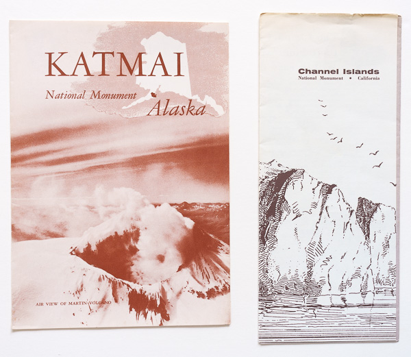
Earliest informational folders for Katmai National Monument (1952) and Channel Islands National Monument (1968).
New parks versus new monuments. To remove the effects of those older units, we can compare only new units established after World War II. For national parks, I excluded places that were simply redesignations of existing monuments or other NPS units. Of the 37 national parks established or redesignated after World War II, only eight were established without redesignating an existing NPS unit. The National Park of American Samoa, authorized in 1988 and established after the necessary land leases were signed in 1993, remains the most recent of them.
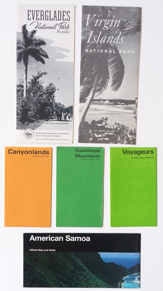
Earliest visitor guides for Everglades (1950), Virgin Islands (1958), Canyonlands (1967), Guadalupe Mountains (1972), Voyageurs (1975) National Parks and the National Park of American Samoa (1997).
| New National Park | Established | Earliest brochure | Lag |
|---|---|---|---|
| Everglades | 1947 | 1950 | 3 years |
| Virgin Islands | 1956 | 1958 | 2 |
| Canyonlands | 1964 | 1967 | 3 |
| North Cascades | 1968 | 1972 | 4 |
| Redwood | 1968 | 1969 | 1 |
| Guadalupe Mountains | 1972 | 1972 | 0 |
| Voyageurs | 1975 | 1975 | 0 |
| National Park of American Samoa | 1993 | 1997 | 4 |
The median interval is 2.5 years. Compare that with newly designated postwar national monuments for which the surviving brochure record allows the interval to be measured:
| New National Monument | Designated | Earliest brochure | Lag |
|---|---|---|---|
| Castle Clinton | 1946 | 1953 | 7 years |
| Fort Union | 1954 | 1956 | 2 |
| Booker T. Washington | 1956 | 1960 | 4 |
| Grand Portage | 1958 | 1962 | 4 |
| Russell Cave | 1961 | 1966 | 5 |
| Buck Island Reef | 1961 | 1967 | 6 |
| Agate Fossil Beds | 1965 | 1967 | 2 |
| Alibates Flint Quarries | 1965 | 1975 | 10 |
| Biscayne | 1968 | 1972 | 4 |
| Florissant Fossil Beds | 1969 | 1974 | 5 |
| John Day Fossil Beds | 1975 | 1979 | 4 |
| Congaree | 1976 | 1988 | 12 |
Here the median interval is 4.5 years, almost twice the national-park figure. Ten of the twelve monuments waited four years or more; no new national park waited more than four. Archives are not necessarily complete. However, taken together with the prewar evidence, they point in the same direction: national park designation continued to correlate with faster publication even after national park and national monument brochures had become visually equivalent.
On December 1, 1978, President Jimmy Carter used the Antiquities Act to proclaim large areas of Alaska as national monuments. Among them were Gates of the Arctic, Kenai Fjords, Kobuk Valley, Lake Clark, and Wrangell-St. Elias. All five were administered by the NPS from their creation. The Alaska National Interest Lands Conservation Act (ANILCA) of December 2, 1980 protected more than 100 million acres of federal land in Alaska and was a conservation milestone because it represented the largest single expansion of protected lands in U.S. history. Among other things, it redesignated the five areas as national parks and preserves. Because of their remote Alaska location and the brevity of the national monument phase, all five passed through their national monument phase without a brochure represented in the historical record, just like Acadia, Grand Canyon, Zion, Bryce Canyon, and Carlsbad Caverns during the initial NPS period.
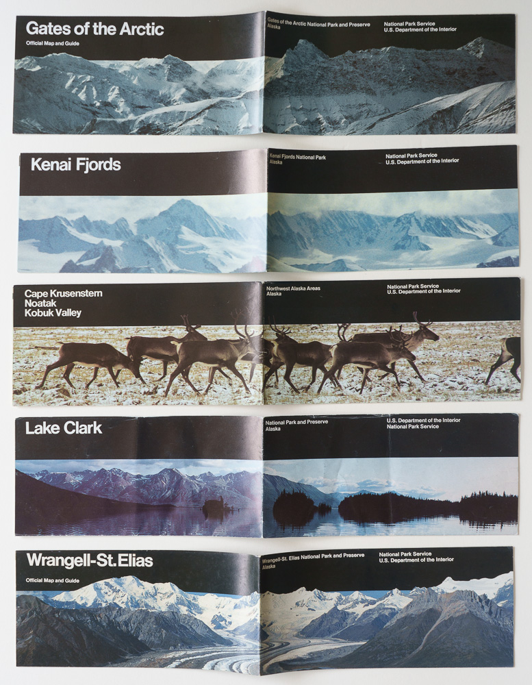
Unigrid brochures for Gates of the Arctic (1995), Kenai Fjords (1985), Kobuk Valley (1990), Lake Clark (1985), and Wrangell-St. Elias (1990) National Parks and Preserves continuing the initial design.
For decades, national monuments received secondary treatment. That hierarchy was consistent with an early conception of national parks as a particularly selective designation, which I discussed in Roger Toll and the Lost Standard of National Parks. A place could be worthy of federal protection without necessarily meeting the higher standard for national park status. At the same time, about half of today’s national parks were first protected as national monuments. The Antiquities Act allowed protection to precede recognition as a national park. Grand Canyon did not become worthy of protection when Congress made it a national park in 1919; Death Valley did not become nationally significant when its designation finally changed in 1994. Their monument status protected them while the judgment about national park status came later. The changing brochures make that history visible: national parks and national monuments once occupied clearly different positions within the system, while the path from one designation to the other repeatedly demonstrated the foresight and enduring value of the Antiquities Act.
Part 6 of an ongoing series: 1 | 2 | 3 | 4 | 5 | 6 | to be continued