Great Basin’s Mount Washington: A Remote Corner of a Remote Park
5 Comments
Great Basin National Park was established on this day 36 years ago. Despite its intriguing mix of natural wonders that include a cave with rare formations, a peak with one of the most southerly glaciers, bristlecone pines and aspen growing nearby, and a six-story limestone arch, Great Basin National Park is one of the least-visited national parks in the continental U.S. On the occasion of the anniversary, I will do my best to stir up 20-year-old memories and notes in order to bring you a location that few visitors have seen in person, although it remains my favorite place in the park. A hidden gem within this hidden gem of a national park, the Snake Range’s Mount Washington offers maybe the most remarkable long-range views in the park as well as its most beautiful bristlecone pine grove, and it is even accessible by road, the highest in Nevada, and quite an adventurous one.
I first learned about the location in the 1990s through a photograph in a book by David Muench – is there a natural place in America that the man has not photographed? I was attracted by the grove’s seemingly more open character, compared to the bristlecone pine grove of Wheeler Cirque that I had visited multiple times. At the visitor center, a ranger guessed that the location may be near Mount Washington. This is what the map of the area looks like in an official NPS visitor guide from the late 2000s:
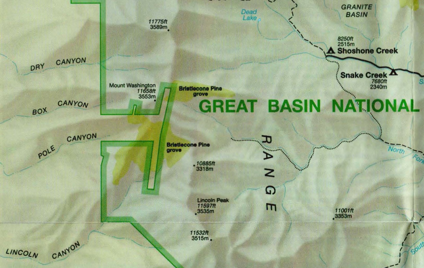
That map indicated that no roads nor even trails lead anywhere close to Mount Washington. However, on another visit, a ranger mentioned that a dirt road reaches the summit starting from outside of the park on the west side of the Snake Range, and recommended a 4×4 high-clearance vehicle with a short wheelbase. At that time, I was driving an older Subaru Legacy, so in October of 2003, with this visit specifically in mind, I borrowed for the first time my wife’s Subaru Forester, a more rugged and compact vehicle.
The unmarked gravel road (NF-453) branches east from NV-894 past the Kirkeby Ranch Airport about 11.7 miles southeast of US-93. It starts easy enough as it climbs an alluvial fan up Pole Canyon, transitioning from the sagebrush plain to a pinyon and juniper forest. After some switchbacks unremarkable enough that I wondered if the Forester was even needed, I reached a fork at about 7850 feet. As the left (north) branch, looked in better condition, I followed it, passing old mining buildings a short distance away, only to find out about an hour later that it dead-ended in a canyon way below the cliffs that form the north face of Mount Washington. Given that it was already late in the afternoon, here went my planned sunset shot on Mount Washington!
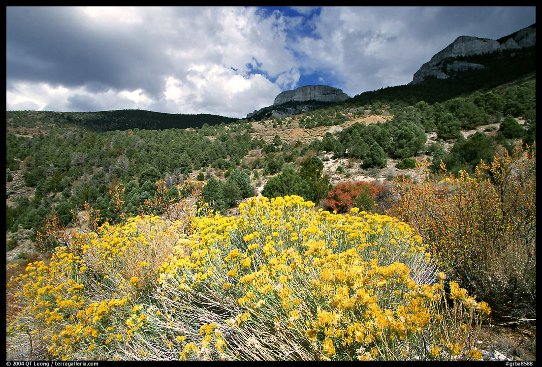
As I backtracked, I photographed towards Spring Valley in beautiful light. Past the mine, I continued on the other (south) fork. Soon the switchbacks became so tight that I sometimes had to make three-point turns. They were also some of the steepest I had ever experienced and I marveled that my vehicle was able to tackle them as it sometimes felt that the turns were more vertical than horizontal. I wondered what the rest of the road had in store, but fortunately, after a sign marking the limit of Great Basin National Park, the road eased most of the way as it winded through burned forests, until a short distance before the summit, where it became more rocky, climbing straight north at a high incline to the top. By that time, it was too dark to photograph on film. Since the barren summit was cold and windy, I drove down a few hundred vertical feet to under the tree line where I found a pullout with a flat spot to camp.
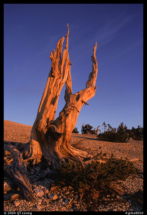
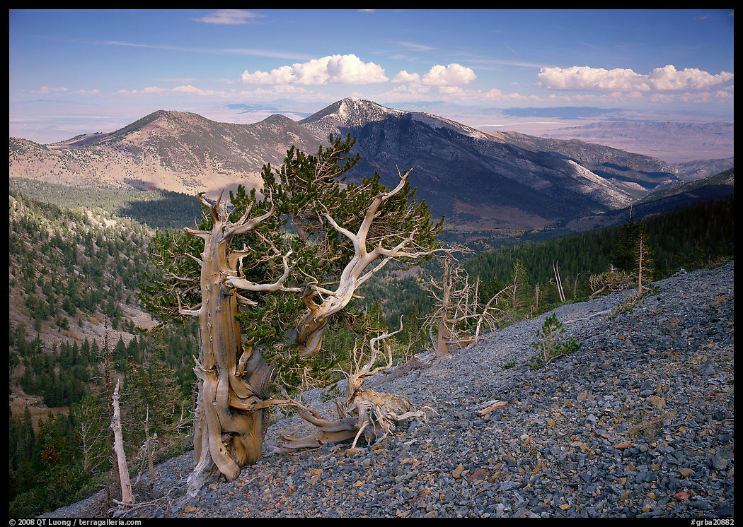
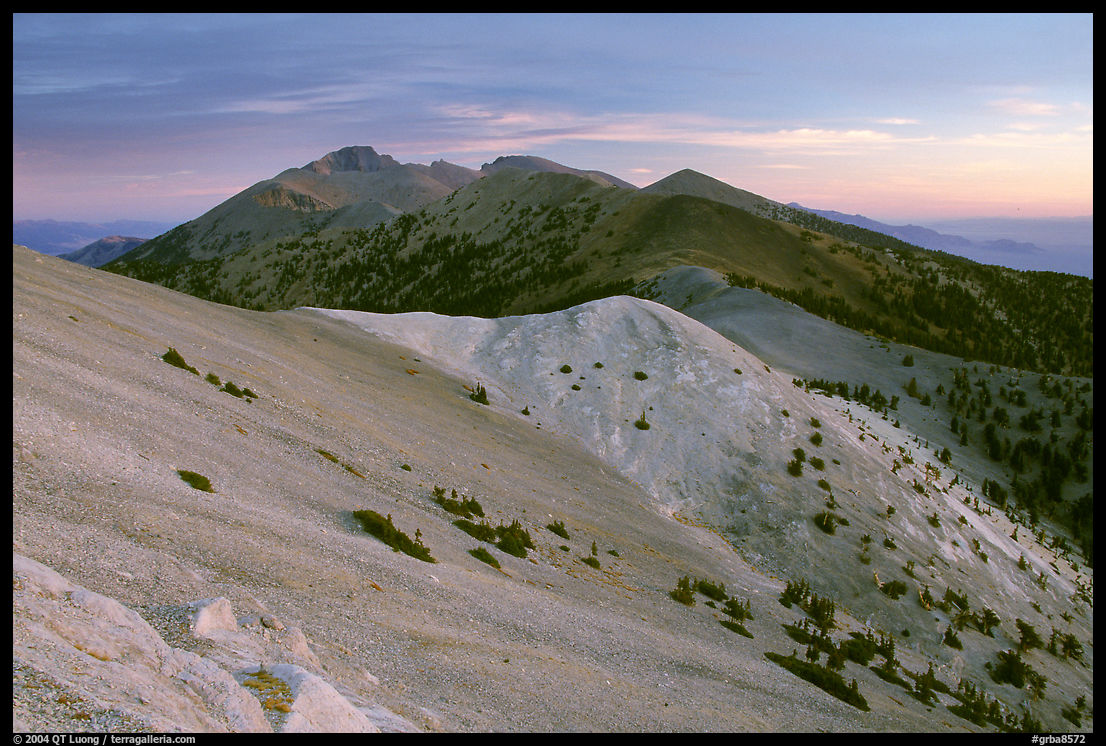
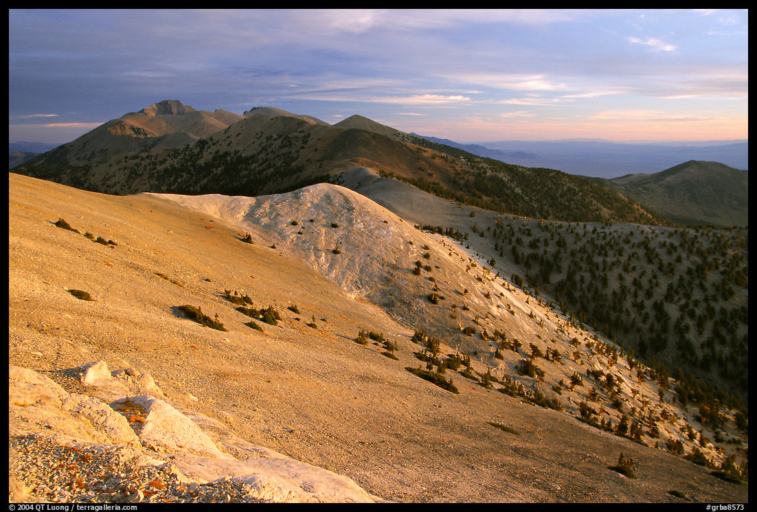
My plan for the next day was to explore the bristlecone pine grove north of Mount Washington from sunrise to sunset. I drove back to the top in the dark, and as soon as there was enough light to see in the distance, I identified a route to the bristlecone pine grove. It was less than a mile away toward the northeast, but as there was no trail, I had to scramble down a steep ridge with a sheer drop on one side and plenty of loose scree. Parts of the grove are located on a gently sloping ridge called the Snake Divide that descends towards the east, catching the first light of sunrise.
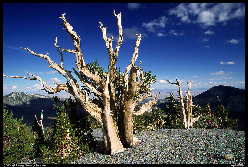
In the Wheeler Cirque grove, the trees are on steep terrain enclosed on three sides by peaks, closely clustered, and often mixed with other species of pine trees such as limber pines, making it difficult to isolate them unless one frames a close-up of a single tree looking up towards the sky. Here, the trees are situated on a low-angle, barren ridge called the Snake Divide and are well-spaced from each other. It was possible to make clean compositions where they detach themselves from their surroundings. Since the grove is located on a ridge, the backdrop is spectacular. The view towards the east (opening photograph) is dominated by the white limestone ridge of Eagle Peak, which is home of the third major grove of bristlecone pines in Great Basin National Park – the first two being in Wheeler Cirque and Mount Washington.
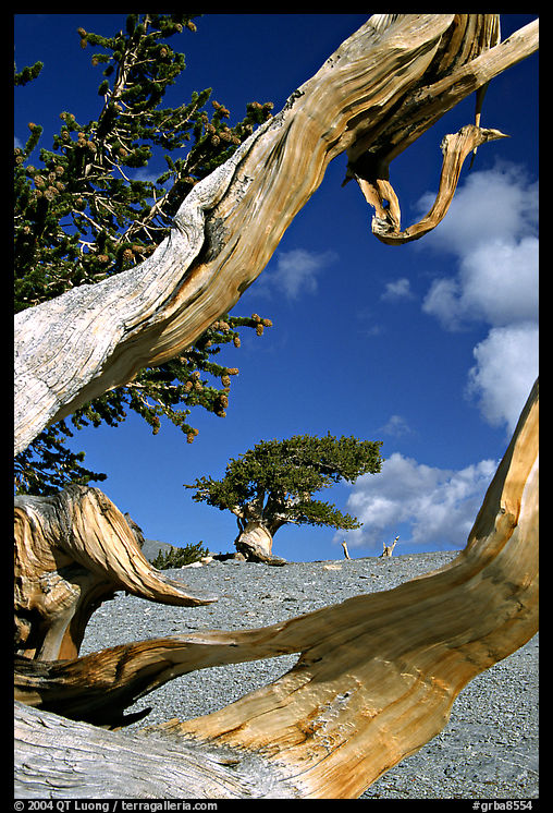
I found enough magnificent trees, each with a distinct character, to spend the whole day there. Among them, I was pleased to recognize the tree photographed by David Muench that had enticed me to come here: it has dual trunks appearing to embrace above exposed roots and below a crown of needles. Since Muench had photographed it well, I didn’t even make a photograph with my large-format camera and instead looked for other remarkable specimens, of which there were plenty. I suppose that seeing the photograph of Muench before prevented me from paying more attention to that tree. On the other hand, without it, I may not have found out about the grove and I may not have experienced this wonderful place. For igniting my curiosity, I am so grateful for his photograph. I subsequently learned that the grove is nicknamed the “Magic Grove”, a name amply deserved.
At sunset, the grove gets in the shadow of the summit ridge, so I made sure to utilize the light of the late afternoon well. A telephoto lens compressed the space between the trees, conveying the impression of a grove densely populated with ancient trees. At the Magic Grove, I seldom used a wide-angle lens as those increase the apparent spacing of features, be it trees or mountains, whereas my feeling was that it was a place where so much came together in a remarkable juxtaposition. Since the location was so lonely, as a safety precaution, I left the grove early enough so that I wouldn’t have to scramble up the precarious ridge back in total darkness. By contrast with the trails of the Wheeler Cirque where I saw dozens of hikers, nobody else was around.
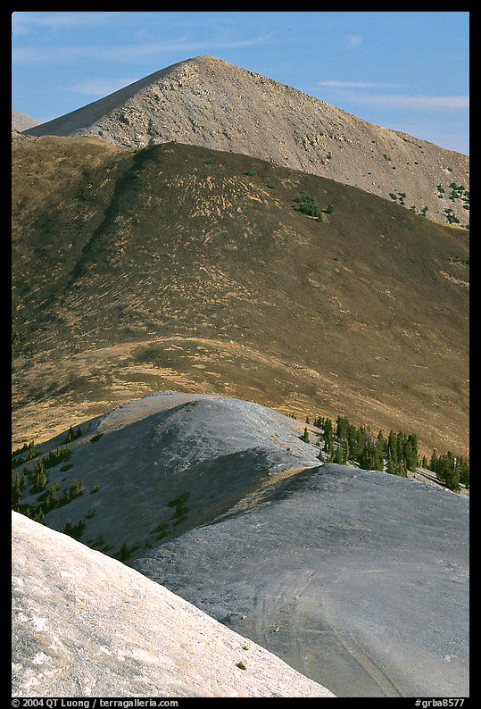
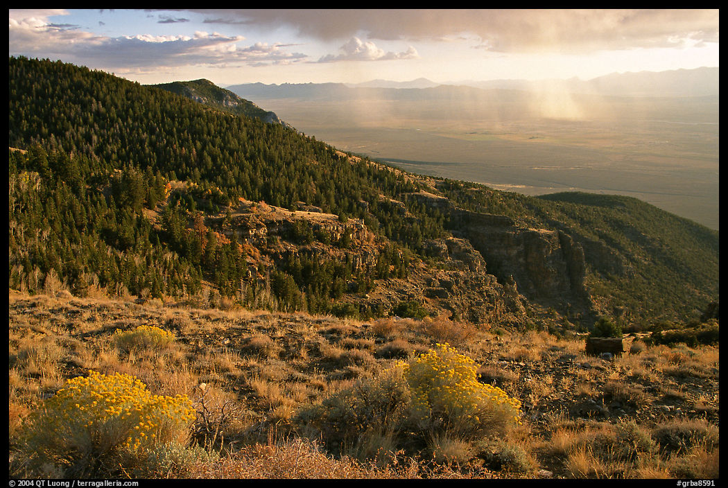
In the crystal-clear air of the high desert, Mount Washington, cumulating at 11,658 feet, and sitting on the summit crest of the Snake Range, offers excellent views over all directions. For the following day, I planned to spend the early morning photographing those larger landscapes. The views are more interesting than from the high point of the range and park, Wheeler Peak (13,063 feet) because when you are on the top, everything looks smaller, whereas the presence of a chain of peaks leading to a higher peak confers a sense of scale. Although the warm light at sunrise was the most dramatic, it was the pre-dawn light and then the early morning light that revealed the colors of the various rocks better. Looking towards the north, Distant Wheeler Peak, Jeff Davis Peak, and Baker Peak are formed of Prospect Mountain Quartzite, a metamorphic rock. Peaks in the middle distance are formed of granite, whereas closer peaks, including Mount Washington, are limestone.
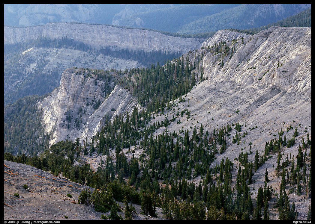
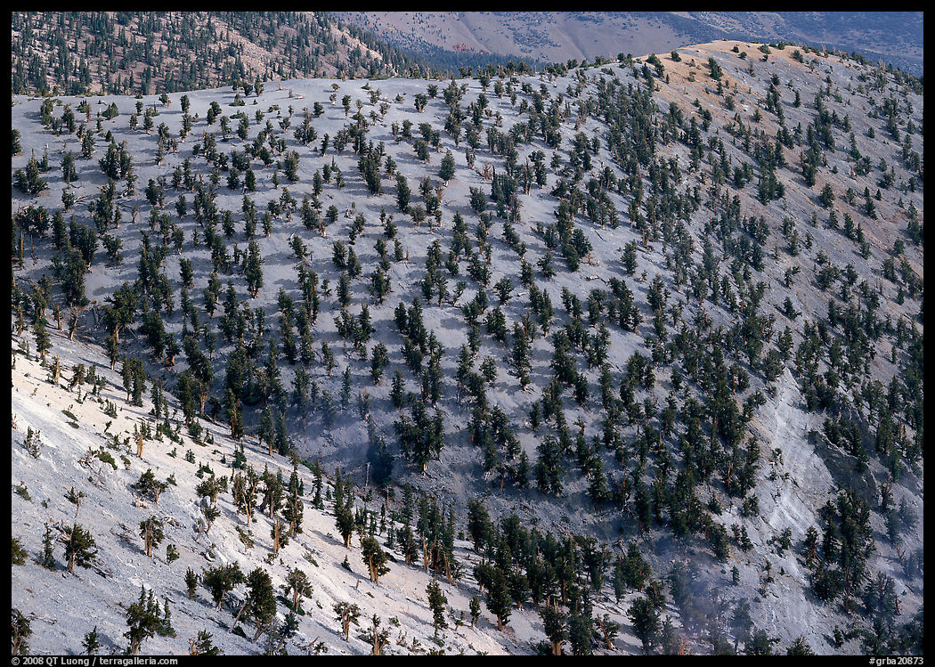
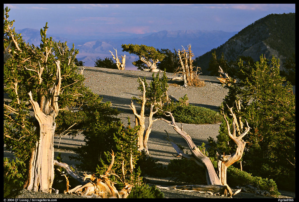
The side of Mount Washington opposite the road consisted of sheer limestone cliffs. Partial cloud cover softened the light, and I excluded the brighter sky to emphasize the silvery quality of the limestone. Looking down towards the east takes in the south fork of Big Wash above which other limestone cliffs tower, whereas looking down towards the northeast showed the pattern of trees in the bristlecone pine grove from a distance. From there, you can see that the Magic Grove is quite extensive, stretching downslope on the southern side of the Snake Divide. A closer look shows that the trees growing lower on the slope are more orderly looking and lack the spectacular twisted limbs of those that grow on the top of the ridge. It is probably because they grow in a milder climate. Harsh growing conditions causes slowness of growth, density of wood, and longevity, but also the trees’ tortured shapes.
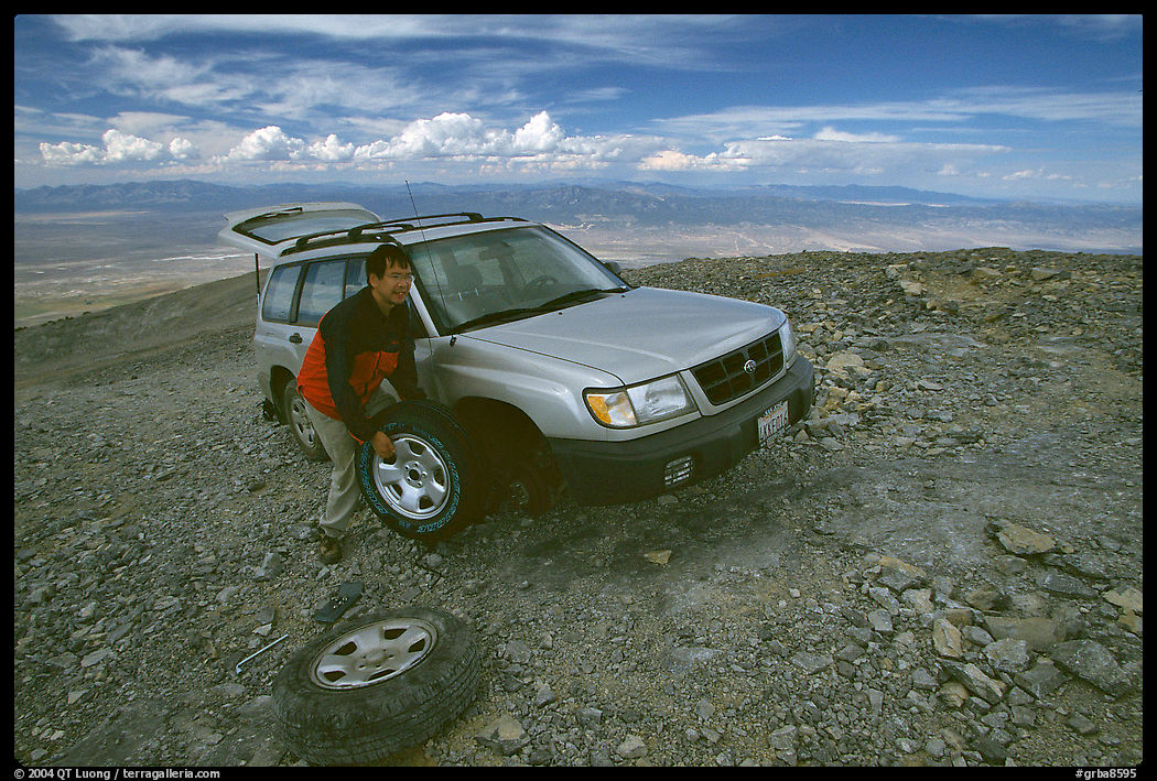
With plenty of supplies, I was thinking of staying there another day, but when I got back to my car, I noticed that one tire was flat, maybe as the result of driving on sharp rocks of the rough section of road a few hundred feet below the summit. Since I didn’t check carefully the borrowed vehicle beforehand, I wondered if I’d be able to find the tools and spare tire, but fortunately there were all there, including a full spare. Changing the tire was a bit of a struggle, but I had no choice. Now without a spare tire in such a remote corner of a remote park, I felt like returning to civilization without further delay. By the time I reached the pavement in the afternoon, I still had not seen another soul.
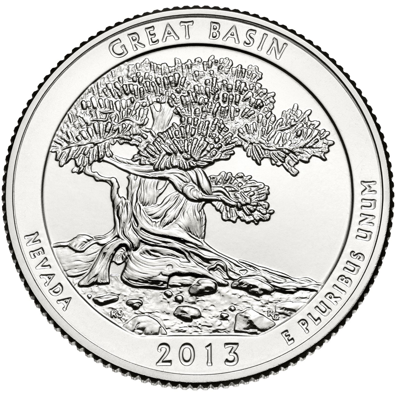
Afterword. In recent years, I noticed more interest for the tree photographed by David Muench and even sold a large print of it. I wondered how much of an influence he could have had on young photographers, until I found out that the tree had been featured on the Great Basin National Park quarter (part of a series of national park quarters), therefore acquiring an instant iconic status.
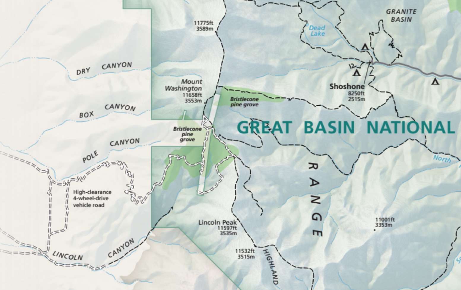
While researching for Treasured Lands in 2015, and again for this article, I noticed new developments, which is typical of a relatively recent park’s evolution. The trail system now reaches Mount Washington, with the shortest hike about 12 miles round-trip and 3,000 feet elevation gain from a new trailhead at Snake Creek via the new Shoshone Trail in the Snake Creek drainage and the Snake Divide Trail which follows the ridge of the same name – the later is indicated on the map available at the park (above), but not on the map on the NPS website as of this writing. Snake Creek is at the end of an unpaved road out of the beaten path, but accessible to all vehicles. The road that I took is now marked. It ends with a loop before the steep section south of the peak, close to where I camped, so you’d have to walk that short distance. There also appears to be a road extension towards the southeast that I didn’t see back then. I haven’t returned to Mount Washington since my visit of 2003, so I don’t know about the current road or trail conditions, but my guess is that it’s still an adventure to get there!


Beautiful work as always! I’ve long wanted to go up there, but I don’t think I’d have the guts to try it in my Subaru – I’m impressed you went for it. The private property on the west side of Mt. Washington is the theoretical future location of one of the 10,000-year clocks envisioned by the Long Now Foundation, though whether anything is actually happening with that project is not clear to me.
https://longnow.org/clock/nevada/
Thanks Jackson. Although the switchbacks are impressive, the road isn’t that bad, maybe the worst section was the section below the summit, which apparently is no longer drivable. It is a fitting place to contemplate deep time!
I love your article on your Mount Washington adventure. I relived a similar adventure in the mountains of Colorado seeking the Bristlecone Pines there. Sometimes was afraid my 4Runner was going to tip over backwards. I photographed the bristlecone pines around Mt Whitney and the Ancient Bristle Cone Forest in the White Mountains of California.What a wonderful place to spend the day.
Thanks for an exciting read.
Thank you John for sharing your experience. I didn’t realize that the Bristlecone Pines range extended as far as Colorado. The groves in the White Mountains of California are definitively easier to access!
Thank you for publishing your adventure. I and a couple of colleagues in a 2nd vehicle tackled that road in August of 2017. The road then was still much as you describe it. I was in a Ford Explorer Sport Trac (short bed) and made numerous 3 point turns climbing. Given the loose stones and steep incline, on my way down I had it in 4-Low much of the way. Found the driving a bit frightening! But for 3 days we saw no one and had many wonderful moments – with and without my cameras. It is a place I’d love to return to…though I’m not sure I’d want to drive it again. Thanks again for sharing your experience.