New River Gorge National Park: Five Classic Sights
10 Comments
The only thing new with New River Gorge National Park and Preserve is its status as our latest national park. The river is very old, and New River Gorge National River had long been known as an East Coast outdoors activities hub offering diverse activities including whitewater rafting with Class V rapids, excellent rock climbing, and even BASE jumping from the landmark New River Gorge Bridge. I was surprised to discover that the park has something for everyone: scenery, biodiversity, history, recreation. Located hundreds of miles from any big city, New River Gorge is not a day trip destination, which is good since in almost a week, I was far from being able to see everything. This article details the sights I expected to see in the park: the New River Gorge Bridge, and the great views of the New River Gorge.
The New River Gorge
The longest and deepest canyon in the Appalachian Mountains, New River Gorge has been cut by a river that is, despite its name, one of the oldest in the world. The river course was set before the Appalachians formed 60 million years ago. Flowing across the Appalachian Plateau, not around it or from it unlike the other Appalachian streams that run west to east, the New River cut into the mountains faster than their uplift rate, carving a gorge 1,400 feet deep at Grandview Point. The steep gradient generating its erosive power makes it one of the finest whitewater rivers in the eastern United States. Over 50 miles within the park, it drops 750 feet – by comparison, the Mississippi River drops 1,500 feet over its entire 2,300-mile course. The New River runs from south to north. Together with the diversity of niche habitats due to topography, the unusual orientation serves as a corridor for species, leading to a biodiversity hot spot.
The National Park and Preserve
Formerly designated a National River, New River Gorge (114 square miles) is long and thin, stretching for 33 miles from Ansted in the north to Hinton in the south, however never more than a few miles away from the river. A first national park redesignation bill introduced in 2018 wasn’t successful because of local opposition, mostly due to the fact that national parks do not permit hunting on their lands. The next year, the West Virginia congressional leadership put together a national park and preserve redesignation bill. Unlike national parks, national preserves permit hunting. They are mostly located in Alaska, where hunting is a way of life, with the only “national park and preserve” in the lower 48 being Great Sand Dunes. Even though the “National Park” part is only 9.4 square miles, representing less than 10% of the park, some still lamented about the loss of hunting grounds as unacceptable, but the bill passed. Although very small, the “National Park” part nevertheless includes the main attractions: the Lower Gorge around the New River Gorge Bridge, Thurmond, Grandview, and Sandstone Falls. Fayetteville is the closest gateway town with amenities. The first four locations in this article are all located in the Lower Gorge, and a short distance from Fayetteville, while the fifth is further south.
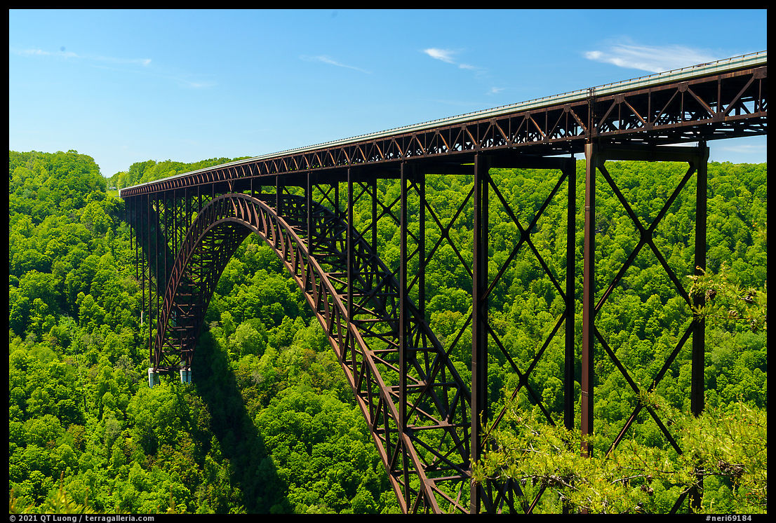
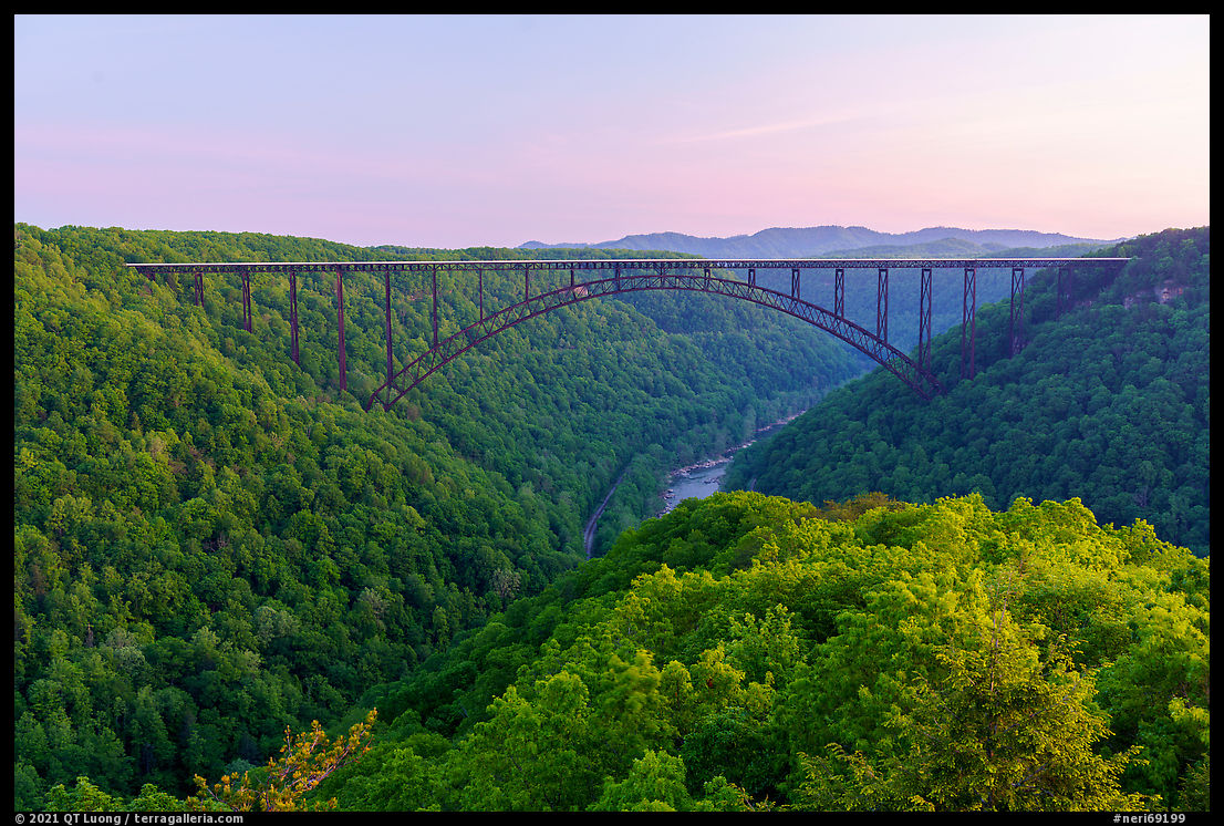
New River Gorge Bridge (1)
The iconic 3,000-foot bridge is the longest single-arch bridge in the Western Hemisphere and the third-highest bridge in the United States. From the Canyon Rim Visitor Center, a short boardwalk leads to an overlook for close-up views of the bridge. A 178-step walk down to an observation platform leads to a better view. The bridge shortened cross-gorge travel time from over an hour to less than a minute. The old cross-gorge route starting in Lansing is now a steep and curvy scenic drive called the Fayette Station Road, crossing several times below the bridge. Many visitors jump out of their cars for a quick shot as the road traverses the smaller Tunney Hunsaker Bridge. It is an excellent spot for an unobstructed view of the Bridge’s full span, and in order to spend more time, I walked back from the riverside parking from which the bridge soars 875 feet above. The sky had been cloudless, however, as I was driving up and out of the gorge, I noticed afternoon clouds moving in. I drove again the mostly one-way road for a second chance. If the conditions improve, just photograph again! The top of the bridge is open to pedestrians only on Bridge Day, however you can take a guided tours along the 24-inch-wide catwalk under the bridge for vertiginous views.
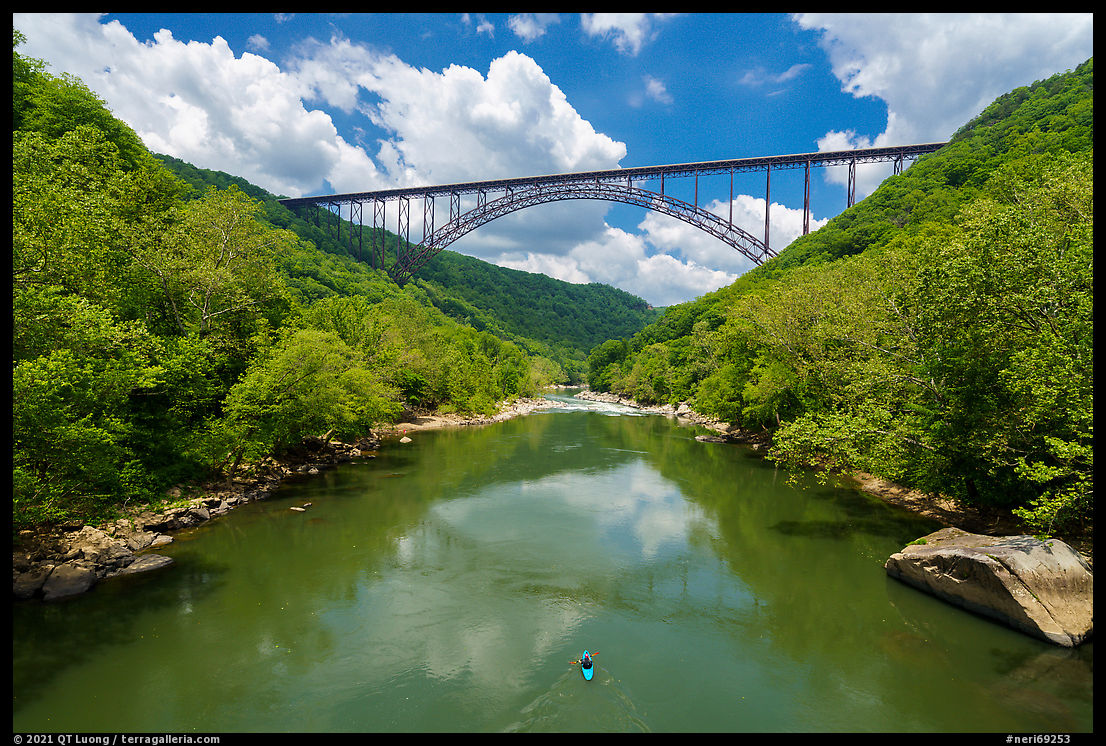
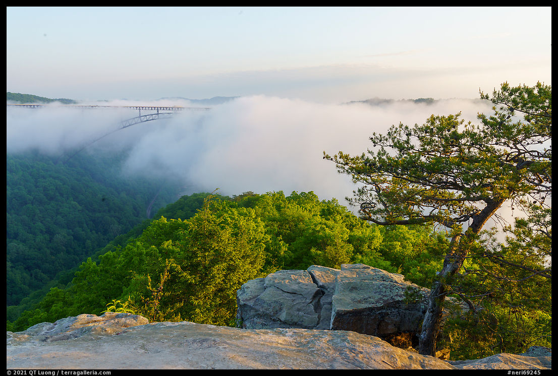
Long Point (2)
Long Point is a narrow ridge extending above the canyon, offering views on both sides of the valley, and especially towards the north and the New River Gorge Bridge, only half a mile away. It is my favorite perspective of the bridge, as the unobstructed view is perfectly symmetrical and beautifully shows the bridge in the context of the gorge. Fifteen minutes before sunrise, under a delicate pastel sky, the softness of the light revealed the textures and colors of the forest canopy without distracting shadows, while its directionality differentiated the slopes that make parts of the canyon from each other. I was glad I woke up before 4 am to hike the 3.2-mile (roundtrip) trail along which I found budding Mountain Laurel.On that morning, I was feeling a bit tired from the jet lag and a long day starting at 5:30AM and ending around 11:30PM, so I decided not to lug out my large-format camera. I came back the next morning for what I assumed to be a sure large-format photograph, only to find the bridge swathed in low fog.
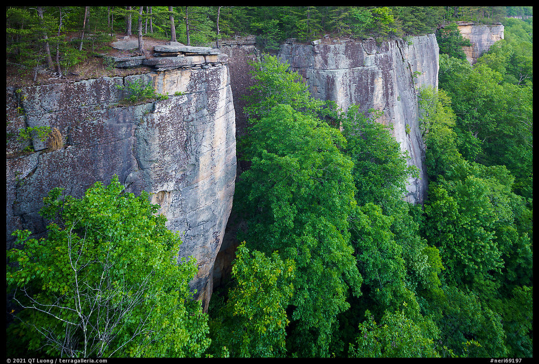
Endless Wall (3)
The most popular hiking trail in the park is the 2.4-mile Endless Wall Trail. It was voted by USA Today readers in 2015 as the country’s top national park hike even though New River Gorge was not yet a national park. If the first trailhead is full, try the second, but do not park along the road, where your car may be ticketed or towed. The serene Eastern Hemlock forest transitions to rhododendron tunnels after Fern Creek, a stream that creates several hard-to-reach waterfalls below. Given the relatively dry conditions, I did not attempt to bushwhack to them. Several side paths lead to the edge of the cliffs, and sometimes to metal ladders that allow rock climbers to reach the base of the cliffs. You can either complete the loop between the two trailheads by walking an additional half a mile along the road, or hike round-trip to Diamond Point, located mid-way, a promontory atop the cliffs that offers high views of the gorge towards the northwest, west, south, and southeast, making it good for sunrise and sunset. From there, I understood why the trail is called that way, as the high wall of Nuttall Sandstone cliffs stretched into the distance, disappearing around the bend in both directions.

Beauty Mountain (4)
Beauty Mountain isn’t really a mountain, but instead a stretch of sandstone cliffs running along the eastern rim of the gorge a thousand feet above the river. Located right at the park boundary, Ram Head is an unmarked spot popular with locals for watching the sun set over the gorge, as it offers a panoramic view for a 5 minute stroll. A woman set up a hammock and a group brought a guitar, creating a festive ambiance, but numerous ledges allow visitors to spread out. To find even more viewpoints, you can hike two-third of a mile along user trails following the cliffs. Take the Edmond-Lansing Road off US-19 and turn right after 3 miles at Edmond, then right again after half-a-mile at the tiny Edmond Post Office. Park after 1.4 miles near a T-junction, respecting the nearby private properties.
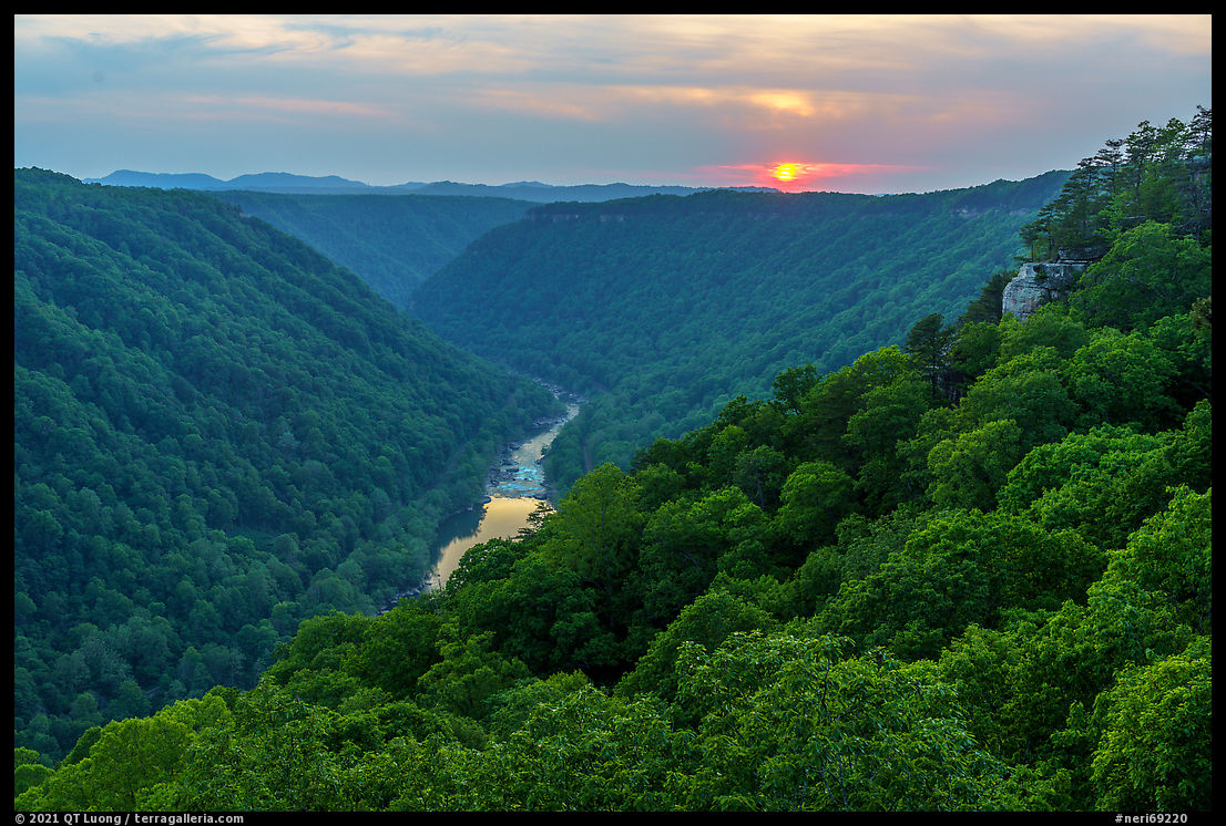
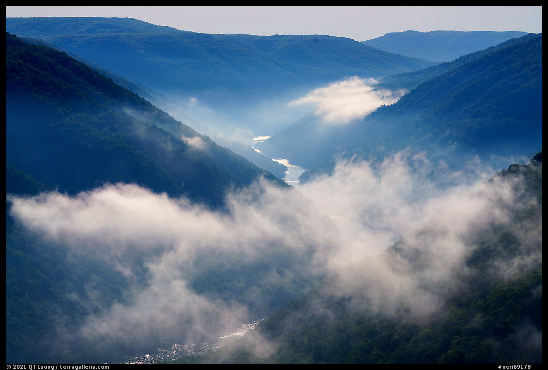
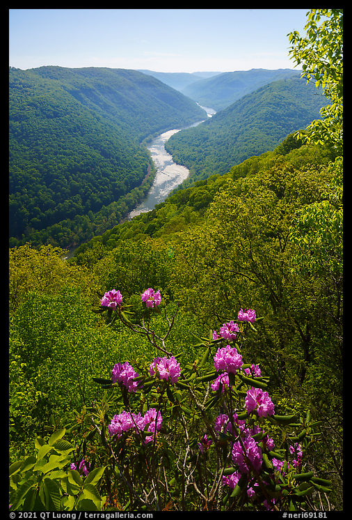
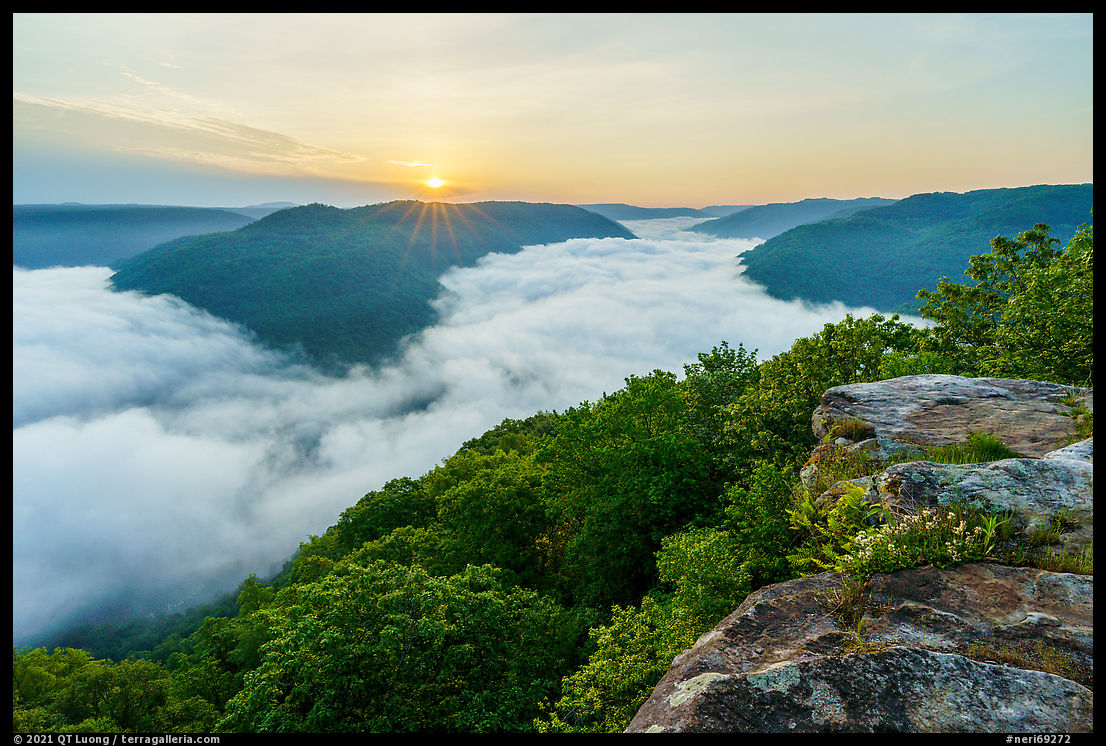
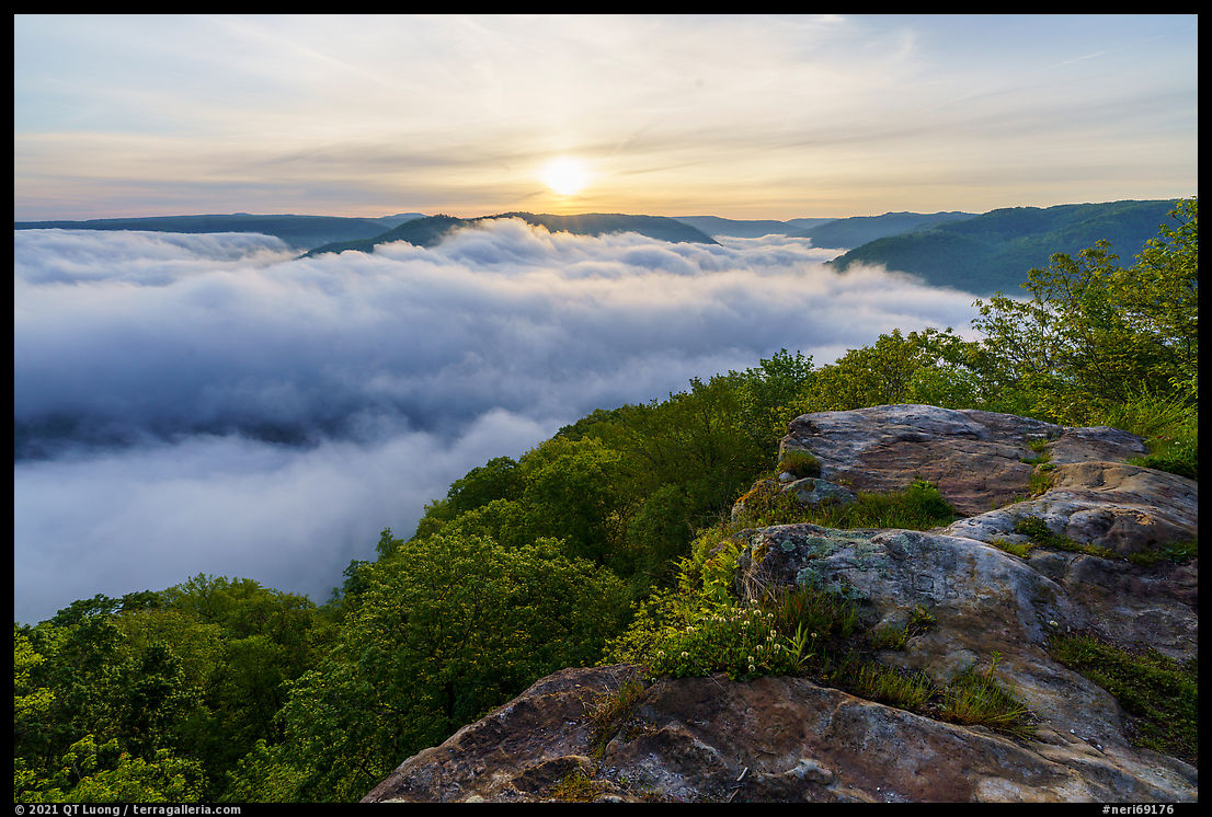
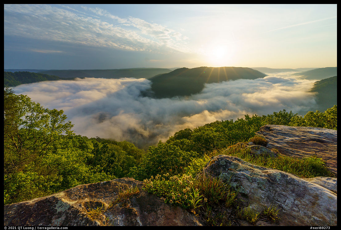
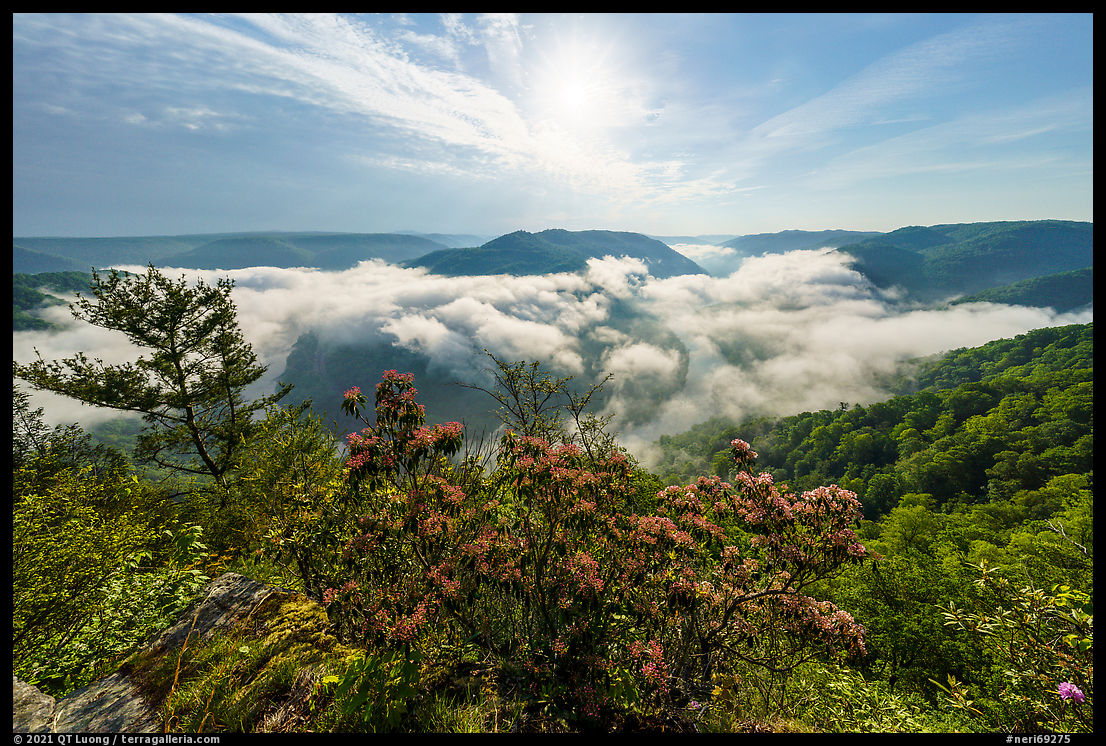
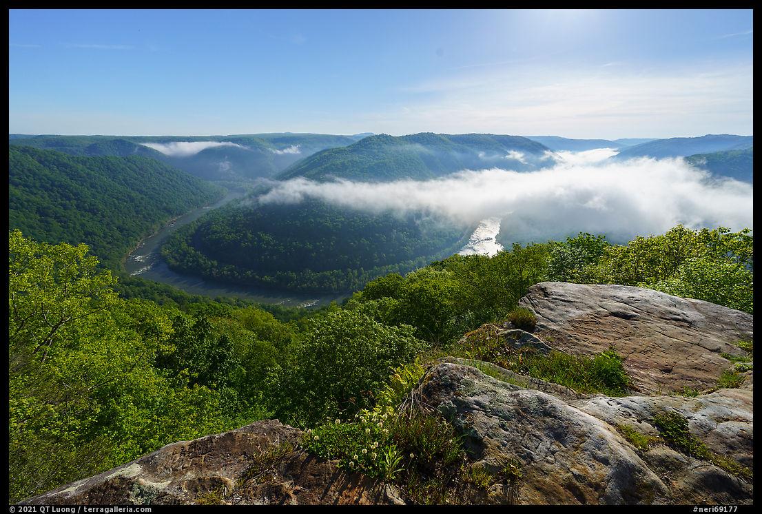
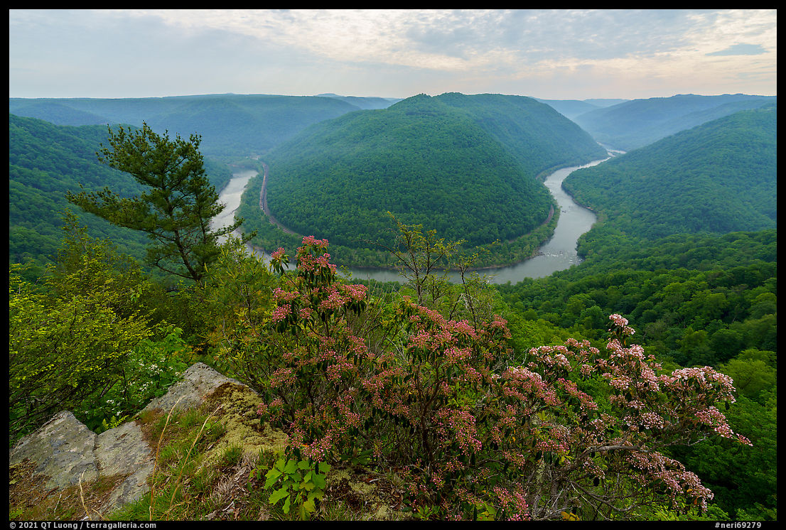
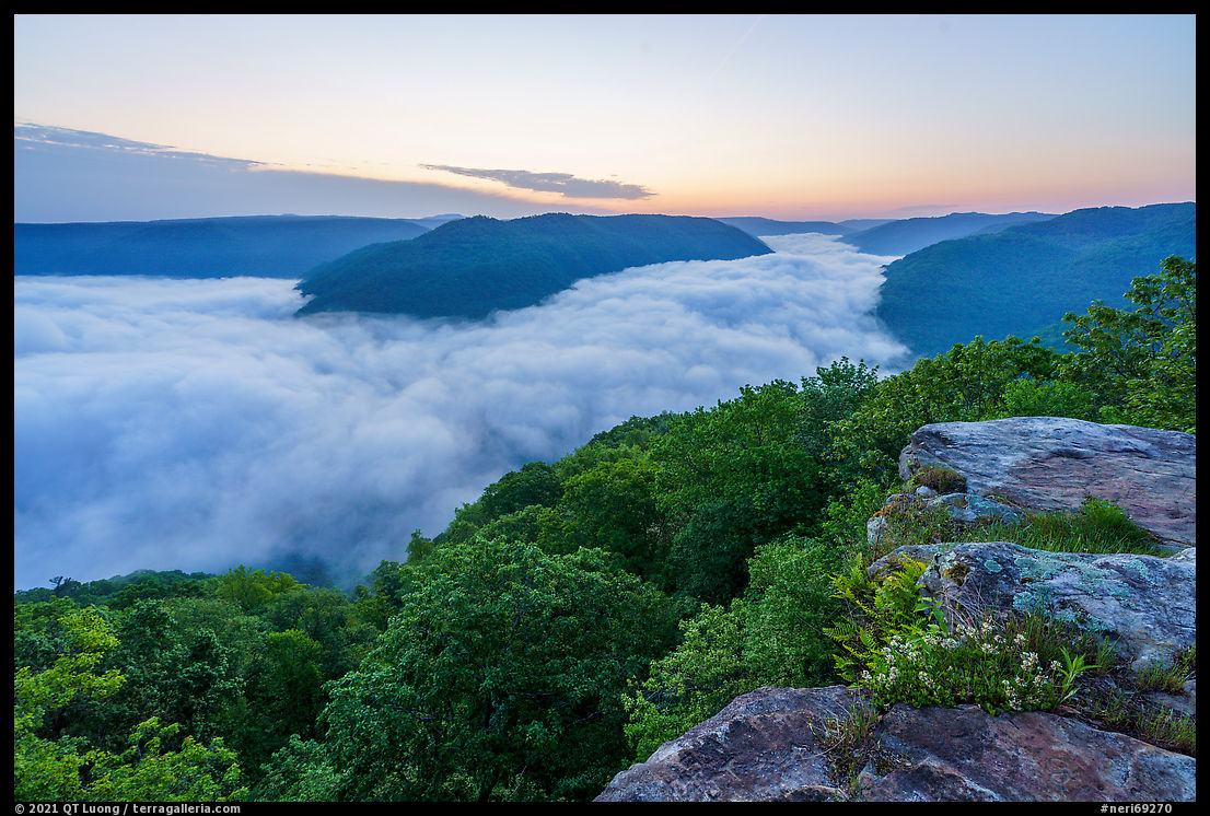
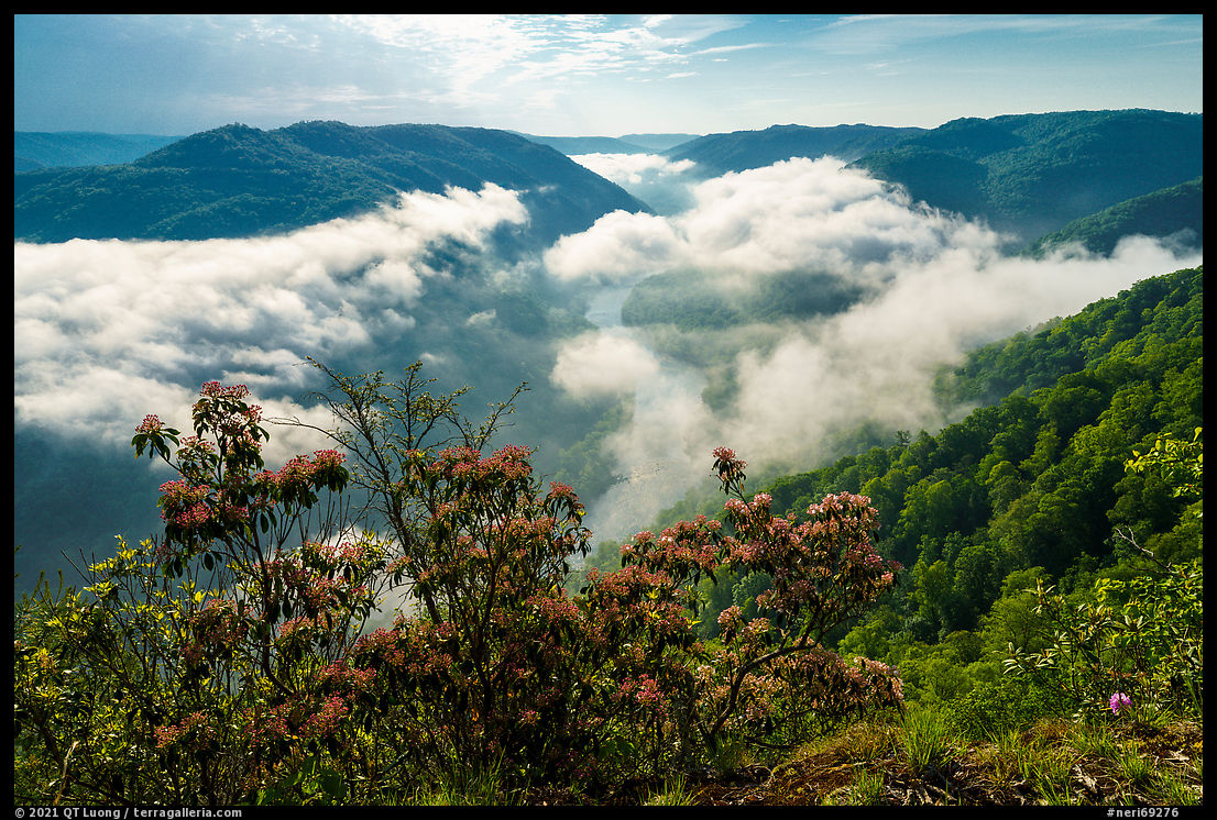
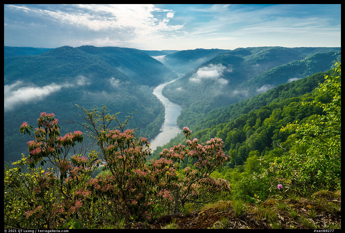
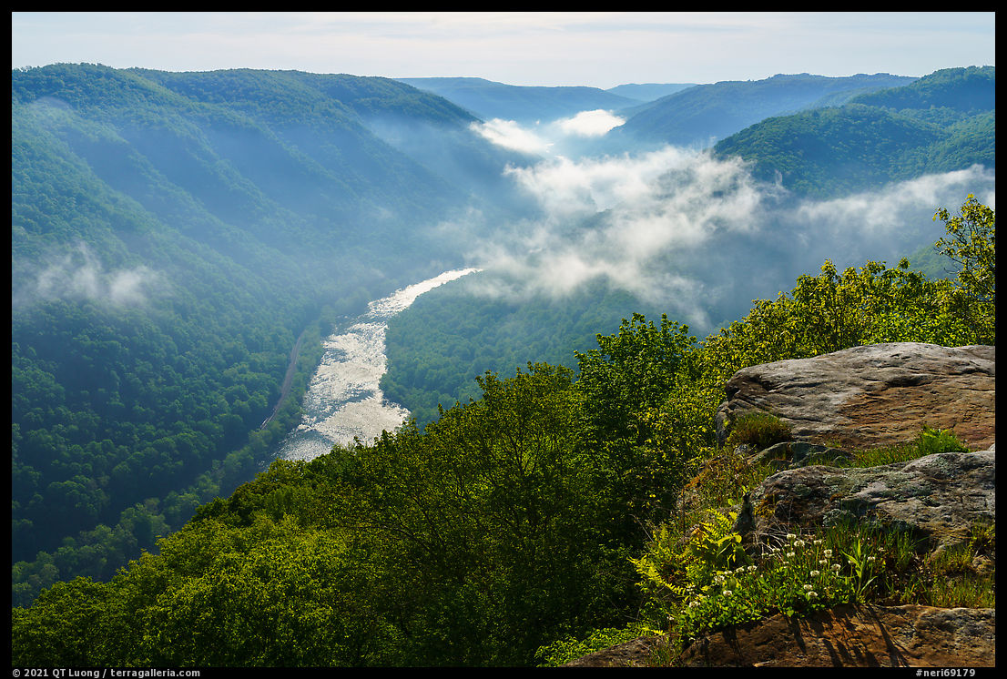
Grandview (8)
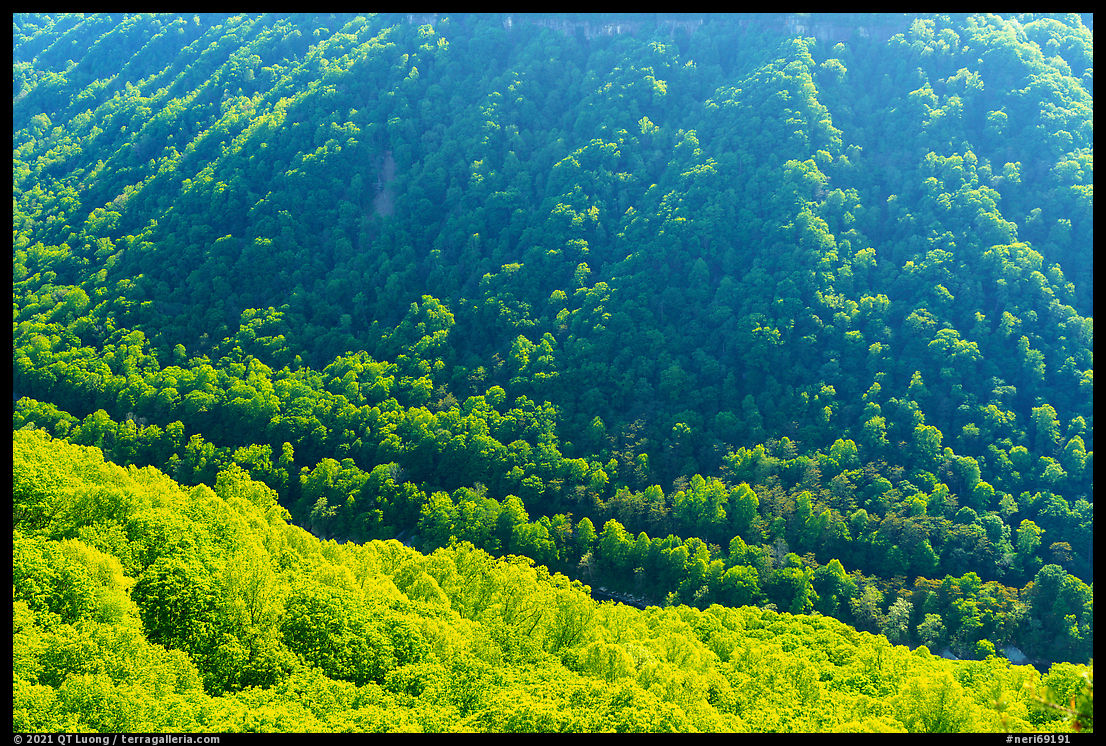
Aptly named Grandview includes the highest overlook on the gorge rim, the Main Overlook located 1,400 feet above the river. A short stroll from a large parking lot with a seasonal visitor center, that overlook offers the most spectacular view of the gorge that I have seen, as the dramatic horseshoe bend of the river below is clearly visible. Starting from there, the 3.2-mile Canyon Rim Trail offers more choices of viewpoints, including the North Overlook, where I found pink rhododendrons to frame the views over the gorge. Although it was early, many were already blooming in mid-May. The east-facing overlooks are great locations to watch the sun rising over the gorge. Inversions that leave you above a striking sea of low fog filling up the gorge frequently occur at that time, making it my favorite to photograph grand vistas. There are many other compositions possible (two open this article), but for the images below, I have selected only wide-angle views of the horseshoe bend – for which I made good use of a 12-24mm lens. Each of those images show something different. Earlier, the light is better, but later, the break up of the fog (that takes place surprisingly fast once it begins) reveals more of the gorge.
1
2
3
4
5
6
7
8
9
10
The survey is closed. Results in this post.


You did a great job capturing what makes the New River Gorge a magical place. I’m happy you spent a week there seeing all of the aspects it has to offer. Let me know if you ever want a tour of western Pennsylvania and New York!
Thank you Zack, although this was a bit premature 🙂 since I think it is the less expected sights in the next post that elevated to New River Gorge so much for me: https://www.terragalleria.com/blog/new-river-gorge-national-park-and-preserve-five-unexpected-sights/
Great photos! I like #3 & #6 but all are very good. Nice roadside park on Highway 60 in WVA that looks over the river below. We stopped by Grandview early one morning and it was completely fogged in.
Thanks. It sounds like fog seems to be a frequent occurence, at least in the spring!
The morning clouds were also out last week – as much as I like them, it seems better to maintain a good portion of the river. The fact that the green is so spectacular this time of year made the contrasts particular attractive.
It’s a difficult choice to make because it looks like the morning fog is quite representative of the area, and inversions are not that common elsewhere, especially at such low elevations.
The photos that show the river highlight the gorge best. Pictures with
clouds are nice, but they obstruct the gorge. Would love to see it in the fall. You always go into great detail on your excursions making it feel like I was actually there.
Thanks. I’ve added much more details on Grandview in this new post: https://www.terragalleria.com/blog/photographing-grandview-point/
Nice photos! You have stimulated my interest in visiting the park.
Great, always one of my objectives!