Around Vermilion Cliffs National Monument
No Comments
Day 12
To rest my legs from hiking about 18 miles the day before, my plan was to spend a lot of time behind the wheel. I would circle Vermilion Cliffs National Monument (136 miles) and also reach two faraway Grand Canyon points, one at its very east at river level, the other at the seldom-visited west rim, on a peak at the top of the Grand Canyon ecosystem.
The Vermilion Cliffs
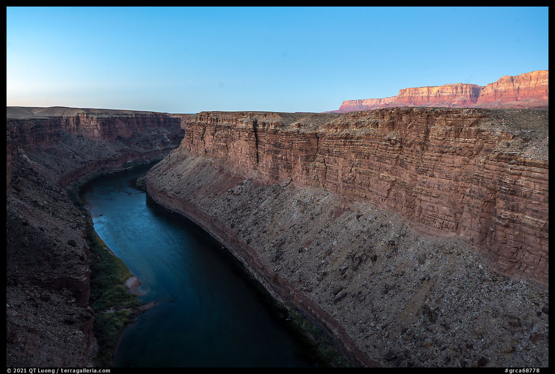
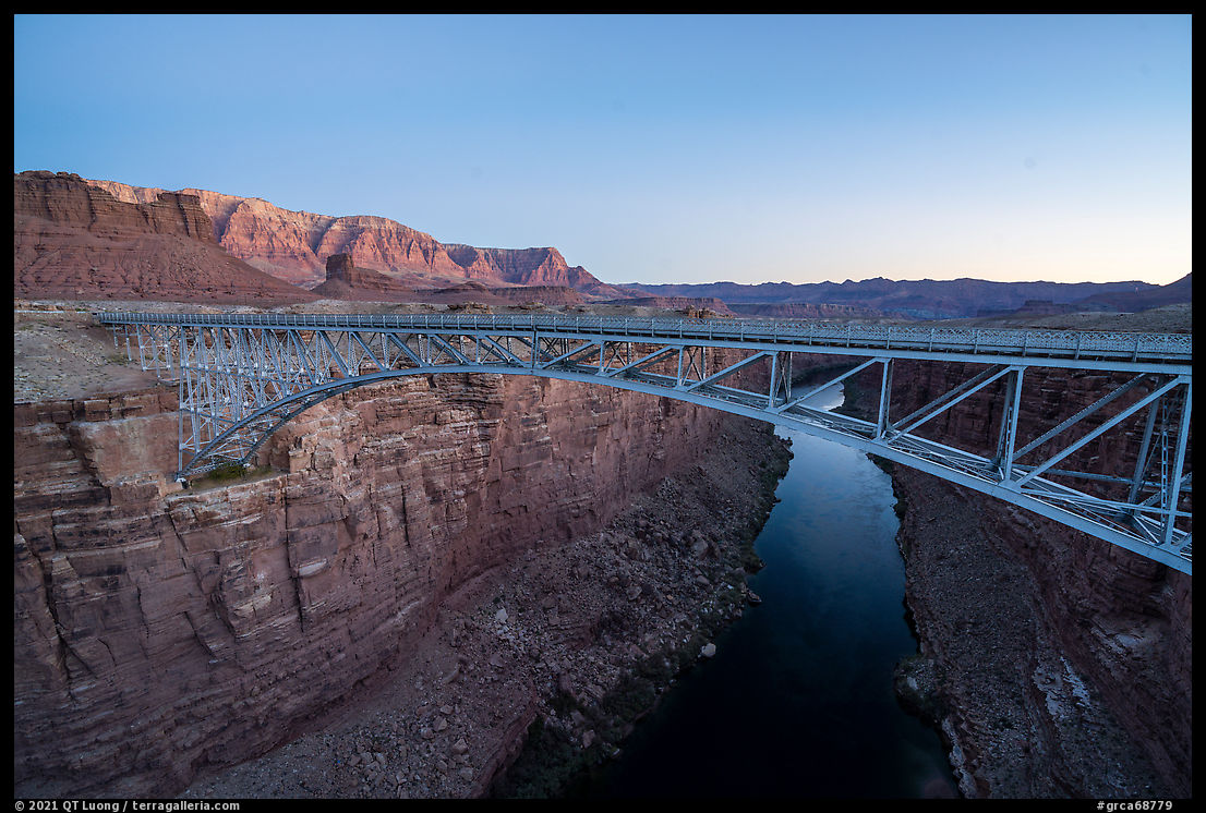
I got up an hour and half before sunrise, and drove from the White House Campground to Lees Ferry, crossing the Navajo Bridge over the Colorado River in pre-dawn. My goal was to photograph the Vermilion Cliffs, but as the light was ideal for capturing the deep gorge, I couldn’t resist stopping and taking a picture. Lees Ferry has a sizeable campground and is the starting point for all Grand Canyon boating trips. The Vermilion Cliffs face the southeast there, so it would work for sunrise, but the main reason I picked that location was that it marks the terminus of the Paria Canyon. I had hiked the day before its beginning, so it was tempting to see both ends. Driving from the Navajo Bridge to the campground, I realized that Lees Ferry wasn’t a good choice for photographing the cliffs at sunrise because the road dropped too low – I should have thought of that, since it reaches the river level. I turned back and hopped on US-89A.
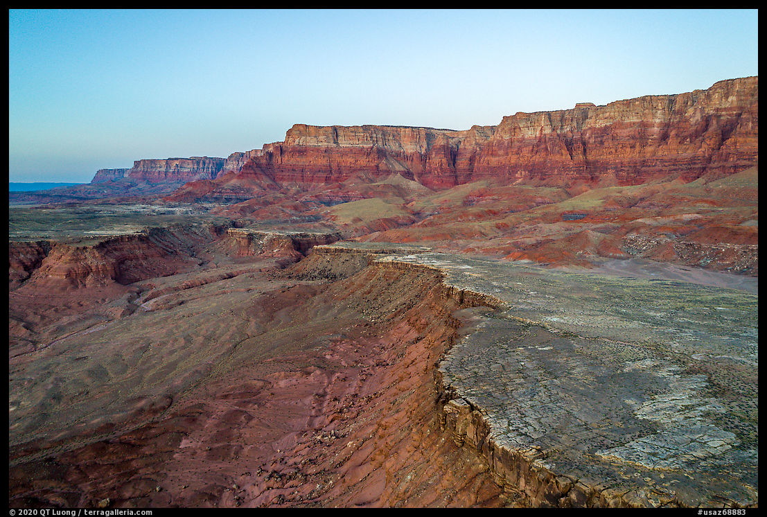
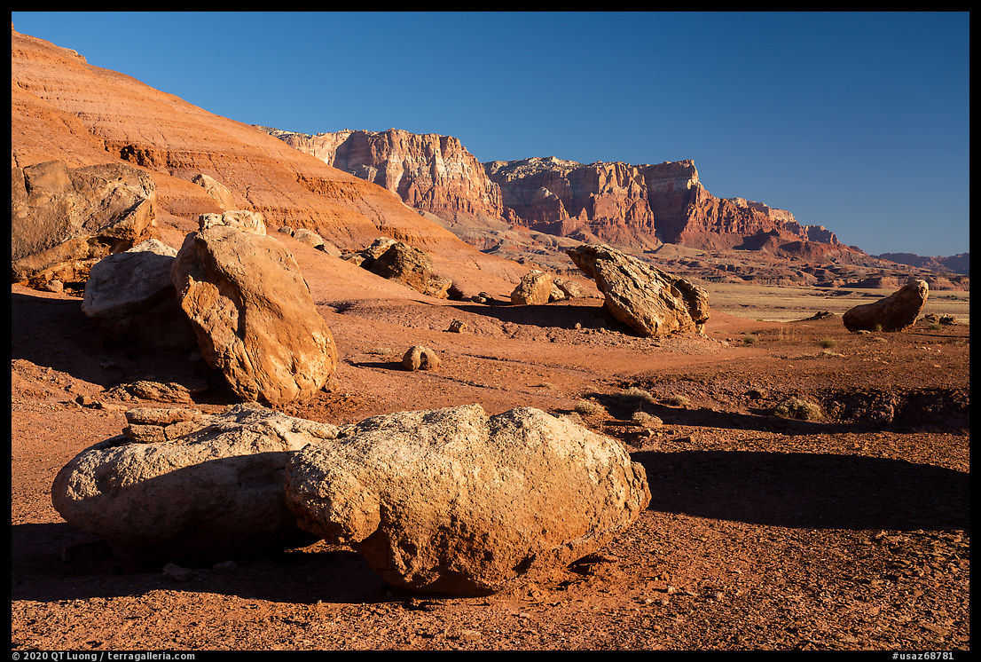
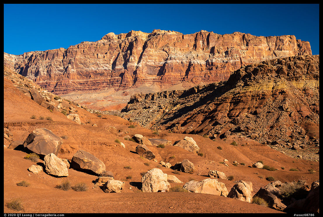
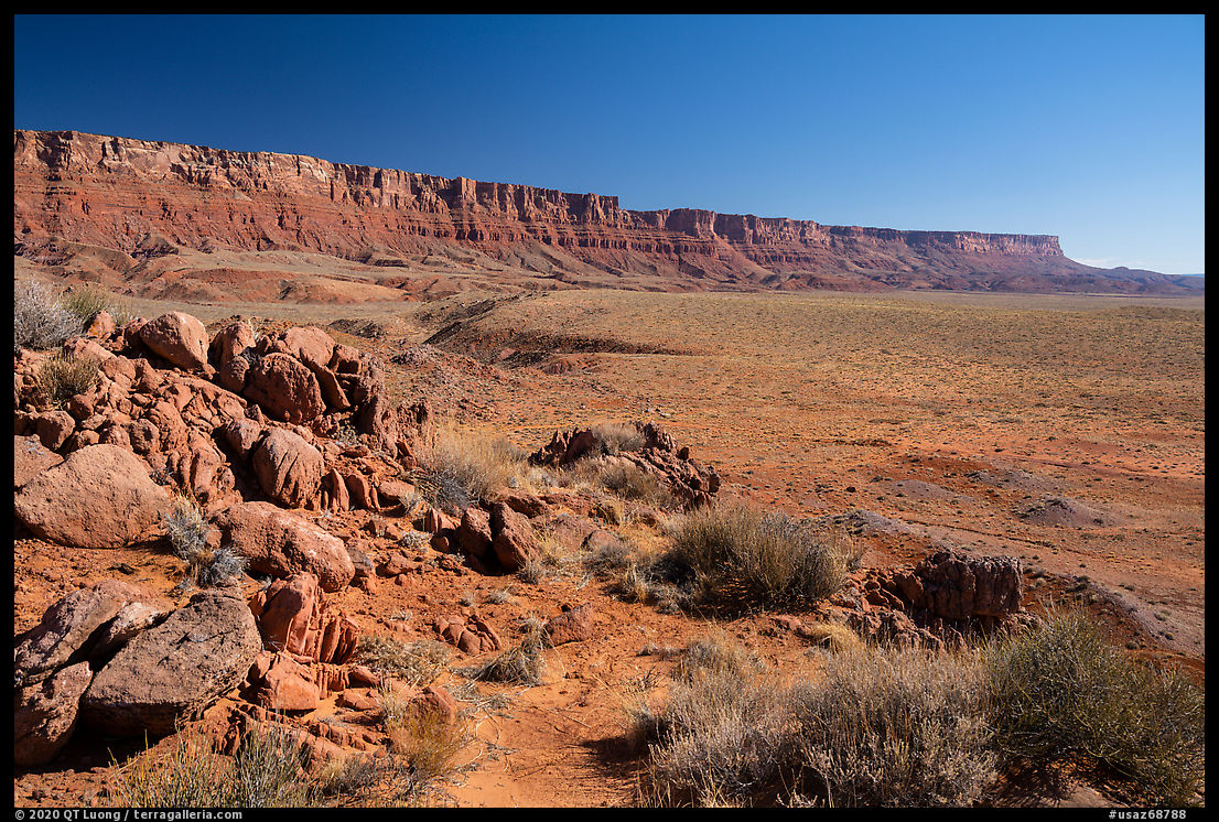
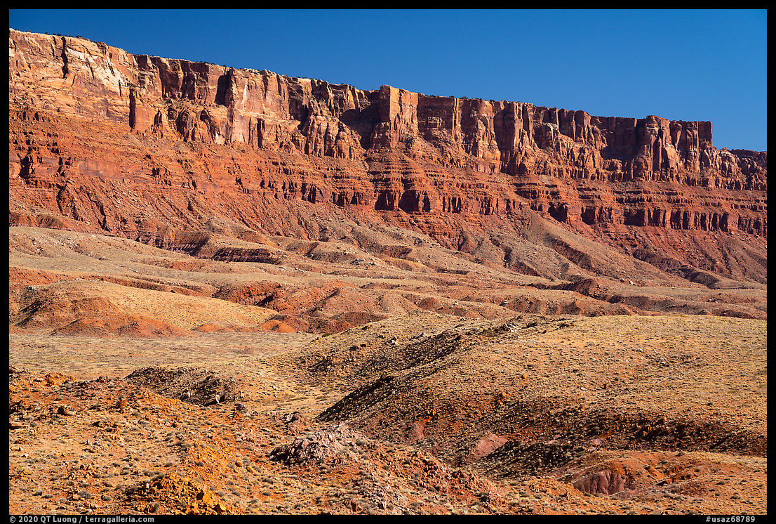
Most people get a first glimpse of Vermilion Cliffs National Monument as they drive US-89A between Jackob Lake and Lees Ferry, as the Vermilion Cliffs tower 2,000 feet above the north side of the highway. The line of cliffs is one of the most impressive in the Southwest because of its length of more than 30 miles, its prominence above land mostly flat for 100 miles, and the bright colors of the Chinle Formation. Along the eastern side of this stretch of US-89A, the Vermilion Cliffs are quite close and there are several places where one could pull out and check out their foothills with remarkable boulders.
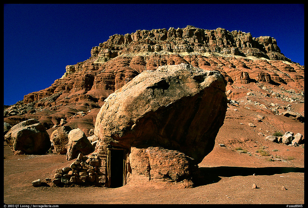
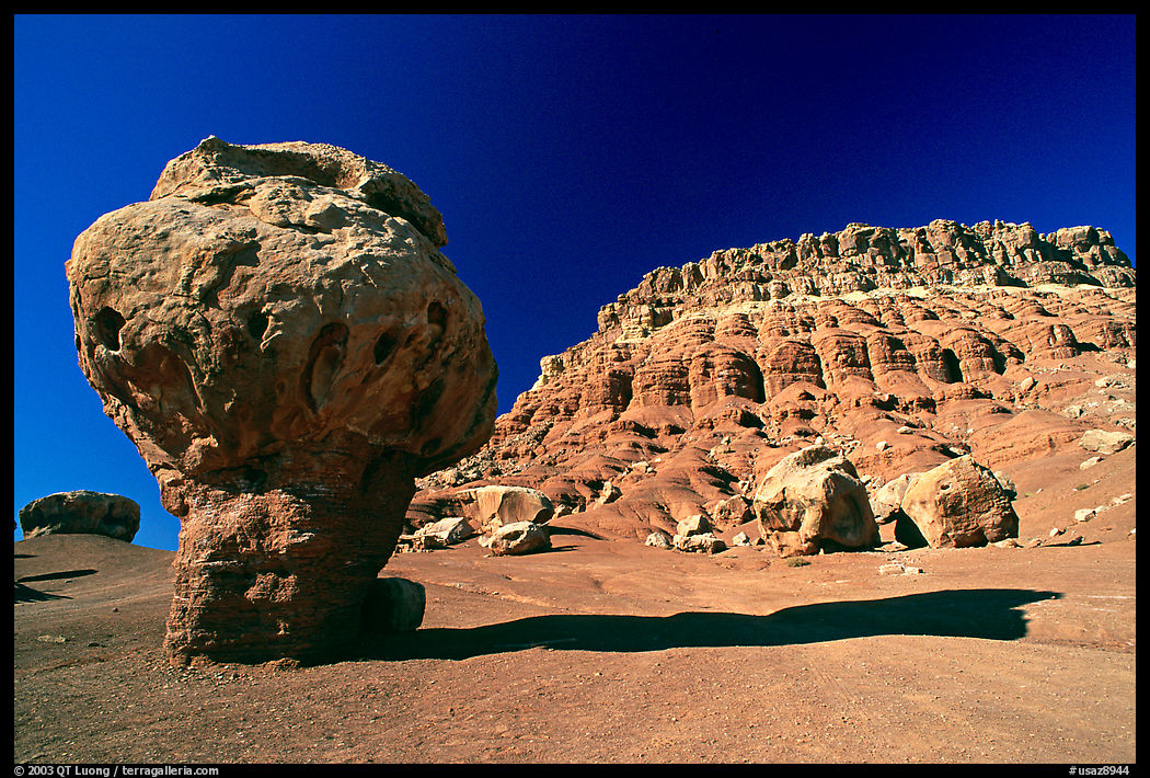
Just east of the settlement of Cliff Dwellers, you’ll find a stone house constructed around a large boulder. It was built not by the Navajo but instead by Blanche and Bill Russell, a couple from New York seeking dry climates because of Bill’s tuberculosis. They happened upon the site in 1927, when their car broke down and they camped overnight there. The house, together with balanced rocks are found at a flat area on the north side of the road. When I first visited the site more than twenty years ago, the place was deserted – that’s Velvia below for a bit of nostalgia. Nowadays, Navajo people set tables to sell crafts there.
As you drive US-89A towards the west, the cliffs become more distant. The gently undulating hills between the highway and the cliffs are traversed by unmarked and rough dirt roads where high clearance or 4WD can be necessary. Near one of the roads, I hiked up a rocky outcrop that provided excellent views of the line of cliffs. Although from a distance the Vermilion Cliffs look impassable, there are a few seldom-traveled routes from which one can scramble to the top.
Maze Rock Art Site
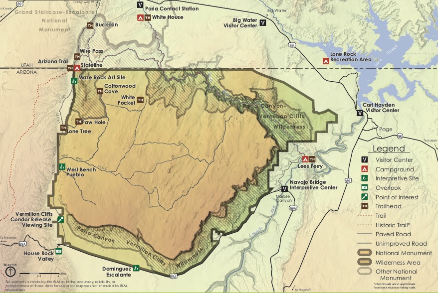
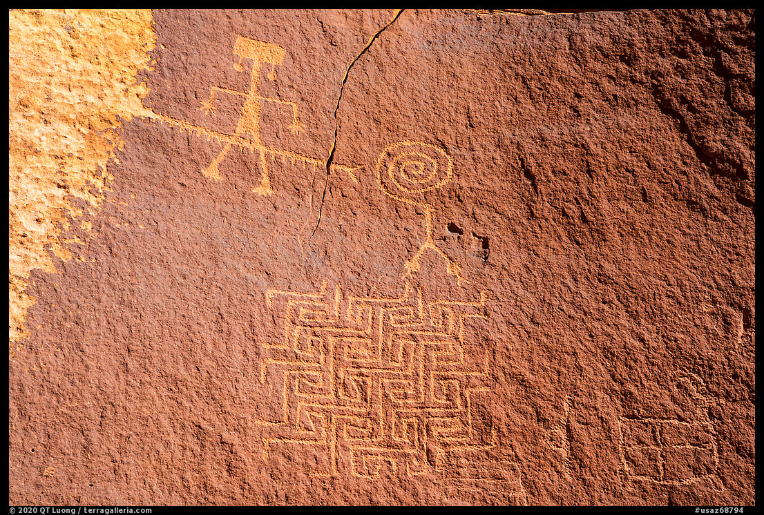
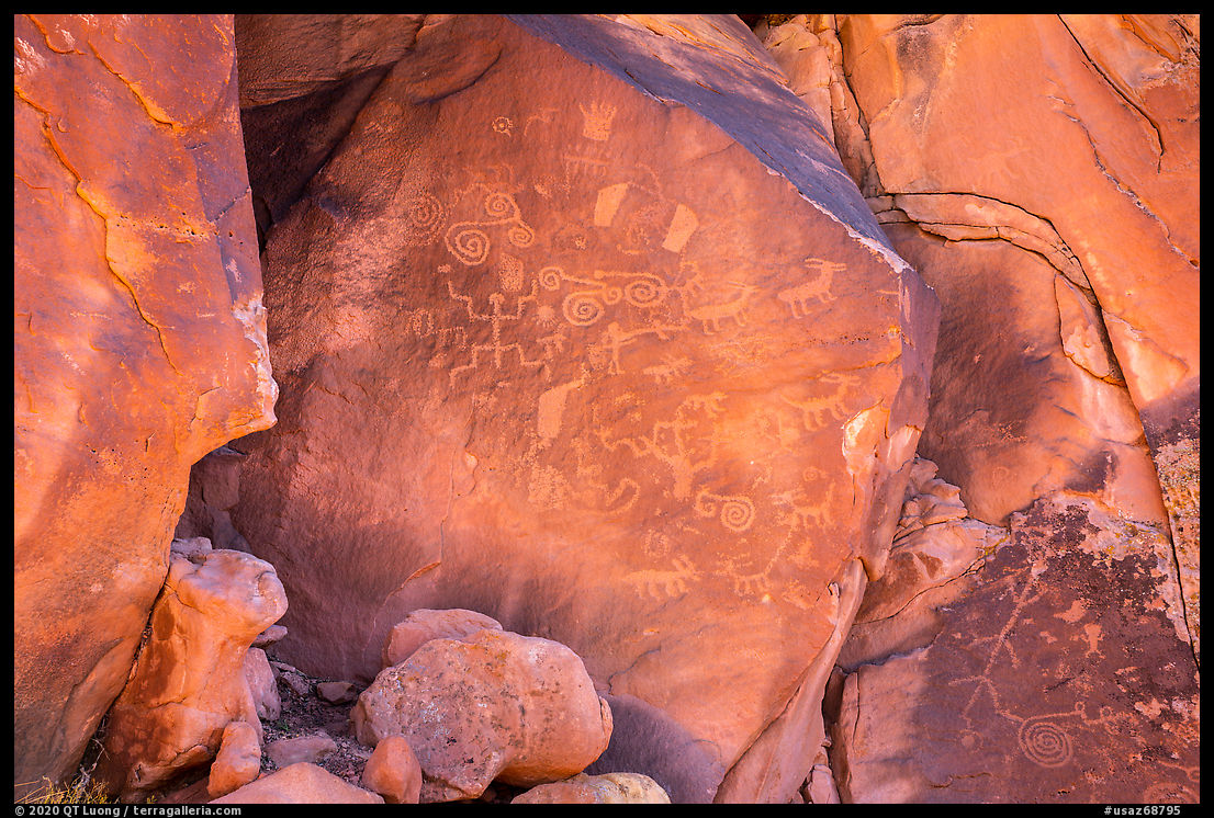
Vermilion Cliffs National Monument consists of a plateau ending to the south and east with the natural barrier of the namesake Vermilion Cliffs. Running at the base of those cliffs, US-89A marks the southern boundary of the monument. House Rock Valley Road runs along the western boundary, and is the road used to access the monument’s extraordinary rock formations such as Coyote Buttes or the White Pocket.The Maze Rock Art site gets its name from a petroglyph depicting a maze-like feature on its spectacular main panel, located on a large west-facing boulder. Only a few years ago, one could have wondered if the site may have been named from the maze-like route through sagebrush and rocks leading to it, but nowadays you can get right next to the main panel via a developed trail (1.25 miles round-trip, 200 feet elevation gain) starting at a signed trailhead with an information kiosk. The parking is along House Rock Valley Road, less than one mile south of Stateline Campground. The panel is just 100 yards beyond the deprecated Notch Trail to the Wave, but it is just outside of Coyote Buttes North permit area, so there are no restrictions.

Towards Mt Logan
My destination for the evening was Mt Logan in Grand Canyon-Parashant National Monument, 140 miles away. Getting to those mountains from AZ-389/UT-59 involves traversing the vast and desolate Unikaret Plateau on unpaved roads for hours. There are two choices. Road 109 starting between Fredonia and Pipe Spring National Monument is surfaced with gravel, making it suitable for wet weather, but also more bumpy. Since the weather had been dry, I planned instead to drive Road 5, as it is shorter and its clay surface is softer – it becomes impassable when wet. When I approached Road 109 from the east, my GPS directed me to take it, and instead, I continued west on the highway, thinking that the next time the GPS would direct me to leave the highway would be for Road 5. Indeed, not too long afterward, the GPS directed me towards a dirt road that looked wide and well-graded enough. I followed it for quite a long distance, but then it narrowed unexpectedly, causing me to stop, pause my audiobook, and take a good look at the very detailed Arizona Strip Visitor Map.I realized that I was not on Road 5. Since I didn’t want to backtrack all the way back to the freeway, I took heart that it looked possible to follow secondary roads to get back on track from my position. I followed such a road, until it reached terrain with ravines shockingly steep for what was supposed to be a plateau. The road became rough enough that I had to drive at almost walking speed for a while, before deciding to turn around to the previous fork. There, I took another road that initially looked promising as it traversed flat terrain. Fifteen minutes later, it just vanished, with no tracks to be seen despite the map’s indications. I backtracked even further. Finally, a third attempt led me to to Road 5, which was definitively wider than the road I had turned into from the highway.
Federal land agencies often mention that you shouldn’t rely GPS in remote areas, and I got a clear lesson why that afternoon, even if my mistake was not as gross as the one warned against above. GPS units simply cannot differentiate between a main dirt road and a secondary dirt road, and in those remote areas, secondary dirt roads may just be too rough for most vehicles. I had found a way to make those long drives enjoyable by listening to audiobooks. Podcasts were fine for shorter drives, but they just didn’t provide enough substance and depth for continuous hours of listening. That afternoon, I was so engrossed with Yuval Noah Harari’s Sapiens that instead of following the itinerary on the map, I made the mistake to rely on GPS directions.
I had initially hoped to photograph the Mt Logan area in the late afternoon, but by the time I reached the boundaries of Grand Canyon-Parashant National Monument, darkness had already fallen. I wondered if I was going to be able to get to the Mt Logan Trailhead that evening, since the information that I had was so contradictory.
The Last Road Trip: 1 | 2 | 3 | 4 | 5 | 6 | 7 | 8 | 9 | 10 | 11 | to be continued

