Visiting the National Park of American Samoa: Tuitula
No Comments
Despite its small size, the National Park of American Samoa is one of the most beautiful parks of the system, graced with stunning white sand beaches, pristine coral reefs, towering sea cliffs, and lush, forested mountains. American Samoa, in the Southern Hemisphere, right in the center of Polynesia, is the southernmost US territory and the only one south of the equator. This makes the National Park of American Samoa the most faraway of the 63 National Parks, the reason why it is one of the least visited despite its great appeal. During the pandemic years, travel to American Samoa was almost impossible because of draconian restrictions. They eased up last summer, so you can again start planning to visit this unique park. The first (and for most, only) part of the park you will visit is located on the main island of Tuitula, and in this article, you’ll discover what I saw there.
Updated: June 2024
The unusual name of “National Park of American Samoa,” rather than “American Samoa National Park,” reflects its status unique in the national park system: its lands are all leased from Samoan villages of Fitiuta, Faleasao, Ta’u, Olosega, Ofu, Afono, Vatia, Pago-Pago, and Fagasa that are the true landowners. Under the Samoan land system, nobody who is less than 50% Samoan can own property. As its name implies, American Samoa is part of the U.S., and almost everybody speaks some English. One of the reasons American Samoa elected to remain a U.S. territory rather than a U.S. state like Hawaii was to perpetuate the validity of their land system. The lease agreement was signed between the American Samoa Government and the National Park Service in 1993 and is valid for 50 years. It marked the intersection of two widely different land tenure systems—the South Seas matai communal land arrangement kept by oral tradition, and the Western record-based.
Samoa is thought to be one of the original homelands of the Polynesian people, according to oral traditions and archaeological findings. 90% of people in American Samoa are either Pacific Islanders or Samoans. The majority of islanders speak Samoan as their first language, and they practice the Fa’asamoa (Samoan way of life). Many Samoans still maintain a close connection to their natural surroundings and rely on the ocean, coral reefs, and tropical rainforests for food and traditional rituals. The park is home to numerous significant cultural artifacts that are closely related to both the past and present of the Samoan people. Besides the scenery and ecosystem, perpetuating Fa’asamoa was a reason why the park was established. The Samoan people are some of the most friendly and welcoming I have encountered. A visit is a great opportunity to discover the vibrant and welcoming Samoan culture. The National Park Service even facilitates a homestay program which I took advantage of during my visit to Tau Island.
Traveling to American Samoa
The Samoan Islands are 2,600 miles southwest of Hawaii and 1,800 miles northeast of New Zealand. They include the U.S. territory of American Samoa and the independent nation of Samoa. The only way to fly to American Samoa from the U.S. is with Hawaiian Airlines. The trip from Honolulu, Hawaii (HNL) to Pago Pago (PPG) takes five hours and is offered on a biweekly schedule except during summer when a third weekly flight is available to accommodate travel demands from Samoans. As of this writing, flights arrive and leave Pago-Pago in the evening on Mondays, Wednesday, plus Thursday in the summer. Because Hawaiian Airlines has a monopoly, that flight is quite expensive, ranging from $1,000 to $1,500, or an outrageous 170K miles. The less convenient alternative is to fly to Pago Pago from Fagalii Airport (FGI) in Independent Samoa, which will likely require an overnight in Apia because of flight schedules. The main airport of Independent Samoa, Apia (APW) can be reached from Nadi (NAN) in Fiji, Auckland (AKL) in New Zealand, or Sydney (SYD) in Australia. If you have time to stop at those places on your way to or from American Samoa, you could visit several of them for not much more than the cost of the flight from the U.S. Although American Samoa is part of the U.S., even if you are a U.S. citizen traveling from Hawaii, a passport is required.Local logistics
For getting around, you could use taxis or the colorful aiga busses, but the most convenient is to rent a car. There are three rental companies. Avis is the only national company. Since the pandemic and as of 2024, they do not maintain an office at the airport, however their agent can meet you at the airport or your hotel, and they responded to email. The local Tropical Car Rental has lower rates, a desk at the airport, but did not reply to emails. Tautai Car Rental’s office was never open and they did not reply to emails.The Tradewinds Hotel is a large business hotel located a mile and a half from the airport with good standard amenities. Both the Sadie’s by the Sea and Sadie Thompson Inn have a better waterfront location in Pago Pago. There are also AirB&Bs that are less expensive. Tisa’s Barefoot Bar, considered by some to be the best eatery on the island (their Wednesday Samoan Fest is a great experience), also operates a high-end B&B located on the beach. There are no campgrounds. Camping is prohibited in the national park, so would be on private land and require permission from the landowner or village chief.
While you can pay for your hotel and car rental by credit card, other transactions either require or are much smoother using cash in U.S. dollars.
The National Park
The park spreads over units on three islands, Tuitula (2,500 acres of land and 1,200 acres of waters) Ta‘ū (3,700 acres of land and 1,100 acres of waters), and Ofu (70 acres of land and 400 acres of waters). Ta’ū and Ofu are two of the Manu’a islands, that lie some 60 miles east of Tuitula and can at times be challenging to travel to, as the availability of commercial flights to the Manu‘a Islands has varied in the past years. All visitors arrive via Tuitula, which is the only developed island, even though it is certainly not set up for tourism like the Pacific resort islands. Unlike the Manu’a islands, it has the usual travel amenities: car rentals, hotels, restaurants, and stores. The parkland on Tutuila Island makes up around one-sixth of the entire island and is situated in the northern center of the island.The Visitor Center
The national park visitor center is located in the harbor area, in the direction opposite to the park from downtown Pago Pago. Besides its excellent exhibits and very friendly staff, it is not to be missed for those who try to visit each of the national parks. If one contents themselves of a visit to the Northwest Alaska national parks consisting of a stroll from a quick bush plane landing, then the National Park of American Samoa is the most difficult to visit of them all, which is why many save it for last. If so, the park rangers there will provide you with a certificate of completion! Since that information is not included in the park literature, don’t forget to ask for precise directions to help you find trees with clusters of fruit bats, the only indigenous mammals on the islands.
The Coast
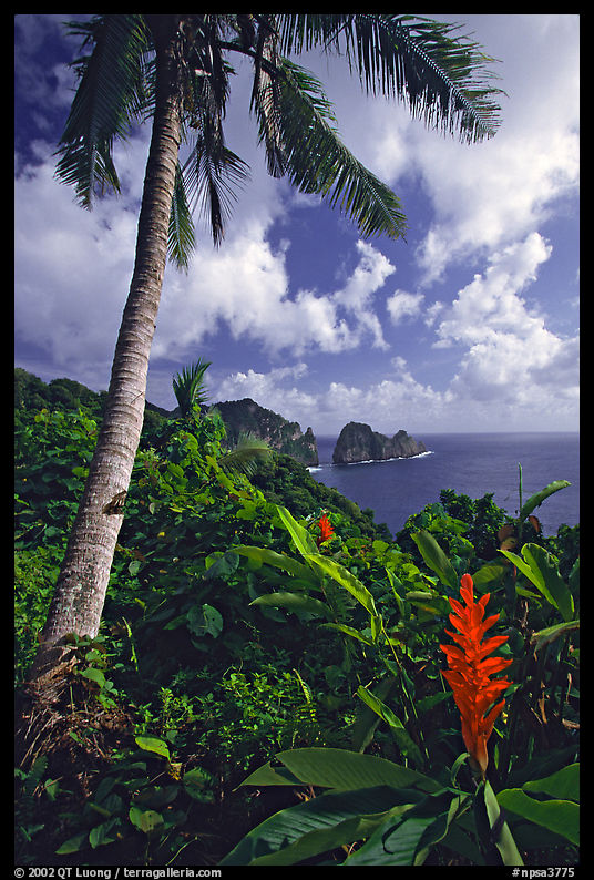
If you are used to visiting national parks by driving in, you won’t find yourself in unfamiliar territory, as there is one scenic road inside the Tuitula Unit. That road, Route 006, enters the park past the village of Afono, and although doesn’t stretch in the park for more than a few miles along the coast, it is scenic. Along it, you’ll find lush tropical vegetation, inviting sandy beaches, higher views over water from the bluff, and two moderate trails, the Lower Sauma Ridge Trail (0.5 miles roundtrip) and the Tuafanua Trail (2.2 miles roundtrip) which is adventurous with its sections with steep steps and ropes for balance. Both start in the forest and provide great views of Pola Island at the end.
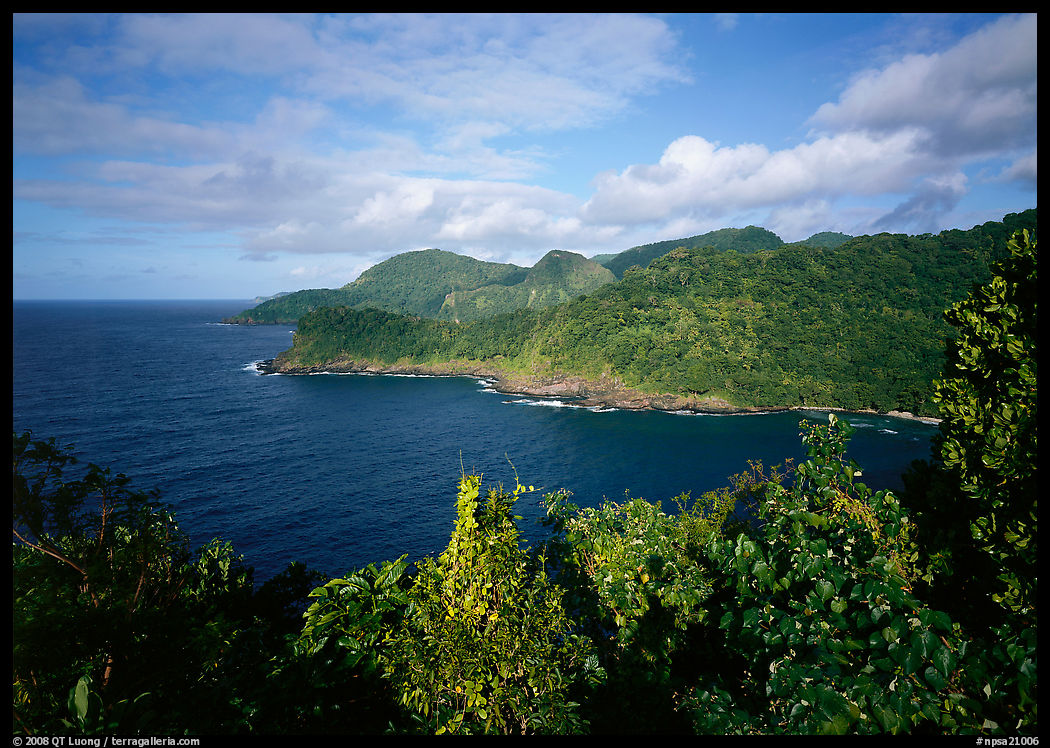
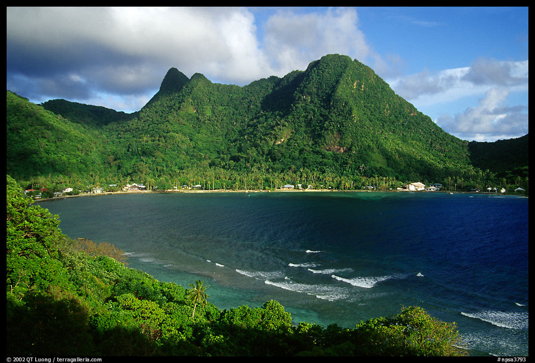
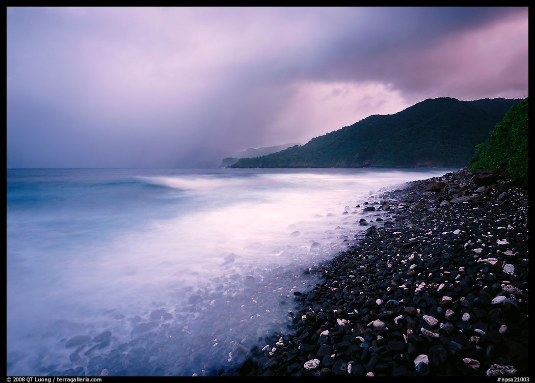
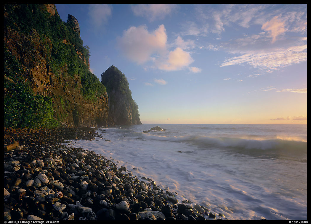
Vatia is a quiet village with clear waters that offer good snorkeling, and homestays are possible. After driving past Vatia to the end of the rough road, which is marked as a hiking trail on the map, a short stroll leads to a beach with large round pebbles. From there, you’ll discover in both directions the most spectacular coastal views on the island. Since that side of Vatia Bay faces the east, I made sure to come at sunrise. On two mornings I witnessed very different conditions. On a stormy morning, I photographed the green hills to the south as silhouettes in a composition full of atmosphere and drama. A long exposure brightened the ocean water, linking it to the sky while creating a strong contrast with the dark rocks of the beach. On a clear morning, when the sun rose over the South Pacific, it illuminated the 400-foot cliffs of Pola Island to the north, covered with lush vegetation, as the waves filled the air with warm moisture. Recalling the Polynesian creation stories about the origins of the Samoan Islands, I imagined I was witnessing the morning of Creation itself. A shorter shutter speed preserved both the form and motion of a wave with an exposure timed so that it would form another line leading the eye toward the cliff.
The Mountain
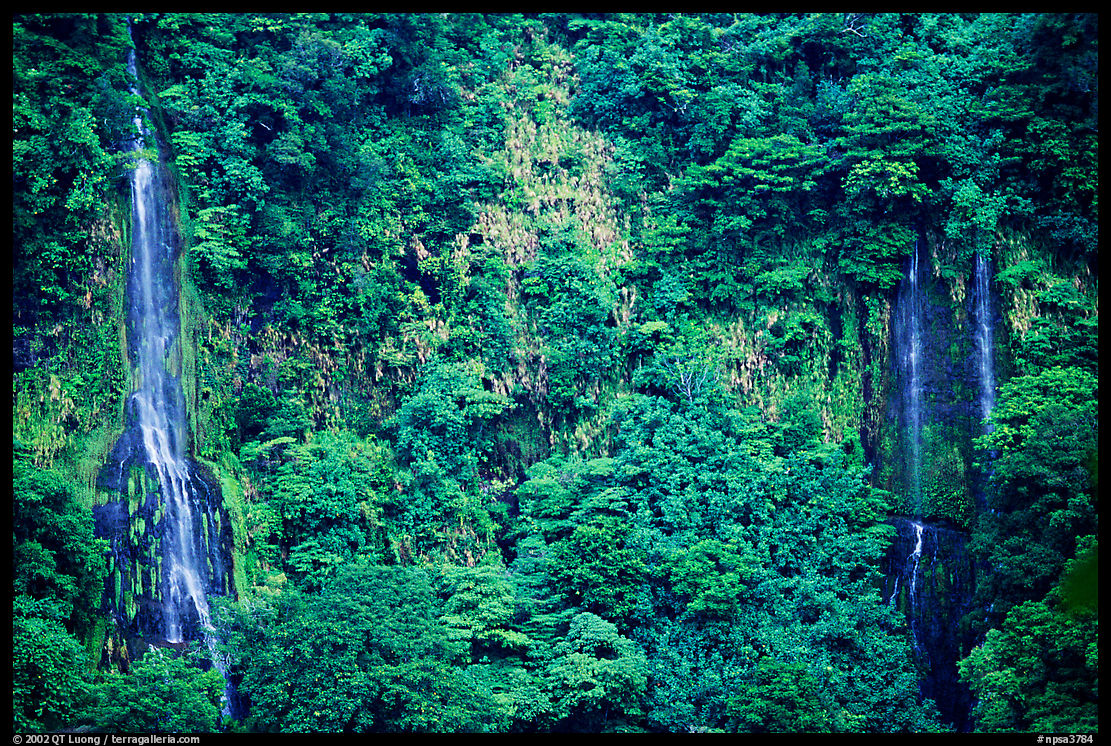
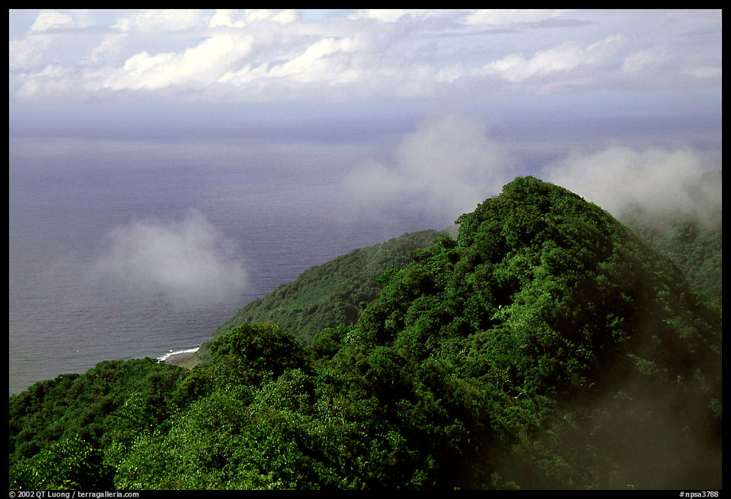
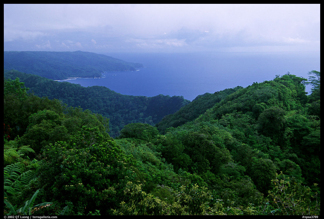
The Mount Alava Trail is the longest and most well-marked hike on the entire island: 7 miles round-trip, with a 1,000-foot elevation gain from Fagasa Pass to the summit. The hike allows you to immerse yourself in the island’s lush mountaintop rainforest. Samoa’s palaeotropical (Old World) rainforests are unique within the national parks because they are closely related to those of Asia and Africa, as opposed to the neotropical (New World) forests of the Americas. The main trail follows a four-wheel-drive track, climbing to the summit of Mount Alava (elevation 1,610 feet). The summit can also be reached by a shorter, but much steeper route (5.6 miles round-trip; 1,610-foot elevation gain) from the Vatia village, involving steps with ropes for balance.
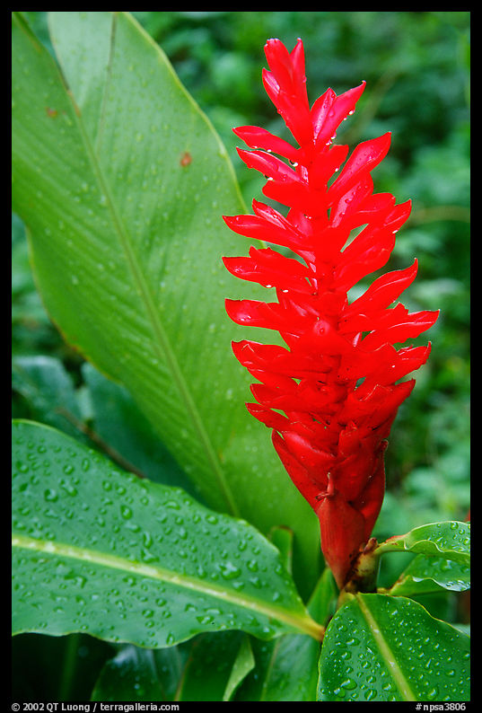
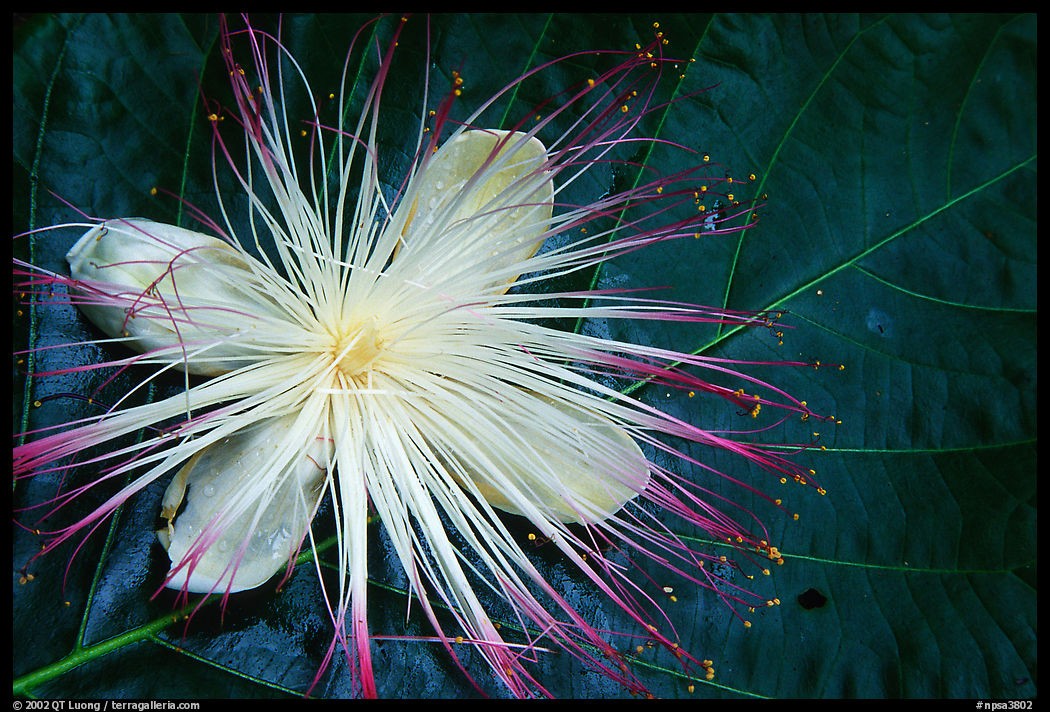
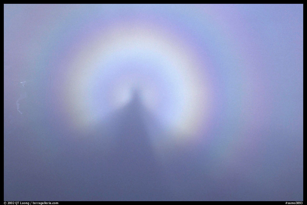
When I arrived there, clouds blocked the views. Pago Pago receives the highest annual rainfall of any harbor in the world. As I learned from previous days that the island’s weather can change quickly, I stuck around, photographing close-ups of tropical flowers in the soft light. My patience was rewarded when the clouds began to break apart. After the strongest Specter of Brocken display that I ever witnessed – centered around my own silhouette, gaps started to reveal distant ridges, creating atmosphere.
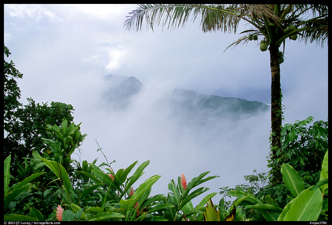
As the trail follows the ridge that marks the southern boundary of the park, the views are spectacular in both directions. When the clouds parted way, I was treated to views of Pago Pago Harbor on one side, and the Pacific Ocean on the other.
There used to be a cable-supported tramway that across the harbor up to the summit. This tramway, which was finished in 1965, was built to give television technicians a route to go to the TV transmitters installed atop Mount Alava for maintenance. Up until 1992, when a cyclone severely damaged it, it was also utilized by locals and schoolchildren, particularly the villagers from Vatia on the north Pacific coast. The tropical heat and humidity makes the Mount Alava hike tough, but that off-the-beaten path activity was hugely rewarding.

