Vast and Ancient: Basin and Range National Monument
No Comments
The Basin geographically defines the state of Nevada. That word may confuse you, since it is included in Great Basin, Great Basin Desert, Great Basin National Park, Basin and Range Province, Basin and Range National Monument. What are they, and how do they relate to each other?
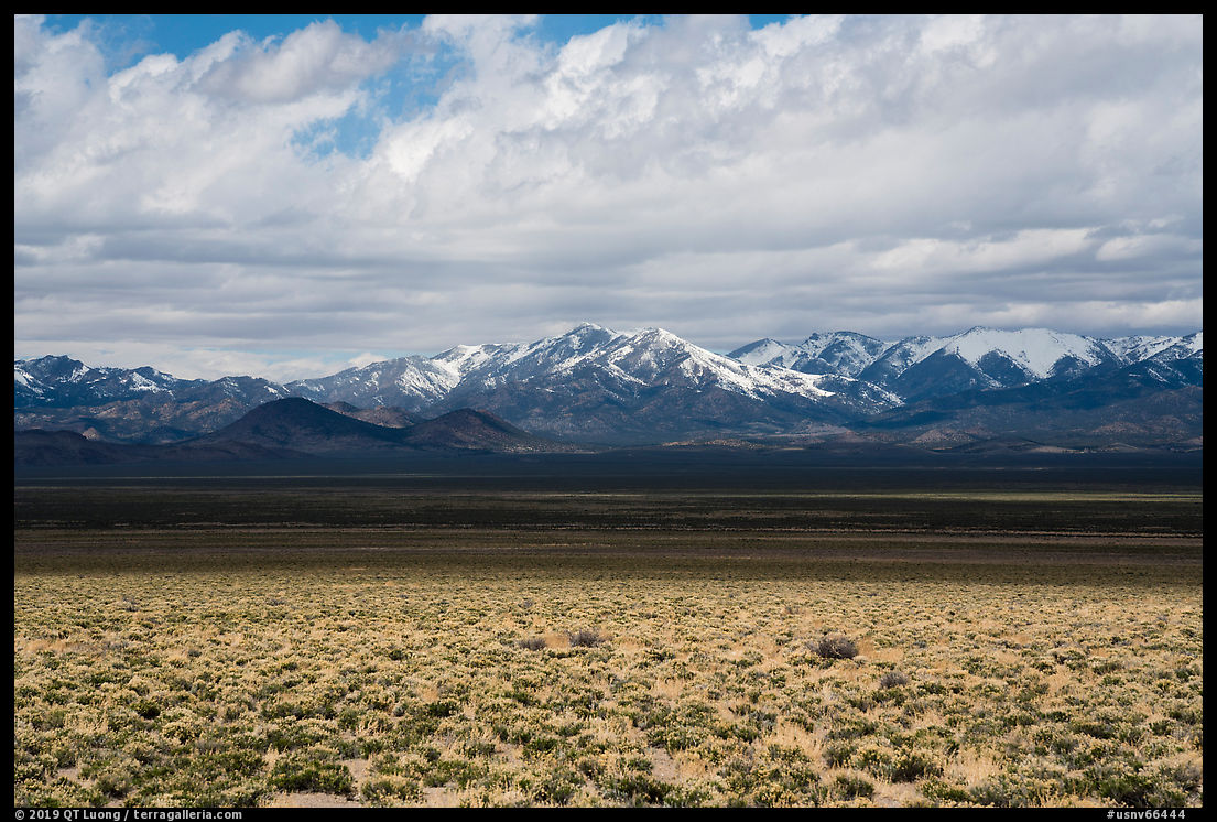
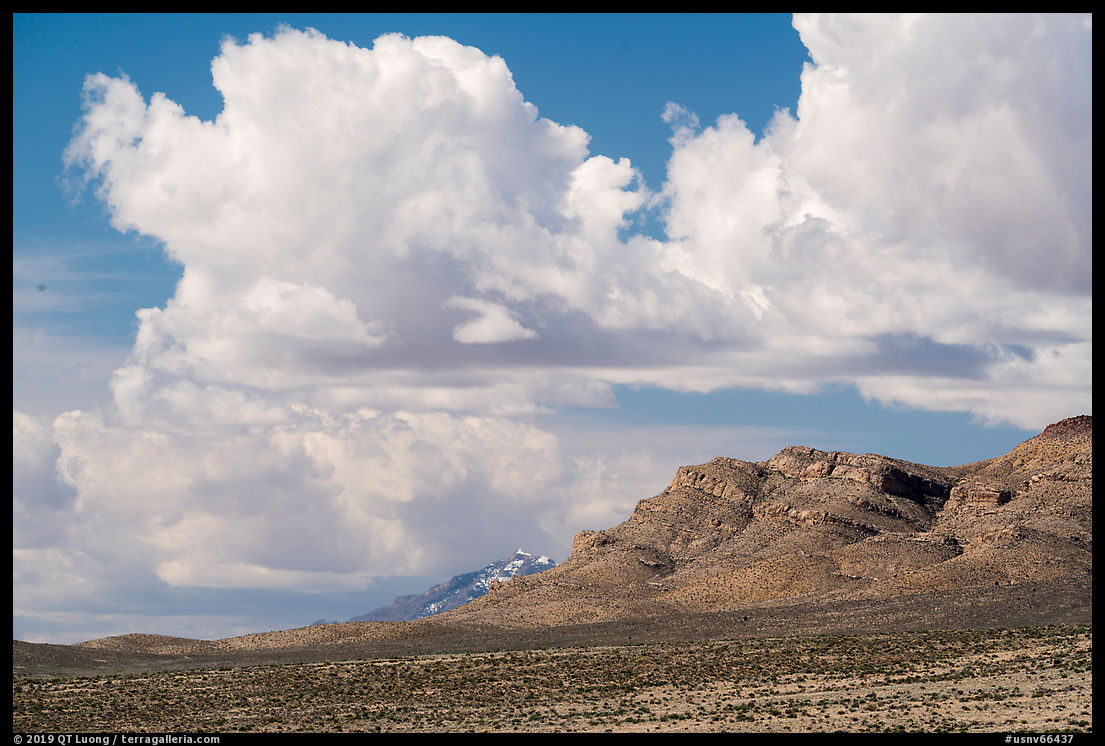
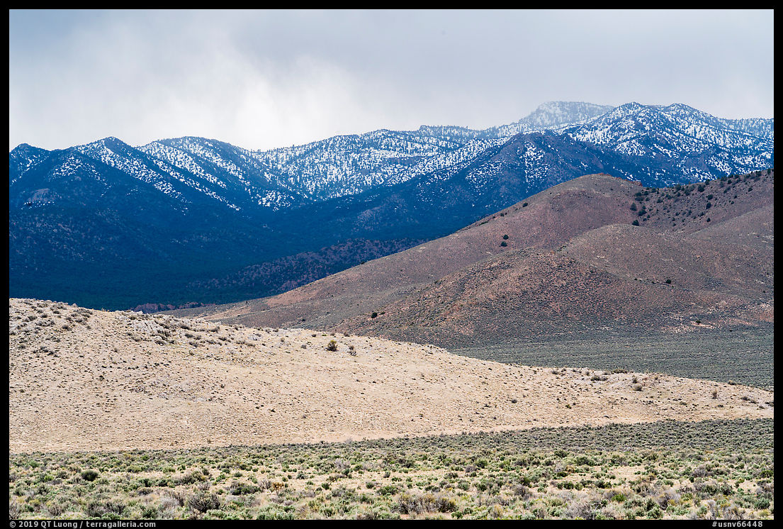
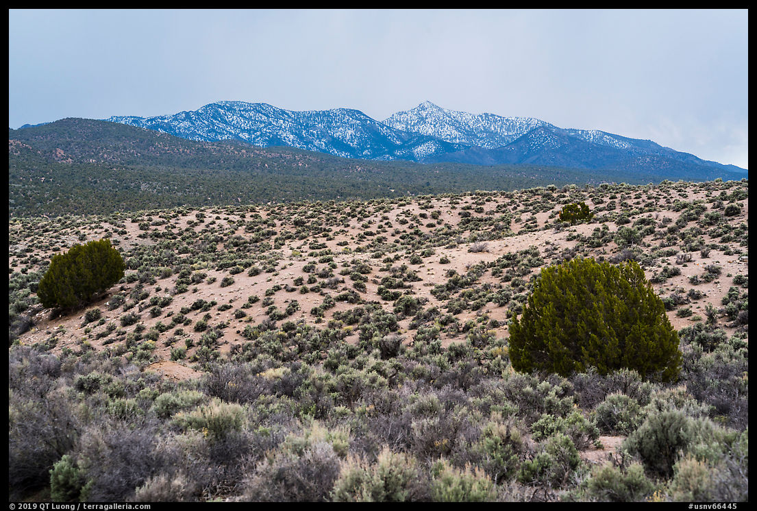
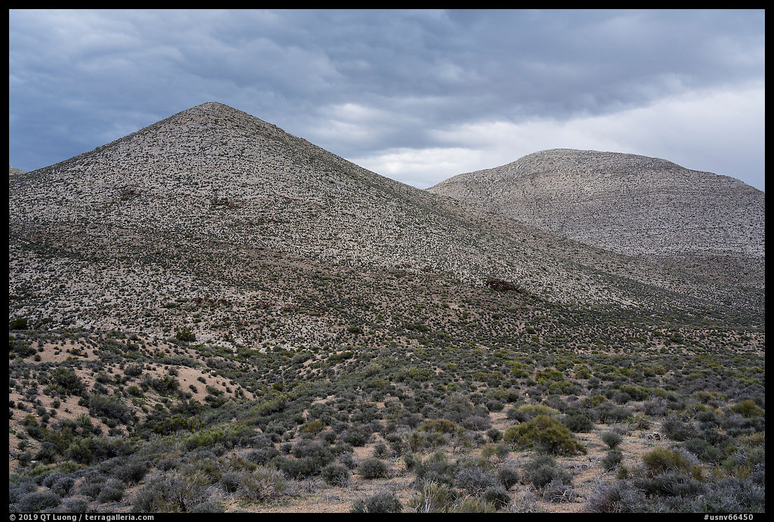
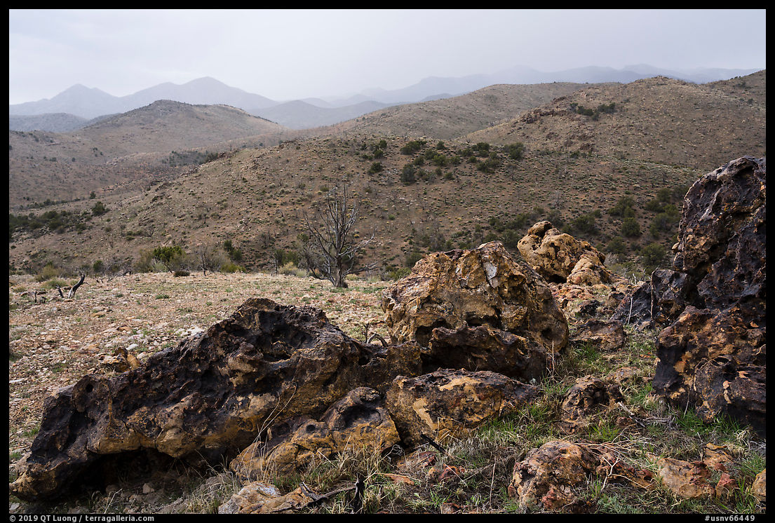
The Great Basin is like a huge bowl. No water falling into this area reaches the oceans, which is remarkable considering its size, one-twentieth of the United States. The Great Basin Desert, the northernmost, highest, and coldest of the four North American deserts (the others are the Mojave, Sonoran, and Chihuahuan) occupies most, but not all of it – to the south the Mojave desert overlaps the Great Basin. Basin and Range refers to another geographic phenomenon. The stretching of the earth’s crust and block faulting has created hundreds of sharp and narrow mountain ranges generally running in a parallel way north to south, alternating with wide and flat desert basins, forming the Basin and Range Province. It just happens by coincidence that the Great Basin is part of the Basin and Range Province. Great Basin National Park protects one of the tallest of those ranges, the Snake Range, where thanks to the high elevation, one finds alpine lakes, forests, and bristlecone pines. However, those attractive scenery elements make up only a tiny portion of the Great Basin so that the terrain of Great Basin National Park is not typical of the Great Basin. Other conservation areas in the Great Basin encompass more mountain ranges. However, rather than the ranges, most of the region consists of the basins, their endless sage flats rimmed by pinon-juniper woodlands. Because of the ease of access, the basins are more developed than the mountain ranges, with extensive mining and secretive military activities taking place. Basin and Range National Monument is representative of the Great Basin, as it protects the two last undisturbed of those basins, Garden Valley and Coal Valley, as well as the connecting mountain ranges.
Located about a hundred miles north of Las Vegas, Basin and Range National Monument was designated in 2015, on the same day as Berryessa Snow Mountain National Monument, and is one of the most remote, least known, and empty areas of a state famous for its emptiness. It makes Great Basin National Park, the 10 least visited national park (the 4th least visited in the continental U.S.) sound outright popular and famous by comparison. During my entire visit, I saw only a few other cars, and nobody that I know had heard of it.
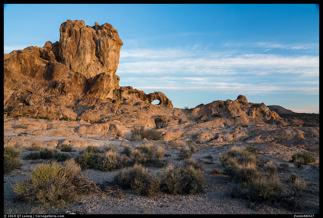
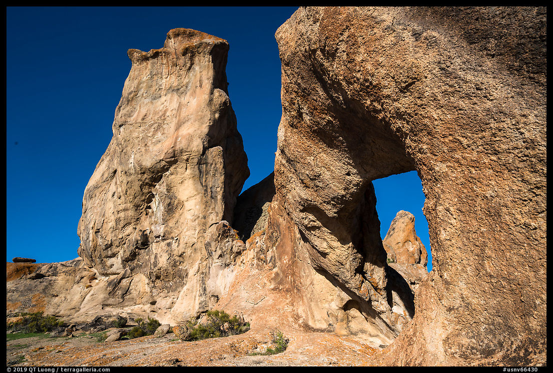
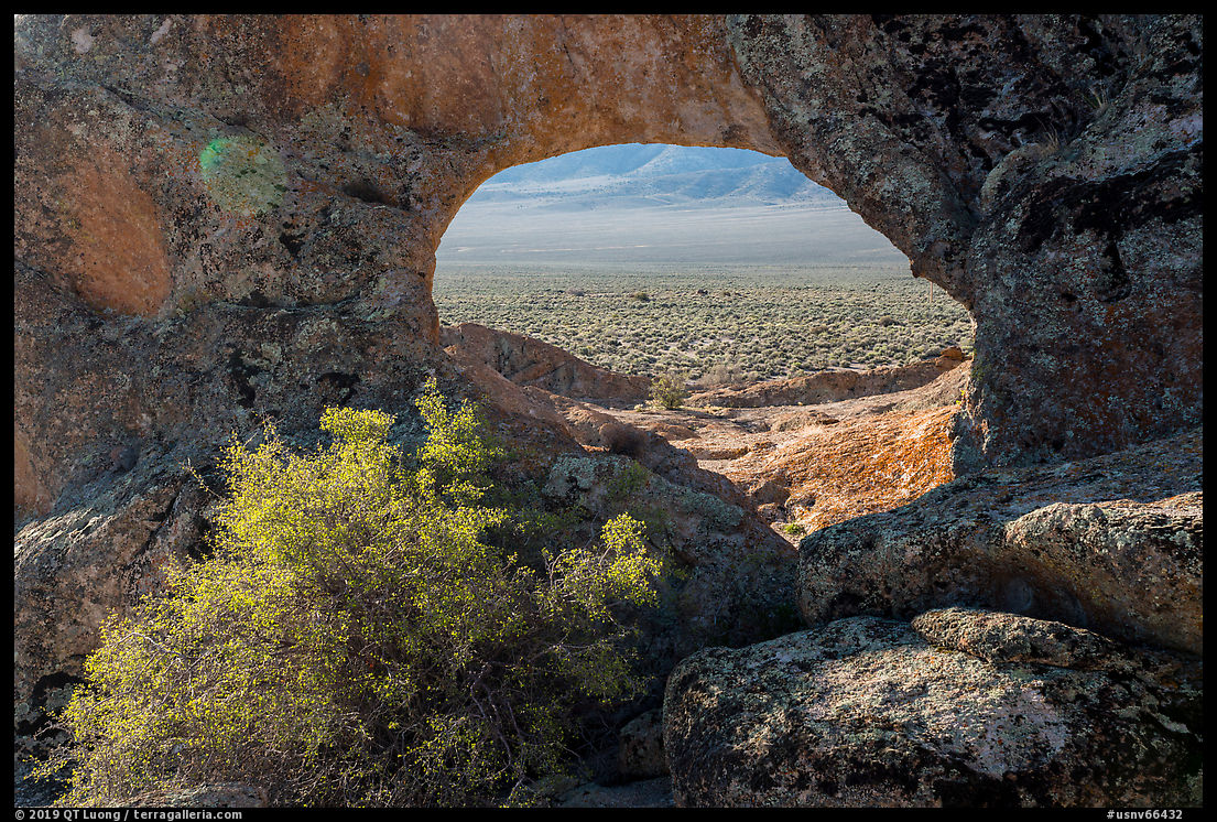
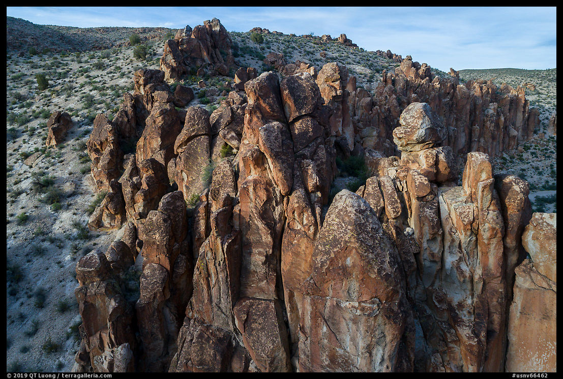
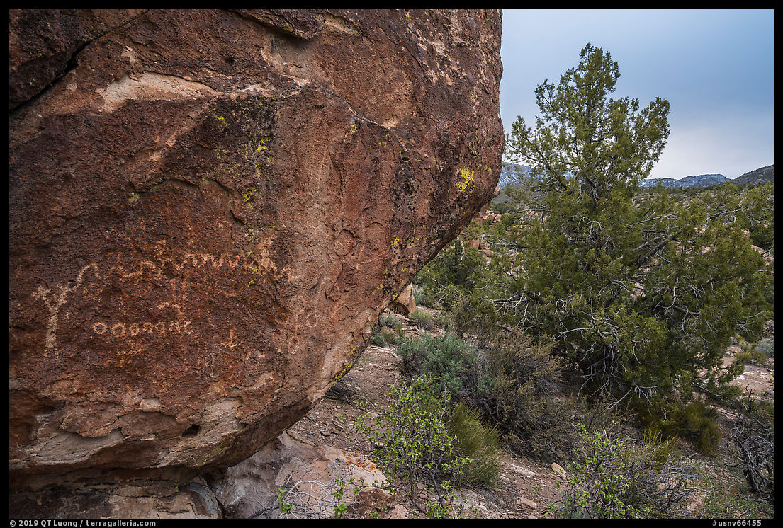
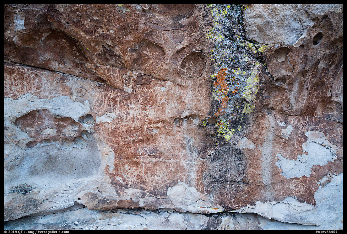
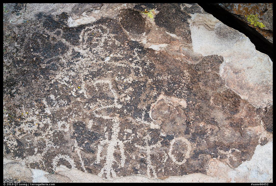
The monument protects a large array of resources, as expected from its sizable area of 704,000 acres (1,100 square miles), stretching 50 miles from north to south and 40 miles from east to west. It is almost ten times larger than Great Basin National Park (77,180 acres). The two basins in the monument connect eight mountain ranges, three of which are entirely contained within the national monument. The vast area is home to a diverse geology that includes remarkable rock formations. It would seem that many parts of Nevada look similar. However, besides being almost undisturbed, what makes Basin and Range National Monument remarkable is a number of remarkable cultural resources spanning the range of North American human history, all in harmony with the huge landscape. Three major archeological areas (White River Narrows, Mount Irish, Shooting Gallery) feature countless ancient petroglyphs as old as 4,000 years. There are also remains of 19th-century settlements and abandoned mines. Traditional ranching practices continue. Starting in 1972, the land artist Michael Heizer has been working on “City”, one of the largest sculptures ever created, more than a mile long, which, when completed next year (2020), will open to the public as part of the national monument – visitors are unwelcome while it is still a work in progress.
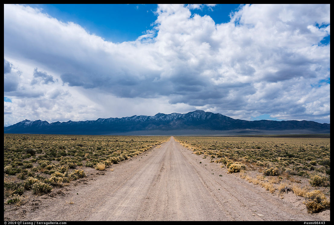
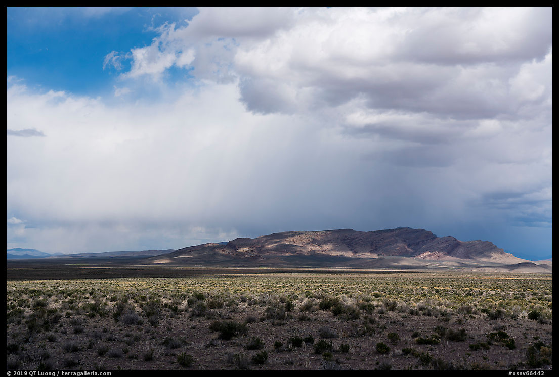
Currently, the national monument is entirely undeveloped. You will find no facilities like visitor centers, restrooms, campgrounds, and no paved roads. However, this does not mean that it is difficult to access. Surprisingly, unlike the locations described in the five other posts of this series, the unpaved roads are generally wide, well graded and easily passable by any vehicle. There are only a few road signs, so following the map requires some attention since all the roads look somewhat similar, but my navigation apps were able to identify them. In a few places information panels with a map of the monument offer precious information not found on the BLM website. Like in most monuments managed by the BLM, there are no entrance fees nor restrictions on dispersed camping. The opportunities for solitude are tremendous.
I initially had planned to spend the better part of a week there, but the call of the super-bloom further south was irresistible, and instead I went only on a quick exploratory trip. I started at the White River Narrows Archeological District, which is the most easily accessed part of the monument, with petroglyphs in the setting of a narrow gorge. I drove Seaman Wash Road to a natural arch highlighted on the national monument’s onsite map. There is no established trail, 38.1944757°, -115.2592076° is the closest point accessible by car via Coal Valley North Road and then a one-lane access road marked by a single wooden fence post on the left shortly before the turn NW. It was then back via Mail Summit Road before visiting the Mt Irish Archeological District, where the road climbed higher and was significantly more rough than the others. Petroglyphs there are carved on boulders rather than on cliffs. I hope that the following photos inspire you to explore for yourself this vast and ancient wilderness where there is much to discover. I am already planning a return trip after the opening of “City”. Take your time, as with most other Great Basin locations, this is not often love at first sight!

Part 6 of 6: 1 | 2 | 3 | 4 | 5 | 6

