Guide to the Schoodic Peninsula, Acadia National Park’s Quieter Side
3 Comments
Acadia National Park is made of three units, plus a few smaller islands. Most equate the main unit on Mount Desert Island with Acadia National Park. That is an excellent reason to spend time in the two other units: Schoodic Peninsula and Isle au Haut. Being lesser-known, they will offer you quiet, as well as less photographed views. Although technically an island, Mount Desert Island is connected to the mainland by a bridge. Travel to Isle au Haut presents the logistical challenges of a boat crossing. By contrast, the Schoodic Peninsula is the only part of the Park on the mainland, which makes access effortless. Read on to find out about my favorite spots on Acadia National Park’s quieter side.
Orientation
The Schoodic Peninsula is quite compact. To loop entirely around the peninsula is a drive of about 11 miles, of which half are located outside the park, and half are a one-way scenic drive. In addition, there are two short spur roads of interest, to Schoodic Head and Schoodic Point. At the beginning of the loop, and before the one-way section, you will find the recent Schoodic Woods Campground, and a ranger station that serves as a visitor center. It takes about an hour to drive the 44 miles from Bar Harbor to the Schoodic Peninsula. Although the Schoodic Peninsula is readily accessible, as it takes about the same time to drive there from Ellsworth as to Bar Harbor, fewer than 10% of visitors to Acadia National Park make that trip. One afternoon, I wasn’t able to find parking at Jordan Pond, and another evening, the road to Cadillac Mountain was outright closed for “traffic congestion”. But from one hour before sunset, to one hour after sunrise, I saw no more than a couple of other cars on the Schoodic Peninsula. That relaxed and uncrowded atmosphere is a welcome change from the main Park Loop on Mount Desert Island.
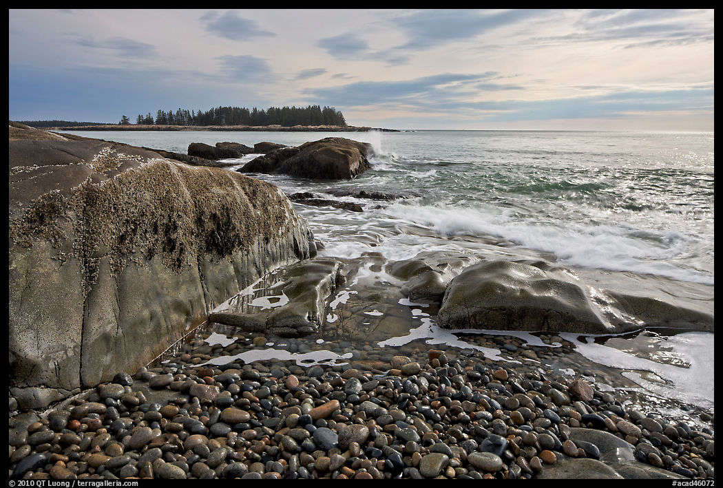
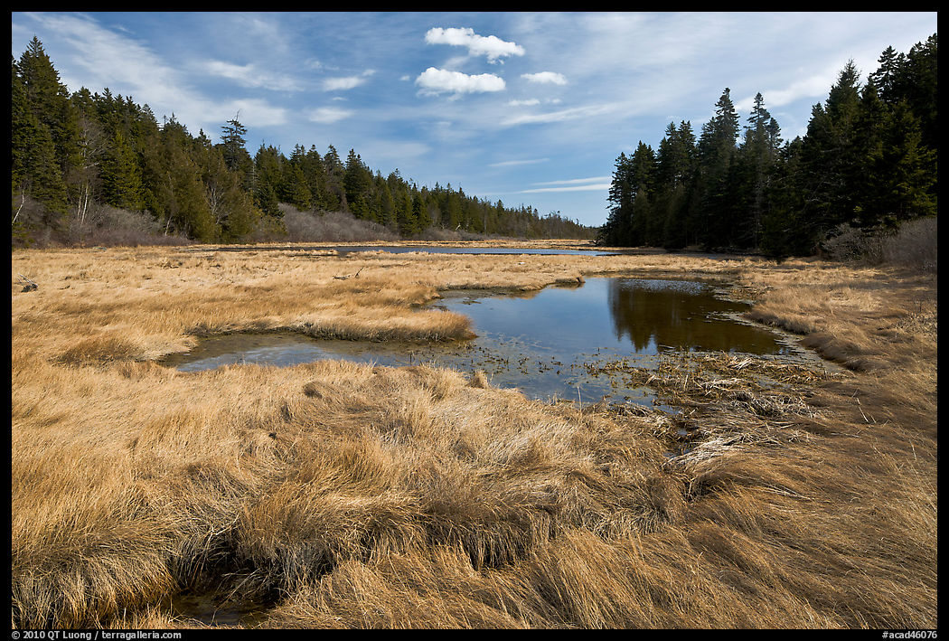
Schoodic Loop Road
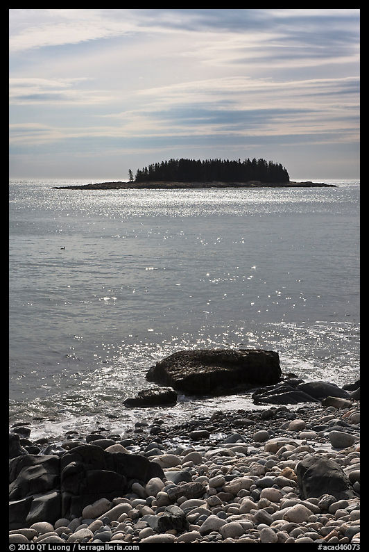
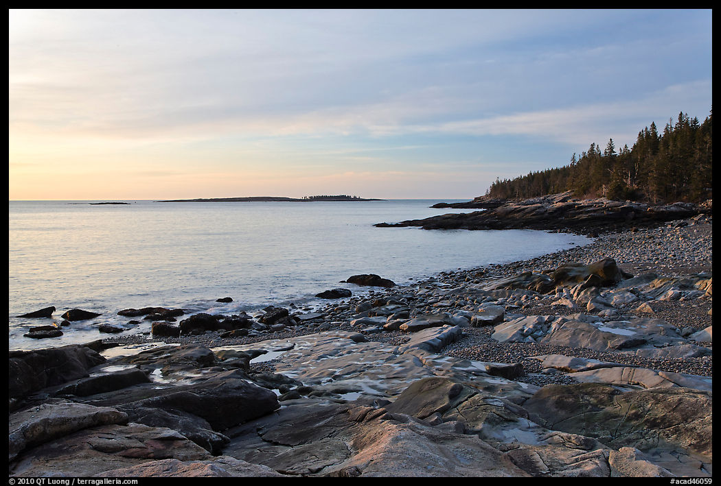
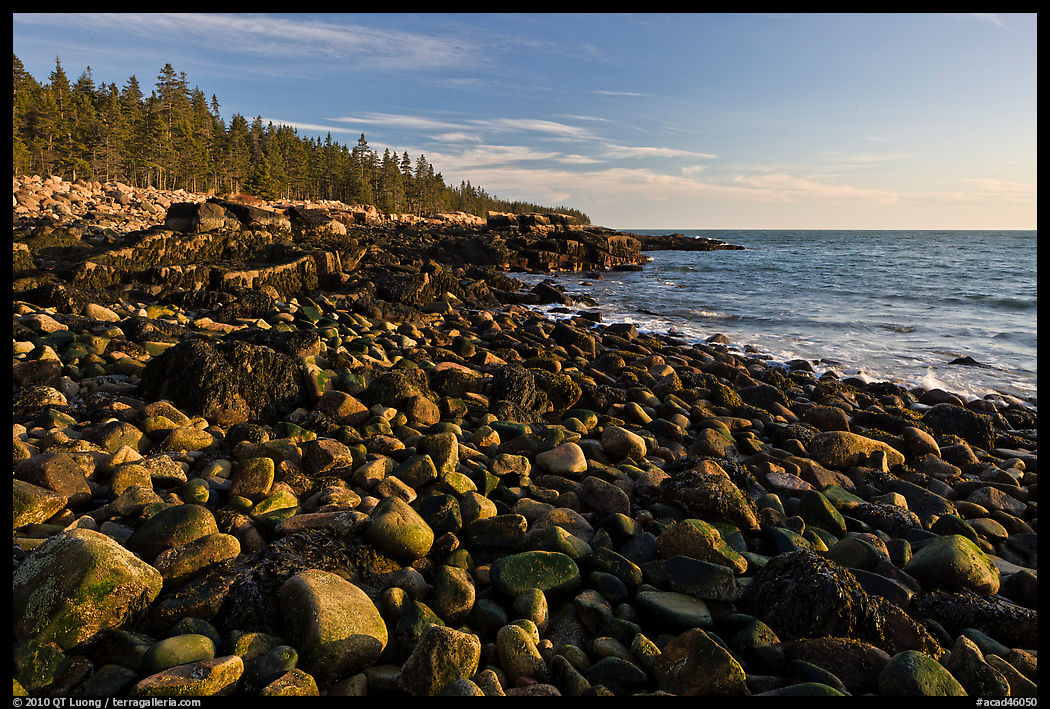
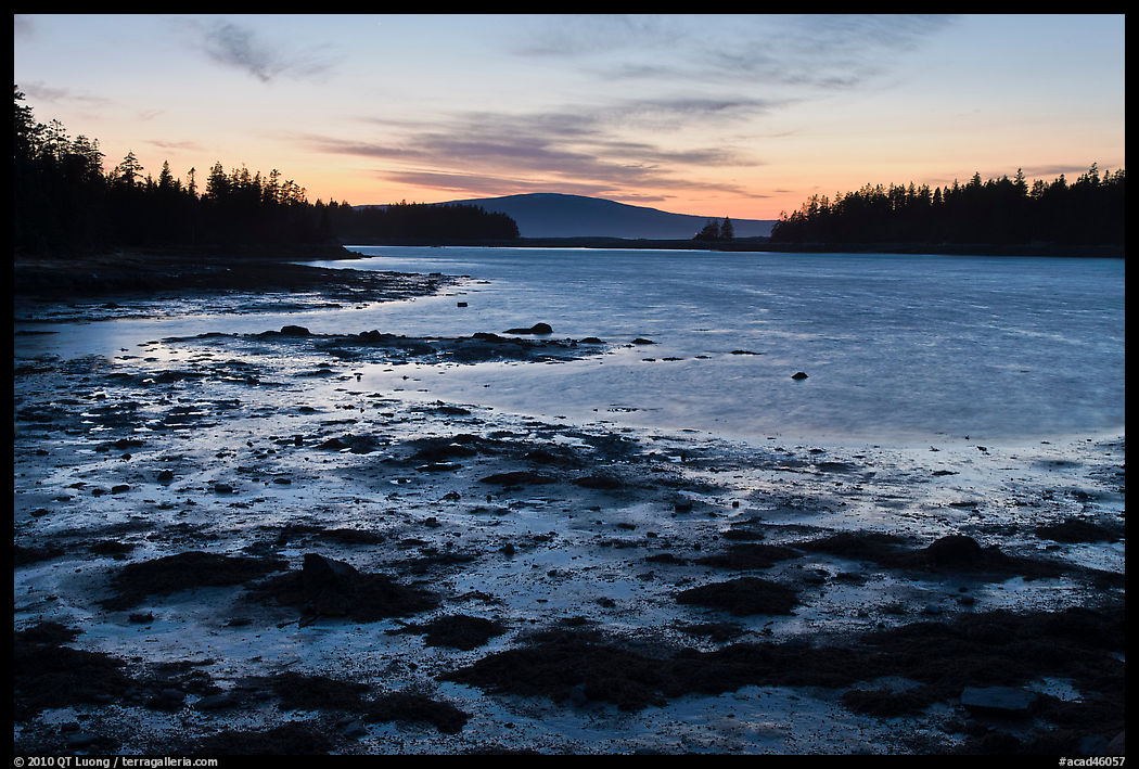
The main road around the peninsula includes a one-way loop section of about 5.5 miles. It follows closely the shoreline. If you see something of interest, just find a pull-out, park your car, and walk to the shore to make your own discoveries. The loop features a range of orientations, giving you options for sunsets as well as sunrises. The terrain is generally flat, but off-shore, tree-covered islets provide focal points to compositions that can include great slabs of pink granite, boulders, as well as tide pools and beaches. In the following paragraphs, I’ll mention a few highlights along the road.
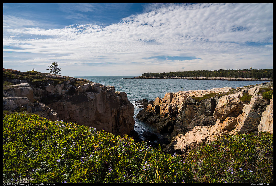
Ravens Nest
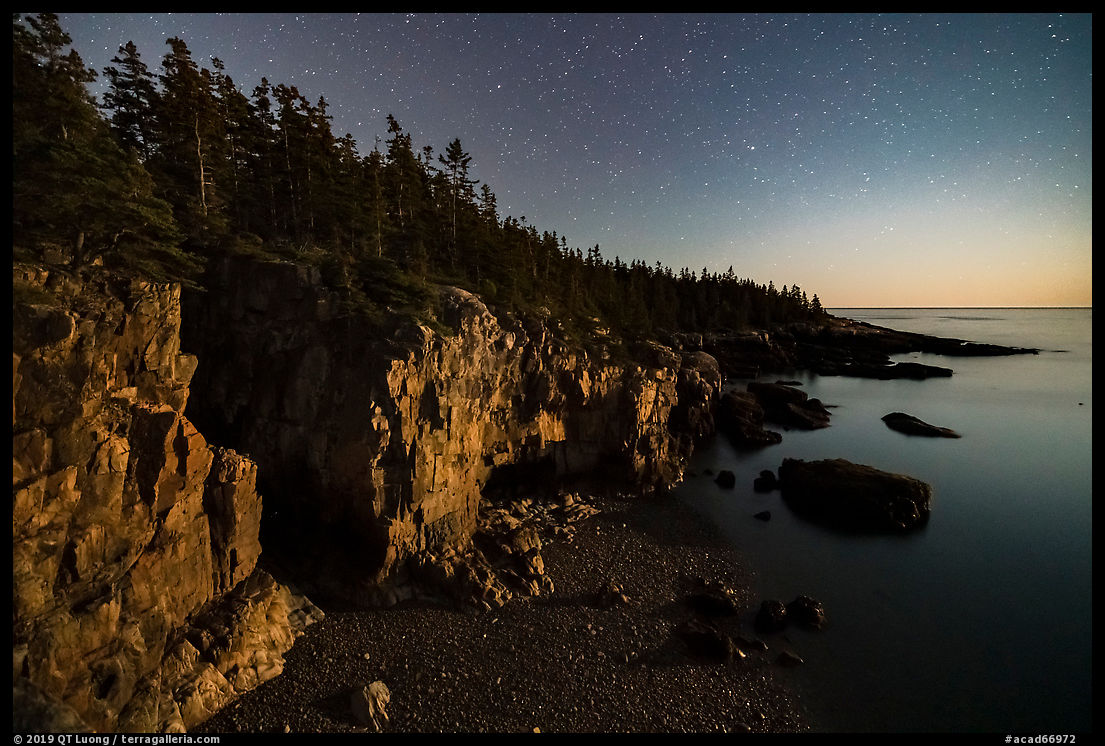
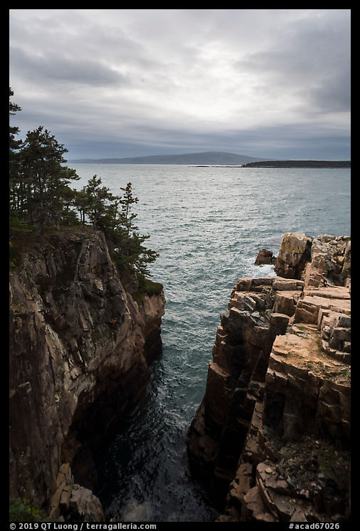
Overall, I find the Schoodic Peninsula reminiscent of the eastern coastal section of Mount Desert Island from Grand Head to Otter Point. Otter Point is a landmark headland that would be difficult to miss, but that is not the case of the most significant headland on the Schoodic Peninsula, despite it being quite impressive. Ravens Nest is not indicated on the official park map, nor is it signed or visible from the road. You don’t happen by chance on that hidden gem, but you have to know of it in advance. Then, finding it is a matter of driving 3.1 mile from the park entrance, and looking for an unpaved and unmarked pullout on the left side of the road with room for just a few cars. The location is marked on Google Maps. Cross the road, and you’ll find a faint, semi-official trail, cordoned in places for resource protection, that leads you in about a hundred yards to the shore. Soon, I arrived at the top of the cliffs and had a choice of several vertiginous viewpoints where one have to exercise the utmost care. The cliffs face the west, so that is an afternoon location. However, my first visit there was at night, timed for moonset. In the dark, the sheer drops were even more intimidating!
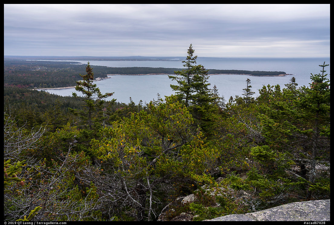
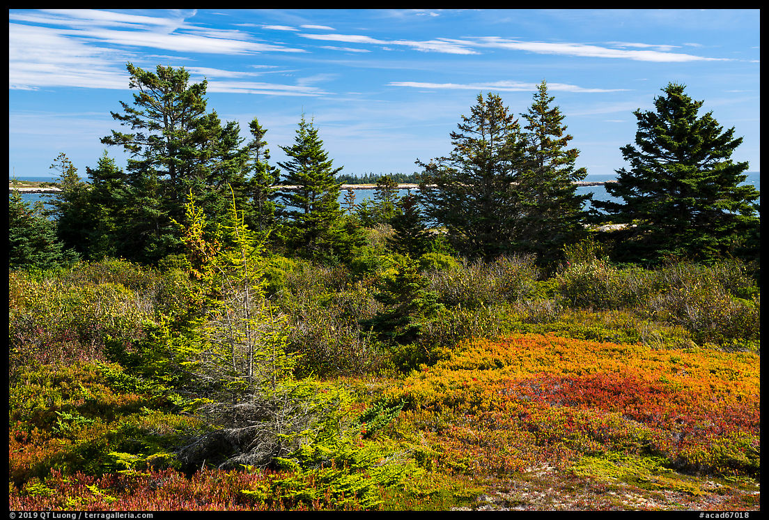
Schoodic Head
Unlike Mount Desert Island, the Schoodic Peninsula does not have what are called “mountains” there, and in particular “desert mountains”, meaning peaks with no tree cover at the top. Instead, the highest point on the Schoodic Peninsula, Schoodic Head, is a modest 450 feet above sea level, and covered in dense woods. Three different trails lead there from the main park road, but for quicker access, you can drive to within a few hundred yards to the top via the unpaved Schoodic Head Road. It starts 3.8 miles from the park’s entrance and is unmarked (look for the back of a stop sign on your left) although indicated on the official map. The trail starts on the east side of the parking lot. Views from the summit are blocked by trees, but by continuing further for less than 10 minutes, for maybe a total distance of a half mile from the parking lot, I arrived at a more open spot where I found distant views that I carefully framed with the trees.
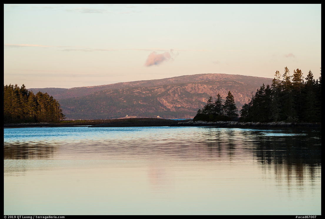
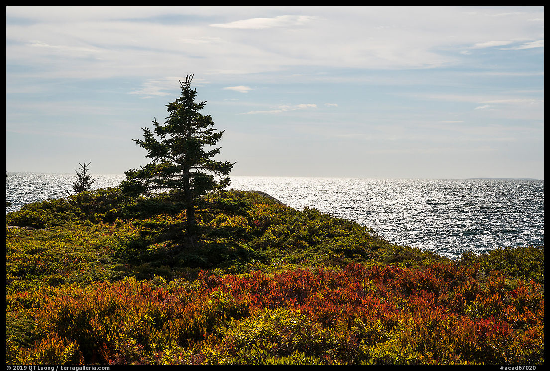
West Pond
Besides Ravens Nest, my favorite views on the west side of the Schoodic Peninsula are found shortly after the Schoodic Head turn off. There, trees frame the distant profile of Cadillac Mountain on Mount Desert Island, while the calm surface of the semi-enclosed bay often gives rise to reflections. I’ve photographed at that spot early in the morning and late in the afternoon. The Schoodic Peninsula doesn’t have large lakes like Mount Desert Island, but there are a few ponds in that area.
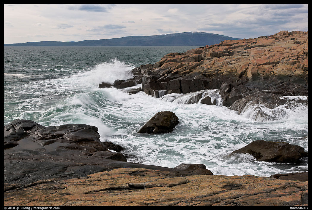
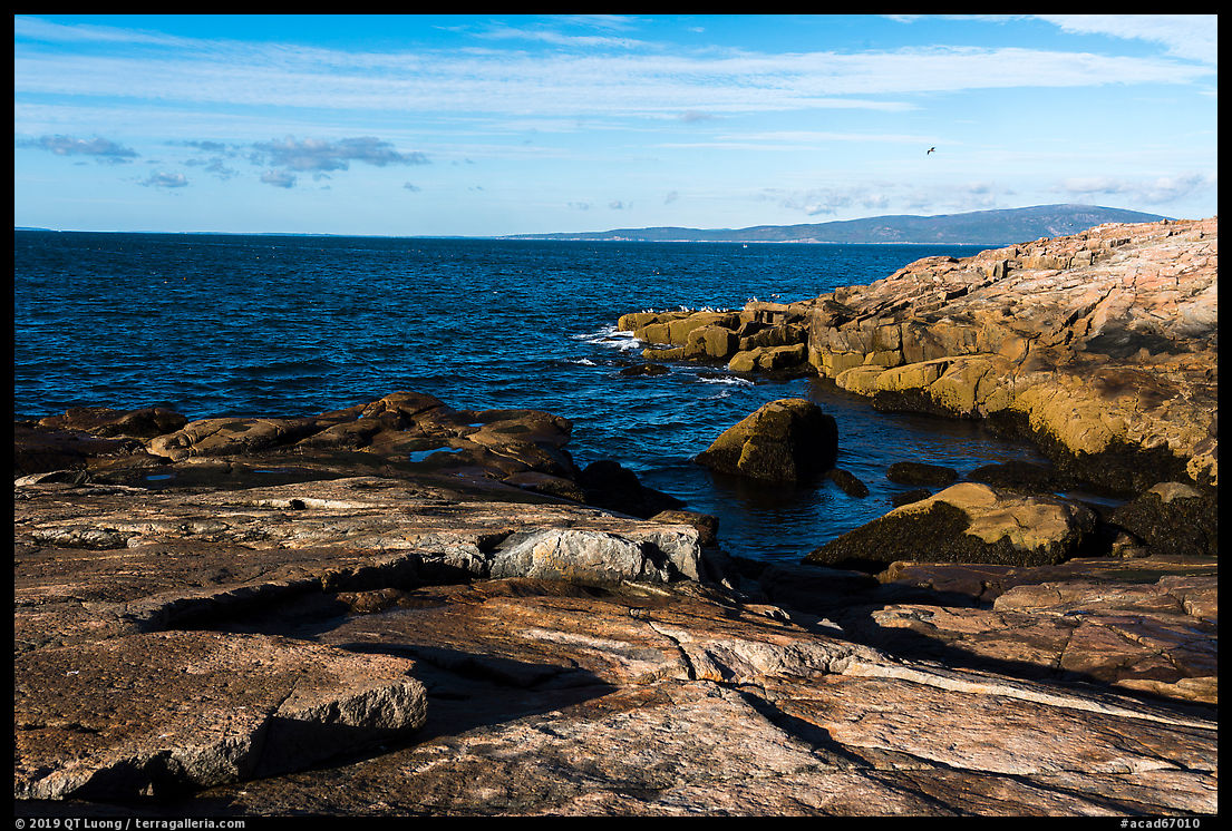
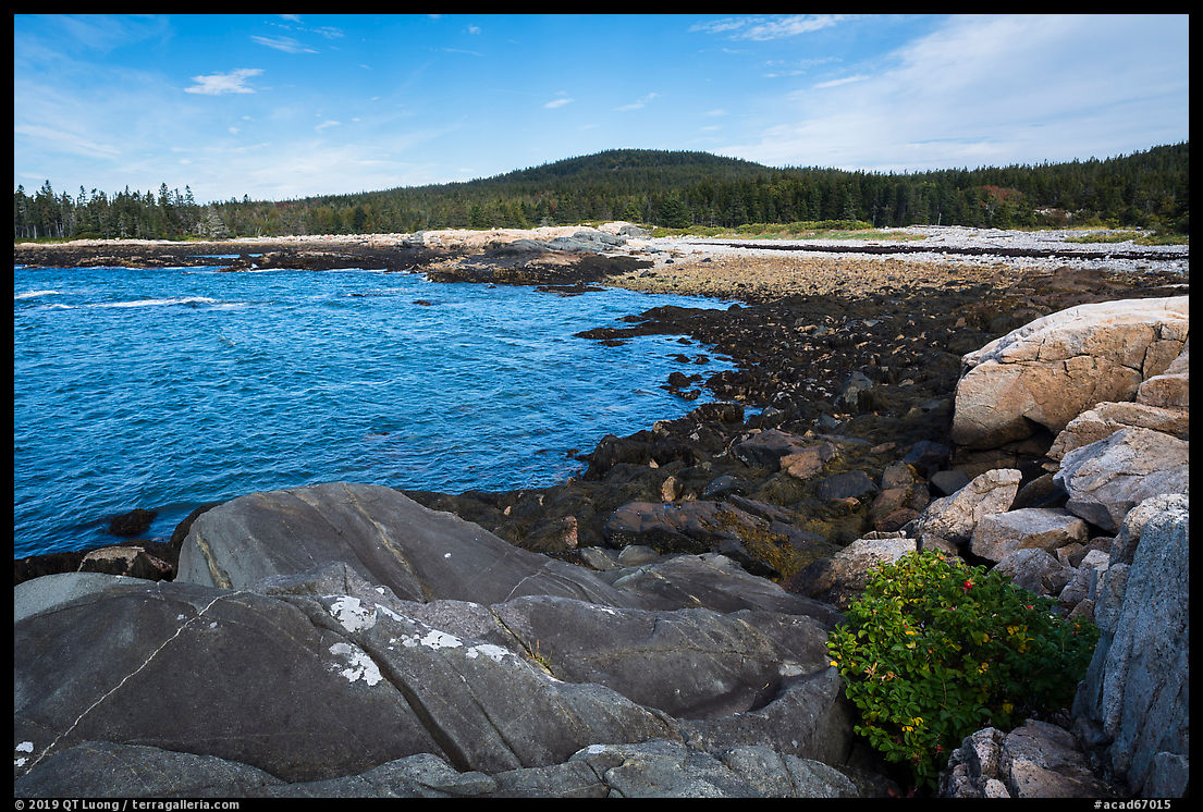
Schoodic Point
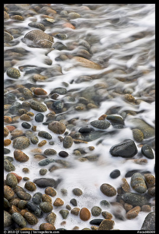
Schoodic Point, reached via a well-marked spur road, is the southern tip of the Schoodic Peninsula. The windy spot, fully exposed to ocean swells, is often a great spot to observe dynamic wave action. If there is none, the extensive rock ledges offer a wealth of textures to check out. Although it would appear that the light is favorable all day, I prefer the late afternoon light there. Besides the Frazer Point picnic area which is considerably less wild-looking, that is about the only spot in the park where I saw other visitors with regularity.
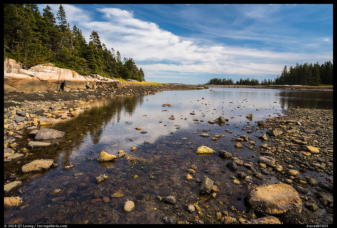
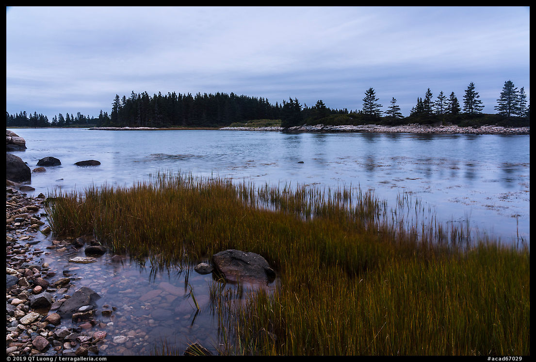
Little Moose Island
If the Schoodic Peninsula is the quieter side of Acadia National Park, then Little Moose Island is the quieter side of the Schoodic Peninsula. On my first trip, I noticed the interesting cobble barrier beach and spent much time exploring the surrounding tide pools, but as the tide was rising, the island itself was not accessible on foot and I did not even think of hiking there. Returning several years later, I had embarked on the popular low tide walk to Bar Harbor Island from Bar Harbor. Signs there warned visitors not to be stranded by the tide, and provided a phone number for a water taxi whose fare was in the hundreds of dollars.
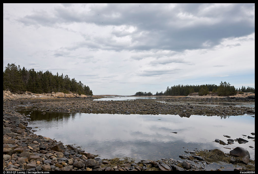
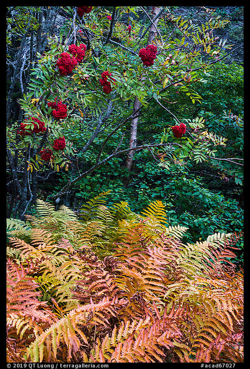
Armed with that experience and a tide app on my phone, I monitored the conditions and determined that it would be possible to walk to the island via a narrow land bridge from about two hours before low tide. I would be able to walk back up to two hours after low tide for a total of four hours on the island. I parked at the Blueberry Hill parking lot, about half a mile after the Schoodic Point junction, and walked west about a third of a mile to the land bridge. There was a small pullout with space for two cars just where it starts. There was a warning sign upon reaching the island, but no cell service was available there, unlike at Bar Harbor Island, so I was on my own. Although the island is only half a mile long, the limited time window of four hours went fast. The absence of an official trail only heightened the sense of adventure, but to protect that delicate environment, I made sure to stay on the existing network of user trails. I discovered on Little Moose Island a bit of a microcosm of the park, with beaches, rock ledges, conifers, and shurbs that turned crimson during the autumn. Just a few hours after walking back to the mainland, I returned to the pullout. Where I was walking, a deep water channel flowed with a swift current. The timing of the tide meant that I had to visit during midday. Looking at the now-inaccessible island I felt privileged to have be able to set foot there.


very beautiful pictures
Gorgeous set….Especially the eighth one I think …it was as if Earth in all its blooming glory erupted in a joyful burst of floral and foliage splendor ….Absolute treat for the eyes!
We love staying on the Schoodic Peninsula. It is so beautiful without all of the crowds. We enjoy staying at Schoodic Woods campground. The Schoodic Institute Junior Ranger Programs are incredible. We also love to go tide pooling at Schoodic Point at low tide. It’s all incredible! https://theadventuredetour.com/quiet-side-of-acadia-schoodic-peninsula/