Fort Ord National Monument
2 Comments
Fort Ord National Monument memorializes a former military base and provides an excellent bike recreational trail system. My first visits shortly after its designation in 2012 left me unimpressed, but after multiple return trips, I eventually began to appreciate the subtle but diverse landscape that includes several Central Coast ecosystems.
Barack Obama ended up designating more national monuments than any other U.S. president. His 29 proclamations easily surpass Bill Clinton’s 19 and Theodore Roosevelt’s 18. They also included some very large areas. However, he got started timidly. The first two proclamations consisted of two forts. It is probably not a coincidence that Joe Biden’s first two national monument proclamations, Camp Hale and Castner Range, were also former military properties, or that Donald Trump’s only proclaimed national monument, Camp Nelson, was another one. The first Obama proclamation in 2011 was Fort Monroe, a structure with a storied history, but spanning only about half a square mile. Although his second proclamation in 2012, Fort Ord used to be an Army post, its extent of 23 square miles and almost entirely natural character made it a different kind of national monument.
Army Base Past
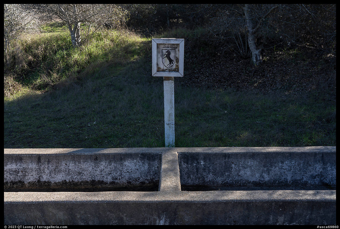
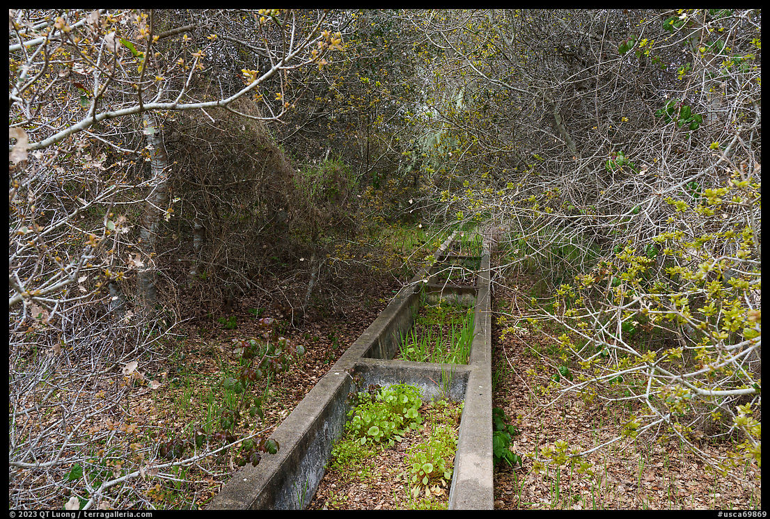
In 1917, the U.S. Army bought 23 square miles for a training area initially named Camp Gigling and then Camp Ord. It was used by horse cavalry units until the military started using motorized equipment. Ford Ord received its current name in 1940 when it became a regular Army post. Up to 1.5 million American soldiers received the Army’s “Basic Training” program over the course of the following 50 years. Fort Ord served as a staging facility for troops departing for war, most notably in Vietnam, in the 1950s and 1960s. At one point, more personnel than the neighboring communities of Marina and Monterey put together were stationed on the grounds — 50,000 troops. In 1994, when the base was decommissioned, it totaled 44 square miles.Although Fort Ord National Monument is cherished for its link to Americans who served their country with honor, nowadays for all practical purposes it is a recreational area and nature parkland. I saw plenty of abandoned Army barracks just outside the monument, but its boundaries appear to have been drawn purposely to exclude them. Besides the many roads that crossroad the monument, some bearing names such as “Machine Gun Flats” or “Engineer Canyon Road”, I discovered a few remnants of the military past inside the monument. Near the intersection of Trail 14 and Trail 19, one of the most interesting was a concrete water through built for the 11th “Blackhorse” Cavalry Regiment stationed at Fort Ord before World War II located near the grave where Comanche, the last ceremonial horse to serve on the fort, was buried with full military honors.
Recreational Area and Nature Preserve Present
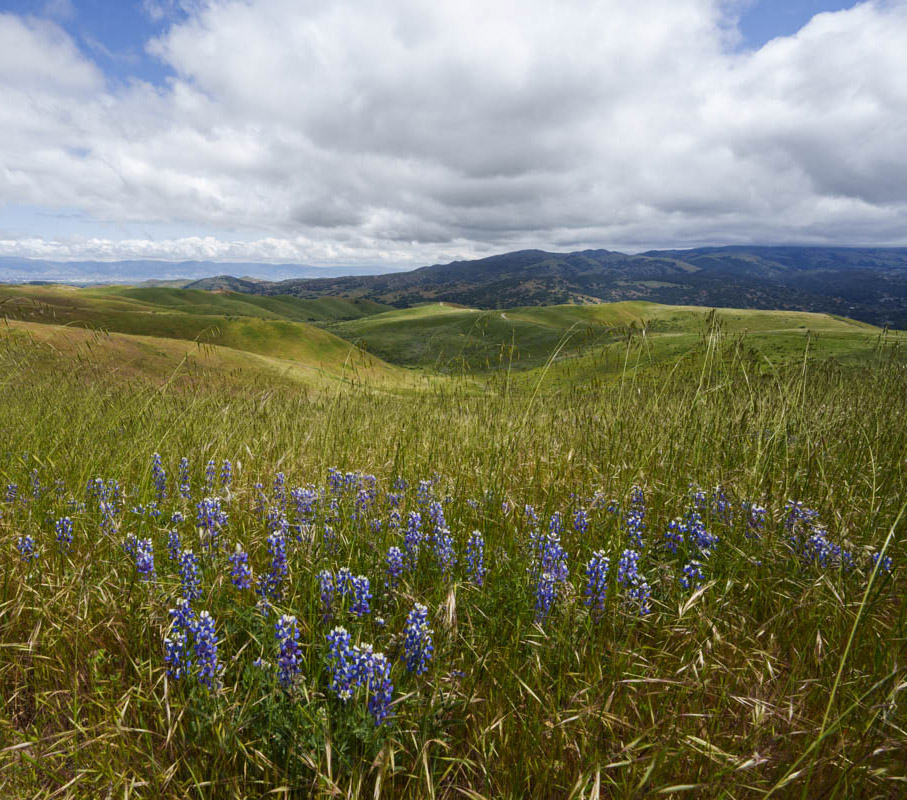
Some of the base’s former grounds now host California State University at Monterey Bay, two golf courses, the military Presidio of Monterey Annex, and other developments. However, as a side effect of its military role, the area had largely not been developed and holds some of the last natural wildlands on the Monterey Peninsula. The Fort Ord area is significant due to its abundant biodiversity and significant Central Coast ecosystems, which support a variety of rare and endemic plants and animals. Large stretches of coastal scrub, live oak woodland, and savanna habitat coexist together with unique vernal pools, in a seamless, interconnected landscape. A coastal strip of 1.5 square miles became Fort Ord Dunes State Park in 2009, while the bulk of it came under the Bureau of Land Management administration as Fort Ord National Monument.The main legacy of the military occupation is the many roads, both paved and unpaved, all closed to motorized traffic. Their extent and generally gentle grade draw bicyclists to the area, making it a mountain biking Mecca of Central California. I was surprised that the entrance areas were so busy even early in the morning. Deep inside the monument, I hardly saw any hikers. It looked like everybody else was riding. For four days in April, the annual Sea Otter Classic, regarded as the world’s largest cycling festival with more than 70,000 participants, takes place at Ford Ord and the adjoining Laguna Seca Racetrack. Probably not the best time to visit if you are hoping for quiet. Fort Ord is not all about roads, though. There are so many trails, 96 of them, that, unlike the roads, they are numbered rather than named. It would seem that the locals view the monument as a recreational area rather than a nature preserve. The grassroots “friends” association, named Fort Ord Recreation Trails Friends, did not reply to my natural history questions.
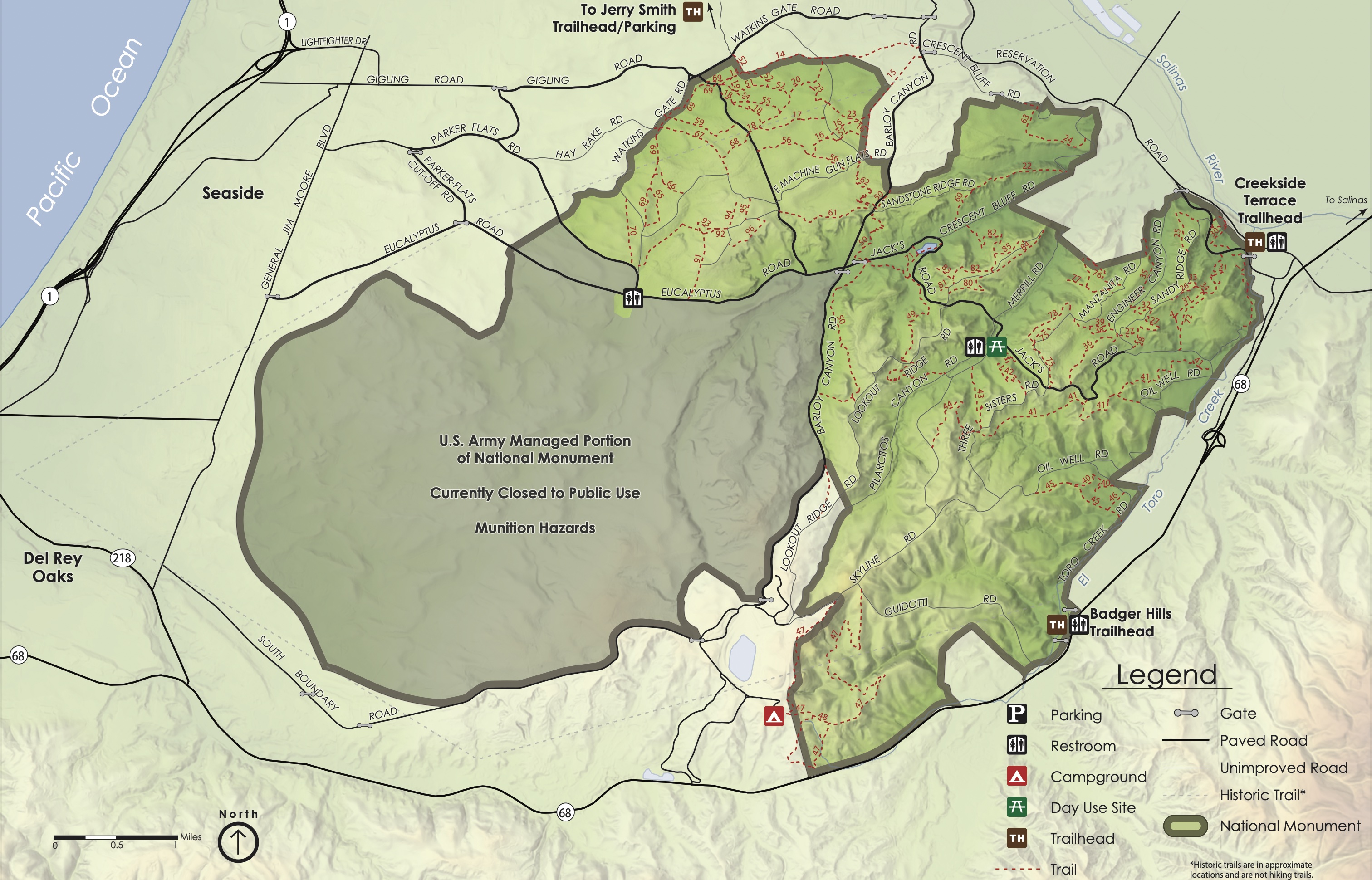
Georeferenced PDF maps:
High-res version of above,
More legible trail map
About half of the monument on the west side is still closed to the public while it is subject to clean-up work for munitions and soil pollution – Ford Ord remains a Superfund site. On the east side, there are two main entrances with sizable parking lots and bathrooms, both off Highway 68 southwest of Salinas, the Creekside Terrace Entrance, and the Badger Hills Entrance. In addition, there are trailheads with smaller parking areas along the north side.
Creekside Terrace
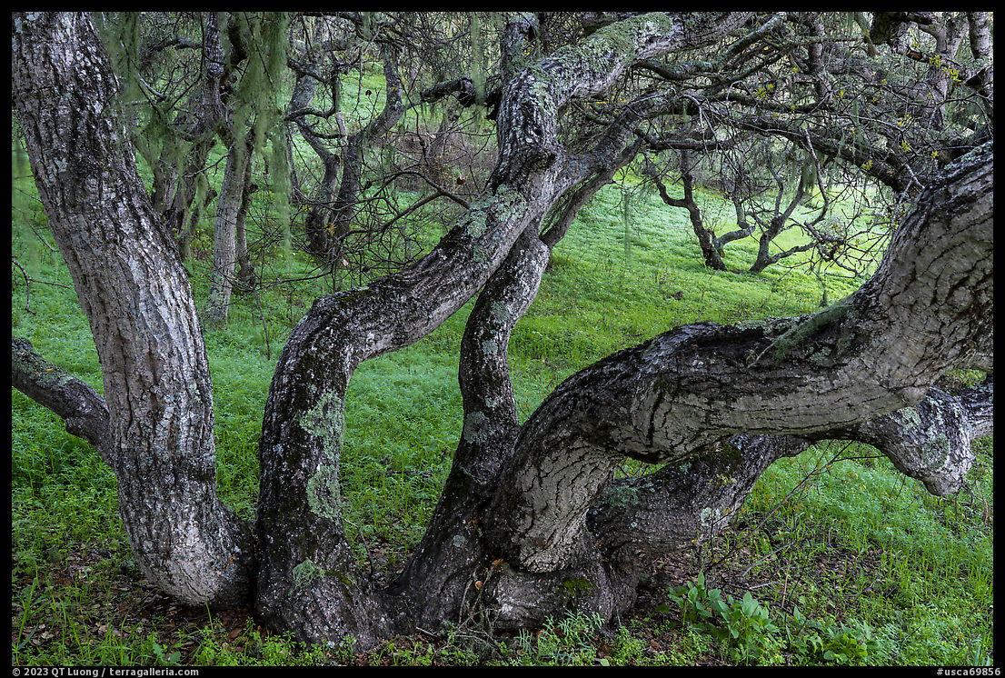
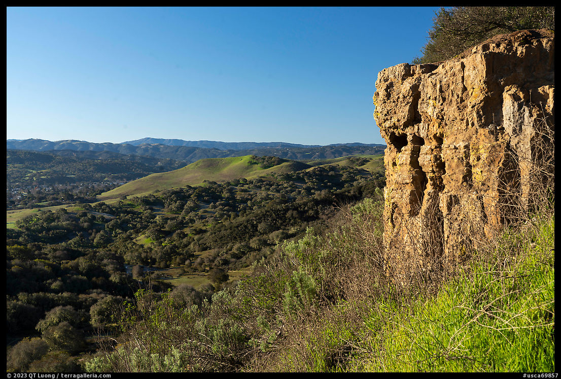
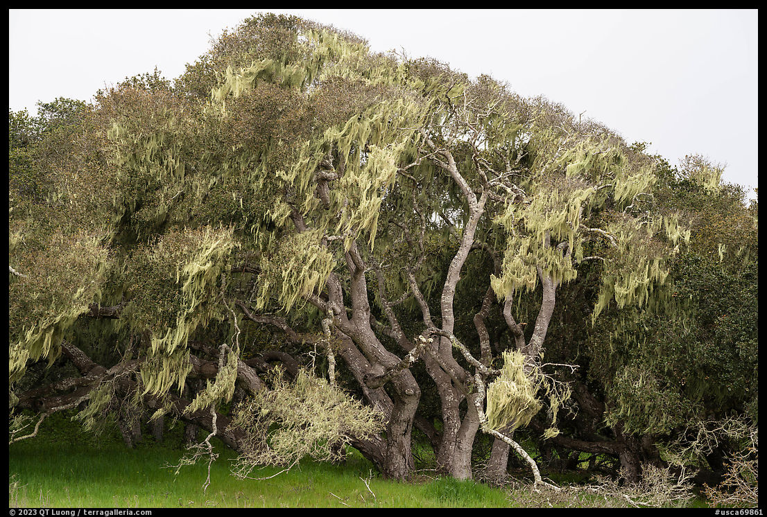
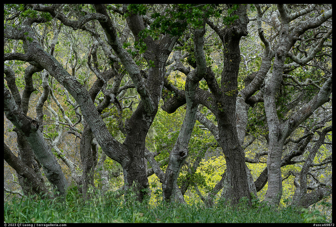
The Creekside Terrace trailhead in the northeast offered an excellent introduction to the monument’s diversity. Following a narrow trail uphill, I first crossed a grove of mature live oaks draped with lichen. At the top of a sandstone outcrop, I enjoyed a vast panorama over the rolling hills and rare native central maritime chaparral habitat. In places, the erosion of the sandstone bedrock created sharp cliff formations reminiscent of Torrey Pines State Preserve near San Diego. Hiking further led to a sizable pool. From there, I returned via Station One Rd and Trail 1, which provided views of the Salinas Valley.
Badger Hills
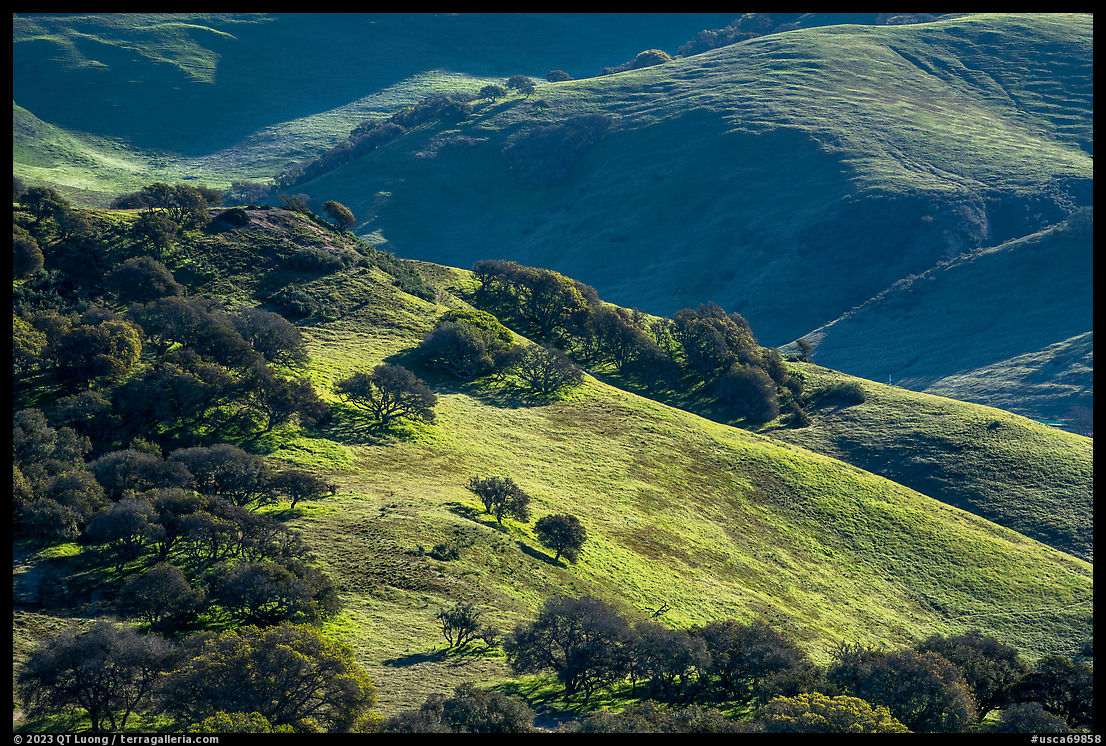
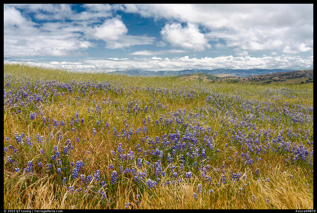
Badger Hills in the southeast is the main entrance to the monument, located off eight miles south of Salinas off Highway 68. From there, I followed a loop consisting of Guidotti Road, Skyline Road, Oil Well Road, and Toro Creek Road. According to Alltrails.com, the 6-mile hike (730 feet elevation gain) is the most popular in the monument. That side of Fort Ord consists of grass-covered gently rolling hills dotted with sparse clusters of oak trees. The open grassland terrain provided wide-ranging views in all directions, but no shade. I had been told that this area, especially in the vicinity of the Laguna Seca Racetrack, is the best in the monument for wildflowers starting in May. Maybe because of the growth of grasses, the blooms that stood out most on the hills were the tall sky lupines growing in dense patches. A different plant community with water-loving trees such as sycamores thrived along the flat portion of the trail bordering a subdivision. It is best to hike in this area on weekdays because, during the weekend, the roar of the vehicles from the racetrack distracts from the quiet of nature.
Jerry Smith Corridor
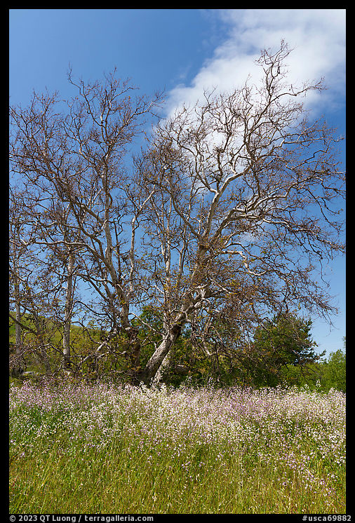
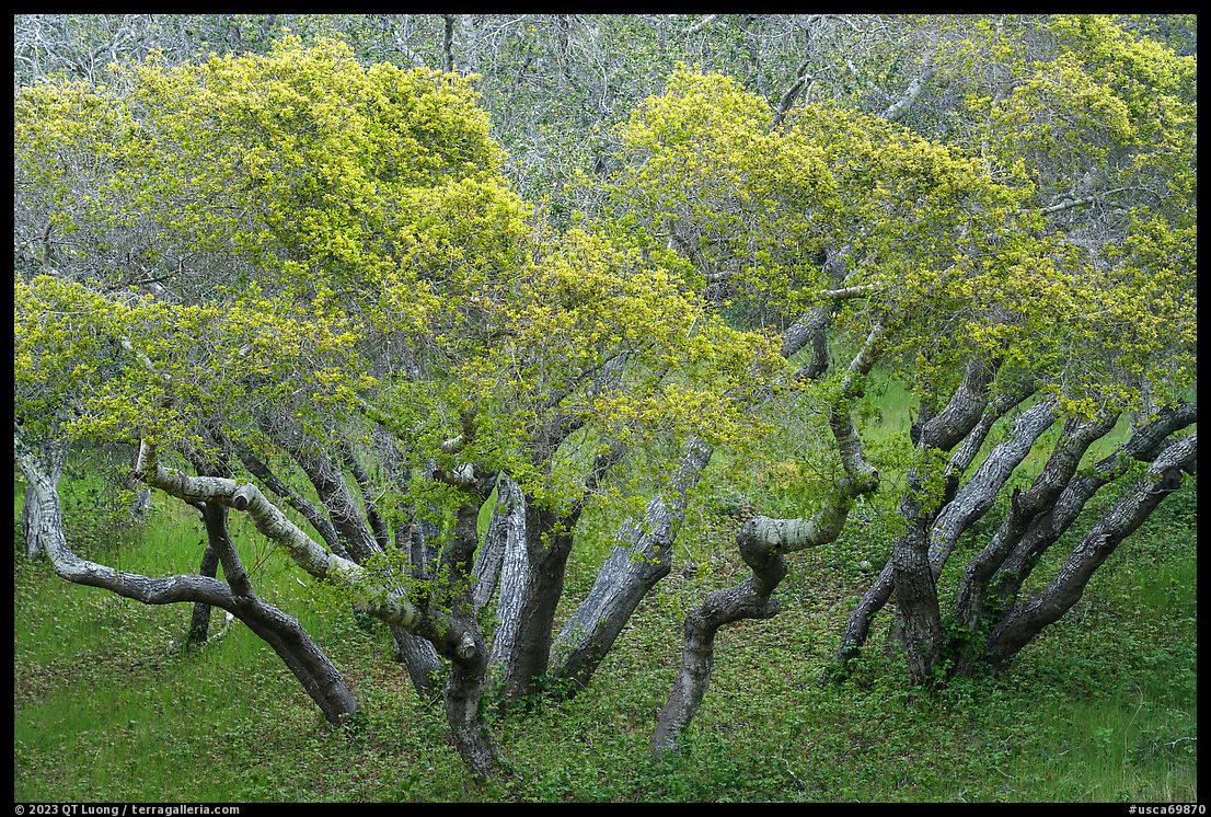
In contrast with the open hills of the southeastern part of the monument, its northwestern part is an upland mesa dominated by groves of coast live oaks. If it feels like a hobbit forest full of twisted ancient trees, it is because the roots cannot penetrate the sandstone strata, therefore limiting the trees in height. Bicyclists park at the east end of Gigling Road in Marina, but for hikers, the quicker access is via the small Jerry Smith Corridor trailhead along the Inter-Garrison Road slightly east of Schooner Road.
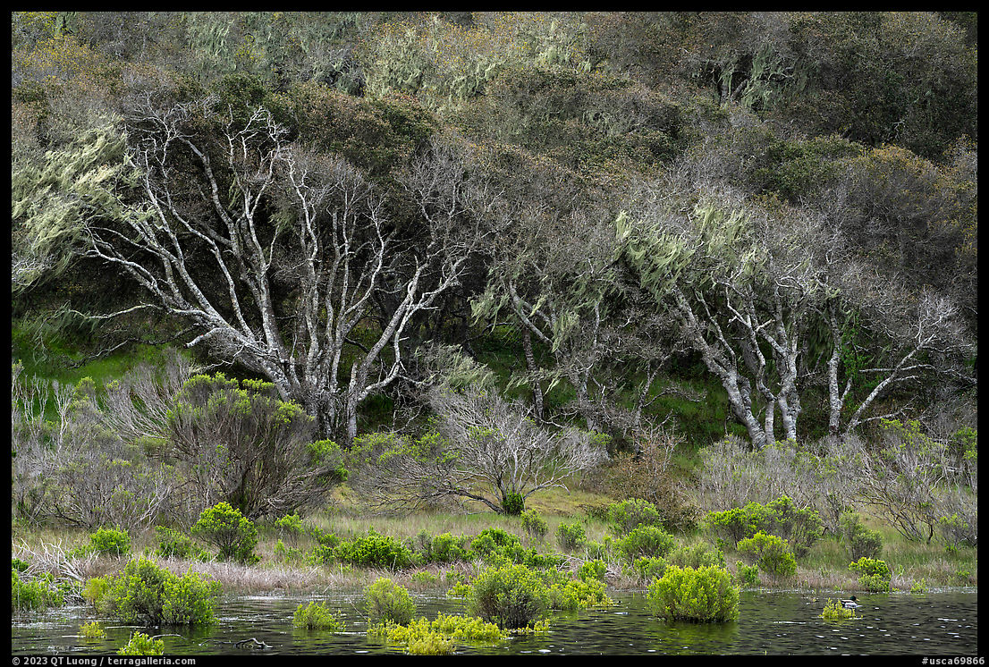
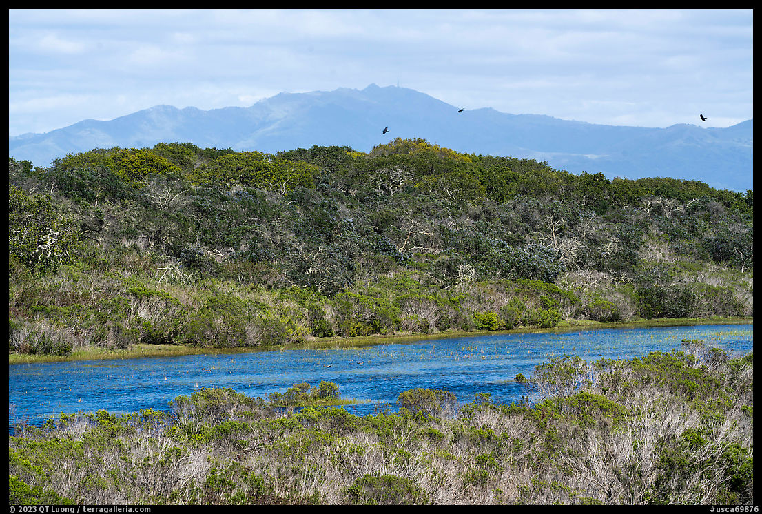
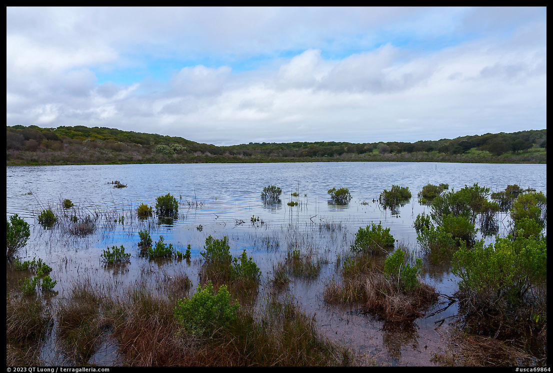
The Jerry Smith Corridor leads past Watkins Gate Road to a vernal pool bordered by reeds. A welcome sight after years of dryness, it is one of the 45 vernal pools in the monument that were brimming with life as a result of an unusually wet rainy season in 2023. Most of them are located in the northwestern part of the monument. The federally threatened California Tiger Salamander and the Contra Costa Goldfields are two examples of the flora and fauna thriving in the habitat created when such seasonal lakes fill natural depressions. The ponds are also crucial components of the local environment serving as stops for migratory birds. The satellite view from Google Maps shows them totally dry, which is the case in the summer of drought years.
I previously didn’t pay too much attention to the national monument closest to my home in San Jose because I thought of it as a recreational area memorializing a former military base. Walking the roads appeared a bit tedious as the views were not even as spectacular as those from some Bay Area county parks. However, by returning several times, especially during springtime, I found that a closer look revealed a very worthy nature preserve with interesting biodiversity.


I lived in Monterey for a couple of years and would frequent Fort Ord NM. It’s more of a National Recreation Area type place, but it has it’s charms and I’m glad it was preserved. It’s good for hiking, biking, and exploring. For now, I like that it’s a nice escape. As Monterey and Salinas continue to grow I’m sure it’ll become more of a destination.
Good photos, Zack. I agree, the locals appear to view/use Ford Ord as a recreation area. On the other hand, not to suggest that Fort Ord is on the same level, Cuyahoga Valley National Park was a National Recreation Area.