Pilot Rock, Cascade Siskiyou National Monument
4 Comments
Our planet is experiencing a mass extinction at a scale unprecedented since the demise of dinosaurs 65 million years ago (UN Report, Center for Biological Diversity). Public lands can act as sanctuaries for biodiversity. In 1947, Everglades National Park was the first large tract of land protected not for its scenic value, but for the benefit of the unique diversity of life it sustained. However, it wasn’t until 2000 that a national monument was established solely for the protection of biodiversity: Cascade-Siskiyou National Monument in Southern Oregon.
(click to enlarge)
More than 3,500 species of plants and animals live in the Klamath Mountains ecoregion, making it one of the three most biodiverse conifer forests in the world – the other two are in the American Southeast and the Primorye region of the Russian far east. Why is such a relatively small place (114,000 acres) so biodiverse? The monument is situated at the convergence of the Klamath (to the southwest), Cascade (to the north), and Siskiyou (to the west) mountain ranges, and is also an interface of the Sierra Nevada (to the south) and Great Basin Desert (to the east) ecoregions. The Cascade Range is relatively young, where the Siskiyous are the oldest mountains in Oregon, and the complex geology contributes to a variety of soil types. The Siskiyous are unusually oriented east-west, facilitating migrations with the coastal ranges, and they became a refuge during the last ice age, as they were not heavily glaciated.
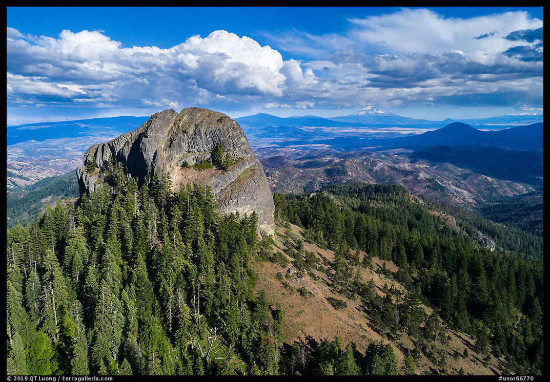
Pilot Rock
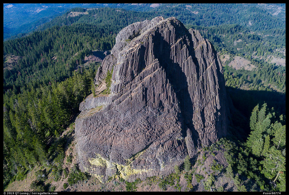
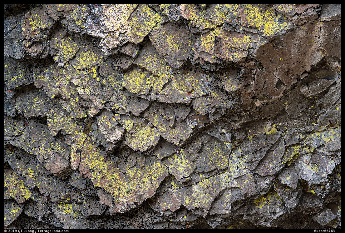
Unlike national parks, large national monuments usually lack an iconic landmark. That’s not the case of Cascade-Siskiyou National Monument, which has Pilot Rock, known by that name since pioneer days, when it served as a landmark to travelers crossing the Siskiyou Pass between Oregon and California. The rock is a volcanic plug, a remnant of a vent left after a volcano eroded away, leaving a trace of the inside of a volcano. Pilot Rock has vertical basalt faces 400 feet high, with columnar jointing similar to the Devil’s Tower.
To get to Pilot Rock’s trailhead, take Exit 6 (Mt Ashland) on I-5, and follow Old Hwy 99 and then an unpaved access road. The trailhead is close enough to the freeway that if you are traveling it, you should consider making a stop. The hike to the base of the rock is about 3 miles (RT) with 625 feet elevation gain, mostly in the 0.75 mile after you leave the Pacific Crest Trail (PCT). Hiking in the late Friday afternoon, I did not see anybody else at the site, and the rock loomed impressively above with steep walls. Intending to climb to the top, I began to scramble up a wide chimney, but faced with a steep chockstone, I elected to follow a ledge towards the right (west) at the base of the cliff. It let me only to the prow of the formation, and from there no more progress was possible. I understood why the BLM recommends to come with someone who has done the climb before. Since it was very windy, late, and I was carrying a full camera backpack, I chose to photograph the sunset from that spot. On my way down, I spotted what appeared to be a possible route to the top, a dihedral in the middle of the north face.
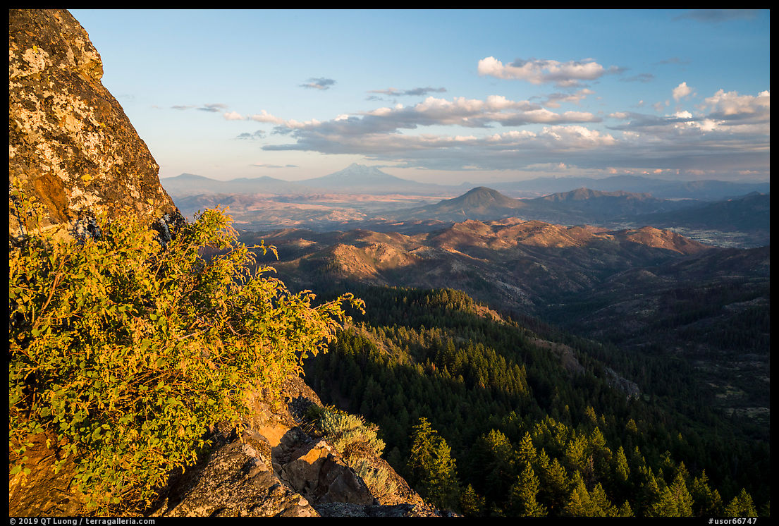

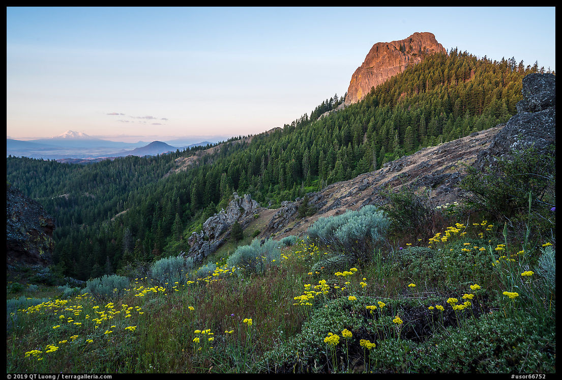
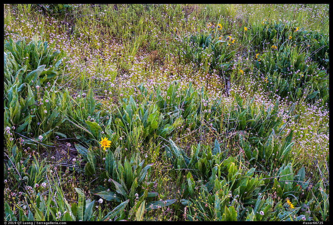
The next day, I started to hike in the dark, and after a mile joined the PCT. The Pilot Rock trail was too close to the formation for a view of it within the landscape, so instead, I aimed for a more distant viewpoint. I took the left fork, continuing on the PCT for slightly less than a mile. From its name and aspect on the map, a point marked as Babbit’s Saddle looked promising, and I had timed my arrival there for pre-dawn. Babbit’s Saddle turned out indeed to be the first spot on the trail with open views and was adorned with multicolored wildflowers. However, since the spot is regularly used for backcountry camping, it was looking far from pristine, with a multitude of places on the ground rendered bare from the foot traffic. While making sure to stay on the trail to avoid adding to the impact, by walking away from the saddle, I found a spot where the ground vegetation was more intact, and from there, I made a wide-angle photograph of Pilot Rock bathed by the light of sunrise, with Mt Shasta in the distance.
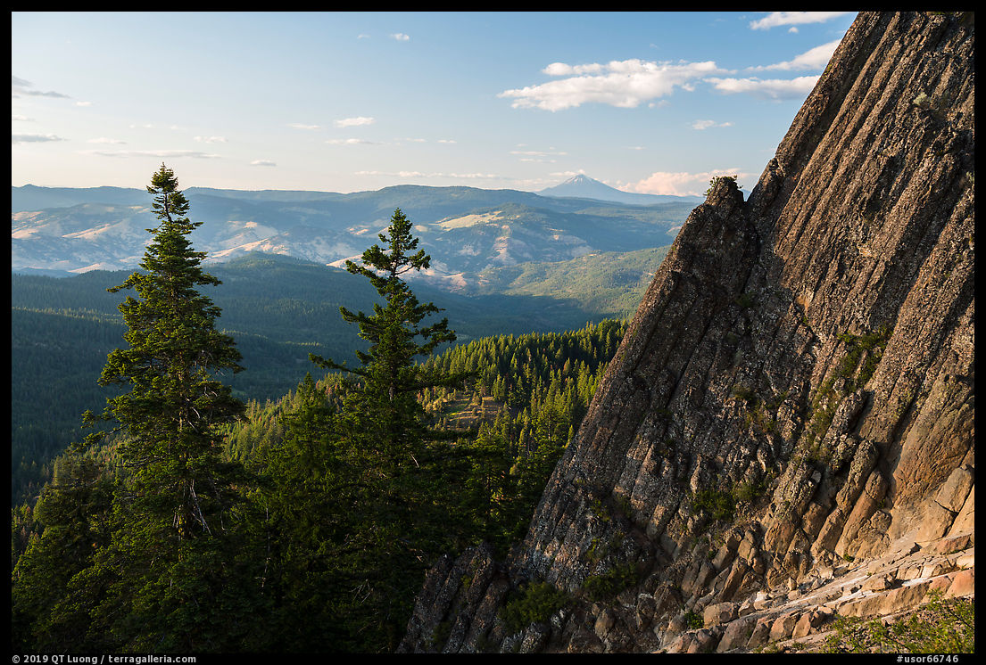
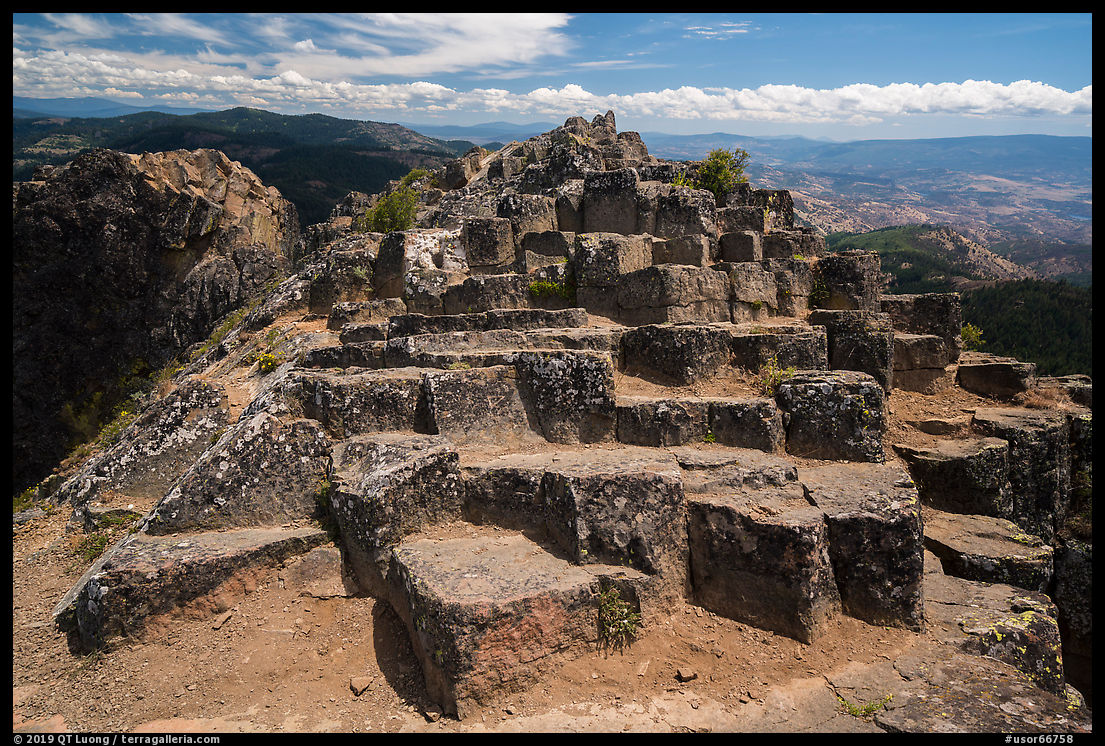
I hiked a few more miles on the PCT, finding only a few open views, before backtracking to the junction with the Pilot Rock Trail. Since it was a Saturday morning, there were already quite a few hikers ahead of me, and looking at them confirmed that the route to the top was via the diedral. I had hidden my backpack and tripod at the junction, carrying only a belt pack (A 20 year old Lowepro Off Trail) with the Sony A7R3, 24-105, 16-35, and a water bottle. With that lightweight equipment, climbing over the chockstone (class 3) was no problem. The rest of the ascent was an easy and fun scramble. The top offered 360-degrees views as expected, but the landscape below lacked defining features, and in midday light what interested me the most was the close look at the columnar formations. Partly cloudy days are my favorite conditions because if I wait long enough, I can photograph either in hard direct sunlight or the soft light of cloud cover. While waiting for the light, I relax and enjoy the landscape with my eyes. For the wide view, sunlight was preferable. The shadows helped define the shapes, the brightness and contrast kept the emphasis on the land. On the other hand, for the detail view, I preferred soft light, for its even character didn’t distract from the colors and textures. Often strong light is better for large subjects and soft light for small subjects.
Beyond Pilot Rock
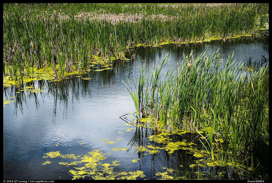
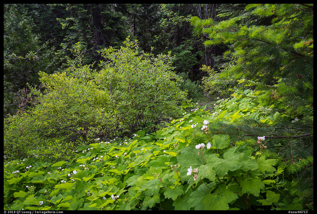
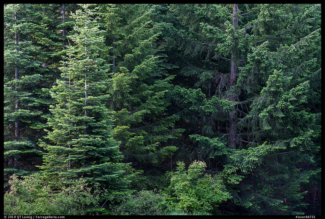
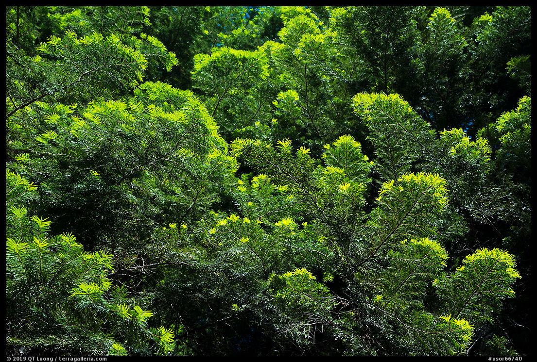
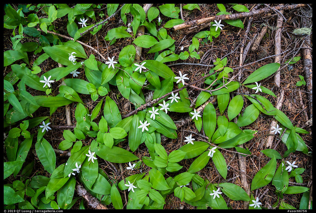
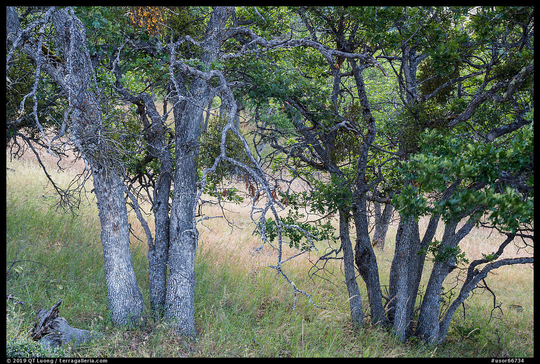
There is, of course, much more to the monument than Pilot Rock. The Pacific Crest Trail (PCT) traverses the monument, and is its main hiking trail. It can be accessed at several points, and a short hike will reveal how much diversity is found in those green woods.
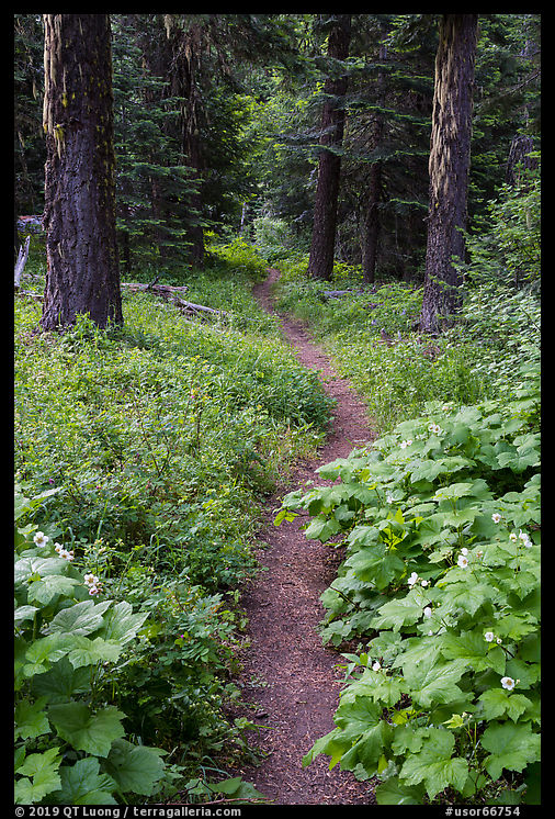
In the next post, although Pilot Rock will remain in our sights, I write about other favorite locations I stumbled upon during my visit. In the while, here are a few vignettes from the deep green tapestry that is Cascade Siskiyou National Monument.
(To be continued)


Great article Tuan! Thanks for covering the Cascade Siskiyou NM. It was excellent to get out on the trail with you. I love your account of getting to the top of Pilot Rock. Keep up the great work.
Thanks again for the location suggestions, and also for your patience with me while you were shivering from those unseasonable temperatures.
Glad you had an opportunity to explore our “Standing Stone” it has a local brewery inspired by it. Even better is that you got connected with Sean Bagshaw our local photographer extraordinaire. That final ascent is very intimidating and takes a few times before the comfort level kicks in. I once ventured off a side route and got into an exposed area that was so unnerving I almost threw my tripod off the rock to get a better grasp.
You inspire me to go back for more photo ops.
The folks that worked toward getting it the Monument status showed me more nearby areas.
A good one is Pilot Rock in the foreground and Mt. Shasta in the distance.
What a great area to have as home!
Thanks for your work.
Jim
Thanks Jim for the comments, Ashland looks like a great place to live, and you certainly have a beautiful “backyard”.