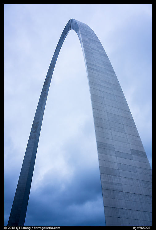
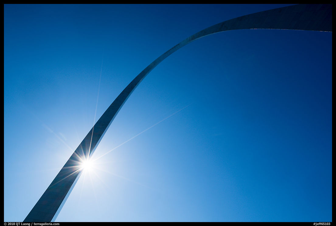
Gateway Arch just became America’s 60th national park. Following my visit to
photograph it, I elaborate on why it is an odd choice, try to understand why and how the name change happened, and voice my personal opinion about the new name.
Why was Jefferson National Expansion Memorial renamed Gateway Arch National Park?
In the 1930s, St. Louis attorney Luther Ely Smith spearheaded a local movement for a memorial site and
convinced Franklin Roosevelt to establish it by presidential proclamation in 1935. Since then local politics and funding have guided the development of the memorial. The recent name-change proposal originated again with a community partnership, this time including the city of St. Louis, Bi-State Development, Gateway Arch Park Foundation, Jefferson National Parks Association and Great Rivers Greenway. It was embraced by the national politicians from Missouri in a bipartisan way. In the summer of 2017, they introduced legislation to change the name in Congress as
Gateway Arch National Park Designation Act S. 1438 and
H.R. 3058.
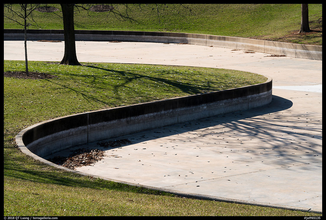
The timing is not coincidental. In 2010, a design contest took place to “re-envision the visitor experience” of the grounds. The winning firm brought back Saarinen’s original master plan, which included a continuous park linking Gateway Arch and the Old Courthouse. In addition, the museum below the Arch is expended and given a new western entrance, and other improvements take place along the river and north side. The renovation, which is the most significant alteration of the grounds since the Arch was built, will be completed in time for a July 2018, grand re-opening of the museum. The project cost $380 million, including $221 million raised from local business interests by the Gateway Arch Park Foundation. With that much money spent, the majority of it from private sources, it is not surprising that someone associated with the fundraising would want to mark the renovation in a lasting way:
this new name will best reflect the magnificent renovations and visitor experience we will unveil in a few months
The name change has two components: “Jefferson National Expansion” replaced by “Gateway Arch” and “National Memorial” replaced by “National Park”.
Why “Gateway Arch”?
The primary reason for the name change was that the memorial is effectively known as “Gateway Arch” to most visitors. The name Jefferson National Expansion Memorial, quite a mounthful, never stuck with the locals, nor did it connect with St Louis. It could be that “Jefferson” became less than important than when the memorial was established, because in 1943, the Thomas Jefferson Memorial was built in the Capitol Mall in Washington, DC. Rather than memorializing Jefferson, the Arch celebrated his main contribution to the westward expansion, the Louisiana Purchase.
While it sounds more recognizable and familiar, the new name of the park substitutes what is being memorialized (the National Expansion, Thomas Jefferson and St Louis’s role in it) for the physical symbol that represents it (the Arch), and now omits the function of the park (to memorialize). It looses the meaning of why the Arch was built and turns it into another structure, celebrating the Arch rather than its reason for being. Simplicity was traded for seriousness. Over the course of my visit to the park, I asked a number of rangers what they thought of the name change. The most supportive answer I heard was “I have no opinion”, and the most frequently voiced was that abandoning the old name diminished the park.

Why “National Park”?
Name change proponents made the case for “Gateway Arch” but not for “National Park”. The only justification for the “National Park” component of the name that I found is in the
National Park Service press release, incidentally, a document that contains a curious (revelatory?) slip in its title: “Jefferson National Expansion Memorial Renamed Gateway Arch Park”:
better communicating to the public its status as a national park
However, making clear the connection of the site with the National Park Service (NPS) is not a reason specific to the Arch, and would call for renaming all the NPS units “National Park”. All the documents related to the name change are silent about the park’s merits.
By contrast, when other NPS units were promoted to “National Park”, that upgrade was a big deal, and often the result of a campaign just to do that based on the park’s merit. As an example H.R.3641 – Pinnacles National Park Act devotes 4 long paragraphs – findings (2) to (5) – to emphasize what makes Pinnacles unique, and H.R.1488 – Indiana Dunes National Park Act uses no less than 14 findings to establish the merits of the area.
Recently, the goal of the other name upgrades has been to bring more recognition and visitors, and an eye towards local economic benefits. As an example, Rep Sam Farr stated in his floor speech advocating for changing the name of Pinnacles National Monument to Pinnacles National Park:
the new national park designation would strengthen the region’s economic and tourism potential… Pinnacles National Monument has not yet realized its full potential to reach locals and tourists… By elevating its stature to a national park, I believe that more visitors will come through our restaurants and businesses and more visitors will stay overnight near the park.
Legislation usually doesn’t emphasizes tourism, yet the words “economic and tourism potential” appear in the text of the
HR 3641 Pinnacles National Park Act. Moreover, at the official
ceremony to celebrate the establishment, Secretary Salazar highlighted
the economic importance of Pinnacles, which welcomed more than 343,000 visitors last year who spent an estimated $4.8 million and supported 48 jobs in the local economy
The same arguments are found within the campaign to rename Indiana Dunes National Lakeshore to Indiana Dunes National Park. However, I could not find a written reference to economic benefits in the case of Gateway Arch. As the top attraction in St Louis, and an internationally recognized American icon visited by more than two million each year, it is not clear if a designation change makes a difference.
Could it be that this redesignation was just an accidental byproduct of the primary name change? Maybe the fact that Gateway Arch is not the entity being memorialized led to removing the “Memorial” designation. What were the possible replacements? The preference of the National Park Service, was for “National Monument”, which they thought was consistent with the size of the grounds and the example set by another American icon, the Statue of Liberty. “Monument” would have certainly described the park appropriately. Is it possible that the
administration’s evisceration of national monuments had devalued the designation in the eyes of the decision makers, therefore leading to the change from National Memorial to National Park instead?

Should Gateway Arch have been named a national park?
The NPS manages 417 park units, but there are only
60 national parks, which
makes “National Park” an exclusive designation, one which has to be approved by Congress. Those are our most special places. Does the name appropriately recognize the merits of the park? In a
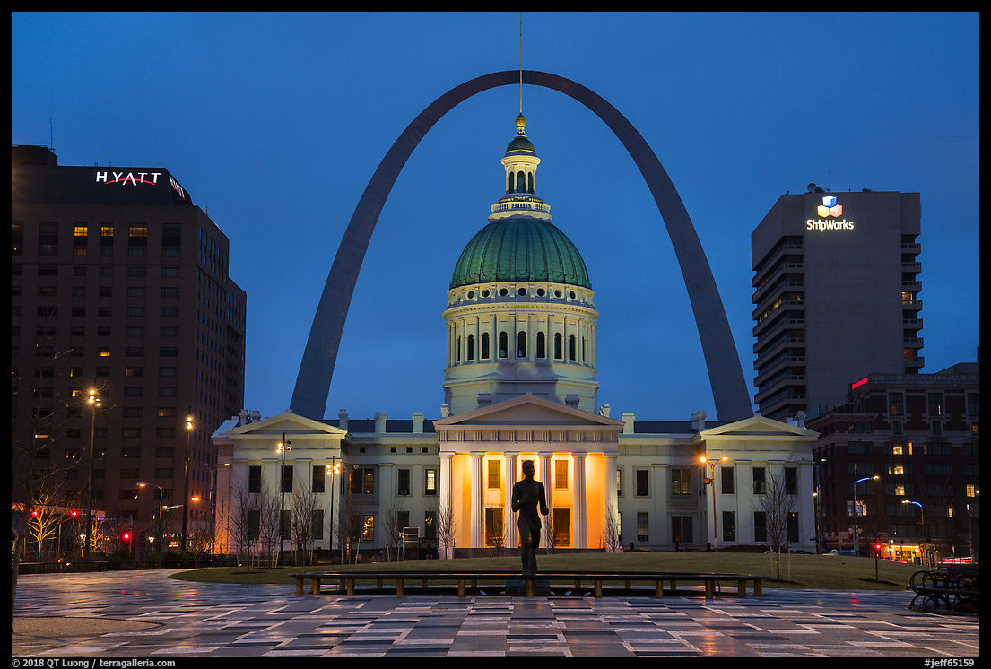
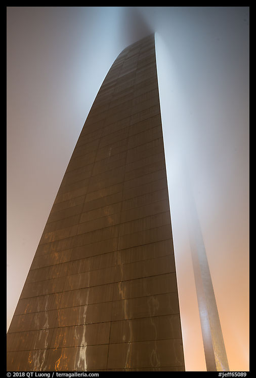
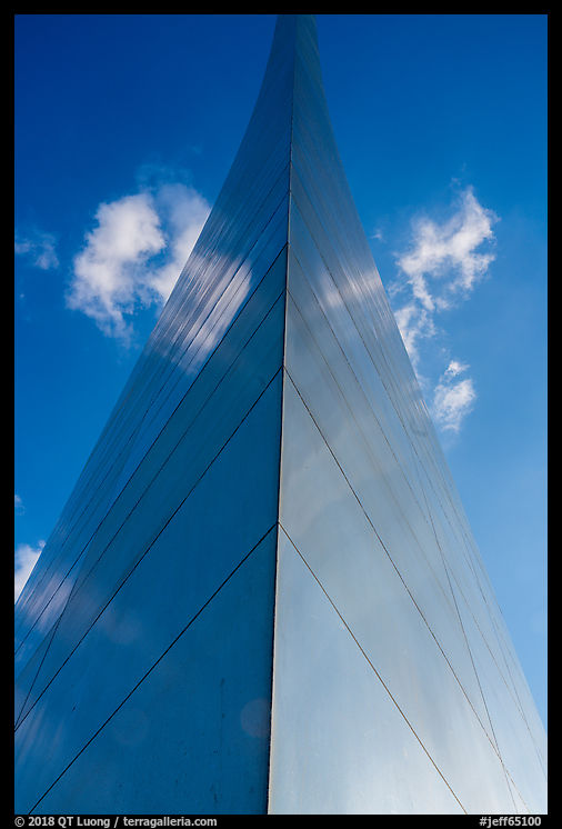
previous post, we saw what makes the Gateway Arch and its grounds one of the standout places in America, but again, that was not argued by the proponents of the name change. On the other hand, it is quite evident that Gateway Arch stands apart from other national parks such as Yellowstone or Yosemite.
According to the NPS nomenclature:
Generally, a national park contains a variety of resources and encompasses large land or water areas.
First, while the size of the Arch makes it an impressive monument, the size of the grounds is diminutive for a national park. Gateway National Park’s area is 0.14 square miles (91 acres). For comparison, the next smallest national park, Hot Springs National Park, at 8.6 square miles is about 60 times larger, and the average area of the 59 other national parks is 1,375 square miles. Second, while a few of the existing national parks – Mesa Verde, Hot Springs, Dry Tortugas – are centered around a man-made resource, none is 100% man-made, unlike Gateway Arch National Park, which was built on forty razed city blocks acquired by the Federal Government by eminent domain.
Hot Springs National Park comes the closest to Gateway Arch National Park, in that both do not encompass large areas, are located in a city, and are centered around structures. Both feature some man-made landscapes, with Dan Kiley’s design being more noteworthy than the Grand Promenade. On the other hand, amongst their historic structures, Bathhouse Row is more unique than the Old Courthouse. Hot Springs has 26 miles of trails and a campground. The scenery includes southern hardwood forests, hills, rock formations, and a gorge with a stream, but it is undistinguished, and the main natural resource is the hot springs system. Gateway Arch has, well, the Arch. Hot Springs has an older history both as a site and a protected area, but no memorial or national historic site had been promoted to national park before Gateway Arch. I consider the two parks to be roughly on the same level, oddities amongst the other national parks. The word “generally” in the NPS definition was precisely there to allow for such exceptions, and I find that they spice up a bit the system, as long as they remain just that, quirky exceptions. Given the push to develop a NPS system that tells an inclusive story of America, it is conceivable to include one 20th-century landmark amongst the national parks, and if so, I cannot think of a better choice.
However, I can only hope that this exception doesn’t become the rule, and open the door for more national parks in the same vein. There are already quite a few questionable national park proposals at different stages of the legislative process, such as this and
that. Approving them would water down the land conservation ideals that led to the creation of the national parks, dilute the “national park” brand, and eventually make the designation meaningless.
How did that happen?
The National Park Service does care about the distinction between national parks and other units. The acting NPS director stated in July 2017:
We believe that the Jefferson National Expansion Memorial is too small and limited in the range of resources the site protects and interprets to be called a national park.
Members of Congress and in particular the Missouri delegation thought it appropriate to overrule the NPS on behalf of the local community. As locally elected politicians, representatives and senators have to advance local interests, while by definition national parks are of national significance. In our case, maybe the decision was caused more by a limited understanding of the NPS system than a desire to benefit local communities, compounded by the absence of clear guidelines. The later problem was identified in this 2013 CRS report:
Today, there are more than 20 different designations (i.e., titles) for units of the National Park System, reflecting the diversity of the areas. There is no statute that sets out and defines all the designations, and Congress has discretion in choosing the type of designation for a unit being established.
The bill passed in the U.S. Senate on Dec. 21, 2017, and U.S. House of Representatives on Feb. 7. It was signed in law by President Trump on Feb 22. Such an approval did not have to be automatic. In 1929, Congress passed a bill to create a national park in the Ouachita Mountains of Arkansas, part of the oldest National Forest in the southern United States, but President Coolidge listened to recommendations from the NPS and vetoed it.
The St Louis newsweekly Riverfront Times
muses that this might go down as the “least controversial move of Donald Trump’s presidency”, but yet it manages to be the most controversial of the NPS names.
Gateway Arch National Park is such an odd sheep that the main reaction I’ve seen from my informed audience is perplexity. Among the general public, most people do not know or care about the meaning of the national park designation, however, I hope that this name change awakens them to the idea of merit for national parks. Then, maybe legislative changes, such as a statute defining the designations or vesting authority to the NPS could be possible. Do you agree?

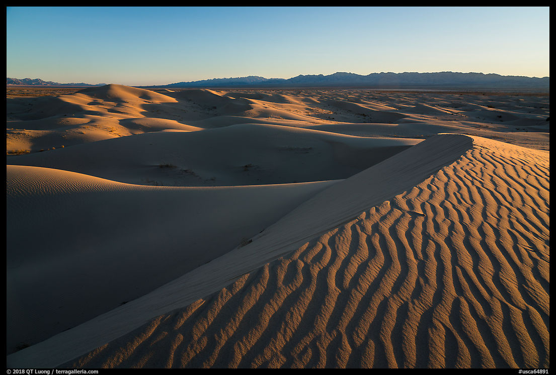
See more images of Gateway Arch National Park
Part 3 of 4: 1 | 2 | 3 | 4