Carrizo Plain Beyond the Superbloom
No Comments
Most people in California had not heard about the Carrizo Plain until the mid-2010s when media widely publicized the superbloom. This year, you’ll be lucky if you even see a few flowers. Due to scarce winter rains, in March the plain looked brown, instead of the green you’d expect in the spring. However, the area is unique and rich enough in natural resources that there was once a proposal to nominate it for a UNESCO World Heritage Site. This post does not even touch on cultural resources, which range from milenia ago to 20th century history. Even without flowers, Carrizo Plain is still amazing, and you won’t have crowds to contend with!
Carrizo Plain National Monument protects a unique ecosystem centered around the most extensive native grassland remaining in California, providing habitat for many plants and wildlife, including the highest concentration of threatened or endangered species in the state. The flat plain enclosed between two mountain ranges, with its vast open space, alkali lake, absence of trees, and summer heat, evokes a mini-Death Valley. Compared to surrounding areas, the Carrizo Plain is relatively dry, receiving less than 10 inches of annual rain. Most of it falls from November to April, with winter temperatures cool but usually above freezing. The monument’s claim to fame is the superblooms, but they only happen in years with perfect conditions, and the peak lasts about three weeks in the window between mid-March and the first week of May. Summers are dry and warm, with daytime temperatures above 100F possible.
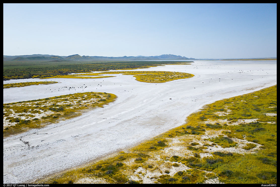
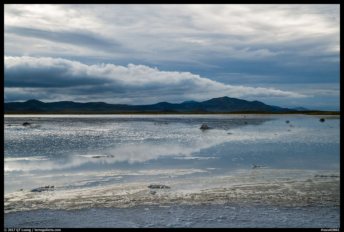
Soda Lake
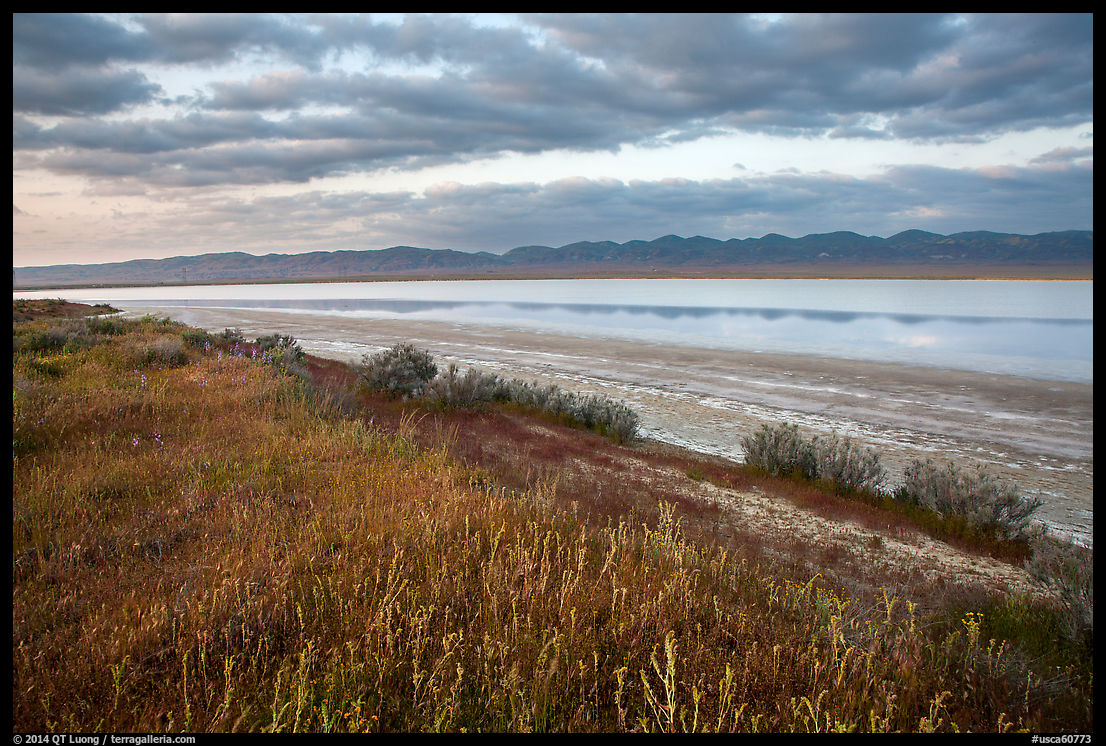
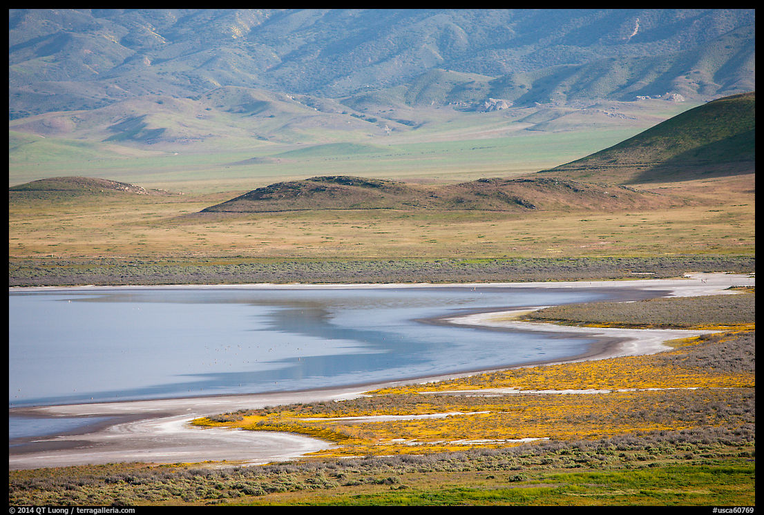
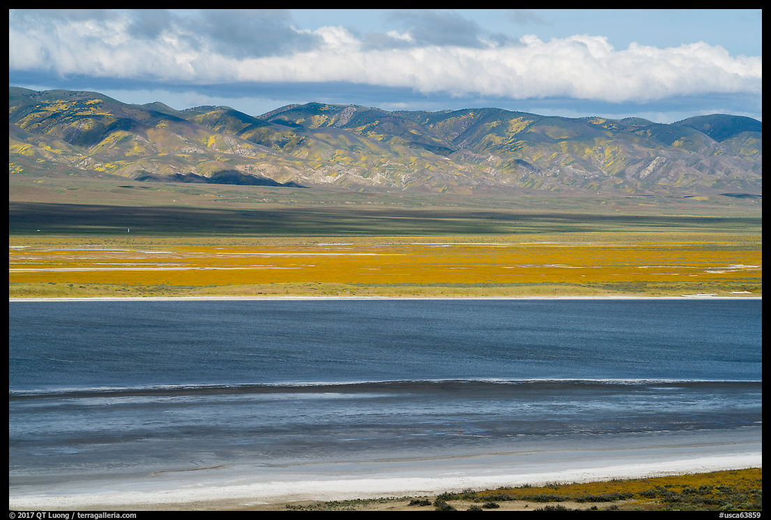
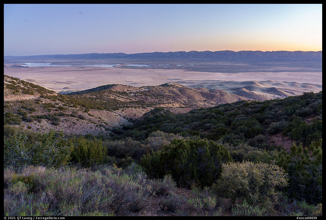
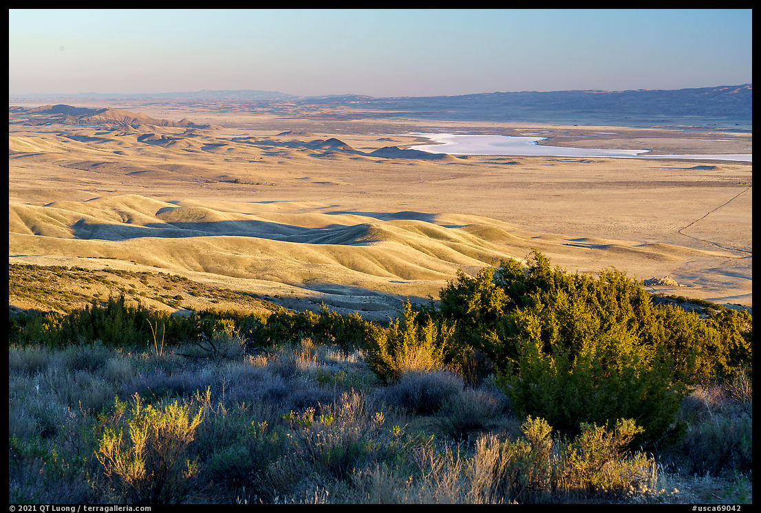
Soda Lake is one of the main natural features of the Carrizo Plain. Further east, there are plenty of basins where water does not drain to an ocean. However, Carrizo Plain is the only closed basin within the coastal mountains, and Soda Lake is the largest remaining alkali wetland in southern California at 3,000 acres. When water evaporates, the lake concentrates white deposits of sulfates and carbonates that look like baking soda. My children found out the solid appearance is deceiving when the glistening surface did not hold their weight, and they sank in the mud to my wife’s displeasure who subsequently threw out their shoes in the trash. A boardwalk allows visitors to take a close look at the lake without ruining their shoes. Overlook Hill offers higher views of the lake from which I observed its appearance vary dramatically with precipitation. Late in the season, or during a dry year like 2021, it looks like a solid sheet of salt. On wet years, winter rains fill the lake, offering an important refuge for migratory birds. At the same mid-April date, in 2010, I saw more salt than water, whereas in 2017, a superbloom year, it was the opposite.
San Andreas Fault
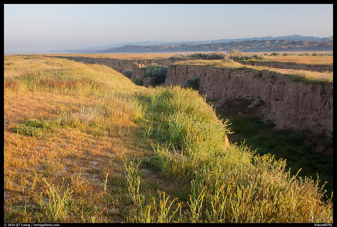
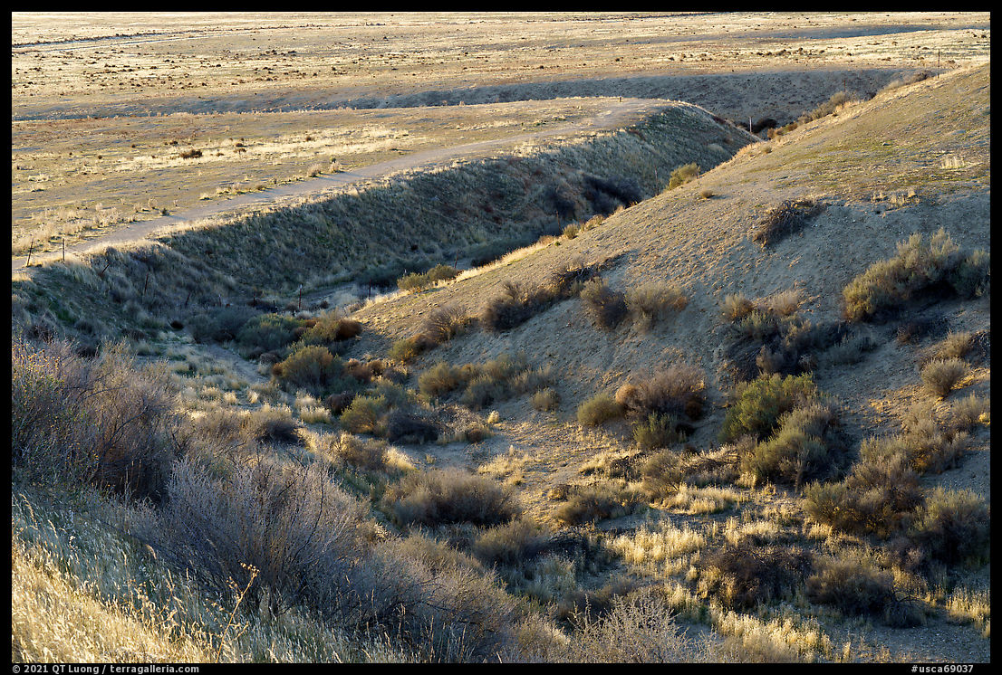
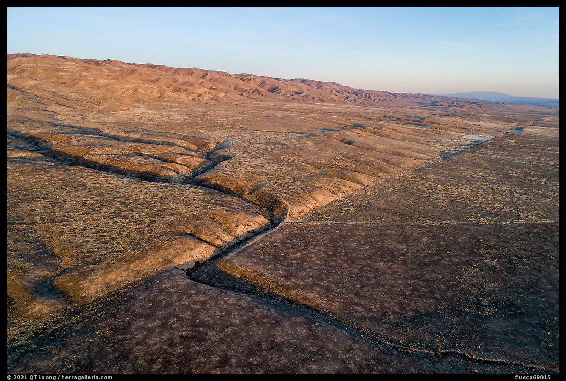
The San Andreas Fault is the other main natural feature of the Carrizo Plain. A fault is a fracture in the Earth’s crust where sides have moved in relation to each other. While the fault stretches for 700 miles from the Salton Sea to Cape Mendocino, its section in the Carrizo Plain is the oldest along the entire length, and the barren character of the plain makes it easy to observe. While it spans the whole length of the monument, at Wallace Creek, an interpretive trail (1.3 miles) takes you to one of the most important geological sites in the world. In 1857, the strongest earthquake in California’s history took place there. Spanish travelers described it as ripping a deep gash across the plain as far as the eye could see. Even though erosion has covered the tear, you can still directly see the cumulative effect of earthquakes on this landscape. Wallace Creek used to flow straight down the hill across the fault with no bends, but the San Andreas Fault movement has offset its course. The San Andreas Fault is the boundary between the Pacific and North American tectonic plates. Each side of the fault has been sliding laterally in opposite directions, with the lower side moving towards the northwest (left in the aerial picture below). As a result, Wallace Creek’s segment downstream of the fault is no longer aligned with the upstream segment, it is offset by 430 feet. This phenomenon is called a stream offset, and Wallace Creek is one of the best examples anywhere. By carbon dating rocks, scientists have concluded it is 3,800 years old, therefore inferring the plates’ relative motion is on average 1.3 inches per year – similar to the growth rate of a fingernail. All the motion occurs during large earthquakes every few hundred years, for example, 26 feet during the 1857 earthquake.
Caliente Ridge
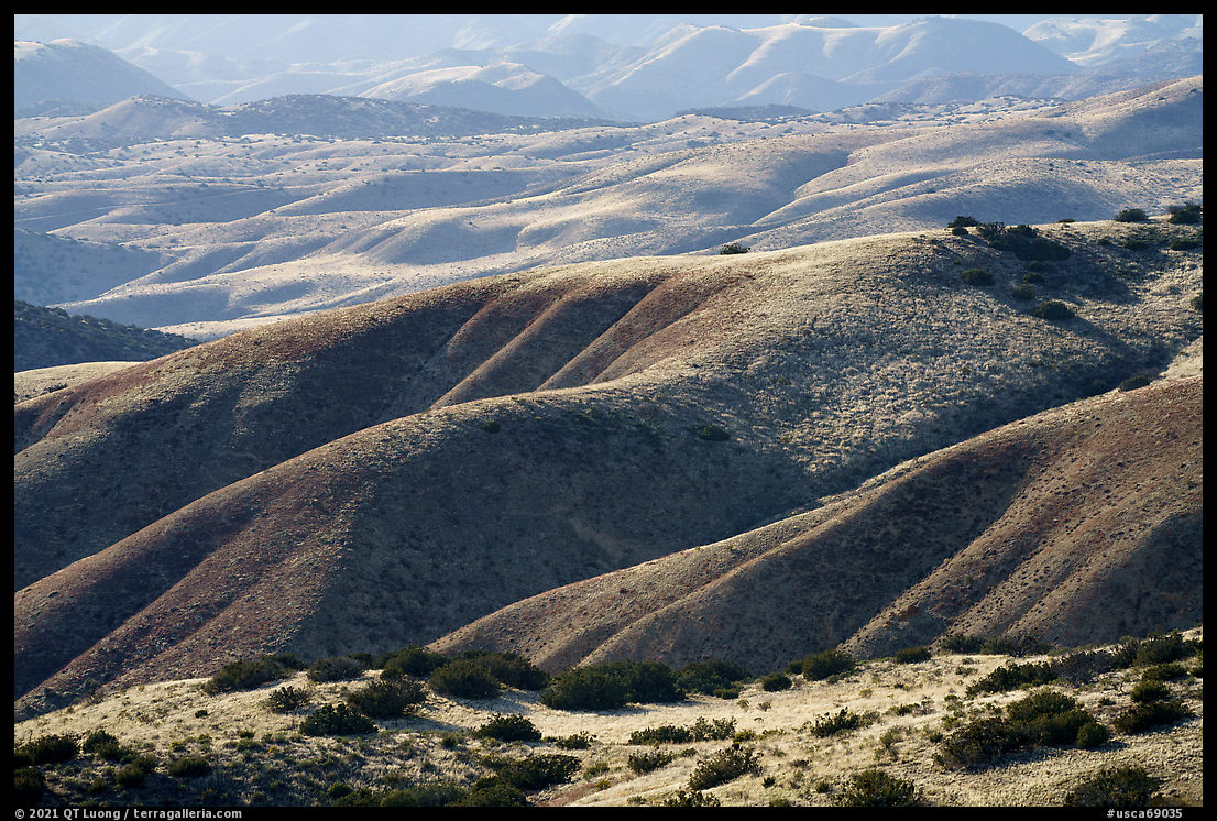
Caliente Range forms the southwest boundary of Carrizo Plain. The only long (17 miles round-trip, 2440’ elevation gain) established trail in the monument follows Caliente Ridge to Caliente Mountain (5100 feet), the highest point in the Caliente Range. Juniper trees confer an ambiance distinct from the Temblor Range. Since they provide no shade, it is best to undertake the hike in the cooler months. The wide and gradual trail offers excellent views of Carrizo Plain on one side and Cuyama Valley and Los Padres National Forest on the other side. As they do not change much, you could turn around at any point for a shorter hike. Even the drive to the trailhead alone provides high views – and scenic dispersed campsites. The narrow and rutted Caliente Ridge Road twists and climbs steeply for three miles from the abandoned Selby Ranch. During periods of rain or snow, the road could be hazardous and may be closed.
More tire fun
I had no problems with my Prius driving the road up and down twice a day. However, the next day, after pulling out at a dispersed campsite for a sunrise photograph, I immediately noticed a tire flat. That was very upsetting and demoralizing since on that trip, I had strived to drive slowly and carefully to try to avoid having yet another flat. Once I finished my photography session, I thought it would be a quick matter to change the tire. There was little clearance between the jack point and the ground, but it was hard-packed dirt, so I didn’t anticipate any problem. However, as the jack came to near full extension, it slipped sideways. I proceeded to try again, with the same result. The jack slipped, and the car crashed down. Since it was hard work to lift the car, for the third try, I thought it piled a few rocks next to the jack. The idea was that if the jack were to slip, the car would rest on the rocks, hence I would not have to lift it from the ground up. It wasn’t a good idea. The jack slipped and became stuck between the car and the rocks. Since the morning, I had not seen anybody on the road. To free the jack, my only option was to dig a hole from sideways and reach underneath it. Did I say the ground was hard? I didn’t have a shovel, but fortunately, I had packed a mountaineering ice-ax. With it, and a backpacking trovel, it took me an hour to dig a hole and free up the jack. I figured out that the low-clearance spot was forcing it to work near full extension, so I moved the car to a higher-clearance spot where there would be less stress, and this time I had no problems jacking the car up. Although my next destination was Los Angeles, on my way out of Carrizo Plain, instead of exiting via the south as initially planned, I exited via the north to minimize driving on dirt roads. When I went to a sketching-looking tire shop in Buttonwillow, I was so relieved to see that what had caused the flat was a good old nail. Could have happened anywhere, right?

