Carrizo Plain National Monument Super Bloom
No Comments
Most of the times a barren-looking grassland, the little-known Carrizo Plain came to life thanks to the abundant rains of last winter, to become the site of a “super bloom”, with some of the best wildflower displays I had ever seen in California. Find out where I discovered the best blooms in this vast and beautiful national monument.
Where is the Carizzo Plain?
The Carrizo Plain is a valley enclosed between the Caliente Range and the Temblor Range, located west of the Central Valley and Barkersfield, about a hundred miles north of Los Angeles. The remote land was used for ranching until 1988, when the U.S. Bureau of Land Management, the California Department of Fish and Game, and the Nature Conservancy partnered to protect what was the largest single native grassland remaining in California. In 2001, President Bill Clinton established Carrizo Plain as a National Monument. The place remains little developed and you need to come prepared. There are absolutely no services within fifty miles, most of the roads are unpaved – some can become unpassable when wet, the only accommodations are two primitive campgrounds without potable water, and the visitor center opens only from December to May, Thursday through Sunday. I liked the isolation, remoteness, and opportunity for solitude, at least on week-days. The monument is administered by the the BLM, and unlike in those overseen by the National Park Service, there are less restrictions. You are also allowed to camp anywhere in the foothills surrounding the plain, and drone flights are permitted.
Valley floor wildflowers
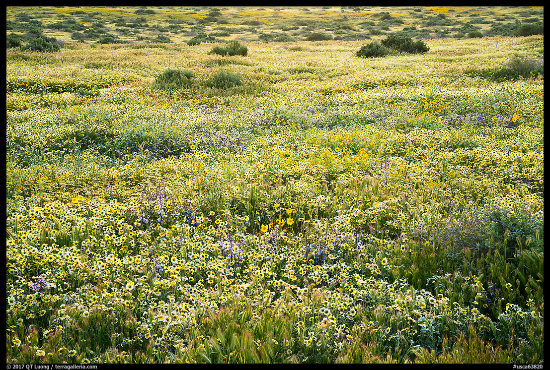
The plain consists of the flat valley floor, which is 50 miles long and up to 15 miles across. It evokes a mini Death Valley with its vast open space, absence of trees and summer heat. However, for a short period of time in March and April, the place comes alive with flowers if winter rains had been abundant. Although last year was supposed to have El Nino conditions, the rains came this winter. This spring, some portions of the plain were covered in carpets of wildflowers so dense that despite my best efforts I could hardly avoid trampling a few.
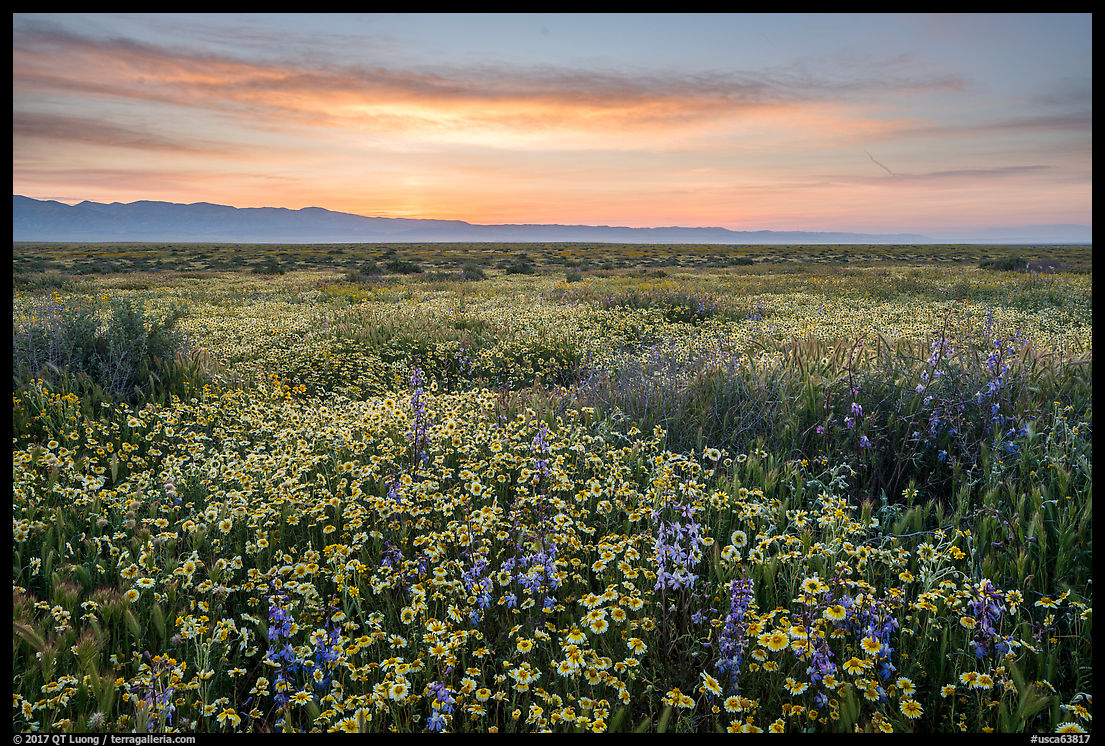
I found some of the most diverse flower mats along the southern part of the Simmler Road, with a mix of tidytips, daisies, goldfields, coreopsis, and phacelia. Wide-angle views gave prominence to foregrounds and helped express the diversity of the bloom, as individual flowers are differentiated. Unlike the California poppies, those flowers fully open without full sun, so I made sure to be there at pre-dawn.
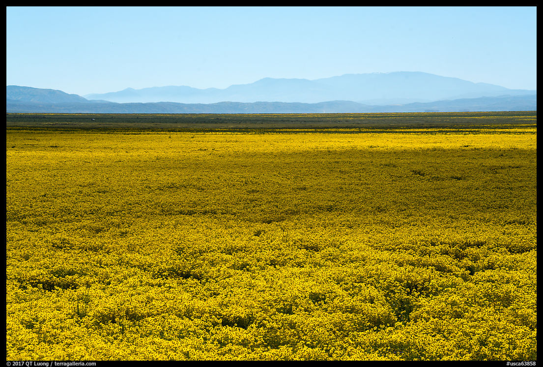
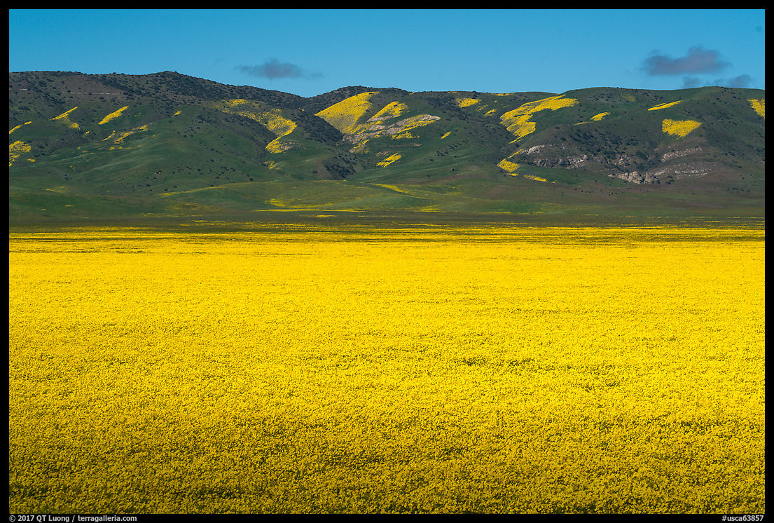
The densest carpets I saw were along the Soda Lake Road close to the Selby Campground. From a distance, the plain at times appeared a solid yellow, and I favored a longer lens to photograph them in order to emphasize the density of the bloom.
Temblor Range wildflowers
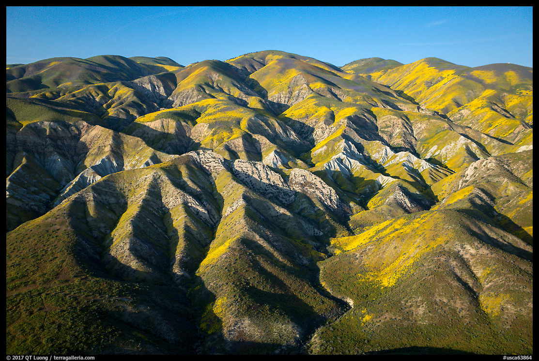
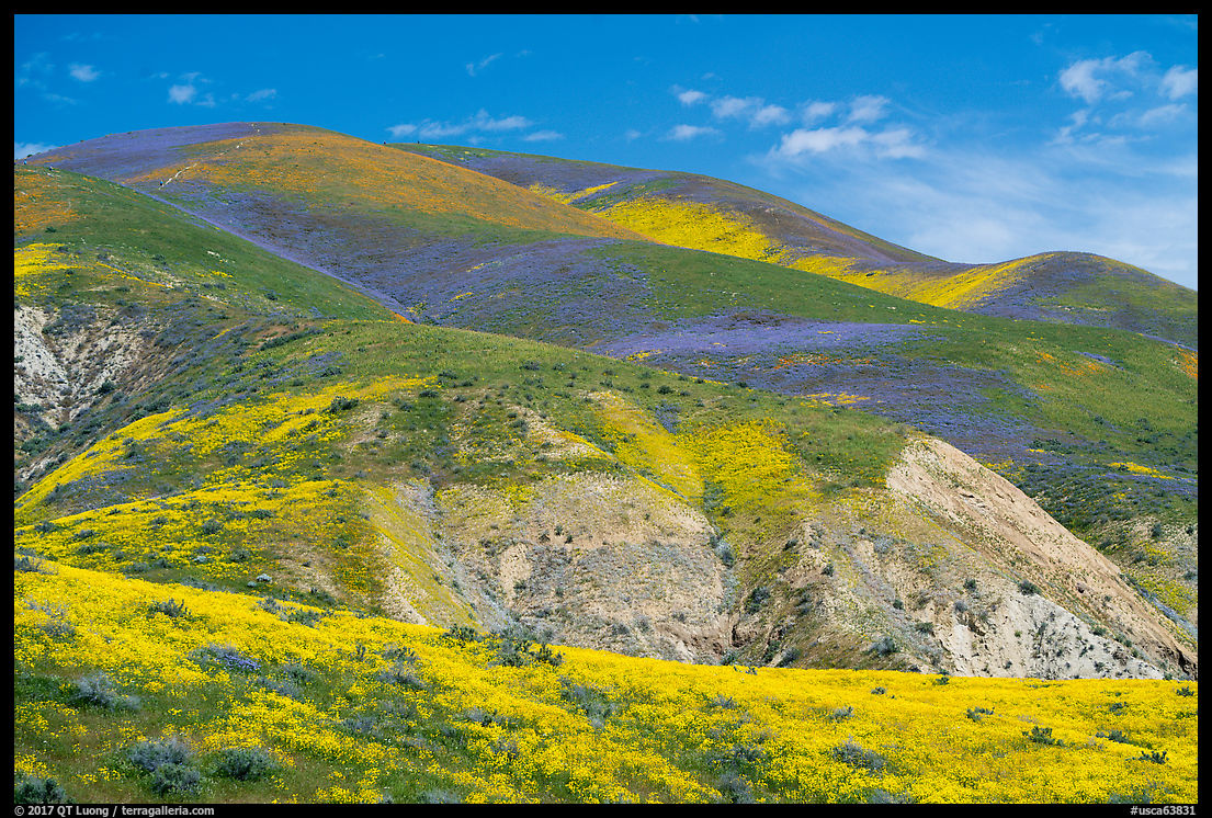
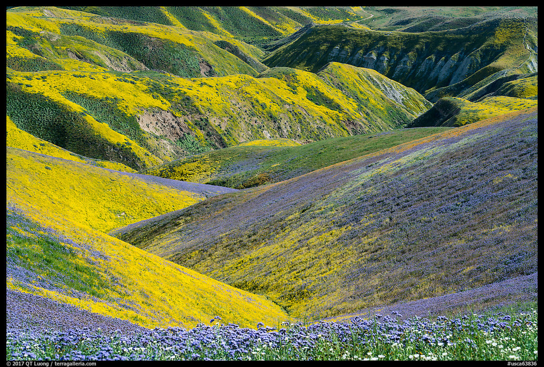
The Temblor Range separates Carrizo Plain from the Central Valley. It consists of rolling hills with an elevation up to 4,000 feet. While the color on the plain often consisted of acres of flowers, the bloom on the hills consisted of patches, but they appeared more colorful from a distance, and I tried to find a way to get closer. Besides the higher elevation, the bloom on the Temblor Range hills appeared colorful and diverse because the flowers there tended to grow in uniform patches rather than mixture of species. From the base, this made the hills appear as if someone had painted them.
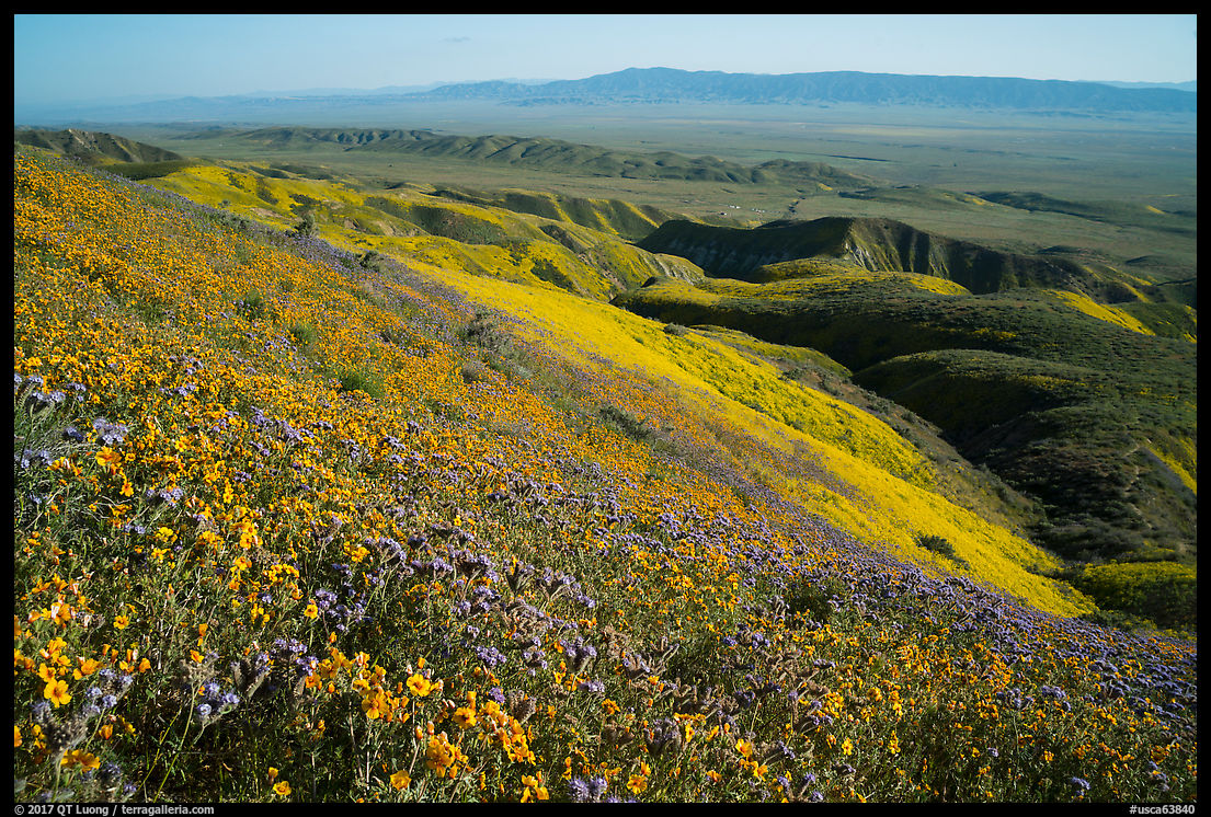
I drove the entire Elkhorn Road, and the most remarkable spot I found was a hill located about four miles north of Hurricane Road. From Elkhorn Road, the hill may appear close, but is a steep 1,400-foot elevation gain in 2 miles via a good user trail that starts at a gate. The views over the plain and diversity of angles made the effort worthwhile.
From a distance, I assumed that the orange flowers would be California Poppies, but they turned out to be the less common San Joaquin blazing stars. Yellows were mostly hillside daisies, and purple phacelia. I visited in mid-April 2017. The color was still bright, although the peak must have occurred a few weeks earlier.
My friend told me that crowds were huge during the week-ends, with lines up to half-an-hour for the two bathrooms at the visitor center. A few years back, I hardly saw anybody. There is more to discover in Carrizo Plain than wildflowers. The Carizzo Plain National Monument extends for 390 square miles, larger than half of the National Parks, but the boundaries of the monument are quite natural, as they follow the valley and surrounding mountains.
The other side of the Temblor Range includes the huge Kern County oil fields, which are the third largest in the country – the cover image of Burtynsky’s Oil was photographed there. This has led some to speculate that there might be some potential for oil there, but in decades past, drilling there had never been commercially viable. Despite that, Carizzo Plain National Monument is one of the national monuments under review. I hope that the photographs on this page help make the case that this beautiful land is worth protecting.
More pictures of Carrizo Plain National Monument

