Two Peaks in San Gabriel Mountains National Monument
No Comments
San Gabriel Mountains National Monument is recent, been having designated by President Obama in October 2014. This, combined with its relatively large size (346,177 acres or 541 square miles), has made it a target for the Trump administration’s “review” of national monuments. However, the San Gabriel Mountains are long-established recreation grounds for the second largest metropolitan area in the United States. Compared to even Santa Rosa and San Jacinto Mountains National Monument, the longest-established (October 2000) of the national monuments described in this series, San Gabriel Mountains National Monument is very developed, with ubiquitous roadside pullouts, picnic areas, trailheads, campgrounds, and even a ski area.
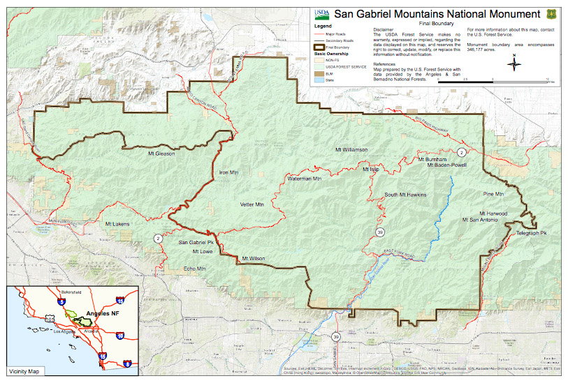
(click on map for larger version)
Mount Baldy (aka Mount San Antonio)
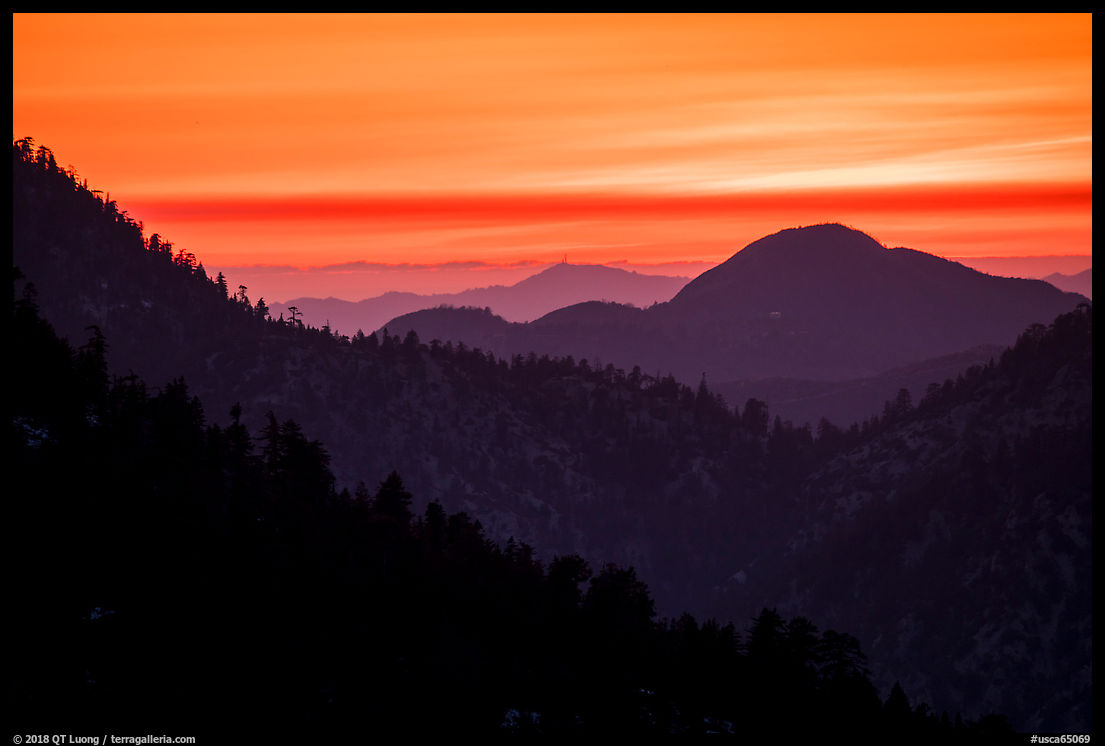
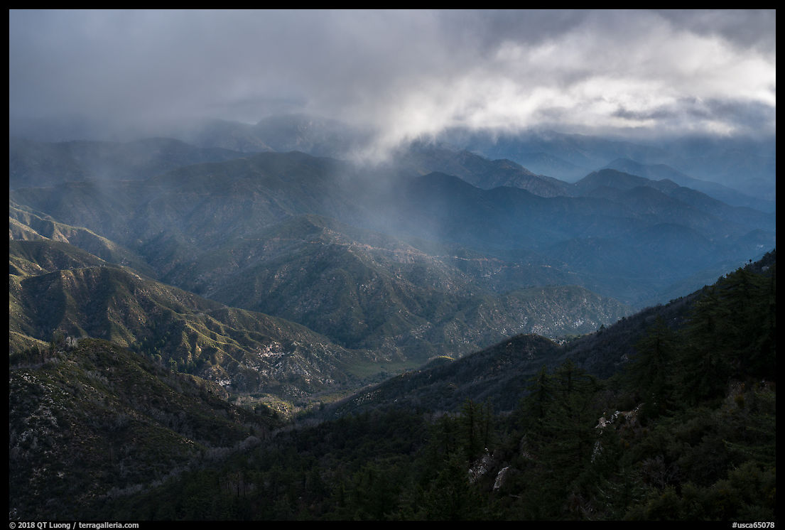
Highway 2, the main artery into the monument, is a spectacular drive that lives up to its name Angeles Crest Highway, offering views both towards the desert to the north and towards Los Angeles to the south. It has many curves, so driving its entire length takes more time than one would expect at first. My favorite section of the highway was the area west of the ski resorts on the flanks of Mount Baldy, and in particular near the Pacific Crest Trail. That section can be closed by snow in winter, and Google Maps indicated a road closure, throwing a wrench in my plans. However, that information turned out to be incorrect, so always better to check with a local source!
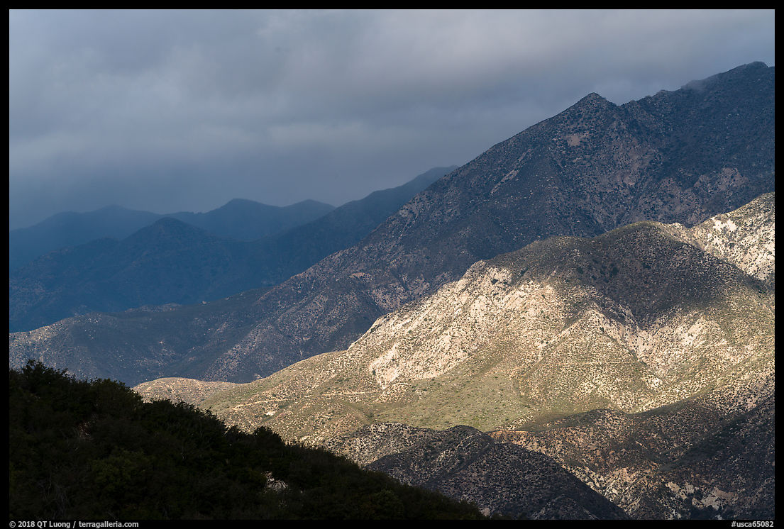
In that section, you can find views of Mount Baldy, the highest peak in the range, rising above 10,000 feet. Although I generally try to avoid image compositing, I had to use focus stacking for this image, merging digitally three images each focused at a different depth in order to render the foreground and background equally sharp. I chose a focal length of 60 mm since a wider lens would have rendered Mount Baldy too small. Longer lenses have less depth of field than shorter lenses. With the foreground just a few feet away, I wouldn’t have been able to render sharply both the desert plants and the mountain even by stopping down to f/22.
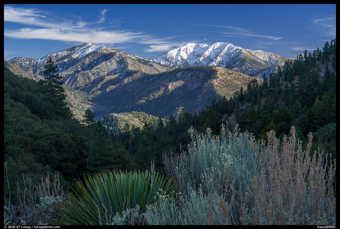
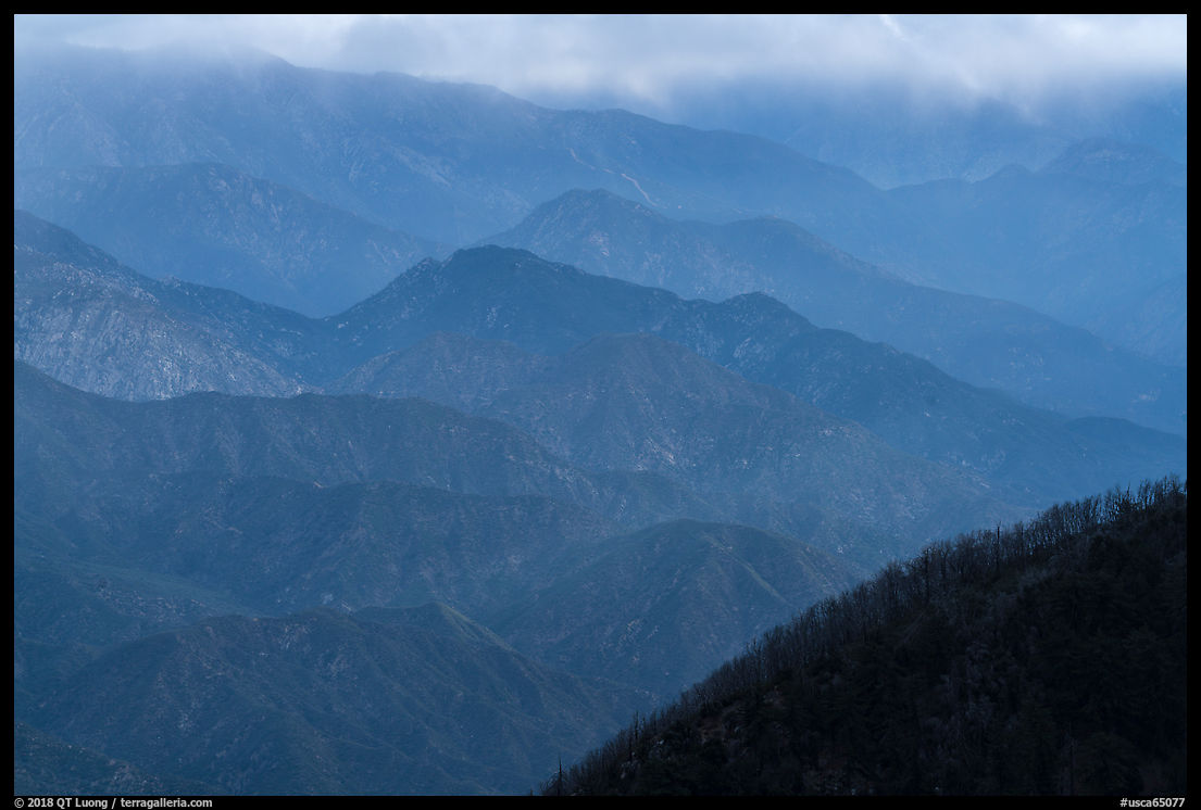
Prior to making the previous photograph from the edge of a parking area, I had to clean out the foreground extensively, since it was marred by beer cans and all sorts of trash. I also chose a lower camera placement so that the shrubs on the right would hide a trail, which is still partially visible. The downside of the development is that for a landscape photographer, it is difficult to exclude man-made features such as roads or power lines from compositions. I framed those ridges with a telephoto lens (140 mm) not only to compress the receding ridges but also because with a wider field of view, a man-made feature would have intruded.
Mount Wilson
Mount Wilson has a relatively modest altitude of 5715 feet but is famous because located near its summit, Mount Wilson Observatory is a place where Edwin Hubble and Albert Einstein conducted research. The 100-inch (2.5 m) Hooker telescope was the world’s largest telescope from 1917, when it was constructed, to 1949. The observatory opens at 10 am, but by using a drone at sunrise, I was able to capture the position of the observatory above the Los Angeles basin, something which wouldn’t have been possible from the ground.
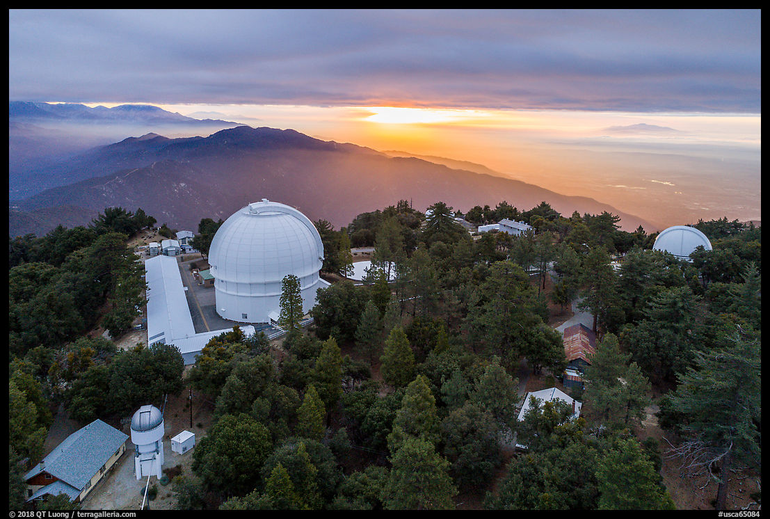
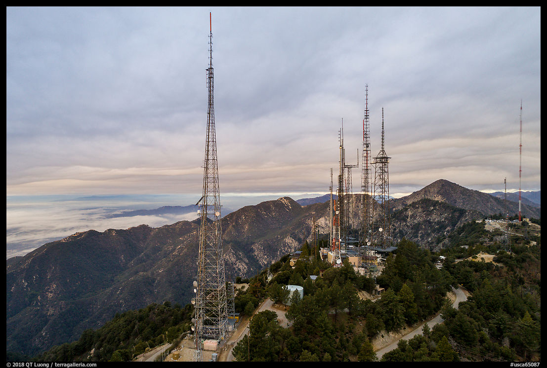
The summit of Mount Wilson is occupied by a large antenna farm. The road, located at the base of the antennas, is too close to them for a good perspective, a problem that was again solved by drone photography.
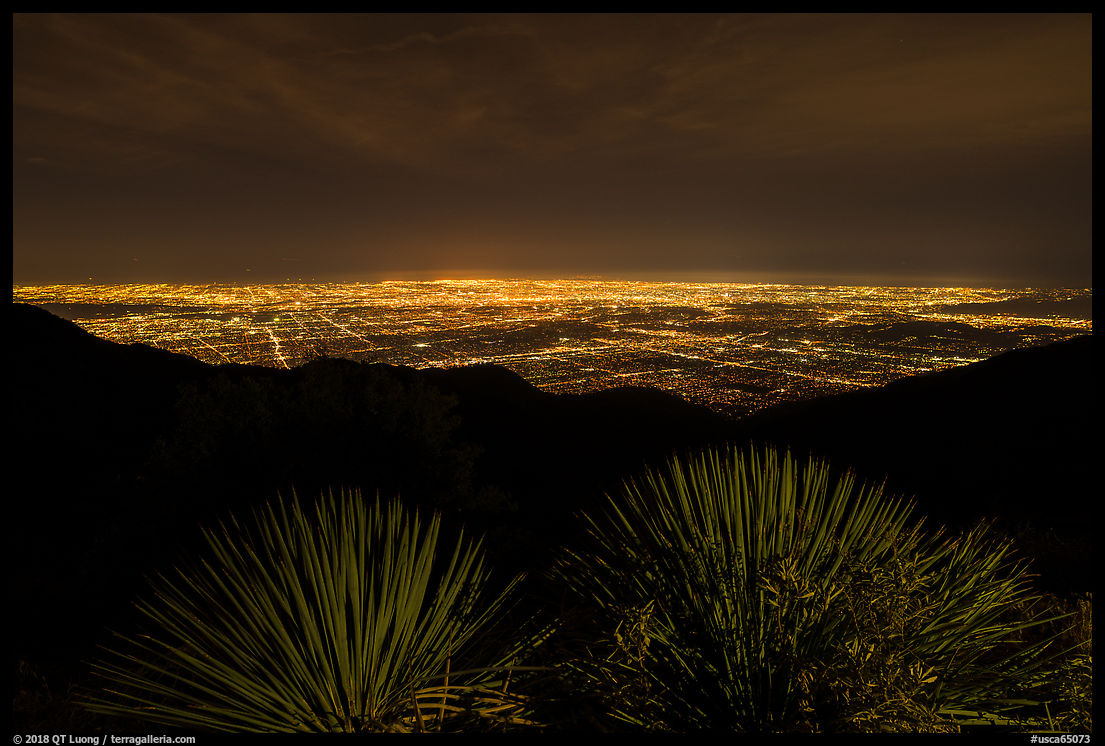
Since the mountains are at the edge of the Los Angeles Basin, the city is visible in many of the views looking towards the south, if only in a distant way. On the other hand, Mount Wilson is directly overlooking the city. A road circles the summit. It is open twenty four hours a day, and I found the most spectacular time to be at night, when the lights of the city shine brightly. To connect the city and the mountains, I used a lantern to illuminate the plants in the foreground, and its brightness control was very useful for matching the lights of the city.
Beyond the two peaks
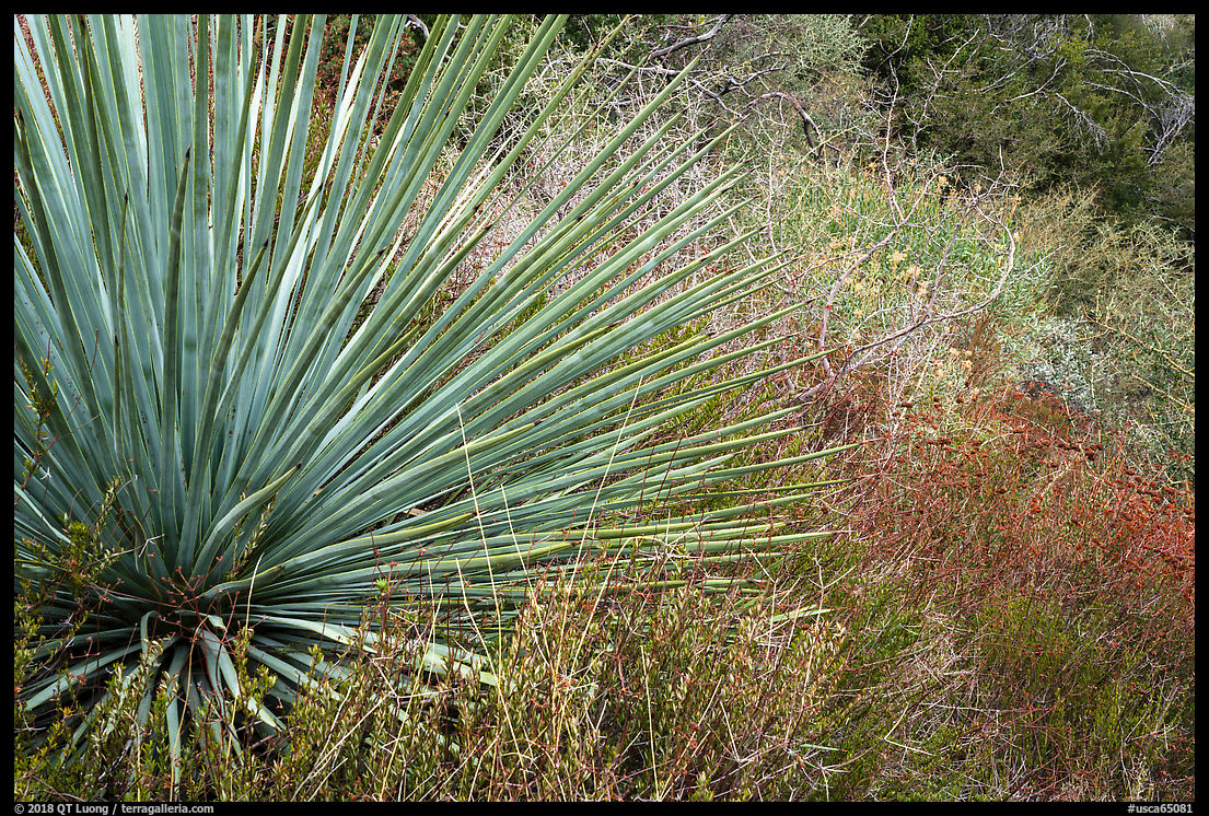
In this post, I’ve just highlighted two contrasting peaks. However, the natural habitats in the San Gabriel Mountains extend from the Mediterranean ecosystem found in only 3 percent of the world to conifer forests.
Despite their proximity to the city, the San Gabriels are vast, tall, and rugged mountains with dramatic topography. They are the backyard of 13 million, some of which outdoors people who have spent their whole lives exploring there. The 10,000 feet elevation of Mt Baldy is all the more significant because the peak rises almost from sea level in the Los Angeles Basin, and the same is even more true of San Jacinto Peak and San Gorgonio. They are big mountains close to large urban areas.
See more images from San Gabriel Mountains National Monument
Part 5 of 5. 1 | 2 | 3 | 4 | 5

