In Search of a High Viewpoint over Great Sand Dunes: Mount Herard
2 Comments
Possibly the most rewarding destination in Great Sand Dunes National Preserve, Mount Herard offers to off-trail hiker fantastic views over the the Sangre de Cristo Mountains and the dune field. Read more about this seldom-visited peak, and find detailed directions to navigate to the summit.
There are no established trails in Great Sand Dunes National Park and Preserve that give good views of the dune field from higher. One can find such a view slightly outside the park, at the Zapata Falls Recreation Area, 8 miles south of the national park. You can photograph right from the edge of the parking area. More varied forest foregrounds are available near the waterfall (1 mile RT), if you are willing to scramble a bit on the slopes above. However, the dunes are a bit distant from there and the perspective reminiscent of the entrance road.

Although information about hiking up Mount Herard – the prominent 13,345 feet mountain that dominates the dune field – is scarce, I figured it out that the summit would provide a more striking view. Mount Herard is of modest elevation by Colorado standards, but it soars a full mile above the Great Sand Dunes.
Starting from half a mile west of Medano Pass – reached through the Medano Pass Road (an adventure by itself), a trail reaches Medano Lake (8 miles RT, 2000 feet elevation gain). The lake is situated in a dramatic cirque of mountains below Mount Herard. From there, the summit of Mount Herard towers impressively above you. If you stopped there, the hike would already be worth it.
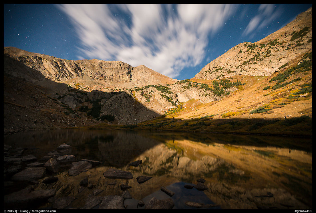
Morning light illuminates the cirque of mountains around the lake best. Since I had returned from the Sand Creek Lake hike quite late the day before, and I planned to summit in the late afternoon, I started at a relatively late time. When I arrived at Medano Lake, the cirque was backlit and the sky cloudy. I didn’t try to photograph it. Instead, I planned to use the same trick as before: photographing with the rising moon as a substitute for morning light.
When I started on the trail, I wasn’t sure whether I would be able to go to the summit. Because of my sprained ankle, the most I had walked all summer was a 2-mile stroll on the sidewalk. At the beginning of this trip, I felt tired after the shorter hikes I had done in Rocky Mountain National Park. Summiting required an additional 1800 feet of elevation gain without the benefit of an established trail. This makes for a total hike of about 3,800 feet elevation gain, and about 10 miles RT.
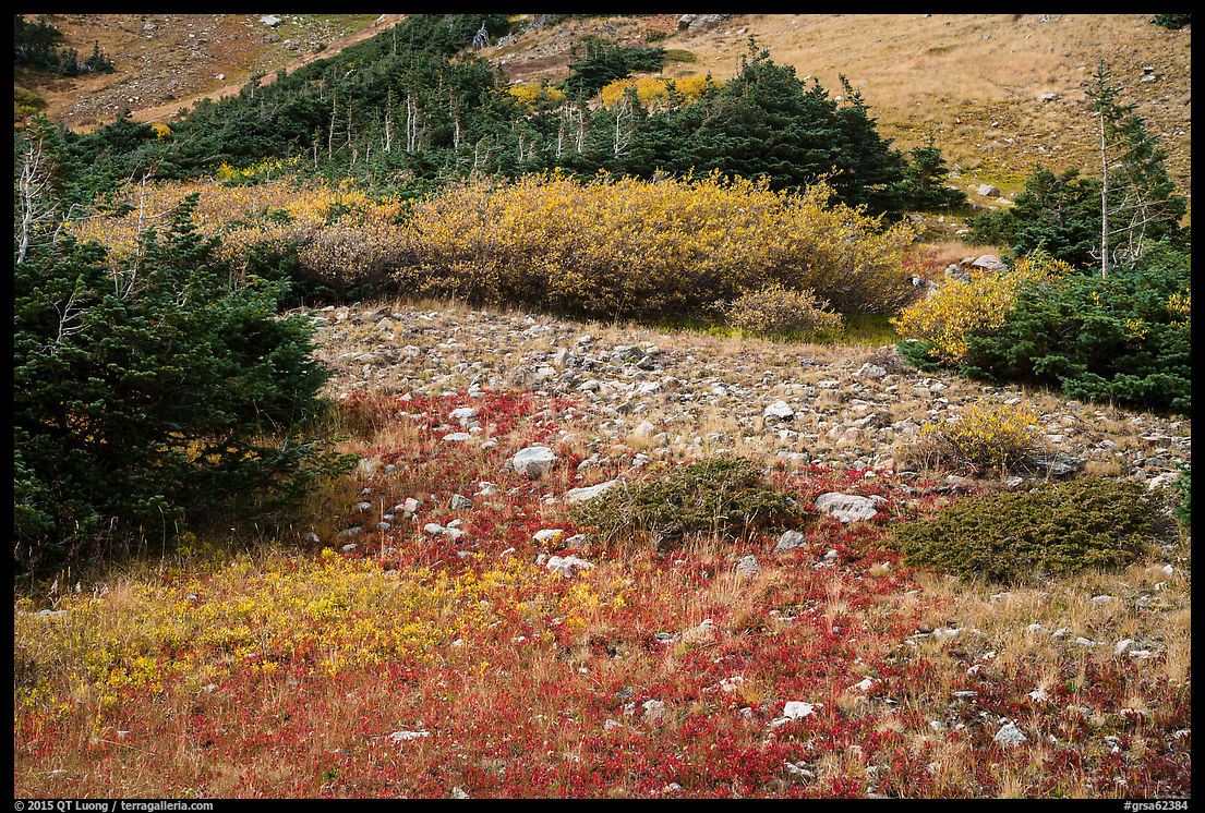
However, I knew that it was the easiest time of the year for this hike. Most of the year, the Medano Pass Road is closed. In the early fall, there is no snow on the ground and no risk of thunderstorms. While pausing on the shores of Medano Lake, I was able to trace a moderate route to the summit. Once I started, I was pleased to see that I’d be hiking on alpine tundra rather than rocks. Luck favors those who try. After less than fifteen minutes of cross-country hiking, I ran into a fairly good user trail, which happened to follow exactly the route that I had traced! At that point, I knew I would be able to make it.
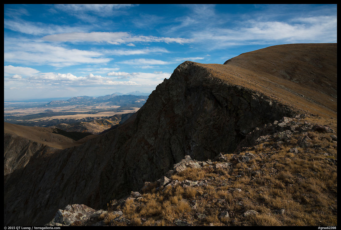
To find the user trail from the start, look for it from the established trail when it skirts the smaller (northernmost) of the two lakes, climbing diagonally the slope to the northwest. It becomes less defined at a wide saddle, although cairns continue to mark the way up a narrower saddle, then a steeper and partly rocky ridge that leads to the rounded summit. Here is my GPS track for the day.
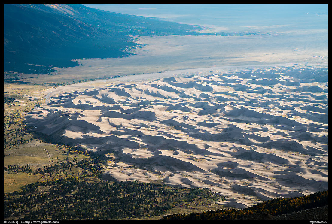
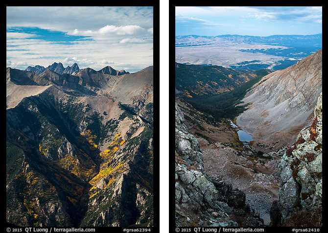
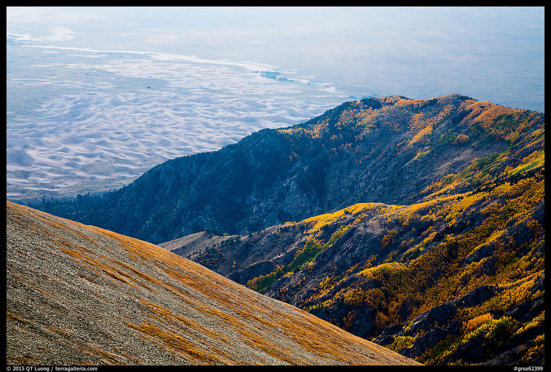
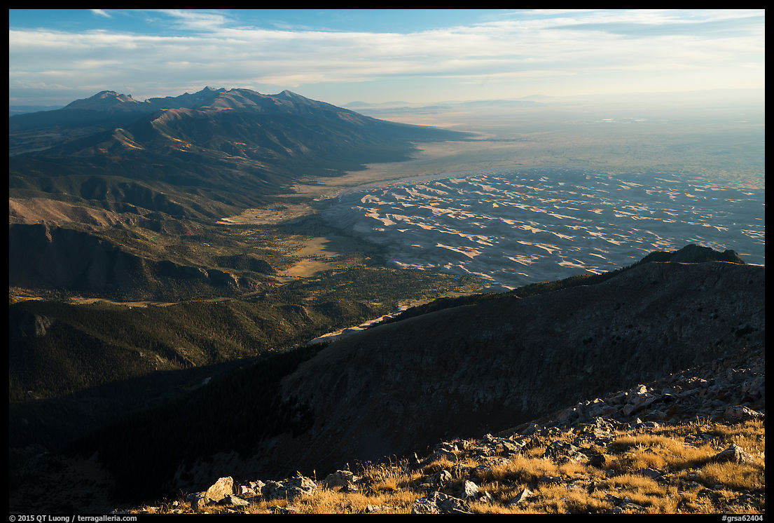
The view in all directions were well worth the effort. The Crestone group lies to the north, the Blanca mountains to the south. The summit is flat, but by hiking down a bit to the southwest of the summit plateau, I took in an extraordinary perspective on the dune field – the best high view in the park. It was indeed much better than from Zapata Falls because you are considerably closer and higher. From there, the 750 feet dunes look small. Like from points below, the light on the dune field is best in late afternoon, which is when I had timed my arrival.
I lingered on the summit until sunset. On the way down, hiking poles were of great help on the steep ridge. It was reassuring to have a GPS track to follow in the dark thanks to Gaia GPS. By the time I got back to the Medano Lake trail, the moon had risen. Instead of continuing down the trail, I made a short detour to photograph the lake as I had planned. This capped a great day in the mountains which was all the more satisfying because of the uncertainty with which it had started.
View images of Great Sand Dunes National Park and Preserve


A very unique view…maybe next time I’m there I’ll give it a go!
QT, Let me know the next time you’re in Colorado.. this is the National Park that’s closest to me, I live in Denver now! Great article, I’ll review it in more detail before I visit the Park..