Sonoran Desert National Monument Guide
9 Comments
Part 1 of 5: 1 | 2 | 3 | 4 | 5
The Sonoran Desert is the most biologically diverse desert in North America – or maybe not, see discussion in the last part of this series. Thanks to the national park designation, the most well-known track of Sonoran Desert consists of Saguaro National Park whose two units straddle the city of Tucson. However, the largest unbroken tract of Sonoran Desert resides south of Interstate 8 and extends into Mexico. The U.S. part in southern Arizona includes the Barry Goldwater Range, Cabezza Prieta National Wildlife Refuge, and Organ Pipe Cactus National Monument. An attempt was made to establish a Sonoran Desert National Park encompassing all those areas and more there, but all we got instead as a departing gift from the Clinton Administration was the much smaller Sonoran Desert National Monument in 2001.
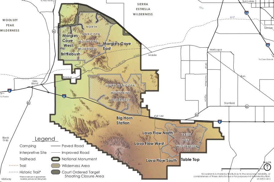
Still, at 776 square miles, it is a sizeable piece of untrammeled land, compared to the 143 square miles of Saguaro National Park. Sonoran Desert National Monument is large enough to include three wilderness areas and three distinct mountain ranges with a wide variety of terrain. In this article, we will successively visit a flat valley closely surrounded by mountains, a mountain top, a large plain covered with saguaro cactus, and foothills with rich vegetation. Like many in the West, it is managed by the BLM. Facilities are quite limited by any standards, as the monument was established for conservation rather than visitation. Here is the official BLM Sonoran Desert National Monument page, and here is a more detailed one from the BLM’s National Conservation Lands program.
For navigation, download this more detailed map from 2016. It is geo-referenced for use in apps supporting geo-referenced PDFs – my choice is Avenza. Note that it differs from the one linked via the above site, which is more recent (2020) but maybe isn’t geo-referenced as its filename doesn’t begin with “GP”.
Maricopa Mountains
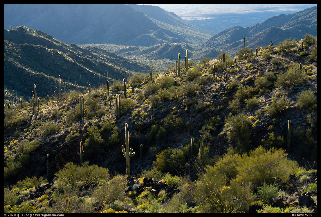
Besides I-8, the Maricopa Road between Gila Bend and Mobile is the only paved road within Sonoran Desert National Monument. Along that road located between the North Maricopa Mountains Wilderness and the South Maricopa Mountains Wilderness, you will find only desert with no development and the same can be said of the South Maricopa Mountains Wilderness.The only facilities in the area are at Margies Cove, in the North Maricopa Mountains Wilderness, and they are the most accessible facilities in the monument. The Margies Cove West Trailhead has parking for a dozen vehicles, three campsites with picnic tables and fire rings, a toilet, and an information station with a display of the map that I linked to above. There is no water, so you must be sure to bring enough, including for an emergency. It is best reached via an unpaved road from Hwy 85, rutted but accessible to passenger cars with careful driving. It took me about 20 minutes. If you come from the north, stay on 85 when Google Maps suggests another more difficult road starting from a landfill and then look for a paved spot to cross the divided highway. Here is BLM’s Margies Cove information. Unlike what you’d expect, that page is not linked from any of the two BLM Sonoran Desert National Monument pages referred above. How did I find it? Following a tip from a BLM ranger, I typed “Margies Cove” in the search box. The search box, rather than browsing, is the way to access most of BLM’s information.
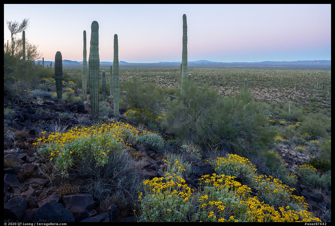
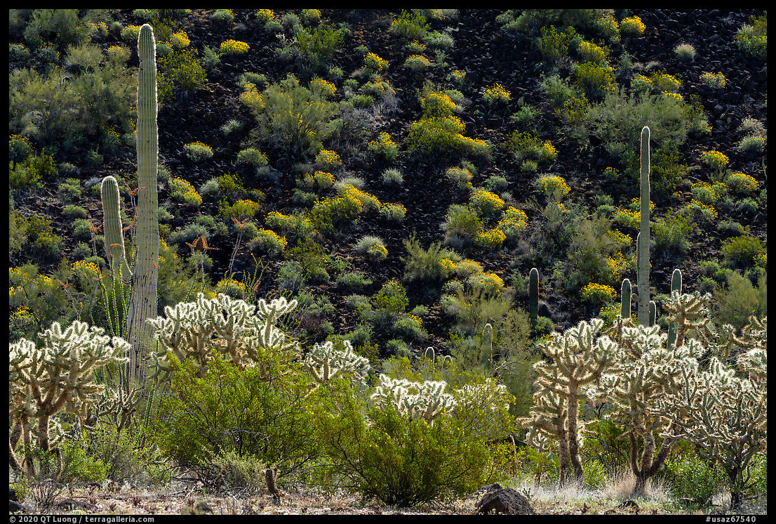
The Margies Cove Trail is a 9-mile route and can be extended with the 6 miles of the Brittlebush Trail that connects two-thirds of the way – the Brittlebush Trailhead can no longer be accessed by road. The term “Cove” refers to a flat valley closely surrounded by mountains on all sides. I was struck by the lushness of the desert floor, which was covered with grasses and even tiny ferns unexpected in the desert. The trail is a easy and pleasant walk. I hiked only a section and from what I saw, it didn’t offer a great deal of diversity of terrain since it was all mostly flat. On the two days when I was there, the weather was rainy. Besides the inconvenience of having to struggle to keep the camera dry, rain in the desert is actually a treat, with a softened luminosity that is quite special. While strong light is preferable for the saguaro cactus, the soft light made it easy to photograph the smaller desert plants.
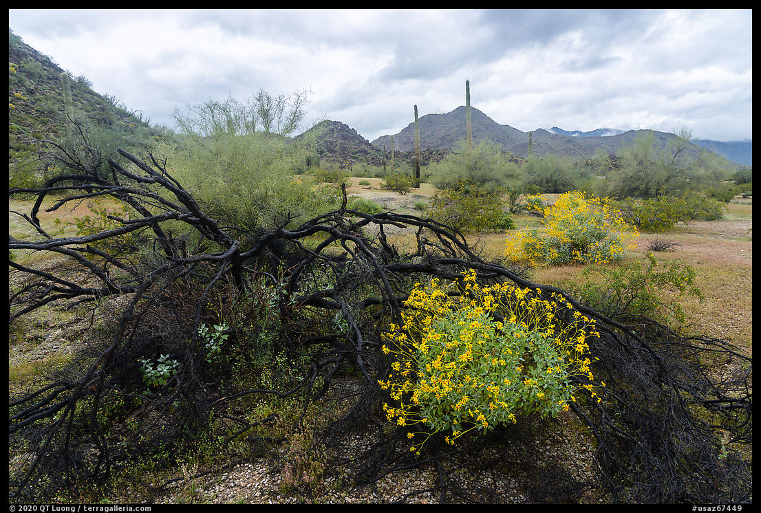
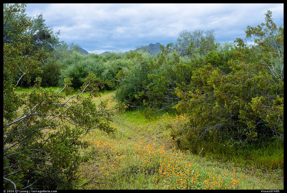
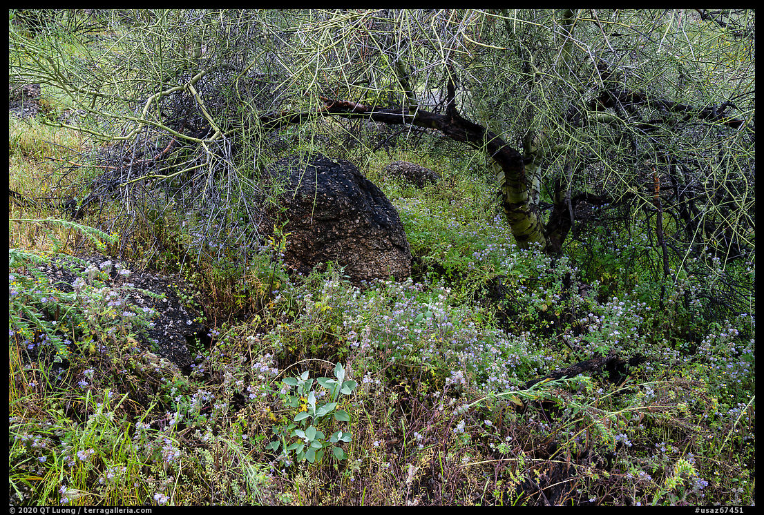
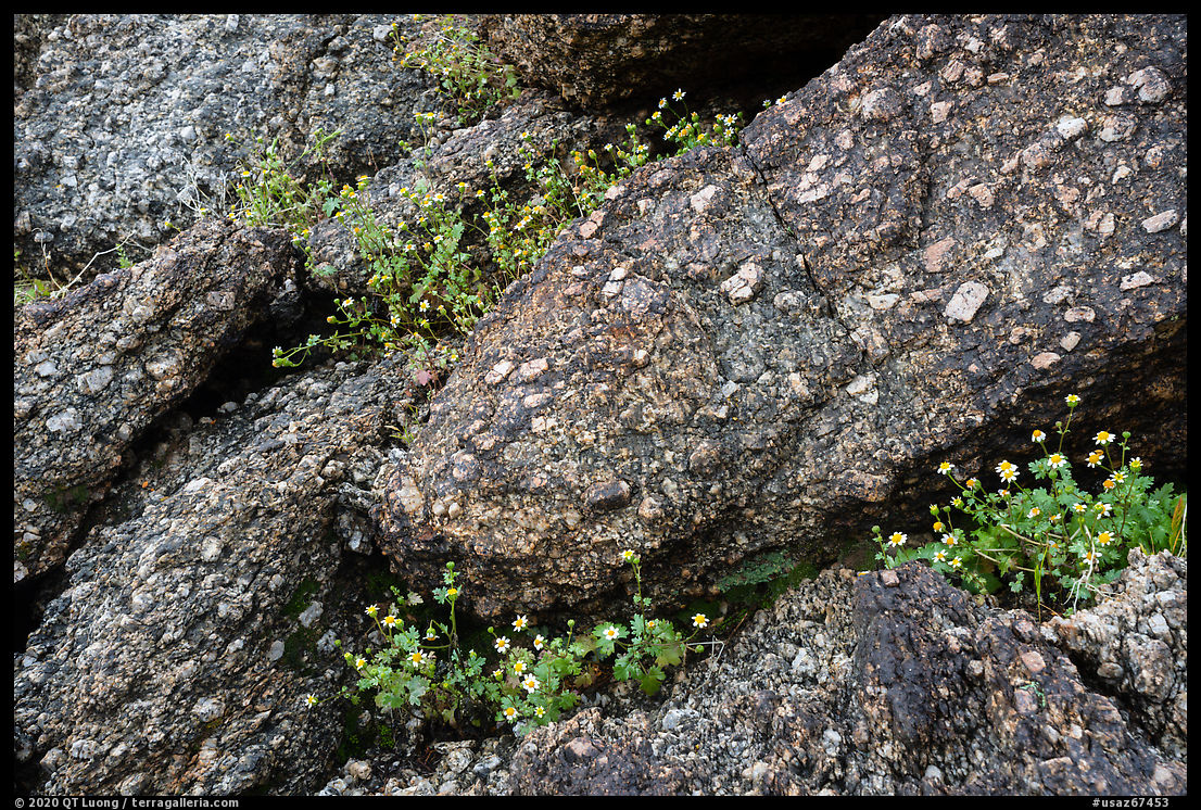
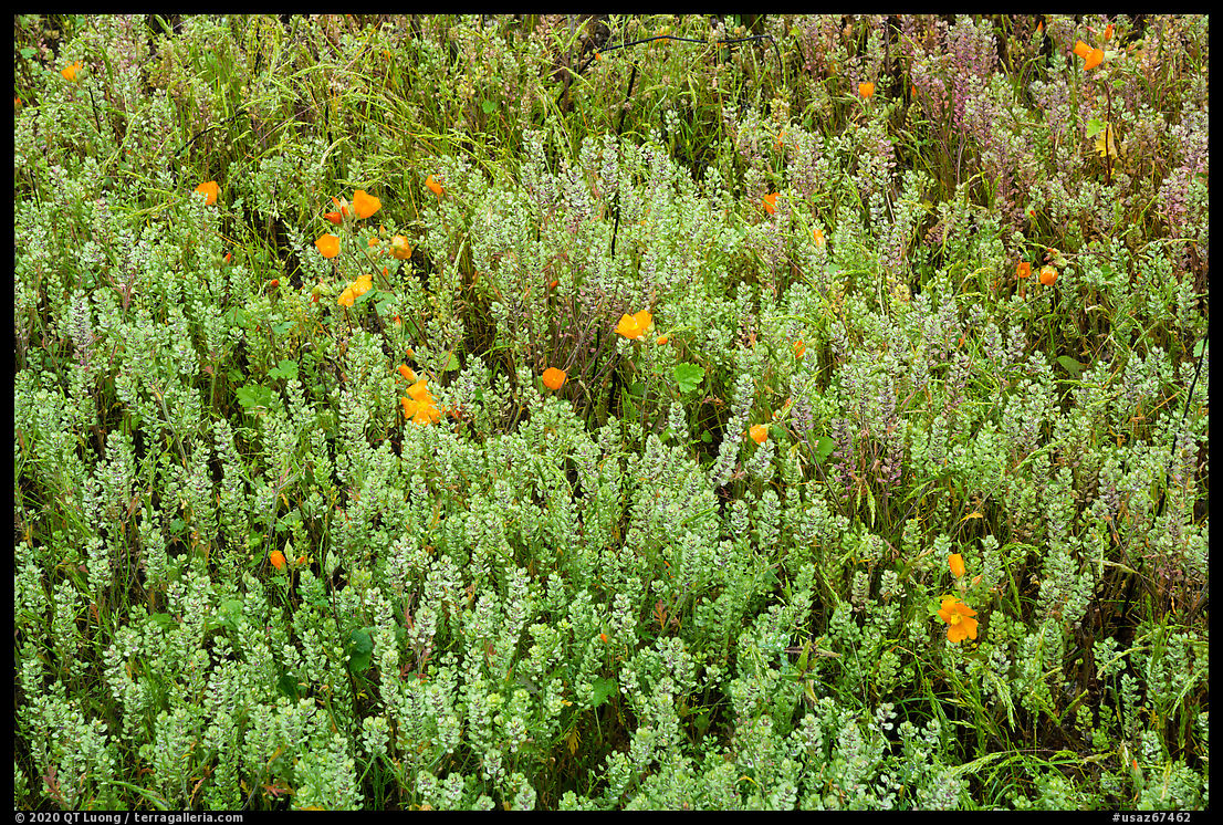
Table Top Mountains
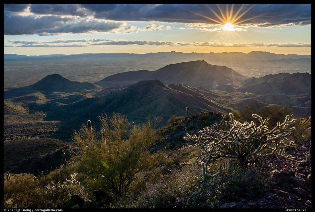
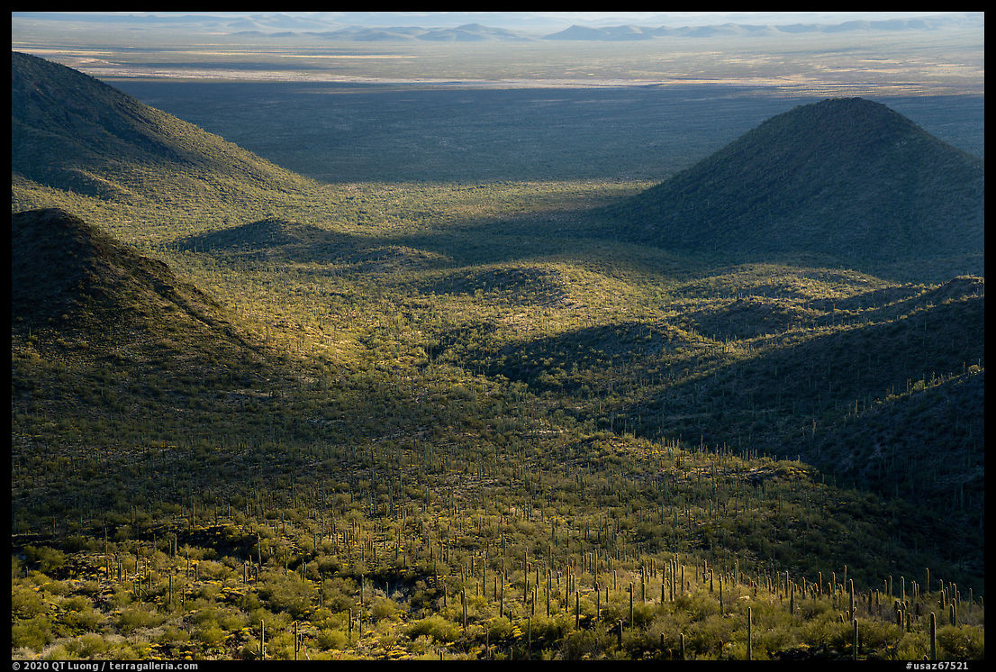
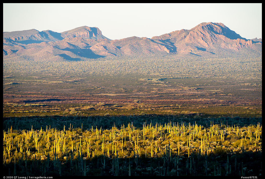
The Table Top Wilderness is home to the only other facilities in the monument. The Table Top Trailhead is equipped in a way similar to the Margie’s Cove West Trailhead. Getting there requires a high clearance vehicle for the rough last 4.5 miles after the left turn – the first 7 miles in Vekol Valley are easy. You’ll first come across the South trailhead for the 7-mile Lava Flow Trail (BLM info), which travels in a relatively level way at the base of hills, and a short distance afterwards, the Table Top Trail (BLM info) at the end of the road. It took me an hour to drive from Exit 144 (Vekol Valley Road) on I-8.The Table Top Trail climbs to the top of Table Top Mountain, the high point in Sonoran Desert National Monument characterized by a flat top volcanic summit, gaining more than 2000 feet elevation in less than 4 miles. The last mile is the steepest and the trail, quite good before, gets a bit rough there. Near the base of the mountain, the trail traverses forests of saguaro enlivened by abundant brittlebush. Once the steep switchbacks begin, the views over the surrounding desert became as spectacular as I had hoped when I had rented a SUV so that I could get to the trailhead. They were better from the switchbacks than from the summit itself, and that’s where I planned to be at sunset time, before hiking back to camp at night.
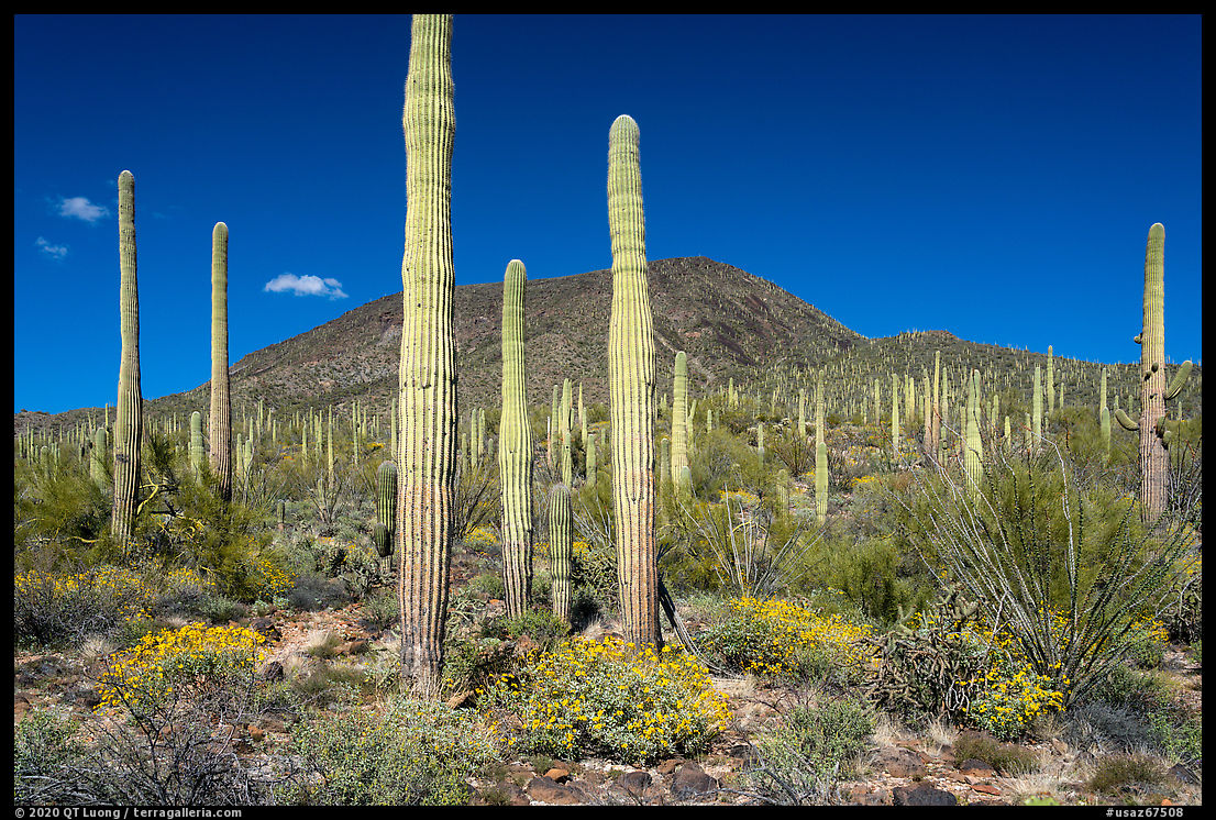
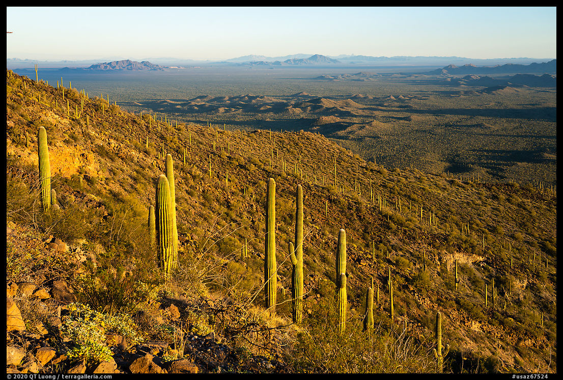
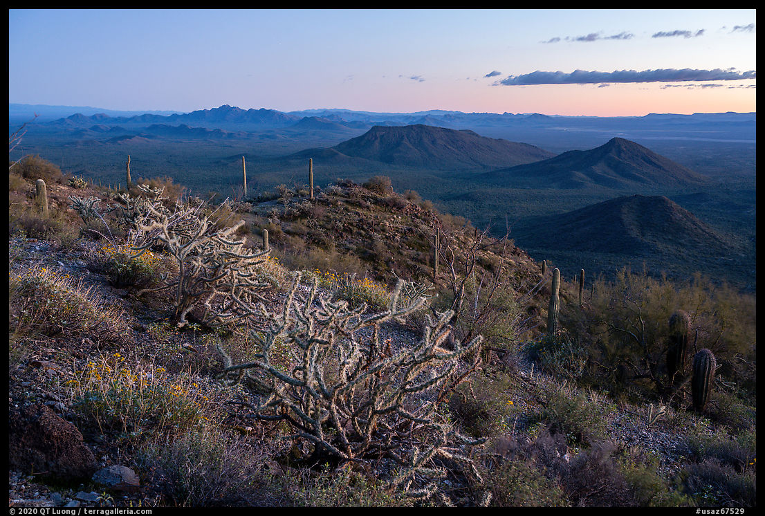
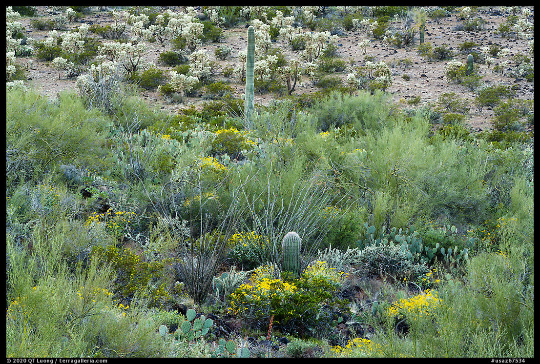
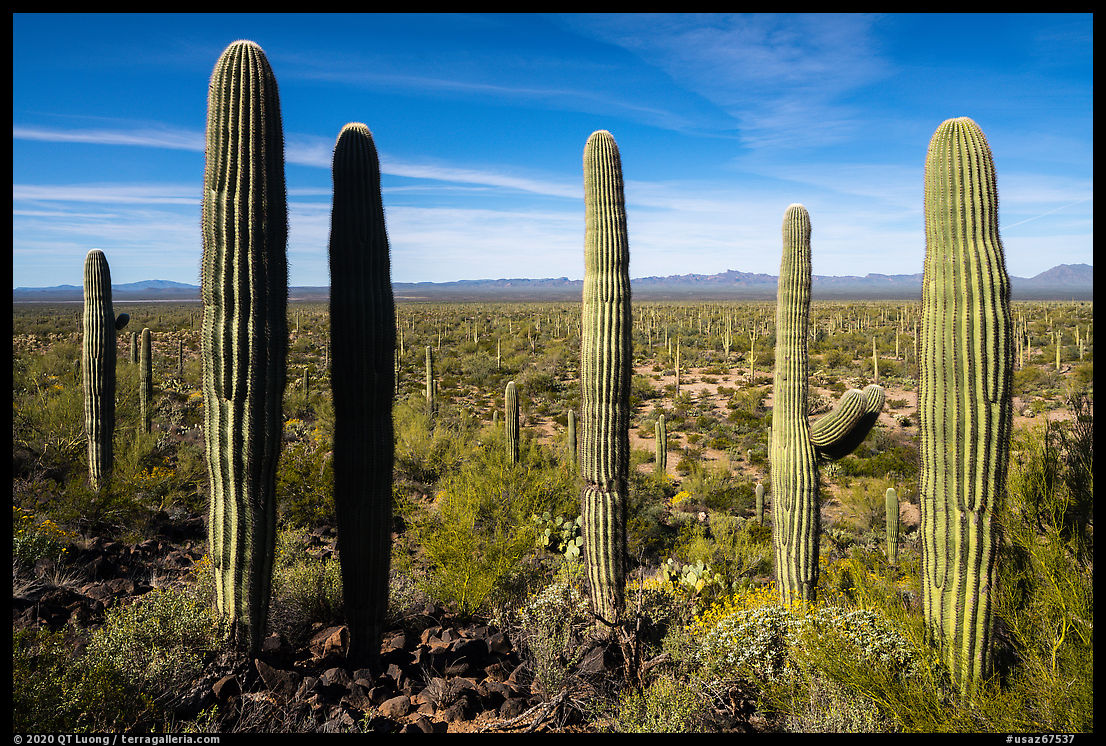
The next morning, I got up by dark. The mountains around the Table Top Trailhead face the west and are well lighted at sunset. However, the light at sunrise is more challenging, as the sun rises behind the mountains. Since the campground is located in an area that is quite flat, I hiked cross-country to a nearby hill for a more elevated view that reveals more of the land and offers more compositional opportunities. I photographed in predawn with the colors of the earth’s shadow on the western horizon. After the sun rose, the hill was in the shade, whereas the plain was lit. In distant views, I included shadows to add visual interest. I took advantage of the shade on the hill, that would soon disappear on that sunny day, for intimate views of the varied desert vegetation. I noticed a striking cluster of five saguaro trees, but they were still in the shade against a sunlit plain, so I waited for the sun to reach them. Since the image relied so much on the repetition of vertical lines, I used a lens with shift to keep the cactus parallel. It was supposed to be a sunrise session, but by the time I went down the hill, it was past 10 AM. However, looking back at the hill, I noticed that it was now grazed by the sun. I switched to a telephoto lens, using a polarizer to darken the lava rocks by suppressing their glare. The backlight made the yellow brittlebush glow while creating a halo of light around the cactus.
The previous post is illustrated with more images of the Table Top Wilderness and provides context to this one.
Part 1 of 5: 1 | 2 | 3 | 4 | 5


Wow! It looks amazing! The photos is just super! Thanks for sharing!
Firstly,thank you for sharing your beautiful work ,since the Google plus days I really admire your varied work .The photographs are delightful and interesting,my journey through desert land in the USA had been through barren stretches of wilderness ,hailing from a populous city in India teeming crowds being the standout feature the vast stretches of beauty and the mountainous skyline encompassing the landscape with redrock formations was a completely enlightening experience ,the silence cuts through the expanse but the varied beauty of the flora and fauna and strikingly beautiful landscapes are interesting. All the captures are beautiful but the last one in this collection is absolutely gorgeous,the luxuriant abundance is stunning.Had I known that such beauty existed would have made it to these places but learnt a lot about places from all the photographs of these beautiful places.
Always a pleasure viewing your work!
Thank you Rita! Coming from France, the vastness of the American West also amazed me.
thank you from Italy for the beautiful walk!
You are welcome! Hope you are well.
QT, have been admiring your work through the beautiful photographs, your books and with your association with Ken Burns ‘National Parks’ I finally saw your work at a small gallery in Modesto, CA a few years back, left me inspired with seeing your photographs in person!
That was a nice show although Mistlin Gallery had only enough room for about half of the Treasured Lands series. Thanks for stopping by.
I was out in Tuscon in January and hope to get back out there to visit some more of the area. Thanks for your insights on where to go as well as the great photos as always.
Hope you have a good trip. SDNM was a great alternative to Saguaro National Park for social distancing.