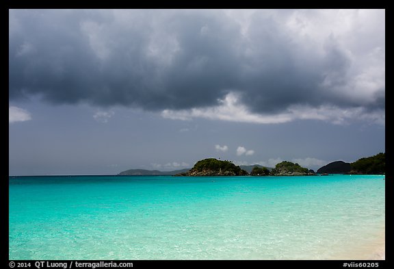
Photo Spot 45: Virgin Islands National Park – Trunk Bay
Since there are no airports on St John, to travel to this lush tropical paradise, I flew into St Thomas, then took a ferry to St John. There, after renting a car, I was surprised to see that on St John, you drive on the left side of the road, like in Japan, UK, Australia, and some other British Commonwealth countries, but unlike on those countries, the car is built for driving on the right, with the driver seat is on the left ! Supposedly the reason for that is to let the driver see the edge of the road better, as many of them in the island are quite narrow and bordered by steep cliffs. The resulting confusion (and night blindness as lights are angled at you) made driving alone quite an adventure. I was glad that the speed limit was 20mph, quite fitting for such a relaxed place.
For my first stop, I headed to Trunk Bay. I had to find out why the beach is consistently rated as one of the top ten beaches in the world, even named at one point by National Geographic as the beautiful beach in the world.
With such a reputation, the beach was extremely popular as expected. It included excellent amenities such as showers, restrooms, snack bar and gift shop, lifeguards, shaded picnic areas, which I understand count quite a bit in the a “best beach” rating by travel magazines. The white sand, turquoise clear water, steep surrounding forested slopes with coconut palms, and small offshore islets made it indeed “picture perfect”, except that the beach is quite crowded and too straight in its middle.
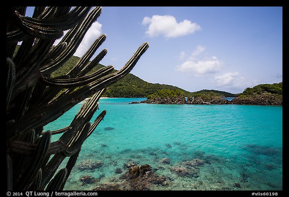
However, I found images at both ends. At the east end, after scrambling on rocks, I spotted some cactus for foregrounds. At the west end, because of the walking distance, I found fewer people and a small curving cove with some rocks. Photographing towards the main section of the beach to emphasize its length, the beachgoers were quite small in the photographs.
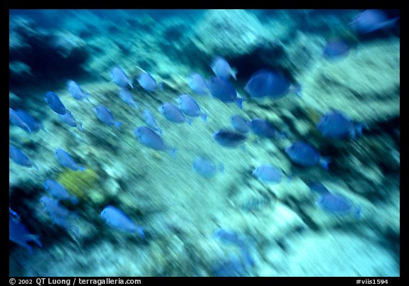
To cool down, I got into the water to check out the unique underwater snorkeling trail. The trail consists of a series of underwater signs providing environmental information and identifying some of the flora and fauna of the coral reef. After relaxing a bit, I had to get back to work. I went back in the water with my Nikonos underwater camera, and tried to capture the schools of tropical fish and the coral. Maybe because of the popularity of the area, the reef environment was not exceptional, but yet it was a perfect way to use the high noon sun. While landscape images often benefit from the low angle of the sun, underwater images need the sun rays to penetrate under the surface, which does not happen when the sun is low.
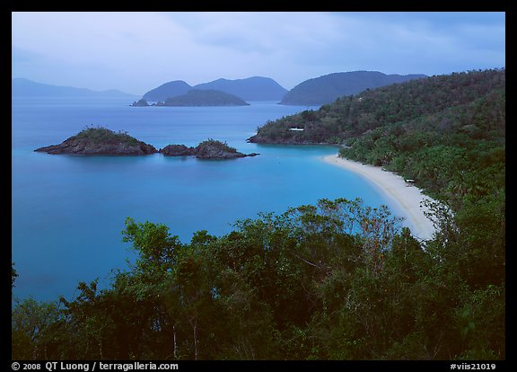
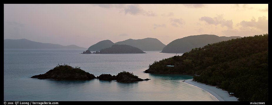
In the late afternoon, people began to leave the beach. I drove back to an overlook situated West of the beach. The higher perspective made it possible to see clearly the whole bay, beach, and islets. As the shadows on this north-facing beach were distracting, I waited for the light to become more even, after the sun had set. The beach was now empty. After making a few exposures, I lingered there to enjoy the quietness of the moment, planning to return there at sunrise to have the place for myself again.
View more images of Virgin Islands National Park
View more images of Trunk Bay