Photo Spot 44: Saguaro National Park – Hugh Norris Trail
No Comments
The saguaro cactus, with its multiple arms, is an icon of the American West. Although Western Films place them all over the place, they actually grow natively only in the Sonoran Desert, whose US portion is all included in southern Arizona. Around Tucson, the higher rate of precipitation causes the saguaro to grow twice as fast as saguaros in drier areas. This is where Saguaro National Park is located, making it the National Park closest to a major city.
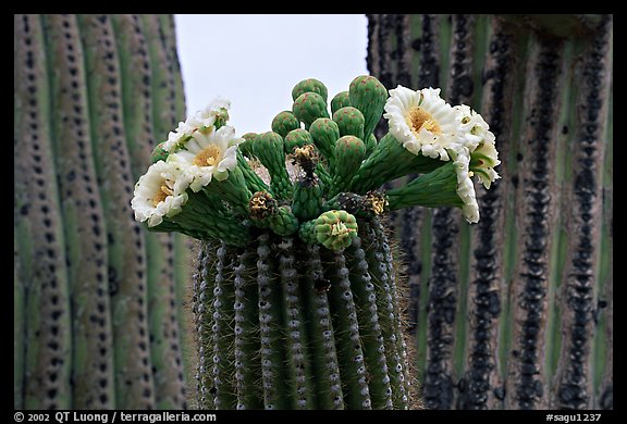
I had come to the Park earlier on a previous visit, enjoying moderate temperatures, and a desert floor carpeted with annual flowers. On that May visit my main goal was to photograph the saguaro blooms, which occur in May and June.
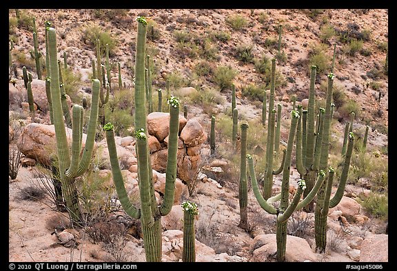
In my explorations of the flats, I had found it difficult to photograph the delicate flowers, as they are clustered near the ends of branches of cactus that grow to sizes between 15 feet and 50 feet. I thought that a hillside would give the most opportunities, as I could be level or look down to some of the saguaros.
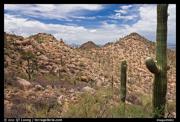
I went back to the Hugh Norris trail, the longest in the Park. The traihead is located on the Bajada Loop Drive, 3.5 miles north of the Red Hills Visitor Center in the Tucson Mountain District (West Unit) of Saguaro National Park. Unlike the East Unit, the West Unit is open 24 hours a day.
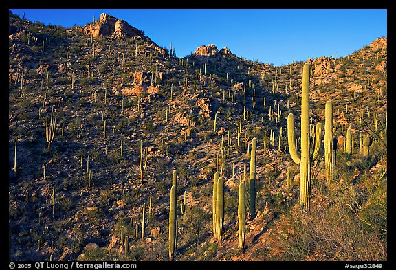
The first part of the trail climbs steadily up a canyon, whose sides are lined up with some of the most impressive saguaro forests in the park. Thousands of giant saguaros spread across the bajada, a Spanish term indicating the transition zone between the mountain and the valley. The steep location offered more varied compositions and a clearer views of the spread of the saguaros than the flats below. On a previous visit, I had found great light there in the late afternoon, with slopes nicely illuminated by the low sun.
The saguaro flowers last only half a day, opening at night, to close by next midday, never to open again. Because of that, and also in order to avoid the mid-day heat, this time I started to hike early in the morning. I was glad I took plenty of water, as it was quite hot in spite of the overcast sky.
As the drainage narrowed, the trail steepened and became a series of switchbacks leading to the top of the ridge. After hiking for a steep mile (which took me about 45 minutes) the trail reached a saddle. I followed a side path from which I found some of the nicest clusters of saguaro cactus, high above the visitor center, which could be seen in the distance. Almost each of the stems were completely encircled by creamy-white, 3-inch-wide flowers with yellow centers flowers.
I continued on the trail towards the top of Wasson Peak, 4 miles further. While in the canyon the views were only towards the west, they now opened up in other directions. The trail was meandering from one side of the ridge to the other and occasionally going along the top, with views changing from one side to the other. However, as the clouds got darker, I turned around before reaching the top, wary of being caught in an afternoon thunderstorm high on an exposed ridge. I will have to come back another time.
See more images of Saguaro National Park
See more images from the Hugh Norris Trail

