Terra Galleria Photography

Tracing National Park and National Monument Designations Through Visitor Guides

On the 110th anniversary of the National Park Service (NPS), this article continues my examination of the official NPS visitor guides over the years, focusing this time on the differences between early brochures for national parks and national monuments. If you haven’t done so, reading the previous installments of this series will provide context.

Part 6 of an ongoing series: 1 | 2 | 3 | 4 | 5 | 6 | to be continued

Today, the National Park Service (NPS) presents national parks, national monuments, historic sites, memorials, and its many other designations as parts of a single National Park System. Its visitor brochures reinforce that idea. Under the Unigrid system introduced in the late 1970s, the designation of a unit does not determine the basic design of its brochure. Historical visitor guides reveal that this uniform treatment developed gradually. National parks initially received priority, national monuments gained distinct brochures around 1940, and only after World War II did their visual treatment converge. This article traces those differences through the brochures themselves, focusing on the first or earliest brochures for parks and monuments, as well as the first brochures issued after an area became a national park, whether through the redesignation of an existing national monument or the creation of an entirely new NPS unit.

More so than in previous installments, the findings in this article require caution. Historical brochure archives are not necessarily complete, and absence from an archive cannot prove that no earlier publication ever existed. Visitation, accessibility, staffing, and development also affected whether a unit needed a brochure. The findings therefore are my inferences rather than proof of formal NPS policies.

1916-1939: National parks come first

When the National Park Service was created in 1916, besides the older Hot Springs and Casa Grande reservations, the areas it administered were either one of 14 national parks or 21 national monuments. In 1917, the agency issued visitor guide booklets for the following national parks: Yellowstone, Sequoia and General Grant, Yosemite, Mount Rainier, Crater Lake, Wind Cave, Mesa Verde, Glacier, Rocky Mountain, plus the Hot Springs Reservation. Although established in 1916, it took years for the lesser-visited Hawaii (1923) and Lassen Volcanic (1925) to receive a visitor guide, and even more for Alaska’s remote Mount McKinley (1927), established in 1917. Platt and Sullys Hill were considered minor units.

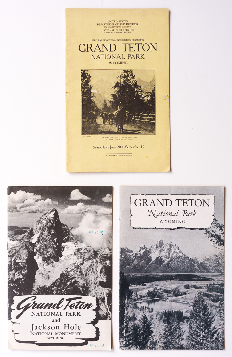
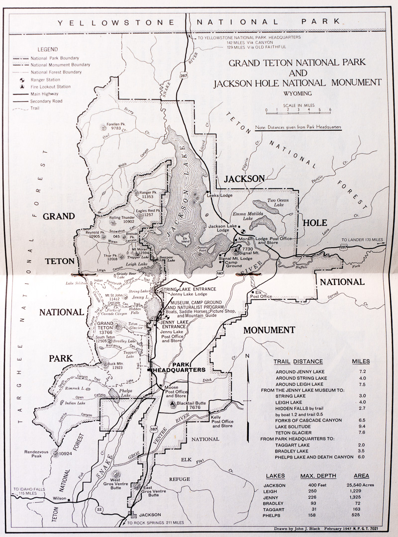
Consistent with the idea that national parks represented a higher standard than national monuments, those two designations did not receive comparable treatment in visitor publications. National parks had substantial official booklets with a standardized design based on a 6×9 inch trim. They contained maps, photographs, descriptions of scenery, transportation information, accommodations, regulations, and practical advice. For the major parks, new editions generally appeared annually. Grand Teton National Park, created from previously undesignated lands, gained a fully standardized booklet the year of its establishment in 1929. At that time, the 150 square mile park consisted mostly of the Teton Range and lakes at its base. In 1943, Jackson Hole National Monument was proclaimed to protect the adjacent high valley. The first postwar visitor guide for Grand Teton National Park had a section about Jackson Hole National Monument. The controversy about the monument ended in 1950, when the incorporation of most of it enlarged Grand Teton National Park to about 484 square miles.

Top: The first visitor guide booklet for Grand Teton National Park (1929). Bottom: 1948 visitor guide booklet, earliest including Jackson Hole National Monument; 1950 visitor guide booklet, first after addition of monument to national park.

1948 Map of Grand Teton National Park and Jackson Hole National Monument.

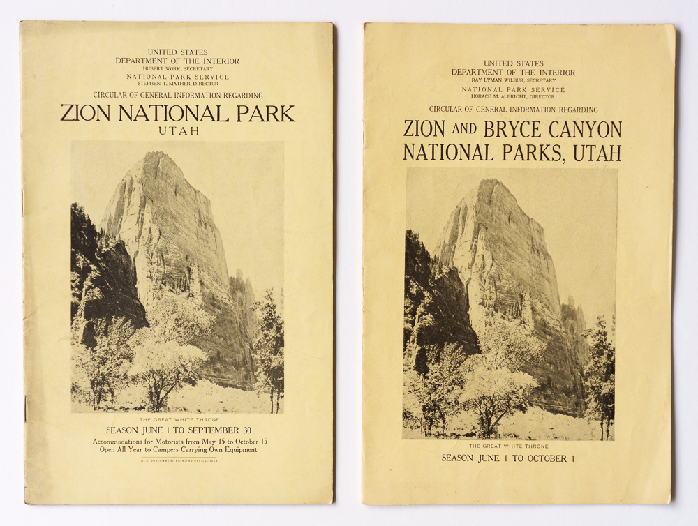
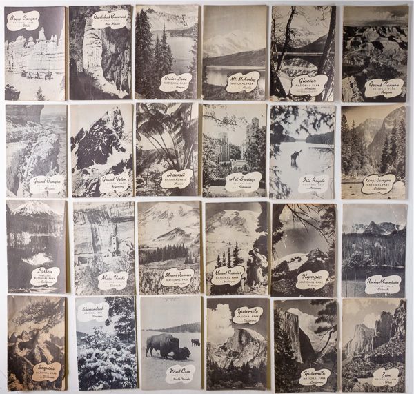
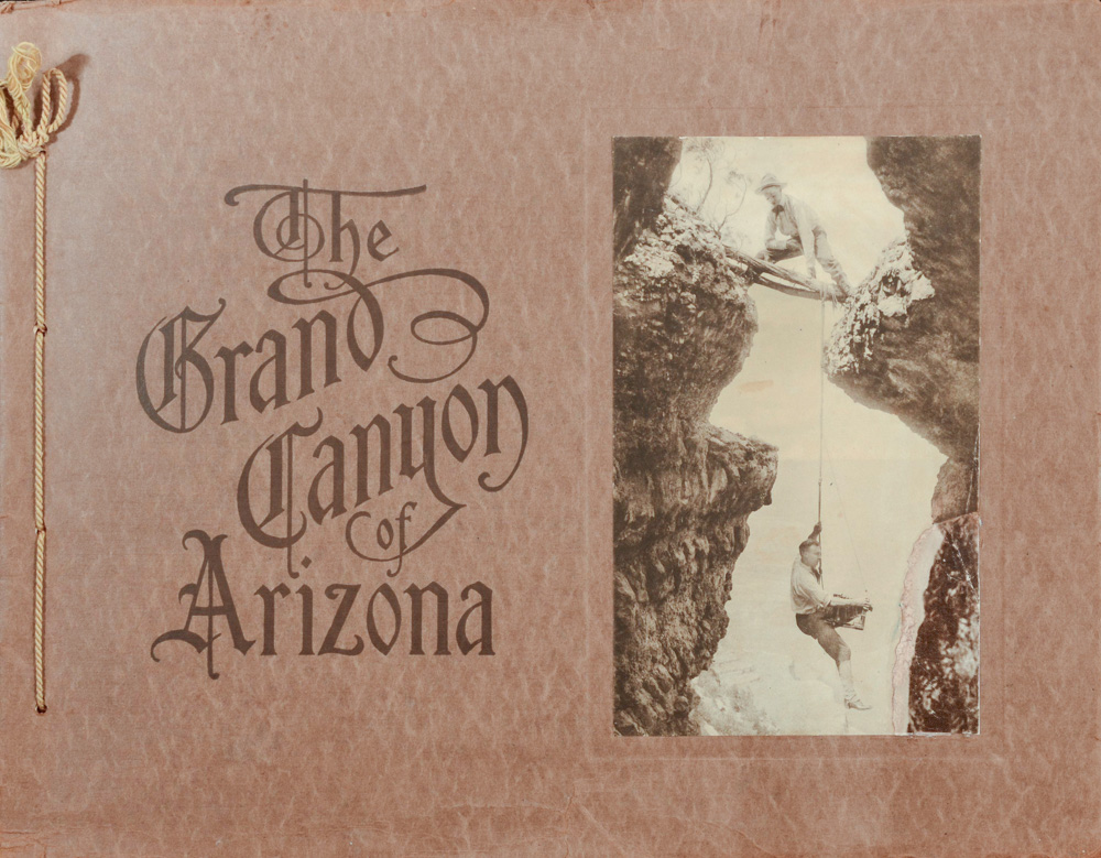
During those years, Acadia (then Lafayette), Grand Canyon, Zion, Bryce Canyon, and Carlsbad Caverns began as national monuments and were later redesignated national parks. The National Park Service issued a booklet for them only after their redesignation. Bryce Canyon was proclaimed a national monument in 1923, and established as a national park in 1928. The following year, it was added to the Zion National Park booklet. The grouping would continue until 1940, when both gained their own booklet. Carlsbad Caverns was also proclaimed a national monument in 1923, and redesignated as a national park in 1930. Its first booklet is from 1933. Note how its cover design differs from the design standards for 1933 (refer to the first article of this series), a fact repeated for several initial visitor guides.

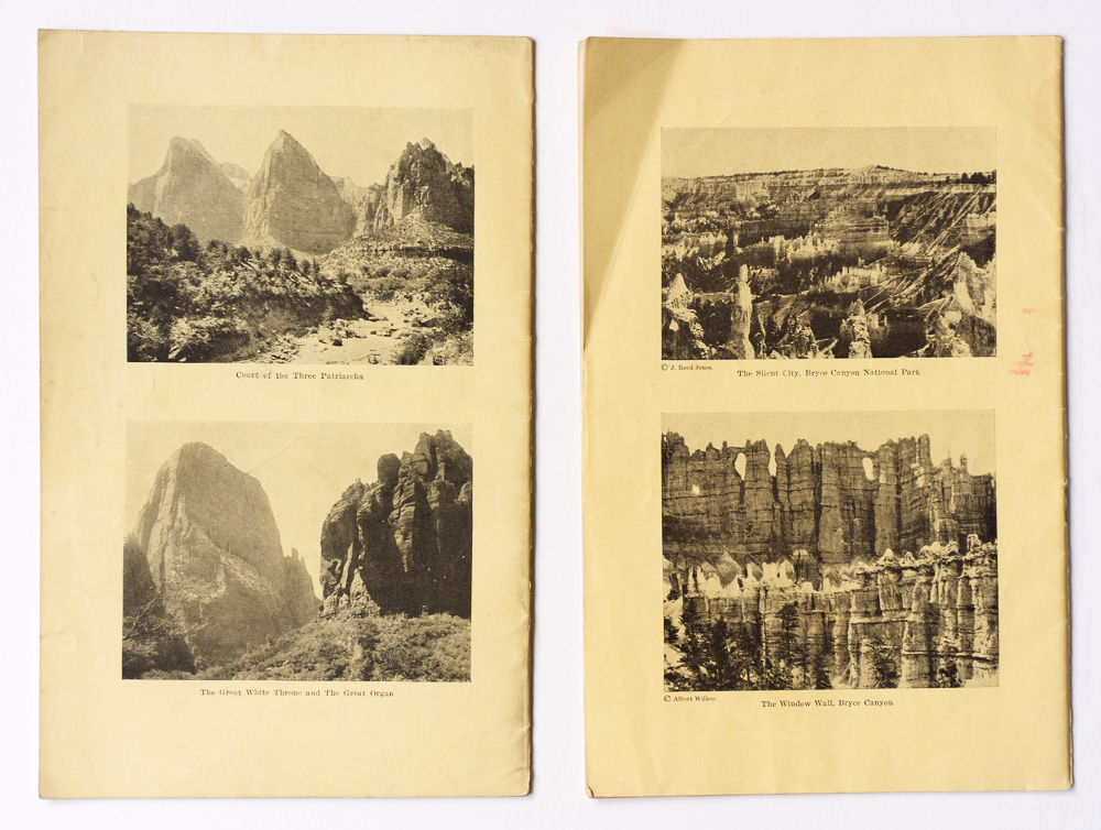
Front and back covers: 1928 visitor guide booklet for Zion National Park; 1929 visitor guide booklet for Zion National Park and Bryce Canyon National Park, first after establishment of Bryce Canyon National Park.

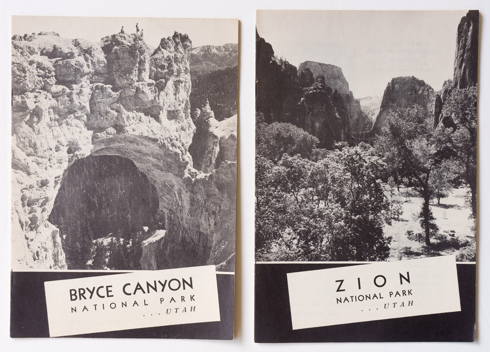
1940 visitor guide booklets for Zion and Bryce Canyon National Park, the first year they were separated.

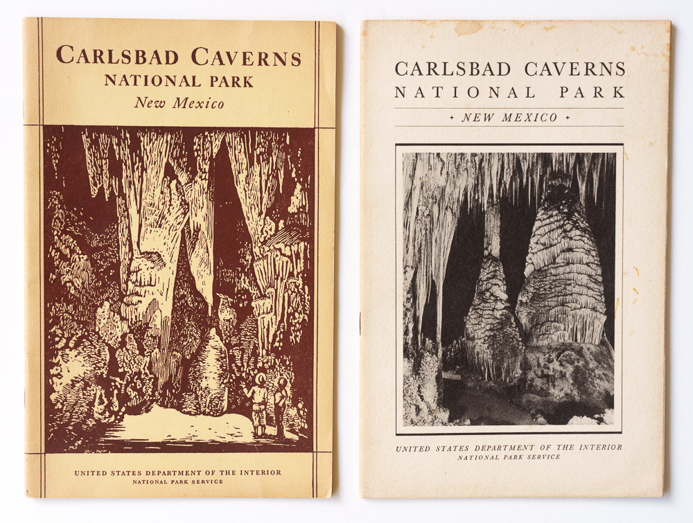
The earliest visitor guide booklet for Carlsbad Caverns National Park (1933); 1935 visitor guide booklet with standardized design for that year.

Most national monuments had nothing comparable to those booklets, even though national monument status repeatedly proved to be a precursor to national park status. As discussed here, about half of today’s national parks were first protected, entirely or substantially, as national monuments. Yet the early brochures suggest that the NPS regarded the national park designation as carrying greater importance.

The rare exceptions. By 1940, NPS administered 82 national monuments. Out of those, I have found only six national monuments with NPS visitor publications before 1940.

Casa Grande Ruins had been federally protected since 1892, when President Benjamin Harrison established the Casa Grande Ruin Reservation, the first federal prehistoric and cultural reserve. It had a resident custodian from 1901, Frank Pinkley, and considerable preservation work had already taken place before the NPS existed. When Casa Grande became a national monument in 1918, it was already a mature federal protected area. Its position grew when Pinkley became superintendent of the Southwestern National Monuments in 1923 while remaining based at Casa Grande, which became headquarters for the group. This helps explain why Casa Grande was the only national monument listed as having a booklet. Such mentions are found in contemporary booklets for major national parks from 1919, 1920, and 1921 (for example, Yosemite National Park 1921, p. 62). Even Grand Canyon National Monument and other major scenic national monuments did not receive this kind of attention.

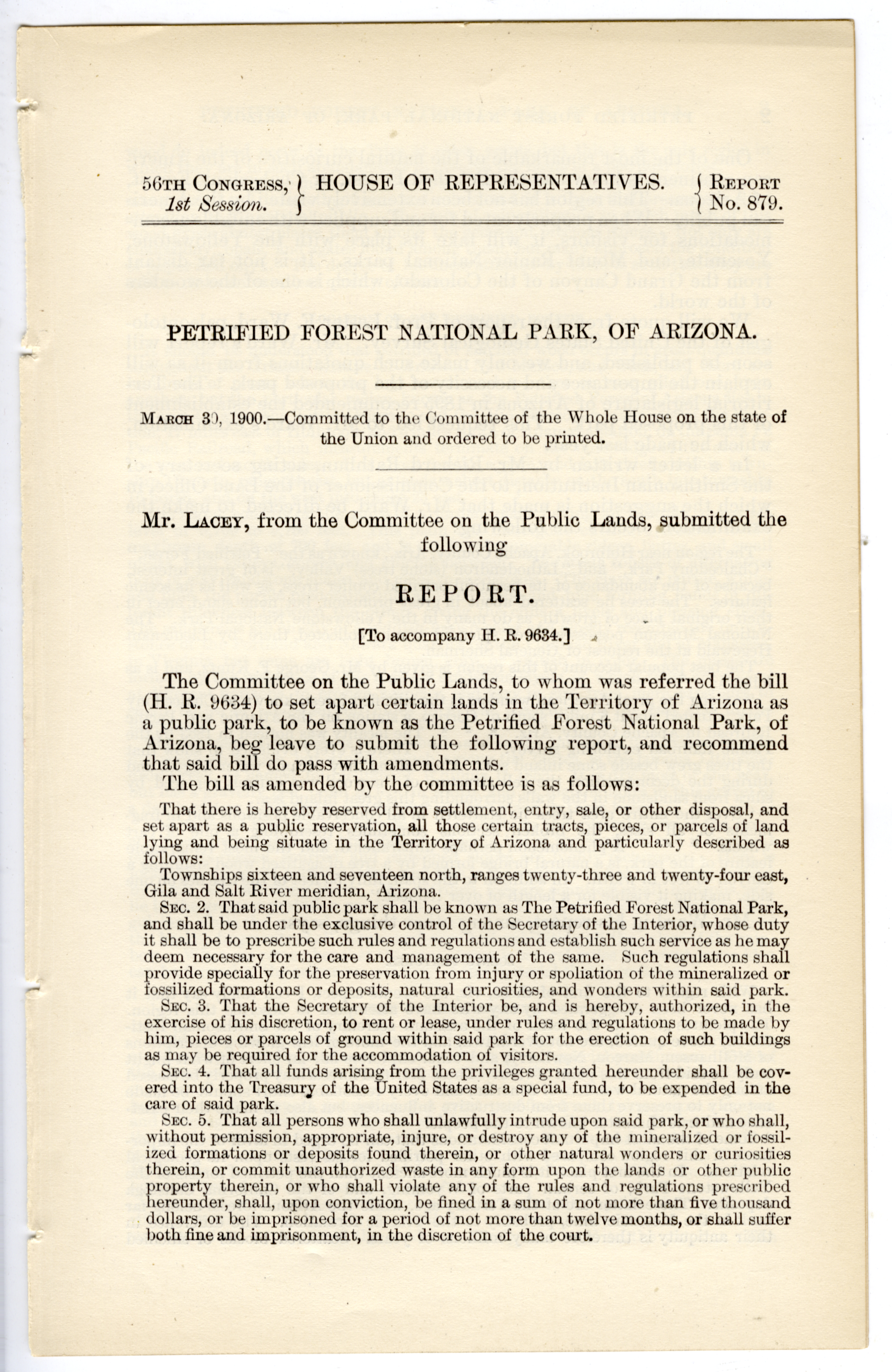
As early as 1900, Representative John F. Lacey of Iowa, chairman of the House Committee on Public Lands and later a key sponsor of the Antiquities Act, reported a bill to Congress that would have established Petrified Forest National Park. His interest in protecting Petrified Forest may also have helped account for the inclusion of “objects of historic or scientific interest” in the Antiquities Act, language that broadened its reach beyond archaeological sites to natural features.

House Report No. 879 (1900), recommending passage of a bill to establish Petrified Forest National Park in Arizona.

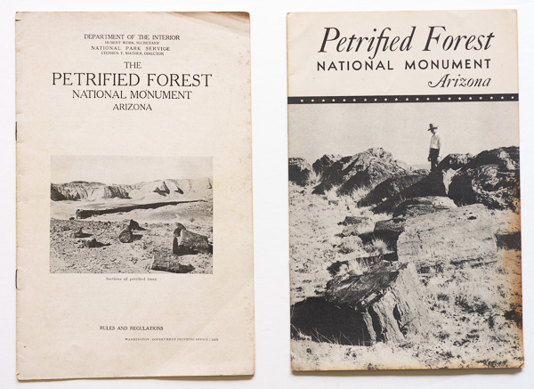
After Congress failed to pass the bill, President Theodore Roosevelt proclaimed Petrified Forest National Monument in 1906. It received a 16-page illustrated booklet in 1925. Rather than resembling the simple monument folding leaflets that appeared later, the booklet was much closer to contemporary national-park publications in design and content. The monument had become an important destination and appears to have received correspondingly elevated treatment over the years. In 1941, unlike other national monuments, it received another 16-page stapled booklet.

Earliest visitor guide booklet for Petrified Forest National Monument (1925); 1941 visitor guide booklet.

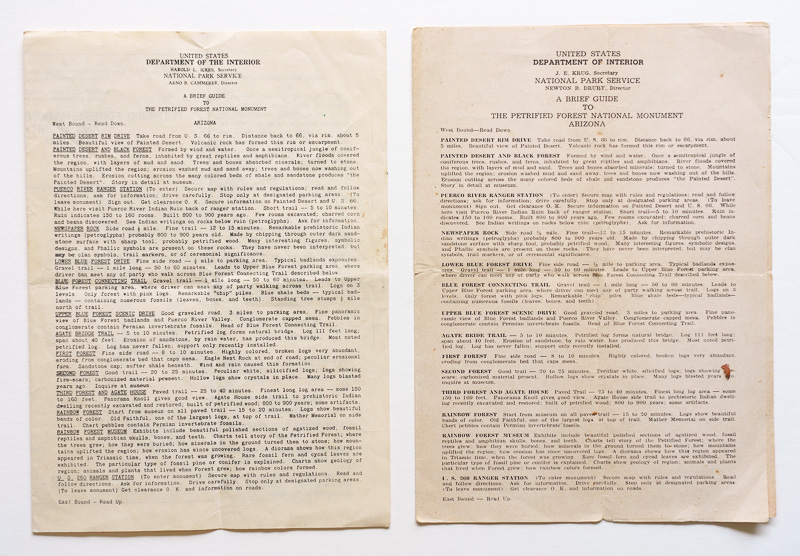
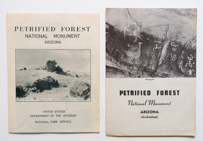
Besides the booklets above, we can find two types of folding leaflets for the monument. Information pamphlets included densely laid-out text on four pages with a map, while 6-page folding leaflets illustrated with photos were designed like visitor guides. The years of issue indicate they were used simultaneously. Although few appear to have survived, I have located a handful of brochures of both types produced for national parks as well.

1939 and 1948 information pamphlets for Petrified Forest National Monument. Note more refined typography in the latter.

1939 and 1941 folding leaflets for Petrified Forest National Monument. The shorter height (8 inches) of the 1939 leaflet would often be used subsequently.

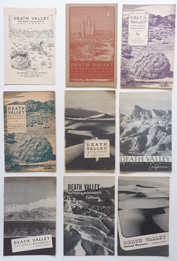
NPS Director Horace Albright had been advocating for a Death Valley National Park. President Hoover instead protected the area by proclaiming Death Valley National Monument in February 1933, and a 4-page folding leaflet appeared that very same year, followed by booklets ranging from 16 to 28 pages in each of the subsequent years. At roughly 1.6 million acres, Death Valley was the largest national monument in the contiguous United States and one of the largest units in the National Park System. Death Valley eventually became a national park in 1994, when an expansion to 3.4 million acres made it the largest national park in the contiguous United States.

Visitor guides for Death Valley National Monument during its first decade, 1933–1942. Unlike others, the 6th and 7th covers follow the design standards for their respective years, 1939 and 1940. Initially located entirely within California, it gained Nevada lands in 1941, as can be seen in the 9th cover (1942).

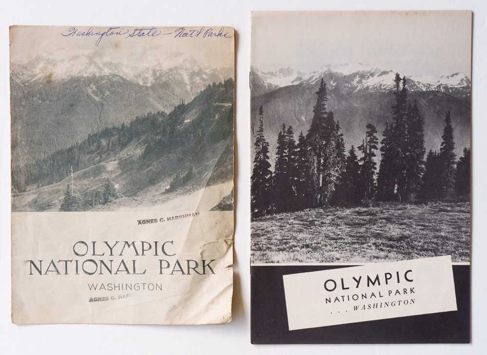
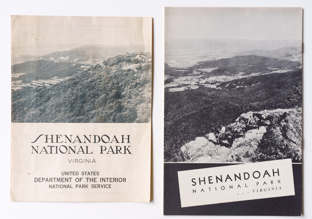
Besides those three, Lava Beds (proclaimed 1925) and Oregon Caves (proclaimed 1909) received NPS brochures in 1936, when the NPS was expanding development and interpretation during the New Deal era. After almost three decades, Mount Olympus National Monument (proclaimed 1909) received an information pamphlet in 1937, shortly before becoming Olympic National Park in 1938. That year, a six-page folding leaflet was issued, followed by a booklet with standardized design in 1940. We find the same publication pattern of a folding leaflet followed by a full booklet for Shenandoah National Park.

Earliest visitor guide folding brochure for Olympic National Park (1938); earliest visitor guide booklet following standardized design for that year (1940).

Earliest visitor guide folding brochure for Shenandoah National Park (1939); first visitor guide booklet following design standards for that year (1940).

The rarity of exceptions reinforces the broader pattern. For the first two decades of NPS history, having an official visitor booklet was strongly associated with being a national park.

1940-1944: National monuments get their brochures

Around 1940 many national monuments that had existed for years or even decades suddenly began acquiring official brochures. Although the trend continued for decades, the table below lists only the first two years of this shift.

First brochure National Monument Designated
1940Fort Pulaski1924
1940Montezuma Castle1906
1940Ocmulgee1936
1940Saguaro1933
1940Walnut Canyon1915
1941Aztec Ruins1923
1941Badlands1939
1941Big Hole1910
1941Canyon de Chelly1931
1941Chaco Canyon1907
1941El Morro1906
1941George Washington Birthplace1930
1941Navajo1909
1941Pinnacles1908
1941Pipe Spring1923
1941Scotts Bluff1919
1941Tuzigoot1939
1941Wupatki1924

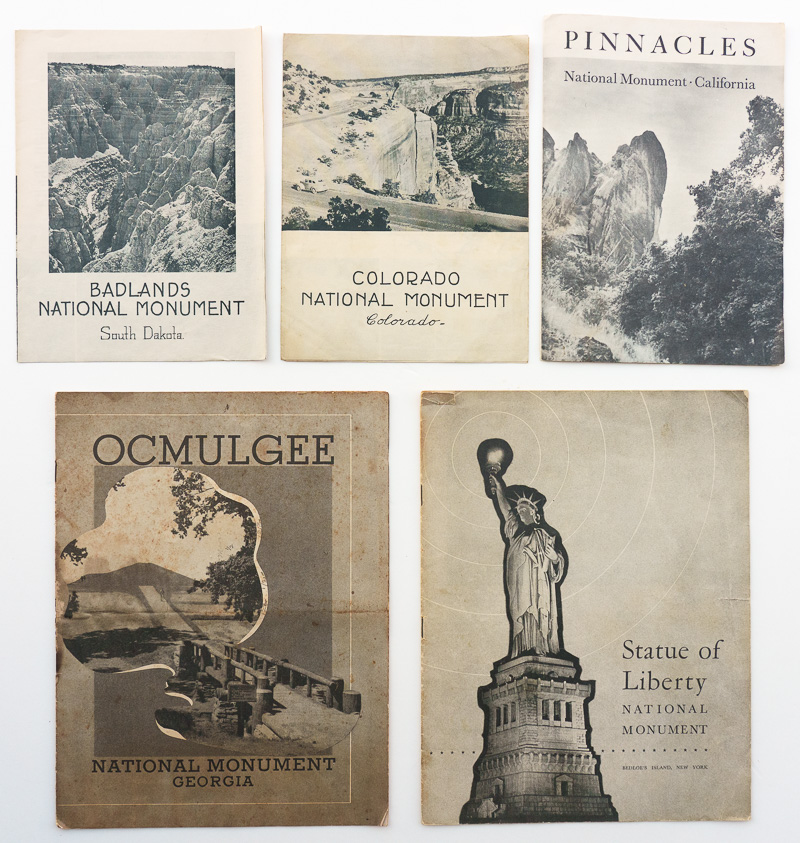
This flurry of publications wasn’t a coincidence. In 1940, the NPS established a more systematic publication program as it sought to provide visitor literature across a system that had expanded enormously, particularly after the 1933 government reorganization transferred monuments, military parks, battlefields, and historical areas from other federal agencies. By 1940, the NPS administered 82 national monuments but only 26 national parks. The new monument publications took several forms. Some were inexpensive two-fold folding leaflets ranging from 6 by 8 inches to 6 by 9 inches, a format already used occasionally before 1940. Others were substantial 16-page stapled booklets, unusually large at about 8 by 10½ inches and extensively illustrated with photographs. The latter proved short-lived. Monuments that initially received the large booklets subsequently switched to folding brochures; as early as 1942, for example, Statue of Liberty received a folding brochure instead of the large 16-page booklet used since 1940. The shift to the smaller format likely reflected economics: producing inexpensive folding brochures made it practical to extend and maintain visitor publications across a system containing far more national monuments than national parks.
Top: Earliest visitor guide folding brochures for Badlands (1941), Colorado (1940), and Pinnacles (1941) National Monuments, which are 6 inches wide. Bottom: Earliest visitor guide booklets for Ocmulgee (1940) and Statue of Liberty (1940) National Monuments.

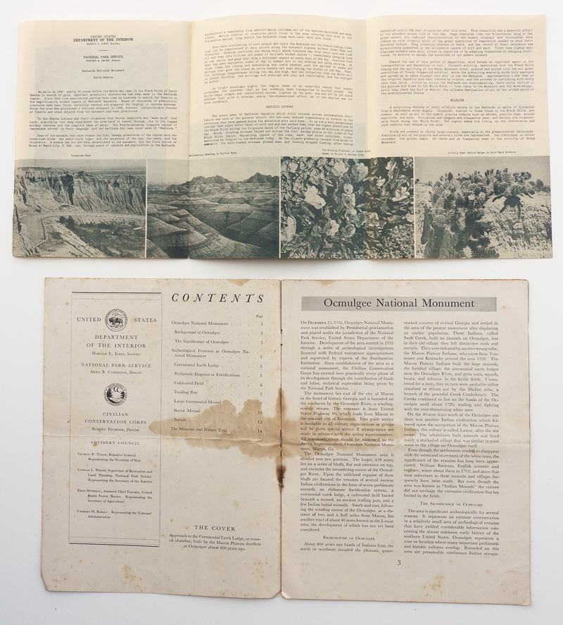
Interiors of visitor guides for Badlands (1941) and Ocmulgee (1940) National Monuments.

The new publications did not erase the hierarchy. Instead, they made it visible. National parks in the early 1940s used a recognizable standardized family of substantial guides. National monuments used distinctly different formats, ranging from folding brochures to large, photographically illustrated 16-page booklets. The distinction was therefore not simply one of size or elaborateness: even the most substantial monument publications remained visually separate from the standardized national-park series. Seen together, they clearly represented different publication classes.

National park visitor guide booklets for the year 1941 (except Great Smoky Mountains, Mammoth Cave, and Yellowstone, details here). Grand Canyon and Yosemite had two different designs.

The change from the previous period was therefore incomplete: before 1940, many monuments had no dedicated NPS brochure. Beginning in 1940, monuments increasingly had brochures, but their brochures visibly identified them as belonging to a different category from national parks. The NPS was starting to provide information throughout its expanding system without yet presenting all designations in the same way.

1945-present: One visual system, but lingering differences in priority

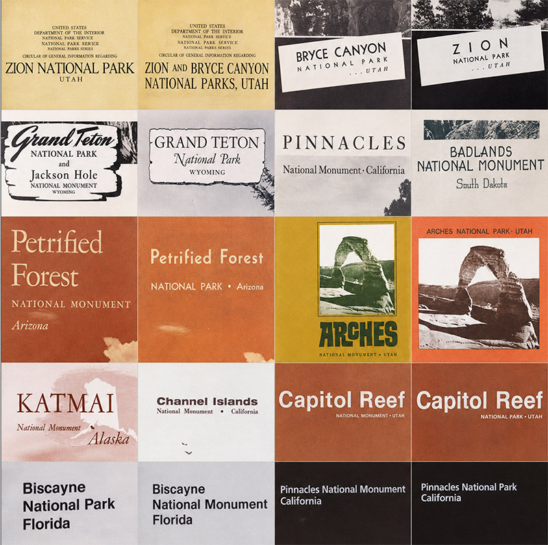
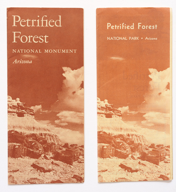
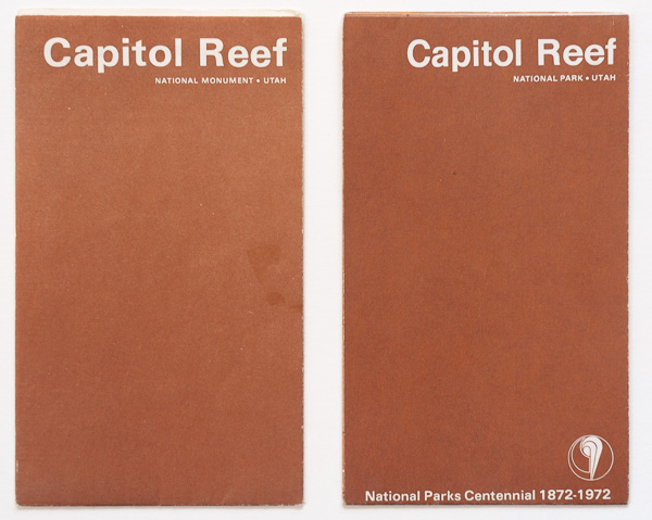
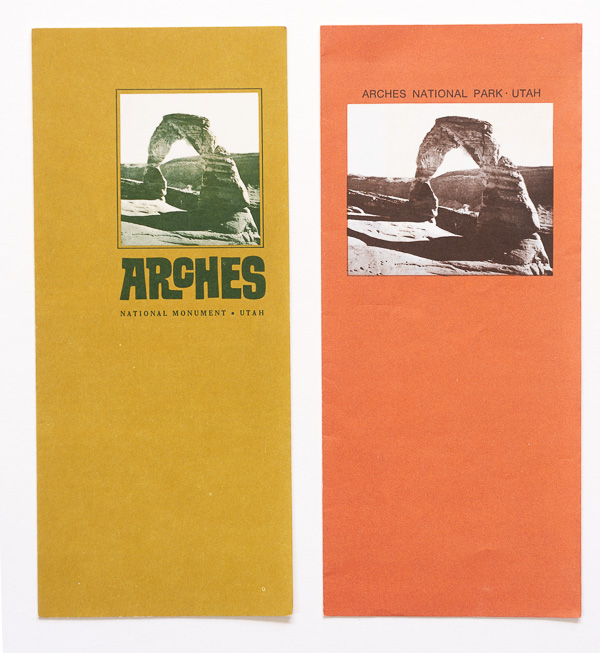
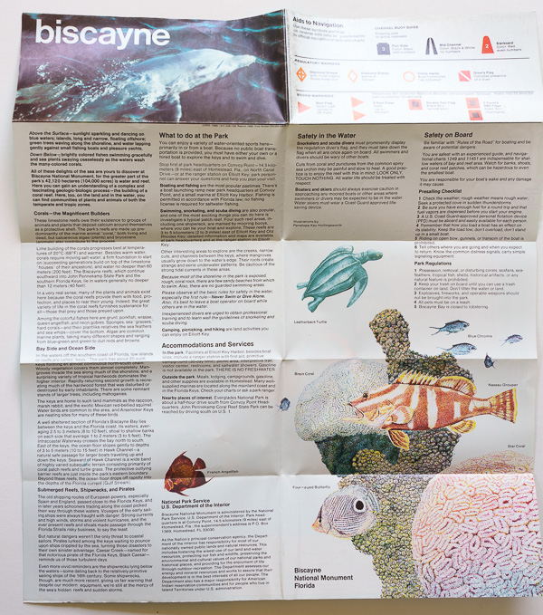
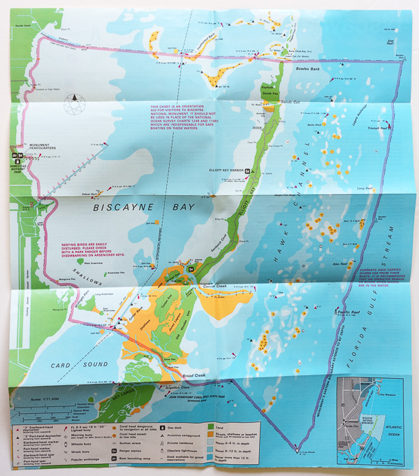
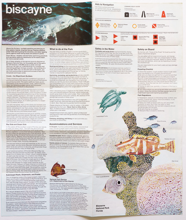
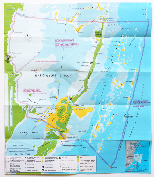
After World War II, the graphic distinction faded rapidly. System-wide design standards were relaxed. National parks and national monuments used the same varied brochure formats and design approaches. The clearest evidence comes from monuments subsequently redesignated as national parks. In earlier decades, becoming a park had often coincided with receiving an entirely different class of publication. After the war, the brochure could remain essentially the same, with only the designation changing from “National Monument” to “National Park”. We can see that on the five postwar design generations discussed in earlier installments. In the case of Biscayne, the change is visible only inside.

1961/1962 visitor guide folding brochures for Petrified Forest National Monument/Park; 1971/1972 pocket guides for Capitol Reef National Monument/Park (refer to the previous installment for a discussion of the 1972 National Park Centennial); 1966/1972 visitor guide folding brochures for Arches National Monument/Park.

Front and back of unfolded 1980 Biscayne National Monument extended pocket guide.

Front and back of unfolded 1981 Biscayne National Park extended pocket guide. The change to “National Park” can only be seen on the bottom right front panel, and on the map labels for the visitor center and the boundary.

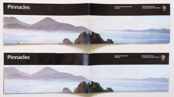
Partly unfolded 2012/2014 Unigrid visitor guides for Pinnacles National Monument/Park.

That is a significant institutional shift. The words “National Park” and “National Monument” still represented different designations, but they no longer used different visual identities. Unigrid would eventually formalize that principle. Beginning in 1977, the NPS worked with designer Massimo Vignelli on a system of common grids, typography, formats, and cartographic conventions. National parks, monuments, historic sites, memorials, and other units could all fit into the same graphic framework. But visual equality arrived before equality in publication priority.

Some monuments still waited decades. A number of monuments established before or during the war did not receive their first known NPS brochures until well afterward:

National Monument Designated Earliest brochure
White Sands19331945
Chiricahua19241946
Great Sand Dunes19321948
Arches19291949
Lehman Caves19221949
Glacier Bay19251950
Dry Tortugas19351950
Capitol Reef19371951
Katmai19181952
Channel Islands19381968

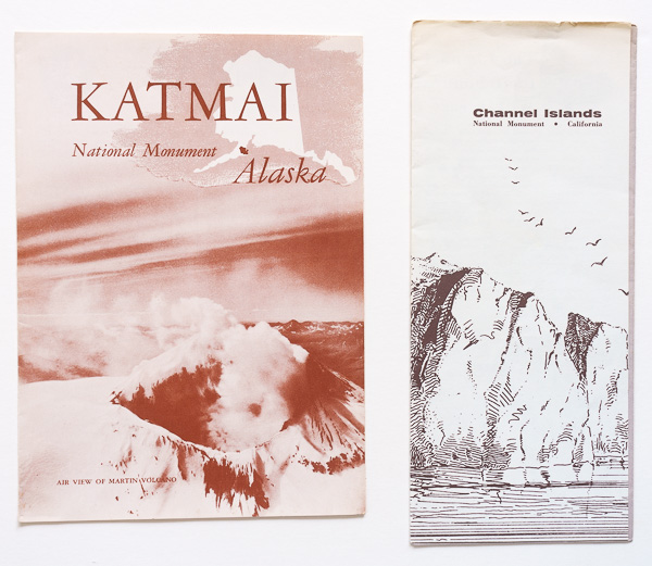
For Katmai, 34 years elapsed between its 1918 monument proclamation and the earliest brochure represented in the archive. Channel Islands waited about 30 years. These places were difficult to visit, but their histories demonstrate how long an NPS national monument could exist without the visitor literature associated with national parks.

Earliest visitor guide folding brochures for Katmai National Monument (1952) and Channel Islands National Monument (1968).

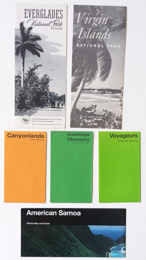
New parks versus new monuments. To remove the effects of those older units, we can compare only new units established after World War II. For national parks, I excluded places that were simply redesignations of existing monuments or other NPS units. Of the 37 national parks established or redesignated after World War II, only eight were established without redesignating an existing NPS unit. The National Park of American Samoa, authorized in 1988 and established after the necessary land leases were signed in 1993, remains the most recent of them.

Earliest visitor guides for Everglades (1950), Virgin Islands (1958), Canyonlands (1967), Guadalupe Mountains (1972), Voyageurs (1975) National Parks and the National Park of American Samoa (1997).

New National Park Established Earliest brochure Lag
Everglades194719503 years
Virgin Islands195619582
Canyonlands196419673
North Cascades196819724
Redwood196819691
Guadalupe Mountains197219720
Voyageurs197519750
National Park of American Samoa199319974

The median interval is 2.5 years. Compare that with newly designated postwar national monuments for which the surviving brochure record allows the interval to be measured:

New National Monument Designated Earliest brochure Lag
Castle Clinton194619537 years
Fort Union195419562
Booker T. Washington195619604
Grand Portage195819624
Russell Cave196119665
Buck Island Reef196119676
Agate Fossil Beds196519672
Alibates Flint Quarries1965197510
Biscayne196819724
Florissant Fossil Beds196919745
John Day Fossil Beds197519794
Congaree1976198812

Here the median interval is 4.5 years, almost twice the national-park figure. Ten of the twelve monuments waited four years or more; no new national park waited more than four. Archives are not necessarily complete. However, taken together with the prewar evidence, they point in the same direction: national park designation continued to correlate with faster publication even after national park and national monument brochures had become visually equivalent.

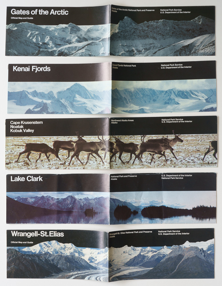
On December 1, 1978, President Jimmy Carter used the Antiquities Act to proclaim large areas of Alaska as national monuments. Among them were Gates of the Arctic, Kenai Fjords, Kobuk Valley, Lake Clark, and Wrangell-St. Elias. All five were administered by the NPS from their creation. The Alaska National Interest Lands Conservation Act (ANILCA) of December 2, 1980 protected more than 100 million acres of federal land in Alaska and was a conservation milestone because it represented the largest single expansion of protected lands in U.S. history. Among other things, it redesignated the five areas as national parks and preserves. Because of their remote Alaska location and the brevity of the national monument phase, all five passed through their national monument phase without a brochure represented in the historical record, just like Acadia, Grand Canyon, Zion, Bryce Canyon, and Carlsbad Caverns during the initial NPS period.

Unigrid visitor guides for Gates of the Arctic (1995), Kenai Fjords (1985), Kobuk Valley (1990), Lake Clark (1985), and Wrangell-St. Elias (1990) National Parks and Preserves continuing the initial design.
For decades, national monuments received secondary treatment. That hierarchy was consistent with an early conception of national parks as a particularly selective designation, which I discussed in Roger Toll and the Lost Standard of National Parks. A place could be worthy of federal protection without necessarily meeting the higher standard for national park status. At the same time, about half of today’s national parks were first protected as national monuments. The Antiquities Act allowed protection to precede recognition as a national park. Grand Canyon did not become worthy of protection when Congress made it a national park in 1919; Death Valley did not become nationally significant when its designation finally changed in 1994. Their monument status protected them while the judgment about national park status came later. The changing brochures make that history visible: national parks and national monuments once occupied clearly different positions within the system, while the path from one designation to the other repeatedly demonstrated the foresight and enduring value of the Antiquities Act.

Part 6 of an ongoing series: 1 | 2 | 3 | 4 | 5 | 6 | to be continued

Bears Ears, Dismantled Again

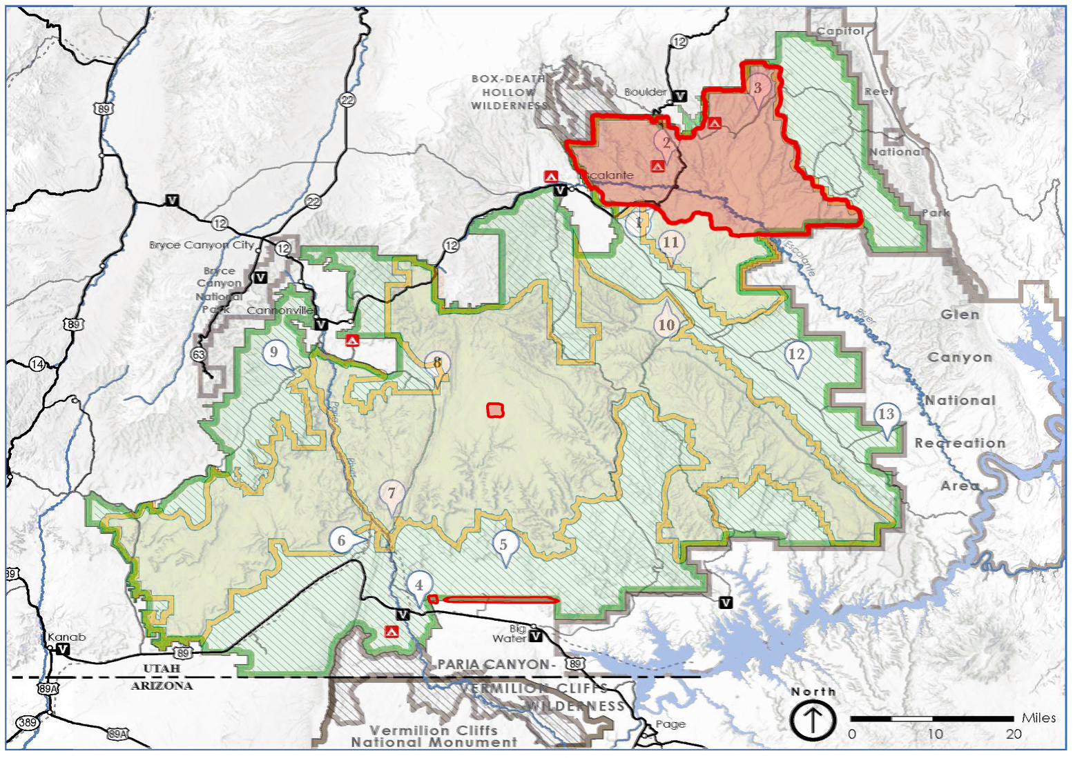
When President Trump reduced Bears Ears National Monument by 85 percent in 2017, it was difficult to imagine a more drastic dismantling. The 1.35-million-acre monument established by President Obama in 2016 was cut to 201,876 acres. President Biden restored and slightly expanded it in 2021. On July 13, 2026, Trump reduced Bears Ears again. This time, he went further. The new proclamation leaves only 121,096 acres—about 9 percent of the restored monument. The remnant left in 2017 has been reduced by about 40 percent. The most precise map I’ve come across can be seen here.

Green: original boundaries of Bears Ears National Monument, established in 2016 and restored in 2021. Yellow: boundaries established during the first Trump administration in 2017. Red: boundaries established by the July 13, 2026 proclamation. Numbered markers identify locations featured in the Bears Ears chapter of Our National Monuments.

The new proclamation also does something the map cannot show. It abolishes the Bears Ears Commission. Bears Ears grew from a Native-led effort and was the first national monument to do so. The original proclamation created the Bears Ears Commission, composed of representatives of the Hopi Tribe, Navajo Nation, Ute Indian Tribe, Ute Mountain Ute Tribe, and Pueblo of Zuni, to advise federal agencies on management. After the 2021 restoration, that relationship developed into a collaborative management structure. The Bears Ears Commission represented a historic approach to public-lands management, giving those with the deepest and longest-standing ties to the land an ongoing, collective role in its stewardship. The Tribal seals added to monument signs in 2022 became a visible symbol of that progress. After the Commission was abolished, the Bureau of Land Management began removing those seals even from signs that remain within the new monument boundaries. What message does that send? That a decade of relationship-building can simply be erased? That the federal government can recognize a Tribal role in caring for Bears Ears, then remove both that role and its symbols when political power changes? The 2026 proclamation declares the Commission “disbanded and terminated” and removes the specific obligation for federal agencies to engage, consult, or coordinate with it or a comparable body.

To understand why that matters, it helps to hear Bears Ears described by people involved in creating the monument. I invited Utah Diné Bikéyah, the Native-led organization whose elders began developing the Bears Ears proposal in 2010, to introduce the Bears Ears chapter of Our National Monuments. Gavin Noyes, co-founder of Utah Diné Bikéyah, and Woody Lee, then its executive director, contributed the following essay while the 2017 reduction was still in effect.

Bears Ears – Deities in Conversation, by Gavin Noyes and Woody Lee, Utah Diné Bikéyah

Perhaps you have heard and even been inspired by the story of the Five Tribes who came together to protect the 1.3-million-acre Bears Ears National Monument in Southeastern Utah. The Hopi, Navajo, Zuni, Ute Mountain Ute, and Ute Indian Tribes aligned across cultural divisions and bestowed their vision for protecting this sacred landscape upon officials in Washington D.C., creating the first-ever indigenous-led national monument in the U.S. However, the story of Bears Ears goes back even further to the Native elders of Utah Diné Bikéyah (UDB), who began this journey with hope and a prayer in 2010. Even before then, though, a ceremony was set in motion by the Holy People that dates back to the beginning of time.

The Navajo teach all life on earth began as a conversation between the Holy People. One deity asked, “what kind of life should we create?” The second decided it should be the kind of life that every being can enjoy. So, the first deity said, “if we are going to pursue this action, it must be done through ceremony and the sacred.” The Holy People first created the universe around them. Then, the sun and the earth. Once the earth was made, one of the deities said, “all life must have a male and female form. Life will be in pairs.” The other said, “we have a sun, and so we shall create a moon, and they will follow each other.” Finally, the last thing left to create was the five-fingered people. Humans were created from insects, passing through five worlds, finally emerging into this one. Then the first Holy Person said, “so long as the sun comes up, it will remind everyone that the ceremony is still happening.” That is why we call this mother earth and why it is a sacred and holy place. We are still in the middle of a ceremony, and the mountains and buttes of Bears Ears are part of the ongoing ceremony where the sun still rises and sets for all creation, for all time.

Bears Ears has always been a place of peace, restoration, emergence, strong medicine, and healing powers. Beginning in 2010, at the request of local elders, Utah Diné Bikéyah created the 1.9-million-acre boundary proposal for Bears Ears. This request is again being made by the Five Tribes to restore and expand protections President Trump took away in 2017. At the outset, UDB’s founding Board Chairman, Willie Grayeyes, established the purpose of the Bears Ears National Monument as a place of healing, where we are each invited “to heal the land and its people.” Willie advises each of us to look deeper into ourselves. “Healing,” he says, is first rooted in our spirituality, and it has essential “psychological, physiological, and social components.”

In Navajo tradition, we are taught monsters once roamed the earth wreaking havoc on human society. Thanks to the “Twin Warriors,” five-fingered people were protected from the wrath of these beasts, who in their final hour pleaded for their lives to be spared. Instead of slaying the monsters, the warriors decided their bodies would be buried underground for all of eternity. As humans, we are taught never to disturb these monsters in their final resting place. The monsters we now understand represent oil, coal, natural gas, uranium, and other minerals placed under the earth’s crust. As humans, we must respect the monsters’ original life-saving plea and leave these negative forces buried. Failure to do so will unleash these “monsters” into the human realm once again.

Bears Ears National Monument is a geography for all “five-fingered people” to enjoy and preserve for our children and future generations. Our organizational name, “Diné Bikéyah” (pronounced di-NAY bi-KAY-uh), is a Navajo word that translates as “the relationship (ké) between the “sole of your foot” and “the earth.” When you visit Bears Ears or any sacred place on this beautiful planet, we at UDB invite you to take your shoes off, tickle the earth with your toes, and say a prayer. This small act will strengthen your relationship with the planet.

Diné Bikéyah, or our soles’ relationship to the earth, is sacred; it is the location on each of our bodies where we directly interact with the natural world with each step we take. We invite you to take your shoes off and feel the ground beneath you, wherever you are. You do not have to visit Bears Ears to know how to respect the earth. Even so, Bears Ears is a great teacher; she is also our companion and healer as we walk the earth. “Diné Bikéyah” is a concept we can all respect and understand wherever we are, and it is part of the ceremony we walk as the sun rises each day.

Some Places Removed from Bears Ears

That essay above was written years before the 2026 proclamation. Its discussion of the “monsters” beneath the earth has acquired an unintended immediacy. In explaining the 2026 reduction, the proclamation overtly and specifically cites silver, copper, molybdenum, lead, uranium, vanadium, and zinc as resources important to economic and national security. Sixty days after the proclamation, lands removed from the monument reopen to mineral and geothermal leasing and to mining claims.

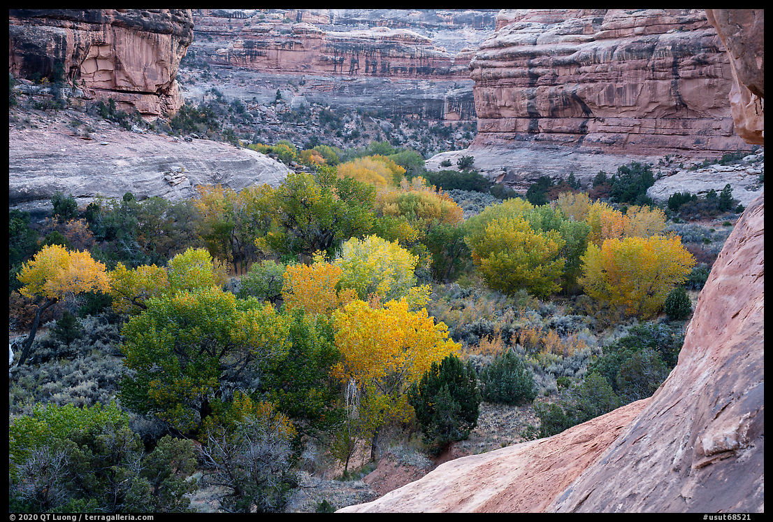
The photographs below were originally published in the Bears Ears chapter of Our National Monuments. Their locations are keyed to the map above. Seen together, they suggest what a boundary map cannot: the continuity and diversity of a landscape of canyons, mesas, forests, archaeological places, and open country. The six following locations are now excluded from the national monument.

3. Lockhart Basin from Needles Overlook, sunset

From Hatch Point Plateau, Needles Overlook opens onto a vast wilderness of rock 1,500 feet below, with views extending toward Indian Creek and Canyonlands National Park.

6. Fallen Roof Ruin, late morning

High above Road Canyon, a small Ancestral Puebloan structure lies beneath a richly patterned sandstone ceiling. Reflected sunlight from the canyon walls gives the shaded alcove its warm glow.

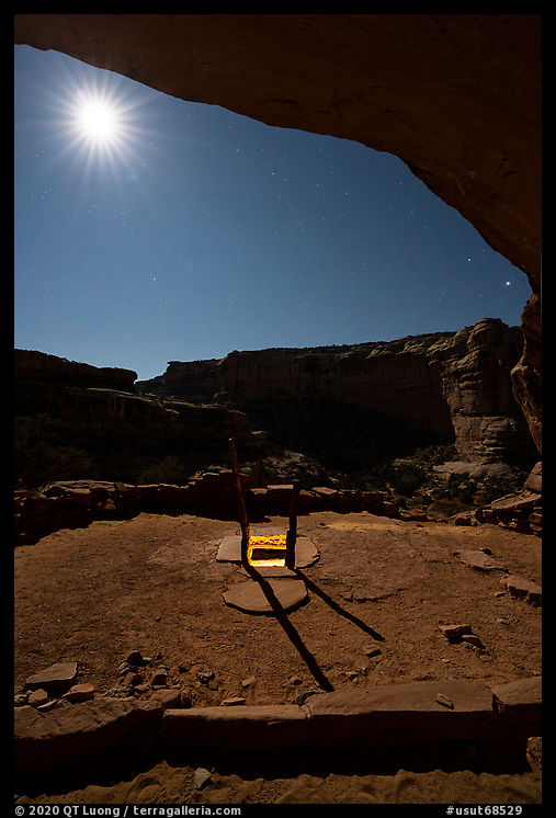
7. Bullet Canyon; Perfect Kiva and moon

The 50-mile Grand Gulch drains much of western Cedar Mesa and contains an exceptional concentration of rock art and well-preserved ancestral structures.

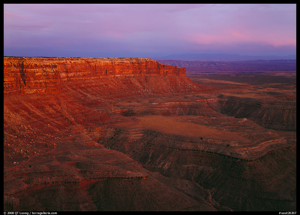
8. Valley of the Gods from Moki Dugway, afternoon; Muley Point, sunset

At the southern edge of Cedar Mesa, the plateau drops abruptly toward the San Juan River. From the Moki Dugway and Muley Point, immense views extend across Valley of the Gods toward Monument Valley and the deeply incised country of the San Juan.

9. Looking north and south from Valley of the Gods, early morning

Between the cliffs of Cedar Mesa and the San Juan River, sandstone buttes and spires rise from a broad desert plain. The landscape recalls nearby Monument Valley but remains quieter and much less developed.

10. Goosenecks of the San Juan River

The San Juan twists for more than six miles while advancing only about a mile and a half, carving meanders roughly 1,000 feet into the uplifted Colorado Plateau.

The 2026 proclamation takes a narrow view of what merits protection. It calls the landscapes seen above “generic,” and argues that petroglyphs, pictographs, prehistoric ruins, and other cultural resources are too common across the West to justify protection of such a large area. That is not only a disagreement over where to draw a line. It is a disagreement over what Bears Ears is: not a collection of isolated archaeological sites and scenic features, but a cultural landscape whose meaning lies in the relationships among places, landforms, routes, resources, and generations of human presence. A boundary drawn tightly around selected “objects” may leave some of them technically protected while severing them from the larger landscape that gives them context. The photographs that follow show three such places. They remain inside the monument, but now lie perilously close to its new boundaries. Out of the ten locations in the Bears Ears chapter of Our National Monuments, only one, Mule Canyon, remain solidly inside the new boundaries.

1. Aerial view, West Bears Ears Butte

Elk Ridge rises nearly 9,000 feet between the Abajo Mountains and Cedar Mesa. The twin Bears Ears buttes, visible across much of the region, are sacred to area Tribes and traditionally used for gathering medicinal plants; I chose to photograph them from the air rather than stepping on them.

2. Newspaper Rock

Indian Creek cuts through towering Wingate sandstone walls. At Newspaper Rock—Tse’ Hane, “rock that tells a story,” in Navajo—more than 650 human figures, animals, and symbols were pecked into the dark desert varnish by people from several cultures over centuries.

4. Aerial view of Comb Ridge and Comb Wash, late afternoon

The 80-mile Comb Ridge forms the eastern edge of Cedar Mesa. This immense tilted monocline is cut by numerous box canyons and alcoves where Ancestral Puebloans found shelter. While the ridge remains within the 2026 boundaries, parts of Comb Wash have been newly excluded.

Nine years of warning

There is another reason this second reduction is harder to accept. In 2017, the scale of the attack was unprecedented. Afterward, nobody could say the vulnerability was unknown. The restoration in 2021 was a victory, but not a durable one.

On July 12, one day before the proclamation, Diné scholar Len Necefer published “Bears Ears Is About to Be Cut Again. The Environmental Establishment Had Nine Years.” His argument is uncomfortable but important: the national environmental movement had ample warning, substantial resources, legal expertise, national attention, and broad public support, while Native-led capacity remained comparatively underfunded.

Public support was not an obstacle. A December 2024 survey of Utah voters found 71 percent support for preserving Bears Ears as a national monument, 89 percent saying Tribes should have a strong role in managing ancestral lands, and 80 percent saying the incoming administration should uphold the existing Tribal agreement. Money was not an obstacle. During those nine years, the five main national environmental organizations (four of which I have supported directly) who participated in the fight reported $91 million in senior compensation.

The national environmental organizations did conduct work in litigation, advocacy, and organizing. Still, results matter. If the objective after 2017 was to restore Bears Ears when political power changed, we succeeded in 2021. If the objective was durable protection, we failed. In the days after the new reductions, the emails I received were overwhelmingly denunciations accompanied by requests for donations. Fundraising is necessary, but after nine years of warning, another emergency appeal cannot substitute for asking why the protection was still so fragile. Necefer asks us to examine not only how much money conservation has, but where it goes and what kind of power it builds. Utah Diné Bikéyah operates on a shoestring budget. Bears Ears originated with Native organizers. Now the Bears Ears Commission itself has been abolished.

The Antiquities Act under threat

The danger extends beyond Bears Ears. The Antiquities Act itself is under attack. For 120 years, presidents of both parties have used the 1906 law to protect places of historic or scientific importance. Half of national parks first received federal protection as national monuments.

Project 2025 did not merely call for another review of national monuments. It provided a roadmap which is unfolding. Its Interior chapter described the 2017 reductions as insufficient, urged a future administration to defend further reductions so the Supreme Court could rule on presidential authority to shrink monuments, and called for repeal of the Antiquities Act.

In 2021, when the Court declined to hear a challenge to a marine national monument, Chief Justice John Roberts wrote separately to question whether the Act’s requirement that reservations encompass the “smallest area compatible” with protecting their objects still imposed a meaningful limit. No other justice joined his statement, but he suggested that a better case could present the issue. Then, on June 23, 2026, less than three weeks before the new reductions, the Tenth Circuit revived Utah’s challenge to President Biden’s Bears Ears and Grand Staircase–Escalante proclamations. It held that courts may review claims that a president exceeded statutory limits under the Antiquities Act and sent the case back for further proceedings.

Downloads from Our National Monuments

I created Our National Monuments in response to the 2017 review of national monuments. The Bears Ears chapter brought Utah Diné Bikéyah’s essay together with my photographs, map, and notes. With Bears Ears diminished again, I am making that chapter freely available, along with the expanded mobile field guide, in the hope that they will help readers better appreciate this extraordinary landscape, and, ideally, experience it for themselves with care and respect.

Original Bears Ears book chapter (PDF, 4.7MB)
Preserves the Utah Diné Bikéyah essay, photography, sequencing, map, and design of the book.

Bears Ears mobile field guide (PDF, 18.8MB)
Expanded maps, directions, coordinates, and location notes for visitors and photographers.

My companion post, Grand Staircase–Escalante, Dismantled, shows what the same July 13 action removed from that monument. Bears Ears raises an additional question. The first dismantling in 2017 was a warning. Nine years later, Bears Ears is smaller still, its Tribal commission has been abolished, and the law that made its protection possible faces a broader challenge. The question is no longer only how Bears Ears can be restored again, but rather what must change before the next restoration so that it can last.

Grand Staircase–Escalante, Dismantled

On July 13, President Trump once again stripped national-monument protection from most of Grand Staircase–Escalante National Monument in Utah. In 2017, his first administration reduced the monument by nearly half. Together with the drastic reduction of Bears Ears (just renewed, and even worse), the action was widely described as the largest rollback of federal land protections in American history. Public opposition was intense, and President Biden restored the monument’s boundaries in 2021.

This time, a far more extreme attack has barely registered in the national news. Trump reduced Grand Staircase–Escalante from approximately 1.87 million acres to just 181,541 acres—a 90.3 percent reduction. The 2017 reductions fractured Grand Staircase–Escalante into three separate units: Grand Staircase, Kaiparowits, and Canyons of the Escalante. The 2026 proclamation effectively eliminates two of those three units. The Grand Staircase Unit disappears entirely, while the Kaiparowits Unit survives only as an 8,900-acre fragment renamed Kaiparowits Horizons. What remains of the monument is largely confined to the Canyons of the Escalante, leaving most of the landscapes that gave Grand Staircase–Escalante its national significance outside the monument. A more precise map can be seen here.

Green: original boundaries of Grand Staircase–Escalante National Monument. Yellow: 2017 boundaries established during the first Trump administration. Red: boundaries established by the July 13, 2026 proclamation. Numbered markers identify locations featured in the Grand Staircase–Escalante chapter of Our National Monuments.

Grand Staircase–Escalante marked an important point in the evolution of the Bureau of Land Management (BLM). I have written before about how the 1976 Federal Land Policy and Management Act transformed the BLM from the caretaker of lands once expected to be disposed of into the steward of a permanent public estate, with conservation among its responsibilities. Twenty years later, Grand Staircase–Escalante became the first national monument managed by the BLM, establishing a precedent for recognizing exceptional conservation values within lands that remained under the agency’s multiple-use mandate. Four years later, building on that precedent, the Interior Department created the National Landscape Conservation System, now known as the National Conservation Lands. Seen in that longer history, the dismantling of Grand Staircase–Escalante represents more than the loss of protection for individual places. It reverses part of a decades-long expansion in how we have understood the value and purpose of our public lands.

The lines on the map do not make the landscapes themselves disappear, nor does exclusion from the monument mean that every other protection vanishes. Much of the land remains federally owned, and some areas retain protections such as Wilderness Study Area status. What changes is the framework governing what those lands are for. The 2026 proclamation makes that shift unusually explicit: it cites the region’s mineral resources as a reason for reducing the monument and provides for excluded lands to be opened to mineral leasing and other uses under the public-land laws. The proclamation itself thus frames the reduction as a move away from the conservation priority embodied by the monument and back toward the broader extractive and multiple-use possibilities of BLM lands.

My book Our National Monuments was created in response to the 2017 review of national monuments. Through photographs, maps, and essays by writers and advocates closely connected to each place, it documented the twenty-seven monuments then under threat. The introduction to Grand Staircase–Escalante was written on behalf of Grand Staircase Escalante Partners by Stephen Trimble, one of the foremost writers on the Colorado Plateau and the American West. The author or editor of more than two dozen books on nature, landscape, and conservation, he has spent decades documenting the region’s ecology, history, and cultures. He is also a recipient of the Sierra Club’s Ansel Adams Award for Conservation Photography.

The photographs that follow were originally published in the Grand Staircase–Escalante chapter of Our National Monuments. Rather than attempting a comprehensive survey, the portfolio highlights a selection of places chosen for their ability to convey the monument’s remarkable variety of forms, colors, and experiences: sweeping slickrock landscapes, sculpted badlands, delicate hoodoos, natural arches, and narrow slot canyons. Seen together, they suggest the richness of a landscape far larger than any portfolio can encompass. Their locations are keyed to the accompanying map. Every one of them now lies outside the monument’s boundaries.

Rather than relying on political talking points about lands that are supposedly “empty”, “not walkable”, or lacking in value, I encourage everybody to visit these places and judge for themselves. To help make that possible, I am making available two free PDF downloads at the bottom of this post. The first presents the Grand Staircase–Escalante chapter from Our National Monuments as originally published, preserving its design. The second is from the companion mobile-friendly field guide with expanded maps, directions, coordinates, and location information. Of the thirteen featured locations, only two remain within the monument’s drastically reduced boundaries. The other eleven—those pictured in the portfolio below—have all been excluded. Whether your interest is in conservation, exploration, or photography, the best way to understand what lost monument protection is to experience these landscapes firsthand. The politicians who removed protection from these lands may have seen them only on a map. I hope you will encounter them in person.

Grand Staircase-Escalante, by Stephen Trimble, GSE Partners

Grand Staircase-Escalante is so big, so diverse, that choosing a favorite place resembles the proverbial blind man touching the elephant. There’s that beloved secret side canyon lush with orchids, monkeyflowers and maidenhair ferns. There is an otherworldly dome of sculptured, cross-bedded, butter-yellow rock. What about the big views across the Escalante River basin at sunset, leading your gaze past shadowed clefts and ruddy bands of slickrock to the elegant skyline of the Henry Mountains? Every canyon, every mesa, every back road has its special delights.

The monument’s enormity contributed to its founding. When President Bill Clinton signed the Grand Staircase-Escalante National Monument proclamation in September 1996, he created a gigantic natural laboratory. Scientists applauded his use of the 1906 Antiquities Act to grant special designation for 1.9 million acres of public lands, embracing sufficient space and multiple habitats to conduct innovative research on climate change, speciation, and migration corridors. As the first unit of the Bureau of Land Management’s (BLM) National Landscape Conservation System, the monument became the model for a new conservation mission for the BLM.

The monument proclamation acknowledged geologic and cultural treasures first noted 150 years ago by geologist and explorer John Wesley Powell. The monument’s rocks provide “one of the best and most continuous records of Late Cretaceous terrestrial life on Earth,” as the proclamation puts it. Scientists find new dinosaurs nearly every time they visit — notably in the Kaiparowits Formation, a fossil locality so rich that Grand Staircase turns out to be the best place on earth to study the extinction of the dinosaurs.

The president recognized the scientific importance of the hundred-mile elevation gradient between Grand Canyon and Bryce Canyon, with cliff-barricade risers and plateau treads, christened by pioneer geologists the “Grand Staircase.” He protected what was left of the Escalante rivershed above Lake Powell. This dissected sandstone wonderland formed the western anchor of a legendary national park proposal in the 1930s. Clinton’s proclamation ended a 30-year debate about whether we should strip-mine coal on the remote and pristine Kaiparowits Plateau.

Or so we believed.
The non-profit Grand Staircase Escalante Partners began working here in 2004 to advance monument science and “honor the past and safeguard the future,” with programs in research, conservation, and education. A decade of restoration partnerships eliminated invasive Russian olive from 90 river miles in the Escalante watershed. Recent efforts to acknowledge the monument as the ancestral lands of eight Native nations strengthen connections with indigenous neighbors on the Colorado Plateau.
None of this mattered once Donald Trump was elected president. Utah politicians saw an opening. Still incensed about President Clinton’s executive order, they believed the president had disrespected their insistence on the primacy of states-rights. Local officials lobbied the new administration to reduce and dismantle the monument. They dreamed of jobs and profits from extractive industry, with little regard for irreplaceable spiritual and scientific values.

President Trump opened the door for desecration in December 2017, when he reduced Grand Staircase by half, creating management chaos and legal confusion. He chopped a cherished and successful national monument into incoherent fragments, removing protections from lands excluded by these new boundaries. Controversial new BLM resource management plans would open vast areas of Grand Staircase-Escalante to clearcutting, unmanageable recreation, and increased off-road vehicle use.

In 2017, Grand Staircase Escalante Partners joined other conservation and scientific organizations in the legal battle to restore the monument’s integrity. One way or another, defenders of Grand Staircase believe we will see the day when we celebrate the reconsecration of this international treasure.

Some Places Removed from Grand Staircase–Escalante

The eleven locations below, from the Grand Staircase–Escalante chapter of Our National Monuments, now lie outside the monument’s boundaries. Numbers are keyed to the map above.

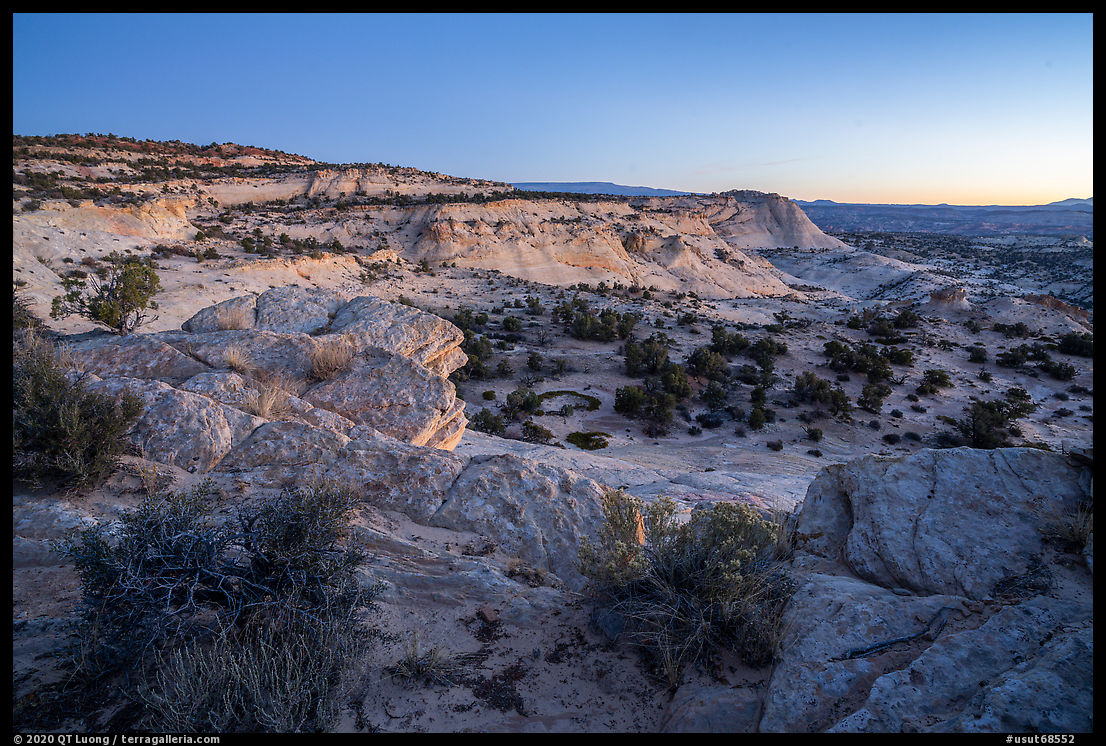
1. Head of the Rocks (Scenic Byway 12), dawn

One of the most expansive roadside viewpoints in the monument, Head of the Rocks overlooks a vast slickrock landscape stretching toward the horizon. The exposed layers reveal the geological complexity that defines Grand Staircase–Escalante.

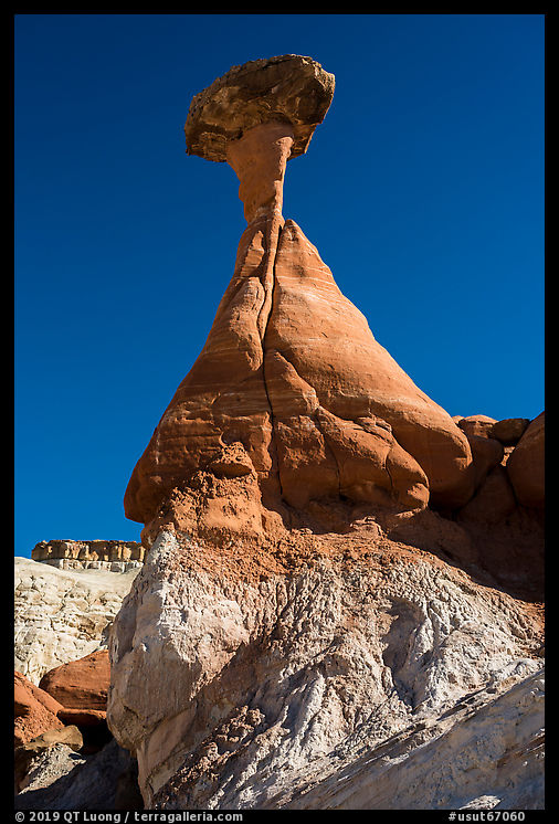
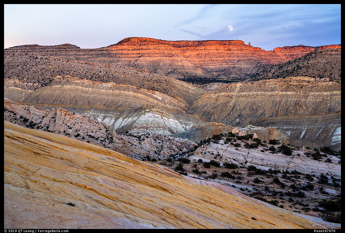
4. Toadstool Hoodoo (Rimrocks Hoodoos), morning

These improbable formations were created when resistant capstones protected softer rock beneath them from erosion. Their fragile forms illustrate geological processes still actively shaping the landscape.

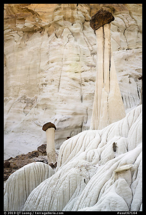
5. Towers of Silence (Wahweap Hoodoos), early morning

Rising from pale badlands, the Wahweap Hoodoos rank among the monument’s most elegant natural sculptures. Their slender forms appear almost architectural against the surrounding desert.

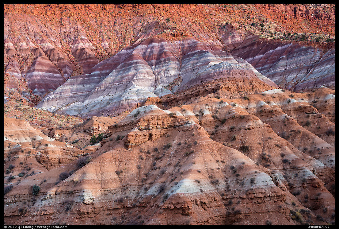
6. Paria Badlands, late afternoon

Layers of sediment weather into hills of extraordinary color and texture. What first appears barren reveals remarkable complexity when explored on foot.

7. The Cockscomb from Yellow Rock at sunset

A vast dome of cross-bedded Navajo Sandstone rises above the surrounding badlands. From its summit, a sweeping panorama reveals many of the geological formations that make Grand Staircase–Escalante unique.

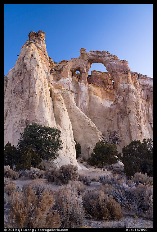
8. Grosvenor Arch, dawn

One of the monument’s best-known landmarks, Grosvenor Arch spans nearly ninety feet and rises 150 feet above the desert floor. Its scale reflects the immense forces that shaped the Colorado Plateau.

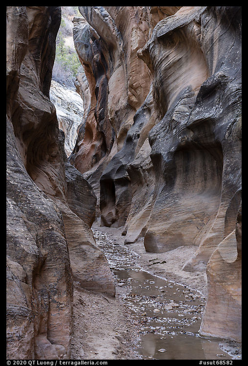
9. Narrows of Willis Creek, late afternoon

A modest stream still flowing has carved graceful passages through pale sandstone, creating one of the monument’s most accessible slot canyons. The constantly changing curves transform each bend into a new composition.

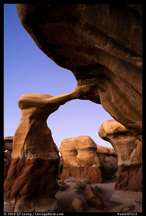
10. Metate Arch (Devils Garden), dusk

Hoodoos, arches, and balancing rocks emerge unexpectedly from open desert. Devils Garden demonstrates the playful variety of forms that erosion can create.

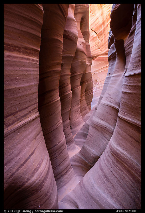
11. Zebra Slot Canyon (Cottonwood Wash), late morning

Named for the striped patterns that sweep across its walls, Zebra Slot Canyon compresses color, texture, and form into an extraordinarily narrow space. In places, the canyon is so constricted that passage becomes part of the experience.

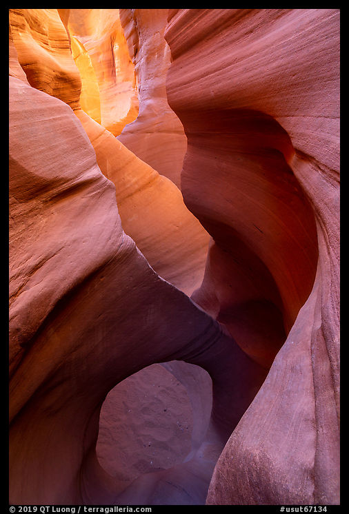
12. Peek-A-Boo Canyon (Dry Fork Coyote Gulch), late morning

Peek-A-Boo and Spooky are among the most celebrated slot canyons of the Escalante region. Their contrasting forms demonstrate the astonishing diversity hidden within the monument’s maze of sandstone.

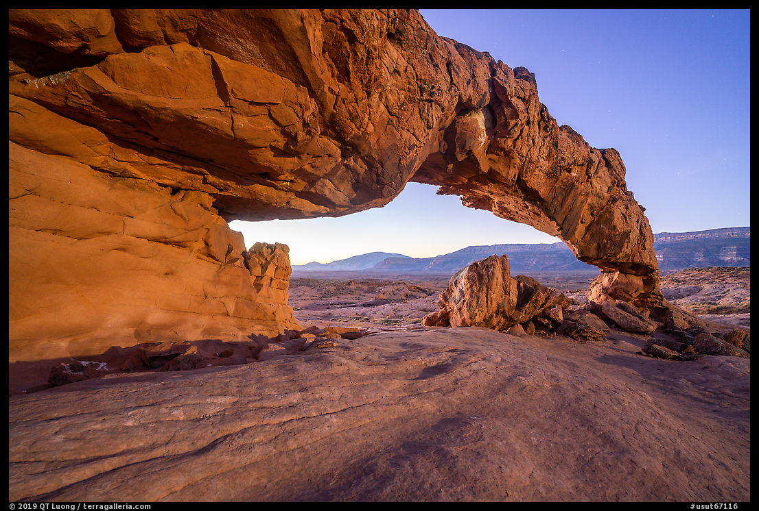
13. Sunset Arch (Forty Mile Bench), dawn

Hidden within an apparently featureless landscape, Sunset Arch reveals itself only at the end of a cross-country walk. Its unexpected appearance is a reminder that many of the monument’s greatest treasures remain invisible from the road.
Downloads from Our National Monuments

Original Grand Staircase–Escalante book chapter (PDF, 4MB)
Preserves the photography, sequencing, and design of the book.
Grand Staircase–Escalante mobile field guide (PDF, 8MB)
Expanded maps, coordinates, directions, and location notes for visitors and photographers. Note that internal links do not function unlike in the full guide.

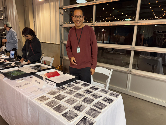
The Trail, Cleared

(click on images to enlarge)

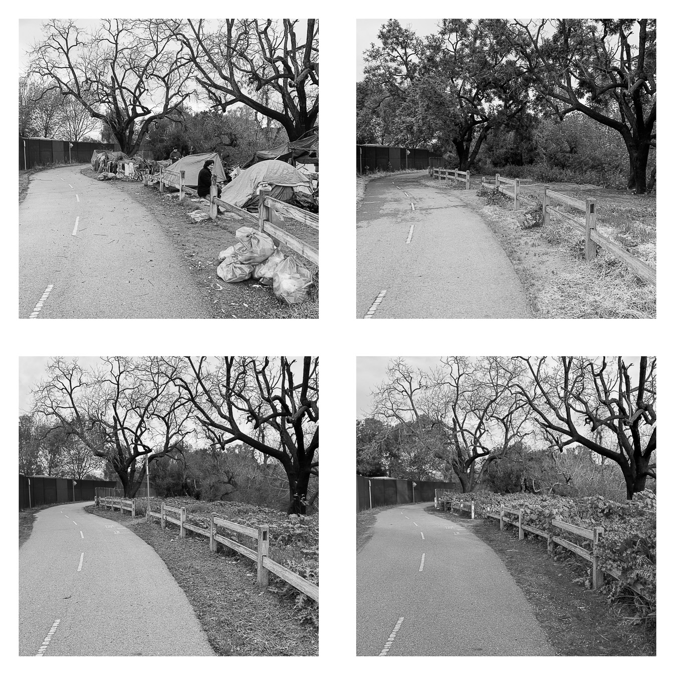
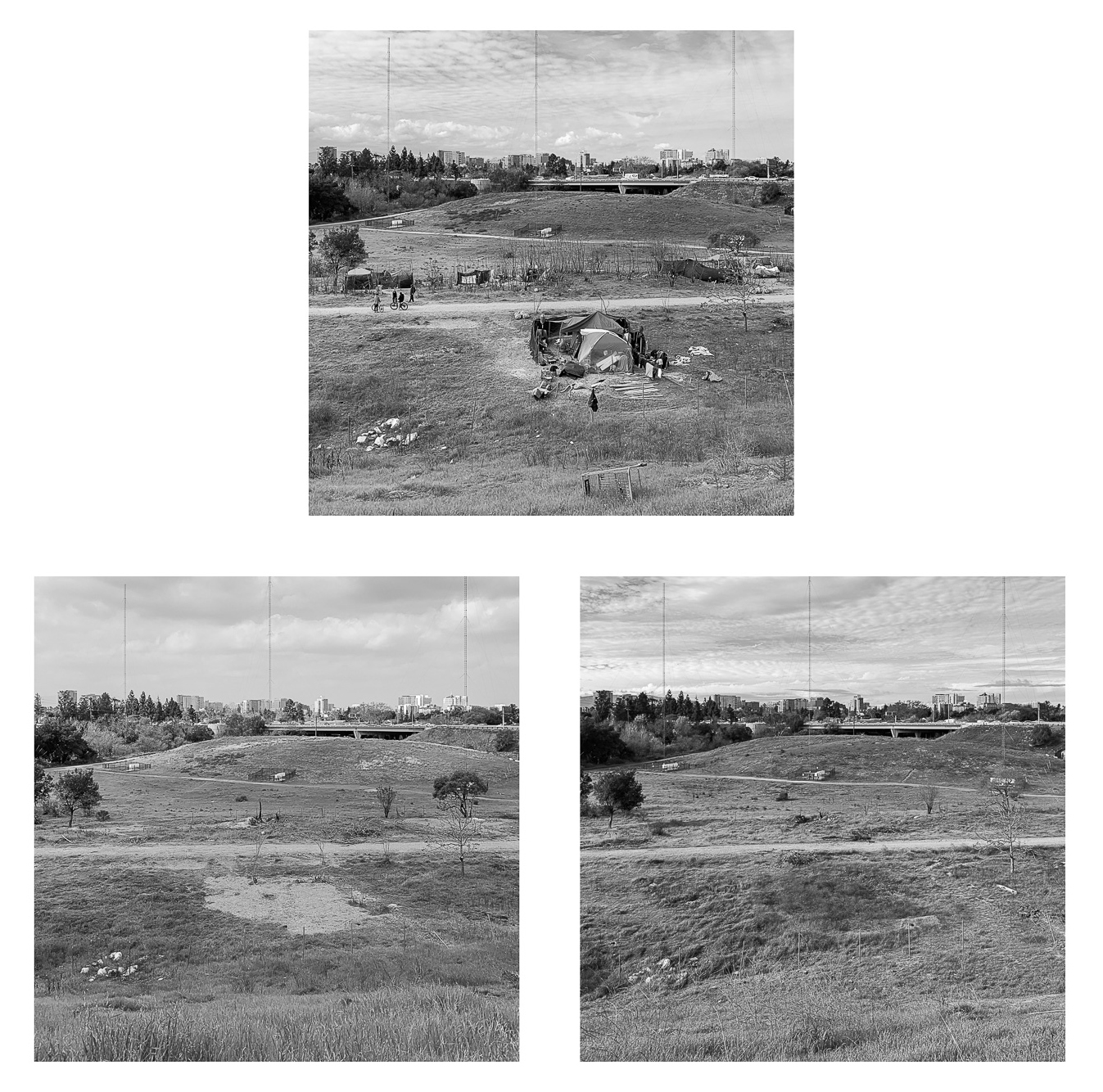
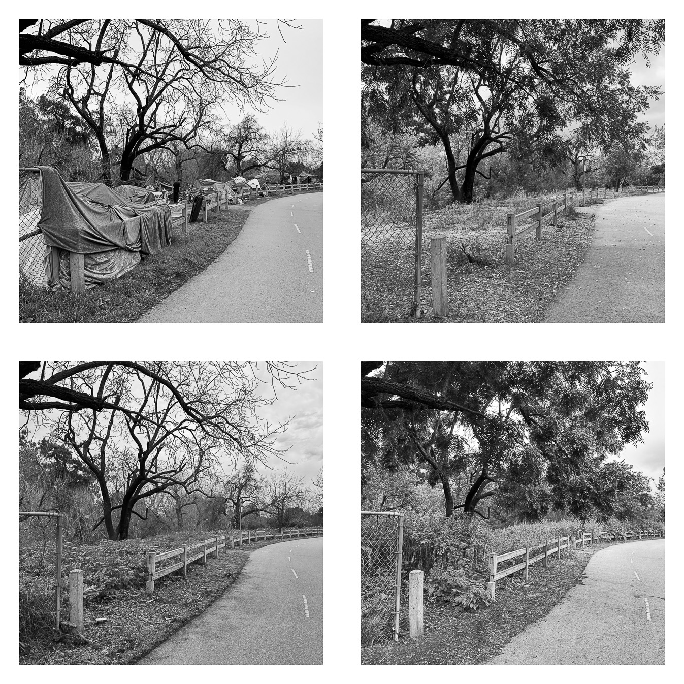
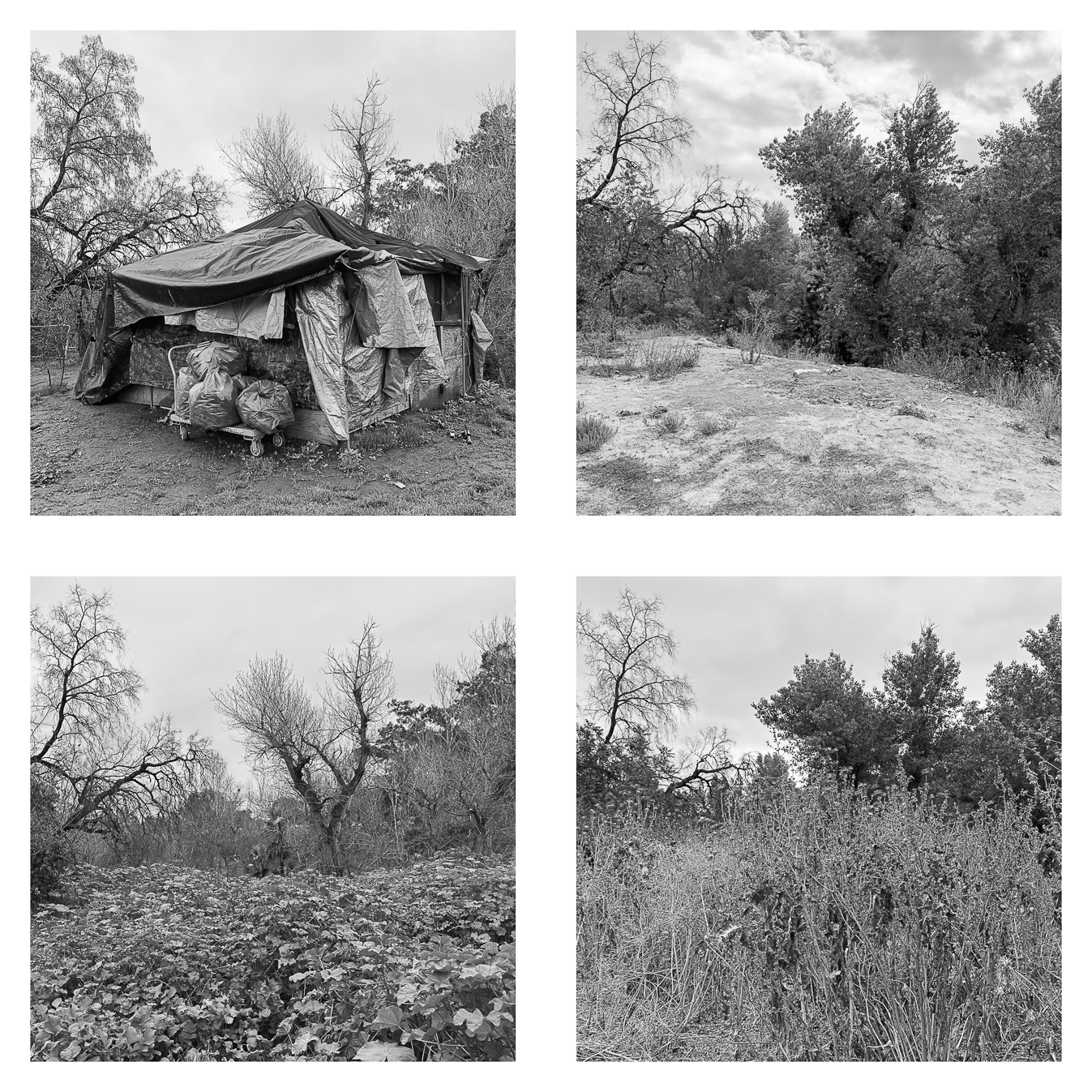
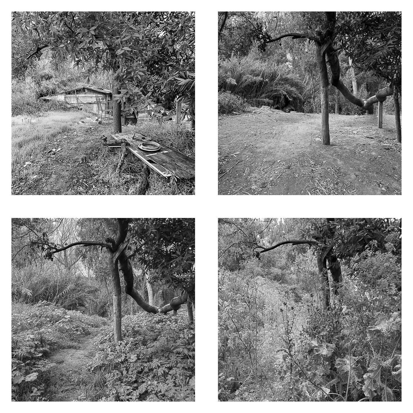
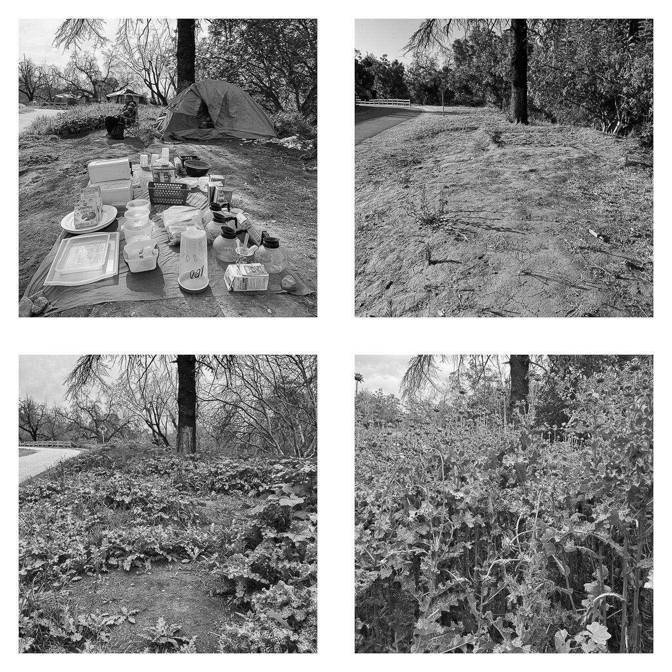
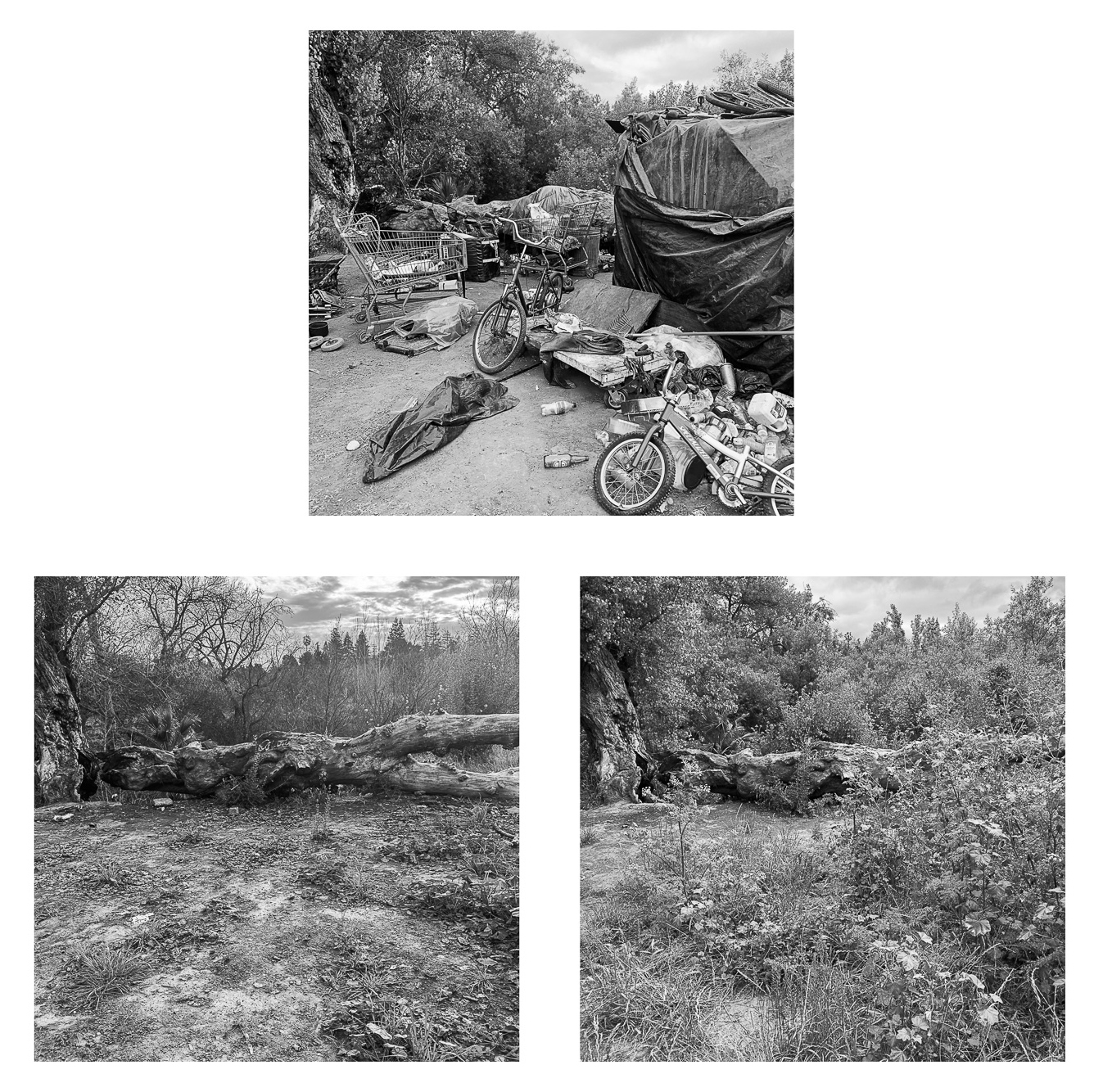
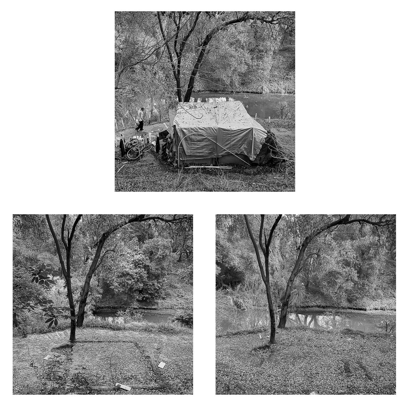
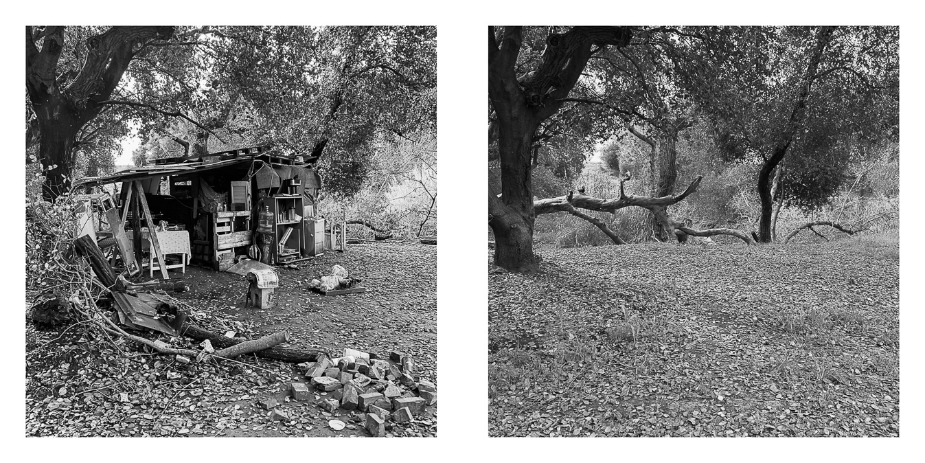
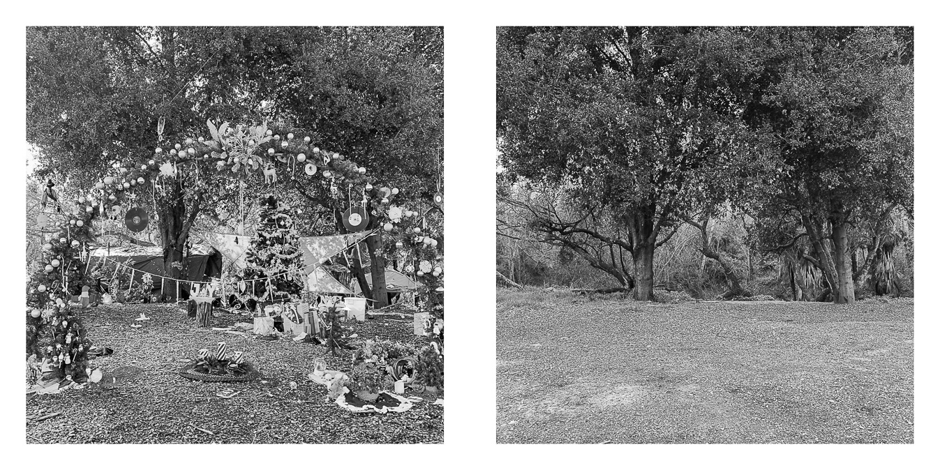
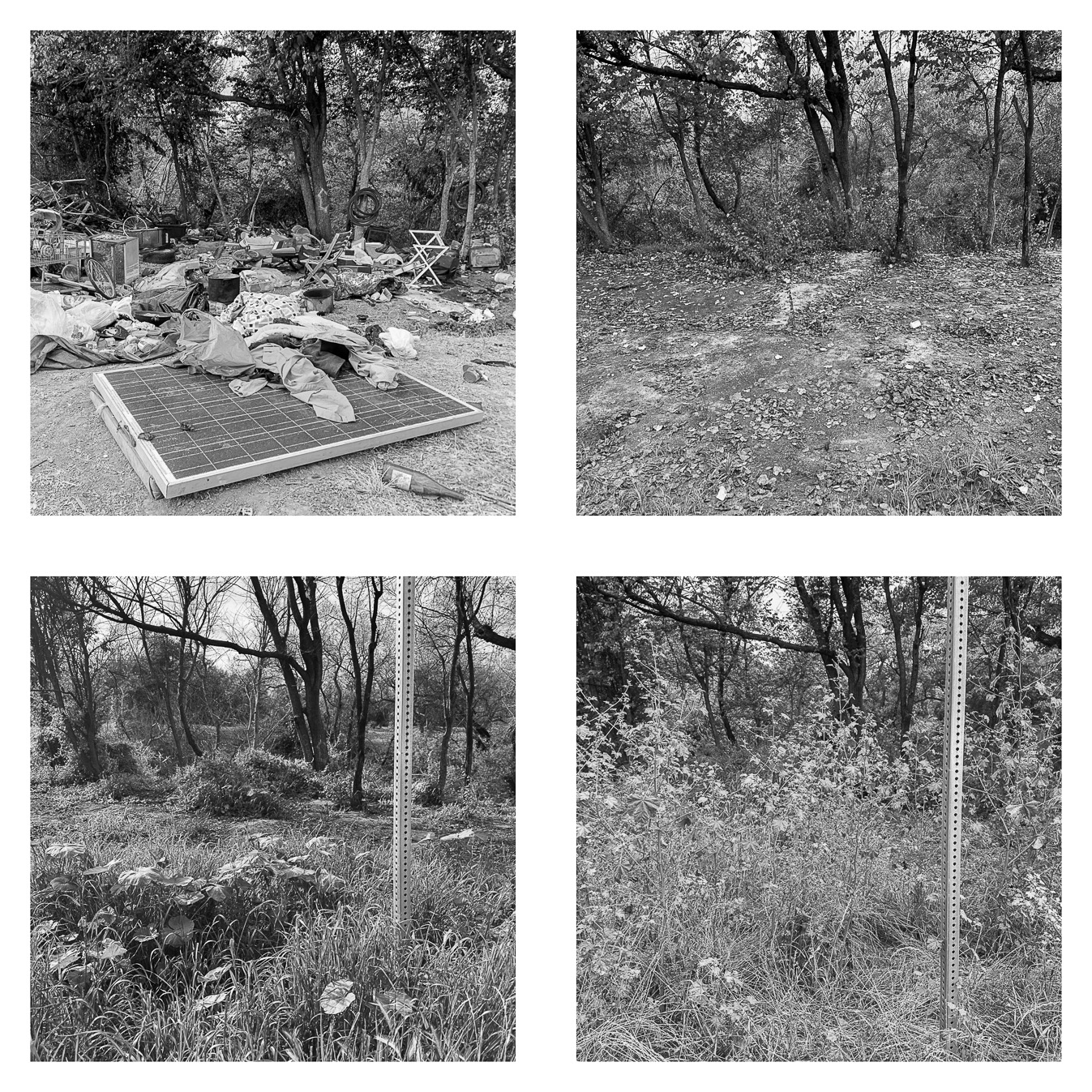
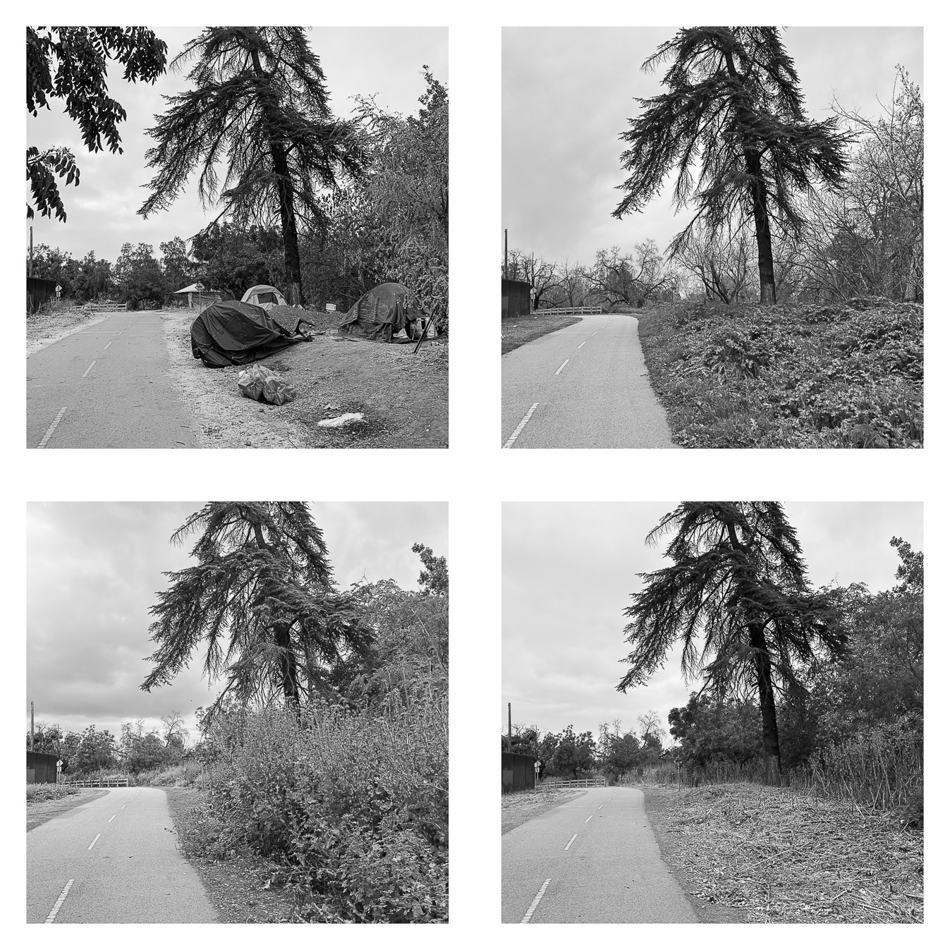
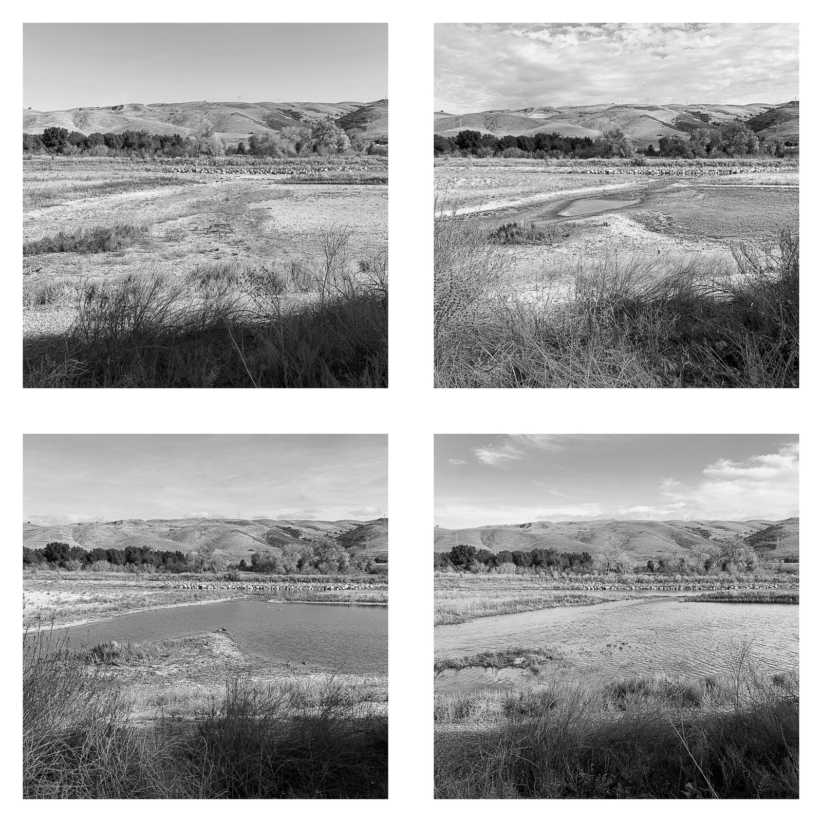
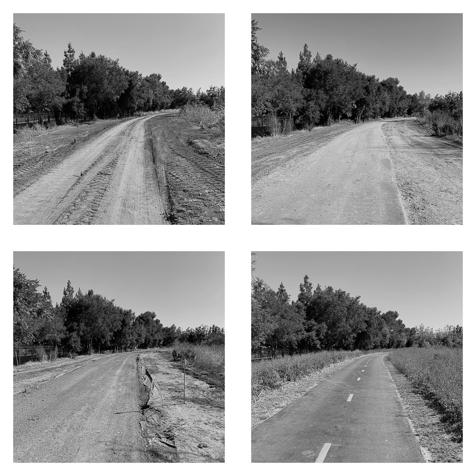
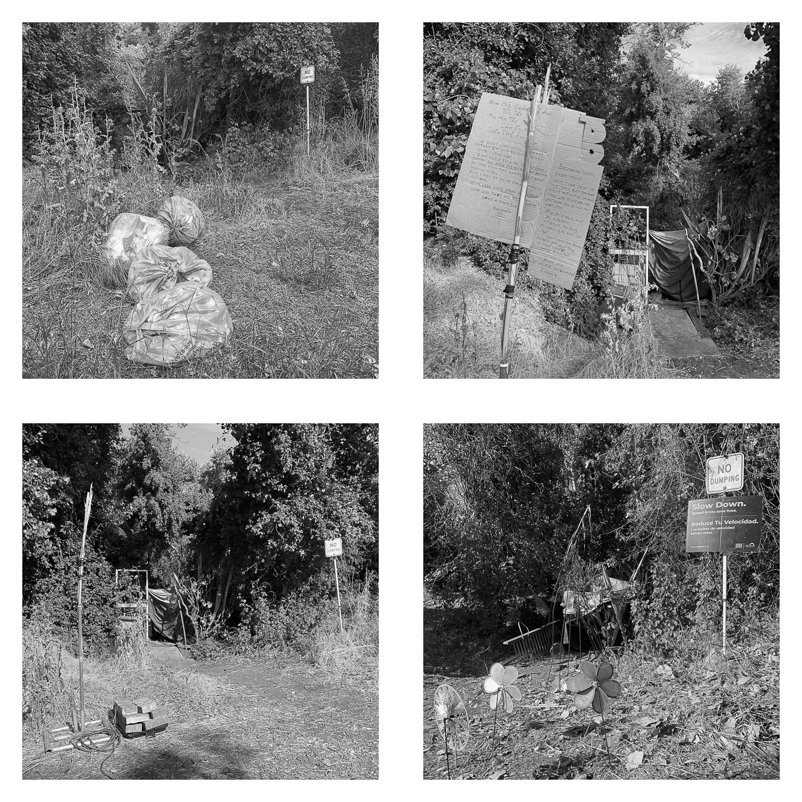
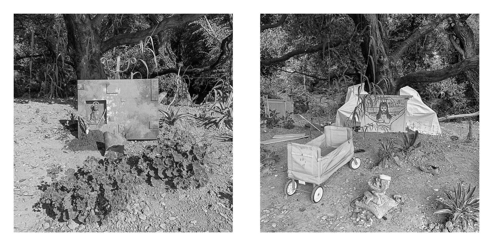
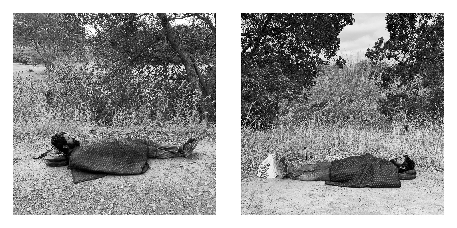
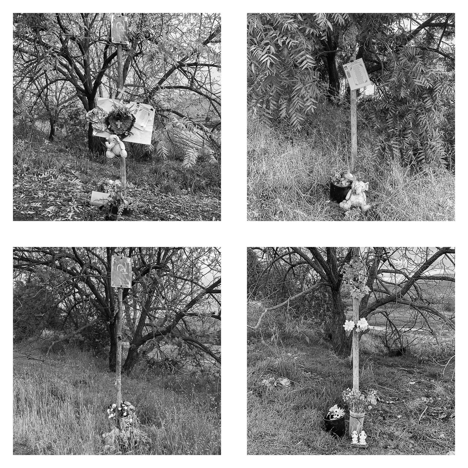
Across the country, cities are reclaiming marginal lands, often in places where unhoused people have lived. The Trail, Cleared examines what happens when ecological recovery and human displacement occupy the same ground.

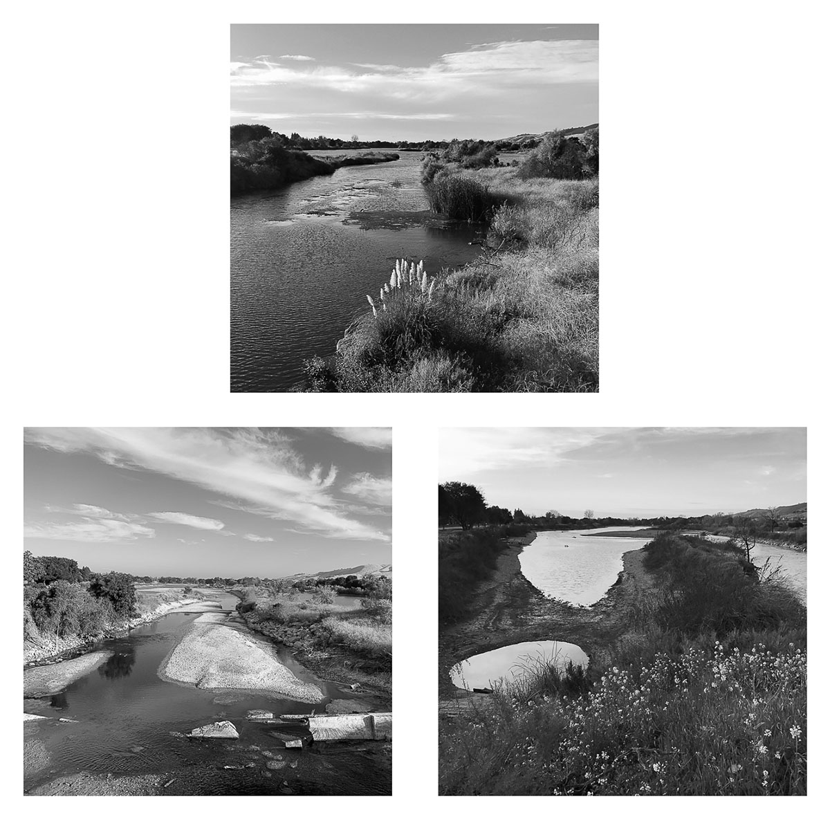
The work grows out of my long engagement with the Coyote Creek Trail, a corridor I photographed repeatedly from 2014 to 2024 for The Trail. That project followed the trail as a lived and contested landscape, where recreation, habitat, and makeshift dwellings existed side by side. The Trail, Cleared begins after that fragile coexistence was largely brought to an end. Following new policies aimed at removing encampments from the creek corridor, a series of 2025 abatements displaced nearly everyone living along the trail and established no-encampment zones.

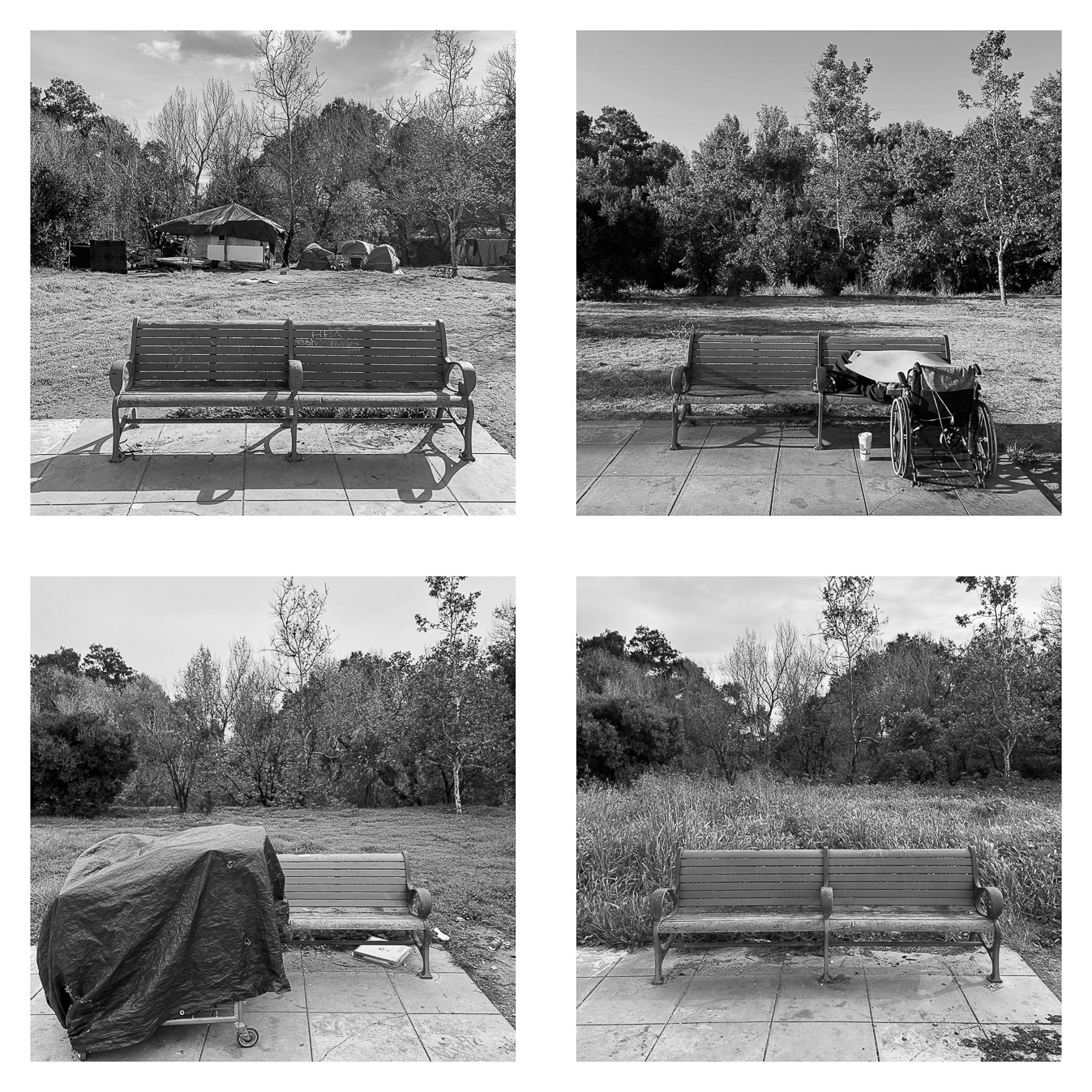
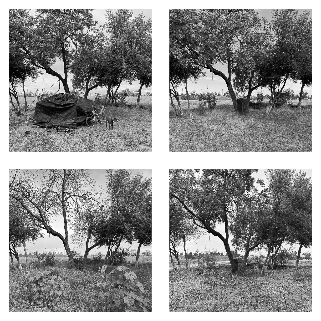
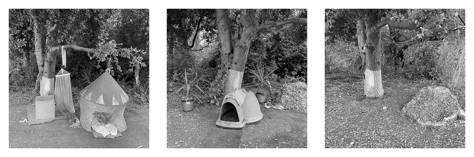
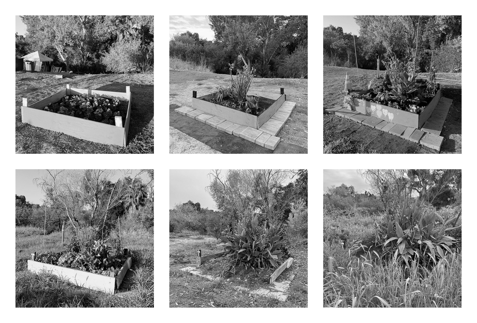
Returning afterward and missing familiar faces, I photographed instead the traces of their presence and the regrowth that gradually covered them. By applying rephotography to cleared encampment sites, the work addresses a subject rarely granted this kind of sustained visual attention.

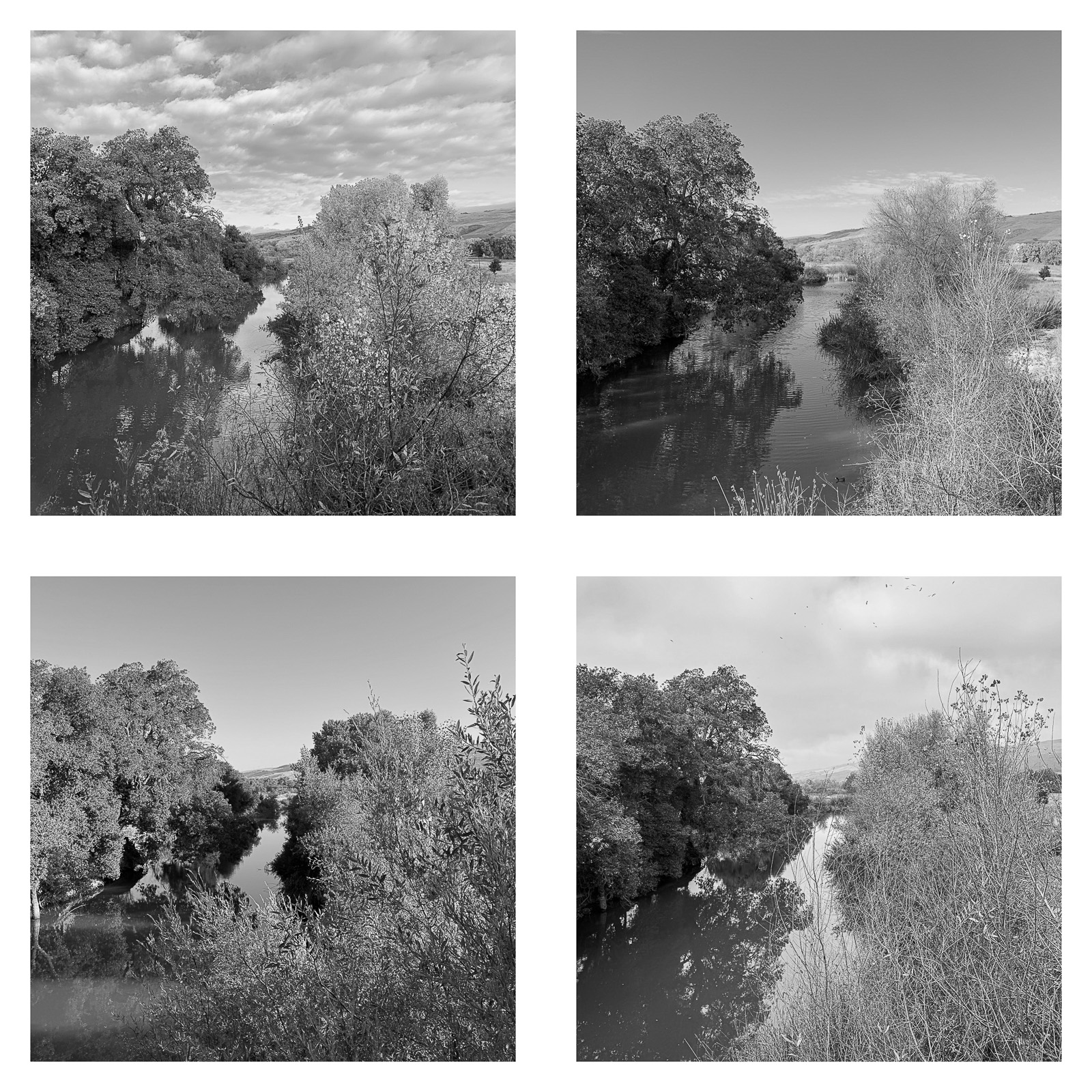
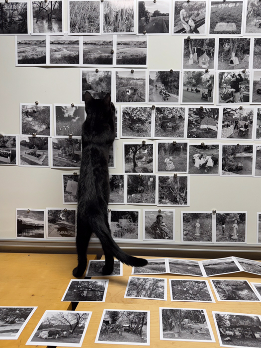
Repeating the same viewpoints over time and assembling them in grids, I use photography not only to record physical change, but also to question what counts as restoration, and what is being erased, in one of the world’s most prosperous regions. I print the photographs as square black-and-white images to evoke cycles of persistence and loss, and to frame human and natural subjects in equal measure.

The creek corridor may appear healed, but the grids resist a simple narrative of renewal. They ask what kind of restoration is possible when ecological recovery follows displacement, and how public land absorbs, conceals, and remembers the people who once lived there.


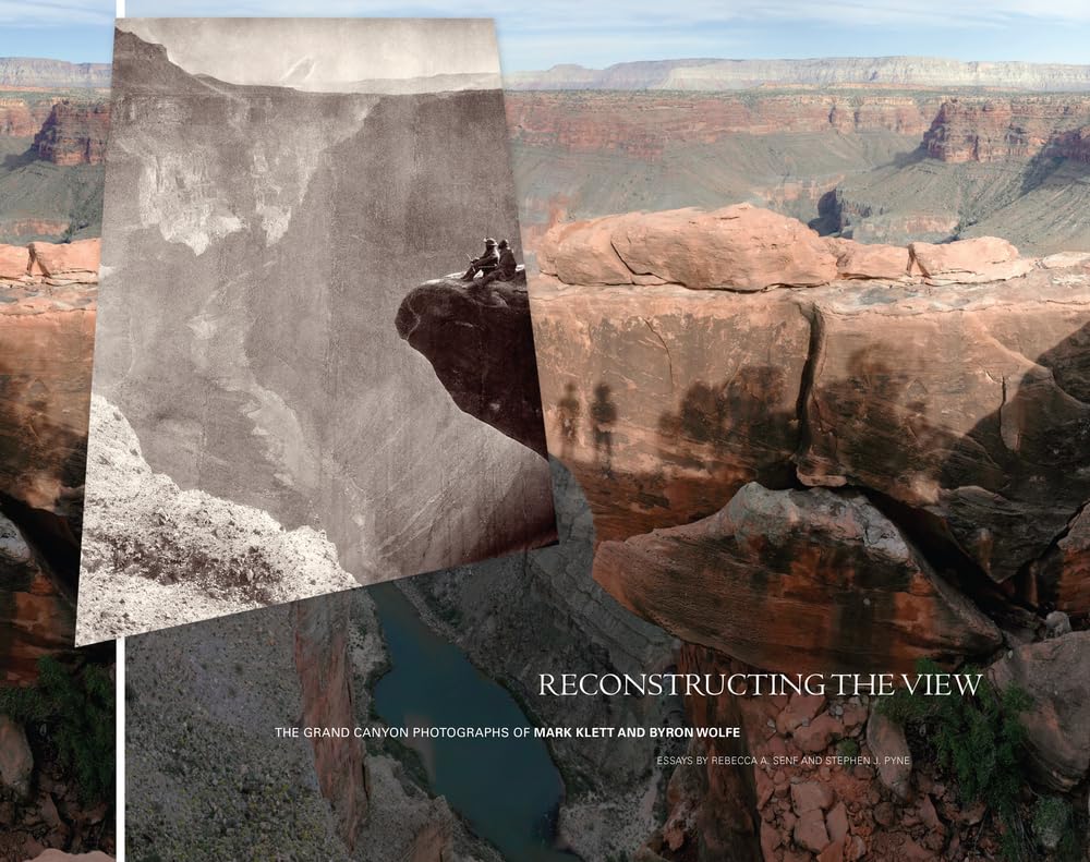
Rephotography is the practice of returning to a previously photographed site and making a new image from the same viewpoint, so that time becomes visible through comparison. Its value now seems self-evident within contemporary photography, but that was not always the case. Mark Klett has recounted showing rephotographic work to Ansel Adams, who reportedly responded, “Interesting, but that’s not art.” Virginia Adams later apologized discreetly. The anecdote is revealing: a method that once appeared closer to survey, documentation, or historical evidence has since become recognized as a powerful conceptual tool.

Several landmark projects helped establish that recognition. The Rephotographic Survey Project returned to nineteenth-century survey views of the American West, using repeated images to examine landscape change, photographic history, and the legacy of exploration. Camilo José Vergara’s long-term urban studies returned to the same buildings, storefronts, churches, and streets over decades, recording cycles of abandonment, adaptation, redevelopment, and neglect. Both projects use repetition to make historical change visible through place.

The Trail, Cleared differs from those precedents because its central subject is not what remains visible, but what has disappeared. The repeated view does not primarily measure geological change or urban transformation. It marks places where people once lived, then follows how those sites become visually absorbed back into the landscape. The later photographs may look calmer, greener, even restored, but their apparent resolution is unstable. They ask what kind of recovery depends on removal, and how quickly social history can become invisible.

This also distinguishes The Trail, Cleared from The Trail. In the earlier project, rephotography documented an ongoing condition: the corridor as a shared and contested space where encampments, wildlife, trail users, water, vegetation, and weather continually reshaped one another. The repeated views recorded flux. In The Trail, Cleared, they are oriented toward aftermath. The subject is no longer coexistence in motion, but memory after rupture.

That conceptual shift changed the methodology. In The Trail, repeated views usually emerged from years of moving through the corridor on foot. They were handheld, observational, and often discovered in the course of a longer passage. The alignment was based purely on memory. For The Trail, Cleared, I often returned directly to a remembered site, almost always with a tripod, to align the new image as closely as possible with the earlier one, using a reference image, often printed on paper.

That process was slower and more difficult than it may appear. At close range, a slight shift in camera position can dramatically alter the relationship between foreground and background. Klett’s western rephotographs were anchored by geological formations and the horizon line; in his Grand Canyon work, the canyon’s strata, rims, and distant profiles provided a vast but comparatively stable framework for alignment. Vergara’s urban repetitions by buildings, storefronts, and street grids. Along Coyote Creek, the reference points were less stable and less distinctive, being generally limited to vegetation. Branches grow, bend, are cut back. Exact alignment becomes a negotiation with a landscape that is actively covering its own evidence.

The grids slow down the before-and-after structure and resist the satisfaction of resolution. In some, change appears linear: vegetation steadily returns, covering the site and making it seem increasingly uninhabitable. In others, the process is cyclical, as the city cuts back growth and exposes the ground again. The result is neither a simple story of healing nor one of disappearance alone, but a more complex record of management, regrowth, memory, and erasure. A cleared site may seem restored, but the repeated frame asks what has been recovered, what has been erased, and what remains only as memory.

Time in The Trail

https://www.terragalleria.com/blog/time-in-the-trail

The Coyote Creek Trail has become part of my own geography. I ran there. I walked there. I returned again and again, now close to two hundred times. That repetition changed what I saw. At first, the trail appeared to be a narrow band of nature running through San Jose: trees, grasses, water, birds. It was not wilderness, and it did not announce itself as a subject. It was ordinary, nearby, and easy to overlook. Over more than a decade, that ordinariness became the point. The trail revealed itself as a managed ecosystem, a recreational corridor, a refuge, a route of passage, and a place where people live. Time is not only one of the themes of the work. It is also its method.

(click on image to enlarge)
Ten grids from The Trail are at the end of this post.
For single photographs, see a previous post

From Single Images to Sequences

For much of the project, I photographed The Trail as single observations. Each photograph stood on its own, but each also belonged to a larger accumulation. The existence of a vast archive, however, meant that on some days, when chance was not cooperating, I struggled to find new subjects to photograph.

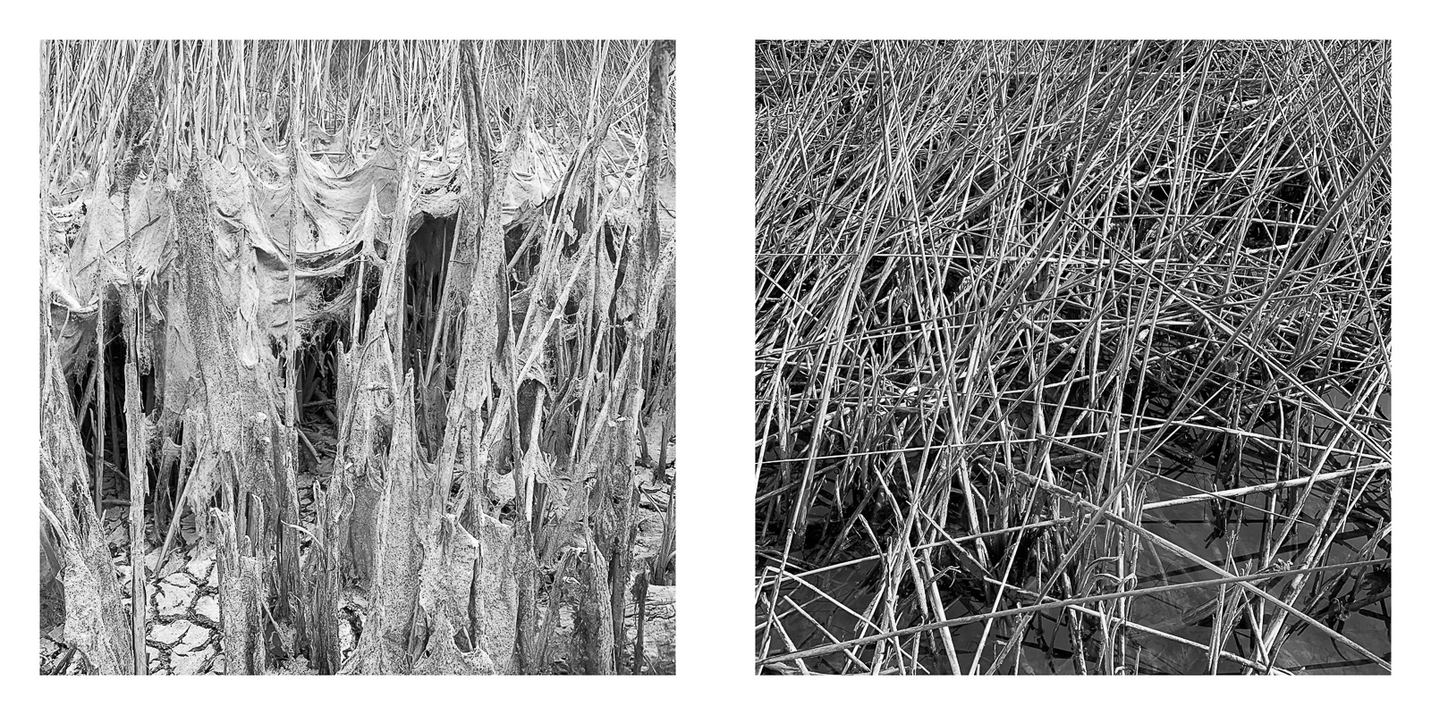
Over time, I began to pay more attention to specific sites. I realized that changes in subjects I had already photographed could renew their interest. That shift changed the work. Rephotography made visible what a single image could only suggest: growth, weathering, care, neglect, construction, disappearance, and return. Grids became a way to hold those changes together without forcing them into a single decisive moment. A memorial gains flowers, then loses them. Paper curls and fades. Stuffed animals weather. A flower bed is planted, grows, declines, and returns in altered form. Delicate and ephemeral draperies of mud cover reeds as water disappears. A doghouse appears under a tree, then the place around it changes. Seen once, these details might seem incidental. Seen again, they become evidence. Seen in a grid, they become time.

Photography fixes a moment. Rephotography unsettles that fixity. Each image says: this was here. The grid says: this did not stay the same. A single image describes a scene. A sequence shows that the scene has a life. The individual photograph can isolate; the grid relates. It allows time to enter not as nostalgia, but as structure.

Different Clocks

The Trail contains different kinds of time at once. There is the time of nature, slow, adaptive, and recurring. There is the everyday time of human activity: repeated acts of use and survival. There is the time of someone sleeping beside the trail, wrapped in a blanket, occupying a place designed for movement rather than rest. There is the time of someone pushing belongings, tending plants, making shelter, or marking a threshold at the edge of public space. Homelessness and clearance also introduce emergency time: crisis, deadline, countdown. For unhoused residents, time may be measured by the next notice or the next sweep. There is also the recreational time of runners, cyclists, families, and dog walkers.

The same corridor holds all of these clocks. It is a contested space, but the photographs do not need to stage a confrontation. The tension is already present in the different ways time is spent there.

Seasonal and Cyclical Time

The creek is governed by natural time, visible both in short seasonal shifts and in longer cycles of erosion, growth, flood, and drought. It carries geological time as well: a watercourse shaping banks and slowly rearranging the corridor through flow and sediment. Rephotography makes those forces visible: the repeated frame lets water and vegetation register as active agents rather than background.

But in The Trail, natural time is not pastoral comfort. Vegetation can shelter or conceal. Flooding can sustain the creek corridor while threatening those who live near it. The same place shifts from open to obscured, from dry to flooded, from bare to overgrown. Ecology and human presence are inseparable here: restoration, recreation, habitat, and habitation occupy the same narrow strip. Natural cycles reveal beauty, but also vulnerability.

Traces, Presence, and Care

For years, I photographed traces. Once people entered the frame, the project became clearer, changing from a study of overlooked land into a portrait of use. The rephotographic sequences extend the recognition that the land was never just scenery. They show that even when people are absent from the frame, their actions remain visible. Many of the sequences are about care. A memorial is maintained. A flower bed is planted. A religious image is placed near a shelter. A dog is given a small house. A camp entrance is arranged with signs, ornaments, barriers, paths, and objects that turn a margin into a place. These gestures are modest, but they resist the idea that the trail is merely public infrastructure or an ecological corridor. They show people making place, and the sequences clarify that care is not a single gesture.

Time is what makes the trail legible. It becomes a record of movement, growth, care, construction, habitation, disappearance, and renewal. The grids make one aspect of that time explicit: they show what changed because I kept coming back. But they are not the whole project. In this first phase of The Trail, the lived experience of the corridor still depends largely on the fluidity of single photographs: encounters, traces, gestures, bodies, animals, weather, light, and the unstable coexistence of different lives along the same path. The movement from single images to grids therefore does not replace the earlier work. It extends it. Rephotography gives structure to duration, while the single frame preserves the immediacy of passing through the trail and noticing what might not be there again. In The Trail, time is not background. It is the condition of seeing.

(click on images to enlarge)


Roger Toll and the Lost Standard of National Parks

https://www.terragalleria.com/blog/roger-toll-and-the-lost-standard-of-national-parks/

Summary: A critical discussion of recent and proposed national park redesignations, measured against the standard Roger Toll helped establish for the National Park Service nearly a century ago.

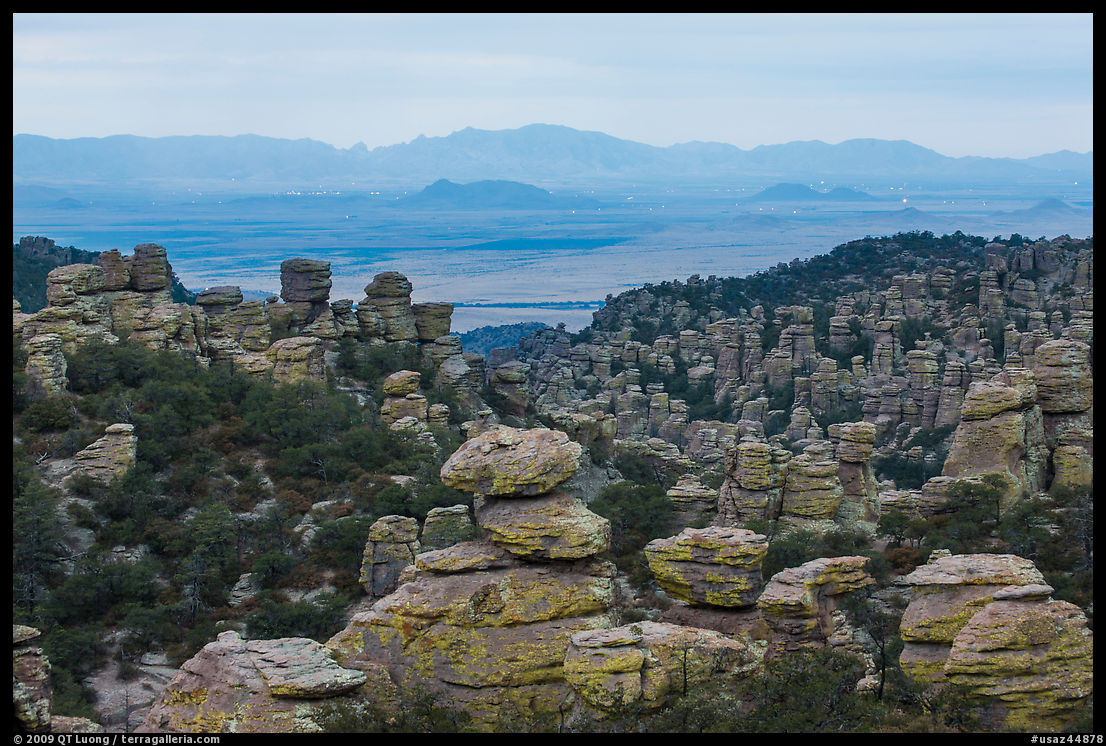
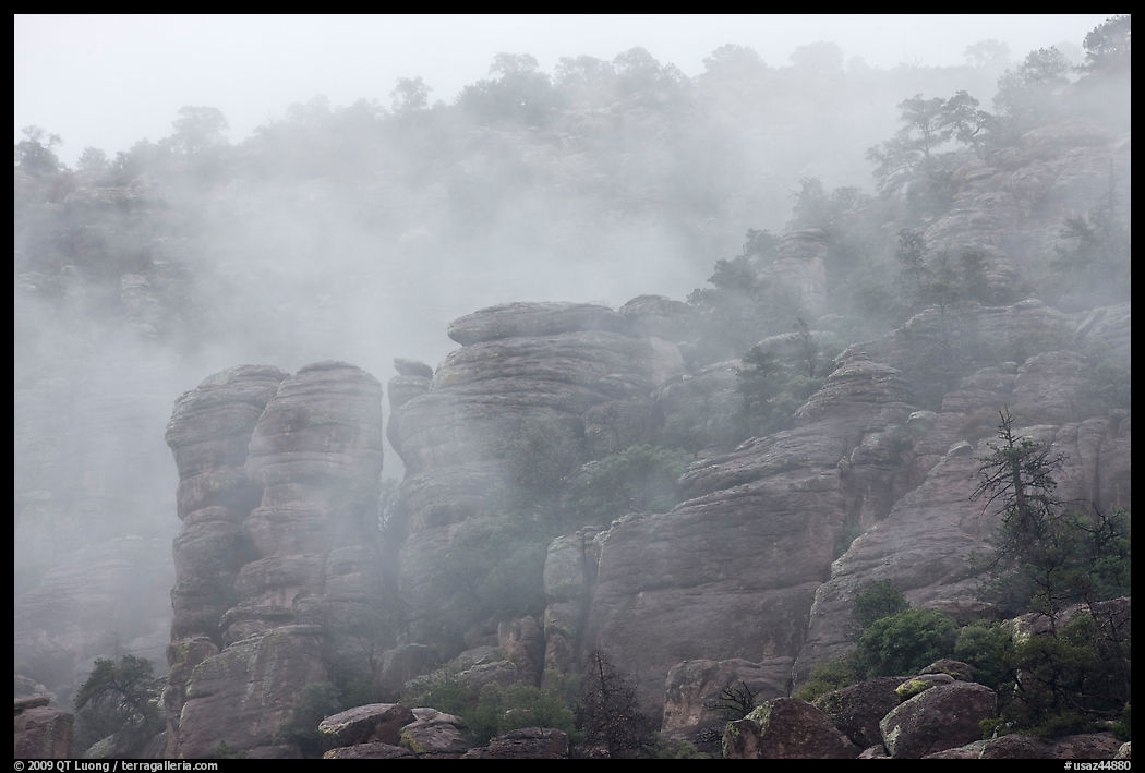
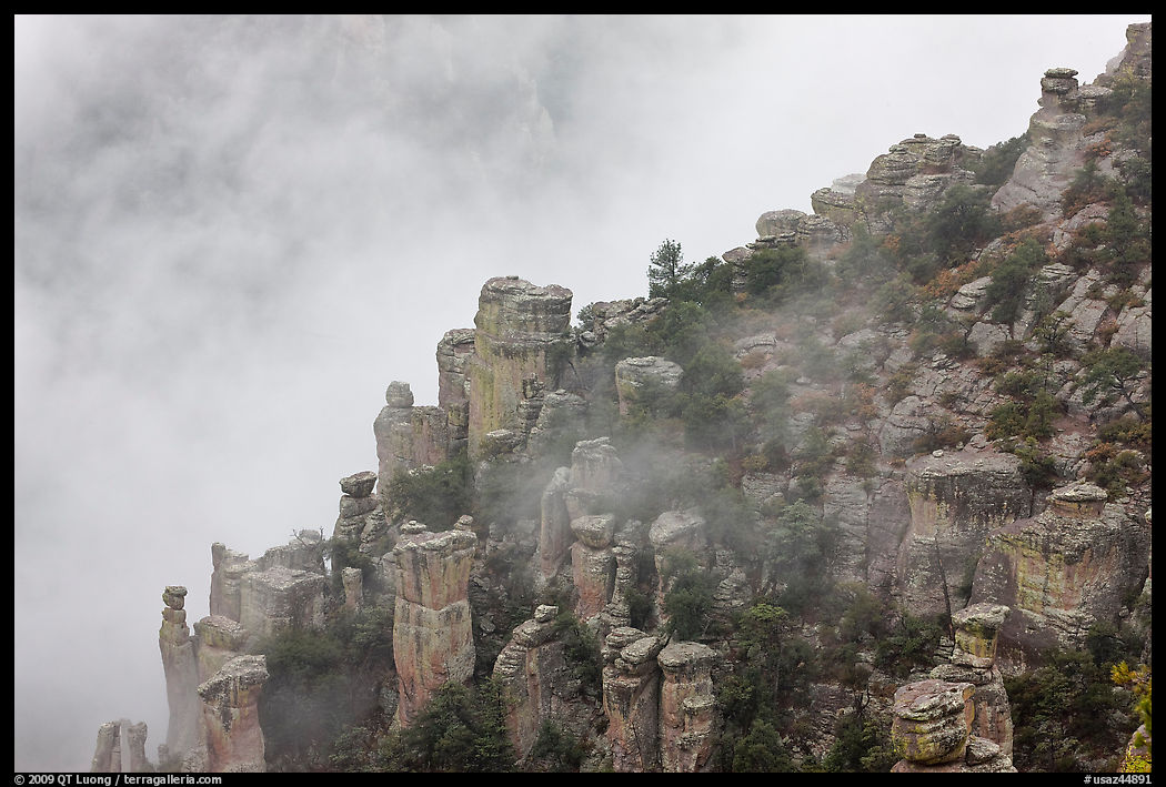
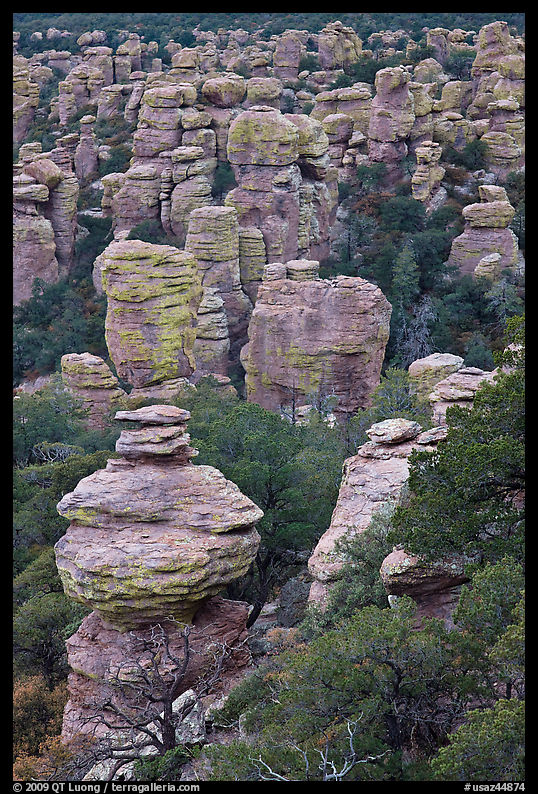
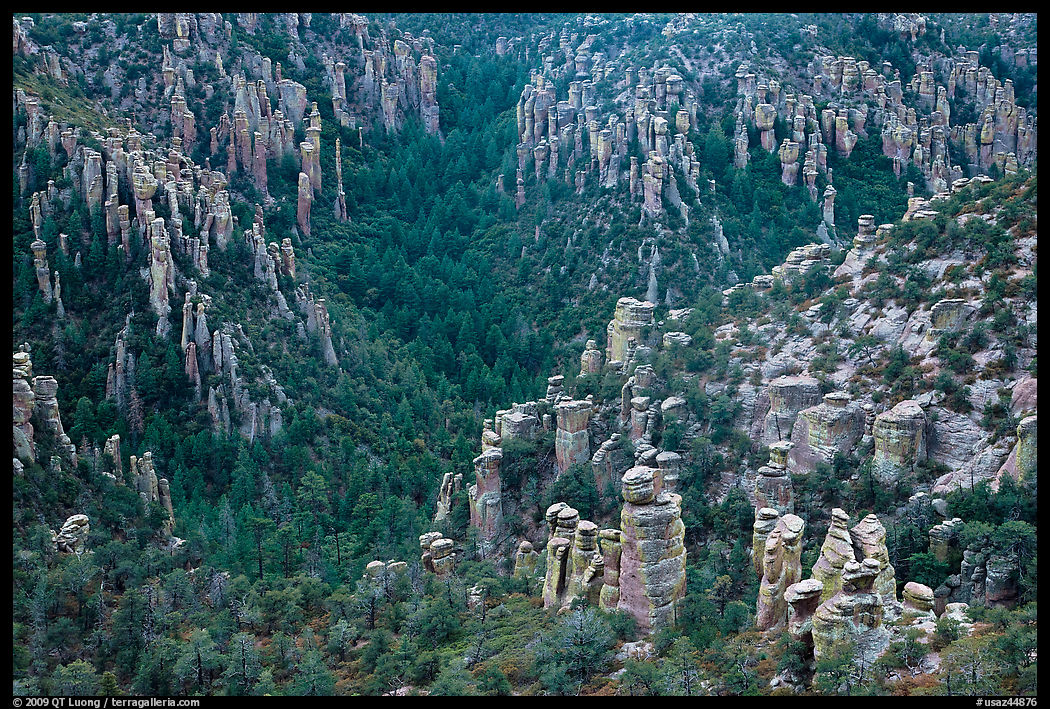
I am sometimes asked what the next national park will be. My bet is on Chiricahua National Monument in Arizona. The Arizona congressional delegation has been pushing for that redesignation for years and through five different Congress. More recently, Ocmulgee Mounds National Historical Park in Georgia emerged a strong candidate to become Ocmulgee Mounds National Park and Preserve, promoted as Georgia’s first national park. In the current 119th Congress, redesignation bills have again been introduced for both, but only the Chiricahua bill has passed one chamber so far. Those two proposals say a great deal about how national park are not viewed in our capital. In both cases, supporters are not simply arguing that these places deserve protection. They are also selling the title itself as an economic asset: a stronger brand, a bigger draw, a way to bring in more visitors, more attention, and more money. Ocmulgee is important as a Muscogee ancestral landscape and archaeological site. Chiricahua is a hidden gem, the most visually striking landscape in the Sky Islands (as illustrated by photos in this section). By comparison, Pinnacles National Park, redesignated in 2013, strikes me as belonging to the exact same class: a place where rock formations create real scenic interest, but not the breadth or scale associated with the major national parks, and one whose new title also carried obvious promotional value. The question is not so much whether they deserve national park status as it is whether the title national park still signifies a demanding national standard, or whether it has become a prestige label routinely pursued because it is useful for regional promotion.

These redesignations are not preservation measures. Units of the National Park System generally operate under the same statutory authorities and management policies regardless of whether they are called a national park, national monument, national historical park, or something else, unless Congress specifies otherwise. Changing the name does not, by itself, create a stronger layer of protection. Some local critics have even argued that redesignation could increase visitation to a relatively small unit that cannot absorb it. That concern does not strike me as abstract. Chiricahua’s infrastructure still reflects its 1930s Civilian Conservation Corps origins, and I remember parking being extremely limited, especially at the top.

The four newest national parks—Gateway Arch in 2018, Indiana Dunes in 2019, White Sands in 2019, and New River Gorge in 2020—were all redesignations of existing units in the National Park System, not newly protected landscapes suddenly rescued from development. Indeed, the last time a national park was created from lands not already in the National Park System was in 1988, with the National Park of American Samoa. That all four were signed into law by President Trump makes the point even sharper. It is not controversial to say that he was not a conservation-minded president. During his first term, he moved to shrink Bears Ears and Grand Staircase-Escalante and attacked environmental regulation. His current administration has weakened or destabilized the National Park Service (NPS), the Bureau of Land Management, and the Forest Service. A political culture that is hostile to conservation can still accumulate “new national parks” precisely because redesignation is not fundamentally about conservation. It is about prestige, tourism, and politics.

There have been several attempts in the past to enlarge Chiricahua National Monument by including the surrounding mountains, which would actually have increased the amount of protected land in the area. In his remarkable work Undiscovered America, which credibly identifies under-appreciated places worthy of becoming our next national parks, Zack/Cora Frank suggests a Sky Islands National Park encompassing the entire Chiricahua mountain range and Fort Bowie. But these days, any extension of protected lands looks problematic, not only for political reasons, but also because of reduced NPS resources. The NPS said that Ocmulgee’s existing national historical park designation was appropriate for a unit whose principal resources are historic. It understood the separate legislative intent to expand the area and pair it with a preserve, but did not support the bill because it would expand the federal estate while NPS is already overstretched with other priorities.

The early National Park Service understood that if the national park title were handed out too loosely, it would stop meaning much. That is the part of the story now being forgotten.

When the National Park Service was founded in August 1916, there were only thirteen national parks. Congress doubled that number before the Second World War. The prestige of the designation encouraged a flood of proposals from communities across the country, many convinced that their own scenery deserved the same status. Hundred of sites were proposed (Wikipedia lists some). That pressure forced the Park Service to ask: what, exactly, should count as a national park, and what should not?

The answer given by the Department of the Interior was demanding. Secretary Franklin Lane wrote to Stephen Mather that the Park Service should seek scenery of “supreme and distinctive quality” or some feature “so extraordinary and unique as to be of national interest and importance.” He warned against lowering the “standard, dignity, and prestige” of the system by including areas that represented their type in less than the highest terms. National parks were not supposed to be merely pleasant, pretty, or locally cherished. They were supposed to be superlative.

To enforce that standard, the Park Service relied on Roger Toll. Toll is not as well remembered as Stephen Mather or Horace Albright, and he is mentioned only once in Ken Burns and Dayton Duncan’s The National Parks: America’s Best Idea, when he was killed in a 1936 car accident together with George Meléndez Wright while inspecting potential international parks and wildlife refuges along the Mexico–United States border. However, he played a crucial role in preserving the meaning of the designation. After joining the Park Service in 1919 and serving as superintendent at Mount Rainier, Rocky Mountain, and Yellowstone, he became the agency’s de facto evaluator of proposed new parks and monuments. Back then, snow closed Yellowstone in the winter. Toll took advantage of that time to travel around the country, inspecting sites and comparing them to the existing parks.

His first major assignment, in the spring of 1928, showed the standard in action. He visited the proposed Ouachita National Park in Arkansas and concluded that it did not measure up. He did not deny its appeal:

it is an attractive region, well wooded, has many clear streams, a number of cascades or low waterfalls and numerous springs … The Ouachita area has considerable possibilities for recreational use and, if developed, would form an important addition to the present recreational attractions
But he also wrote:
During the past 20 years, all parks that have been created have been of high standard and exceptional quality. During that period, Congress has rejected all areas that were unsuitable for national parks, even though many of these areas have beauty and attractiveness, but not scenic supremacy… … It is the policy of the National Park Service and of the Department of the Interior to maintain the standard established by Congress and to recommend as national parks only those areas which have the most remarkable and superlative scenery in the country or other unique features so extraordinary as to possess national interest of the highest order. … Every national park should be worth traveling across the country to see. If an area is not of that quality, it is not of national-park type. … The Ouachita area does not contain features nor scenery on a scale equal to, nor even approaching, the majority of the national parks that have been established by Congress.
Congress pushed ahead anyway, as it has done in some recent cases despite objections from the National Park Service, but President Coolidge pocket-vetoed the Ouachita National Park bill after Congress adjourned on March 3, 1929. For once, the standard held.

Over the next several years, Toll inspected more than a hundred sites. He recommended against park or monument status in most cases. The Park Service, he believed, had as much interest in excluding unsuitable places from the system as in admitting superlative ones. He understood that the integrity of the system depended on restraint. Yet when he encountered something truly exceptional, he said so. He praised the lesser-visited Kolob Canyons as park-quality scenery and recommended that it be added to Zion National Park. They were set aside as a separate Zion National Monument in 1937, and added to the park in 1956.

Toll Mountain rises above the amphitheater of Chisos Basin Campground in Big Bend National Park.

Texas offers a particularly clear example of how the older standard worked. By the 1930s, Texans were irritated that their state still had no national park. The 1930 Texas Democratic Convention called on the state’s congressional delegation to secure at least one. Texas wanted a park because national parks conferred status, and states without one seemed somehow left out. Yet the Park Service refused to treat this as a matter of entitlement. Toll inspected seven proposed Texas sites. His job was to decide whether any of them actually rose to national park caliber. He found one that did: Big Bend. He identified the Chisos Mountains and the great Rio Grande canyons as the area’s chief scenic features, described the South Rim (my pick for the park’s photo spot) as “spectacular,” and concluded that Big Bend was “decidedly the outstanding scenic area of Texas.” He concluded that it was suitable for a national park. Congress agreed, authorizing Big Bend in 1935. He found the Guadalupe Mountains to be the second most scenic area in Texas, but suggested that the area would make an excellent addition to Carlsbad Caverns rather than a separate national park. He concluded that the other sites he visited should remain at the state-park level, and indeed most of them were subsequently protected as such. A place could be scenic, interesting, and worth protecting without automatically being pushed toward the highest title.

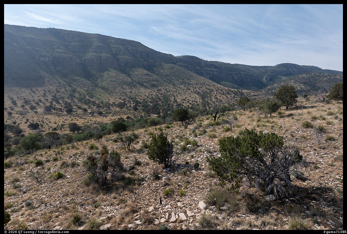
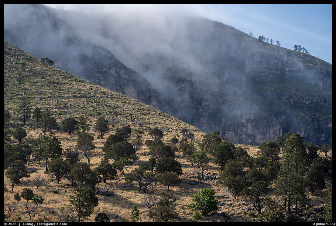
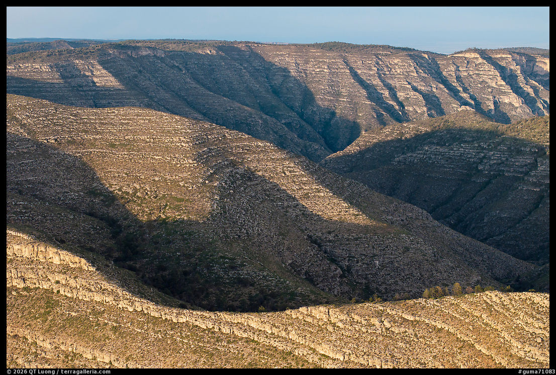
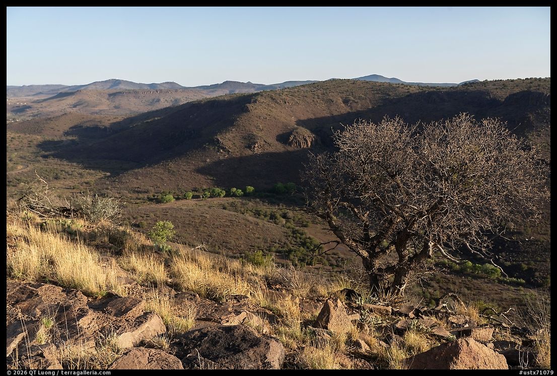
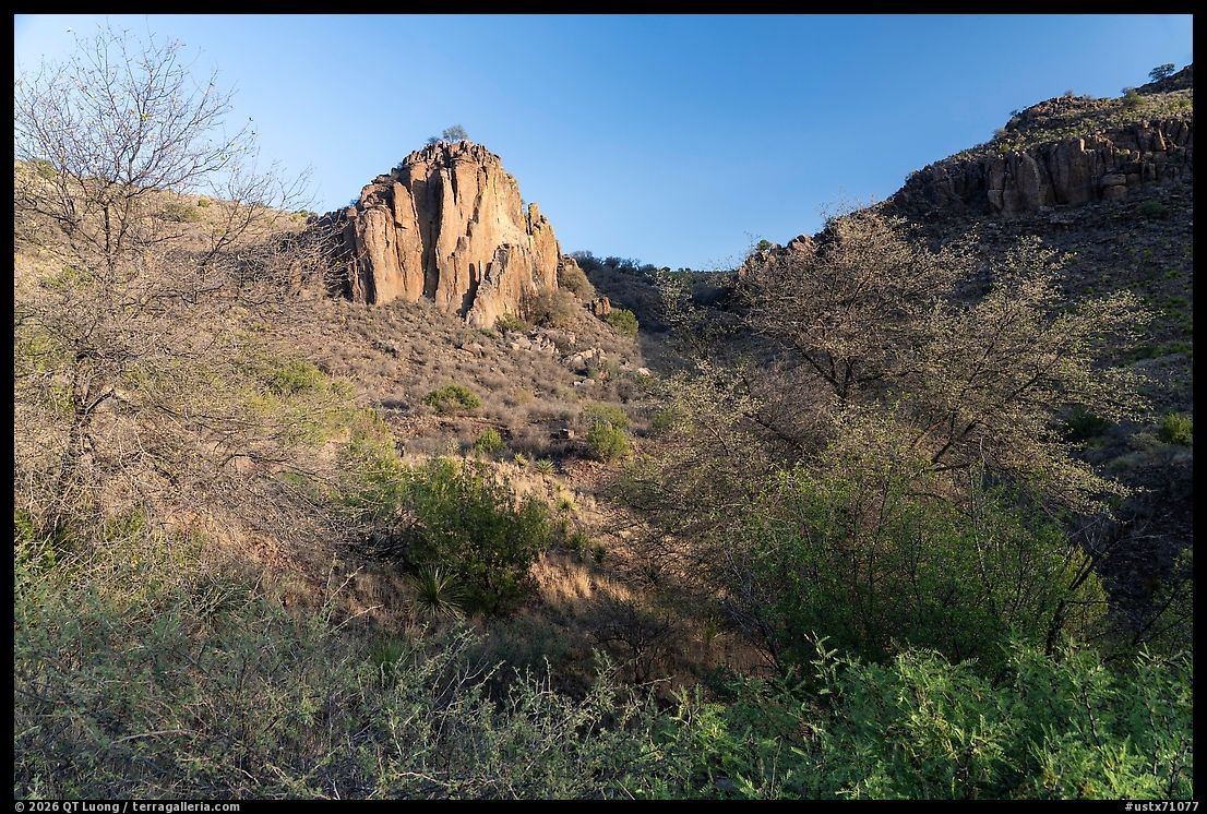
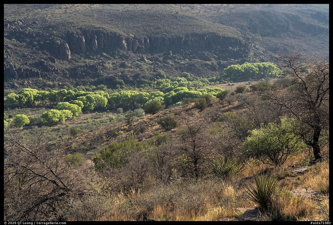
Last June, besides Big Bend National Park and Guadalupe Mountains National Park, I went to Davis Mountains State Park, one of the sites inspected by Toll. The facilities and access were superior to those of some national parks: trails of course, but also a scenic drive, overlooks, a large developed campground, and a lodge. Yet, while the vegetation ranging from cottonwoods to desert plants was quite diverse, the rock formations interesting, and the views wide-ranging, the place lacked the grandeur of the two Texas national parks. El Capitan, Guadalupe Peak, and McKittrick Canyon are generally considered the main features of Guadalupe Mountains. On my last visit to that park, I visited the Dog Canyon area (photos above), which is considerably less distinctive, very out of the way, and does not even have a paved road. I still found its rugged, enclosed, wilderness-like scenery more impressive than Davis Mountains State Park (photos below). That kind of comparison is exactly what Toll insisted on: not whether a place is worthwhile, but how it stands against the best of its kind. Toll believed that such evaluations could not be made in isolation. To know whether a canyon, mountain range, or forest was of outstanding national value, one had to know what comparable places existed elsewhere in the United States. That comparative discipline was the center of his work, and something I can relate to as someone who has made more than 400 visits to national parks. The Park Service treated the national park label as a demanding comparative judgment. The label meant something because officials were willing to say no.

Now compare that seriousness with the recent pattern. The most notorious case is Gateway Arch National Park, redesignated in 2018. The Department of the Interior itself argued against calling it a national park, saying the site was too small and limited in the range of resources and that Gateway Arch National Monument would be more appropriate. Congress ignored that judgment and granted the higher-status label anyway. If a 91-acre urban memorial site centered on one iconic structure can be called a national park over the objection of the Department charged with managing the system, then the old discipline has plainly collapsed.

Indiana Dunes National Park, redesignated in 2019, is more defensible than Gateway Arch, but it still belongs to the same drift. The problem is not that Indiana Dunes lacks value. The problem is that the logic of redesignation increasingly has less to do with the old question—is this place truly in the top rank of its kind?—and more to do with whether the more glamorous label can raise visibility and spending. Once that is the logic, the designation becomes a stronger consumer-facing brand rather than a stricter measure of comparative merit. On the merits, I would argue that some of the other nearby national lakeshores offer more striking scenery.

White Sands National Park, also redesignated in 2019, is a more interesting case because it is undeniably extraordinary in one respect: the gypsum dunes. Yet White Sands also shows how much narrower the threshold has become. Officially, the park contains more than dunes. It also has ancient human trackways. But for the ordinary visitor, White Sands remains overwhelmingly a one-dominant-resource park. The dunes are the experience. The trackways are scientifically important, but they remain inaccessible to the visitor and do not transform the park into a broad, composite place in the sense that Yosemite, Olympic, Yellowstone, or Grand Canyon are composite places. White Sands is often used to rebut concerns about lowering standards: look how beautiful it is. But beauty alone was never the whole point. A place can be visually stunning, fully deserving of protection, and still represent a narrower category than what the term national park once implied.

New River Gorge National Park and Preserve, redesignated in 2020, with its spectacular landscape more varied than White Sands and more scenic than Indiana Dunes, is one of the strongest recent national parks. Yet, the redesignation was framed as an economic engine for southern West Virginia, making the economic motive especially explicit. National-park status was not merely recognition. It was sold as part of a larger strategy to bring dollars, jobs, and a new identity to a region long associated with the decline of coal.

The larger issue is not whether these places have merit. It is whether the national park designation still signifies what it once did. Roger Toll belonged to a Park Service that asked whether a proposed park truly belonged in the company of the system’s highest examples. The current system increasingly asks a different question: will the title help the region, strengthen tourism, and generate more attention? One could object that national parks have always benefited nearby economies. But that is different from redesignating units because the title itself is expected to produce more tourism, more jobs, and more headlines. In the first case, economic benefit is a consequence of protecting an extraordinary place. In the second, the title becomes an instrument. Once that happens, the question is no longer, does this place belong in the same category as the great parks? The question becomes, would the region benefit if we called it that?

The United States has many important places that deserve protection. Some deserve to be historical parks, preserves, seashores, lakeshores, recreation areas, wilderness areas, or even that catch-all, national monuments. There is no dishonor in those titles. The dishonor lies in treating them as inferior labels to be escaped whenever local boosters think national park will sell better. A mature system would protect important places under the designation that best fits their actual character. Roger Toll understood the danger a century ago. If the designation was stretched too far, it would lose its meaning. He knew that the prestige of the national park system depended not merely on adding good places, but on preserving the difference between the extraordinary and the merely worthy. That distinction is now being steadily eroded. The country is not short of places worth saving. It is short of the discipline to call them by the right names. The national park label is being lowered, and with it, the clarity of the whole system.

Baaj Nwaavjo I’tah Kukveni – Ancestral Footprints of the Grand Canyon National Monument

https://www.terragalleria.com/blog/baaj-nwaavjo-itah-kukveni-ancestral-footprints-of-the-grand-canyon-national-monument

The first step is to pronounce and remember: Baahj-Nuh-Waahv-Joh Ee-Tah-Kook-Venny.

The name itself slows you down. “Baaj Nwaavjo” in Havasupai means “where the ancient people roamed,” while “I’tah Kukveni” is the Hopi translation of “ancestral footsteps.” The monument’s full name makes clear that this is not empty land, not just scenery, and not simply an extension of the Grand Canyon brand. It is a cultural landscape whose meanings long predate the federal designation. Proposed by the Grand Canyon Tribal Coalition, it was the third successful Native-American-driven campaign for a national monument, after Bears Ears in Utah and Avi Kwa Ame in Nevada.

Proclaimed in 2023, Baaj Nwaavjo I’tah Kukveni–Ancestral Footprints of the Grand Canyon National Monument protects 917,618 acres, or about 1,434 square miles, of land surrounding Grand Canyon National Park. That makes it one of the larger national monuments in the country, comparable to though still smaller than Grand Canyon National Park itself, which spans 1,217,262 acres, or 1,902 square miles. The monument is not a single compact block. Instead, it is made up of three distinct parcels around the canyon region, each with its own character, access issues, and attractions.

(click on map to enlarge)

That variety helps make the monument compelling. It is not the Grand Canyon’s main event. These lands hold pine forests, sagebrush flats, side canyons, rock art, old airfields, fire lookouts, sacred mountains, and overlooks. Like other BLM and USFS lands, much of the monument is remote and lightly developed. Although paved roads skirt parts of the monument, exploring it generally requires driving on unpaved roads. High-clearance vehicles are recommended. Roads can become impassable after rain, and winter snow closes Highway 67 and many forest roads on the Kaibab Plateau. The place demands some planning, self-reliance, and respect for conditions on the ground. I will provide some coordinates when Google Maps search for landmarks gives incorrect result.

South parcel

Though perhaps the least dramatic, the easiest section to explore is the south parcel in the Kaibab National Forest’s Tusayan Ranger District, bordering the South Rim of the Grand Canyon. Here, pine woodlands and sagebrush prairie spread across a landscape accessible by Forest Service roads. That mostly flat area stops a couple of miles short of the Grand Canyon in the north, although some distant views of it can be had from elevated viewpoints. The most prominent landmark is Red Butte, a volcanic formation just east of Highway 64/180 on the approach to Grand Canyon National Park. On a plateau that is otherwise strikingly flat, the butte stands out. It is a sacred place for the Havasupai, Hualapai, Navajo, Hopi, and Zuni, and the proclamation describes it as a towering landmark with evidence of long human habitation.

The hike is straightforward: about 3 miles round trip with roughly 900 feet of elevation gain on a well-maintained trail. On the flat summit, a two-story lookout provides 360-degree views over surrounding forests stretching to the horizon, with a hint of the distant Grand Canyon. In a monument full of hard-to-reach places, Red Butte is one of the clearest places to begin. On my way back from a weekday sunrise hike—sunset would be preferable for the light, but I had to contend with unseasonably warm temperatures—I was surprised to encounter three parties. Everyone had arrived in high-clearance vehicles, although a regular car could probably make it through the 2.7 miles of dirt road from US-180, 12 miles south of Tusayan, to the trailhead (35.817198, -112.101145).

That same southern unit also contains traces of recent human history. Nearby is the historic Grand Canyon airfield area, including the hangar associated with the 1920s Red Butte Airfield, used by aviators such as Charles Lindbergh and Amelia Earhart. Near Grandview Point in Grand Canyon National Park stands the 80-foot Grandview Lookout Tower, built in 1936 by the Civilian Conservation Corps, which can still be climbed for a glimpse of the Grand Canyon unusually framed by extensive tree canopies. Google Maps suggested a route entirely on unpaved Forest Service roads from US-180, but by starting from Desert View Drive in the national park, I needed to drive only 1.3 miles on the well-graded Coconino Rim Road/Fire Road 310, beginning at (35.968140, -111.972217). That is enough to get you out of the national park and into Kaibab National Forest, where dispersed camping is allowed and widely used. The 1889 Hull Cabin lies 2 miles farther on. None of these places is as famous as the park’s overlooks, but together they show that this landscape has long been inhabited, used, and traversed rather than merely admired from a rim viewpoint.

Northeast parcel

On the opposite side of the Grand Canyon, the northeast parcel around Marble Canyon and House Rock Valley offers a very different experience. Here the land, bounded on the north by the Vermilion Cliffs, descends across open, arid sagebrush country toward the very edge of Marble Canyon. Marble Canyon is the narrow, steep-walled upstream section of the Colorado River canyon from Lees Ferry to the confluence with the Little Colorado River, and it is distinctive because it is tighter, more linear, and more enclosed than the broader, more complex, and more vertically expansive main Grand Canyon farther downstream. A good introduction is the historic Navajo Bridge, where four public-land units meet: Grand Canyon National Park, Glen Canyon National Recreation Area, Vermilion Cliffs National Monument, and Baaj Nwaavjo I’tah Kukveni. It is a geographic junction, but also a useful reminder that this monument is woven into a larger network of protected canyon country.

From US-89A, rough roads lead to a series of dramatic canyon viewpoints from which you can peer down directly into the Colorado River, unlike at the Grand Canyon National Park South Rim and North Rim, from which the river is a distant sight. The terrain below the canyon rim belongs to Grand Canyon National Park, while the flat plateau lands above the rim are part of Baaj Nwaavjo I’tah Kukveni–Ancestral Footprints of the Grand Canyon National Monument. Badger Creek Overlook is one of the easier goals, reached by a 2-mile primitive road called Honeymoon Trail off US-89A across from Lee’s Ferry Lodge and about 3.7 miles from Navajo Bridge. It includes a short rocky section that is manageable for a high-clearance vehicle. The reward is a short trail leading to an outstanding view of the confluence of Badger Canyon and Marble Canyon. Three miles farther south, at (36.753172, -111.718717), a road with more rocky sections leads to varied viewpoints over Soap Creek Canyon and the rim of Marble Canyon. Both areas are popular dispersed camping sites where I saw a few RVs parked for what looked like long periods. Apart from those, I had the canyon rim to myself. Unlike at Badger Creek Overlook, the roads were not lined up with rocks to prevent off-road driving, but to protect the diminutive Brady Pincushion cactus, I made sure to explore on foot beyond the established roads. Longer rough roads continue toward viewpoints for Rider Canyon and South Canyon, side canyons of the greater Marble Canyon system. The terrain here is less about developed trail experiences than about reaching edges—places where the plateau suddenly breaks open into depth.

House Rock Valley is part of the House Rock Wildlife Area, known for open scenery and its bison herd, and it includes archaeological remains and wildlife habitat across a broad undeveloped corridor. South of US-89A, House Rock Valley Road functions mainly as access through a large open landscape. I stopped at House Rock Valley Overlook along US-89A for a distant panoramic view at sunset.

Northwest parcel

The northwest parcel, across the Arizona Strip and Kanab Plateau, may be the monument’s most adventurous and arguably its richest for hikers willing to work a little harder. This is where broad plateaus break into major canyon systems, especially in the Kanab Creek Wilderness, where the enormous red-rock canyons rival the Grand Canyon itself. The northwest parcel extends south to meet Grand Canyon National Park along the north rim area, so it reaches the canyon edge, but it does not include the parts of the Grand Canyon, only tributary canyons. In the Kanab Creek drainage, the monument’s combination of scenery and cultural resources becomes especially vivid.

Gunsight Point offered a car-accessible cliff-edge panorama over the confluence of Kanab Creek and Snake Gulch where I experienced perfect solitude at sunset. I drove for about an hour on unpaved roads with an SUV, and in dry conditions, the road looked manageable for any vehicle with decent clearance, though mud can quickly change the equation. Google Maps was not reliable. From US-89A, 1.6 miles south of Fredonia, turn onto Forest Service Road 22 and continue south for 12 miles to Gunsight Road 1048, which dead-ends at a lone tree at the edge of the mesa in 17 miles (36.653652, -112.618545).

I found Snake Gulch to be more rewarding as a hike than as a distant view, though, thanks to the combination of accessibility, beauty, and cultural content. I headed there straight after visiting Gunsight Point rather than returning to Fredonia. Google Maps correctly locates “Snake Gulch Trailhead.” Regardless of your starting point, from Forest Service Road 22, you follow Forest Roads 423 and 642. Only the last 5 miles are unpaved, but they were well-graded. The Snake Gulch trail stretches out for 21.5 miles, but for a day hike, you can turn around whenever you like. I noticed that the farther I went, the fainter the trail got. Rock art begins to appear about 2.5 miles in, in the form of an alcove lined with petroglyphs.

The best concentrations of pictographs are between about 4.5 and 6.25 miles from the trailhead, mostly on the north side, although the most spectacular wall I saw was located on the south side, near and east of the confluence with Table Rock Canyon. It included turkeys and large anthropomorphic figures above precarious ledges, with even a visitor register and interpretive materials in a metal box. In this stretch there are dozens of rock art sites, attributed primarily to Basketmaker peoples who lived in the region from roughly 300 BCE to AD 800. Narrowing after the first 2.5 miles, the canyon was pretty and surprisingly verdant with many diminutive wildflowers in March. Because the terrain is gradual and feels mostly flat, the 13-mile round-trip hike (800 feet elevation gain) did not feel difficult, but the numerous side trips to check rock art lengthened it from a half-day to a full day, so on a warm day, I was glad I started before dawn. AllTrails has useful coordinates for rock art sites.

It is the kind of place where the monument’s name—ancestral footsteps—feels literal rather than symbolic. Kanab Creek more broadly is one of the monument’s most significant landscape-and-cultural areas, containing ancient villages, cliff houses, granaries, pictographs, petroglyphs, and important riparian habitat. In other words, this is not just canyon scenery. It is a record of human presence embedded in the land itself. That is the central distinction of Baaj Nwaavjo I’tah Kukveni. The monument is not simply protecting views around the Grand Canyon. It is protecting a lived-in, storied region whose ecological and cultural values are inseparable.

Baaj Nwaavjo I’tah Kukveni was never just a scenic designation. From the start, it was a political act as well as a cultural one: a tribes-led effort to protect Grand Canyon homelands, waters, and cultural sites from renewed industrial pressure, especially uranium mining. That fight did not end with President Biden’s 2023 proclamation. In January 2025, a federal judge dismissed two lawsuits challenging the monument, but opponents signaled that the legal battle might continue on appeal.

The threats are not only in court. In September 2025, Representative Paul Gosar introduced a bill to nullify Baaj Nwaavjo I’tah Kukveni, which conservation groups said would strip protections from the monument and reopen the door to new uranium mining claims and other development. Whether or not such efforts succeed, they make clear that the monument remains contested terrain in Washington as much as on the ground.

Mining pressure is especially important here because the monument does not erase older mining entitlements. The 2012 federal withdrawal protected more than a million acres near the Grand Canyon from new mining claims for twenty years, but existing rights and older mines remained a loophole. That is why Pinyon Plain Mine, inside the monument’s boundaries, has continued operating, with uranium ore hauled out across tribal lands and communities. More recently, Grand Canyon Trust reported that as uranium prices rise, the company operating Pinyon Plain hopes to develop at least one additional mine in the region.

So the monument should not be understood as a final victory. It is better seen as a hard-won layer of protection—real, significant, but still vulnerable to lawsuits, hostile legislation, and the persistent economic push to industrialize the lands around the Grand Canyon.

In a time when public lands are often consumed as a sequence of branded highlights, Baaj Nwaavjo I’tah Kukveni resists simplification. It surrounds one of the most famous landscapes in the world, yet much of its power lies in places that are quieter, less monumental in the conventional sense, and more revealing of how people have moved through this land over centuries. That may be the best way to approach Baaj Nwaavjo I’tah Kukveni: not as the scenery outside the Grand Canyon, but as a monumental landscape in its own right—one defined not only by geology, but by memory, use, reverence, and presence. The ancient people roamed here. Their footsteps remain

Ten Grand Canyon Photography Books

https://www.terragalleria.com/blog/ten-grand-canyon-photography-books

There are countless photography books about the Grand Canyon. Many are excellent—well printed, visually memorable, and made with real devotion to the place. Although it spans over a century, this survey is not an attempt to identify “the best,” nor is it comprehensive. Instead, it reflects what I have kept close: the books in my own collection that seem to me the most significant, along with a few transitional titles that help connect larger developments in the history of Grand Canyon photography.

“Significant,” for me, does not mean only strong pictures, though every book here has them. It also means books that changed how the Grand Canyon was photographed, published, or understood: works that pushed technique forward, defined a new aesthetic, documented a pivotal moment, or turned photography into something more than description—into argument, history, or self-reflection. Some matter because they helped shape public opinion about what should be protected. Others matter because they expanded the language of landscape photography, or because they made the canyon feel newly seen—whether from the rim, from the river, or from the difficult terrain in between. And a few are included not because they are major landmarks in themselves, but because they form useful bridges between those that are.

What follows, then, is a personal map of influence: a small selection of books that, in different ways, helped build the Grand Canyon’s photographic imagination, together with a few intermediate works that clarify how one moment led to the next. If I had to reduce the list to only three books, they would be Lasting Light, The Hidden Canyon, and Reconstructing the View. These are the books I return to, and the ones that continue to reward attention each time I pull them off the shelf. If you have any personal favorites, please let me know in the comments!

The Grand Canyon of Arizona (1910)

The history of photography of the Grand Canyon is dominated by the Kolb Brothers, Ellsworth and Emery, who spent almost eight decades exploring and photographing the Grand Canyon. They operated a studio at the edge of the South Rim of the Grand Canyon from 1904 to 1976. In the early days, there was no dependable source of water at the Rim to operate the darkroom, so they had to hike down to Indian Gardens and back up for refills. However, it was their daredevil exploits (as suggested by the book’s cover showing Emery dangling from a rope to try and take a photo) that brought them fame. With almost no boating experience, in 1911, they spent four months navigating the entire length of the Green and Colorado Rivers, from Green River, Wyoming, to the Gulf of California, filming the entire expedition. The film went on to become the longest-running movie in history, being shown in their studio until 1976. The expedition also resulted in the book Through the Grand Canyon from Wyoming to Mexico. Initially published by The Macmillan Company in 1914, it underwent 18 printings until 1970, and copies signed by Emery are easy to find. In 1974, Emery made his last river journey at 93, two years before his death. That book is an adventure/travel narrative illustrated with small black-and-white photographs, not primarily a photo book. By contrast, The Grand Canyon of Arizona, initially self-published in 1910, is a photo album with 19 tipped-in 11×8 inch plates, bound with card and string. Subsequent editions slightly differed in the photo selection (pages of the 1911 edition, pages of the 1913 edition). You turned it sideways to view the vertical photos. The process, hand-colored collotype, was not amenable to large-scale production, which may explain why the album has become rare. Collotype was a high-quality photomechanical method that used a light-sensitive gelatin-coated plate to reproduce a photograph with very fine continuous tones, without the dot screen of modern halftone (offset) printing. After the collotype image was printed in black and white, color was added by hand—typically with watercolor or similar pigments—so each plate was individually tinted. The plates include views from the rim, from the river, from the trail (with people invariably on horses), waterfalls, long-gone infrastructure, and even a rephotographic pair. Depicting the human imprint as well as the landscape, they offer a beautiful and pioneering record both timeless and historical.

Grand Canyon: A Pictorial Interpretation (1950)

The previous title on this list dates from 1910, whereas the next dates from 1964. Stephen Pyne argues that, in the first half of the twentieth century, the Grand Canyon remained somewhat disengaged from the dominant modernist photographic imagination and did not fully re-enter it until environmentalism recast the canyon as a powerful symbol of preservation; in the meantime, magazines such as Arizona Highways served as the principal vehicles for canyon photography. If Ansel Adams’s black-and-white photographs — reissued in The Grand Canyon and the Southwest (2019) — never became the canyon’s definitive visual language, unlike their role in shaping that of the Sierra Nevada, the Kolb brothers had already anticipated one reason why: The Grand Canyon of Arizona was published with hand-colored plates, as if the canyon itself demanded color from the outset. Arizona Highways treats Josef Muench as one of its foundational photographers and notes that his images helped shape the visual imagination of the Southwest. He traveled to the Grand Canyon more than 250 times during his career, collaborated frequently with his wife Joyce on texts, and stands at the head of an important family line of nature photographers: his son David Muench would go on to become one of the major photographers of the American West, continuing the family’s long engagement with the canyon – David Muench’s Timeless Moments: Grand Canyon National Park (2017) resulted from seven decades of photography. In that context, Grand Canyon: A Pictorial Interpretation, a modestly sized volume (6 x 8.5 inch), is worth noting as an early mass-market pictorial bridge between the luxurious hand-colored canyon albums of the early twentieth century and the more ambitious photographic books that followed in the 1960s. Judging from its color cover, the publisher seems to have recognized the importance of color, even if the interior remained black-and-white and printed in gravure, perhaps because high-quality color reproduction would still have been too expensive.

Time and the River Flowing (1964)

Time and the River Flowing is significant as the book that helped prevent the building of two dams in the Grand Canyon, marking one of the first successes of the modern conservation movement in 1968, when the construction project was abandoned. Fusing photography, nature writing, and activism, the book turned the Grand Canyon into not just a place of spectacle but a conservation argument. Published by the Sierra Club in 1964 as the eighth volume of its influential Exhibit Format Series, in an oversize 14.8 × 11.5-inch trim, the series’ format effectively brought the scale and impact of gallery-like photographic display into book form. The color plates used Kromekote, a cast-coated paper with a very hard, very smooth, mirror-like glossy surface, lacquered for added gloss and saturation. The work combined François Leydet’s text and literary excerpts with numerous photographs, using the visual power of photography to shape public feeling. The primary photographer was Philip Hyde, but the book featured photographs from several others, including Ansel Adams — in color! With a narrative following a river trip, it fostered our understanding of the Grand Canyon as something whose value depended not only on scenery, but on the continued life of the river itself.

Down the Colorado (1969)

Powell’s Diary of the First Trip Through the Grand Canyon, 1869 is the foundational firsthand account of the first Colorado River expedition and an early document of scientific exploration in the American West. It helped establish the Grand Canyon not just as a dramatic landscape, but as a subject of geographic knowledge, national imagination, and later mythmaking around exploration. Powell’s narrative became one of the key texts through which later generations understood the canyon before the era of modern photography and mass tourism. When the diary was republished in 1969 — the centennial year of Powell’s 1869 journey — as Down the Colorado, edited by Don D. Fowler with Eliot Porter’s photographs and afterword, it gained a second significance: it linked the nineteenth-century expedition narrative to the twentieth-century environmental and photographic imagination of the canyon. The Place No One Knew, a requiem for Glen Canyon, was possibly the high point of Porter’s work, and in Down the Colorado he continues that mostly intimate aesthetic, while the book, published by Dutton, reprised the oversize trim of the Exhibit Format Series. His pictures do not simply illustrate the text but renew its sense of wonder. Although Powell’s diary starts at Green River, Wyoming, the photographs concentrate mostly on the Grand Canyon portion of the river.

The Grand Canyon (1973)

Published by Time-Life in 1973, with text by Robert Wallace and photographs by Ernst Haas, The Grand Canyon was part of the widely distributed American Wilderness series, so it helped circulate a vivid, contemporary color vision of the canyon beyond expensive coffee-table books. The book brought Ernst Haas’s modern color photography to one of the most iconic American landscapes in a 9×10-inch book designed for a broad audience. Haas had already made his mark as a major figure in photojournalism and color photography, using 35mm cameras, unlike the photographers of the previous books, who worked with large-format cameras. In the 1960s, he began to photograph nature, culminating in The Creation, published in 1971. That same year, John Blaustein guided him down the Grand Canyon on assignment for Time-Life. The resulting book applies Haas’s lyrical, highly abstract, and interpretive use of color to the Grand Canyon, presenting the landscape not simply as topographic fact or scenic monument, but as a place of changing light, atmosphere, and visual drama.

The Hidden Canyon: A River Journey (1977/1999/2015)

The Hidden Canyon: A River Journey is a classic Grand Canyon river book because it unites John Blaustein’s photographs, Edward Abbey’s journal, and an introduction by Martin Litton, three figures central to the postwar environmental and river-running culture of the Colorado. John Blaustein was not an outside observer but a longtime Grand Canyon river guide and photographer, so the book carries the authority of lived experience on the river rather than scenic distance. The 35mm photographs convey the experience of navigating the alternating calm and churning waters of the Colorado in small wooden rowboats known as dories. Edward Abbey, one of the most influential literary voices of the desert Southwest, brings to it humor and the emotional force of modern wilderness writing. During the trip, despite a lack of prior river-running experience, he was entrusted with the oars of a dory, something that certainly would not happen on a modern trip! Martin Litton, a legendary Grand Canyon river runner, dory outfitter, and major Grand Canyon conservation activist, frames the project from within the movement that fought to protect the Colorado. Together, their roles make the book more than a beautiful canyon album: it becomes a document of river culture, environmental commitment, and intimate canyon experience from river level. The book was first published in 1977 by Penguin Books, reissued in 1999 by Chronicle Books, and then in 2015 by Cameron Books, with additional new photographs and an afterword by Kevin Fedarko. In order to study book design, I acquired copies of the three editions and found the differences instructive. Although Cameron is by far the smaller publisher (making copies of my favorite 2015 edition less common, hence my use of the 1999 edition as the default), I liked the work of their creative director Iain Morris enough to trust them to publish the first edition of Treasured Lands.

Canyons of the Colorado (1996)

Like Down the Colorado, this book pairs Powell’s diary with the photographs and commentary of a modern-day photographer, Joseph Holmes. Canyons of the Colorado stands out for the exceptional consistency of both Holmes’s images and their reproduction. Although some of the finest Grand Canyon photographs are in the book, its scope is much broader: the subject is the Colorado Plateau as a whole, not just the river corridor. I am particularly fond of the early morning Nankoweap cover photograph, as most of the images of the location are from the evening. The book belongs to an early transitional moment, when photographs made on film were increasingly reproduced through digital prepress workflows—a shift especially relevant in Holmes’s case, given his pioneering work with drum-scanned color transparency film and digital color management. The nuance achieved through those techniques is evident when the book is compared with Down the Colorado; yet despite its high production values, it remained relatively affordable. For comparison, Down the Colorado cost $30 in 1970 ($250 in 2026), whereas Canyons of the Colorado cost $40 in 1996 ($85 in 2026) in hardcover, with a more widely circulated paperback edition also available.

Lasting Light (2006)

Lasting Light is a great anthology, treating Grand Canyon photography as a history and an evolving tradition, not just a collection of the finest (mostly) nature images of the canyon. The book traces 125 years of photographing the canyon and places contemporary photographers within that longer lineage, showing how different generations have interpreted the same landscape in different ways. It is especially valuable because Stephen Trimble did more than assemble pictures: he interviewed 21 contemporary Grand Canyon photographers and framed their work within a broader narrative of the canyon’s photographic record, as established with his discussion of work by past masters. Trimble himself is a noted writer and photographer of the American West, not merely an editor-for-hire, which gives the book its distinctive strength: it is both visually rich and historically self-aware, written by someone deeply engaged with western landscape and environmental meaning. Last Light offers a historical understanding of how generations of photographers have looked at the Grand Canyon and, through their differing visions, built a photographic tradition around it.

Reconstructing the View: The Grand Canyon Photographs of Mark Klett and Byron Wolfe (2012)

Rephotography is the practice of returning to the vantage point of an earlier image and making a new photograph from that same position, so that the new picture matches the old one. Mark Klett and his collaborator Byron Wolfe have refined this approach since the late 1970s, when the Rephotographic Survey Project retraced nineteenth-century survey photographs of the American West and re-made them as closely as possible. Robert Webb’s Grand Canyon: A Century of Change (1996), which rephotographs hundreds of views first made during the 1889–90 Stanton expedition in order to document physical and ecological change, represents a more documentary branch of Grand Canyon rephotography, whereas Reconstructing the View pushes the method toward a more conceptual inquiry. Instead of using rephotography simply to produce a strict “before and after” comparison, Klett and Wolfe take advantage of the possibilities of digital photography and processing to create striking large-scale panoramic digital composites that inventively connect times and places. For this project, the source images have been extended from historical photographs and drawings by William Bell and William Henry Holmes, to photographs by Edward Weston and Ansel Adams, and to souvenir postcards and images from Flickr. Altogether, the method, explained in Rebecca Senf’s essay, is broadened into an inquiry about the representation of the canyon itself, the history of which is the subject of Stephen Pyne’s essay. Instead of treating the canyon as a timeless icon, Klett and Wolfe show it as a place filtered through generations of image-making, so the work becomes a meditation on time, perception, authorship, and the accumulated mythology of the canyon. Beautifully produced with fold-outs, Reconstructing the View shows that Grand Canyon photographs do not merely depict the canyon but actively shape how it is seen, remembered, and culturally constructed.

The Grand Canyon: Between River and Rim (2018)

In a one of the most photographed placed in America, how do you find new images within a straight photographic practice? One solution is to go to places where no other photographers have ever stood. While the rims overlooks are popular with tourists, and the river has been made accessible by the river-running industry, the area in-between is mostly inacessible beyond the limited number of trails. It is that area that the authors explore, by hiking the length of Grand Canyon National Park below the rim, 750 miles of rugged, unforgiving, barely mapped, and often vertiginous terrain. Between River and Rim brings together Pete McBride’s photographs and text, with an introduction by the writer Kevin Fedarko (author of The Emerald Mile) who was his companion on the traverse, to present the canyon from an unusual perspective. That gives it a distinctive place in Grand Canyon literature and photography. Pete McBride, the 2025 recipient of the Ansel Adams Award for Photography, has spent 20 years working along the Colorado River. Addressing directly recreation use (and overuse) of the canyon on the eve of the Grand Canyon National Park 100th anniversary, the book is not just a gripping adventure story, but also an argument for protecting the canyon’s threatened silence, fragility, and lesser-known terrain, a conservation concern later extended to the entire river in The Colorado River: Chasing Water (2024).

2025 in Review and Happy New Year

http://www.terragalleria.com/blog/2025-in-review-and-happy-new-year

In 2025, I completed the first part of The Trail project. Besides location work close to home, that also meant trying to get the work out. At the same time, even though photography in parklands was not a priority, I found myself visiting eight national parks across the country—traveling more this year than any other since the pandemic.

I have written about how I started photographing along the Coyote Creek Trail in 2014: first looking for urban ecology, then including traces of human presence, and eventually the activities of people—both trail users and unhoused residents. The year 2025 was a turning point, as sustained sweeps cleared most of the unhoused communities along the trail. In that sense, it felt like the end of an era in which those lives were visible, and therefore a good time to wrap up the first part of the project—depicting the trail as a shared and contested public space. I narrowed more than 6,000 photos down to 120 to produce a physical book maquette. I also began work on the project’s second phase, tackling the tension between displacement and environmental restoration, with rephotography as the guiding framework. Although I made more than forty visits to the trail in 2025, a significant part of my activities this year was less about making photographs than about getting the work out.

Over the past quarter-century, I had built a career rooted in nature and conservation photography. Although there is continuity—nature and public space are central to The Trail—the project falls squarely within social landscape photography. The photography world is now divided into silos with little overlap; for example, traditional nature landscape photography rarely appears in art museums or photography festivals. That change of direction meant seeking an audience new to me, one closer to documentary and fine art practices. Without direct entry points into that world, I entered dozens of open calls. Those are low-percentage affairs, and one has to get used to rejection letters, but in the end images from The Trail were juried into four group exhibitions, beginning with the Center for Photographic Art. I attended more art events—gallery openings, lectures, fairs—than in the previous five years combined, and I enjoyed them more because I came with purpose.

In June, for the first time in my life, I participated in a workshop. Organized by Trespasser (photographers Bryan Schutmaat and Matthew Genitempo, designer Cody Halstom) in Marfa, Texas, it wasn’t about taking pictures so much as organizing a body of work into a book. Having never attended art school, the workshop was a bit of an eye opener. In November, I traveled to New Mexico for Review Santa Fe, a juried portfolio review—scheduled one-on-one meetings in which a photographer shows a selection of work to an industry professional (mostly curators in my case) to get feedback and discuss opportunities. Although well established in the nature and conservation fields, I felt I had to step out of my comfort zone and restart from scratch with humility. Overall, although outcomes remain elusive, I made some progress toward inserting myself into the fine art photography community.

I wove public-lands photography into some of those travels. Prior to the workshop in Marfa, I revisited nearby national parks to explore areas I had missed and to continue my decade-long national parks social landscape project. On my first evening at Guadalupe Mountains National Park, after a sunset made spectacular by a fast-approaching storm, I hiked back in the dark and the rain, as thunder lit the sky nearly every minute. The distance between Dog Canyon and the main Pine Springs entrance is only about six miles as the crow flies, but by road it’s roughly 110 miles—about a two-and-a-half-hour drive. One often hears of crowds in national parks, but there were only two other cars at the campground. On my fourth visit to Carlsbad Caverns National Park, I had four objectives: photograph the sunset bat fly-out; visit Slaughter Canyon Cave (an undeveloped cave, unlike the main cavern); create a performative figure-in-landscape photograph inside the main cave; and make a night landscape photograph with stars in the park. Despite solid credentials, the NPS denied my permit for the bat fly-out; Slaughter Canyon Cave tours were canceled amid budget cuts; I prepared for restrictions on tripods in the cave by bringing a clamp to attach to guardrails; and despite cloudiness, my all-night timelapse captured enough of a starry sky. When I used the same approach in Big Bend National Park, however, the clearing was even more tenuous, and nighttime temperatures over 80 degrees resulted in heavy sensor noise.

After Review Santa Fe, I made a wide-ranging tour of New Mexico. From north to south, I visited twelve locations, including nine national monuments, two national park sites, and White Sands National park for a bit of fall color. My write-up focuses on how the longest government shutdown affected them.

Other excursions were more about traveling with family and friends. On a sunny January Southern California camping trip with a big group, I squeezed in a little Joshua Tree climbing and even tried the Palm Springs Surf Club’s wave pool—surreal (and expensive) to “surf” in the desert. After the social stretch, my wife and I explored a few Joshua Tree National Park areas I’d missed and took a quick first look at the newly designated Chuckwalla National Monument (of which some images are included in this write-up about threats to public lands) but a rough road shook loose the Prius skid plate. Between that and my preoccupation with photography, the trip strained our harmony, so we called it quits for this visit.

In March, I returned to Yosemite Valley for the first time in years—pulled back by a Yosemite Conservancy screening of Brendan Hall’s film Out There, followed by a public conversation between the two of us. Along the way I hiked upper Chilnualna Falls with friends, and ended up doing engagement photos for Brendan and Gaby. One of Ted Orland’s “Compendium of Photographic Truths” reads: “When your friends finally realize that you are a True Artist, committed to making sensitive and meaningful images, they will ask you to photograph their wedding.” That maxim held true on this occasion—though I doubt Ted had in mind a 5×7 film camera loaded with film that expired in the 20th century. For the classic valley view, the crowds at Tunnel View would have been distracting, but we had mostly Artist Point to ourselves.

In mid-September, my wife and I took a low-key New England trip—early for peak foliage, with great weather and manageable crowds—and I made “smooth travel” my main goal. Besides a stop at the Frances Perkins National Monument, a reminder of a civic legacy that feels hard to imagine being honored in the same way today, we enjoyed revisiting places I love in four states, including Acadia National Park and the White Mountains. The Flume was as lovely as I remembered, however the entrance fee seemed to have risen sharply.

The Grand Canyon river trip was, by far, the most memorable experience of my year. Even though I came home with a lot of photographs, I still count it among the trips where my own picture-making wasn’t the priority, because I was leading a workshop. Ten days on a raft through the canyon’s interior changed the scale of everything: the Grand Canyon stopped being a panorama and became a lived sequence. Read what it means to see it from within; a set of highlights from the trip; and a closer look at photographing directly from the Colorado River, including what it takes in practice.

If you have read so far, my sincere thanks for your interest in my work. I wish you and your family a belated happy new year 2026 full of happiness, health, joy, peace, and wonder.

Last Christmas on the Trail

https://www.terragalleria.com/blog/last-christmas-on-the-trail

Beyond wishing you happy holidays, I wanted to share a story from the Coyote Creek Trail that feels true to the season—about light in the dark, and what happened on the trail since the beginning of 2025, when I first presented the project. Life for people living outside is paced by the seasons in a way most of us can ignore. While nearby neighborhoods brighten with holiday lights and front-yard ornaments, the trail stays undecorated. Winter is the hardest season: cold, and the rainiest.

For years, that contrast felt absolute. Despite well over a hundred visits since 2014, I hadn’t seen any marker of the holidays on the trail until December 2023, when a fellow jogger ran past in a Santa hat. We exchanged a few friendly words. She mentioned knee pain; I passed along a couple of exercises a physical therapist had given me. Small talk, practical help, one of those brief, ordinary moments that somehow feels more “seasonal” than any decoration.

Then, in spring 2024, I noticed something else that didn’t fit the usual picture of survival mode: a campsite along a newer and easily accessible section of the trail where someone had planted decorative flowers, in a dry patch of dirt beside a tent. Maybe rock purslane: dark pink blooms, tall leafless stalks, improbably vivid against the dust. By summer the flowers were gone, but the impulse remained. Potted plants and succulents hung from ropes and branches of a large leafy tree sheltering the camp.

People like to compress homelessness into a single story: job loss, addiction, mental illness, personal failure. The reality on the ground is messier and more varied than the assumptions. This particular resident told me he made his living reselling goods on eBay, including plants, like my wife does. A rented room didn’t have space for inventory, so he found another room closer to the creek—close enough to keep a tent for storage. Theft from the tent pushed the arrangement one step further: he started living there instead. He didn’t want to be photographed, but he did give me permission to photograph his camp.

By December, the decorating instinct came roaring back—this time unmistakably. Given his fondness for making the place his own, I was only half surprised to find multiple Christmas trees and inflatable figures, all loaded with ornaments. I returned at dusk with my wife, and he switched on the Christmas lights for us. We joked that he had a hundred times as many ornaments as we did. A patch of public land that most people pass without seeing had been turned into someone’s yard, lit up for Christmas. Not as a performance or a statement, but an act of stubborn normalcy.

And then it was gone. This first Christmas on the trail that I saw turned out to be the last.

At the time, camping along Coyote Creek was treated as allowable so long as people followed the City of San José’s “good neighbor” rules: limits on footprint, setbacks from schools and infrastructure, not blocking right-of-way, trash set out for weekly pickup, proper disposal of biowaste, no littering or environmental damage. When sites accumulated large amounts of debris, the city could do escalated cleanups removing materials outside the organized living space, whereas more severe violations resulted in abatements.

However, the legal ground had been shifting. In 2018, the Ninth Circuit’s decision in Martin v. City of Boise had held that a city cannot impose criminal penalties for sleeping outside on public property when no alternative shelter is available. In June 2024, the U.S. Supreme Court rejected the Ninth Circuit’s Eighth Amendment approach in City of Grants Pass v. Johnson, holding that the Eighth Amendment does not prohibit enforcement of generally applicable public-camping laws—leaving those choices primarily to local and state governments, which have been quick to react.

Around the same time, San José’s creek policy accelerated for a different reason: heightened pressure from a state agency to move encampments out of sensitive areas in order to meet water-quality compliance requirements of the Clean Water Act and its stormwater permits. Following a Santa Clara Valley Water District ordinance, the city planned to clear a 12-mile stretch along Coyote Creek starting in January 2025 and reinforce a new encampment ban after that. A Sept. 25, 2025 official city news release stated that “on average, 88% of trash found in San José creeks is due to illicit dumping near unhoused communities.” In the previous fiscal year, the city spent nearly $64 million to reduce impacts from encampments, removing 3.6 million pounds of trash.

Later this year, I joined a volunteer clean-up and was astonished at the amount of trash. We filled more than 100 large bags. It was physical proof that, even after the city actions, the creek corridor is carrying a burden far beyond what biweekly community days could solve. What would a sustainable response even look like?

This Christmas, the trail is lined with new “No Encampment Zone” signs (signaling that encampments can be removed immediately—without 72-hour notice) and the encampments in close proximity to the trail are gone. At what human cost?

Santa Clara County’s housing math is brutal. The 2025 point-in-time count found 10,711 people experiencing homelessness, while an analysis of interim programs counted about 3,454 temporary shelter beds (of which about 3,000 are located in San Jose, which has the 4th highest homelessness rate in the country) across 38 programs, roughly one bed for every three unhoused people. Besides safety concerns, Patrick Hogan, an unhoused man, is quoted reflecting on riverbed days: “There was more freedom of movement, more feeling of community, people looking out for each other, including people outside the homeless community. There was a real sense of belonging.” Since not everyone is seeking shelter, the city has pursued arrests tied to repeated refusals, part of a statewide crackdown on homelessness where Mayor Mahan and Governor Newsom are in alignment with President Trump. Even so, 1,400 individuals are on the county’s shelter waiting list, and more people have become homeless in San Jose and Santa Clara County. While safe camping sites and tiny homes have helped reduce the proportion of unsheltered among the homeless population, the sweeps have been swift, removing 462 encampments on Valley Water land from January to August. Over the year, I collected more than thirty (expired) area-wide abatement notices along the trail, each with a different date or location.

Alfredo never encountered anything like the current pace. He lived in relative dignity, even making artwork. His belongings were thrown away, in violation of official city procedures. People who had learned how to survive outdoors were suddenly forced to move without the gear that made survival possible. Now that his tent is gone, he sleeps under the porch of a public library. After I brought him a care package for the holidays, I was heartened to see that in the time it took me to jog to the north end of the trail and back, he had already painted a page in the new sketchbook.

If the holidays are supposed to sharpen our attention toward generosity, what are we actually seeing when we step onto this trail? And after the season passes, what would it look like to keep paying attention? What could change if more of us refused the comfort of not noticing? If resilience is something the trail keeps demonstrating again and again, in small gestures of care and persistence, can that resilience become contagious, and point toward a future where what’s hidden is no longer ignored?