Baaj Nwaavjo I’tah Kukveni – Ancestral Footprints of the Grand Canyon National Monument
No Comments
The first step is to pronounce and remember: Baahj-Nuh-Waahv-Joh Ee-Tah-Kook-Venny.
The name itself slows you down. “Baaj Nwaavjo” in Havasupai means “where the ancient people roamed,” while “I’tah Kukveni” is the Hopi translation of “ancestral footsteps.” The monument’s full name makes clear that this is not empty land, not just scenery, and not simply an extension of the Grand Canyon brand. It is a cultural landscape whose meanings long predate the federal designation. Proposed by the Grand Canyon Tribal Coalition, it was the third successful Native-American-driven campaign for a national monument, after Bears Ears in Utah and Avi Kwa Ame in Nevada.
Proclaimed in 2023, Baaj Nwaavjo I’tah Kukveni–Ancestral Footprints of the Grand Canyon National Monument protects 917,618 acres, or about 1,434 square miles, of land surrounding Grand Canyon National Park. That makes it one of the larger national monuments in the country, comparable to though still smaller than Grand Canyon National Park itself, which spans 1,217,262 acres, or 1,902 square miles. The monument is not a single compact block. Instead, it is made up of three distinct parcels around the canyon region, each with its own character, access issues, and attractions.
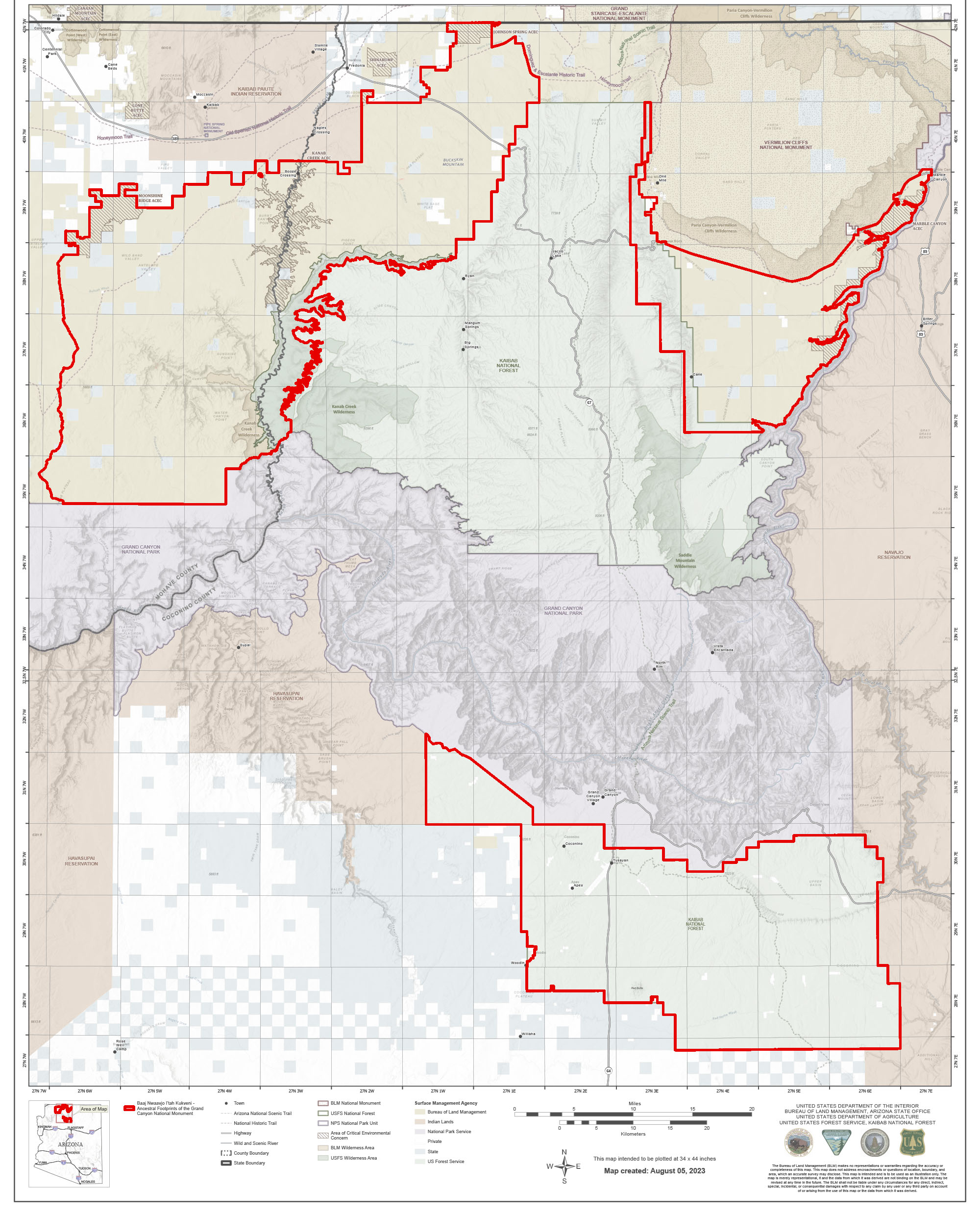
(click on map to enlarge)
That variety helps make the monument compelling. It is not the Grand Canyon’s main event. These lands hold pine forests, sagebrush flats, side canyons, rock art, old airfields, fire lookouts, sacred mountains, and overlooks. Like other BLM and USFS lands, much of the monument is remote and lightly developed. Although paved roads skirt parts of the monument, exploring it generally requires driving on unpaved roads. High-clearance vehicles are recommended. Roads can become impassable after rain, and winter snow closes Highway 67 and many forest roads on the Kaibab Plateau. The place demands some planning, self-reliance, and respect for conditions on the ground. I will provide some coordinates when Google Maps search for landmarks gives incorrect result.
South parcel
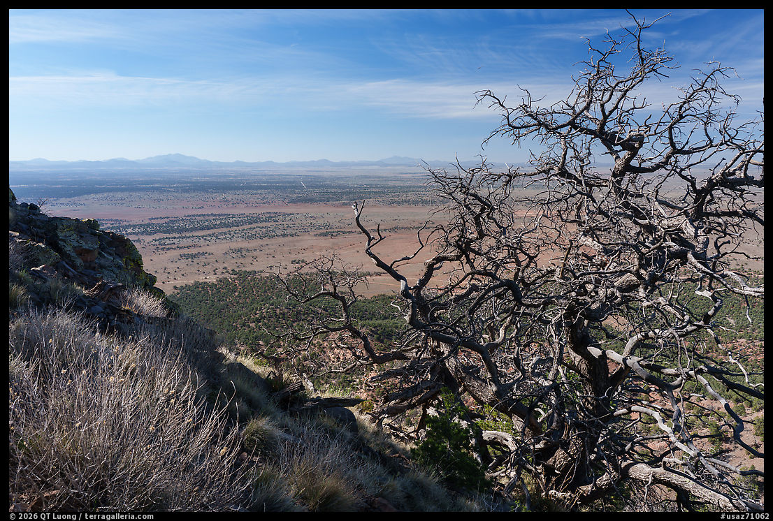
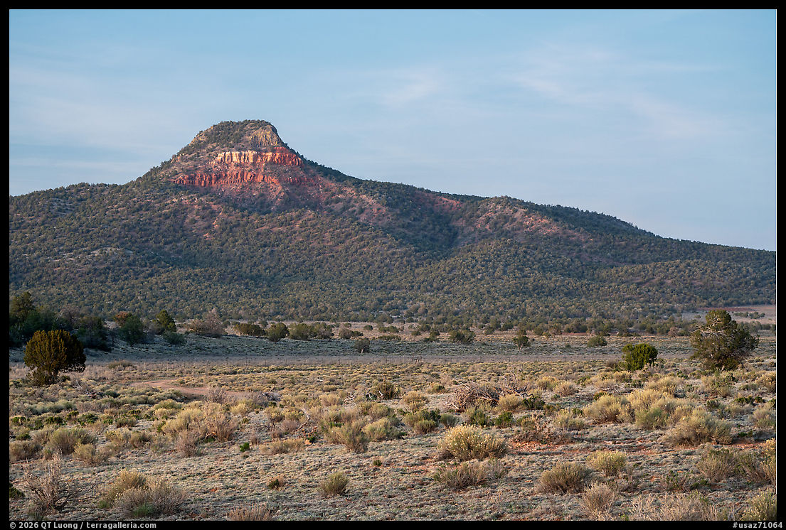
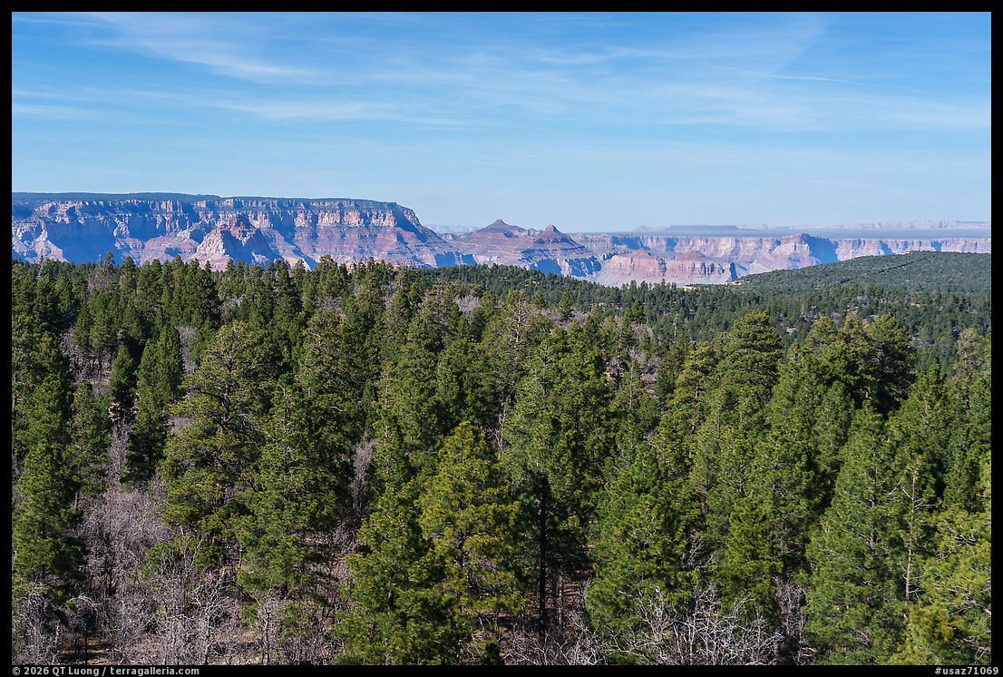
Though perhaps the least dramatic, the easiest section to explore is the south parcel in the Kaibab National Forest’s Tusayan Ranger District, bordering the South Rim of the Grand Canyon. Here, pine woodlands and sagebrush prairie spread across a landscape accessible by Forest Service roads. That mostly flat area stops a couple of miles short of the Grand Canyon in the north, although some distant views of it can be had from elevated viewpoints. The most prominent landmark is Red Butte, a volcanic formation just east of Highway 64/180 on the approach to Grand Canyon National Park. On a plateau that is otherwise strikingly flat, the butte stands out. It is a sacred place for the Havasupai, Hualapai, Navajo, Hopi, and Zuni, and the proclamation describes it as a towering landmark with evidence of long human habitation.
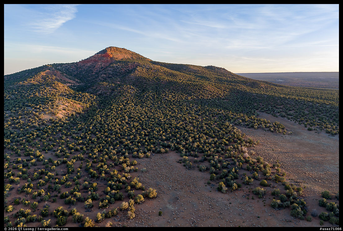
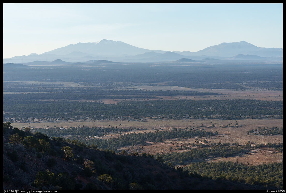
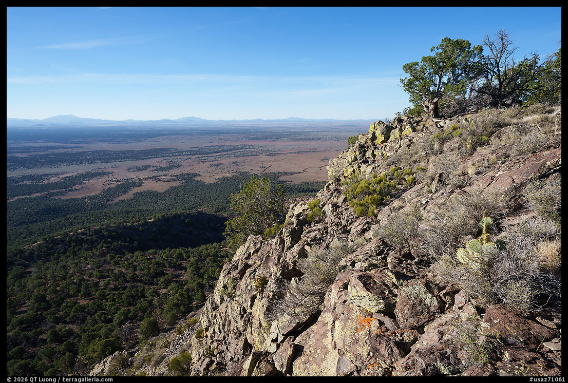
The hike is straightforward: about 3 miles round trip with roughly 900 feet of elevation gain on a well-maintained trail. On the flat summit, a two-story lookout provides 360-degree views over surrounding forests stretching to the horizon, with a hint of the distant Grand Canyon. In a monument full of hard-to-reach places, Red Butte is one of the clearest places to begin. On my way back from a weekday sunrise hike—sunset would be preferable for the light, but I had to contend with unseasonably warm temperatures—I was surprised to encounter three parties. Everyone had arrived in high-clearance vehicles, although a regular car could probably make it through the 2.7 miles of dirt road from US-180, 12 miles south of Tusayan, to the trailhead (35.817198, -112.101145).
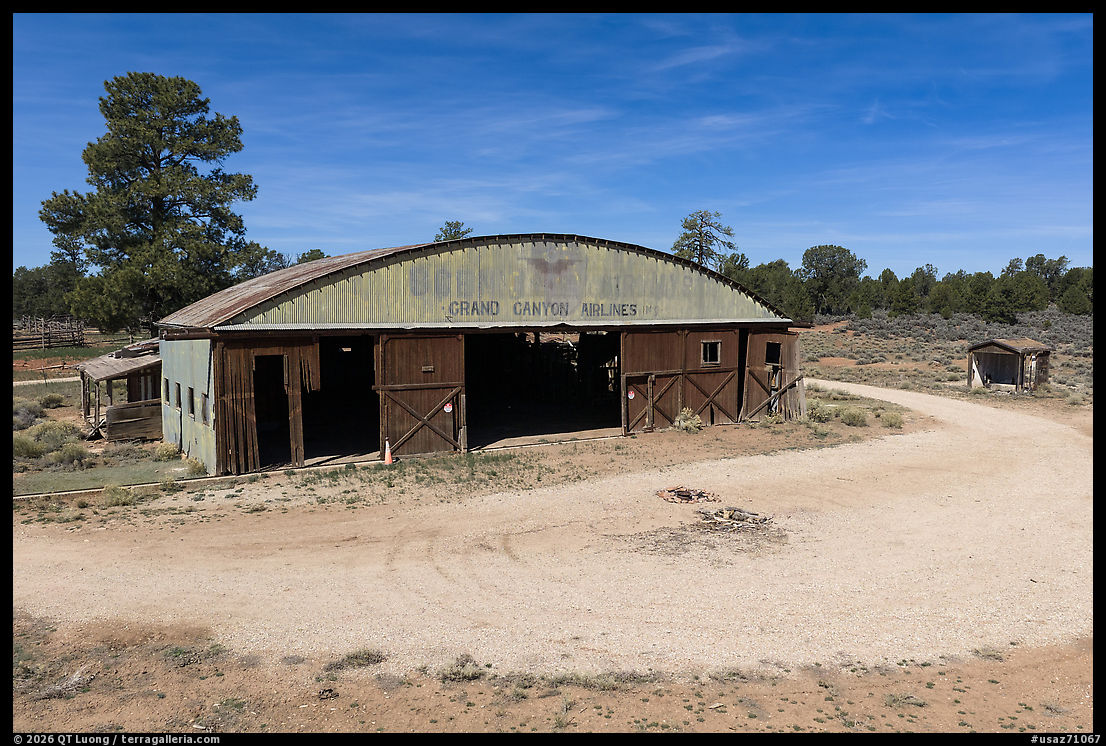
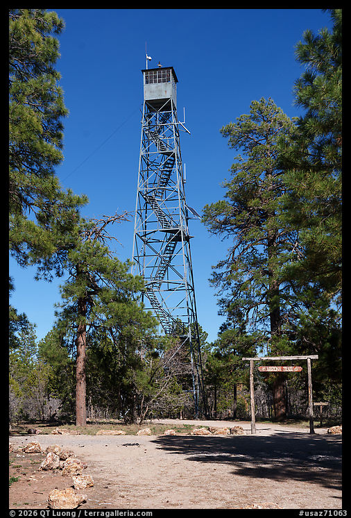
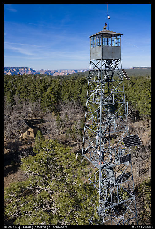
That same southern unit also contains traces of human history. Nearby is the historic Grand Canyon airfield area, including the hangar associated with the 1920s Red Butte Airfield, used by aviators such as Charles Lindbergh and Amelia Earhart. Near Grandview Point in Grand Canyon National Park stands the 80-foot Grandview Lookout Tower, built in 1936 by the Civilian Conservation Corps, which can still be climbed for a glimpse of the Grand Canyon unusually framed by extensive tree canopies. Google Maps suggested a route entirely on unpaved Forest Service roads from US-180, but by starting from Desert View Drive in the national park, I needed to drive only 1.3 miles on the well-graded Coconino Rim Road/Fire Road 310, beginning at (35.968140, -111.972217). That is enough to get you out of the national park and into Kaibab National Forest, where dispersed camping is allowed and widely used. The 1889 Hull Cabin lies 2 miles farther on. None of these places is as famous as the park’s overlooks, but together they show that this landscape has long been inhabited, used, and traversed rather than merely admired from a rim viewpoint.
Northeast parcel
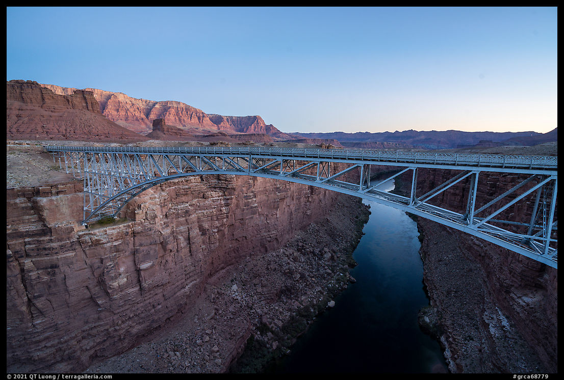
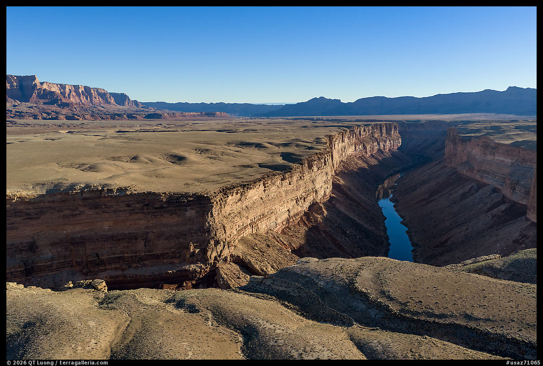
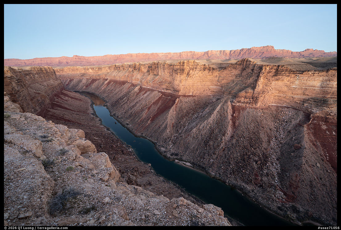
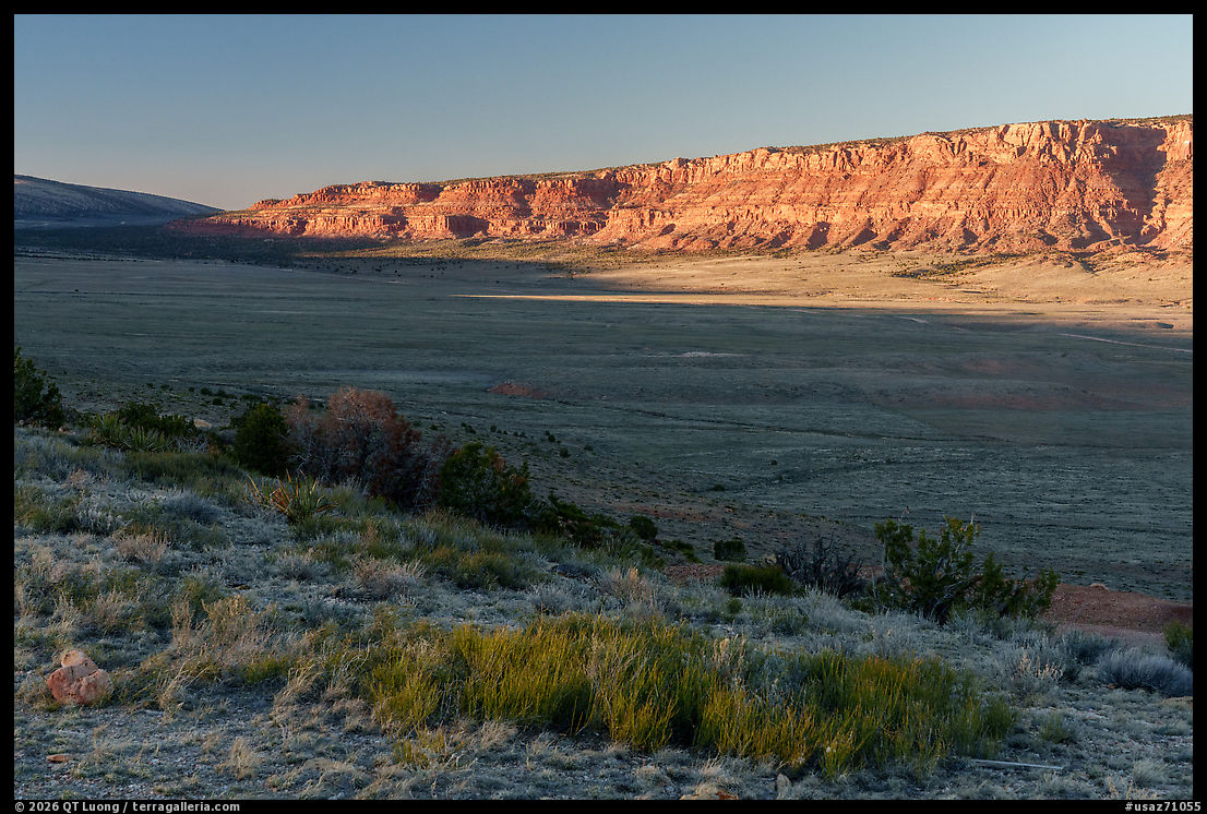
On the opposite side of the Grand Canyon, the northeast parcel around Marble Canyon and House Rock Valley offers a very different experience. Here the land, bounded on the north by the Vermilion Cliffs, descends across open, arid sagebrush country toward the very edge of Marble Canyon. Marble Canyon is the narrow, steep-walled upstream section of the Colorado River canyon from Lees Ferry to the confluence with the Little Colorado River, and it is distinctive because it is tighter, more linear, and more enclosed than the broader, more complex, and more vertically expansive main Grand Canyon farther downstream. A good introduction is the historic Navajo Bridge, where four public-land units meet: Grand Canyon National Park, Glen Canyon National Recreation Area, Vermilion Cliffs National Monument, and Baaj Nwaavjo I’tah Kukveni. It is a geographic junction, but also a useful reminder that this monument is woven into a larger network of protected canyon country.
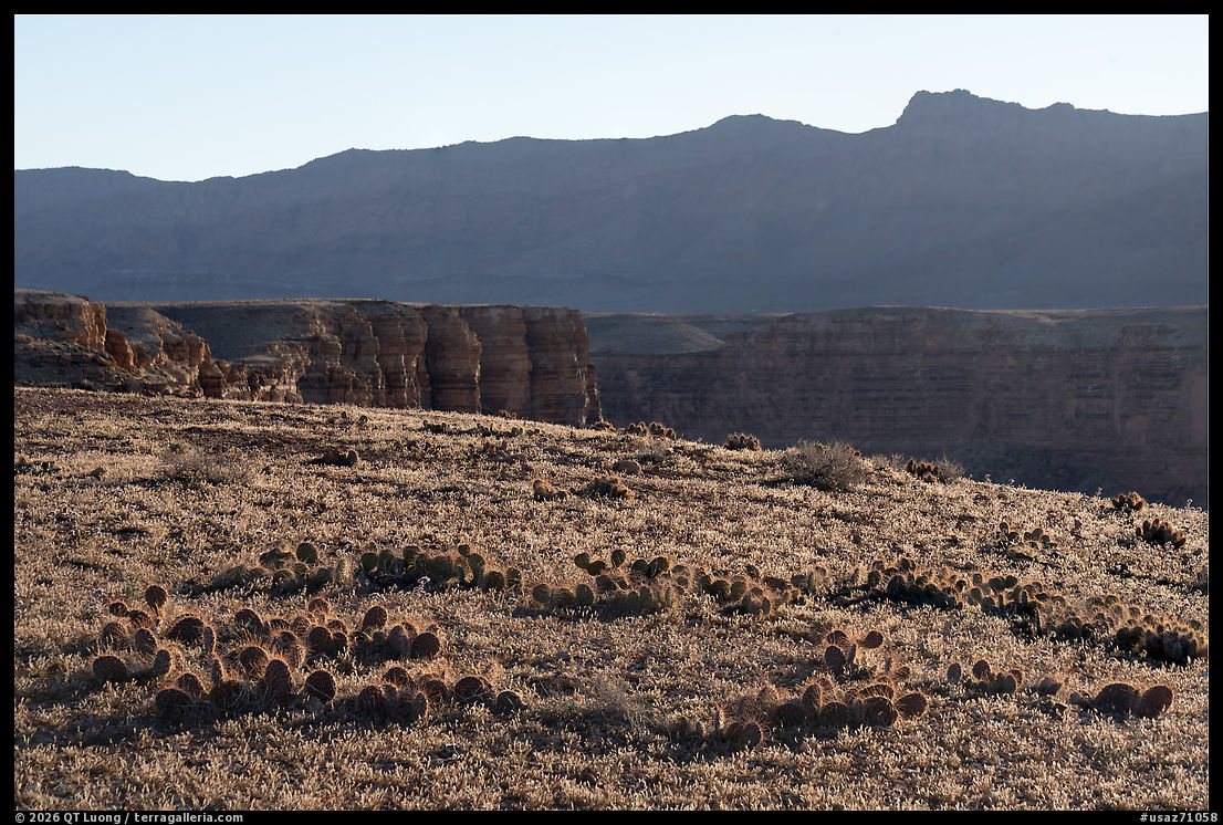
From US-89A, rough roads lead to a series of dramatic canyon viewpoints from which you can peer down directly into the Colorado River, unlike at the Grand Canyon National Park South Rim and North Rim, from which the river is a distant sight. The terrain below the canyon rim belongs to Grand Canyon National Park, while the flat plateau lands above the rim are part of Baaj Nwaavjo I’tah Kukveni–Ancestral Footprints of the Grand Canyon National Monument. Badger Creek Overlook is one of the easier goals, reached by a 2-mile primitive road called Honeymoon Trail off US-89A across from Lee’s Ferry Lodge and about 3.7 miles from Navajo Bridge. It includes a short rocky section that is manageable for a high-clearance vehicle. The reward is a short trail leading to an outstanding view of the confluence of Badger Canyon and Marble Canyon. Three miles farther south, at (36.753172, -111.718717), a road with more rocky sections leads to varied viewpoints over Soap Creek Canyon and the rim of Marble Canyon. Both areas are popular dispersed camping sites where I saw a few RVs parked for what looked like long periods. Apart from those, I had the canyon rim to myself. Unlike at Badger Creek Overlook, the roads were not lined up with rocks to prevent off-road driving, but to protect the diminutive Brady Pincushion cactus, I made sure to explore on foot beyond the established roads. Longer rough roads continue toward viewpoints for Rider Canyon and South Canyon, side canyons of the greater Marble Canyon system. The terrain here is less about developed trail experiences than about reaching edges—places where the plateau suddenly breaks open into depth.
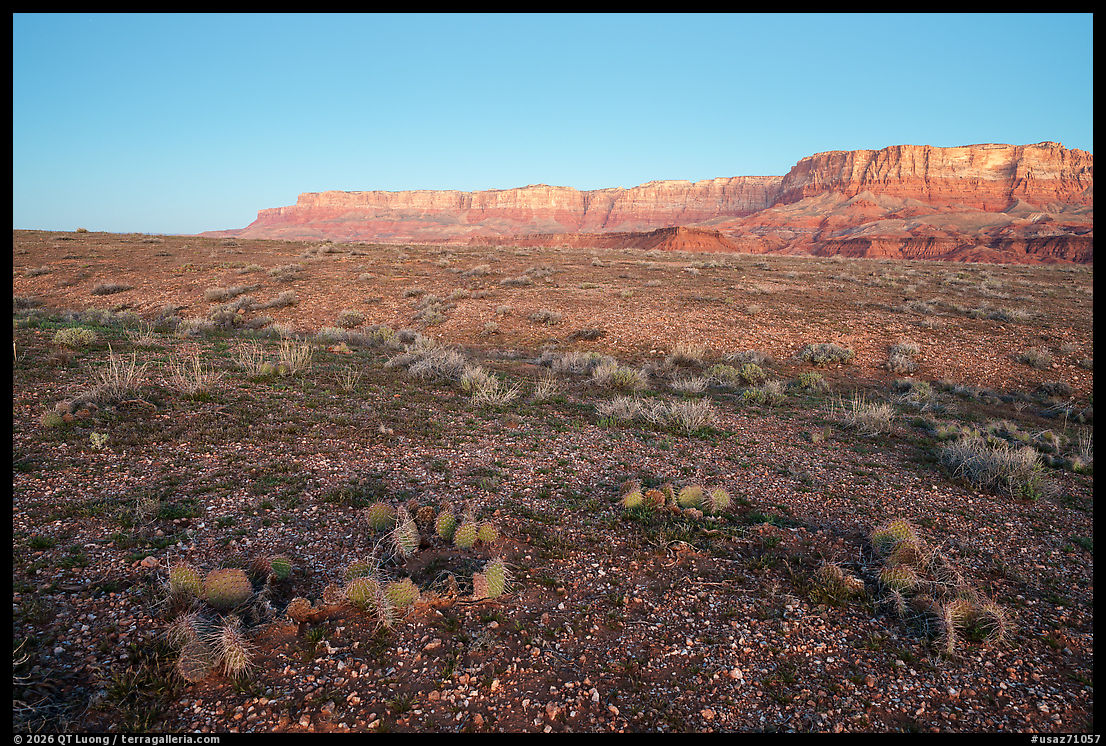
House Rock Valley is part of the House Rock Wildlife Area, known for open scenery and its bison herd, and it includes archaeological remains and wildlife habitat across a broad undeveloped corridor. South of US-89A, House Rock Valley Road functions mainly as access through a large open landscape. I stopped at House Rock Valley Overlook along US-89A for a distant panoramic view at sunset.
Northwest parcel
The northwest parcel, across the Arizona Strip and Kanab Plateau, may be the monument’s most adventurous and arguably its richest for hikers willing to work a little harder. This is where broad plateaus break into major canyon systems, especially in the Kanab Creek Wilderness, where the enormous red-rock canyons rival the Grand Canyon itself. The northwest parcel extends south to meet Grand Canyon National Park along the north rim area, so it reaches the canyon edge, but it does not include the parts of the Grand Canyon, only tributary canyons. In the Kanab Creek drainage, the monument’s combination of scenery and cultural resources becomes especially vivid.
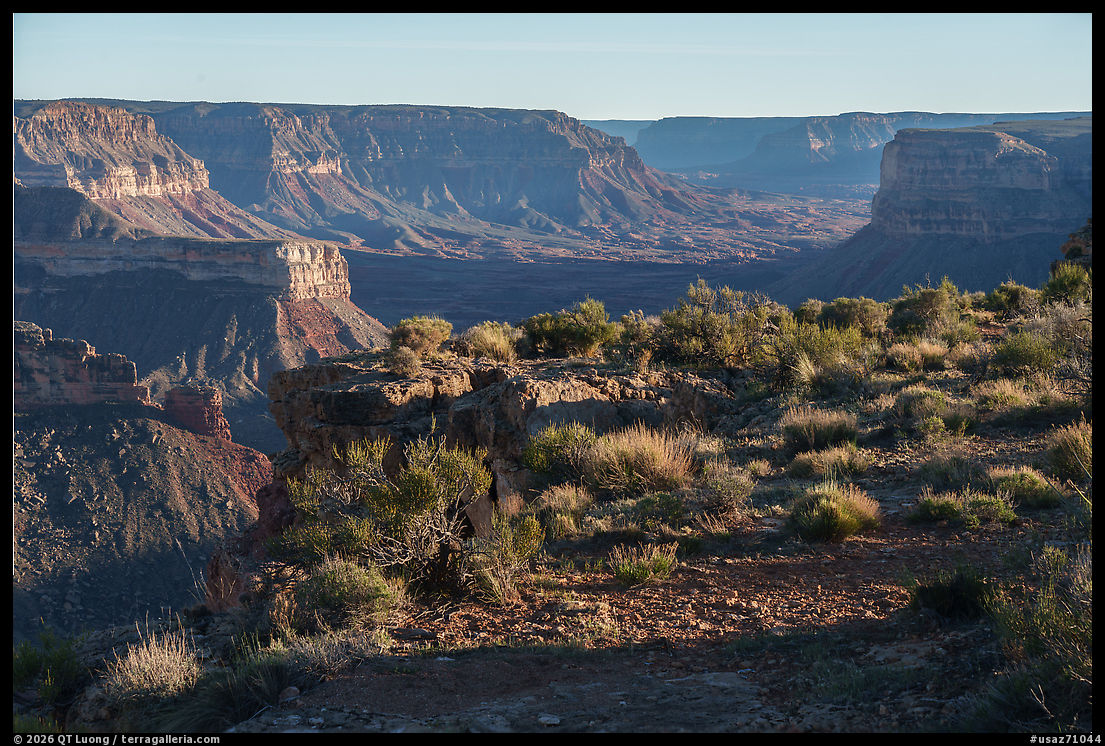
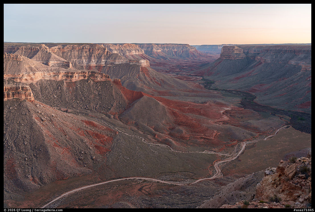
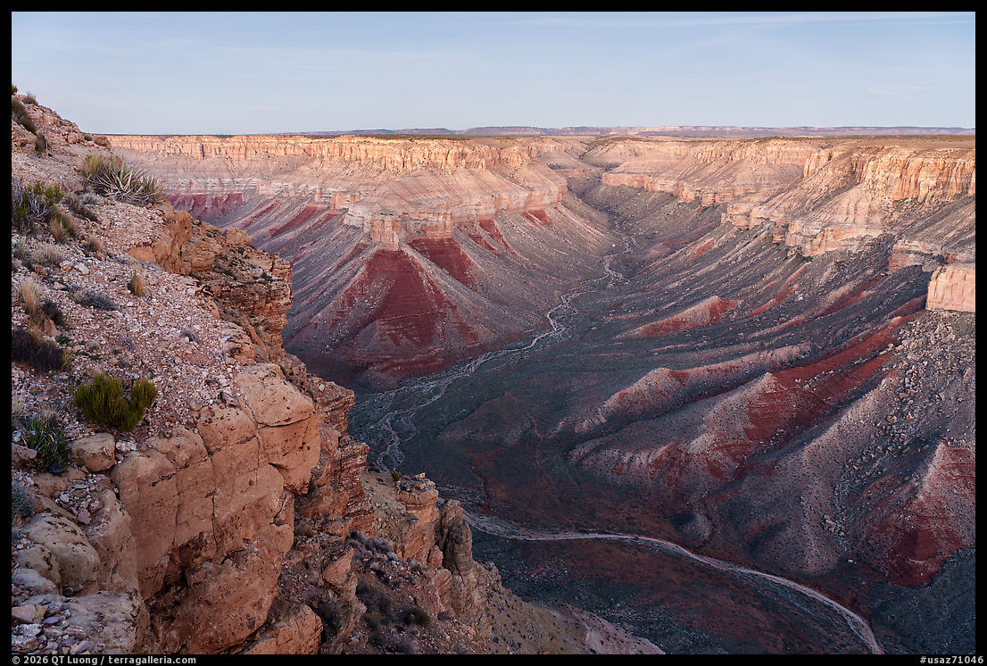
Gunsight Point offered a car-accessible cliff-edge panorama over the confluence of Kanab Creek and Snake Gulch where I experienced perfect solitude at sunset. I drove for about an hour on unpaved roads with an SUV, and in dry conditions, the road looked manageable for any vehicle with decent clearance, though mud can quickly change the equation. Google Maps was not reliable. From US-89A, 1.6 miles south of Fredonia, turn onto Forest Service Road 22 and continue south for 12 miles to Gunsight Road 1048, which dead-ends at a lone tree at the edge of the mesa in 17 miles (36.653652, -112.618545).
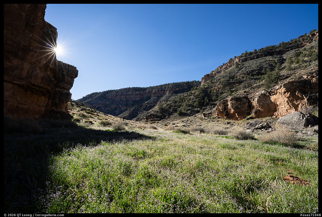
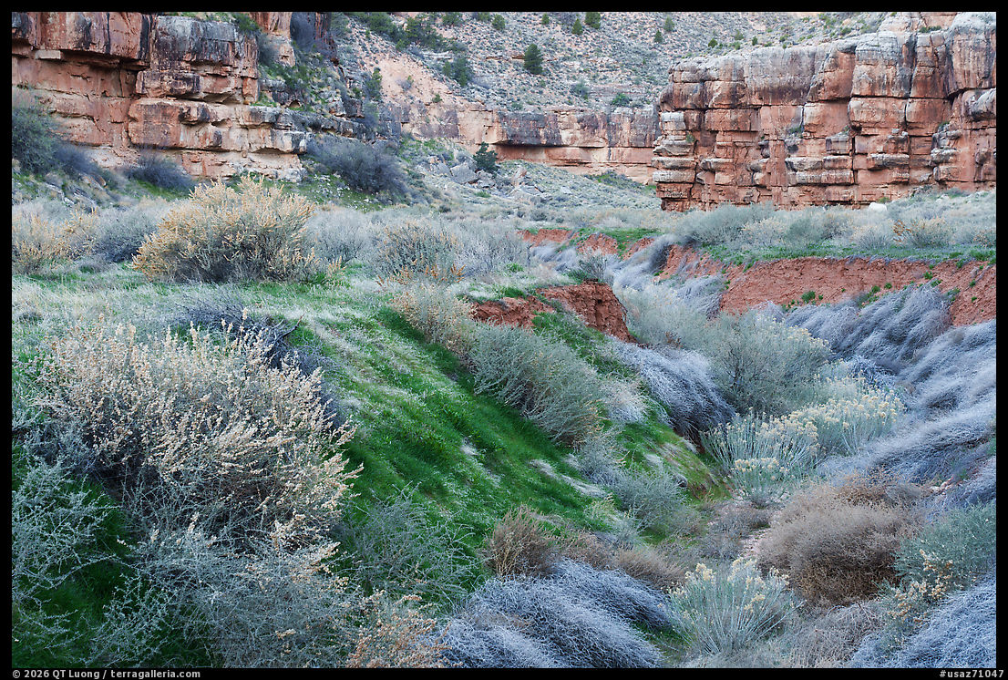
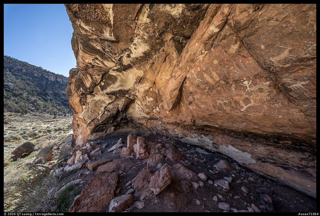
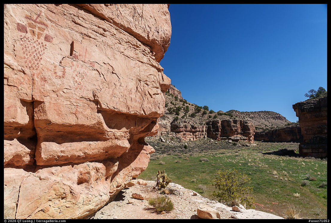
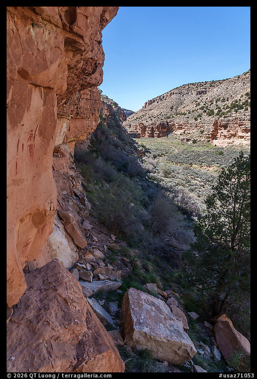
I found Snake Gulch to be more rewarding as a hike than as a distant view, though, thanks to the combination of accessibility, beauty, and cultural content. I headed there straight after visiting Gunsight Point rather than returning to Fredonia. Google Maps correctly locates “Snake Gulch Trailhead.” Regardless of your starting point, from Forest Service Road 22, you follow Forest Roads 423 and 642. Only the last 5 miles are unpaved, but they were well-graded. The Snake Gulch trail stretches out for 21.5 miles, but for a day hike, you can turn around whenever you like. I noticed that the farther I went, the fainter the trail got. Rock art begins to appear about 2.5 miles in, in the form of an alcove lined with petroglyphs.
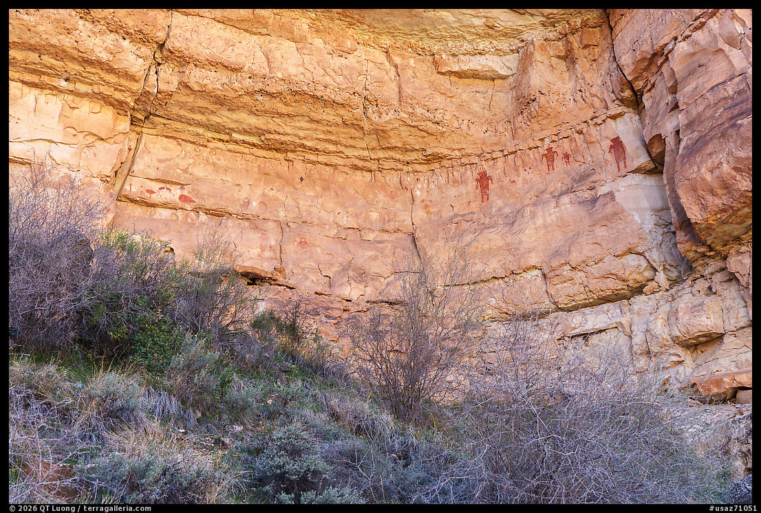
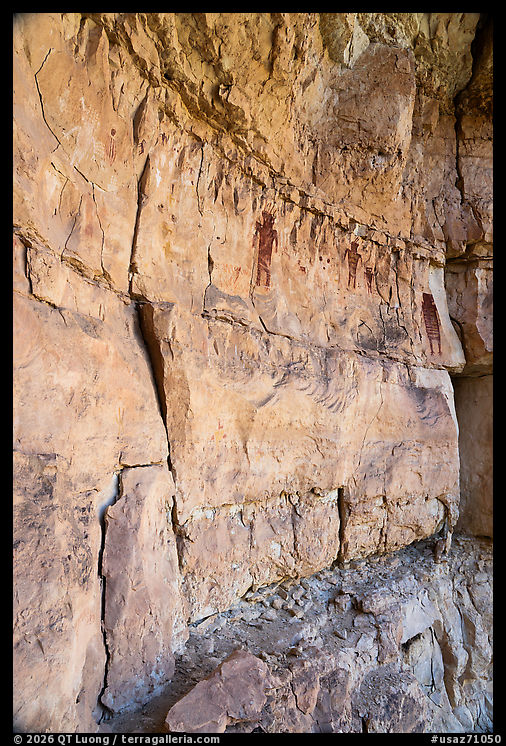
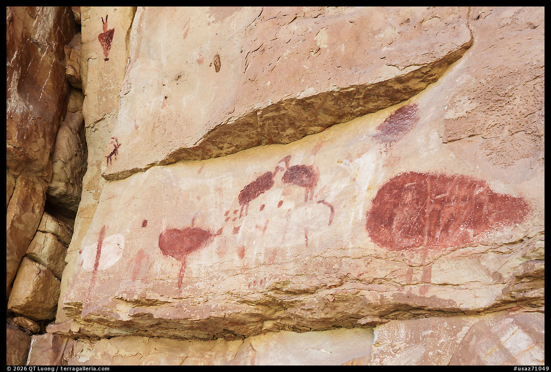
The best concentrations of pictographs are between about 4.5 and 6.25 miles from the trailhead, mostly on the north side, although the most spectacular wall I saw was located on the south side, near and east of the confluence with Table Rock Canyon. It included turkeys and large anthropomorphic figures above precarious ledges, with even a visitor register and interpretive materials in a metal box. In this stretch there are dozens of rock art sites, attributed primarily to Basketmaker peoples who lived in the region from roughly 300 BCE to AD 800. Narrowing after the first 2.5 miles, the canyon was pretty and surprisingly verdant with many diminutive wildflowers in March. Because the terrain is gradual and feels mostly flat, the 13-mile round-trip hike (800 feet elevation gain) did not feel difficult, but the numerous side trips to check rock art lengthened it from a half-day to a full day, so on a warm day, I was glad I started before dawn. AllTrails has useful coordinates for rock art sites.
It is the kind of place where the monument’s name—ancestral footsteps—feels literal rather than symbolic. Kanab Creek more broadly is one of the monument’s most significant landscape-and-cultural areas, containing ancient villages, cliff houses, granaries, pictographs, petroglyphs, and important riparian habitat. In other words, this is not just canyon scenery. It is a record of human presence embedded in the land itself. That is the central distinction of Baaj Nwaavjo I’tah Kukveni. The monument is not simply protecting views around the Grand Canyon. It is protecting a lived-in, storied region whose ecological and cultural values are inseparable.
In a time when public lands are often consumed as a sequence of branded highlights, Baaj Nwaavjo I’tah Kukveni resists simplification. It surrounds one of the most famous landscapes in the world, yet much of its power lies in places that are quieter, less monumental in the conventional sense, and more revealing of how people have moved through this land over centuries. That may be the best way to approach Baaj Nwaavjo I’tah Kukveni: not as the scenery outside the Grand Canyon, but as a monumental landscape in its own right—one defined not only by geology, but by memory, use, reverence, and presence. The ancient people roamed here. Their footsteps remain

