The Desert Peaks
No Comments
Days 3,4,5
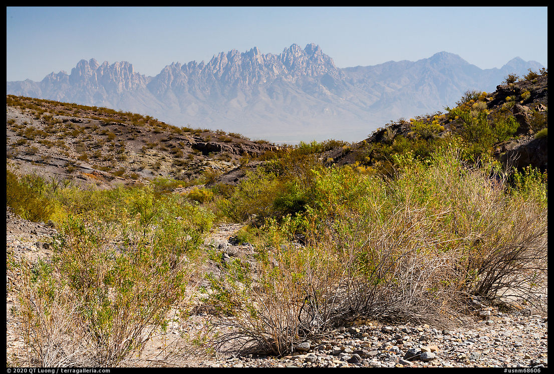
Organ Mountains-Desert Peaks National Monument protects five mountain ranges located in four detached sections of distinct character straddling all sides of the city of Las Cruces and separated by two interstate highways, I-10 and I-25. To the east, the 20-mile-long Organ Mountains, although they form the second smallest section, are the most developed and most impressive. To the southwest, the Potrillo Mountains are the most remote section of the monument. To the northwest are the Robledo Mountains and Sierra de las Uvas. To the north are the Doña Ana Mountains, the smallest unit. Those three ranges together form the Desert Peaks. Having visited the Organ and Potrillo Mountains in a previous trip, this time my objective was to photograph the Desert Peaks.
Picacho Peak
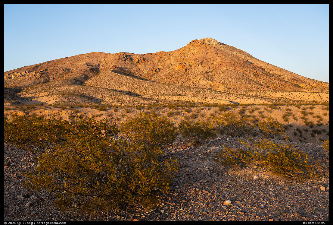
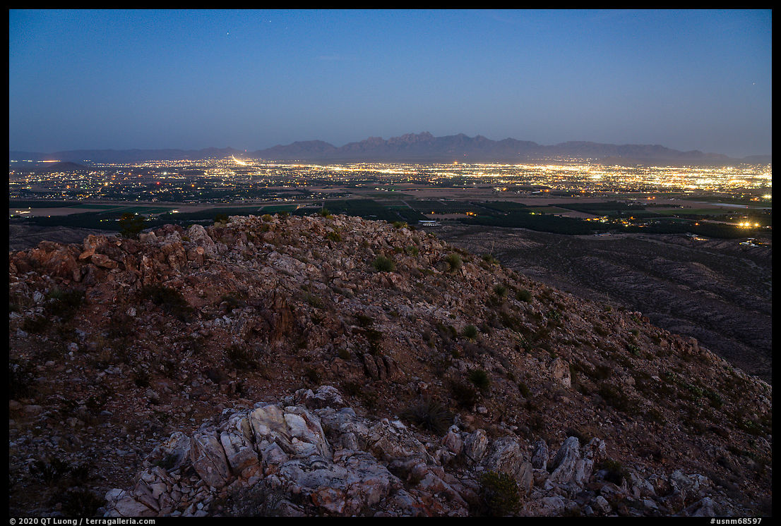
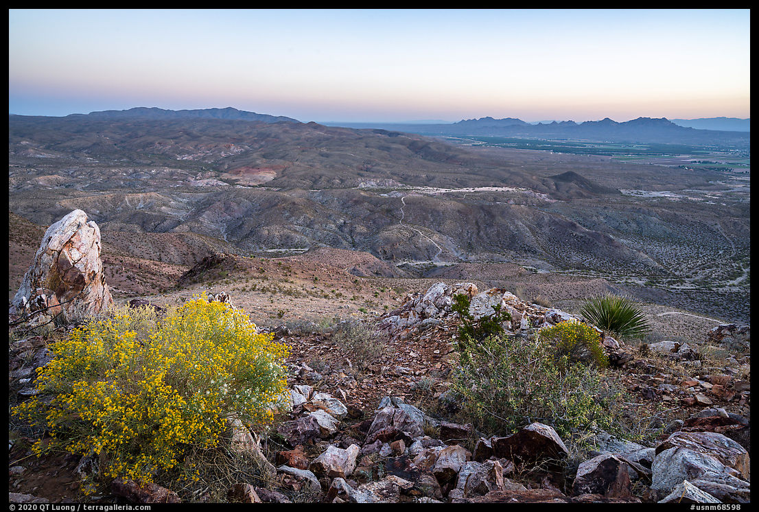
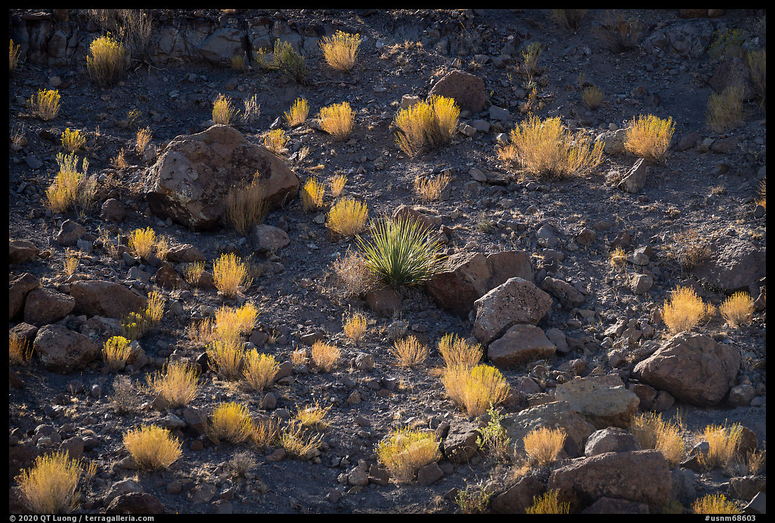
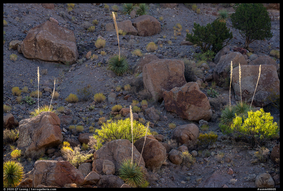
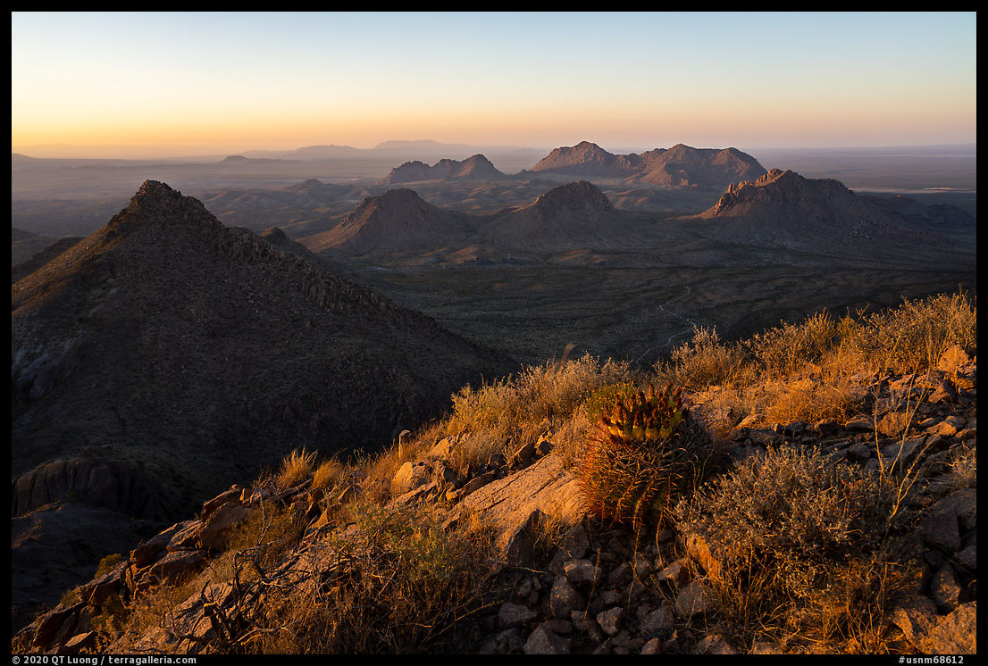
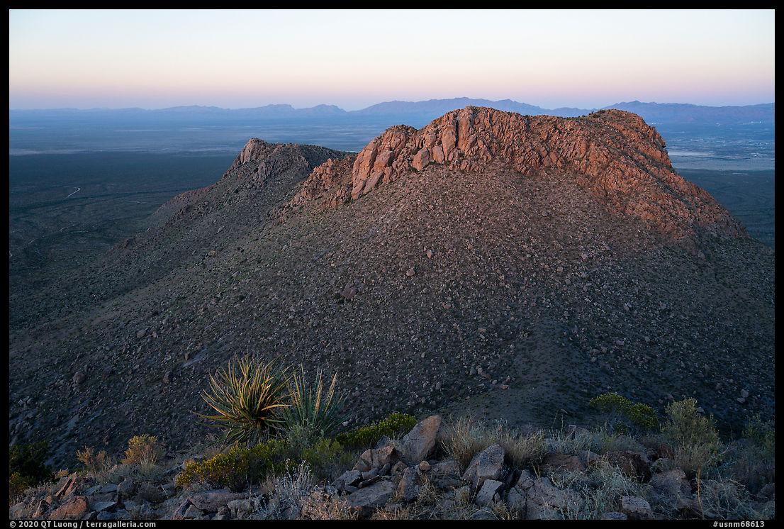
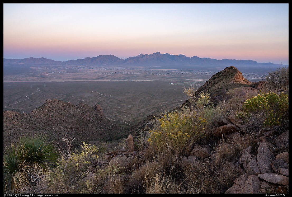
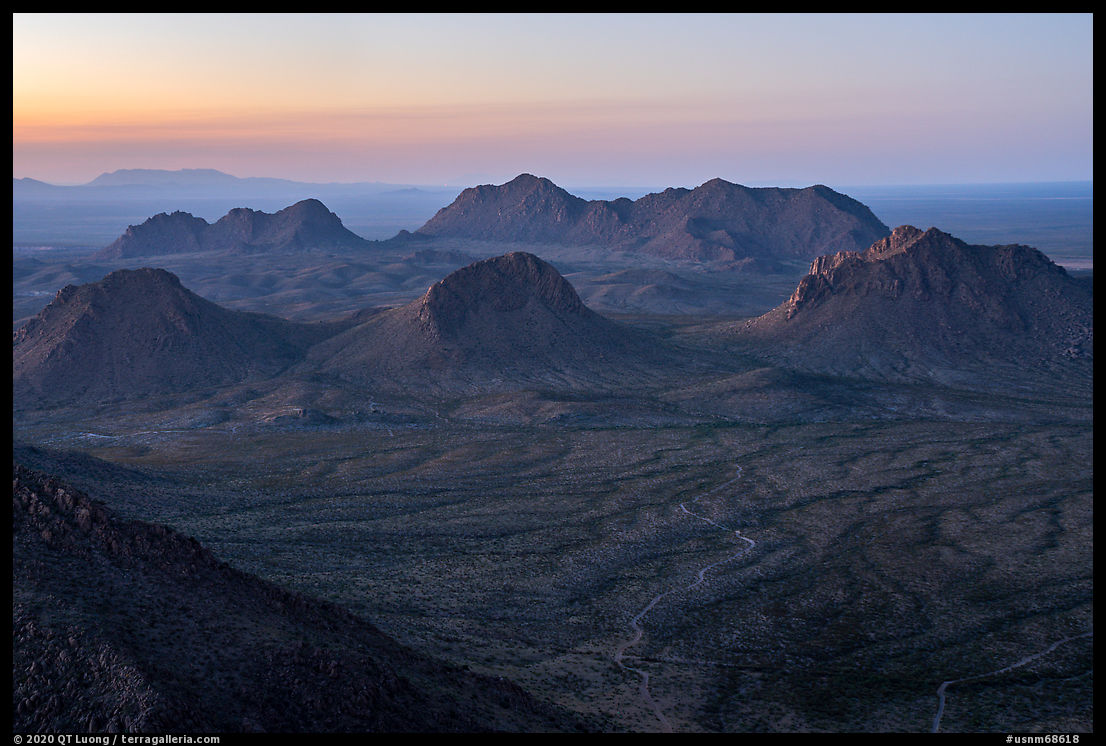
The Robledo and Sierra de las Uvas section consists of low peaks, secluded canyons, grassy tablelands, and riparian areas. It memorializes the largest amount of human history in the monument. Valles Canyon includes rock art from three cultural periods. Also present are also records of early travelers along the Camino Real, the Gadsden Purchase, Civil and Apache Wars, outlaws, and World War II aircraft training targets. The vast area is little visited, except for the Picacho Mountain Recreation Area located just 7 miles west of Las Cruces.The route to the Picacho Peak trailhead passes a residential area and follows Loop Road for 0.9 miles after it changes to dirt then turns north towards the mountain. Driving from Tucson, I arrived there with less than one hour of daylight left. Although in retrospect it would probably have been more productive to photograph by drone, after the long drive, I was eager to stretch my legs and instead started the hike to the peak through the well-used and wide trail (2.5 miles round-trip, 770 feet elevation gain). The area was popular with locals for hiking with their dogs, on the way up I met several walking down. Picacho Peak (4954 feet) provides a view of the entire monument, second in the area only to Organ Needle – a much more difficult hike, but by the time I made it to the summit, the light didn’t work very well.
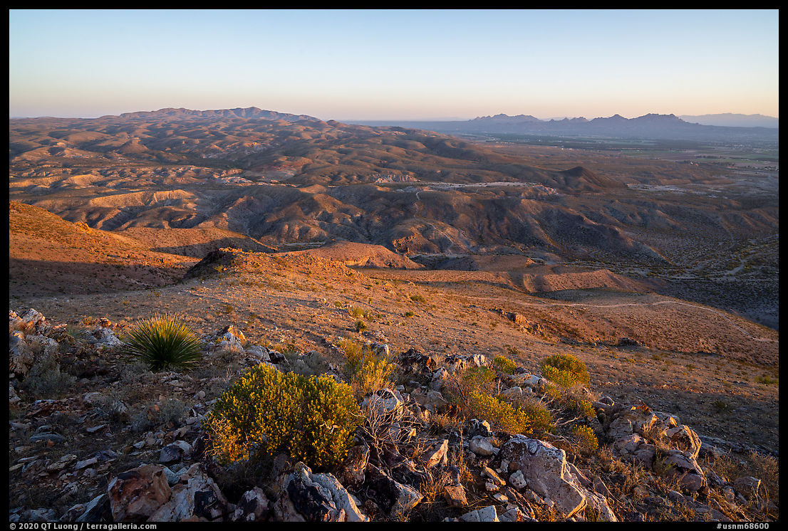
I returned at dawn the next day, arriving at the summit about half an hour before sunrise. While the landscape was beautiful to see at dawn, I thought that the rather flat and distant landforms benefited from the stronger light that occurred after sunrise. The different light required a different foreground composition. Instead of backtracking I continued east and returned via the less used Box Canyon Loop Trail (5.3 miles, 1000 feet elevation gain) that traverses canyons and arroyos north of Picacho Peak. With the sun high and clear skies, I tried to look for places with light contrast and found some on slopes at an angle that made them grazed by the sunlight.
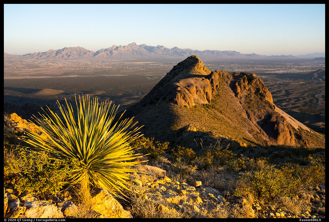
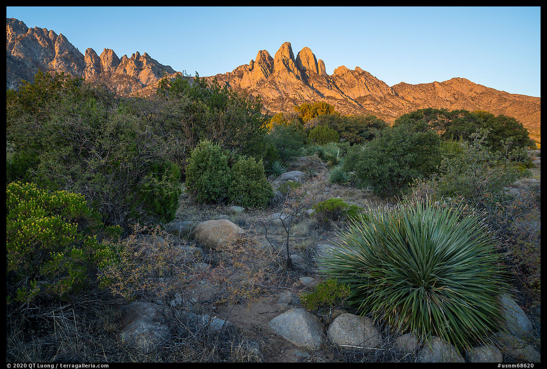
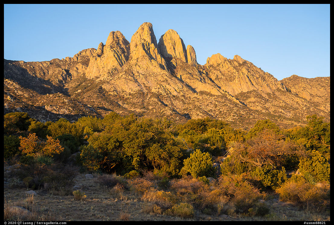
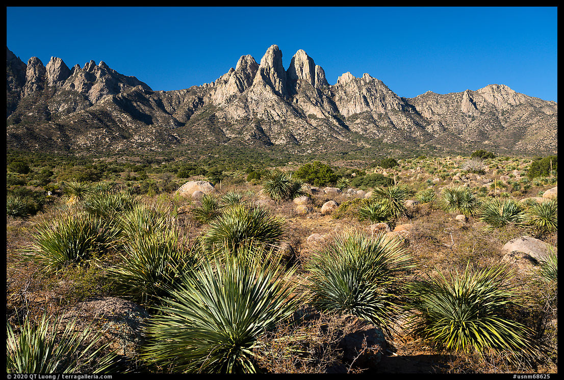
Dona Ana Peak
The Dona Ana Mountains section of the monument is centered around a striking cluster of pyramidal peaks of monzonite porphyry, of which the highest is Dona Ana Peak (5,835 feet). The area is popular with mountain bikers who use the trailhead located at the end of Desert Wind Way, quite a distance from the peaks. Unlike Picacho Peak, Dona Ana Peak is not popular for hiking. There is no signage, official trailhead nor established trails, and for the entire afternoon I didn’t see anybody. There are several ways to get closer to the peaks via unpaved roads, but they all require a SUV. The research I did prior to the trip turned out several accounts of requiring a 4WD truck. Because of the incident on the first day of the trip, this made me apprehensive, but the roads turned out to be only moderately challenging.
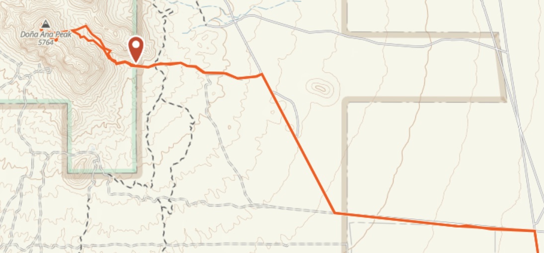
To approach the peak from the east, from US-70, I followed North Jordana Road for 3.7 miles, turned left at a cattle gate, right at a power line road, and left after 1.1 miles. From the end of the track to the summit, it was 1,000 feet elevation gain in less than a mile through the valley between the peaks reached by a class 2 scramble, and then a very steep slope with difficult footing straight towards the peak. Although there were sections of user trails, I mostly missed them, but fortunately, spiny desert plants were scattered. When I reached the ridge, the afternoon wind hit me with full force, but once at the top, by descending a bit on the downwind side, I found a spot sheltered enough to enable photos with long exposures at sunset without vibrations. Hiking down at night, by following the arroyo at the bottom of the valley rather than a path on the slope, the hiking was easier than on my way up until the dry watercourse dropped precipitously. I had to scramble up over rocks to reach passable terrain.
Back to Aguirre Spring
During my previous trip, I had misplanned my activities at Aguirre Spring, on the east side of the Organ Mountain. Since Aguirre Spring is the only campground in the monument, after hiking down from Dona Ana Peak, I drove there with the easy plan to photograph the mountains at sunrise. This time instead of being high up on the Pine Tree Loop Trail, I worked from the campground area, with its granite boulders and Chihuahuan Desert vegetation. It was a nice change from each of the two previous days, when starting to hike a mountain well before sunrise, I finished a hike on another mountain well after sunset.
The Last Road Trip: 1 | 2 | 3 | 4 | to be continued

