Waterman Peak, Ironwood Forest National Monument
No Comments
Day 3
After arriving at the trailhead for Waterman Peak in Ironwood Forest National Monument at 12:30 am, I walked around to locate the trail. Having driven straight from the previous sunset location, I had re-arrange the gear in my new rental car to make room for sleeping before setting up the alarm clock for 5 am. I had two reasons to start early. I wanted to catch the sunrise high up on the mountain. Although it was late October, the Arizona weather forecast still called for high temperatures in the mid-90s, so I was hoping to be off the mountain before the day would heat up.
I could see the lights of Tucson, below, but as they were distant, I expected the quiet of the wilderness. Maybe around 4 am, the noise of an approaching truck woke me up. At first, I thought that maybe some other hikers had the same idea I had. However, it sounded like the truck turned around and left shortly after arriving at the trailhead. Then the same thing happened again, and that time I identified the noise as generated by a large truck. After the third occurrence, I just decided to wake up to see what was going on. A truck – big indeed – appeared to be going back and forth to spray water. I wondered why, but at least, it put me on an early start, as I started the trail before 5 am. Better too early than late.
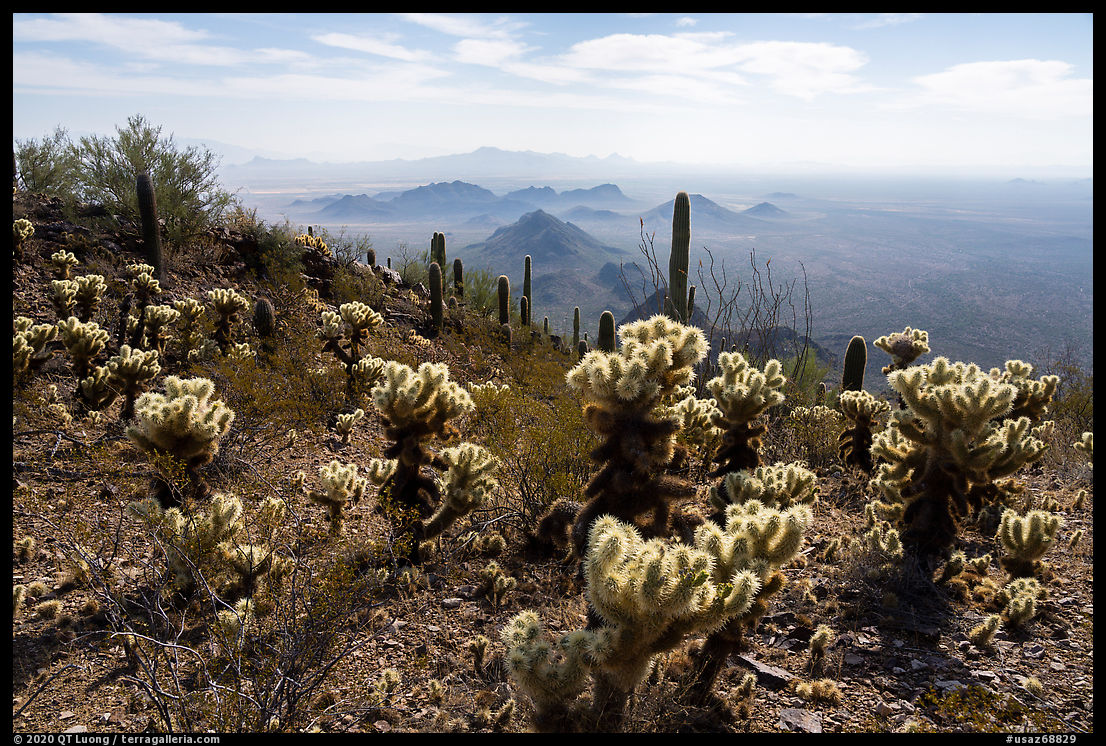
Waterman Peak (3830 ft) is a rare desert limestone uplift featuring endangered flora such as Nichol’s Turk’s head cactus, a round blue-green barrel cactus, or the elephant tree reaching its easternmost range. The last population of bighorn sheep indigenous to the Tucson basin has thrived there since the establishment of the monument. To protect them, the BLM suggests not hike in the area during the calving season from February to April. My previous visit to Ironwood Forest National Monument was in March. Although the closure is voluntary rather than enforced, and although I wasn’t sure when I’d be back, I had refrained from hiking the mountain tops.
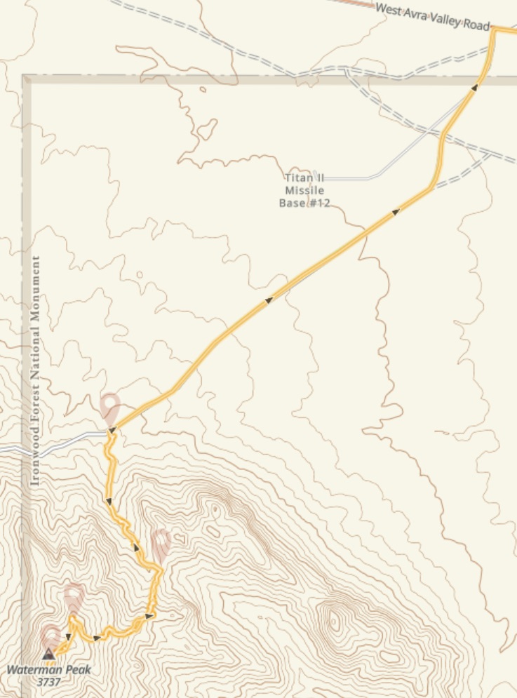
To reach the trailhead from I-10, follow the Avra Valley Road (exit 242 on I-10) for 20 miles, then turn left onto Johnson Mine Road. The trailhead is at the second parking area, 1.2 miles from Avra Valley Road, you won’t have to drive on any unpaved road to reach it.
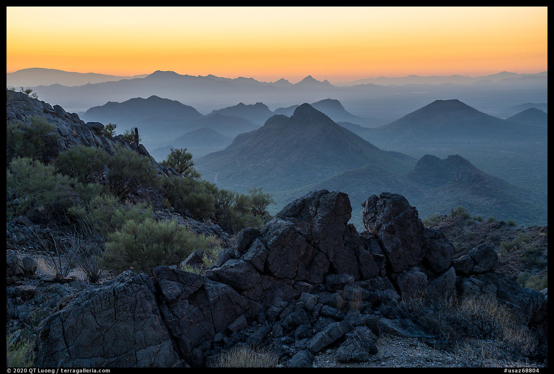
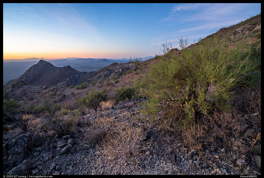
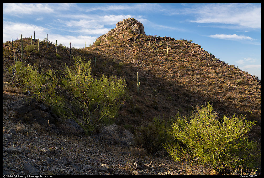
The trail to the summit (3.5 miles, 1260 feet elevation gain) has the distinction of being the only official trail in the entire monument, but apart from the first half mile that follows an old mining road to a saddle, I found it faint. Fortunately, the rocks on the slope were stable and there was little vegetation, so missing the trail did not matter much. After an hour of hiking, I reached a second saddle, and although it was still too dark to see well, the position looked promising, as it offered views in several directions. I stopped and began photographing, at first using the “bright monitoring” function of the Sony that provides something akin to night vision. Soon enough, dawn arrived, and I alternated between compositions, orientations, and focal lengths as the light quickly changed.
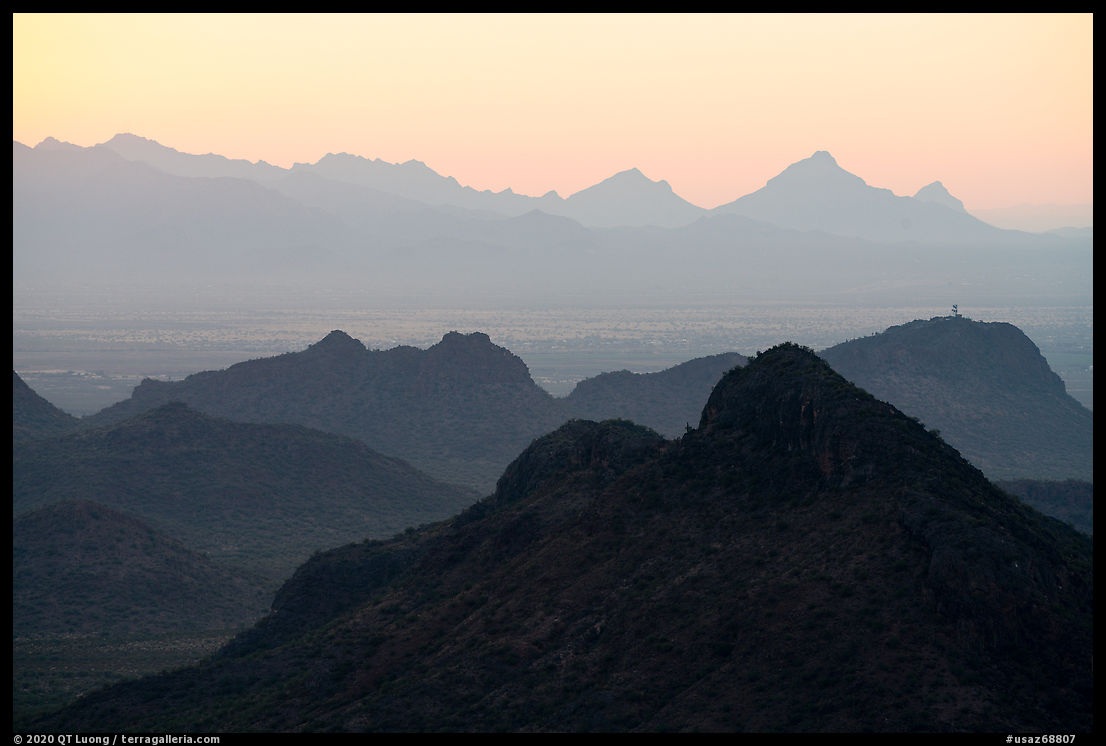
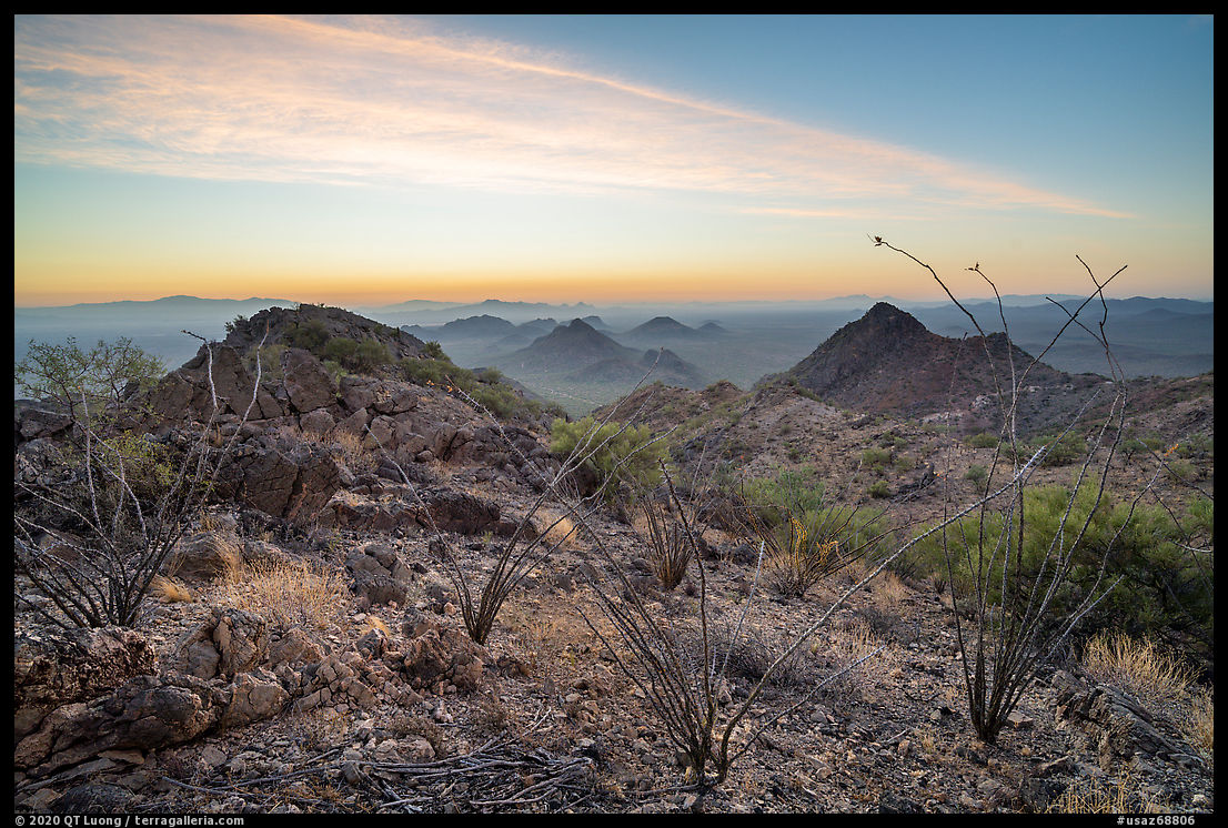
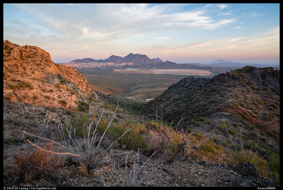
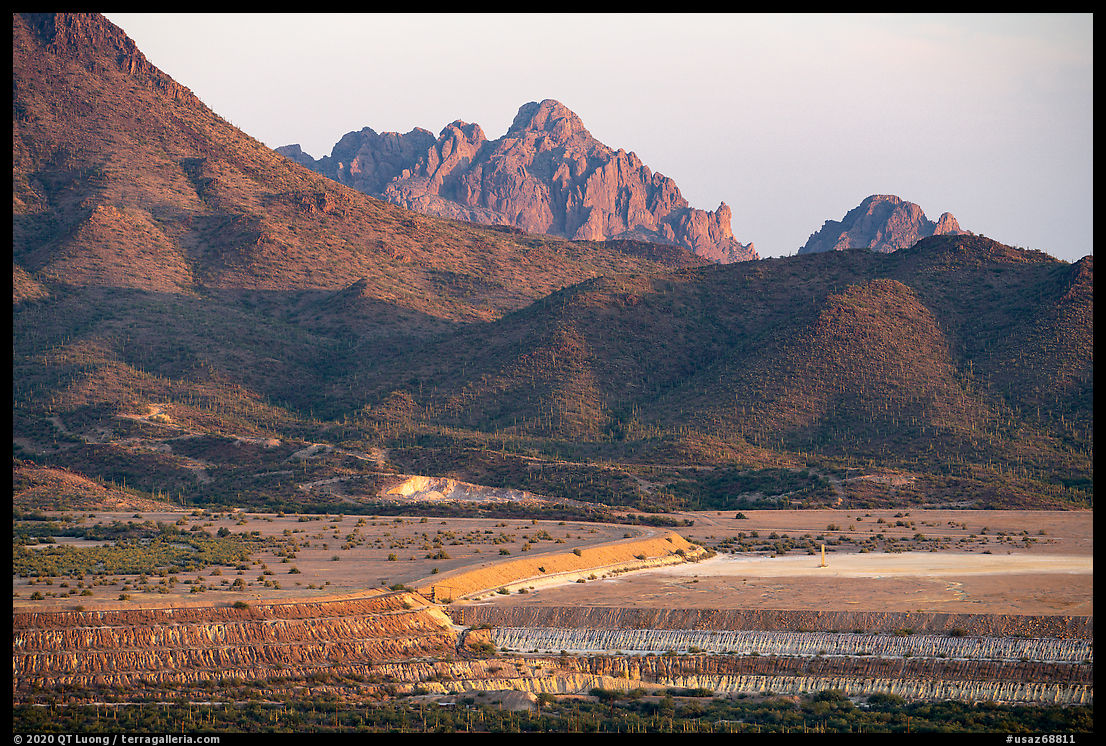
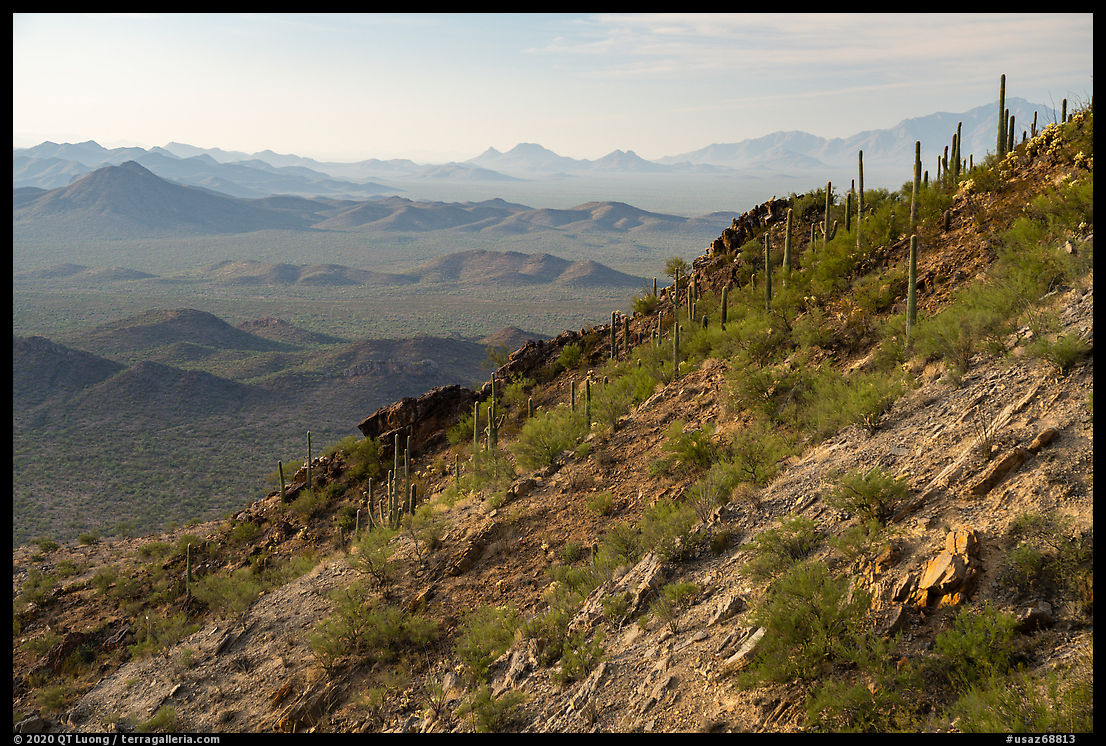
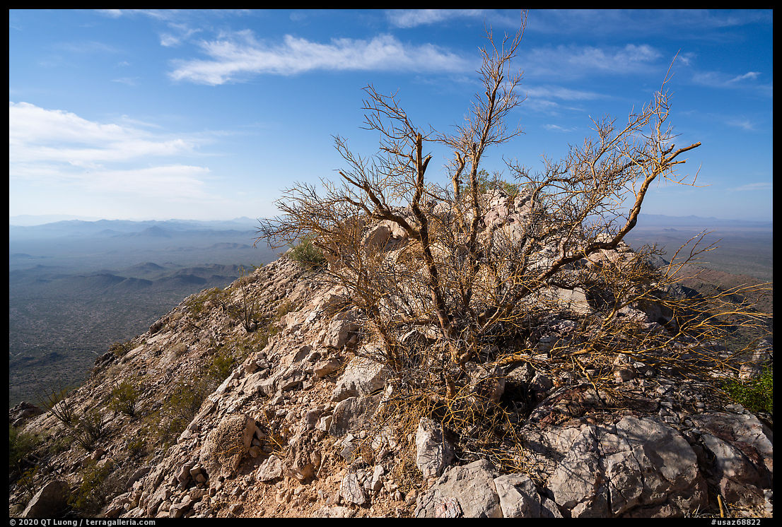
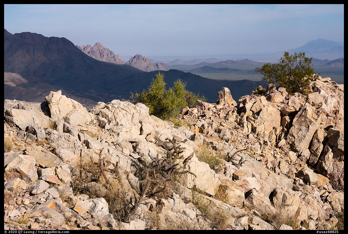
The actual summit didn’t come to view until a broad ramp and required a bit of easy scrambling to reach a narrow summit ridge with excellent 360-degree views. It included a large open-pit mine. The century-old copper mining operation on the south side of Silverbell Mountain moves 3,6 billion pounds of earth every month and has sought to have the monument reduced so that they can assert new claims. Heavily loaded trucks frequently come and go and maybe that was why the road needed to be frequently maintained. The mine foregrounded any wide views of Ragged Top, the monument’s crown jewel – and not so wide views, the last photo above used a 200mm focal length! I figured it out that for a nature image, I could hide the mine with the western summit ridge of Waterman Peak, but with the sun in my back, the landscape lacked any depth. However, when isolated clouds began to quickly move across the land, I sensed an opportunity. It materialized when their shadow fell on the slopes of Silverbell Mountain, providing contrast and separation.
Back to the trailhead, having slept less than 4 hours, I yearned for a nap, but without any shade nearby, the temperature in the car was now too warm. On my way back to the interstate, I pulled out for 20 minutes on the parking lot of a church with a large tree before starting the 300-mile drive to my Picacho Peak. 300 miles you ask? Isn’t Picacho Peak just a short hop north on I-10? Well, I am referring to the less-known Picacho Peak in New Mexico, near Las Cruces. I would need to break the drive with another 20-minute nap before getting there.
The Last Road Trip: 1 | 2 | 3 | 4 | to be continued

