Terra Galleria Photography

New images: Allagash Wilderness Waterway and the Lacroix Locomotives (with directions), Maine

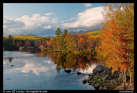
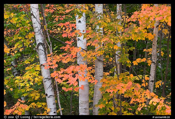
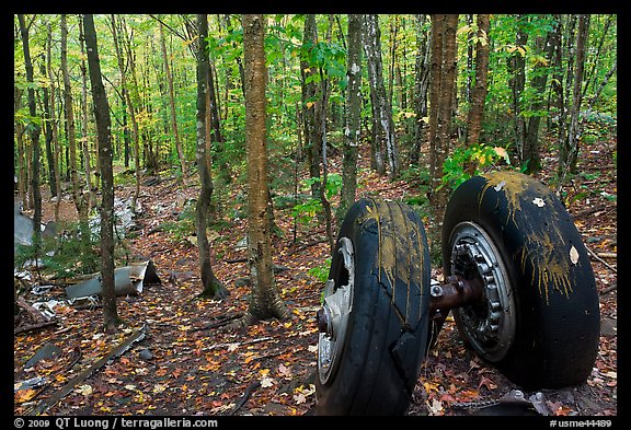
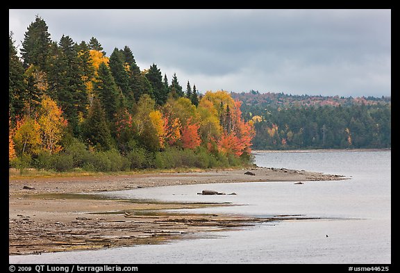
I’ve posted new images of the Allagash Wilderness Waterway, the third installment of images of the Maine North Woods (trip report).

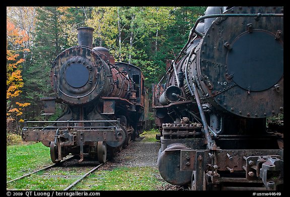
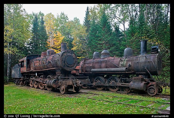
There are not a lot of places where you can be hiking through a remote forest and suddenly stumble upon huge, rusting, but otherwise well-preserved, steam locomotives, stuck one hundred miles from the closest modern track. One of the things that makes the Allagash so interesting is the possibility to discover remnants from a bygone lumber industry in unexpected places.

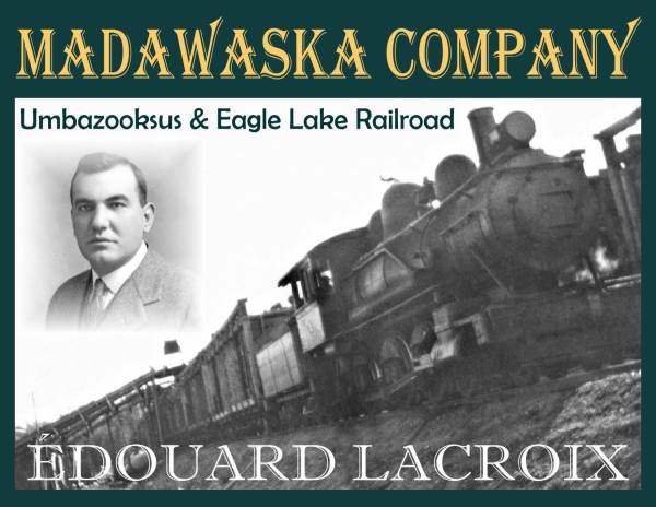
The locomotives were part of a short railroad, build by Edouard Lacroix in the mid twenties against all odds, that was used to solve the problem that the adjacent rivers flowed North, to Canada, while they wanted to float the logs to mills in Millinocket. Half a decade later, by 1930, the area was logged off, and the railroad stopped operations.


courtesy Jean Lacroix / www.cumberlandinc.com

When I asked in Greenville and Millinocket, nobody knew the exact location. However, once I traveled North, past the Teleos checkpoint, everybody that I asked (a checkpoint clerk, a ranger, and a forestry worker) was aware of it. Terry Harper, who has personally worked on the locomotives, provides precise directions to the locomotives (including GPS coordinates) in Railroad.net. Since I’ve used a slightly different route, I’ll provide my own below, including coordinates for the locomotives themselves.

You *need* to get the new Delorme Atlas for Maine. Since I respect copyrights, I won’t reproduce the relevant sections here. On the atlas, the site of the Lacroix Locomotives is clearly marked on Map 55 as “Tramway”, on the shores of Eagle Lake. If you have a canoe, you can get from within 100 yards of the locomotives from Eagle Lake. Otherwise, it is a 2 mile hike. I had a rental Ford Focus (a regular car), which was enough to make it to the trailhead, but in the area everybody else was driving trucks. The secondary roads were slightly overgrown, but not overly wet or rutted.

To get to the trailhead, drive Golden Road, then Teleos Road (checkpoint) to Chamberlain Bridge (there is a ranger station there). On the map, it’s quite clear that you need to follow Grande Marche Rd, but on the terrain, since the roads are not marked, it can be a bit confusing. The road through John’s Bridge is longer, and according to the checkpoint clerk, less well maintained. Follow the signs for the “Loon Lodge” until a T-junction where the road to the lodge is on your left, but you’ll continue straight. You will soon cross a bridge over the Allagash Creek. Continue about a mile, then take the first unmaintained road on your right, and then after slightly more than a mile, the first road on your right again. Drive until the road is blocked by boulders, or maybe 1/4 mile past that point if you can squeeze in, and park your car (N46 20.176′, W069 23.948′) before the road becomes too overgrown.

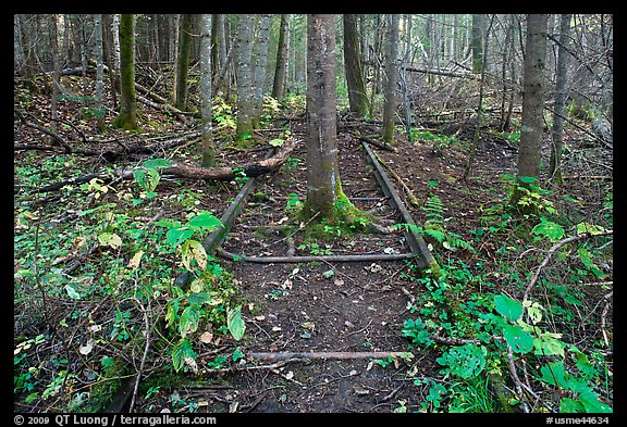
Walk on the road for less than a mile. You will see a trail on your left (N46 19.777′ W069 23.436′). The trail is fairly faint and unmaintained, but if you are an experienced hiker, you will be able to follow it. When I was there, the whole trail was marked with tape, making it fairly easy to follow, but Terry warns you that you should not trust tape. You will intersect railroad tracks twice at a short interval. The second time, make a left. The locomotives are in a clearing (N46 19.360′ W069 22.550′).

If I was to come back, I’d get there earlier than I did, since there are quite a few artifacts to explore in the area. I started to hike in the afternoon, and left the locomotives half an hour before sunset. It was getting dark in the forest, which was kind of scary since the trail was not that easy to see, and despite the short hike, the area felt remote (I didn’t meet anybody after leaving the main road). The North woods are not a place you want to be lost, but with a bit of care, they can provide personal discoveries.

New images: Moosehead Lake, Maine

I’ve posted new images from Moosehead Lake in Maine, the second installment of images of the Maine North Woods (trip report).

Moosehead Lake, the largest in Maine, sits in a beautiful area of the Maine North Woods. The lake, bordered by low mountains and rolling hills, features an intricate lakeshore (280 miles long) and more than 80 islands. While Baxter State Park is preserved as a wilderness area, on the shore of Moosehead Lake there is a popular resort, Greenville. Yet so far the developement has been limited.

In 1998, the Plum Creek Timber company bought 900,000 acres of Maine woods, becoming the largest private landowner in the US. Those lands include over 60 miles of shoreline along Moosehead Lake. Although the company initially stated it was only interested in doing sustainable forestry, it is in fact a Real Estate Investment Trust. In 2004, Plum Creek announced its plans for the largest development in Maine history, along some of the most beautiful sections of Moosehead Lake. Those sprawling plans include a thousand house lots and two mega-resorts, a golf course, marina, and RV parks. For an update on the situation, check Natural Resources Council of Maine.

A day of diving in the Channel Islands

This past Saturday, I dived one of the most beautiful sites I had seen. Although I had done three trips to the California Channel Islands before, I had never gotten into the water there.

Part of the reason was that, being used to diving in warm waters, my only diving experiences in California, near Monterey, were rather unpleasant. I remembered the difficult beach entries, cold water, poor visibility, the feeling of being restricted by the thick suits, hood and gloves, as well as the attendant difficulty to control buoyancy. But now, I had to travel to Thousand Oaks for a photography exhibit opening on Friday night, only half an hour away from the Channel Islands harbor in Ventura, and I knew that October was one of the best times there, with warm and calm waters. The Channel Islands being part of a Marine Preserve, that was an important aspect of the National Park that I had missed.


Bottom photo by Patrick Smith who exhibited beautiful seascapes in an instantly recognizable style at the Westlake Village Four Seasons Hotel.

The week before, I had asked master underwater photographer Philip Colla for advice. Philip, who was most generous with his time, recommended that I had my Nikonos serviced, since it hadn’t been used in a while. Once the workhorse of underwater photography, the venerable camera seems to be well on its way to extinction. Nobody in Northern California doesn’t service it anymore. Since I didn’t have time to send it out, I just greased and replaced o-rings, and then hoped that the body wouldn’t leak. When I was reloading film on the boat, other divers looked with curiosity. On Friday, just before the exhibit opening, I had spent one hour and half trying to find film in Thousand Oaks (In 100 ASA, I had only expired Sensia in my freezer) without success.

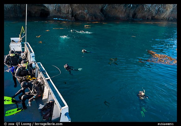
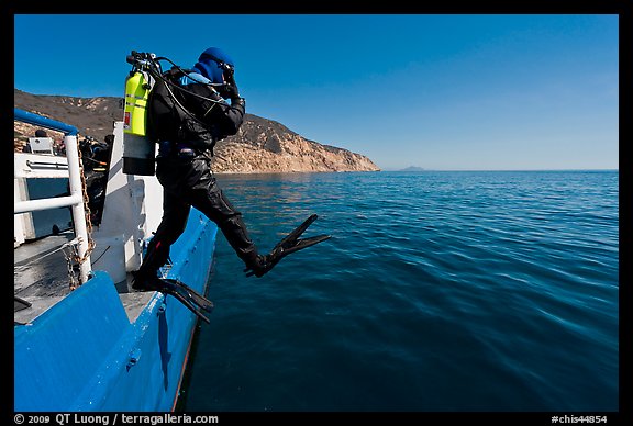
I signed up with the Spectre which turned out to be excellent. After the exhibit opening, I drove to Ventura and slept on the boat. At 6am in the morning, the rented diving gear was already there. The crew was most friendly and helpful. Diving from a boat is the way to go ! It was so much easier than diving from the shore. Yet it had been so long since I last dived (at that time 35mm film cameras were largely superior to digital) that I was exhausted from the first dive. It didn’t help that I was missing weights. Fortunately, as the day progressed, I felt more at ease in the water.

The underwater beauty made it all worth it. Diving in the giant kelp forest there was unlike any experience I had before, in its shear three-dimensionality. I had dived kelp before in Monterey, but the visibility was so poor that I couldn’t appreciate the size of the underwater forest, while all I could see was the surge motion that made me feel sick. But there, in the Channel Islands, the visibility was probably 50 feet, and the sight of those tall columns of seaweeds rising deep from the ocean floor to the surface was truly wonderful. As many of the dives were in a Marine Reserve, there were also plenty of fish and a few seals.

As I didn’t have a strobe, my goal that day was just to photograph the kelp forest at shallow depths. My briefing with the divemaster went something like that: “Do you have a buddy ? – No – I can find you one – He might not be happy diving with me, since I want mostly to photograph kelp – When was your last dive ? – It’s been years – Do you still remember skills ? – Maybe, not sure – Hmm – I’m gonna dive to less than twenty feet – OK, Tuan, be careful.”

Although it was a great day, I won’t know if I had been successful until I get my film back. In the while, have a look at Phillip Colla’s images of kelp, which anyways are most certainly superior to anything I hoped to do. Even if you do not scuba dive, I would highly recommend that you snorkel the waters of Channel Islands. You won’t experience moving inside the kelp forest to the same extent, but it will still be a marvelous sight.

New images: Baxter State Park, Maine

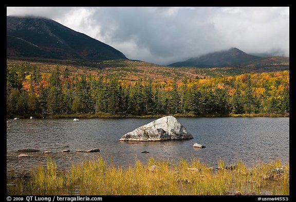
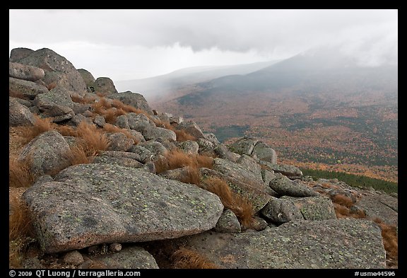
I’ve posted new images from Baxter State Park in Maine. This is the first installment of images of the Maine North Woods (trip report). Second installment next week.

Baxter State Park is one of the largest wilderness areas in the North East of the US (the only other comparable area are the Adirondacks in upstate NY). Established as a gift to the people of Maine from Percival Baxter, a former governor who used his personal fortune to purchase the more than 200,000 acres (800 sq km) of the park, with the goal to keep the land forever wild, it has the particularity of having no commercial activities, paved roads, running water, or even electricity, so come prepared ! There are, however, plenty of trails, campsites, and natural beauty.

Access is more strictly controlled than other parks that I have visited. You have to check in during opening hours (the gate is closed from 10pm to 6am), receive a permit under your name that is affixed to your windshield (the reverse of the permit reminds you of the 20mph speed limit). When you exit the park, you return the permit.

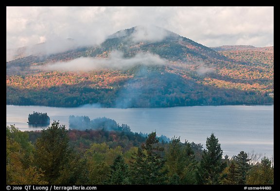
The centerpiece of Baxter State Park is Mount Katahdin, at 5,267 feet (1,605m) the highest mountain in Maine, well-known as the northern terminus of the Appalachian Trail. Trails on the mountain are also strictly controlled. Although I was eager to ascent Katahdin, when I was there, the mountain was constantly cloud-capped, with serious chances of rain. Instead of finding myself with zero visibility, I hiked to a shorter peak, South Turner Mountain, whose summit was under the clouds. Before the rain came, the storm conditions created beautiful spots of light over the autumn landscape.

On the way to South Turner Peak, I passed Sandy Stream Pond, considered to be one of the top spots for observing moose in the North-East. The game there is to set-up your tripod on the small observation platform (in order to preserve vegetation, you are not allowed to step out of it), which was near full capacity at 8am on a weekday. You then wait all day for a moose to come out. I went hiking instead.

QT Luong’s images featured in Common Ground

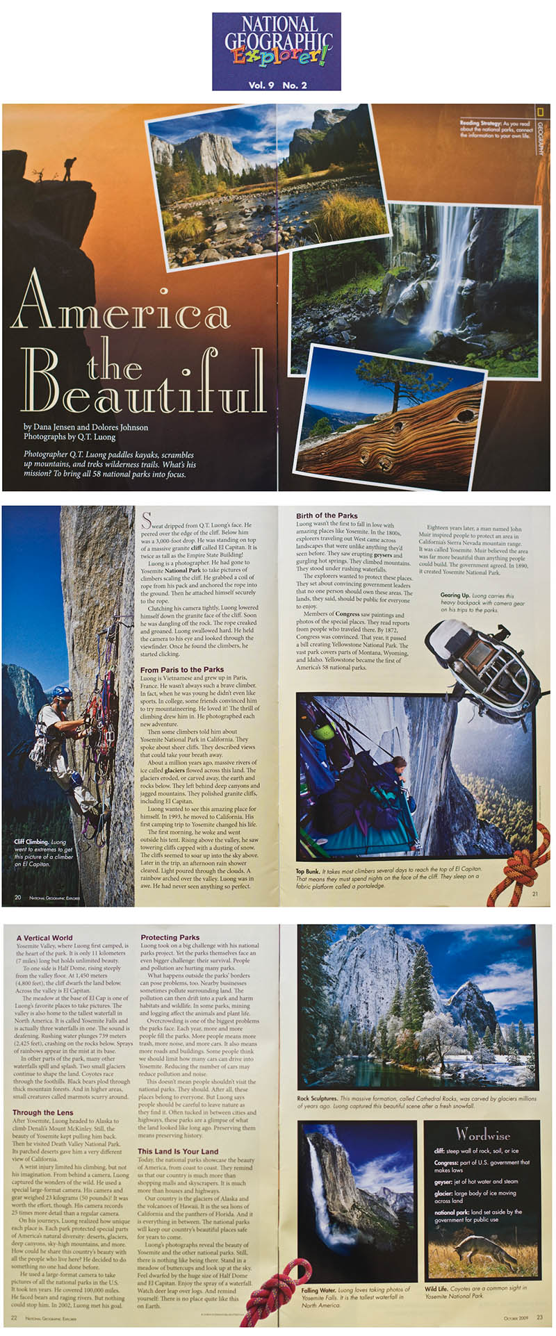
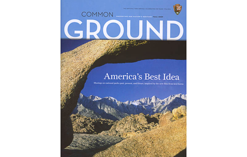
Quang-Tuan Luong’s images of the National Parks are featured in the Fall 2009 issue of Common Ground, the official magazine of the National Park Service published for the Heritage Community. They run in an article discussing the National Parks film by Ken Burns. The issue also has articles about Ansel Adams, and Japanese-born painter Chiura Obata who both worked extensively in Yosemite.


The Maine North Woods

I just returned from a trip to an area of north western Maine known as the Maine North Woods. I envisioned it as an extension of my work on the National Parks. Since the mid 1990s, some have talked about creating a new Maine Woods National Park there. The idea to possibly contribute to conservation by depicting the beauty of an area was most appealing. The National Parks Conservation Association had expressed interest in obtaining images of the area. I knew that the idea has been controversial, being opposed by some local residents and Maine’s government, so I was also interested in having a good look for myself, and compare the area with the 58 existing National Parks that I had visited. Pictures galleries will follow in about a week, but for now I will give a short account of the trip.

Although many people are involved in the fight to establish MWNP, Roxanne Quimby’s life could make her a character worth of being featured in the Ken Burns series. In 1975, Fresh out of art school in San Francisco, she and her boyfriend George traveled to Maine with just $3,000 that they used to buy 30 acres of woods. They built a cabin where they lived without electricity, running water, or a car – their WV bus had died. Twins were born to the couple, however they separated after a few years. In 1984, Roxanne bought honey from a beekeeper named Burt Shavitz – they eventually became partners. Looking to use Burt’s stockpile of wax, she began to create products, such as candles and lip balm that she initially sold at fairs. In 2007, Burt’s Bees, the leading natural personal-care brand, was acquired for nearly a billion dollars. In the while, Roxanne had begun to buy vast expenses of Maine land, with the goal to preserve the landscape forever by establishing a park, much like John D Rockefeller Jr did for the Grand Tetons and Acadia, and Percival Baxter for Baxter State Park. More of the captivating story can be found in a Yankee Magazine article, The Most Controversial Woman in Maine.
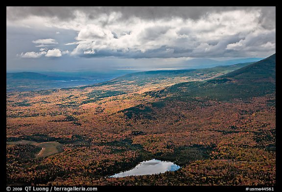
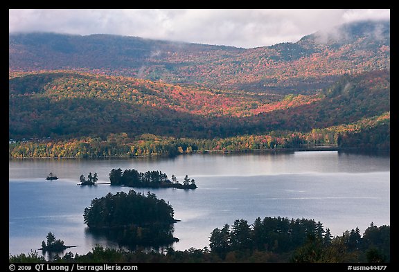
As I was traveling towards the East, I spent the first day in Greenville and around Moosehead Lake. On the second day, I explored the area between Greenville and Millinocket around the Golden Road. The third day was spent in Baxter State Park. Because Katahdin was in the clouds, I hiked a secondary summit that was initially under the clouds. The next day, I visited the Allagash Wilderness Waterway, where I managed to locate the two locomotives curiously stuck in the middle of a remote area at the end of an unmaintained and unmarked trail (this might be the subject of another posting). On the fifth day, I explored the vast area North and East of Baxter State Park, eventually exiting the North Woods at the town of Ashland.

What struck me first about the proposed area for MWNP was the sheer size, 3.2 million acre, larger than Yellowstone and Yosemite combined. There is a historic opportunity to preserve a large swath of land, but that szie makes it a very ambitious proposal, and I could see why this alone would be controversial. If you look at the other national parks, only those in Alaska are larger. However, unlike the proposed MWNP, the Alaskan parks were mostly undeveloped wildernesses that were already federal property. Moreover, in the last forty years, there was only one new national park that did not begin as an existing NPS unit, the National Park of American Samoa. I suppose the way you negotiate is to start with an extreme position and work towards a compromise, and I foresee that the proponents of MWNP will have to significantly reduce their ambition.

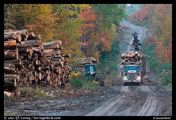
I spent five days in the area and had barely began to scratch the surface. It is criss-crossed by a very extensive network of forestry roads, unpaved but well-maintained and easily passable by car. The Delorme Atlas is necessary to navigate them, and even though it is still easy to get confused, as signs are rare. Besides those roads, development is limited to remote camps and private lodges. I saw relatively frequent traffic, maybe one truck (nobody there besides me drove a car) every fifteen minutes, yet the area feels remote. Such a large, relatively undeveloped block of forest is certainly unique in the eastern US.

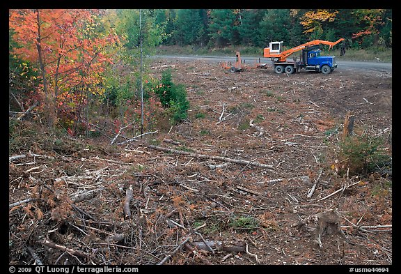
Within the area, there is a mix of mountains (the most spectacular of which is Katahdin, already protected within Baxter State Park), lakes (including Moosehead, largest in Maine), wild rivers (including the Allagash, protected as a Wilderness Waterway), and ponds. This mix makes the terrain more varied than some other Eastern Parks. Although I am no expert, the forest itself, a mix of evergreens and northern hardwoods, appeared to me not to include much old growth. On the other hand, while I encountered many logging trucks, the harvested zones were small in size, unlike the large clearcut areas of, for instance, the Olympic Peninsula. The area is certainly beautiful, although like in many eastern places there are not a lot of spectacular views, as the forest obscures them below the timberline. In parks such as Acadia, Shenandoah or the Great Smoky Mountains, the road takes you above timberline (or almost), but in the Maine North Woods, a long hike is necessary.

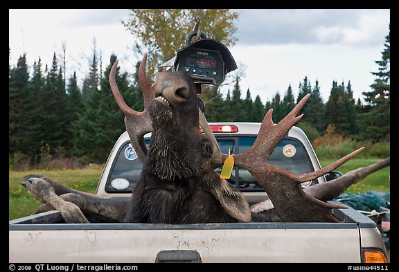
Although most of the land is private, the areas that I visited (managed by North Maine Woods Inc) were opened to the public much like a publicly-owned park, with fees charged at “checkpoints” comparable to the parks entrance stations. There was a registration procedure more strict than in the public parks I knew. You had to obtain an individual permit under your name and check in and out. Baxter State Park operated also the same way. This combination of private ownership and public access with relatively liberal regulations happened at a scale I hadn’t seen before, and I could see why this model could be more attractive than the national parks model. Most recreational activities were authorized, included hunting. As I arrived at the height of the hunting season, I saw more moose than I ever saw before, although all dead!

With all those characteristics, I could understand the reluctance towards a national park. However, the problem is that the current situation is hardly stable. Economic globalization has made local logging uncompetitive. With land ownership shifting from timber companies to real estate developers, the care of the land and access could rapidly change for the worse. The Maine North Woods are at a cross roads. Although it should eventually be for the public to decide, the option of a national park should at least be given a serious consideration, in the form of a feasibility study.

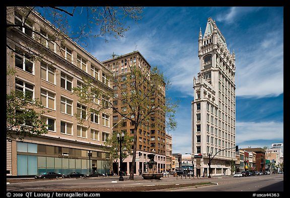
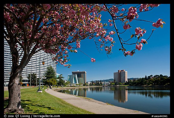
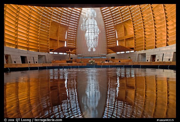
New images: Oakland CA

Oakland is the third largest city in the San Francisco Bay area. When I was working at the University of California, Berkeley, I’d sometimes drive there for a medical visit with Kaiser Permanente. Since then, Oakland has been largely out of my map, maybe because the perceived urban grit didn’t appeal.

It wasn’t until one of my readers, Freddie, complained about the omission two years in a row that I decided to have a good look. I frequently receive emails with suggestions for new locations. The more precise the ideas, the better, although exotic location have necessarily to wait. But this one was, so to speak, in my neighborhood. I found a ethnically diverse city full of character, historic buildings, and theaters, with a rich geography that includes a large freshwater lagoon lake, waterfront, and hills.

When I was starting, about twenty years ago, I had to be in awe of my environment to be compelled to photograph, which is probably why I concentrated so much on natural wonders. Although they is still a primary source of inspiration, I have found that as the years go by, I am increasingly able to find something of interest in more ordinary settings. The process of photographing is not foreign that evolution, for photography teaches you to look.

In my research, I’ve come across several more locations that I have still to check out in Oakland, so this is certainly not the last installment.

See the pictures of Oakland

Events and exhibits fall 2009

I will be headed for New York City at the end of the week to attend two events in conjunction with National Parks Week NYC. The first event on Tuesday, Sept 22 is a Green Carpet Gala at Ellis Island that promises to be a quite formal fundraiser. A few of my prints will be offered for silent auction there. Since I don’t own a tuxedo, I will be dusting up the suit I bought for my wedding, hope it won’t be too tight :-). In contrast, on Wednesday Sept 23, there will be a free event at the East Meadow of Central Park that includes a concert, appearances, and a preview of the Ken Burns film on National Parks. 8 of my National Parks images – printed on canvas by a third party rather than original prints – will be on view in the VIP tent.

There has been a selection of those National Parks images on display since August at the Balboa Theater in the Richmond District of San Francisco. For a report, see here. That exhibit will run through the end of October, and there might be a talk/slide-show planned for a Sunday, so stay tuned for details.

Last, I will be participating in a group exhibit at the Four Seasons Hotel & Resort in Westlake Village, California (near Los Angeles), from October 16th, 2009 thru Jan 16th, 2010.

Book: “The Printed Picture”, by Richard Benson

I have seen many of my images reproduced on a variety of mass media (editorial publishers usually send a copy), sometimes in a somewhat unsatisfactory way. I understood that the limitation of reproductions are due to the problem of having to render continuous varying tones with discrete dots of inks, and that the primary mass color printing process used to solve the problem involved halftone and offset printing, but I never knew how those techniques worked, and why they became so dominant.

In the eighties, I dabbled in darkroom work, doing both black and white and color printing which gave me some grasp of the silver processes. However, I did not know much about the long evolutionary history of those processes, how they came to be that way.

Besides my own photographic practice, I try to see many as many photographs as I can, either in exhibits or in books. This made me aware of the variety of methods that can be used to make a print, such as carbon printing, cyanotype, platinium/palladium, contact printing on azo and dye transfer. And then, there are all of the “historic” processes, such as wet-plate, who have been revived with great effect by photographers such as Sally Mann (whose new show, Proud Flesh opens today in NYC). I had a basic knowledge about all those, but never really understood the relationships between them, and why those various prints look the way they do.

Reading The Printed Picture by Richard Benson answered all those questions.

Richard Benson is possibly the most authoritative voice on printing today. A former dean of the Yale School of Art, he is a photographer exhibited in such venues as the Museum of Modern Art (NY) and the Pace McGill gallery. As a offset printing expert, he helped create reproductions of the seminal “The Work of Atget”. His personal interest in printing led him to collect many historic prints and reproductions, some of which are shown in the book.

The Printed Picture surveys the whole history of image printing processes, from the earliest books to today’s digital processes, with a particular emphasis on the photographic image and its reproduction.

Venerable process such as woodcut, engraving, etching, and lithography are first described. The attention then turns to the fundamental principles of silver-based photography, including the latent image, through an examination of daguerreotypes, early silver papers, and tintypes, before the innovation of the dry-plate that opened the door for photography to “become more like poetry than carpentry”. The problem of reproducing photography in ink is tackled next, through letterpress halftone, gravure, collotype, and then photo offset lithography. A short discussion of digital printing concludes the book. Benson has a word there to say about inkjet prints versus lightjet prints, but that would be a subject for another post.

Although I haven’t counted them, there are probably more than a hundred processes described. For each of them the ideas and mechanics are described concisely but precisely, in a one-page essay facing at least one visual example, which is enlarged so that the astonishing craftmanship of some the earlier methods can be seen. Understanding all the steps involved in some of the processes still require quite a bit of concentration, not because the description is confusing, but because those processes are so complex. One cannot help but marvel at the ingenuity used to produce something that nowadays we tend to take for granted.

What is most remarkable is that Benson manages, despite the tremendous amount of information provided, to weave threads through clear classifications that illuminate the evolution of each process through its relationship with previous processes. One example of such classification is his division of processes between relief methods (ink is laid on raised surfaces), intaglio methods ((ink is laid in depressions), and planographic methods (ink is laid on a flat surface). The evolution from stone lithography to modern offset printing, or from early engravings to rotogravure becomes clear. Color reproduction, with its unique challenges, is given a distinct thread that ends with some warnings about the limits of color management that echo my experience, and that of other experienced printers I have talked to.

Beyond the technical explanations, which are presented with the highest clarity I have seen, the book is much enriched by Benson’s musings on esthetics. Much of the book has a lively and conversational tone. The author is never afraid to tell us his personal opinion about each of the process described. For example: “Despite its occasional successes, gum bichromate is a poor process, unable to render the clear and beautiful tonalities that lie at the core of the photographic medium”. He even goes on more philosophical considerations about photography in general, and its enormous cultural and social influence, such as “The power that the photograph gets out of its assumed connection to the world from which it was made is almost always stronger than the idea of the artist who tries to alter it”.

The idea that the medium’s artistic accomplishments cannot be separated from its technological innovations was the main organizing theme of John Szarkowski’s history of photography, Photography Until Now. In turn The Printed Picture makes the point that the characteristics of a given process affect the meaning of the image reproduced by it. I’ve learned a lot from the book and highly recommend it to anyone interested in the medium.

National Parks Travelers

If you’ve followed the PBS link at the end of my post about the Ken Burns National Parks film, you’ve seen that collecting the National Parks stamps that can be obtained at visitor centers has been a popular hobby. More than a million of the “Passport” books designed to collect the stamps have been sold. There are stamps not only in the 58 National Parks, but also at each of the 391 National Park Service units that include a hodgepodge of designations, such National Monuments, National Historical Sites, National Lakeshore, National Memorial, etc…

I knew that others make an obsessive pursuit of visiting National Parks and NPS units. I had read about a person who visited all the units. However, I was surprised when I received an email last week from Nancy Bandley, the president of the National Park Travelers Club (NPTC). Some of the descriptions here are straight from that email. Nancy pointed out that the club includes 14 members who have not only visited all the 58 national parks, but all 391 national park sites in the NPS system. They even have a program with the NPS to write letters of congratulations to any one in the club who achieves what they call the Platinum Member status- visiting all 391.

The website of the club is http://www.parkstamps.org. Access to most of the site’s contents requires a free registration. There is a forum full of trip reports, where members quiz each other by posting “mystery photos”, details of obscure parks that are in general, amazingly, quickly solved.

At first, you get the impression that the club is heavily focussed on collecting the stamps. Parks with several visitor center locations have several different stamps, whose exact locations are listed. The passport stamps continue to grow rather exponentially with the addition beyond the 391 to National Trails, and National Heritage Corridors. One corridor, Hudson River Valley, has 61 stamps in it alone. They helped Eastern National, the organization who created the passport program for the national parks, design a new passport called the explorer edition- it is larger, has a loose leaf binder arrangement to add in more pages, which is rapidly becoming more imperative to the serious visitor and stamp collector. This month alone brought 13 new stamps for a new Heritage Corridor, the Gallah Geechee. However, Nancy kindly made it clear that although it may seem that the emphasis is on stamps, it is not the primary purpose of the group, that is park visitation.

Ken Burns used the “stamps” sequence out of an hour-long interview for the film. However, in my quest, the focus has never been into just visiting the parks, but rather (a) to photograph each park with a large format camera (b) to photograph each park extensively enough so that the image collection is truly representative of the place. To this effect, I have visited each of the National Parks on average more than 3 times, being less than 10 parks away from having visited them all twice, returning to many locations several times, in different weather and seasons.

I do not even have the Passport. Instead, I just used the front endpaper pages of the National Geographic guide to collect the stamps. Mine was the first edition of that guide. Although subsequently I sought a number of publications more specifically geared towards the photographer (this would be the subject of another post), I have found the National Geographic Guide to the National Parks of the United States, now it its 6th edition, to the best all-around guide to the National Parks. That was the book used to plan most of my travels.

It would be nice if modesty prevented me from mentioning that in 5th and 6th edition, National Geographic used more than 40 of my images, including the sunrise image of Cholla Cactus in Joshua Tree National Park as the book opener in the 5th.

Speaking of resources for National Parks travelers, let me also mention a few free ones, besides, of course, the NPS site. That site has much improved over the years, and now gives easy access to all the official maps (which used to be buried in a hard-to-locate section) and brochures. They are still lacking a bit in the photo department, though 🙂 The aptly named http://www.nationalparkstraveler.com is the best source for daily news and updates about the parks. In addition, Kurt Repanshek, the editor, and his collaborators also regularly post great features, such as the traveler’s checklist. The National Parks Foundation offers the extensive National Parks Owner Guide for download. There is also a section with a lot of information at the National Parks Conservation association.

By he way, the first photo is from Kobuk Valley National Park, the least visited of the 58 National Parks. That quiz was not even in the ballpark in listing Big Bend as least visited (NPS statistics). The previously cited sites are much less likely to have that kind of errors !