Crossing the Missouri River by ferry in the middle of nowhere
No Comments
Along the 149 miles of river in Upper Missouri River Breaks National Monument, the monument lands surrounding the river grow larger and wilder as we move from west to east. From Fort Benton (river mile 0) to Coal Banks Landing (river mile 41.5) the river is mostly surrounded by grassy meadows and agricultural lands, with not much to explore beyond the river corridor, an exception being Decision Point and Wood Bottom. The section from Coal Banks Landing to Judith Landing (river mile 88.5) is the most popular thanks to its white cliffs and great hikes. It will be the subject of the next article.
The eastern part of Upper Missouri River Breaks National Monument
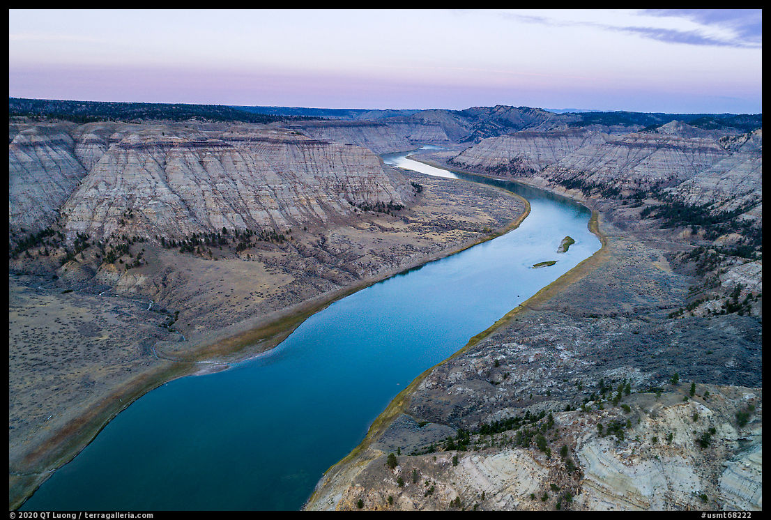
From Judith Landing to James Kipp Recreation Area (river mile 149), the boundaries of the monument extend well beyond the banks of the river into rugged badlands that include several Wilderness Study areas. The character of the monument changes not only because white cliffs are replaced by badlands, but also because the river becomes less developed and traveled. Floating the section from there to James Kipp takes 4 or 5 days, but it is possible to get a quick glimpse of its terrain without a boat. The Bullwacker Road north of the Missouri River was the main avenue into the eastern part of the monument, but it is no longer accessible to the public. South of the Missouri River, the unpaved Missouri Breaks Back Country Byway starts from Winifred and briefly enters the monument. It requires 4WD to traverse. The site described in this article, not even marked on the BLM general map, also requires extended driving on an unpaved road. However, although it descends quite steeply into the river valley, the road may be passable by a carefully driven sedan in dry weather.
The McClelland-Stafford Ferry
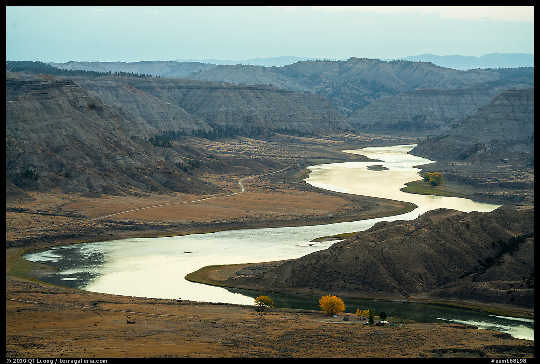
Between the Loma Bridge and James Kipp Recreation Area, only the bridge at Judith Landing built in 1982 spans the Missouri River. However, drivers may cross the river at two additional locations using cable ferries that inject a sense of adventure to a road trip, as they are a throwback to another era – the McClelland-Stafford Ferry has been running from the 1920s. They operate 7 AM to 7 PM, Monday-Saturday, and 9 AM to 5 PM Sundays, about May 1 to Nov 1, depending on conditions, and are free. A diesel motor powers the ferry, guided by a drive cable spanning the river. The most popular of the two is in Virgelle. The McClelland-Stafford Ferry (river mile 101.8) is located in the middle of nowhere, 16 miles north of Winifred. I arrived from the north. As I passed the ferrryman’s house, he saw me and hopped on his ATV to operate the ferry. Otherwise, I would have used a call box to summon the ferry. Once we reached the south shore, instead of doing an empty trip back to his house, he pulled out a chair and started fishing from the ferry, waiting for cars to arrive from the south. On the busiest days, in August, there are about 10 crossings a day.


The Old Army Trail
On the north side of the river, next to the ferrryman’s house, there is a small campground and the trailhead for the Old Army Trail (5 miles round-trip, 900 feet elevation gain). The jeep road was built in 1869 to aid in the recovery of the cargo from a sunken steamboat. It is now one of only two designated trails inside the 377,346-acre national monument – the other is at Decision Point. After a section along the river leading to the site of the wreck, the trail climbed steeply to a ridge offering sweeping views of the Breaks before ending at a private property gate with menacing no trespassing signs. I started hiking at night so that I would be able to catch the sunrise high up, instead of being in the flat section of the trail within the valley.


When to go
The road should not be attempted even by 4×4 vehicles in wet weather. Roads in the area become impassable when wet (from snowmelt or precipitation) because they are laid on very sticky soil called “gumbo”. Some mentioned to me even helicopters getting stuck. Central Montana’s climate is continental with low annual precipitation. Winters are cold with snow and sub-freezing temperatures from mid-October to April. From mid-May to June, the landscape is green and flowers bloom, however rain and mud are likely, and mosquitoes can be bad. July and August offer consistently dry weather with highs in the 90s. Fall colors, seen mostly on the cottonwood trees that dot the riverbanks, and the return of possible inclement weather start in mid-September. This year, the weather remained perfectly dry during my visit in late September/early October, but at the same time last year, there was snow on the ground.


More images of Upper Missouri River Breaks National Monument

