The wild side of Virgin Islands National Park
No Comments
For most visitors, Virgin Islands National Park is defined by the beaches on the north shore. However, although the whole island of St John is only 20 square miles – 7 miles long, 3 miles wide, it offers a great variety of terrain besides the iconic beaches. In this post, I will describe my explorations of the wilder and less visited south shore of St John.
Ram Head
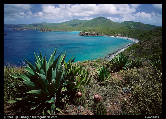
St John is known as a tropical paradise, but unlike the rest of the island, the south-east tip is arid and dominated by desert plants such as cactus and agaves. Ram Head, at the southernmost point of St John, at the top of high cliffs, offers spectacular views of the wildest part of the island amidst the blowing wind and the sound of the waves crashing 200 feet below you. The trail is 2.4 miles RT with steep and slippery sections. It begins at the eastern end the beach at Salt Pond Bay Beach, climbs a hill before descending at sea level to a blue cobblestone beach, then climbs again to a cactus-covered hillside at the top of Ram Head Point.
Yawzi Point and Lameshur
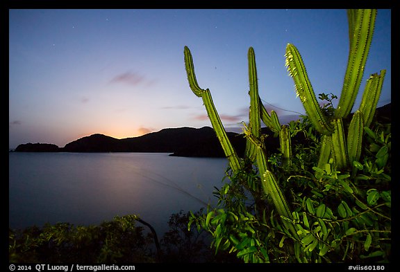
The short 0.5-mile Yawzi Point trail at first doesn’t look promising. However the small rocky headland situated between Great Lameshur Bay & Little Lameshur Bay where it ends has great views on both sides.
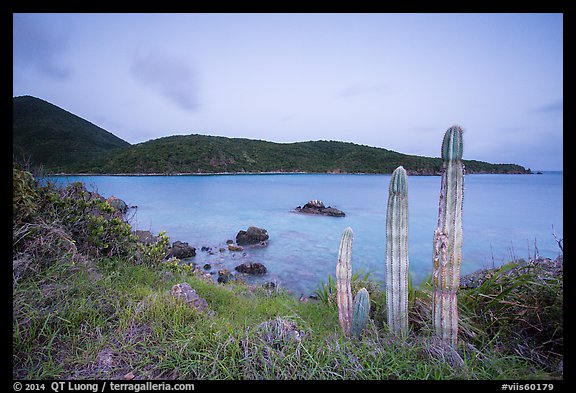
When you reach a cactus overlooking Little Lameshur Bay, be sure to continue over a short, sketchy section above Little Lameshur Bay to reach the headland. Due to the range of orientations, there are good possibilities at any time of the day.
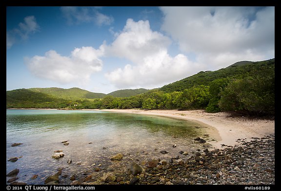
Because of the remote location, nearby Little Lameshur and Great Lameshur beaches are quiet. To get there, you need to negotiate a 1-mile dirt road with large potholes filled with water. They are easily passable by a high-clearance vehicle but could be marginal for a passenger car.
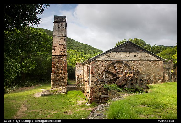
Petroglyphs and Reef Bay Sugar Mill
The Reef Bay Trail descends 900 feet from Centerline Road over 2.1 miles (one-way) to the shore at Reef Bay, where the extensive Reef Bay Sugar Mill ruins are found.
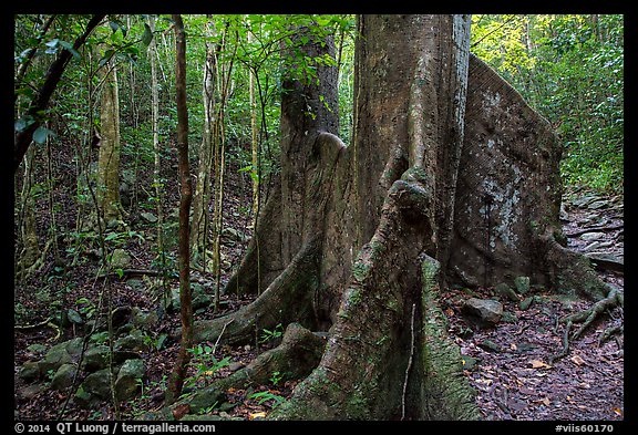
You will be hiking in a dense forest with no views, passing some impressive trees in the first (wet) section, before traversing a dryer section with a different vegetation.
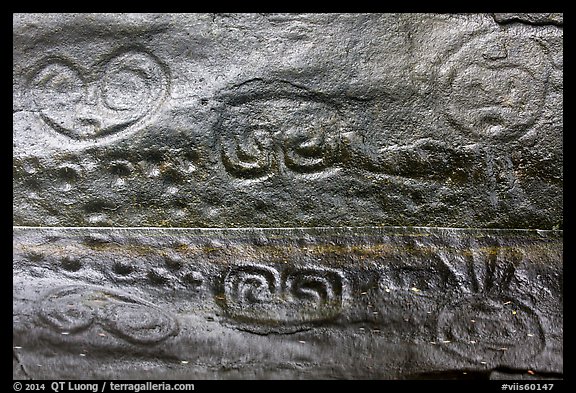
1.6 miles along the trail, a 0.3-spur leads to the Reef Bay Petroglyphs, carved into a 70-foot tall rock face situated right above the pool that provides unique reflections. If it has rained recently, an ephemeral waterfall drops in the pool behind. If they are dry, splashing a bit of water from the pool into the petroglyphs improves the contrast. Cloudy conditions are best, otherwise the panel faces east.
Reef Bay Trail is the most difficult trail on the island, and considered by the park to be a “backcountry trail”. Pay particular attention to where you are coming from near the junction with the Petroglyph trail. On my way back, as darkness was falling, I followed the wrong ravine and ended up hiking cross-country for a while before at least finding the trail again. Hiking back is tougher than the distance indicates, because of the steep trail and tropical heat and humidity. The park organizes guided hikes that include a boat pick-up at the beach, so that you don’t have to hike back. As an alternative, you can get there by hiking the Lameshur Bay Trail, about the same length as the Reef Bay Trail but with less elevation change.
Does those explorations sound appealing or would you rather spend your time at the beach ?
More photos of Virgin Islands National Park.

