Wrangell-St. Elias National Park’s spectacular Bonanza Mine Trail
One Comment
Wrangell-St. Elias National Park combines spectacular glaciated mountain scenery with well-preserved remnants of mining history. A well-mapped, although strenuous way to experience this unique mix is to hike the Bonanza Mine trail, maybe the best trail in the national park with the most hiking trails in Alaska.
Because of their low visitation and the National Park Service’s (NPS) policy to favor backcountry exploration in those parks, the Alaskan National Parks have very few official trails relative to their immense size. We saw in the previous article that not only Gates of the Arctic National Park has been set up to be devoid of official trails but also the rangers do not provide itinerary recommendations. All the official trails in Alaska’s national parks combine for less than 200 miles – for comparison, Yosemite has more than 750 miles of trails. More than half of those trail miles are located in Wrangell-St Elias National Park, making it a great choice for those who prefer not to wander out cross-country. Although I have not hiked every trail in Wrangell-St Elias National Park, from my research and five visits to the park, I would guess that the Bonanza Mine Trail is the most rewarding of them. With a 4,000 ft elevation gain and about 9.5 miles round-trip (to the ridge), it is a relentless ascent, but well worth the effort. It is a contender for the best trail in an Alaskan national park.
At first, the Bonanza Mine Trail didn’t look so interesting. It starts as an uphill 4WD road used by residents to drive to their private properties included in the park – other visitors are not allowed to drive motorized vehicles. As the first half of the trail is in the forest, trees block the views. Mosquitoes would be an issue in the summer. On the other hand, it was easy to gain elevation at a quick rate since the grade and footing were easy with few occasions to pull out the camera. If I was to return, I would start at night to hike this section of the trail in the dark so as to witness the sunrise higher up and enjoy the better morning light conditions at the top.
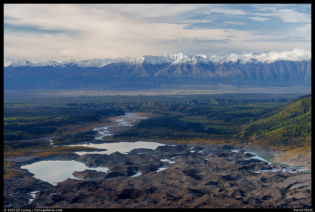
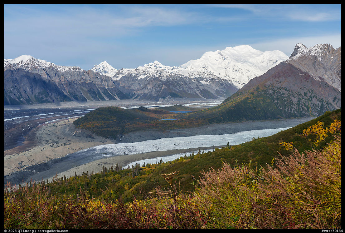
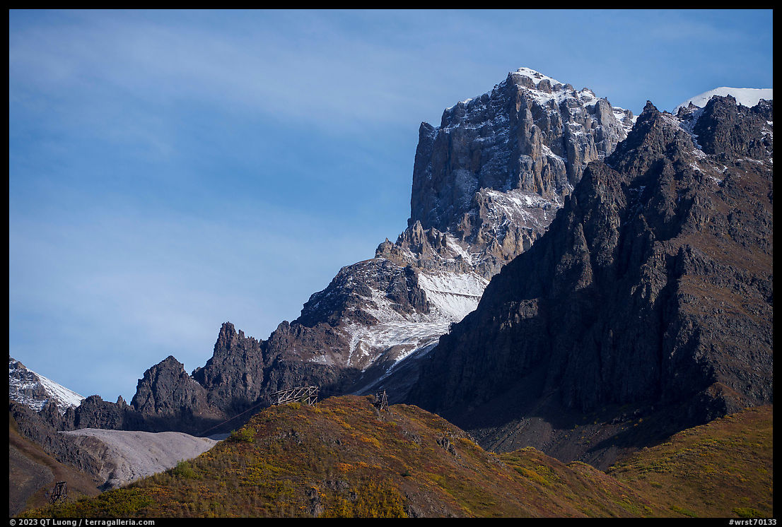
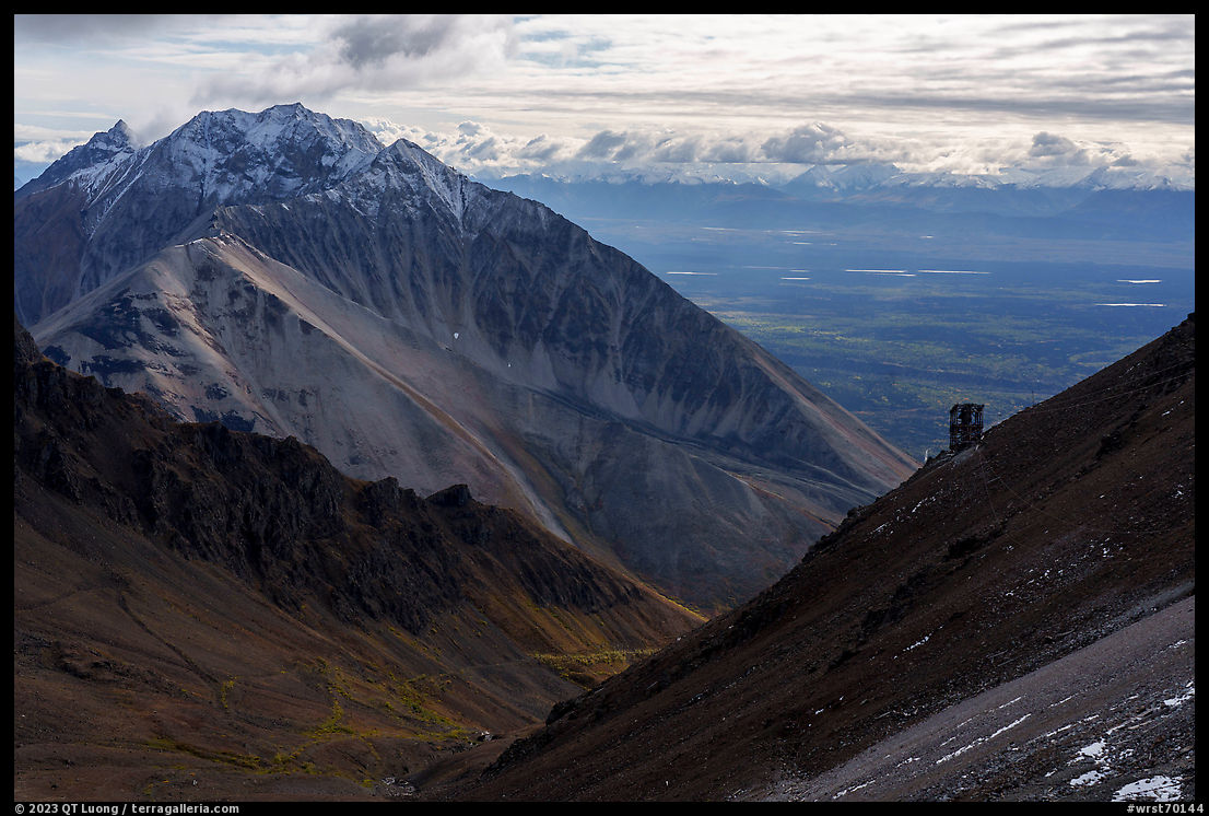
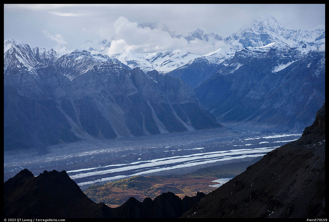
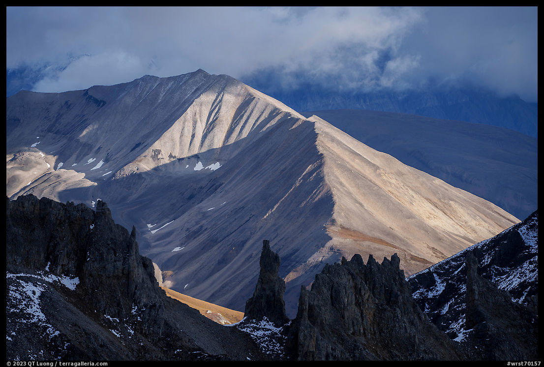
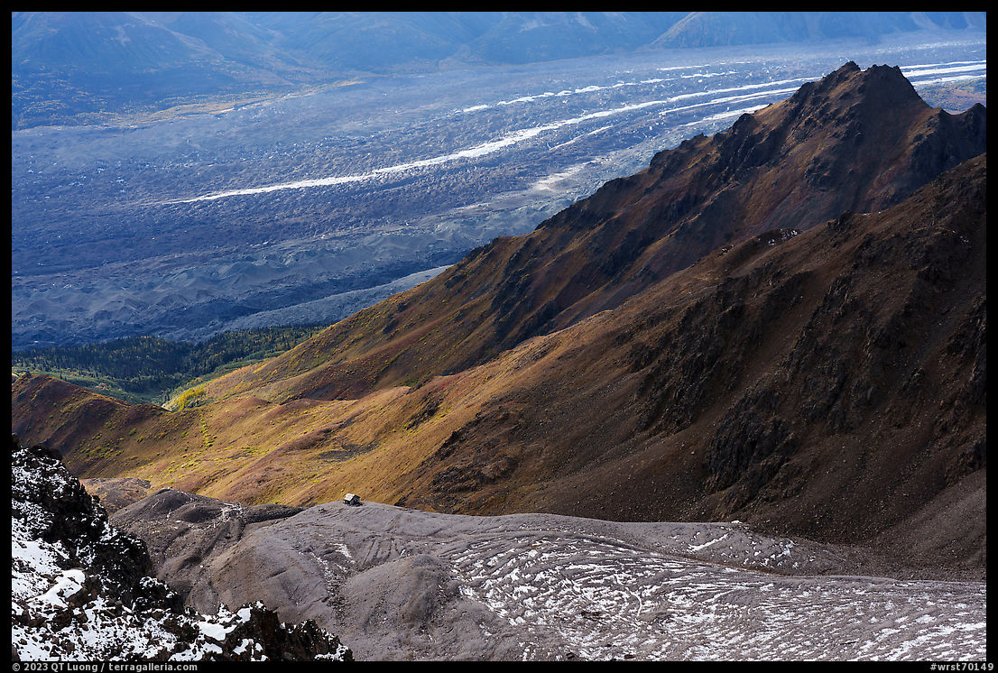
Once I reached the tree line around 2 miles from the trailhead, fantastic views opened up, and it was difficult to limit the number of stops for photography. The Chugach Mountains lay to the south, with the lakes formed by the Root Glacier moraine in the foreground. To the north are the Wrangell Mountains, dominated by Mt. Blackburn (16,390 ft), the fifth-highest peak in the United States. Those east-facing mountains are front-lit in the morning and backlit in the afternoon. Below are the converging Kennicott and Root Glaciers. The only other nearby location with a better view of them is the summit of Donoho Peak, but getting there requires much more than trail hiking: crossing the Root Glacier and scrambling up steep scree. Above are craggy peaks, dotted with historic mining structures that add a human dimension to the wild landscape. Note that from the other high trail nearby, the Jumbo Mine Trail requiring a comparable effort, ridges block many of the views available from the Bonanza Mine Trail.
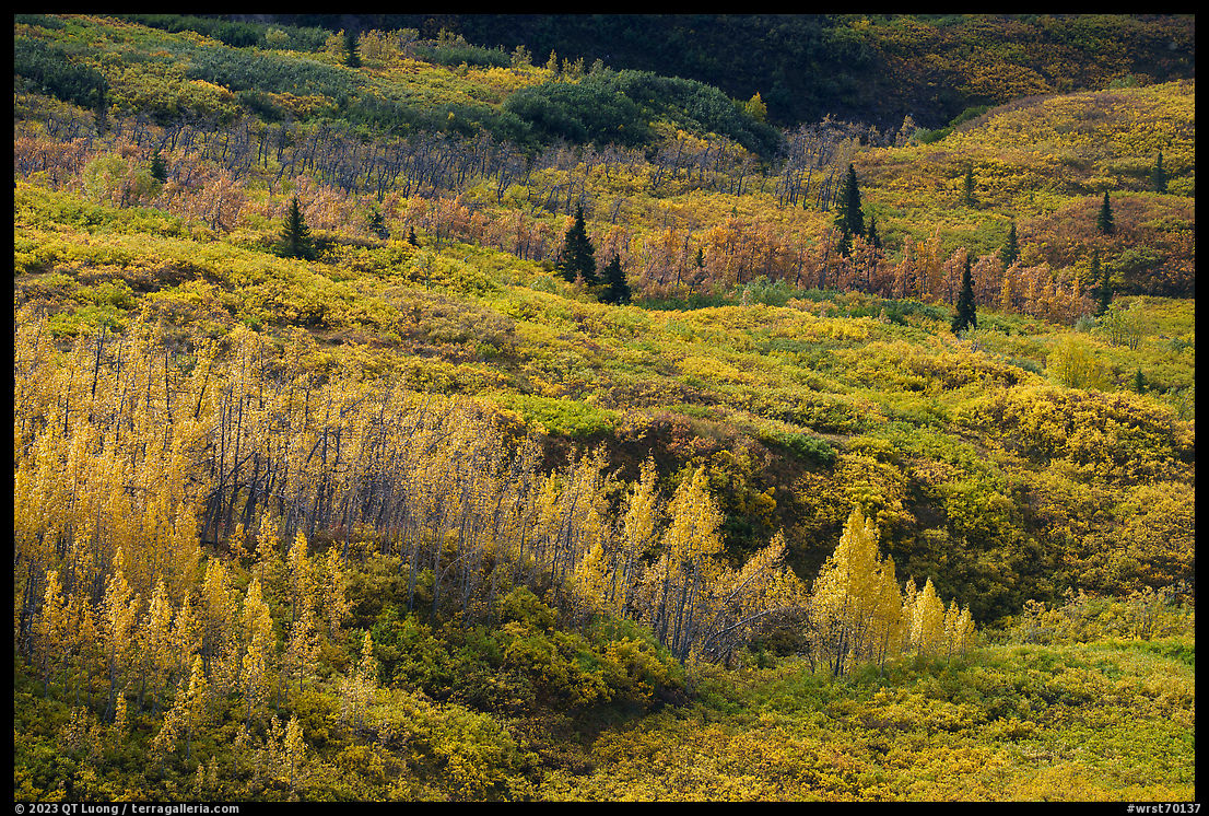
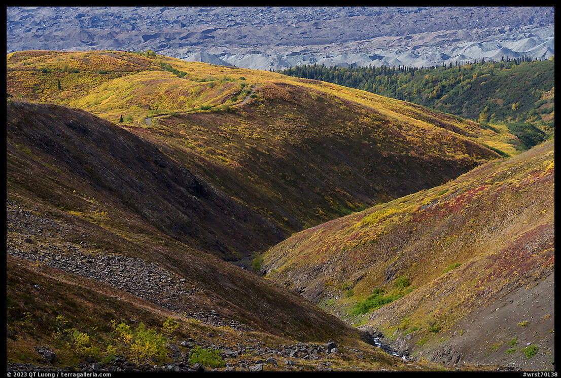
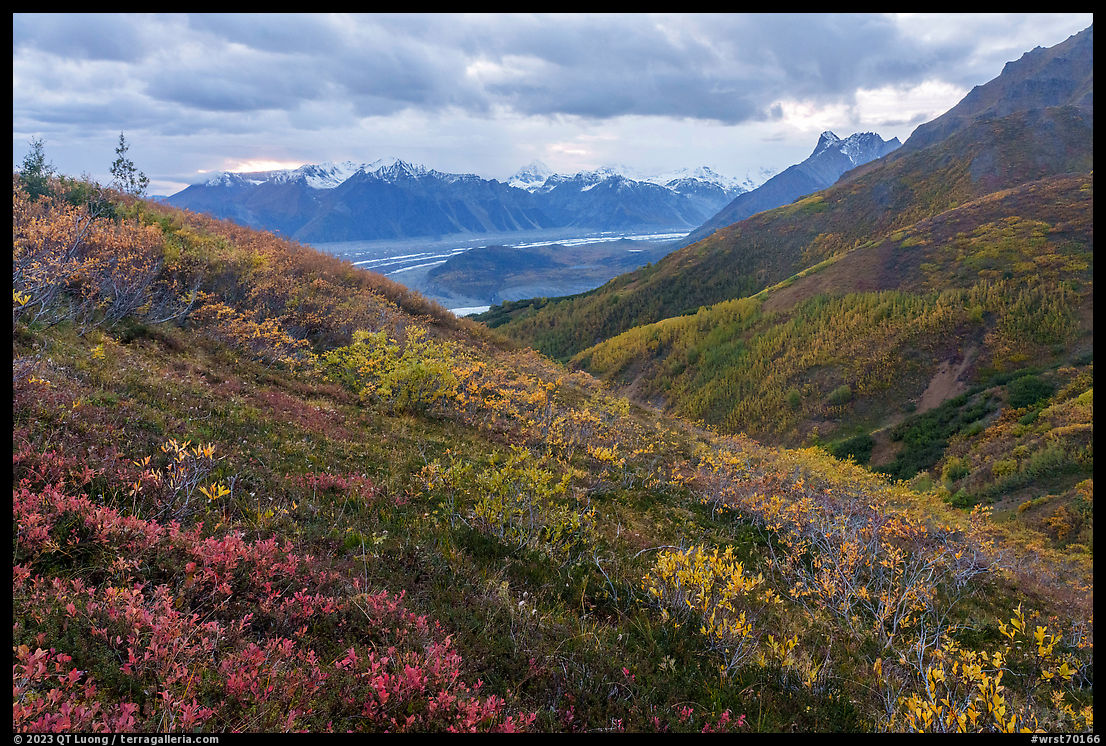
Because the trail gains 4,000 feet of elevation, it traverses several vegetation zones, which were beautiful in mid-September. At middle elevations, trees displayed vibrant foliage, and I photographed with a bit of backlight to emphasize their brilliance. Higher up, the berry plants turned the tundra a mosaic of colors, for which I preferred the soft light that came after sunset. It was the only time on the hike that I missed my tripod as I had to crank ISO to 1600 to be able to stop down the lens enough (f/11 at 1/30s). At that time of the year, all services in McCarthy and Kennicott are closed, which is a pity considering that it is the best time of the year to hike. We had the long trail to ourselves, not meeting a single other person during a full day of hiking, however, we had to be entirely self-sufficient. Note that before July, snow may cover the upper portion of the trail.
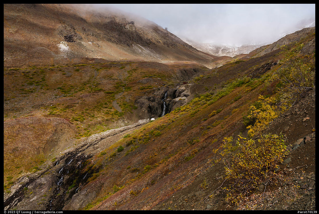
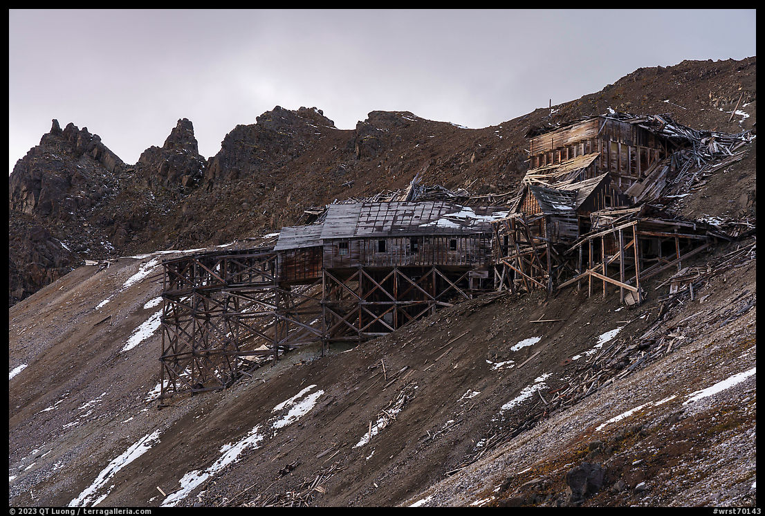
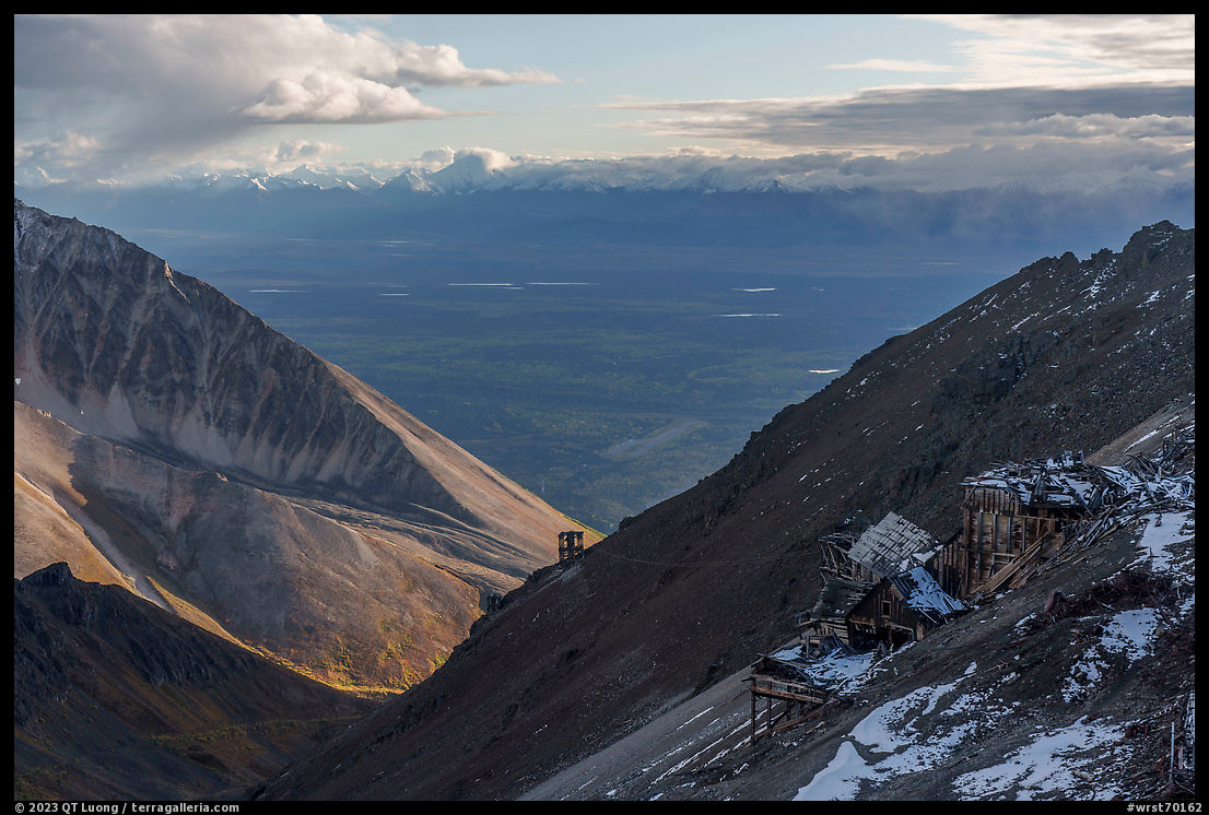
At about 3.25 miles from the trailhead, the drivable part of the road ends at a breakover tram tower. The road, which was built in the 1950s to access the Bonanza Mine reaches the mine directly, but its unmaintained section above the tower is rocky with difficult footing. The footing is much better on the well-used path that follows the valley and then climbs steeply. The trail skirts waterfalls of Bonanza Creek and crosses a small creek from which water could be obtained. Various artifacts and remnants of mining structures regularly dot the landscape. Most noticeable were towers for a tram that carried the ore and miners down to Kennicott. The Bonanza Mine’s setting, in a high cirque of mountains, is impressive and brings immediately to mind the hardship endured by the miners who worked at such an inhospitable location starting from the early years of the 20th century. Being part of one of the richest copper ore deposits ever discovered which yielded over $100,000,000 in profit, the now ghostly evocative mine deserves its name. In the afternoon, the structures are backlit from the trail and then in the shadow of a ridge, so I wished we had lingered less on the trail and arrived there earlier. I photographed the tram towers as silhouettes against the valley and for the Bonanza Mine I took advantage of clouds that softened the light.
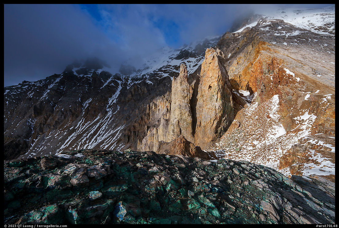
The Bonanza Mine, sitting at an elevation of 5,865 feet, is 4.25 miles from the trailhead. In the continental United States, the elevation would be modest, but keep in mind that the starting point of the trail at 2,000 feet is already above the lower part of the Root Glacier! Since the buildings are unstable and partly collapsed, we heeded the NPS warnings and did not spend time trying to explore them. Instead, we kept going up to the ridge above them by following a faint user trail. For a little additional effort (0.25 miles and 150 elevation gain), with views opening up to the north, the panorama was sweeping. It was one of the most spectacular viewpoints accessible from a trail I have seen in Alaska. As is often the case from mountain summits, after making wide-angle photographs, I worked to isolate portions of the landscape. In the only direction without distant mountain views, striking rock pinnacles flanked Bonanza Peak above us, and in that case, my favorite photograph was made with a wide-angle lens (below). We spent five days camping in the park, and for this hike, I had picked the day with the most sunny weather based on the forecast, which turned out accurate. On the days immediately before and after our hike, we would have been standing inside the clouds with no views. Verizon allowed me to get weather updates, whereas my friend had no coverage with AT&T and T-mobile.
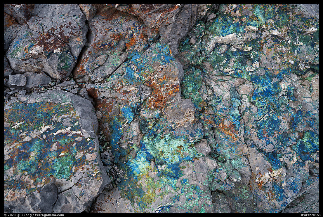
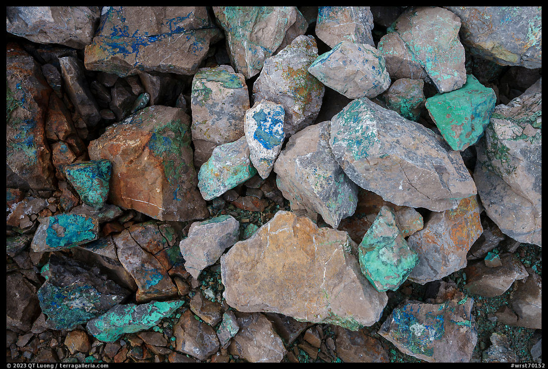
Looking closer, it was easy to understand why people underwent all this effort to build those now-abandoned structures in such a remote location. The rocks displayed such vibrant colors from the mineral copper deposits. Although the scenery around was so impressive, it was this logical, yet unexpected find that captured my attention for a long time. I scurried around with my eyes fixed to the ground until it was time to head down. Departing in the morning from the Jumbo Creek campsite instead of from the trailhead next to the Kennicott Mill (unmarked, but located between the large wooden bridge over National Creek and the mill) added about 3 miles and 200 feet elevation gain to the trail for a total of 12.5 miles with 4,200 feet gain. We spent about 15 hours, with the balance I normally strive for, about half the time for hiking and half of the time for photography. A well-spent day on the trail!
Autumn in Alaska II, part 3 of 5: 1 | 2 | 3 | 4 | 5


Great photos, as always! I love the fall colors.
My wife and I hiked this trail in June 2022, so we had the pleasure of crossing a couple snowfields over the steep scree. There was only one set of footprints in the snow, so we were the second and third people to reach the mine that year.
As you noted, it is a great workout, but the view from the top is well worth it.