Palms to Snow in Santa Rosa and San Jacinto Mountains National Monument
2 Comments
Instead of its utilitarian name, Santa Rosa and San Jacinto Mountains National Monument could also be have been called Sand to Snow National Monument because it spans a similar range of elevations, from the desert floor to the top of San Jacinto Peak, which culminates at 10,834 feet. Although San Jacinto Peak is lower than San Gorgonio, it is even more prominent (only 5 mountains in the continental U.S. exceed its topographic prominence) and dominates the landscape of Coachella Valley. Its steep north face rises abruptly 10,000 feet in 7 miles, one of the largest gains in elevation over such a small distance in the continental U.S. Not only the high-elevation areas of Santa Rosa and San Jacinto Mountains National Monument are more visible than those of Sand to Snow National Monument, they are also more accessible as well, as they can be reached without hiking. The lower elevation areas comprise canyons enlivened by year-round streams that create rich oases.
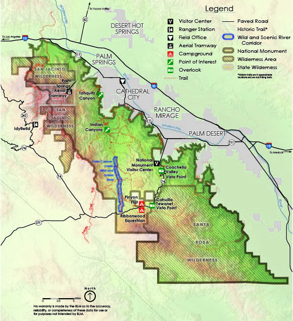
Highway 74 and the Santa Rosa Mountains
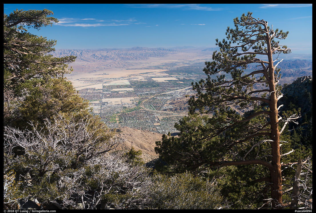
The portion of Highway 74 crossing the Santa Rosa Mountains is appropriately called the Palms to Pines scenic highway since it takes you from clusters of desert palms up to conifer forests in less than ten miles of switchbacks. The national monument visitor center lies 3.5 miles from the start of the highway in Palm Desert and is the trailhead for the 2.7-mile Randall Henderson Loop Trail that gives a good glimpse of the low elevation desert environment. About mid-way, the Coachella Valley Vista Point offers a great view of the valley and mountains.
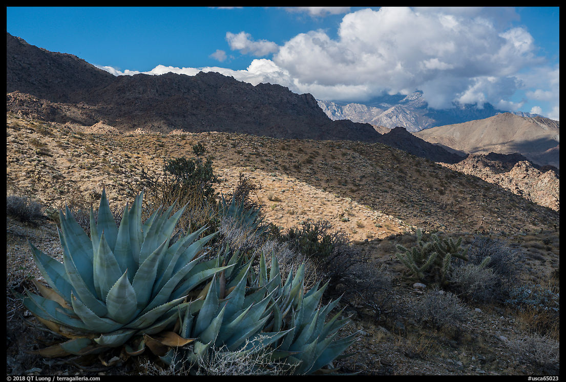
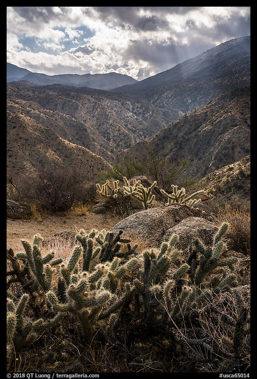
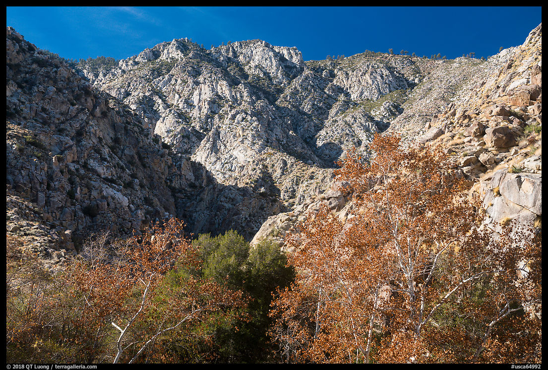
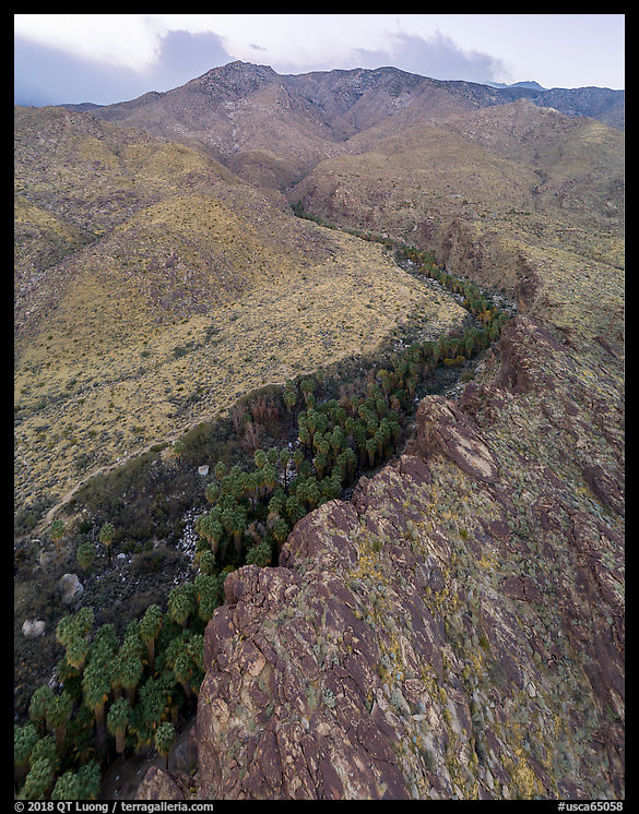
My favorite stop along the highway was the Cahuilla Tewanet Vista Point, located about 10 miles from the visitor center. A short trail leads you into the Santa Rosa Wilderness, above the aptly named Deep Canyon. A dense and varied collection of desert plants provide foregrounds to expansive views. During my early morning visit in January, the temperatures were near freezing, and the weather changed from sunny to hail by the minutes, making for an exciting outing in spite of its short length.
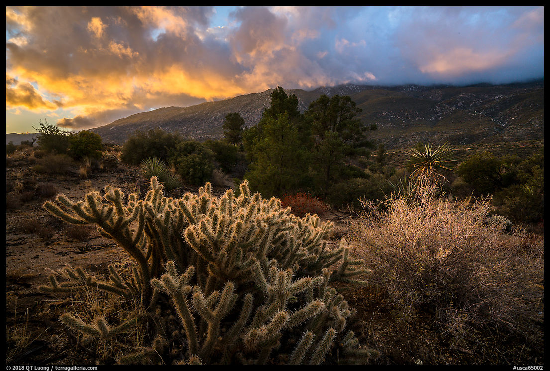
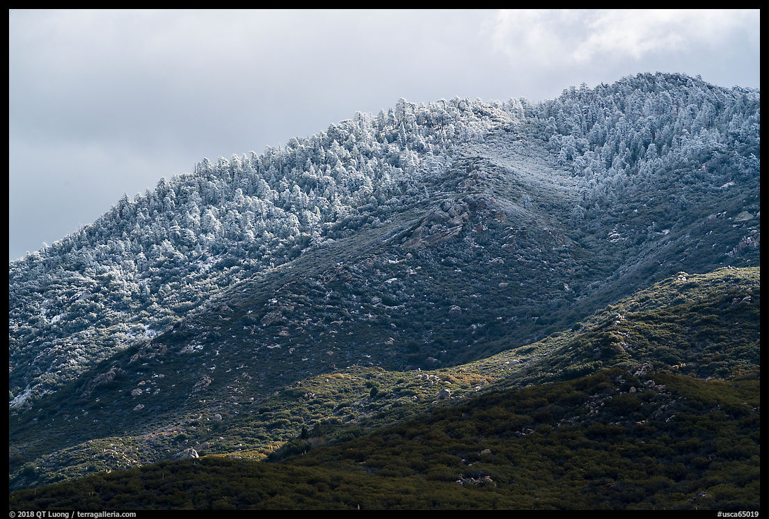
The night before, I stayed at the Pinyon Flat campground, which was cold and very quiet. When my alarm clock went off, I heard the sound of rain (or was it hail?) falling on the car’s roof, as it had been intermittently through the night. That is a sweet sound because it means that you can stay in bed! However, it did not last long, and upon opening an eye, I saw some bright spots in the sky. I hurried out and managed to find a spot near Highway 84 with cacti and open views of the Santa Rosa Mountains, just in time to catch the sunrise colors in the clouds.
On the south side of Highway 84, at a sign reading “Santa Rosa Mountain, Santa Rosa and San Jacinto Mountains National Monument” the steep, rough and unpaved Santa Rosa Truck Trail, (which becomes Forest route 7S02) ascends amongst conifer forests into the Santa Rosa Mountains, leading to campgrounds and snow-capped peaks.
Palm Springs Aerial Tramway and the San Jacinto Mountains
The Palm Springs Aerial Tramway takes you in about twelve minutes from the upper reaches of the Coachella Valley at 2,643 feet to the Mountain Station at 8,516 feet above sea level. On the way, you pass five biomes, ending at an alpine forest.
The ride is made even more spectacular by the abrupt rise which occurs over only two and one-half miles, and the rotating design of the tram cars. The Palm Springs Aerial Tramway is one of only three aerial trams in the world and the largest. The tram car floor rotates constantly, making two complete revolutions throughout the duration of the journey so that you have the chance to see in all directions without moving in the car, which is too packed for that. My kids, who would never have hiked up the mountain, loved the ride. From the Mountain Station, San Jacinto Peak is still a long way, but there are nearby nature trails to explore.
Tahquitz and Indian Canyons
A number of canyons lie at the base of San Jacinto Peak, in the Coachella Valley, a short distance from downtown Palm Springs. They are the ancestral home of the Agua Caliente Band of Cahuilla Indians, and are nowadays part of the Cahuilla Indian reservation. They are under the care of staff wearing uniforms identifying them as “Tribal rangers”.
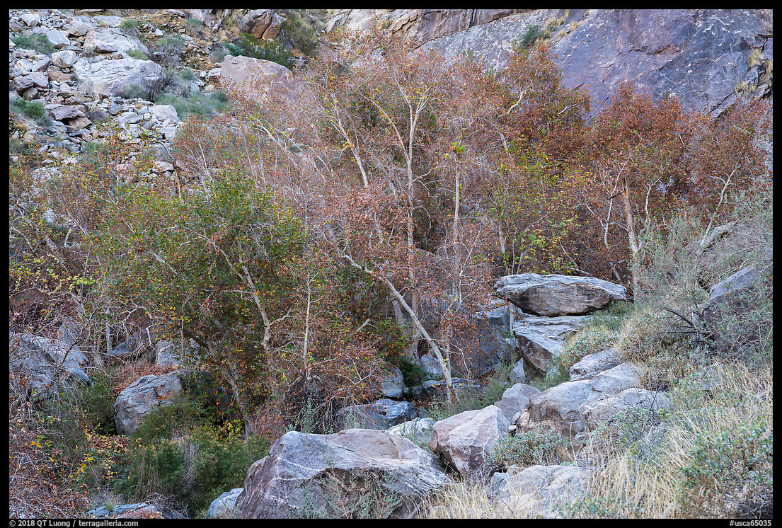
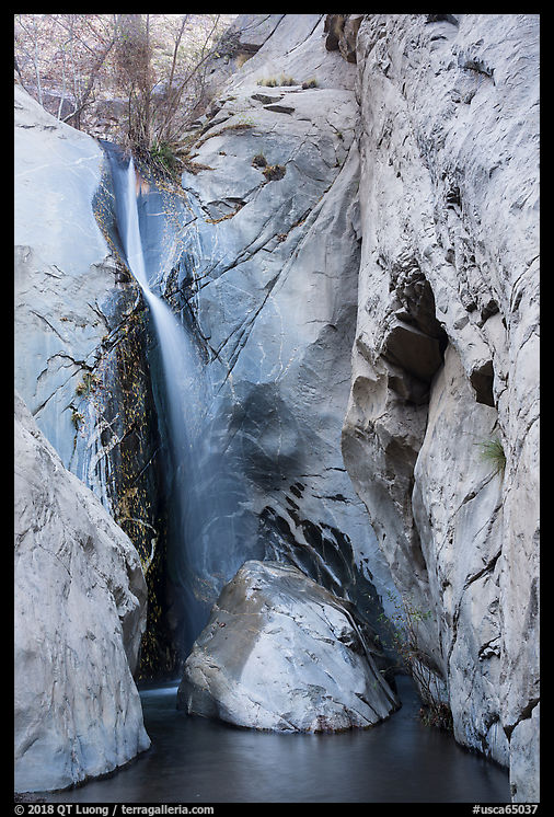
Tahquiz Canyon is known for its 60-foot waterfall, which you can see by hiking a two-mile loop with 350 feet elevation gain. The stream that creates the waterfall had a decent flow. It supports deciduous trees, and although it was January, I was pleased to notice some residual foliage color from the last autumn.
Indian Canyons is a larger tribal area than Tahquiz Canyon with trails up to 4 miles roundtrip and several flowing streams. It features three separate canyons, which together form the largest system of native fan palm oases in the country. Both are day-use areas only with entrance fees charged, and closing times are strictly enforced.
See more images from Santa Rosa and San Jacinto Mountains National Monument
Part 4 of 5. 1 | 2 | 3 | 4 | 5


I’ve long felt that native Americans who spent summers at the top of San Jacinto Peak and winters in Palm Springs centuries ago had the most idyllic existence imaginable. I’d trade my life for theirs in a heartbeat, even without cameras/photography. 🙂
Thank you, Cristina! You must try them!!