Canyons of the Ancients National Monument: an Interconnected Cultural Landscape
No Comments
Of all America’s prehistoric civilizations, none left more visible traces than the Ancestral Puebloan culture, and nowhere else in the country can one find so many of their ancient sites, than at Canyons of the Ancients National Monument.
The Anasazi or Ancestral Puebloan culture flourished between AD 300 and 1300 in the Four Corners area. Within this vast region, there are three large protected archeological areas: famous Mesa Verde National Park, Bears Ears National Monument which made recent news, and the lesser known Canyons of the Ancients National Monument. The monument is located outside Cortez, Colorado, on the side opposite to Mesa Verde.
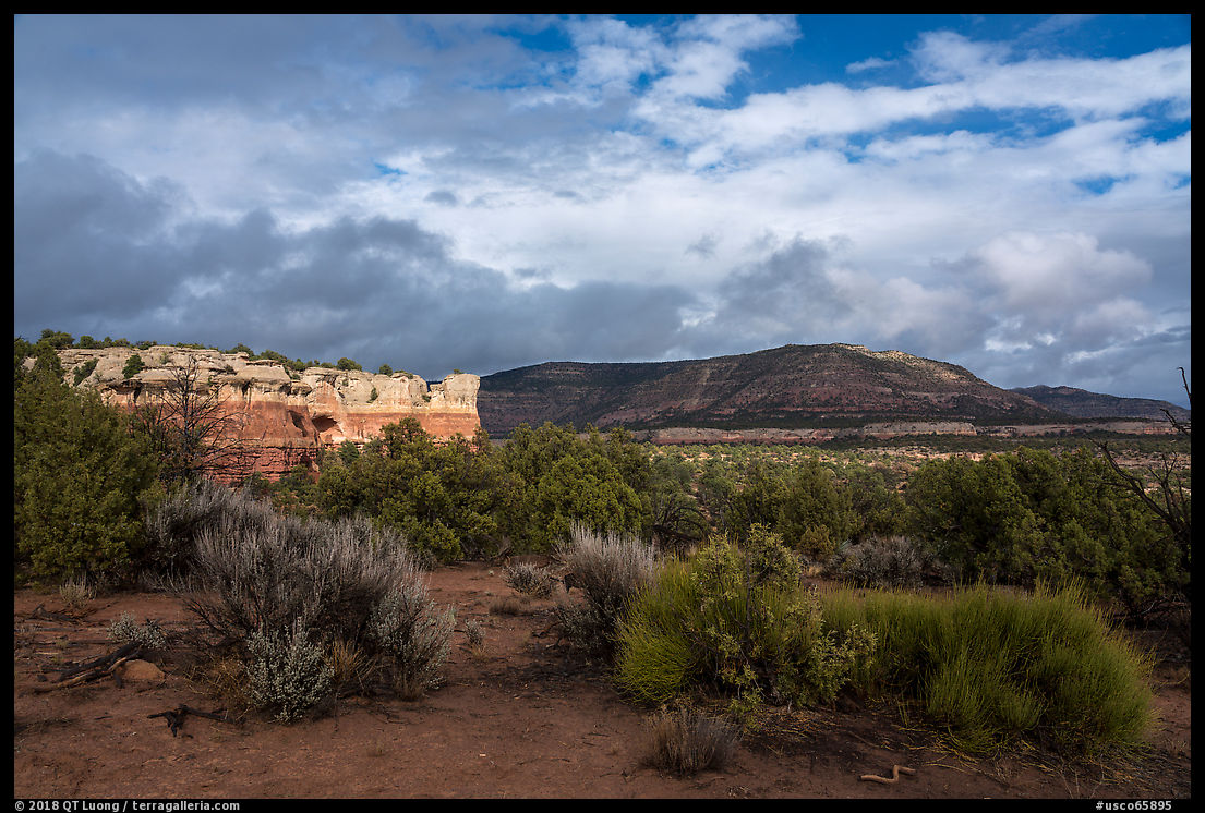
The geology of Canyons of the Ancients, with the mesas and branched canyons, is quintessential of the American Southwest. Natural resources attracted its past inhabitants, and the rugged landscape has contributed to the protection of the historic sites. When Canyons of the Ancients National Monument was established, in 2000, it was the largest protected cultural landscape at 176,000 acres (275 square miles) – by comparison, Mesa Verde extends for 81 square miles. The landscape-level protection let us study the Ancestral Puebloans choices for the locations their communities, the way they structured their society and used natural resources, preserving the pattern of the way people lived on and made use of the land over 10,000 years.
Individual sites take on greater significance when considered in the context of a larger cultural landscape. Canyons of the Ancients National Monument features the highest known archaeological site density in the United States. There are more than 6,000 recorded sites, and many more are yet to be discovered, with their total number estimated to be up to 30,000. In some areas, more than 100 sites have been found per square mile, and according to estimates, that is the average density of archeological sites in the monument including sites yet to be discovered. Those sites include cliff dwellings and kivas, but also petroglyphs, shrines, agricultural fields, dams, and other components of human life.
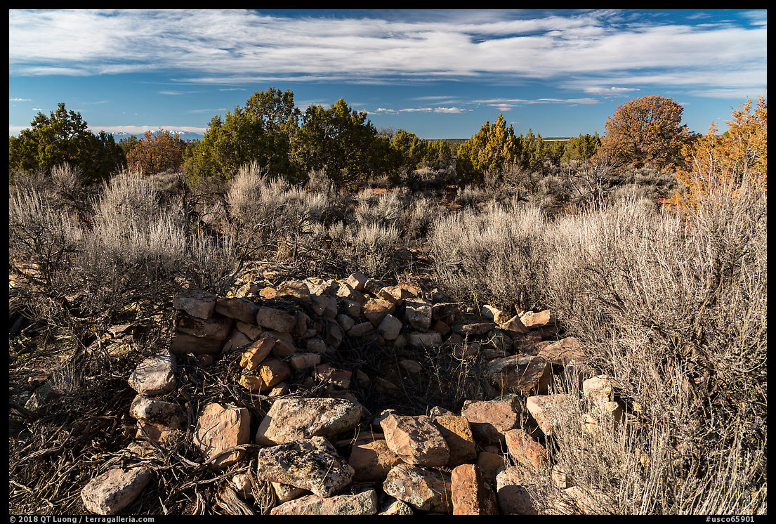
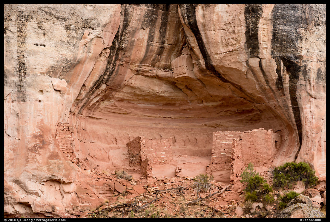
The area has a primitive character, with few facilities and visitors. It is the opposite of Mesa Verde National Park in a way, and rewards those looking for out of the beaten path locations. Although not situated in the monument, the Anasazi Heritage Center in the town of Dolores serves as its visitor center. It has the most extensive exhibits and artifact collection related to that ancient culture anywhere. You can get good maps and information about the monument there, but in my experience, the staff will not direct you to sites other than those listed below. With the exception of them, all archeological sites in Canyons of the Ancients National Monument are left in their original, unrestored state, and are not marked for their protection and to further self-discovery. Therefore, although the monument has a plethora of ancient sites, finding them is a different matter.
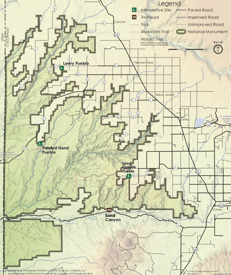
Lowry Pueblo
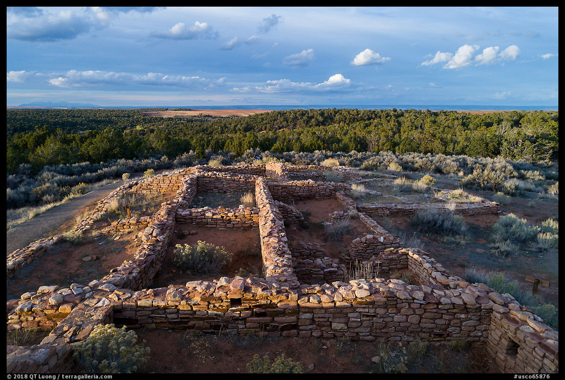
Lowry Pueblo is the least isolated area in the monument, as it is close to agricultural lands – but I was still the only visitor there. The fertility of those lands helps explain why that area was settled by the Ancients Puebloans and why the community prospered there. Lowry Pueblo is also the most developed of the sites in the monument, which means that you’ll find a restroom, picnic area, packed trails, interpretive signs, and stabilized structures. However, the tallest part of the main structure is now covered by a large metal roof.
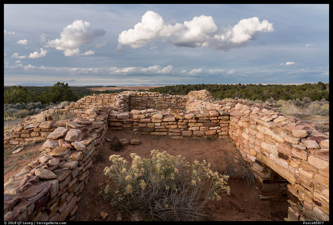
Avoiding it, I photographed lower walls. Notice the slightly higher viewpoint showing more of the walls in the second image? It was from a drone. You don’t have to fly them high for the difference of perspective to be visible! In the first image, I photographed under the soft light of a cloud so that no shadows would break the shapes of the shrub and walls, but in the second image, the shadows created by the strong light of direct sunlight help outline the structure of the more distant subject.
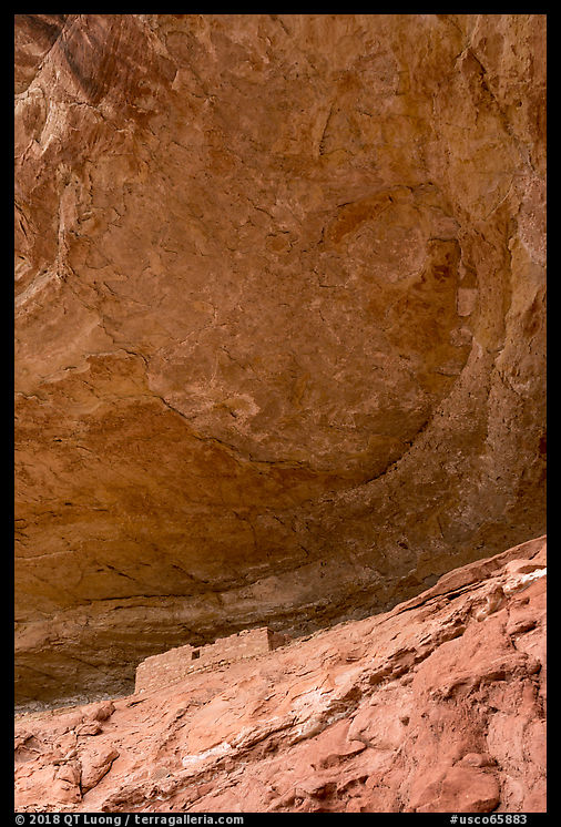
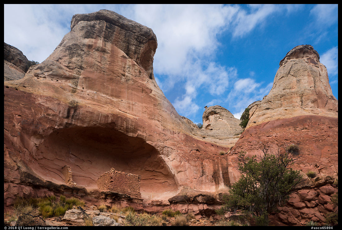
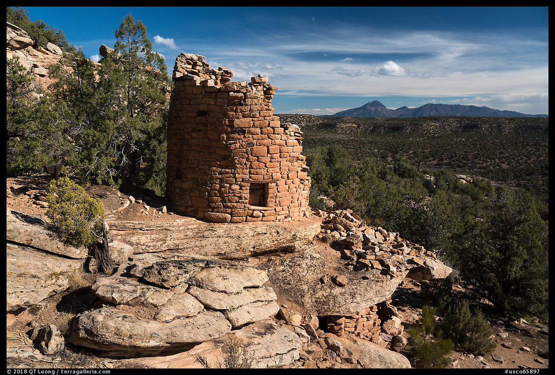
Painted Hand Pueblo
Since few large structures in the monument have been excavated, those you can see are much smaller than the major dwellings in Mesa Verde National Park. Most of the ruins at Painted Hand Pueblo have been left unexcavated, but the site is remarkable for a single circular tower sitting on a large boulder on the rim of the canyon, overlooking a scenic landscape. Those types of compositions work better when the sun shines from the direction of the canyon, which in this case is the afternoon. Note that nearby Hovenweep National Monument, which is totally surrounded by Canyons of the Ancients National Monument, has several clusters of ruins with similar character which are easier to find and to access, but more restricted.
Sand Canyon
Sand Canyon Trail is the best place in the monument to easily see many structures thanks to signage pointing to spur trails that led to points of interest. Sand Canyon can be approached via two trailheads separated by 6.5 miles of trail. Sand Canyon Pueblo is located near the north trailhead. The ruins are as large as the Cliff House in Mesa Verde, but they have been reburied after excavation, so all you can see now is rubble outlining the structure. After less than 2 miles, steep switchbacks drop about 1,000 feet, so the other trailhead, along paved county road G is more popular. Starting from the south trailhead, 8 major structures can be seen on the first 4 miles, and most turn back at the switchbacks. Because you hike for quite a ways from one structure to the next, and you have to look for them in cliff alcoves away from the main trail, there is more of a sense of discovery than at a place like Hovenweep where most of the sites can be spotted at a glance or right next to the trail.