Mount Baldy Insomnia
2 Comments
Mount Baldy, officially named Mount San Antonio, is the most well-known mountain in Southern California. The 10,068-foot peak, named for its treeless top, is the highest point in the Los Angeles area. It can be seen from anywhere in the city, forming a spectacular backdrop in winter when it is snow-covered and requires mountaineering skills. The peak is usually clear of snow from late May to October.
It takes only half an hour to drive Mount Baldy Road from the freeway in the city of Upland to the start of Falls Road at Manker Flat, an indication of how close to the city such a big mountain is. From there, the two main routes climb 3,900 feet to the summit. The Baldy Bowl Trail (4.5 miles one-way) ascends steeply the southwest side of the mountain amidst tall trees and towering slopes, passing about midway the Sierra Club Ski Hut where a small stream runs. To follow the Devil’s Backbone Trail from Manker Flat, you first hike 3.5 miles (1,550 elevation gain) up a dirt road to Baldy Notch. From there, the trail follows an airy and exposed ridge for 3.5 miles (2,350 feet elevation gain) to the summit. As a shortcut resulting in the shortest route to the top, you could ride to Baldy Notch on the Mount Baldy ski lift that starts up the road a quarter of mile past Manker Flat. Combining the two routes results in the challenging 11.3-mile Mount Baldy Loop. Hiking clockwise let you descend via the more gradual Devil’s Backbone.
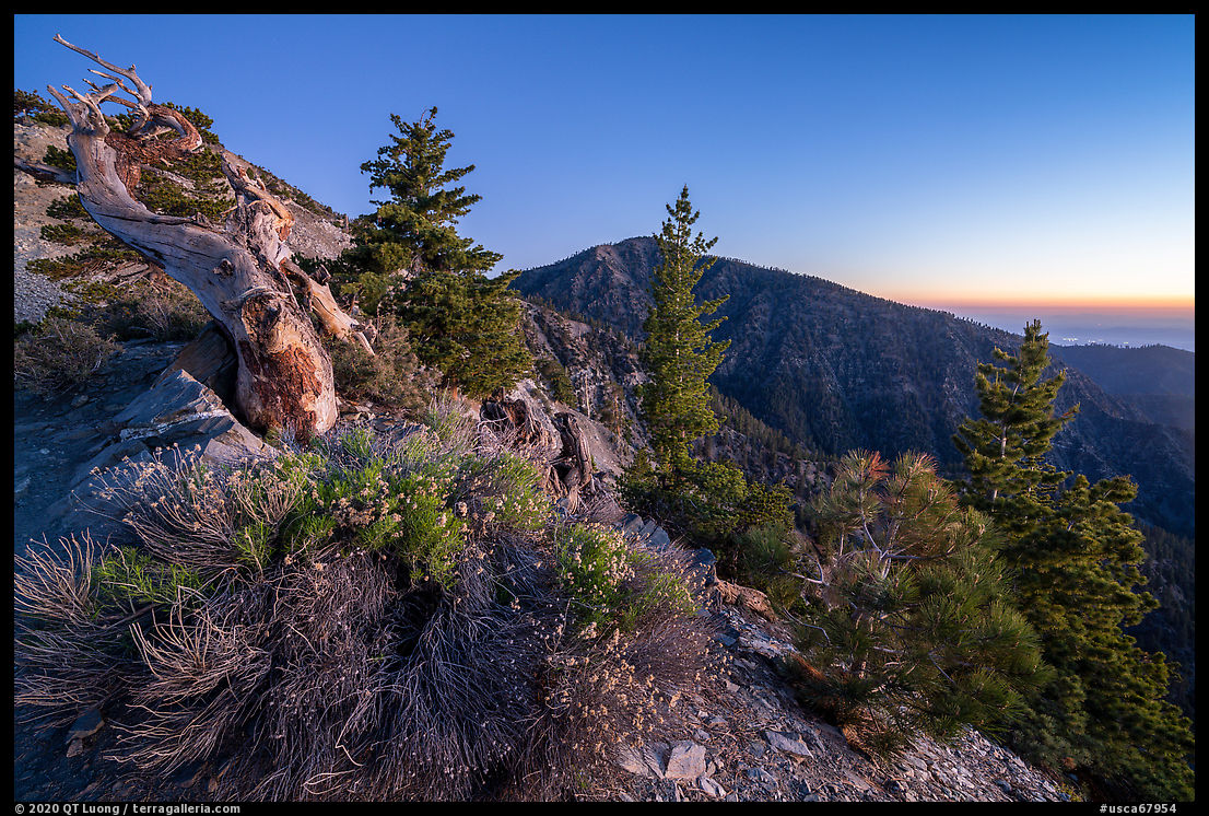
In order to beat the heat and crowds of summer, as well as catch the first light high up on the mountain, I started at 2:30am. Since I preferred to hike in the dark the least interesting section of the trail, which is the road to Baldy Notch, and to greet the sunrise at a location with open views, I hiked the loop counter-clockwise, which placed me on the Devil’s Backbone at dawn. I passed a tent at the start of the ridge, in which backpackers were still sleeping. I suppose seeing the ski resort only at night was not too much of a loss. Later in the day, there can be a line of hikers, but in the early morning, I rejoiced at having such a popular trail to myself. Not too many insomniacs. Reaching into alpine elevations, and punctuated only by sparse twisted ancient trees, it offered superb views.
The Mount Baldy hike starts by following paved Falls Road for 0.6 miles up (275 elevation gain). When the pavement ends and the road turns sharply to the right, a dirt path to the left leads to the base of San Antonio Falls, a 150-foot tall multi-tier waterfall with year-round flow. In the summer, many yuccas bloomed on the surrounding slopes. I timed my arrival for the late afternoon, when the waterfall, which is south-facing, got in the shade. Since it is such a short hike, I had to wait patiently for a window of time when its base was clear of families.


“It can be seen from anywhere in the city…”
That might have been true when you were there (the pictures support your observation), but, for quite a few months each year, smog and haze make it impossible to see much of anything inland of Los Angeles. Things have improved radically since I arrived here in 1978, but visibility still isn’t anything to write home about.
Thanks Sal, for the reminder. In the final text, I will add “On clear days, it can be seen…”