Guide to Giant Sequoia National Monument: Northern Unit
2 Comments
Because it is wedged between areas of Sequoia and Kings Canyon National Parks, the northern unit of Giant Sequoia National Monument, is more traveled than the southern unit. When driving highway 180 (Kings Canyon Scenic Byway) between Grant Grove and Cedar Grove, or the Generals Highway between Grant Grove and Sequoia National Park, many visitors don’t realize that they are not in Kings Canyon National Park but rather in Giant Sequoia National Monument. However, relatively few venture outside of the highways. Apart from the road linking the Princess Campground on Hwy 180 to the Quail Flat Campground on the Generals Highway via Hume Lake, roads are unpaved. They are closed in the winter and spring, generally from late November to June. Many National Forest campgrounds are available, and so are basic travel amenities in small communities within the monument, including gas, food, and lodging. You could also stay in the nearby national park lodges and campgrounds.
Converse Basin Grove
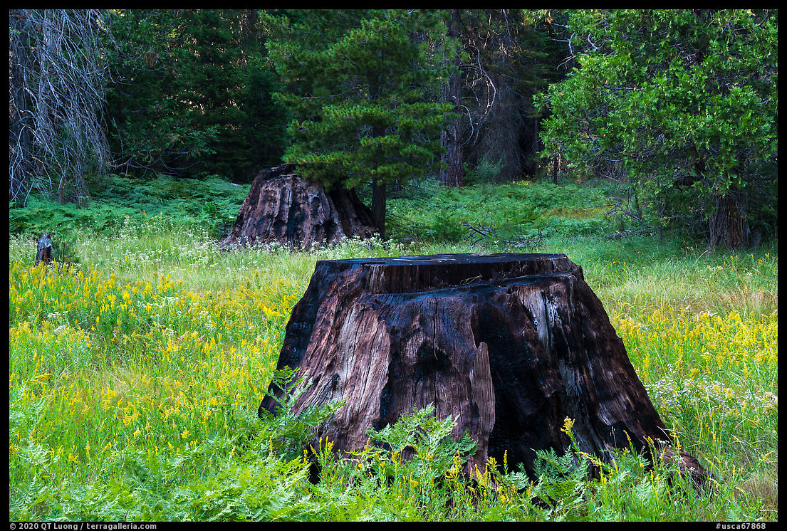
The Converse Basin Grove was reputed to be the finest and largest sequoia grove in the world. However, only a dozen of the giants survived the late 19th century historic logging period. One of them is the Boole Tree. Because it has the largest diameter (36 ft) of any living giant sequoia, it was once considered to be the largest tree in the world. By volume, it is the 6th largest and has the distinction of being the largest tree in a national forest. Ironically, it was named not for a general or president, but rather for Franklin Boole, the lumber supervisor who oversaw the cutting down of the rest of the grove. Was he a deserving choice? There are tales that he specifically spared the tree so that it would be named after him, but the most plausible explanation for the tree’s survival is that harvesting a tree that large was not economically practical because of the breakage in falling. Unlike redwoods, sequoia trees are brittle. Those magnificent trees often end up as toothpicks and fence posts. Why the tree was named after Boole still remains a mystery.


I was excited to see a photograph on Wikipedia depicting the Boole Tree towering above smaller trees and prominently isolated against the backdrop of the High Sierra, unlike any other significant sequoia tree I know. Hiking counter-clockwise, I found the tree on a spur trail after a mile (450 feet elevation gain) on the interesting 2.5-mile Boole Tree Loop Trail punctuated by numerous large stumps, burned trees, and wildflowers. The rest of the loop provides views of the Kings River gorge and the High Sierra.
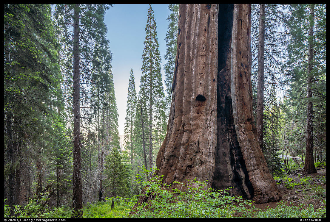

The grove, once cut to the ground except for the Boole Tree, has recovered remarkably well, but as a result, I was disappointed to find that the giant, located in an east-facing bowl, is surrounded by tall century-old second-growth that obscure distant views of the entire tree. This left only the distorted view from the base, from where I could barely make up the characteristic tip of the tree, a thick, leafless snag. On visits to the tree on two different days, I didn’t see anyone on the trail. The experience was more personal than around the well-known sequoias in the nearby national parks where railings are necessary to protect the trees. I squeezed into a burn scar, getting inside the tree. Afterward, with nobody around to disturb, I sent out my drone in the air, from which the tip of the tree and the High Sierra came into view, but the base of the tree was obscured.


On the way to the trailhead, the 2.5-mile FS 13S55 unpaved road (about 5 miles north of Grant Grove Village on Hwy 180) passes aptly named Stump Meadow. The boneyard of sequoia stumps provided a vivid reminder of the industrial-scale destruction that took place in the Converse Basin Grove. Shortly before, another unpaved road branching out of Hwy 180 leads in 2 miles to the 1-mile round-trip trail to the Chicago Stump, named so because the tree, once the second-largest in the Converse Basin Grove, was sawed into sections and reassembled at the Chicago World’s Fair. It now has the distinction of being the largest tree ever cut down.


Indian Basin
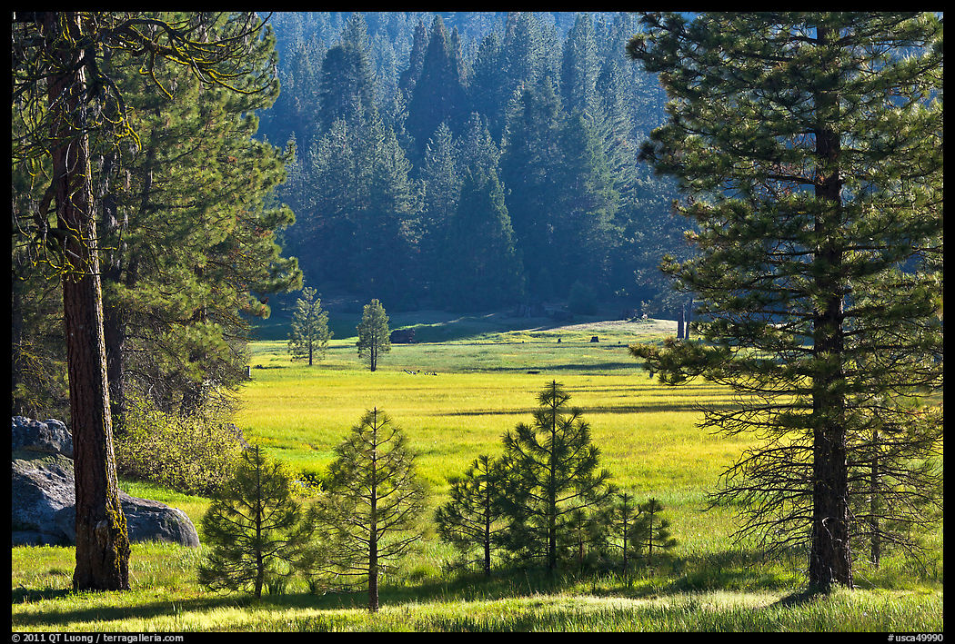
Princess Campground is the nicest and most easily accessible campground nearby. It borders a large, beautiful meadow, and includes the trailhead for the Indian Basin Trail (1-mile loop) where you can see more giant stumps.
Kings River Gorge
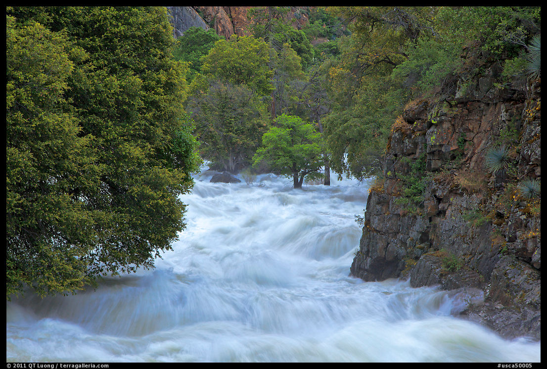
On the way to Cedar Grove, after a precipitous drop, Hwy 180 follows the dramatic gorge of the Kings River, arguably the deepest river cut canyon in the country. My favorite views within the gorge are looking east, just before the road descends to the river near Boyden Caverns. Although often labeled “Kings Canyon National Park”, they are from the national monument and no national parklands are visible from there. The developed marble cave can be visited on a 1-hour tour. No tripods are permitted, and the formations are backlit, making photography a challenge. Past the bridge, the road continues at river level, offering many views of the tumbling river that I find impressive when it is swollen by spring runoff. Three miles before Kings Canyon National Park, south-facing 80-foot Grizzly Falls lies a short stroll from a picnic area. It is reached by the sun from late morning to mid-afternoon.


Buck Rock Lookout
The lookout building, perched atop a granite dome and accessed via a series of vertiginous stairs totalling 172 steps was constructed in 1923. It is historically significant as one of the three surviving early live-in cabs, but is still a working fire lookout, normally open to the public June-October during the “business hours” of 10:30 am to 5:00 pm – as of this writing, no visits are permited because of the coronavirus. Outside of those hours, parts of the staircase are open, or you can just stand on a nearby rock. To minimize disturbance to the fire looker, please refrain from flying drones outside of the business hours, or at close proximity to the lookout! The location of fire lookouts is selected for great 360 degree views over the region, and Buck Rock Lookout indeed offers a superb view of the Great Western Divide. Only the Needles Lookout rivaled it in the area, but it was lost to fire. Drive 8 miles on Generals Highway from Hwy 180, turn left on the Big Meadow Road (FS 14S1), turn left onto FS13S04 which becomes quite rough for a passenger car on the last 1.5 miles, and walk past the gate 300 yards. Continuing on the Big Meadow Road at the fork leads to the meadow of the same name.


#/media/File:Boole_Tree.JPG)
Awesome captures ….The varied beauty of the Parks is so very beautiful.Absolutely loved the sixth photo of the trees as it represents the natural shades of Analogous colors and my favourite of all analogous colors….So very captivating to see in their natural shades in Nature ….The trees with the yellow,green and the blend of yellowish green…
Used these colors in a college project on a giant vase but just thinking how fascinating it would be to see Mother Nature’s natural splendor….Nature is a many splendors beauty….Sigh !!You guys get to see these awesome places….Loved the photos.
Thank you. It is unusual to see those shades of green because usually one is standing so low compared to the canopy. Also, they would be lost in midday light. The image was made right at sunrise.