Exploring around and above Kilauea in Hawaii Volcanoes National Park
4 Comments
Part 2 of 3 : 1 | 2 | 3
After photographing the lava ocean entry, my other main goal in this sea-to-summit trip was to hike to the top of Mauna Loa. Altitude sickness is a frequent problem for hikers going from low elevations to the summit – in Hawaii, most people stay close to the beach, which is sea level. In order to acclimatize a bit, I spent some time around and above the Kilauea area of Hawaii Volcanoes National Park. Kilauea is at about 4000 feet elevation, where it can gets surprisingly cold and wet.
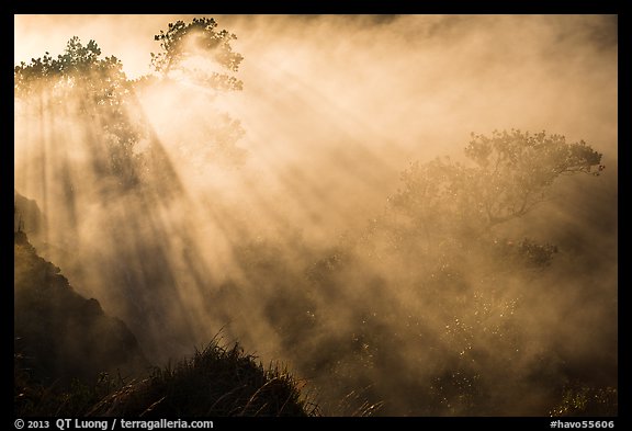
On my previous visit to the area, I had some success photographing the Halemaumau vent, so this time I focused on different areas of the Halemaumau crater. Shot backlit at sunrise, the otherwise ordinary-looking Steaming Bluff took an ethereal quality.
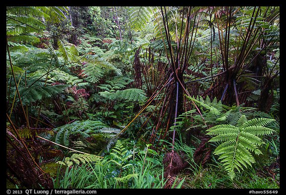
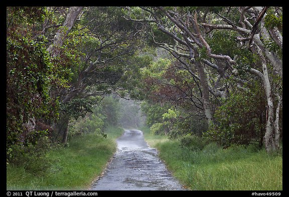
In rainy weather, one of my favorite spots in the park is the short hike to the Thurston Lava Tube. The Tube itself is not great to photograph, but on the way you’ll cross one of the lushest spot in the park, a wonderful rainforest with giant ferns towering above your head (great for close ups too).
The Kilauea Iki trail is one of my favorite trails on the entire Big Island. It is a moderate hike of about 3 miles with about 450 feet of elevation gain/loss which offers a great variety of terrain. It starts in the rain forest nearby the Thurston Lava Tube trail.
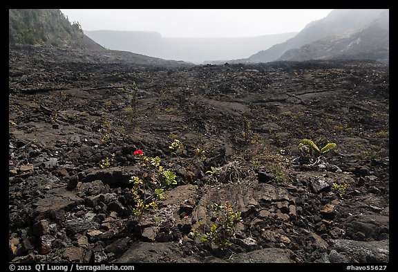
You go suddenly from the ancient forest to the newly created maw of the crater floor, where just a few plants cling to life. The contrast couldn’t be more dramatic.
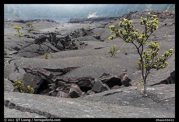
The trail traverses the entire Kilauea Iki crater, which just a few decades ago was a lava lake, offering a close view of different types of lava formations.

It then takes you back through the forest, with some glimpses of the crater you’ve just hiked across. Because the crater is surrounded by a rain forest, weather can change very quickly there, turning from sunny to showers in an instant.
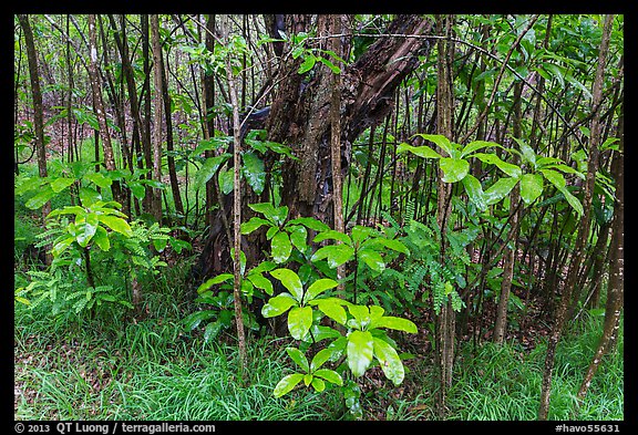
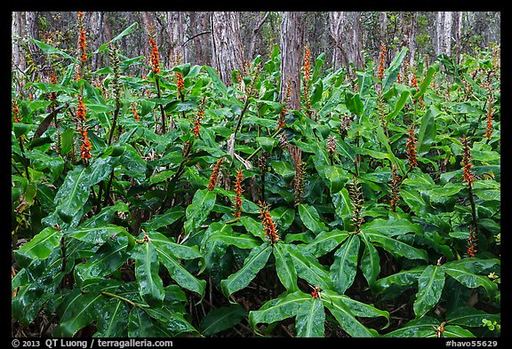
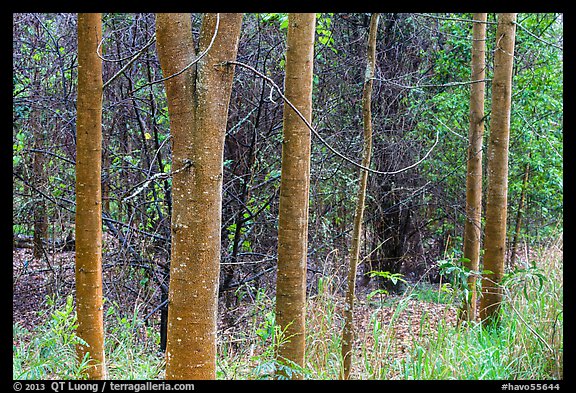
At the start of the Mauna Loa Road, The one-mile Kīpukapuaulu trail – another rainy day favorite – explores a hot spot of biological diversity, with more native tree species per acre than any other forest in the park.
The essence of this habitat is captured in its name kipuka (an island of ancient vegetation surrounded by a sea of younger lava flows), pua (flower), ulu (growing).
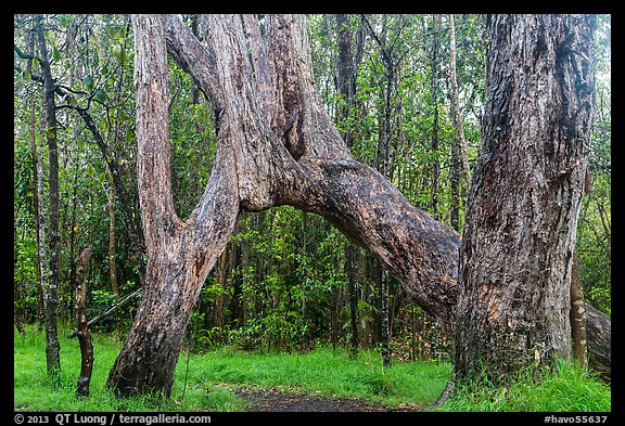
The underlying lava there is more than 8,000 year old, while the lava around the kipuka is much younger, at around 600 year old. More than 10 feet of soil has supported thousands of years of plant succession, resulting in huge, mature trees.
Mauna Loa Road, for the most part one-lane, winds up its way for 11 miles which can take up to 45min to drive. On the way, you can observe how the vegetation changes as you gain almost 2600 feet of elevation. In overcast or rainy conditions, the beautiful dryland forest is a great subject.
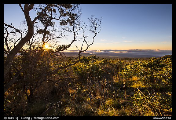
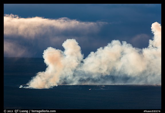
The terminus of the road is the Mauna Loa Overlook, from which you can look at the forest below, and in the distance, the Halemaumau crater and plume if the weather is clear. Notice how small it appears in the image above. Super-telephoto required for the image below ! The light there is best at sunrise, which was convenient for me to capture as I slept there to acclimatize.
The Mauna Loa Overlook is also the trailhead for the Mauna Loa trail, which leads to the summit of Mauna Loa, an adventure I’ll describe in great detail in the next post.
More images of Hawaii Volcanoes National Park


Great images and write-up QT! Kilauea Iki is definitely my favorite trial in the Park as well.
Thanks. Glad that you had a good time there as well.
Mauna Loa road is one of my favorite get away areas on the island. Use to Mnt bike up the road. Shot the summit eruption back in 08 from up there. Nice and cold for sure.
That’s a steep climb that will keep you in shape for your volcano explorations. Previous time I was there, I got drenched and very cold.