terragalleria.com · the photography of QT Luong
Home / US National Parks / Alaska / Wrangell-St Elias [ page 1 of 16 ]
[ Color | Black & White ]
Home / USA / Alaska / Wrangell-St Elias NP [ page 1 of 16 ]
New book: Our National Monuments - America's Hidden Gems
    How to buy prints or license images
Previous pictures: Kenai Fjords photos

Wrangell-St Elias National Park

Pictures by QT Luong

More pictures of Wrangell-St Elias Next pictures: Glacier Bay
[1 : Overview]
[2 : Periphery]
[3 : McCarthy Road]
[4 : Crystaline Hills]
[5 : Near Kennicott]
[6 : Kennicott Mill Town]
[7 : Bonanza Ridge and Mine]
[8 : Root Glacier Views]
[9 : Root Glacier Details]
[10 : Mt Donoho]
[11 : Aerial views]
[12 : Nabesna Road and Hills]
[13 : Skookum Volcano]
[14 : Rambler and Nabesna mines]
[15 : Structures]
[16 : People]
[All]

Large Format photos of Wrangell Saint Elias National Park · Panoramic photos of Wrangell Saint Elias National Park

Wrangell Saint Elias, a half-day drive east of Anchorage, is a park of enormous size, 13.2 million acres (53 thousand squares kilometers) six times the size of Yellowstone, larger than Switzerland), which is populated by enormous mountains, glaciers, and rivers. There are 9 of the 16 highest mountains in the US, and more than 150 glaciers, among them the Malaspina which alone is the size of Yellowstone, the Nabesna, which is 75 miles long, and the Hubbard, which advances 10 meters per day.

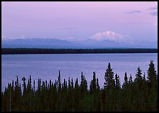
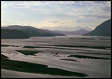
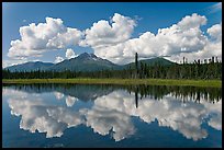
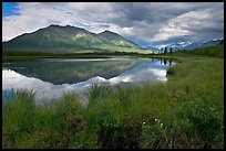
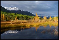
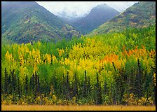
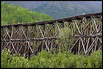
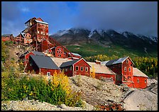
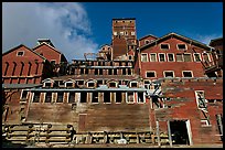
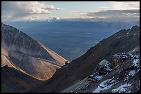
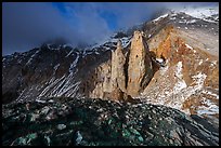
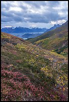
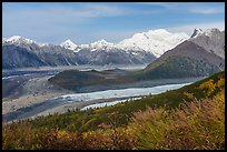
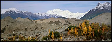
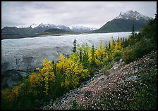
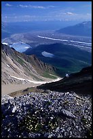
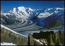
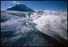
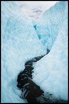
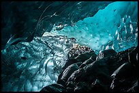
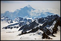
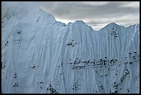
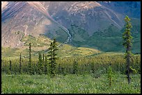
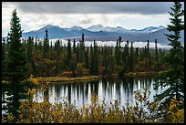
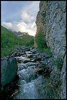
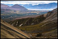
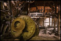
Unlike most of the Alaskan parks, Wrangell Saint Elias is penetrated by two roads, which make it easier to explore on a tight budget. I have driven four times the McCarthy Road, which leads to the impressive abandoned old copper mining town of Kennecott, situated right above the glacier of the same name. The view from Kennecott is dominated by Donoho Peak, which lies like an island between the two vast Kennicott and Root glaciers. Walking from Kennecott, in three days, I navigated across the crevasses and streams of the Root glacier and climbed the steep scree slopes of Donoho Peak to get a commanding view of the wide local glaciers and of the entire Wrangell range. I rounded my exploration of the park by driving twice the less-traveled Nabesna road and touring the remote University range and Bagley Field (largest non-polar glacier) by airplane.

[CLICK on any picture to see a larger image and details, to add to selection, to order, and to download wallpaper.]

Wrangell range and Mt Blackburn above Willow Lake with pink sunset hues. Wrangell-St Elias National Park ( color) Wide Copper and Chitina rivers. Wrangell-St Elias National Park ( color) Clouds, mountains, and reflections. Wrangell-St Elias National Park ( color) Grasses, lake, and mountains. Wrangell-St Elias National Park ( color) Snowy mountains and aspens reflected in Ruth Lake. Wrangell-St Elias National Park ( color) Mountain sloppes with aspens in different stages of autumn colors. Wrangell-St Elias National Park ( color) Section of Gilahina trestle constructed in 1911. Wrangell-St Elias National Park ( color) Kennecott abandonned mining buildings. Wrangell-St Elias National Park ( color) Kennecott concentration and smelting plant. Wrangell-St Elias National Park ( color) Bonanza Mining Camp and tram station. Wrangell-St Elias National Park ( color) Pinnacles below Bonanza Peak. Wrangell-St Elias National Park ( color) Tundra in autumn, Kennicott Glacier, and Wrangell Range. Wrangell-St Elias National Park ( color) Root and Kennicott Glaciers, Mt Blackburn. Wrangell-St Elias National Park ( color) Moraines and snowy mountains. Wrangell-St Elias National Park (Panoramic color) Late wildflowers, trees in autumn colors, and Root Glacier. Wrangell-St Elias National Park ( color) Junction of Kennicott and Root glaciers seen from Donoho Peak, late afternoon. Wrangell-St Elias National Park ( color) Mt Blackburn and Kennicott glacier seen from Mt Donoho, morning. Wrangell-St Elias National Park ( color) Stream running on surface of Root Glacier and Donoho Peak. Wrangell-St Elias National Park ( color) Glacial stream between steep walls of ice, Root Glacier. Wrangell-St Elias National Park ( color) Ice cave, Root Glacier. Wrangell-St Elias National Park ( color) Aerial view of Mount St Elias. Wrangell-St Elias National Park ( color) Aerial view of ice wall, University Range. Wrangell-St Elias National Park ( color) Meadow covered with white wildflowers, and spruce trees. Wrangell-St Elias National Park ( color) Rock Lake and Wrangell range in autumn. Wrangell-St Elias National Park ( color) Stream and cliff, Skokum Volcano. Wrangell-St Elias National Park ( color) Nabesna River Valley from Skookum Volcano. Wrangell-St Elias National Park ( color) Double rainbow, Devils Mountain. Wrangell-St Elias National Park ( color) Road and Nutzotin Mountains at sunset. Wrangell-St Elias National Park ( color) Ball mill inside Nabesna Mine. Wrangell-St Elias National Park ( color)
There are 29 color pictures on this page out of 371 color pictures of Wrangell-St Elias.

Themes: Wrangell St-Elias Fall Color

Places: Kluane Wrangell St Elias Glacier Bay Tatshenshini Alsek