| Home / Black and White / USA / Alaska/ Steese Highway |
[ Color | Black and White ]
Map
|
|
|
| |
Steese HighwayBlack and White pictures by QT Luong |
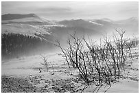
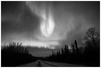
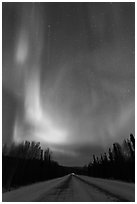
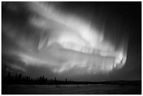
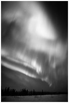
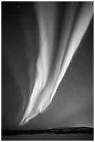
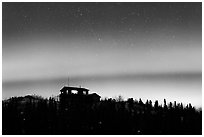
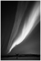
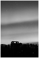
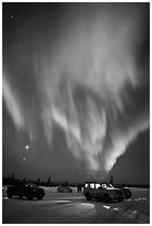
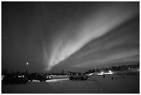
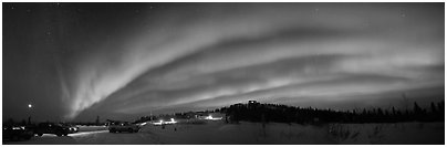
| The Steese Highway runs from Fairbanks to Circle, a town which is actually 50 miles south of the Arctic Circle. As it was originally opened for gold mining, several historic mining camps (such as Chatanika) can be found along the Steese Highway. The Steese Highway passes through rugged, unpopulated areas so there is little traffic and light pollution along, making it a good choice for viewing the Northern Lights starting from Cleary Summit, only half an hour from Fairbanks. |
[CLICK on any picture to see a larger image and details, to add to selection, to order, and to download wallpaper.]
|
|
Anchorage | Fairbanks | Seward | Portage | Whittier | Prince William Sound Ninilchik | Homer | Hope | Seward Highway | Parks Highway | Glenn Highway Denali Highway | Richardson Highway | Steese Highway | Dalton Highway | Wiseman North Pole | Chena Hot Springs | McCarthy | Kotzebue | Eskimo Villages Misc Alaska places | Glacier Bay | Wrangell-St Elias | Kenai Fjords Lake Clarke | Katmai | Denali | Gates of the Arctic | Kobuk Valley
|
|
|
Home
·
Contact
·
Mailing List
·
About QT Luong
·
Blog/News
·
Terms of use
Buy fine art prints · License stock photos · Hi-res wallpaper · Books · Myanmar Photo Tour |
|---|