Puerto Rico
Pictures by QT Luong
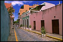
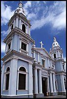
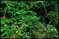
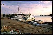
Puerto Rico (or Porto Rico, meaning "rich port" in Spanish) consists mostly of an island of approximatively 170 km by 60 km (105 miles by 35 miles). in the northeastern Carribean, which offers an interesting juxtaposition. Politically, Puerto Rico is a self-governing unincorporated organized territory, part of the commonwealth of the United States. As such, Puerto Rico offers the usual modern amenities of the 50 states such as freeways, shopping malls, and convenience stores. At the same time, there is the heritage of four centuries of Spanish culture. The island was the most important stronghold of the Spanish empire in the Carribean until its conquest by the United States in 1898. The main language spoken by the 4 million inhabitants of Puerto Rico is still Spanish. There are cities of various sizes, less developed villages in rural areas, and superb protected natural areas. In June 2000, I spent a couple of days on the main island, exploring the NE and SW parts.
Puerto Rico
 USA
USA